GeoGuessr (Norwich Version) – Walk 3
I already have a better explanation (well, longer explanation anyway) for this plan. In essence, whilst lockdown is on, I need to find ways of walking nearby to Norwich in quiet areas for my LDWA 100 training. So, I’m using GeoGuessr to pick out five random locations within a certain area which I’ve defined and then walking to them, to see what kind of story I can uncover.


The five locations, which were conveniently all relatively central, meaning that walk wasn’t too long. Which was handy as I have an inability to walk on anything vaguely icy without sliding over and there was no shortage of ice in the city centre.

As can be seen, the five locations didn’t make for a long walk, so trying to make this sound like an adventure is going to be quite challenging….. It’s more of a plod around Norwich, but I shall do my best….


Two wooden sculptures in Old Library Wood, an area of the city much improved now that a community project has been set up to improve the park. It’s been really successful and it’s a much more pleasant area to walk through now than it was.

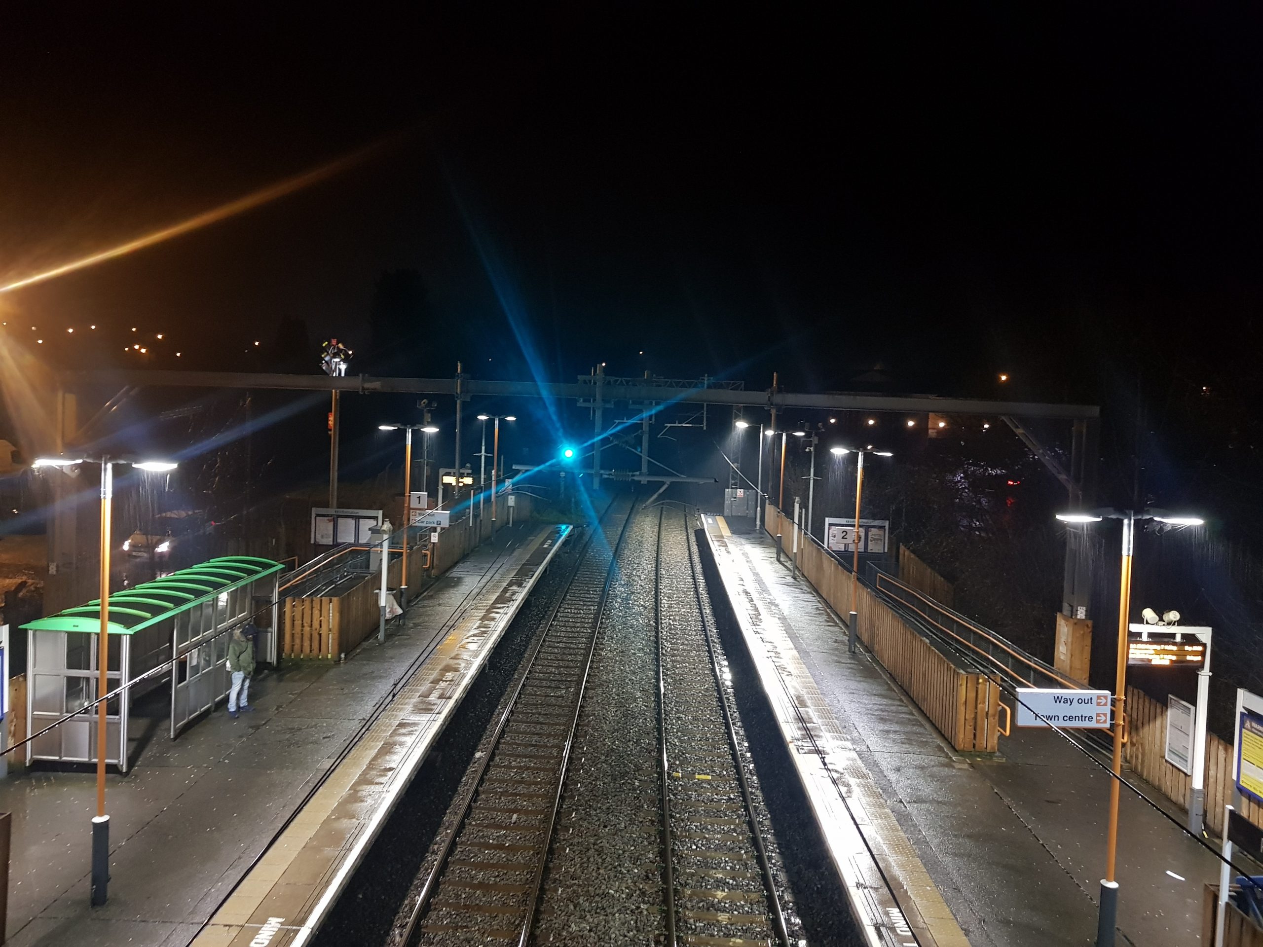
And, after about three minutes of walking, here’s the first location, which is outside Norwich railway station. Just for those interested, Norwich railway station still doesn’t have a Greggs, whilst Ipswich does. I don’t get much involved with rivalry between cities/towns, but, as Viz would say, sort it out Norwich…..

Norwich Railway Station was formerly known as Norwich Thorpe Station, when the city was fortunate to have three railway stations, the others being Norwich Victoria (opened in 1849) and Norwich City (opened in 1882). Norwich Thorpe opened in 1844, but the current building dates from 1886, both of which are visible in the above map from 1884. The top building of the two is the one that was being constructed when the map was produced, the one below it is the original and this has now been demolished.

And our second location wasn’t much of a walk, located next to Norwich City Football Stadium at Carrow Road. Note the icy pavement and the road which was entirely free from ice. I take the radical view that if the council can’t clear the pavements, then pedestrians should just walk on the road instead. However, car drivers don’t much like this approach if I’m being honest.

Crossing the River Wensum on the Julian Bridge, named after St. Julian’s Church and Lady Julian.

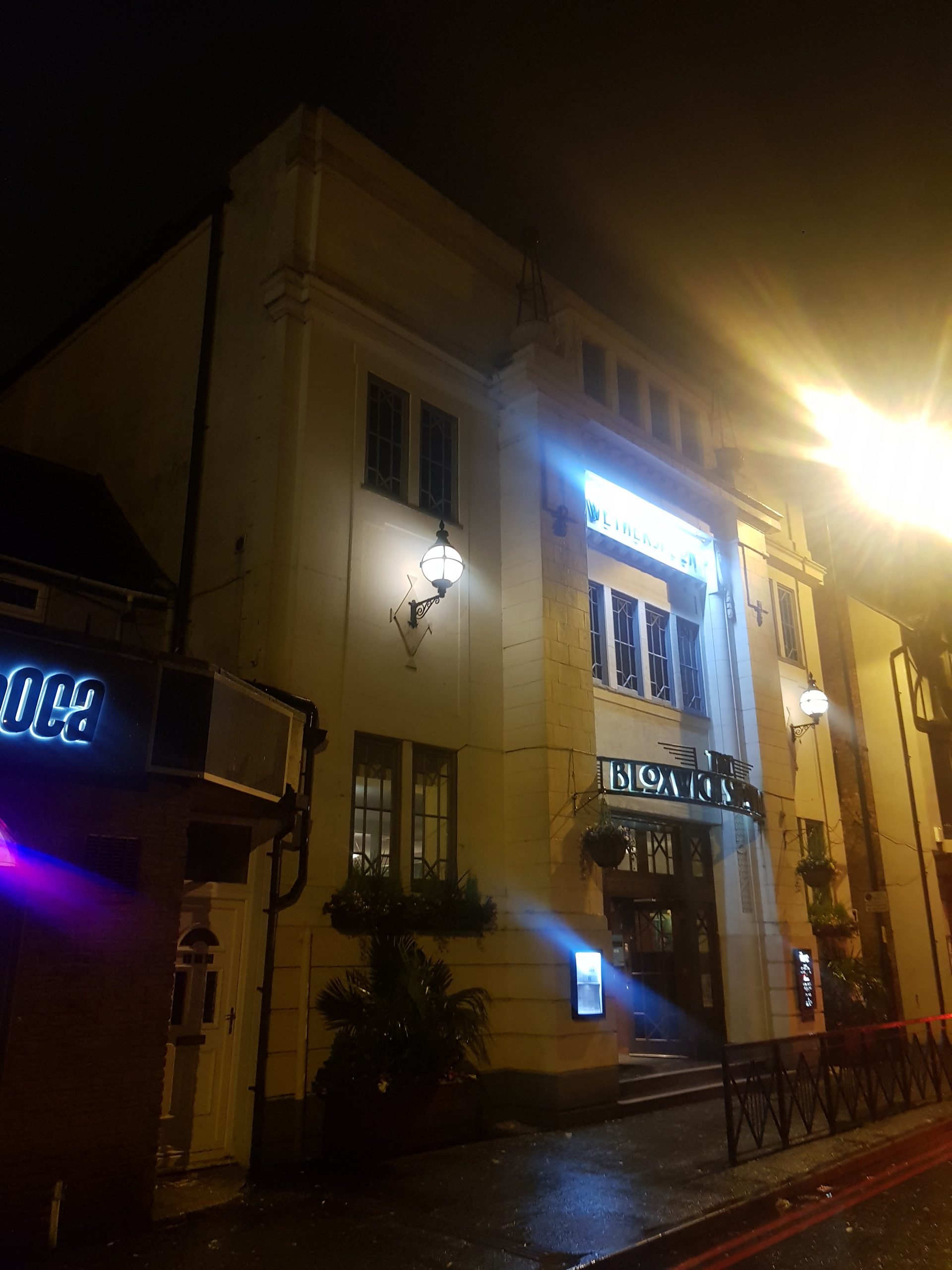
The still closed Queen of Iceni pub and I’ll be glad when this, and other licensed premises, can re-open…..

Who says Norwich isn’t hilly? Down the steps is the war memorial commemorating those who workers from Bullards Brewery, Morgans Brewery, Steward & Patteson and Youngs, Crawshaw & Youngs who lost their lives fighting for their country. There’s more about this at https://www.warmemorialsonline.org.uk/memorial/197721/.

Our third location isn’t accessible at the moment as there’s work underway at Norwich Castle, so the area in front of the building has been closed off. They’re spending £13.5 million on the castle’s renovation and this will restore it to something more like its twelfth century appearance.
As as aside, being slightly controversial (again, although perhaps grumbly is another word more appropriate here), I fear that this will lead to further price increases, which had already hit near enough £10, with surcharges made for visiting certain parts of the building. Although those who are so inclined to visit museums seem broadly pleased when they visit, I’ve heard too many people over the years refuse to go or to take their children on the grounds that it’s too expensive. Anyway, enough grumbling for now.

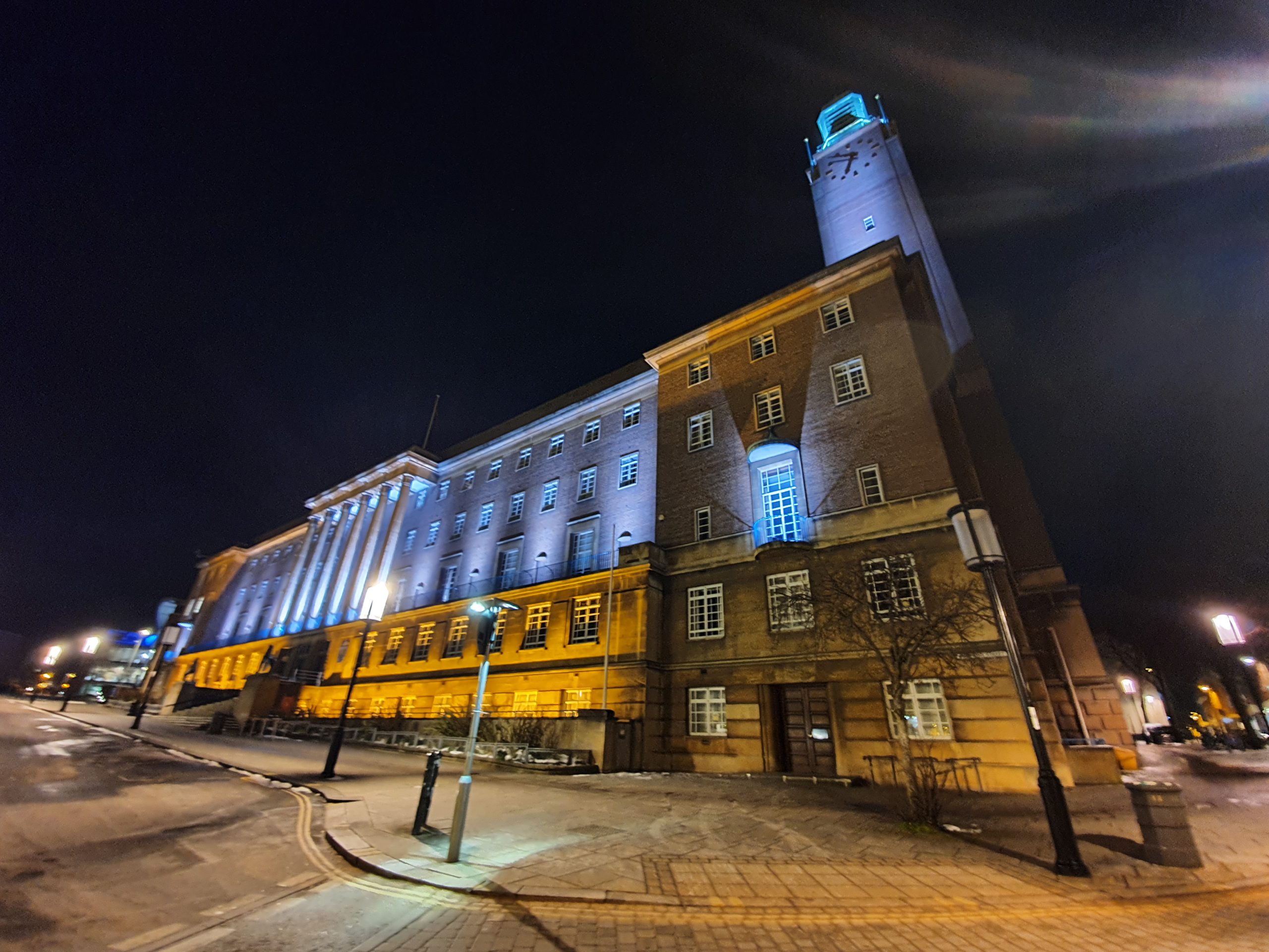
Crossing the city centre we walked by Norwich City Hall, completed in 1938 and unfortunately destroying tens of interesting buildings which were on the site.

St. Giles on the Hill Church and I mention its full name as a reminder of just how many hills there are in this city.

The Roman Catholic Cathedral, built from the 1880s on the site of the former Norwich City Gaol. I won’t linger on the details of this building for long, it has appeared on a few of my walks recently…..

Fortunately, the locations on our route meant that we went past the chip shop on Stafford Street, handily called The Chip Shop. As another slightly grumbly comment, although I’m pleased to note that the number of chip shops refusing to take cards is falling (albeit slowly), this one remains steadfast in their opposition to customer convenience and only takes cash.

The arrival of my chips……

The portion of chips here looks very small, but that was a combination of how they were wrapped and how closely I was holding them. The portion size was though generous and the battered sausage was a rather lovely complement to them. They came to £3 each, which is a bit above the average for Norwich, although hardly excessive given the quality.

Our fourth location was Northumberland Street, a road which hasn’t changed a great deal over the last century in terms of the buildings. I don’t know the background for this street’s name, so I’m going to make up the best reason that I can. One of the biggest influences on building in the city in the nineteenth century was the Unthank family, which many Norwich residents will recognise due to Unthank Road. This family was from Northumberland, and their ancestral of Unthank Hall is still there. There might not be any link at all, but this is the best reason that I can think of, so that’s what I’m going with until gives me a better explanation.

Our fifth location. This was handily in the area of St. Martin’s, meaning I ‘treated’ Nathan to a mini history walk around the area of the Tabernacle.
This wasn’t a particularly long walk, slowed down only by my carefully walking in areas of ice (Nathan made some reference to Bambi which I ignored), which makes it hard to make a fascinating story of this little adventure. But, to be fair, there were chips involved in proceedings and that made it all worthwhile. Given the ice situation though, it was perhaps fortunate that this wasn’t an overly long expedition.