Liam and I got round to drawing the first random location for our wave of Norfolk GeoGuessr this summer, and maybe beyond if it proves to be exciting and delighting. I wouldn’t use post this in advance, but Liam managed to guess the location of this in Norfolk, which is more than I did. It’s accessible within two bus rides of Norwich and there’s a nearby pub and church, so that’s that sorted……
Tag: GeoGuessr
-

Norfolk GeoGuessr – New Series
Woooo, after a slight gap in proceedings, feeling that this blog needs even more variety of content (to achieve my dream of three readers), I’ve convinced my friend Liam to start on a new round of GeoGuessr locations. I haven’t got quite round to writing up the national one we did last year, that’s something else on my little list. The old series is here and I’ve done these with either Liam or Nathan (with the expeditions always being exciting and giving me something to write about). We did some national locations and Liam and I do have a national one to do at some stage that we’ve already drawn, but for this run we’re going to limit ourselves to Norfolk.
The aim is to travel to a random point in Norfolk which we generate on Geoguessr and then get there using public transport, before also visiting the nearest historic point of interest and the nearest pub. Potentially, we might visit a local restaurant of choice as well if there’s something appropriate in the area. We might get a location three metres from the King’s Head in Norwich, or we might get somewhere in Thetford Forest with snakes. The benefit is that Geoguessr uses Google Streetview to get its random locations, so it will be on a road of some kind and won’t be in the middle of a snake den.
When we get to the point we will draw the next location and it might occasionally be possible to immediately get there, but likely we’ll manage just one in each day. Especially if I decide that there are two pubs nearby to visit.
I doubt very little can go wrong with this plan….. We draw our first location tomorrow and hopefully will be able to visit a few this summer. I might even do a little bit of video, but don’t expect anything of any decent quality.
-

Gdansk – GeoGuessr 1
Before I start with this, I’ll mention that this series of posts is all a bit random (but random is good) and my only little aim is to generate locations in GeoGuessr that I walk to. There’s no point in this other than being a useful way to see different parts of the city that I wouldn’t otherwise think of going to, and it gives some structure to posts such as this.
The location randomly selected by GeoGuessr was ul. Mariana Seredyńskiego, 80-753, a short distance east from the city centre.
I was staying at the Novotel (which is behind me in the above photo) which was the starting point. This is Brama Stągiewna, or the milk jar towers because of their shape. This was once part of the city’s fortifications, but they were badly damaged during the Siege of Gdansk in 1813 and then again in 1945 when they were set on fire and their roofs collapsed. The building was repaired in the post-war period and is now in private hands.
Usually I’d go over to the bridge which is to the left of the Brama Stągiewna, but they’ve taken it down for reconstruction, so there’s this temporary metal structure a little further down the river. More about this temporary bridge in my second post, as it’s been constructed on older foundations.
Once on the other side of the Motława River, there’s a better view of Brama Stągiewna.
More on this later because another GeoGuessr location brought me back here, but this Granary Island which has been heavily developed over recent years. The number of cranes visible is testament to how much more construction is taking place here. I’ll see if I can find my photos of Gdansk when I first came here a few years ago, before any of this modernity was here, it was just the remains of the old buildings.
The grand Hotel Gdansk which is located in a former granary building overlooking the river. The name is just slightly fiddly to find in search engines, as it just comes up with a random list of hotels in Gdansk, but it’s a prestigious name that apparently they had to get the permission of the City Council to use.
One of the old cranes by the side of the river.
S/Y Korsarz, a sailing ship built in Gdansk (or the Free City of Danzig at the time)
STS Generał Zaruski, a sailing ship built in 1938 in Sweden and they had to remind the Poles in 1945 that they needed to pick it up as it was completed and paid for. It’s still in use and has now been acquired by the City of Gdansk.
At the back of the photo is the iconic crane (zuraw) which was once one of the largest in the world. Badly damaged during the Second World War it was reconstructed and is now an interesting museum.
The grand 5-star Hotel Podewils Old Town Gdańsk is in an eighteenth century building that was once next to the drawbridge to the Ołowianka Island. There’s an interesting history of the building at the hotel’s web-site at https://www.podewils.pl/en/hotel-podewils-in-gdansk/hotel/history.
The 50-metre tall Amber Sky ferris wheel on Ołowianka Island is visible in the background. Without being rude to the residents of ul. Angielska Grobla, it was notable here that the modernity and grandness came to something of an end, with things suddenly feeling a little more derelict. I mention this street as it means the English Dike, or the Long Gardens, and this dates back to when King Henry IV visited the city, something he did twice. Traders came to the Hanseatic City and the authorities gave the English their own area, ostensibly for their own protection, but more likely as they kept getting drunk and upsetting the locals. This was separated by a river, which was then turned into a road and dike, and the name has lingered on.
This looked like an interesting building, although it’s now mostly derelict. It’s on the land formerly occupied by the meat works and there’s a history of the structures at https://historia.trojmiasto.pl/Dawne-kino-Piast-Co-z-niego-zostalo-i-w-co-sie-zmieni-n134052.html. This whole area is gated off and there’s a large construction project expected to take place, which I assume will be primarily residential. This part of Gdansk is just two minutes walk from the central tourist area and I can imagine in a few years the whole area will have been entirely modernised and renovated.
And just across the road from the derelict building in the previous photos, here we are. I didn’t spend much time trying to line up the GeoGuessr shot exactly, but it’s visibly in the same area.
-

Warsaw – Warsaw GeoGuessr 2
And, following on from my earlier GeoGuessr in the day, I did recognise this one from the photo. The second and third locations that GeoGuessr had selected were well outside my travel pass zone, so I missed those ones out.
I didn’t bother to guess correctly (in case someone, likely Nathan, questions why if I knew where it was why I am so far out), but it’s the Palace of Science and Culture. I’ve posted some photos from the top of this building before…..
After I had popped to the Bianco e Verde restaurant, I meandered to the nearest tram stop to get back to the city centre. Fortunately, for the sake of this exercise, the tram I got on went near to the Palace of Science and Culture, so this is one of the easier locations to get to. As an aside, the one thing that I’m not keen on in Poland is that you can’t cross the road as a pedestrian when the lights are read. I know that’s the case in other countries, but it still feels odd to stand there with ten other people unable to cross, even though there’s not a tram, car, bus or anything else vehicular in sight.
This is one of the older style trams, which have no accessibility for wheelchairs and the like, which was relatively empty. They’re pleasant to watch the world go by, frequent, never usually too busy and efficient. The newer trams are more pleasant to be on and there seem to be ever more of them, so I assume that there’s a schedule to phase the older ones out.
And there’s the tram after I had got off.
The tram stop was Warszawa Centralna, where I’ve taken several trains from to go to other cities in Poland. I haven’t written the visit up yet, but I went to Warsaw’s railway museum last week and found out that this railway station opened in 1975 and it replaced the hopelessly inadequate former Warszawa Główna railway station. This former railway station, once the most important in Warsaw, is now the home of the railway museum, but more on that in another post.
I’ve never noticed this before, but I think it’s a memorial to railwaymen who died during the Second World War. There are no shortage of plaques like this around the city, with many being relating to the Second World War and the Warsaw Uprising.
Turning the corner, there’s the Palace. This remains a very controversial building and I’ve written before about how it was unpopular with many when the Soviets plonked it down in Warsaw. There is an ongoing debate today about whether it should be taken down and replaced by a park, but I’m not sure that’s entirely useful. It’s now part of the city’s history and has a place in Warsaw’s cultural life, and taking down buildings just because they’re Soviet perhaps isn’t enough of a reason. But, it’s not my country and it’s up to the people of Poland.
And that was near enough for me to the original GeoGuessr location. I did see what the fifth location was, but it transpired that it was also outside of the city’s boundaries and my travel pass, and I thought that two visits was sufficient for today anyway. I’ll return to this little project when I next return to Warsaw, which I’m hoping will be in early 2022. Hopefully that’ll be the catalyst to get me to see different parts of Warsaw, as I’m becoming ever more familiar with this rather lovely city and need to find some more of its hidden secrets.
I’ve never seen a broken tram screen before like this, but, fortunately, it didn’t last very long. And with that, I left the centre of Warsaw to get to the airport hotel, with my flight being tomorrow.
-

Warsaw – Warsaw GeoGuessr 1
This is another one of my irrelevant series of posts, but I didn’t have anywhere specific to go in Warsaw today so I thought that I’d make it random by using GeoGuessr to come up with some locations. The process also gives me an opportunity to ramble on about Warsaw life in a way that doesn’t fit in anywhere else on the blog, so that seems like another bonus.
There we go, the first location randomly served up by GeoGuessr. It’s fair to say that I didn’t recognise it or have a clue where it was.
It transpired that it was located in a part of the city that I haven’t been to before, which is frankly why I quite like this process, as it does bring about new experiences. I’m not claiming that this is a big and exciting adventure akin to climbing Mount Everest or Beeston Bump, but it brings a little entertainment to my day.
The location could only be reached by bus, or a long walk, which meant finding the nearest bus stop which was near to the Poniatowski Bridge.
There wasn’t a wide range of buses to choose from, so the 185 it was.
Standing at the bus stop, looking back at the start of the Poniatowski Bridge which goes over the River Vistula. This bridge hasn’t had the happiest of times, with working starting in 1904 and being completed in 1914. The Russians then blew it up in 1915, the Germans rebuilt it and then it got destroyed by fire. The Poles repaired it after the end of the First World War and the bridge did fine for quite a while, until the Germans destroyed it in 1944. Trying to make a quick fix after the end of the Second World War, a temporary structure was put up which promptly then fell down. The bridge was then restored in 1946 and it has remained standing, and been beautified a bit, since then.
After a ten-minute wait at the bus stop, here we are (well, here I am, along with a small number of other passengers and the driver) on the bus. I like the USB connectors incidentally (the orange thing) which is handy if very low on power. Buses here are like the rest of the public transport system in Warsaw, it’s possible to buy a ticket at machines all around the city and then just get on and validate the ticket once. It’s useful that a 24-hour ticket actually lasts for 24 hours, and not until the day as it does in places such as London. Mask wearing at the moment in Warsaw is high, although a fair number of people don’t cover their nose. A 24-hour ticket costs around £2.80 and can be used on trams, trains, buses and the underground (with a few limitations).
And after a journey of around ten minutes, safely off the bus…..
I wasn’t too bothered about finding the exact spot that the GeoGuessr photo was taken as it was in the middle of a road which was as wide as a motorway. I did though instead walk over the nearby pedestrian bridge to get a photo of the general area from both sides. It’s very clear that these are some Soviet style housing blocks, and there are no shortage of them. There’s an interesting statistic in the Museum of Warsaw which notes that the city’s population was 1,335,000 in 1941 (and had been around 1.2 million at the outbreak of the war) and it took until 1970 for the Warsaw’s population to return to that number. Even today, the city’s population is only 1.75 million.
Anyway, that had brought me to the location of the GeoGuessr photo, so I thought I’d have a look to see what else was nearby.
A Mini on top of the car dealership.
Located very near to the GeoGuessr location, I found this strangely fascinating, it’s the oldest surviving shopping mall in Warsaw, the Centrum Handlowe Panorama or the Panorama Shopping Centre. This was once the height of decadence in post-communist Poland, with a Pizza Hut moving in and numerous on-trend shops from around the world. It’s fair to say that the glory days are well behind it.
Opened in the early 1990s, the shopping mall still looks quite glamorous internally, although it needs some repair and some of the escalators don’t work.
Perhaps the biggest issue here is that the shops were either closed or not particularly notable brands to drag customers in. There were very few customers about and this appears to be something of a niche operation. It seems that it has been featured in the local press over the last few years, as the building is owned by the retailers and they seemingly can’t agree on anything important. Some wanted it turned into offices, some want modernisation and some don’t want to do much at all. I can’t imagine that this shopping centre has got a long life ahead of it in its current form, but I rather liked seeing a building that was part of the transition to a western culture.
With that excitement, I thought I’d go and find a local restaurant and I went to the Bianco e Verde which was nearby, but more about that in another post. And then I did one more GeoGuessr location…..
-

GeoGuessr 3 – The Story
As I posted yesterday, I’ve decided to restart the GeoGuessr ‘adventures’ that I was going on, as I really rather enjoyed them. In short, it’s using the GeoGuessr web-site to find a random location in the UK and then going there. The reason is to see what stories can be told about any random place in the UK, as I am a little obsessed with random things. The plan was that I’d generate a new location and then plan how I was going to get there and who with.
Then, something slightly bizarre happened with my first choice. It was located within 0.6 miles away from Paddington railway station, where I needed to go today anyway. I’m taking that as the universe’s message to tell me to get on with these. That’s the uplifting upside, but the downside is that it also means that it’s bloody difficult to tell a story when walking such a short distance, so this is my best effort. Don’t expect War and Peace….
The starting point I decided on was where I needed to be anyway, which is Paddington railway station. The railway station was first opened in 1838 and the present Isambard Kingdom Brunel designed structure was completed in 1854.
The GWR trains, but unfortunately the Great Western Railways branding will soon be going to be replaced apparently with Great British Railways, a name with simply no heritage attached to it at all. It sounds like it’s being rebranded in honour of Michael Portillo and his television series. Anyway, I won’t get distracted with politics.
The not unimpressive station clock. The station is the busiest I’ve seen it in some time, although it was hardly packed with passengers during my visit. Things seem to be slowly returning to some form of normality on the rail network, but there’s still some way to go.
Paddington wouldn’t be Paddington without the bear….. This is apparently in usual times very hard to get a photo as children want to sit by it, as this is the location where the bear was discovered by the Brown family in the Paddington film. I suspect my friend Liam’s eldest child might be a bit too old to want to see this, but the younger two might well be convinced for it to be included as part of a day trip to London (via McDonald’s, the cable car, the Houses of Parliament and wherever else children want to go, or at least, where I think children should go to learn about beer, history and fast food). Anyway, I digress.
The Great Western Railway War Memorial which was unveiled on Armistice Day in 1922 by Viscount Churchill, who later became the longest serving chairman of GWR. There’s a page just about the war memorial on Wikipedia.
It’s possible to leave the railway station from the rear, which gives access to some underground platforms, and also to the Grand Union canal, which I thought I’d meander along for a bit.
I’d never noticed these heritage photos of the railway before.
I like this one in particular, with the planks visible that were helpfully placed to allow residents to get to their front door during the construction of the underground. It doesn’t look ideal and I can think of some friends who would likely fall straight off those planks into the abyss below.
This is the Darcie & May Green, a barge designed by Sir Peter Blake which is used as a restaurant or bistro type arrangement.
This whole area is quite vibrant and I’ve never been to this part of London before, so it’s new to me.
A bridge over the Grand Union Canal, which is 137 miles long (the canal, not the bridge) and stretches from Birmingham to London.
There were two sculptures here by Sean Henry, and I’ve seen one of his works before in Holland Park. The two figures look at each other along a long strip of paving, which looks like it rather gets in the way of the nearby restaurant’s seating. A good talking point though.
There was a lot of bubbling at this point of the canal which seemed odd.
A sign explained what was going on……
Not a “wildlife jacuzzi”, but I like that phrase.
This all felt a little continental, or it would have done if the weather wasn’t quite overcast. There were families having picnics and the more wealthy (or more frivolous families) were dining on board the restaurant boats that are moored up here.
The area is known as Little Venice and as the sign suggests, it’s not clear whether this name was thought up by Robert Browning or Lord Byron. At that point I left the canal and walked a short distance along Westbourne Terrace Road.
This property on Westbourne Terrace Road has a plaque noting that the author Margery Allingham (1904-1966) lived here between 1916 and 1926.
The area around here was all a bit, well, roady, for my liking.
And here we are at the destination already and I slightly risked life and limb to get this photo. It’s the best that I can get under the circumstances, although the underground sign on the right isn’t quite visible. It’s near enough to the spot of the random location that GeoGuessr served up though, so I was content with the state of affairs I had managed to deliver.
The entrance to the Royal Oak underground station and I’m actually not sure I’ve ever got on or off here before, which must be one of the very few underground stations within Zones 1-4 I can write that about. Based on that, this destination was a little bit of a voyage of discovery, albeit quite a small voyage.
The station is located on the Circle Line and also on the Hammersmith & City Line, having first opened on Monday 30 October 1871.
The station was named after the nearby pub the Royal Oak, but a little annoyingly for the rail company, that then changed its name and it’s now known as the Porchester. Today, the station is a two platform affair with a central staircase going to the main station hall. However, when it was first built there were three platforms, something long gone due to a reconfiguration required for the mainline services into Paddington.
Not much of particular note, but this is the underground’s station central platform. This could have become a more important transportation location recently when there were plans to move the coach station from its cramped and inadequate accommodation at Victoria into a larger purpose-built site. The neighbours didn’t seem delighted and it’s also not really that well linked into the city centre, so I’m not sure that it was ever that good an idea.
The closeness of Paddington is evident here, the six railway lines which run into and out of the mainline station.
And so that was that. OK, it rather lacks the depth of excitement that the two previous GeoGuessr expeditions had. I also couldn’t find any nearby pubs that didn’t seem to be gastropubs mainly serving food, so I couldn’t pop into anywhere obvious for a quick drink.
I’m not entirely sure that this mini expedition gave me any new outlooks on life either, but at least it was an easy adventure to organise, even though it wasn’t particularly adventurous. But, it at least gets my little series of GeoGuessr meanders back up and running.
Anyway, the next thing to do was to generate a new location for GeoGuessr 4. And I managed to get a location near Banbridge which is in Northern Ireland. Under the rules we’d set for previous ones, we were rejecting Northern Ireland for the moment (due to the difficulty in getting there in a weekend).
So, this is the second location. I know exactly where this is (not through the image above, but by scrolling about) but I’m fairly sure that no-one else will. As a clue, it’s 2 hours 58 minutes from Norwich by car, or 16 hours by public transport, involving five bus journeys. This could be quite an adventure to get there….. How lovely.
-

GeoGuessr – Starting Again…..
One of the little side projects that I greatly enjoyed was randomly selecting locations using GeoGuessr and then going to them. When Nathan and I were doing this, our rule was that we would use the United Kingdom map and then go to wherever the random location was in England or Wales. If it selected somewhere in Scotland, we would skip to the next round, but if we got Scotland again, we’d go as that was what fate was telling us.
Due to a new arrival, Nathan isn’t doing any more GeoGuessr adventures and so I’ve found some new willing (and probably unwilling and slightly sceptical, but there we go) participants as I can’t let this little project fade away. The joy is to try and tell a story of the journey to a location and be open to whatever experiences come along, and we had a fair few on the two trips we did make, the first to St. Osyth’s and the second to Rugeley. I will select a random location and will then have to pick someone who has the time to go there with me from my little panel of friends. What could possibly go wrong…..
I consider it bad luck to fix this adventure, so I have to go wherever it says. I have scrapped the third location that we had lined up for early 2020 (before Covid-19 hit), primarily as I can’t remember where it was and that’s not ideal. That means I have just selected a brand new location, and it’s above, click on the image to see it in more detail.
And, yes, that’s a bloody London Underground sign. I’m in London and I’ve managed to get a location in London. Fate is telling me something, although I don’t know what it is. I didn’t know where the location above was, and congratulations to anyone reading this who does know from just that image, but I was able to move about the map to find out. Given where it is, I might as well just do that tomorrow and I’ll try and add a craft beer bar in to the arrangement as well.
How exciting! (well I think it is)
-

GeoGuessr (King’s Lynn Version)
I know King’s Lynn reasonably well, but there’s still clearly much history that I’ve yet to discover. I’m using my GeoGuessr tactic of getting the web-site to suggest five random locations in the town and then visiting them. I’m not claiming it’s akin to climbing Mount Everest in terms of excitement, but it’ll do for the moment. Also, on this one, and unusually, I visited the locations in order that GeoGuessr presents them. The five random locations generated are in the screenshots above, and I used a map of only central King’s Lynn, which had a total of 71 possible places.
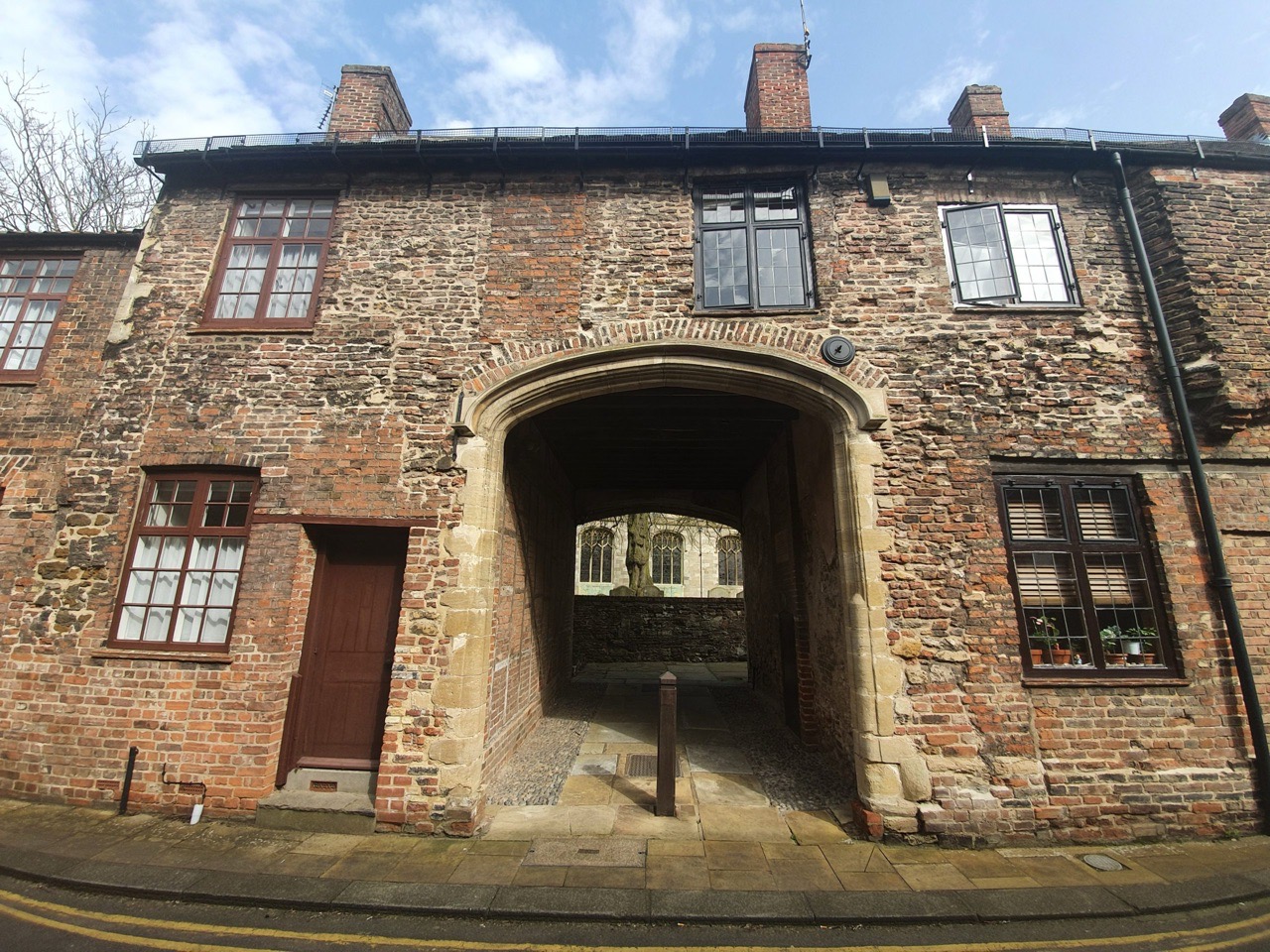
I started off in the town centre, near to Greggs, where I’d just accidentally purchased a chicken bake. Above is White Lion Court, with its post-box located just inside the arch. It’s named after the White Lion pub which once stood on Norfolk street, with that archway now also leading through to Vancouver Court and Burtons Court.
And here’s the first location, the High Street of King’s Lynn. All very decadent.
The walk to the next location went by numerous historic buildings, this one is 2 St. Margaret’s Place, which is where Sparrows Hall stood. It was rebuilt in 1513 and has since been lived in by merchants, doctors and a vicar, although the frontage to the building is from the early eighteenth century. This is Grade II listed and the record notes that many internal features remain in place, including eighteenth century doorways and frames.
A short distance down the road is St. Margaret’s Vicarage, which was built for a wealthy merchant in around 1821, but taken over by the Church of England in 1912 to be used as a vicarage. It’s a Grade II listed building and the record notes that a few internal features remain, including some wood panelling and section of plaster cornices (which are apparently uninteresting). Before this residential building was constructed, there was a seventeenth century building here that the Burney family lived in, of which perhaps most notable was Fanny Burney.
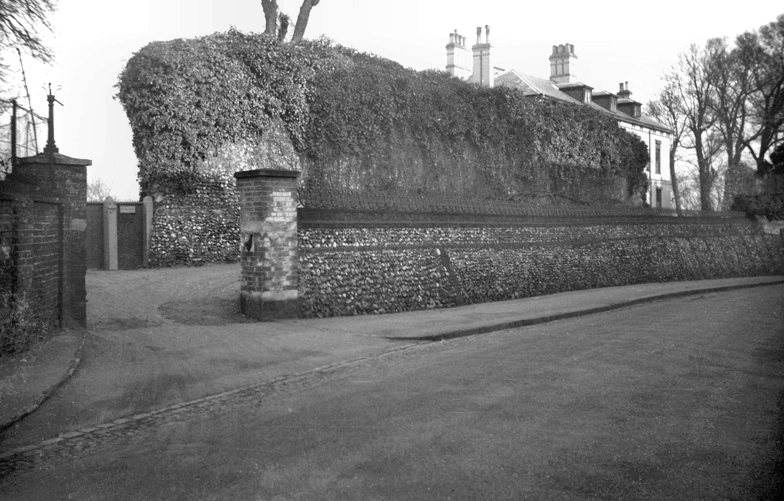
The stretch of wall doesn’t look overly exciting, but there’s a plaque with information attached to it noting that one of the people who lived here was William Claiborne (1600-1677) and his son went off to the New World, becoming the first Surveyor of the Virginia colony in 1621.
This is St. Margaret’s House which was built in around 1755 for Edward Everard (1699-1769). It replaced the Hansa Merchant’s House which were former warehouses and office buildings relating to the Hanseatic League. The current building is once again called Hansa House, although I’m not entirely sure what it’s used for now, I think it’s rented out as offices and is also licensed to hold weddings.
Priory Lane, which I think retains something of a medieval feel. OK, imagination is required as there’s a tarmac road with double yellow lines on it, but otherwise, it has that feel.
This is the site of St. Margaret’s Priory, which stood here between around 1100 and 1538, and was attached to St. Margaret’s Church. The buildings along here date from the fourteenth century and they were restored in 1975, with the Duke of Edinburgh popping along in early July 1975 to formally commemorate the work.
This was a complete surprise to me, I have walked nearby to it before and never noticed it. This is the value to me in doing GeoGuessr in this way, it means that I have to walk to places I wouldn’t have thought about going to, thereby actually noticing things….
It’s the Jewish cemetery in the King’s Lynn, although unfortunately it’s all locked up and so I had to point my camera through the bars. It’s in a walled off area of its own and I can see why they want to protect it. Known as Millfleet Burial Ground, it was used by the community of Dutch Jews who lived here between around 1750 to 1846.
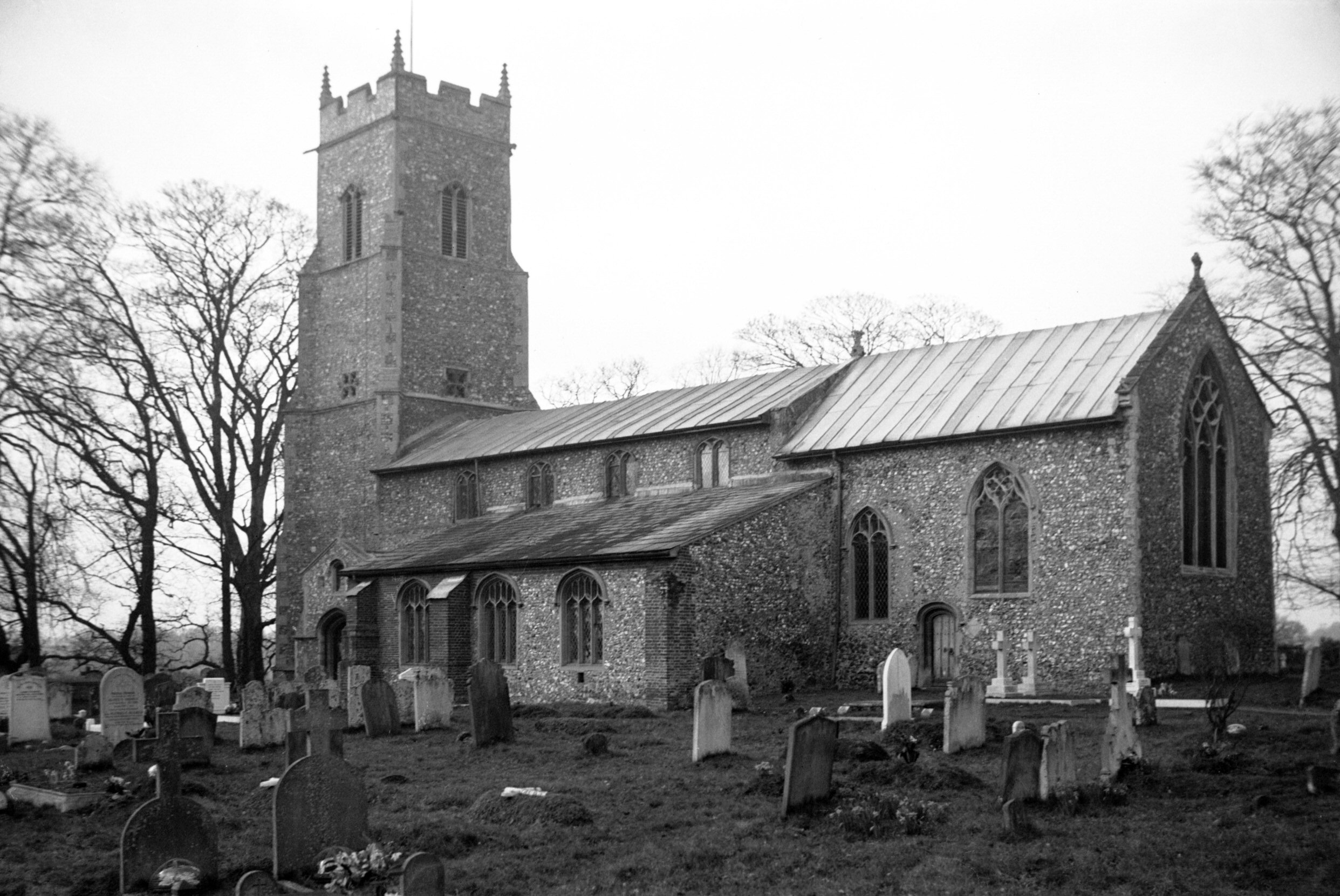
All Saints Church, which is located within a small housing estate and seems to be the geographical hub of the community, although I’m not sure if it’s the spiritual hub. It’s the oldest parish church in King’s Lynn and has been here since at least the eleventh century, although the current building is primarily from the fourteenth and fifteenth centuries. There was an anchorite cell here and there looked like some interesting structural elements to the building, not least with the tower that has fallen down. I was hopeful of seeing inside when I saw that the outer doors were open, but, unfortunately, the inner doors were locked. I note that others have also struggled to gain access, which is all rather unfortunate.
I couldn’t find the exact spot for the second location and wasn’t overly concerned, it was near enough.
This library is one funded by Andrew Carnegie, a wealthy man who spent much of his money on building libraries in numerous countries, including the United States, the UK and Canada. In the end he funded 2,500 libraries, a remarkable contribution to the state of world literacy, and he was here in person on 18 May 1905 to open King’s Lynn’s library.
I haven’t quite worked out the origins of this street name (indeed, I haven’t worked the origins out at all), but this sign is on the road that leads into the bus station.
The third location, which is on Norfolk Street, very near to where I started off.
There are several of these older street signs in King’s Lynn, and the traces of an even older one underneath.
My fourth location was back where I had just come from, so I returned via St. James’s Park, and I hadn’t realised just how big this park was. This section was a churchyard which was turned into an area of parkland at the beginning of the twentieth century.
The park was reasonably busy, but it’s such a large space that it didn’t feel particularly congested. On the right of the above photo is Red Mount Chapel. There wasn’t much litter about either, so it wasn’t like the scenes I’ve seen in newspapers of how hordes of locals have descended on parks and left their rubbish behind.
And this is Red Mount Chapel, more formally known as the Chapel of St Mary on the Mount, and its been here since 1485. It became used as a stop-off for pilgrims who were walking to Walsingham, but following the Dissolution of the Monasteries it was taken over by the town council. It rather lost its religious purpose after that, with the signage at the site noting that the council started to dismantle it and the structure has since been used for water storage, as a gunpowder store, as a study, as an observatory and as a stable. It has been restored recently and looks in good shape externally, although I can’t imagine there’s much original left inside.
The Gaywood River meanders through the park.
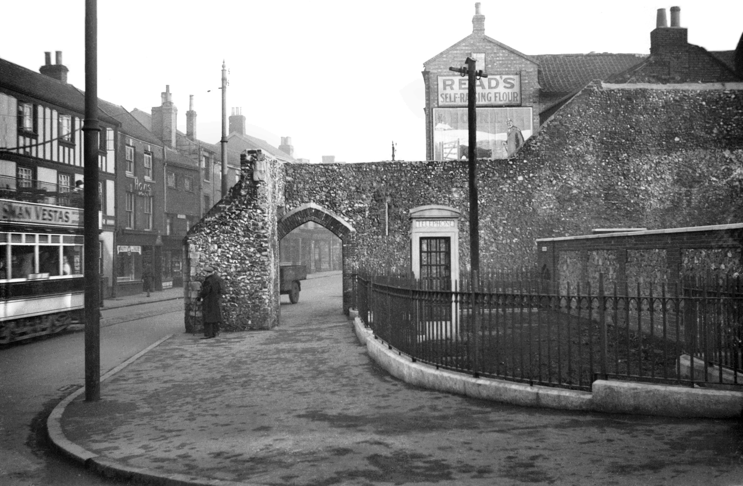
I never knew that this was here either, it’s the Guannock Gate, which was part of the town’s defences. These defences were never really tested during the medieval period, it was only during the Civil War that they became useful, and they’ve never been breached. Most of the defences were removed in the nineteenth century, including some big chunks as they were in the way of the railway when it came to King’s Lynn. This section is more in keeping with an ornamental garden, to interest those promenading around the park.
Talking (or writing) of the promenading, this is the Broad Walk, which was established in 1753 to allow locals to have somewhere to walk and exercise. However, the owners didn’t want the riff raff walking through here, so a gatekeeper was installed to ensure that only the wealthy and fashionable classes were allowed to walk in this area. Important to maintain high standards….
A wooden statue along Broad Walk.
Framingham’s Hospital, which is no longer in use, but was originally constructed as almshouses in 1677, although the current structures date to 1848.
The fourth location, which was on London Road and not that far from the second location.
A former school along Millfleet.
This is very odd, a Biedronka store in King’s Lynn, which doesn’t seem to fit the normal look of the Polish chain. I like this chain in Poland, as it tends to be cheaper than Aldi and Lidl, but this one seems a more unique set-up and I’m not sure exactly what link it actually has to the Biedronka in Poland.
This building was constructed in 1859 as the Union Baptist Chapel, designed by RM Smith. It was turned into the town’s museum in 1904, an innovative way to use the building, and it has continued to be used for that purpose.
The fifth location was King’s Lynn bus station, which concluded this little adventure. I accept that this was hardly the most challenging of walks in terms of the length, but I did find more history than I had expected simply by heading off in random directions. There were numerous areas I didn’t get the chance to visit, so I might have another go at this little exercise next week. How lovely….
-

GeoGuessr (Norwich Version) – Walk 5
I already have a better explanation (well, longer explanation anyway) for this plan. In essence, whilst lockdown is on, I need to find ways of walking nearby to Norwich in quiet areas for my LDWA 100 training. So, I’m using GeoGuessr to pick out five random locations within a certain area which I’ve defined and then walking to them, to see what kind of story I can uncover.
The five random locations, all fairly close to the city centre, so this ended up being a walk of just under seven miles. Nathan was helpfully understanding when I turned up late as I bumped into (not literally) someone I knew.
It’s a little difficult to find anything new in the centre of Norwich given how much I’ve been traipsing around it, so the more mundane may become more predominant. But, perhaps there’s something just as magical about these old stones under the road surface than a building that was constructed at the same time. The paving here on Barrack Street is likely the best part of a century old and it was part of a long roadway down towards the River Wensum, although it’s mostly gone now.
This was the first location, Whitefriars Bridge, which I’ve written about before…..
This, until recently, was the Del Ballroom on Waggon and Horses Lane which was used until 2013 as a dance studio. Norwich City Council decided that as there was a dance studio nearby, this interesting and quirky building could be torn down, despite some local objections from nearby property owners. I suppose it’s not a hugely historic building, as it was only built in the 1930s, but it added some character to the local area. The seven new properties they’re cramming into the site don’t have car parking provided and no right to a permit, so it’s all quite environmental in terms of not adding cars to the roads of Norwich. Anyway, I digress……
Our second location and this photo was taken from just outside the rather lovely Strangers’ Hall Museum. The Strangers were Dutch Protestants who were invited to live in Norwich by the city authorities and so many came that they eventually comprised a third of the city’s population. They did much to boost the textile trade in Norwich and also helped the local economic situation, with relatively little evidence of any animosity between locals and incomers. There’s a strong legacy in the city today of Dutch style buildings and it was the migrants that brought over canaries, which is the city’s football symbol today.
This is the former site of St Benedict’s Gate, also known as Bennet Gate and Westwyk Gate, which was demolished at the end of the eighteenth century. A little bit of this gate survived until the Second World War air raids destroyed it, as can be seen in this George Plunkett photo. Today, the route of the city wall and the outline of the city gate is marked out in brick paving which is always a marvellous idea.
The line of the wall looking up towards Grapes Hill.
Our third location, the former Britannia pub.
The pub was opened in 1975 and closed again in 2000, now being used for housing. It’s really not the most attractive of buildings, but I’m sure that the city council thought that this was marvellous when they approved it in the early 1970s. The pub was built to replace the Sandringham Arms, an interesting Victorian building which had been a licensed premises since the 1860s.
The Rose Valley Tavern, or whatever name they’ve fiddled it about to now, which has been a licensed premises since the mid-nineteenth century.
And Nathan had put chips on the agenda for the evening’s walk, which was a most useful idea. I’ve never been here before, so another first, this is Lee’s Fish Bar on Chester Street.
Full marks for presenting chips (and a battered sausage) like this, they were much easier to eat and this is proper innovation as far as I’m concerned. Also, I discovered that they had given me scraps with the chips, and I very much like them. I was in rather a good mood with Nathan for some time after this little meal. The chips were quite salty, but I liked that, indeed, they catered very well for me here.
Fourth location, which is Leopold Road. I’m not going to comment on the history of this road as I didn’t pay any attention to it at the time, so that would be a bit fake….
This is the railway crossing which goes under Hall Road, although the line isn’t there any more, it led into what was Norwich Victoria Station. This was a complete mistake IMO to remove, as the lines connected in, so the city could have trains running into the centre of Norwich, opposite the bus station. An integrated public transport policy. Although, it’s important to note that passenger services ended here over 100 years ago, in 1916, and the station was used primarily for goods transportation after that.
Nathan was doing the navigation for the evening and he excelled himself (I hope he doesn’t read this, he’ll quote that for ages) in the choice of route towards our fifth location. This is the former city wall at Carrow Hill and George Plunkett took a photo here in 1934 when it was covered in rather more ivy.
At this point it was dark and we were navigating by torch light down this hill Nathan had chosen, but it took us under Wilderness Tower. I promise that I won’t enter this photo for any photography competitions.
There are some reasonable views of the city from up here.
And then by Black Tower, although I accept that there’s not a great deal of detail visible in the photo. I’ll walk by here again in the day to take some more photos I think.
And we dropped down to near Norwich City Football Club for our fifth location and I’m unsure why GeoGuessr keeps giving random locations around here. I have more photos of the side of Morrison’s than is healthy for someone in their late 30s / early 40s…..
Anyway, this was an easy way to add a few more miles of walking in, as it’s really not long until the LDWA 100….. The weather was mild, which was fortunate, as it’s annoying to get drizzle when trying to get chips on the go.
-

GeoGuessr (Hoveton and Wroxham Version)
I already have a better explanation (well, longer explanation anyway) for this plan. In essence, whilst lockdown is on, I need to find ways of walking nearby to Norwich in quiet areas for my LDWA 100 training. So, I’m using GeoGuessr to pick out five random locations within a certain area which I’ve defined and then walking to them, to see what kind of story I can uncover.
This walk was very basic, as it was part of our longer Wroxham Wander (I’m pinching the idea of naming walks in the way that the LDWA do now….) walk. Anyway, this was just five random locations in Hoveton and Wroxham, done primarily to see a little bit of the villages that we might not otherwise have done.
Our five random locations, all within about five minutes walk of each other…..
Our first location was on Brimbelow Road, which is a long road with many riverside properties, all quite decadent. This was the part of Hoveton that expanded during the late nineteenth century and early twentieth century, when it became something of a holiday destination.
Our second location was Roys of Wroxham, known as the largest village store in the world. They’ve been trading since 1895 when the Roy brothers opened their first store in Coltishall, and they opened in Hoveton in 1899. Although the store is located in Hoveton, it takes its name from when supplies used to be sent to them at the local railway station, then known simply as Wroxham (it wasn’t named Hoveton & Wroxham until 1966). That meant that the store became known as Roys of Wroxham and that name has stuck since.
The building in the above photo is the department store section of Roys and was constructed in 1966, although was nearly entirely destroyed in a fire that took place in May 1995. A temporary store was opened for a year so that Roys could keep trading, but their new store was open by mid-1996.
Our third location was the chip shop, although we visited Greys Chips over the road for lunch. It’s a busy little area of Wroxham, it’ll be packed in the summer when (well, and if) lockdown is over.
A photo by the river at the rear of the King’s Head and there’s a path which goes by the river all the way to Hoveton & Wroxham railway station.
Lots of swans on the River Bure. Clive (someone I know who panicked when he saw a swan in the river and he capsized his canoe) would very much like it here….
Our fourth location was Grange Walk, named after the Grange building on this street. The Grange is Grade II listed and was built in the early nineteenth century, although it likely has an older core as there’s been a structure there for some centuries. Today, the Grange is in use as an antique dealer’s shop.
One of the boats in the boatyard next to the Bure.
We missed the train passing under here by only a minute, so there’s no photo of the new Greater Anglia fleet…. This is the Norwich to Sheringham line, perhaps a surprising survivor of the cuts in the 1950s and 1960s. The line from Hoveton & Wroxham to Aylsham, the Bure Valley line, was less fortunate and was closed, although is still in use as a heritage railway.
Our fifth location was at Nobel Crescent, located near to St. Mary’s Church.
St. Mary’s Church, a Grade I listed building of note because of its Norman door, although that wasn’t visible when we visited as the building was locked. We did compare a photo of the graveyard today with the one taken by George Plunkett in 1934, and it’s notable how some gravestones have disappeared since that time. I do wonder where these headstones have ended up, whether they’ve been laid flat or just destroyed.
The Trafford Mausoleum, located in the churchyard of St. Mary’s and built in around 1830 to be the family vault of the Trafford family, who lived at the now demolished Wroxham Hall. The design was deliberately medieval and is attractive, although it really does dominate the churchyard.
There’s a drop at the rear of the church down to the River Bure, which shows quite sensibly that they’ve located the church on a raised piece of ground.
The Grade II listed Church Cottage, located next to the churchyard of St. Mary’s. This property was constructed in around 1830 and it was extended in 1999 in a similar design.
Walking down Church Lane, whilst listening to Nathan muttering something about me faffing about taking photos…. This street is the old heart of Wroxham when it was a medieval village, although the centre of the settlement has shifted towards today’s tourist heart of the river.
I never knew about Caen Meadow until we saw a sign pointing towards it, and it’s a rather lovely area near to the River Bure and there are numerous benches and places to sit, along with the opportunity to paddle in the river (we didn’t do this). It’s not known why Caen Meadow has this name, it might be because stone from Caen was used in the building of the nearby St. Mary’s Church and so this could have been brought up from here. Alternatively, it has been suggested that there might have been a monastery on this site which would have perhaps been part of the lands owned by the Abbess of Caen.
Anyway, this was the shortest GeoGuessr challenge that we’ve done, being completed in around twenty minutes. But, it did have the advantage of bringing us to a part of Wroxham that I’ve never visited before. And then we had to walk back to Norwich…..


