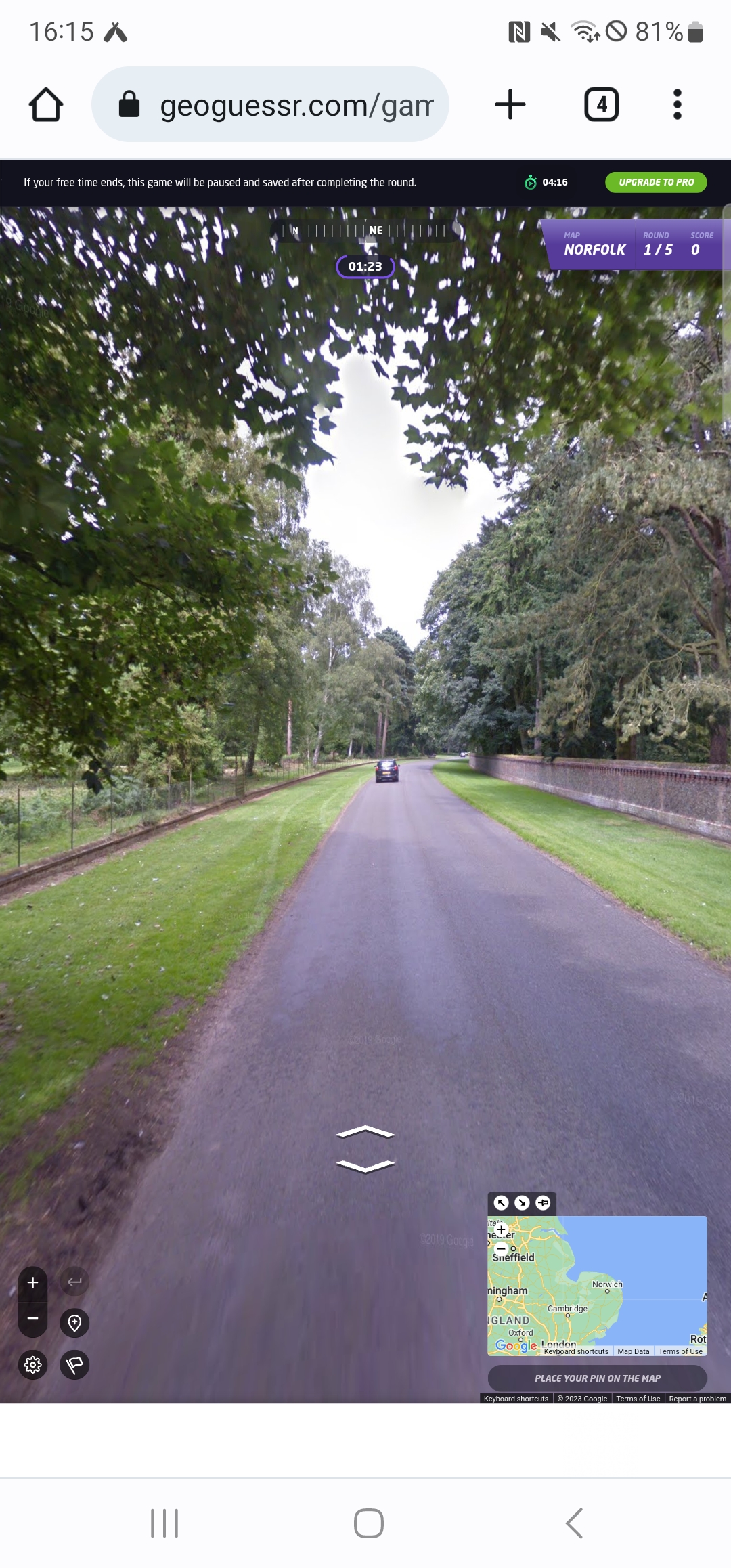
I already have a better explanation (well, longer explanation anyway) for this plan. In essence, whilst lockdown is on, I need to find ways of walking nearby to Norwich in quiet areas for my LDWA 100 training. So, I’m using GeoGuessr to pick out five random locations within a certain area which I’ve defined and then walking to them, to see what kind of story I can uncover.


This walk was with Liam and the five locations that we got are above.

We didn’t follow the Komoot route exactly and it came in at just under 18 miles, a rather useful training walk for the LDWA 100 and managing to avoid people for the vast majority of the day. We were fortunate in that our three locations outside of the city centre were all located in the same sort of area, as it would have made for a much more challenging expedition if just one had been off towards the east of Norwich.

We started the walk going through Old Library Wood in Norwich.

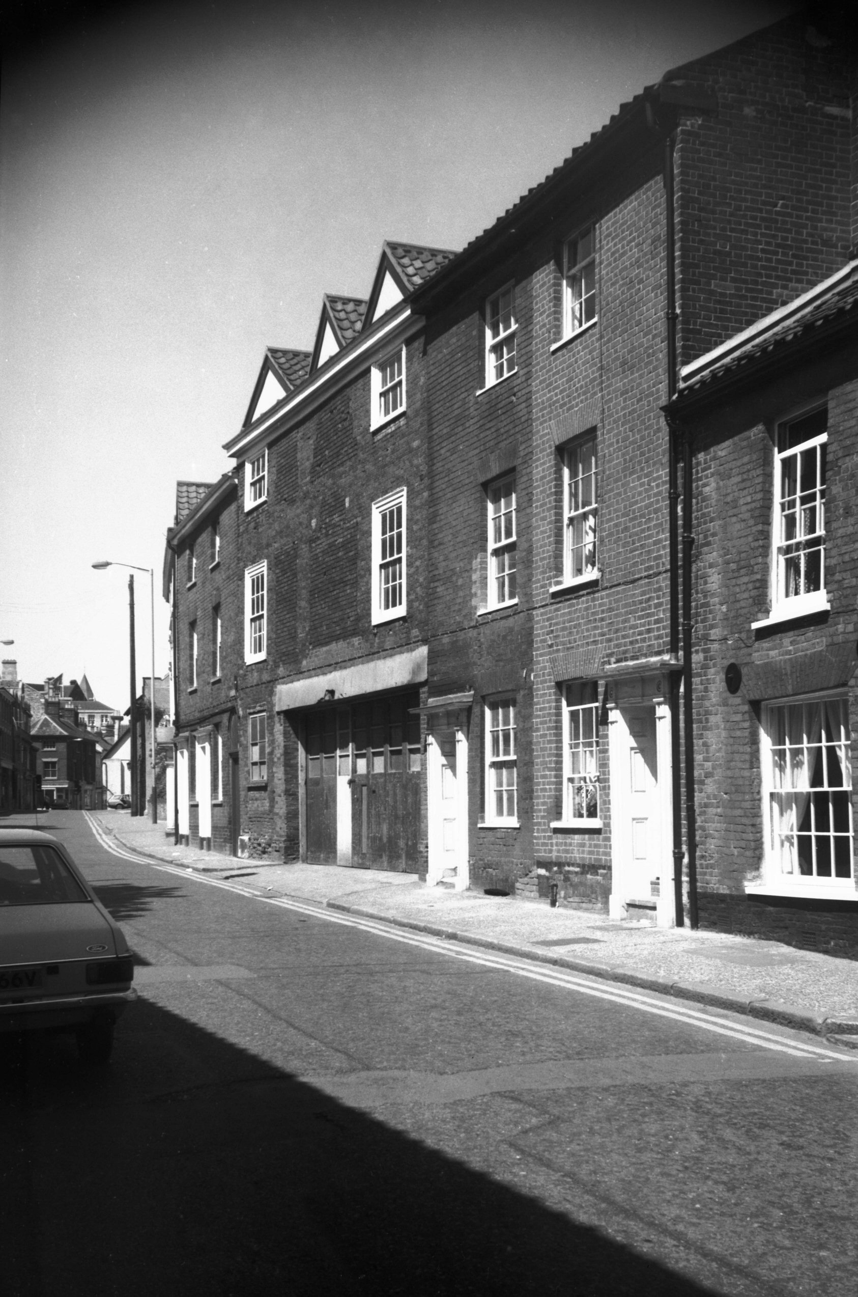
Our first location, which was 83 to 87 King Street, which has been much tidied up since George Plunkett took a photo here in 1985.

By a lucky coincidence we managed to walk past a Greggs en route to our second location.

A sausage roll and a latte, rather lovely.

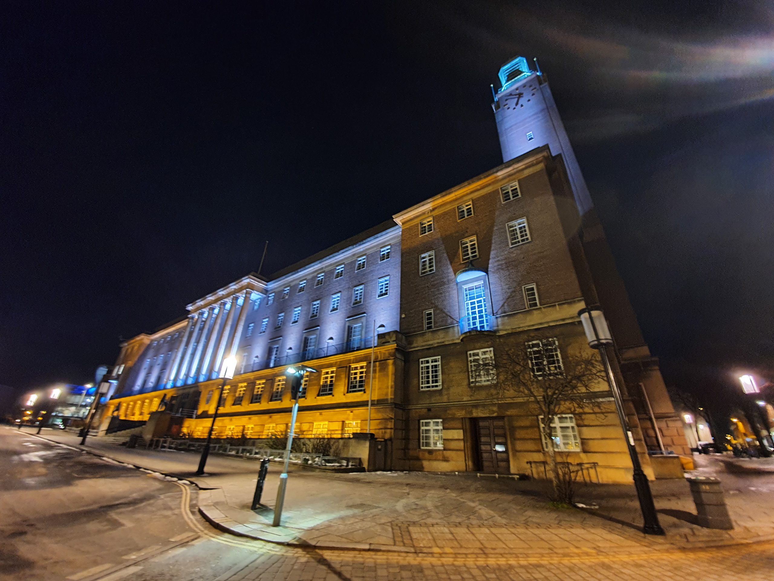
And the second location, showing the Guildhall and Tesco Metro. The Guildhall dates from 1413 and has been an important municipal building over the centuries and was used as the meeting place for Norwich City Council until 1938 and Norwich Courts until 1977.

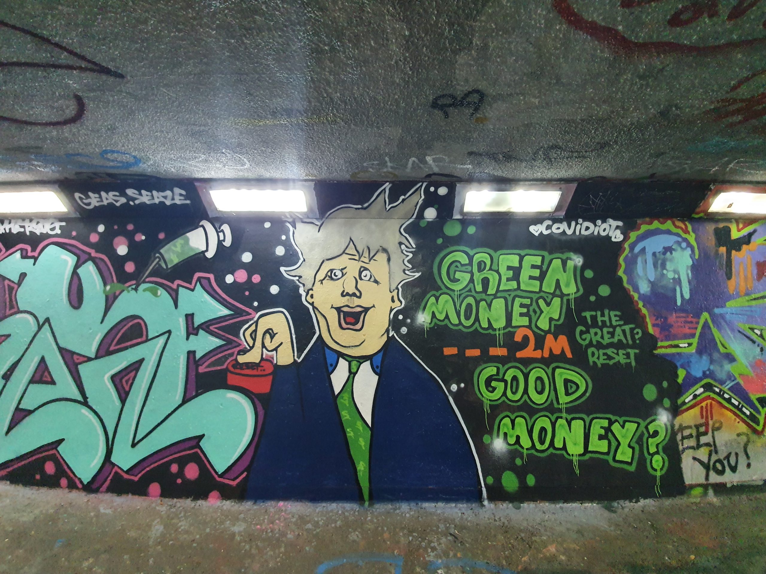
Some colourful graffiti in the underpass which stands roughly where the Bull and Butcher pub was once located before the inner ring road ploughed through the area. I hadn’t realised how much graffiti there is here, at least it’s quite artistic and not just random swear words scrawled onto a wall.

I had a quick pop into Earlham Cemetery for this photo….

I hadn’t noticed this before, a milestone from when this route was once a toll road leading from St. Benedict’s Street in Norwich to the metropolis of Dereham. The route was 16 miles long and the road was a turnpike between 1770 and 1872, when the tolls were removed. I assumed that this was a modern replacement, but it’s actually from the fourth and final set of milestones which were added by the Turnpike Trust in 1868. The metal plate is recent, as is the white paint which has been added over the stone. Each to their own, but having seen a photo of what it was like before the restoration, I preferred it as it was as I like history being raw and authentic (and yes, I know it’s just a stone and talking about it being raw is perhaps excessive….).

A few weeks ago, Nathan and I walked here trying to trace the source of the River Wensum and when we were walking in this area off Hellesdon Road we saw some parakeets. Liam and I tried to spot some, but unfortunately failed….

And another milestone. Ignoring the modern metal plate and the patchy white paint, the beauty of the original stone can still be imagined.

And our third location in Bowthorpe, which didn’t really require walking far from the Dereham Road.

We then walked from Bowthorpe to Costessey, this photo shows the Wensum Valley in the background. There’s what I consider to be an appalling attack on the countryside here proposed by Norfolk County Council, but fortunately the Stop the Wensum Link are working hard to end this environmentally disastrous project.

This next stretch wasn’t entirely ideal, rather mountainous.

A decorative datestone on this building on West End in Costessey.

Slightly annoyingly, this photo doesn’t show how steep I thought the hill was here.

Walking through the woods….

We then came out into Queen’s Hill, a relatively new housing development located between Costessey and Taverham. The estate, according to the EDP, has 1,784 homes and 5,000 residents and despite people living there for ten years, they’re only now building their first shop, a Co-op which will open in late 2021. It felt a safe area to be, all quite middle-class and content, but I was surprised to see just how tightly the developers have packed the houses in.

Public transport to Queen’s Hills isn’t ideal, there’s no train or light rail (the council didn’t seem bothered about this when they gave permission for thousands of homes to be built), and the bus stops have an absence of any information. I mentioned the Wensum Link above, the county council seem almost bemused as to why there is so much traffic in areas like this, it’s almost a mystery given that there’s limited public transport…. Anyway, I won’t grumble….

A rather sweet little shed, which I think was a book swap location, with the house behind it having an artistic display in their windows.


These four photos are from where cars have splashed water up against the hedge, creating a rather impressive little ice display. I was quite transfixed by the whole thing, although I’m easily pleased to be honest….

[The River Tud, which is a future expedition for Nathan and me…..]
Writing later on, this wasn’t the Tud (which is an off-shoot of the Wensum), this is the River Wensum…..

Unfortunately, the bridge at the entrance to Taverham isn’t listed, so I can’t find out much about it. There’s an access point for firemen to attach hoses to the river though jutting out.

And another view from the bridge, all rather scenic.

Entering Taverham we thought we’d better get some lunch, and the chip shop here was well reviewed and it seemed only appropriate to pop in. I took this photo after eating chips, which might be noticeable from the smears on my phone’s camera……

Friendly service, no facility to accept cards (my perennial complaint) and the prices marginally above average. All fine, nothing exceptional, but perfectly good value for money so nothing to complain about with the food. Liam had to wait for more chips to be prepared for his order, and I think the staff member seemed confused when I said to leave them unwrapped (most people don’t want to walk along an icy road in the cold eating chips perhaps) and I then realised he forgot to add the salt and vinegar.

The Post Office looks like it does lovely fish and chips…..

And our fifth and final location in Taverham.

After some surprisingly slippery roads in Taverham, we decided to get back to Norwich by walking down the Marriott’s Way, the former railway line. Not very original perhaps, but it’s an easy walk back into the city.

A bridge over the River Wensum, I’m not sure what that unsuitable surface on the bridge is.

There’s still a lot of flooding in the fields nearby to Marriott’s Way.

A variety of faces on some trees.

All rather peaceful….

This is Dragon Bridge on Marriott’s Way, and there’s a story about a little train incident that happened here which is best told at Marriott’s Way web-site.

And the end of the walk, with Gas Hill (Mountain) being closed off to traffic, a common occurrence in the mountain tops of Norfolk.
So, the end result was that neither of us fell over on the ice, which was a major achievement in itself. The temperature was moderately warm, which was helpful, and it was useful to get some walking distance in for the LDWA 100. There were some areas of the city that I hadn’t seen before, mainly around Queen’s Hill and Taverham, so it was useful to see something new.
As for the whole concept of these five random locations….. I still really like it, as the element of the random forces some exploration in areas that I might not think about ever visiting and it is quite handy at ensuring I can visit new chip shops in the Norwich area….


