As Hilton, IHG and Expedia have obfuscated and delayed my refunds with the current situation, I’ve been genuinely impressed by Accor Hotels and the response from their hotels. And, I’m also pleased that the chain gave me Platinum status, which I would have reached anyway this month, without making the stays. Which is a little difficult at the moment.
This arrived through the post today, and I like little surprises like this. Like a kid really.
I nearly did an unboxing video, but that would have perhaps been a little excessive.
Well, how lovely.
And these wireless earphones are genuinely very useful as I don’t have any and was thinking of getting some. I’ve got them set up and although I’m not an expert in these matters (or indeed many matters at all) they seem decent quality.
I can now definitely say that Accor Hotels are my favourite hotel company. I’m so easily bought with gifts…..
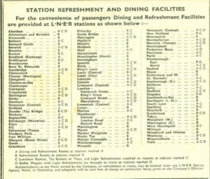
I hadn’t seen a list like this before, it details what catering facilities there were available in all of the London and North East Railway (LNER) stations.
Strange to think that there was a refreshment room at Newmarket railway station, there isn’t even a station building left there now for those passengers passing through.
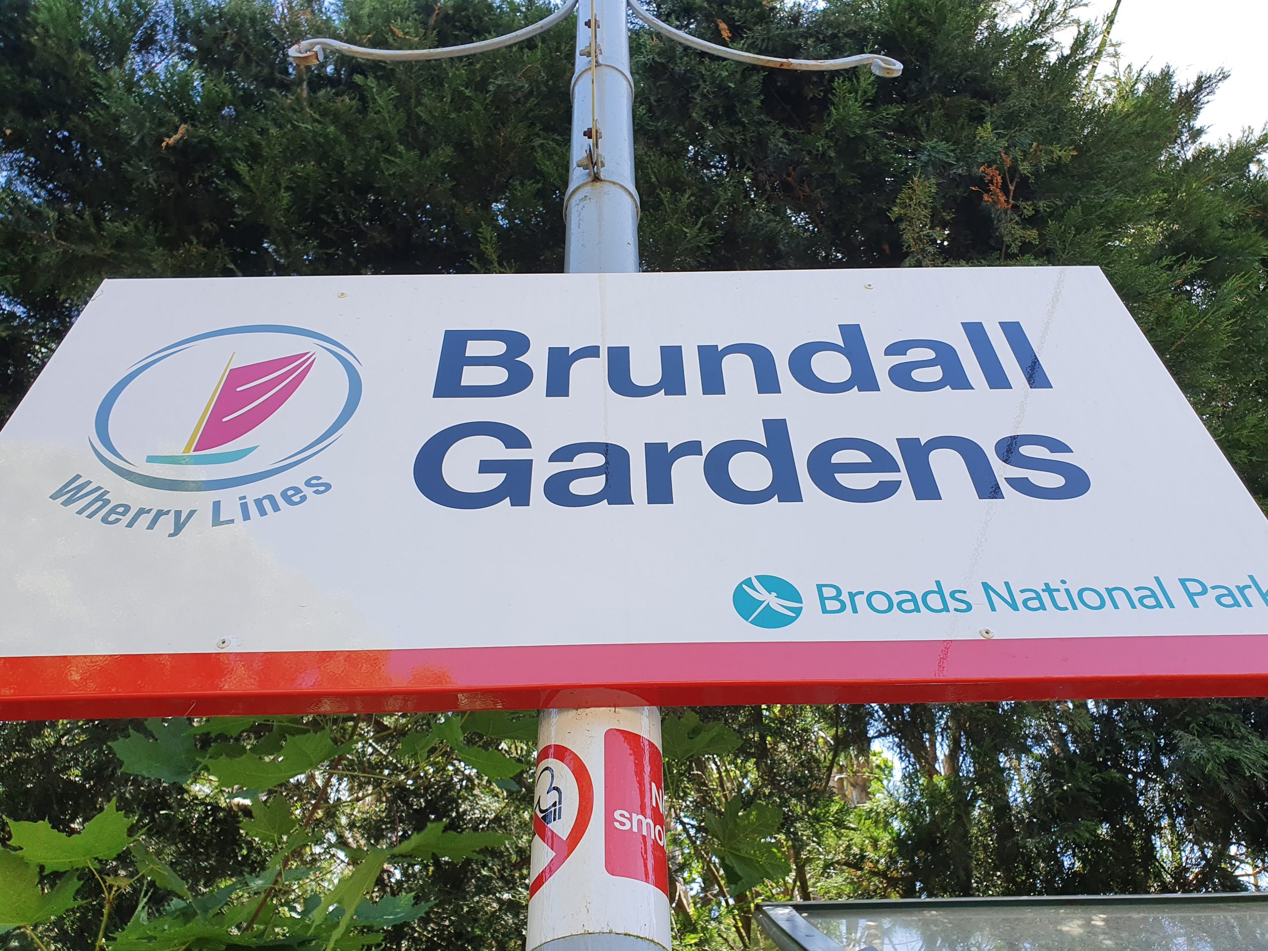
We went through this railway station on our third training walk for the LDWA, it’s one of two stations in Brundall.
Brundall Gardens is a little unusual as a railway station as it’s a more modern station that was added to an existing line. It was built in 1924 on the Norwich to Great Yarmouth line, located around four miles from Norwich and less than one mile from Brundall’s main railway station. On the above map from 1900, the railway station is just above the field which is numbered 7.
Standing on the southern platform, this is the line to Great Yarmouth. Operated by London and North Eastern Railway (LNER), the railway station opened on 1 August 1924 to allow access to the nearby 76-acre site of Brundall Gardens. It was originally known as Brundall Gardens Halt and was renamed as simply Brundall Gardens in 1948.
The gardens that the railway station was built for had been purchased by Michael Beverley in the 1880s and he had laid them out to include waterways and lakes. Frederick Holmes-Cooper, who had made his money from the cinematic industry, bought them in 1921 and the gardens were being visited by 60,000 people in 1922. The installation of the railway station cost £1,733 and Cooper gave LNER £150 per year to fund a stationmaster. There’s a map of the gardens at http://www.brundallvillagehistory.org.uk/maps.htm.
Still standing on the south platform, this is the line to Norwich. A booking office was placed on the north platform, with a waiting room and passenger accommodation installed on the south platform. Only the booking office now remains, other than for a basic shelter on the south platform.
On the footbridge, looking in the direction of Great Yarmouth.
On the footbridge, looking in the direction of Norwich.
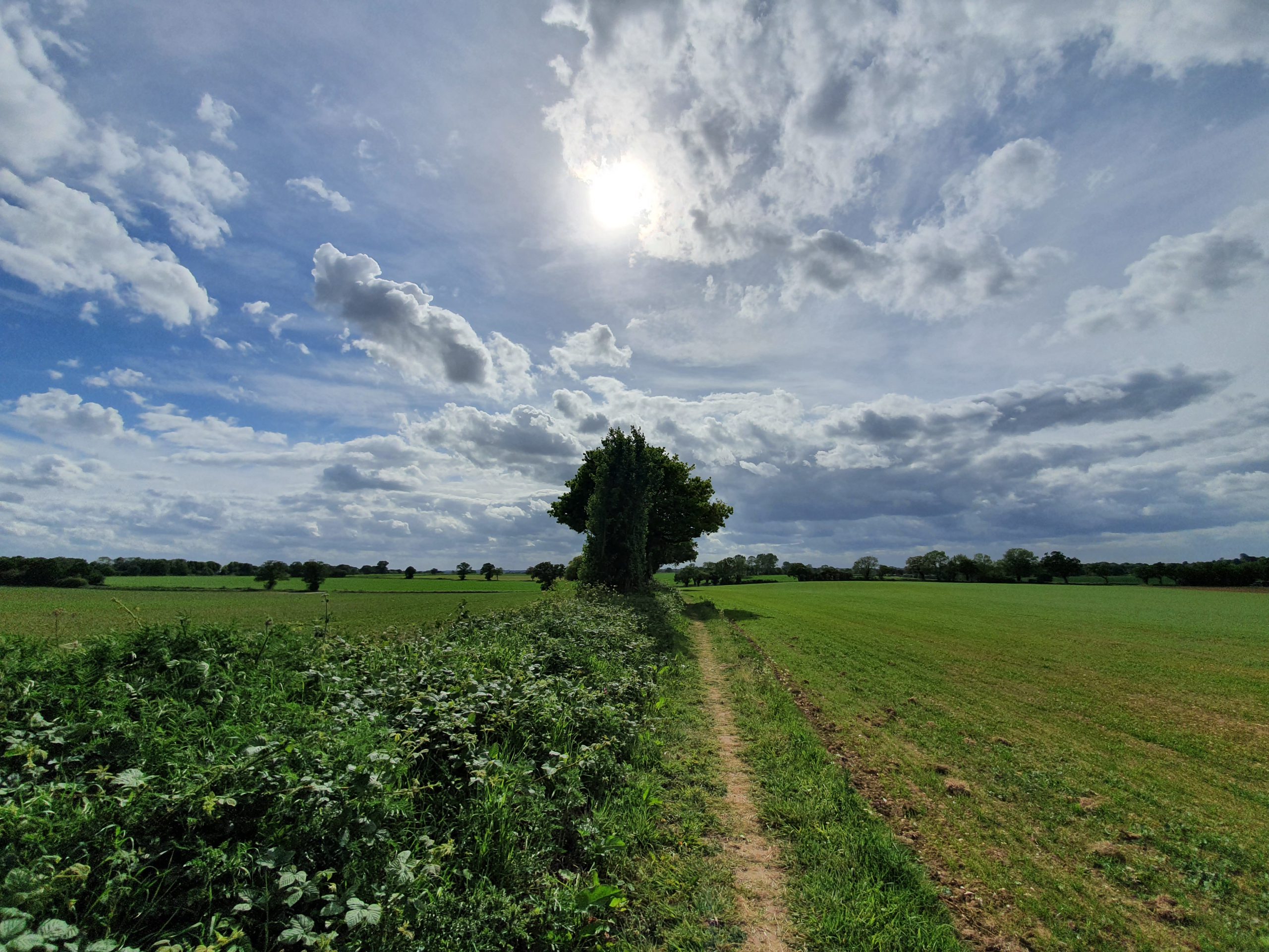
There’s a footpath that goes from Postwick towards the station.
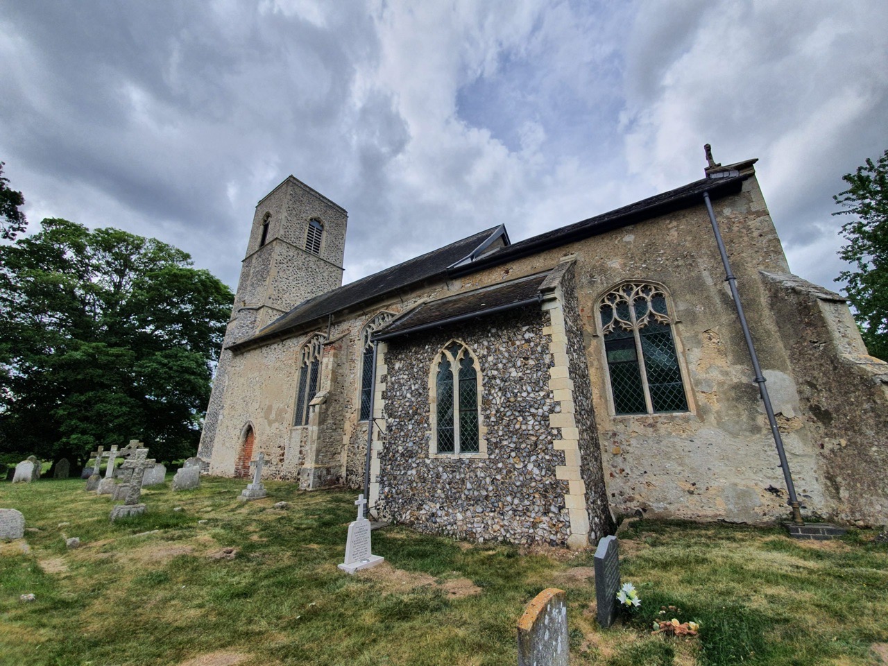
We visited here on our third training walk for the LDWA 100 next year, and it’s the Church of St Michael All Angels on the edges of Brundall, in what is the deserted medieval village of Braydeston. Although nothing now remains of Braydeston, this settlement was listed in the Domesday Book in 1086 and it’s known that there were ten households here in 1428. The date of this means that the village wasn’t abandoned due to the Black Death, it was probably just a change in either the fishing or farming needs of the local community.
The village of Braydeston was located in the field by the church and this building dates to the thirteenth century, although has some Saxon structure within it. For such a relatively small settlement, it’s a substantial church and the tower was added later following a bequest from John Berney in 1440. The roof line of the church was also lifted at the same time at what appeared to be the height of the building’s fortunes.
Due to the current situation, there was no access to the interior of the church, but it does hold one of the few bread ovens which remain in church buildings.
An early medieval doorway which was bricked up in the nineteenth century. The church had fallen out of usage in the seventeenth century, but as part of the Victorian resurgence of religion, services were again held here and a new organ was installed.
One of the railed-off tombs.
I’ve seen many grave markers like this, although they’re normally older. This one commemorates the life of Elizabeth Mary Theobald and Harold Thomas Theobald.
At the front of the church, there was a footpath query in the early twentieth century, something a little rarer then. This related to the meadow path which crosses into Brundall and although it was defined as a footpath, cars started to use it, not least hearses getting to the church. The local council said that cars could use the track, although wiser heads have since prevailed and it’d be quite difficult to get a hearse along that track today.
This walk was socially distanced….. And is the third walk in preparation for the 2021 LDWA 100. But isn’t an LDWA walk in itself, because these have all been suspended until the troubles are over.
WALK NUMBER: 3 (Norwich to Lingwood)
DISTANCE COVERED: 22 miles
NUMBER OF NATHAN’S FRIENDS WE “ACCIDENTALLY” BUMP INTO: 3
SUFFICIENT BEER CONSUMED: No
PUBS VISITED: 0
WEATHER CONDITIONS: Moderate
ATTACKED BY ANIMALS: No
NUMBER OF SNAKES SEEN: 0
It’s taken me over a day to be able to upload this due to some faffing about with moving servers, but here we are, the walk we completed on Saturday 23 May 2020. There’s a bit more history to this walk as nothing overly eventful happened, but hopefully enough to remain sufficiently readable. I’m going to struggle to ham this up enough to make it a rock n roll type story, and certainly we didn’t smash anything up on our travails, but I shall dredge what memories out that I can.
The walk started near to Rosary Cemetery, which is notable for being the first non-denominational graveyard in the UK.
It’s a beautiful setting, peaceful and quite expansive, with nearly 20,000 people buried here.
Lion Wood, some of which is ancient woodland. Nathan seemed to think that I got lost in this wood, but I was just looking at some of the trees which weren’t on the path.
What’s left of Pinebanks, formerly used by Norwich Union. I’m not sure that I’ve seen these buildings and grounds for the best part of 25 years, despite it being relatively near to where I live. Not sure what’s going on here, but there should be some redevelopment of the area over the next few years.
This route took us back onto the Yarmouth Road. Nothing exciting happened here.
The Buck in Thorpe St. Andrew, which was closed before the current situation and it’s had a difficult few years. It’s a seventeenth-century building, with numerous extensions and an internal layout that I find quite disjointed.
This is Thorpe St Andrew Parish Church and I’ll have to write more about this elsewhere, otherwise this is becoming a history blog post. In short, this is the tower of the abandoned church which is now the gateway to the new 1866 church structure which stands behind it.
We walked by here in the morning and it was already open, so we knew that we could get chips on the way back and we looked forwards to them throughout the day. More on this bloody debacle later though.
And another derelict building, this time the Griffin pub which had been licensed premises since the middle of the eighteenth century. Formerly also known as Griffin & Pleasure Gardens and the Hungry Fox, it also took the perhaps ridiculous name of Gunga Dins Old Colonial House between 1984 and 1986. It looks like the building will avoid being demolished and since it comes with a chunk of land, there might be a fair amount of redevelopment around here.
The name of a property on Griffin Lane.
I have some friends that might get a sticker such as this just to avoid social contact after the current crisis is over.
Just as we were wondering how we were supposed to join the Southern Bypass, these steps appeared. They were much steeper than they look in the photo and reminded me just how hilly Norfolk is.
Here’s the beautiful and peaceful site of what was once Postwick Grove.
This is marked red and white to stop cars driving down the pedestrian path. This worries me, as it’s likely some bloody idiot has tried it.
The thirteenth-century All Saints church at Postwick, which we would have missed if it wasn’t for the Komoot app sending us down here.
Back into countryside, there were numerous woodland areas on this section of the walk.
Brundall Gardens, our first of three railway stations in the day. More on this station in another post, but this was originally known as Brundall Gardens Halt and was opened in 1924 to serve the increasingly popular local lakes and gardens. The station was inserted onto the existing line, just a short distance from Brundall’s main intermodal hub (well, the local bus).
Into Brundall, it was time for lunch. The staff here have turned their shop into a slalom type affair, which is an Ikea style effort which means you have to walk along every aisle, so the four poor staff stacking shelves had every single customer go by them. Although this amused me when Nathan got trapped in an aisle with four staff on all sides. Anyway, the store’s attempt to force staff to meet every customer within 3 inches aside, the meal deal arrangement proved satisfactory and the staff seemed helpful and friendly.
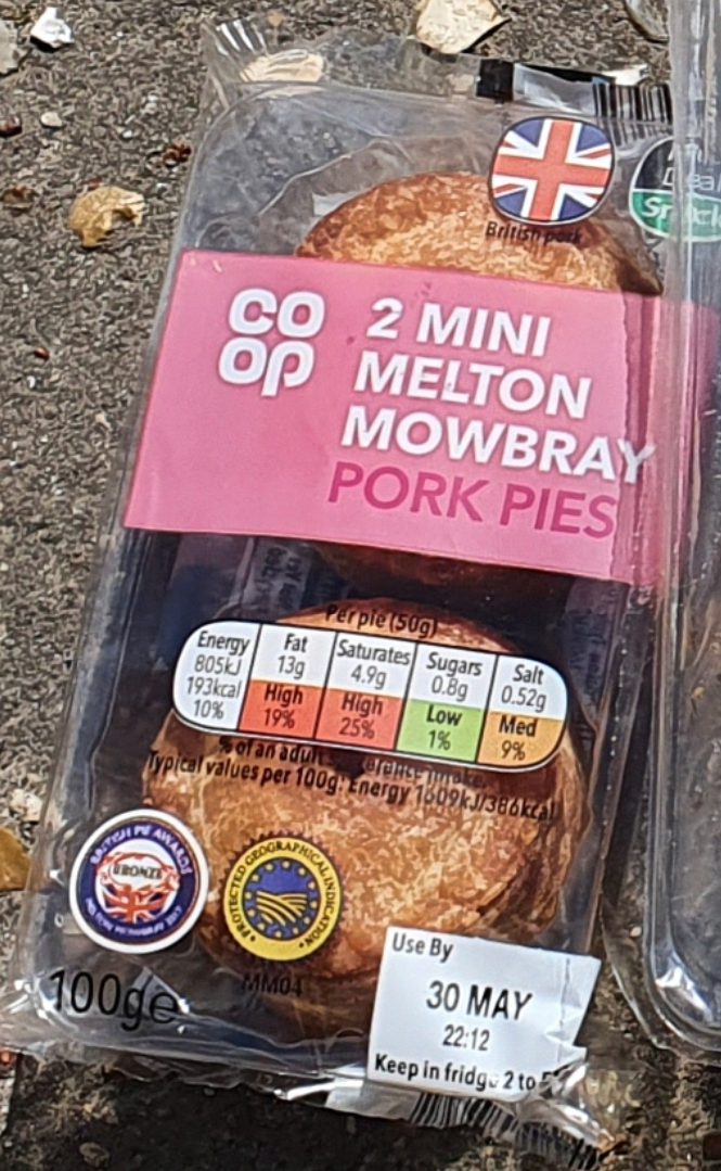
The lunch-time meal deal. I use this photo partly because anything food-related gets uploaded, but also so I could whinge on about the poor quality of the pork pies. I think Nathan agreed with me when I mentioned the quality, although I suspect he lost interest when I commented on the subject a few more times. I like to have things to get annoyed at.
The Ram Inn. It was shut.
The train at Brundall railway station, which opened in 1844. I hope that Greater Anglia haven’t realised that there’s a lovely station building here, as otherwise they might want to rush over to knock it down to build a car park.
This is about as much sense as I’ve got out of Greater Anglia information team about how much of the Brandon railway station’s frontage they can save. Anyway, I digress and this was a cheap dig. Which is actually probably what Greater Anglia will be doing at Brandon with their bloody car park.
The Huntsman. It was shut.
Mr Motivation excited me by telling that he knew that this pub was open.
It was shut. Although, it was open if we’d have timed it differently, so we were nearly there…. It was at this point that I realised I had made a mistake not to carry a bag, which could have contained a couple of delicious beers.
Nathan knew this area well, as he worked around here and so he was able to tell me quite confidently that there was no path and only a narrow verge on this stretch of road. Anyway, we enjoyed walking along the path that was unbroken and you can see just how treacherously narrow the verges were in places. But, I didn’t say anything as it’s not worth causing any upset.
Whilst walking down this road there was a surprise. Nathan’s friend Ben appeared driving down the road as if by an amazing coincidence. Let’s be realistic, Nathan’s slipped him £5 to drive up and down for an hour for this magic meeting. Let’s remember Nathan “doesn’t know many people”, but frankly, it’d be easier to walk around with the Pope the amount of times we’re stopped on walks. But more on that later.
Strumpshaw church, more on this another time….
After we had got over the ‘shock’ of Nathan’s friend driving by, we were rewarded with this sign showing that it was just 1/4 mile into Lingwood.
One mile later we arrived into Lingwood.
It was shut.
The former Methodist chapel at Lingwood. Again, to avoid this quick walk report turning into a major epic, I’ll write about this another time.
The Lingwood & Strumpshaw reading rooms, more another time….
When we heard the gates come down I explained, using all my knowledge and experience of the railways, that it would definitely be the train going from Great Yarmouth to Norwich. So we looked out for it coming from the Great Yarmouth direction. Anyway, the Norwich to Great Yarmouth train then appeared from the Norwich direction. We swiftly moved on.
I can’t recall ever going to Lingwood, so this is a first for me, the delights and excitement of Lingwood railway station. I really can’t make that sound interesting, although there’s some heritage to the station building (not yet knocked down by Greater Anglia), which was opened in 1882 by the Great Eastern Railway and is now in use as a B&B. More on this in another post though.
Looking down the line towards Lingwood’s sole platform.
After taking in all that Lingwood had to offer, we meandered back a different way to Brundall, taking a more scenic countryside route from Lingwood. Although not until we bumped into the second person that Nathan knew.
This is the thirteenth century St Michael and All Angels in Brundall, although it was once the parish church of Braydeston, but that settlement was abandoned in the medieval period.
After we had left the church, the next friend that Nathan had phoned up to make up an appearance came randomly cycling along with his family. With a conversation that was skilfully scripted to ensure that I could gather how competent Nathan was at his previous job, I pretended that I didn’t think this was another rigged effort.
Hmmmmm. We bravely went into the field full of danger, but we didn’t see the bull.
Back in Brundall, this is a glorious building and it dates back to the seventeenth century, now sadly lost as a pub, but it was the Old Beams and before that the White Horse.
A quick snack from the town’s other Co-op on the way back.
Free books outside a charity shop. I’d add it said that they were free, I hadn’t just assumed that, but I decided against carrying anything back.
As mentioned earlier, we had been looking forwards to chips, and in my case, sausage & chips, since we walked past this fish & chip shop, the Thorpe Fish Bar, earlier on in the day. So, I stroll in after nearly walking in the exit door, and checked if they accepted cards. Which they didn’t. Now, this situation just very slightly annoyed me. I spent 5 weeks in Poland earlier in the year and every single shop, bar, restaurant, hotel and newsagent accepted cards. But here we are in the customer service driven UK and a few outlets here stick rigidly to cash. This wouldn’t matter, but the pair of us walking professionals had one credit card and one debit card between us. But, anyway, that’s their choice and they did tell us that there was a cash machine at Sainsbury’s which was nearby. The service was incidentally excellent and friendly, so I was quite impressed by that.
So, Nathan very kindly offered to run to Sainsbury’s. I had already upped my order to jumbo sausage and chips in anticipation and I noticed Nathan meandering slowly over to the ATM without much running involved if I’m being honest. Given he’s told me that he’s the park run king, I had expected a little more eagerness. Then he messages me about half an hour later saying that the ATM is out of order. Since neither of us carried cash, this proved to be a disaster. I was a little disappointed that this could have potentially been a regular new source of fish and chips for me, but I’ll never know now. I seem destined to always eat at the wonderful Grosvenor fish and chip shop in the city centre. Some things are just destined to be though and this is fine, as the Grosvenor has delectable and succulent delights that I haven’t tired of for over twenty years.
That meant we had to walk the last miles back hungry. Other than Nathan mentioned a couple of times (9 times I think) that his wife would be putting a pizza in the oven that would be waiting cooked when he got back. So, I popped into Aldi and managed to buy some half-price rice pudding. Really living the culinary dream there….
And, that was that, the walk ended after 22 miles (it’s a bit shorter on the Runkeeper file as we did a bit before I turned it on, and some after I turned it off) and there were no injuries. This training programme is definitely flying along. And for anyone wondering, Nathan said his meat feast pizza was delicious. As indeed was my rice pudding.
I usually visit the British Museum three or four times a year, something which is a little difficult to do with the current virus situation, primarily because it’s shut. However, they’ve placed hundreds of thousands of images on their web-site, so this will have to do me for the moment. The images can be used non-commercially, as long as the British Museum is credited. So, this is their credit.
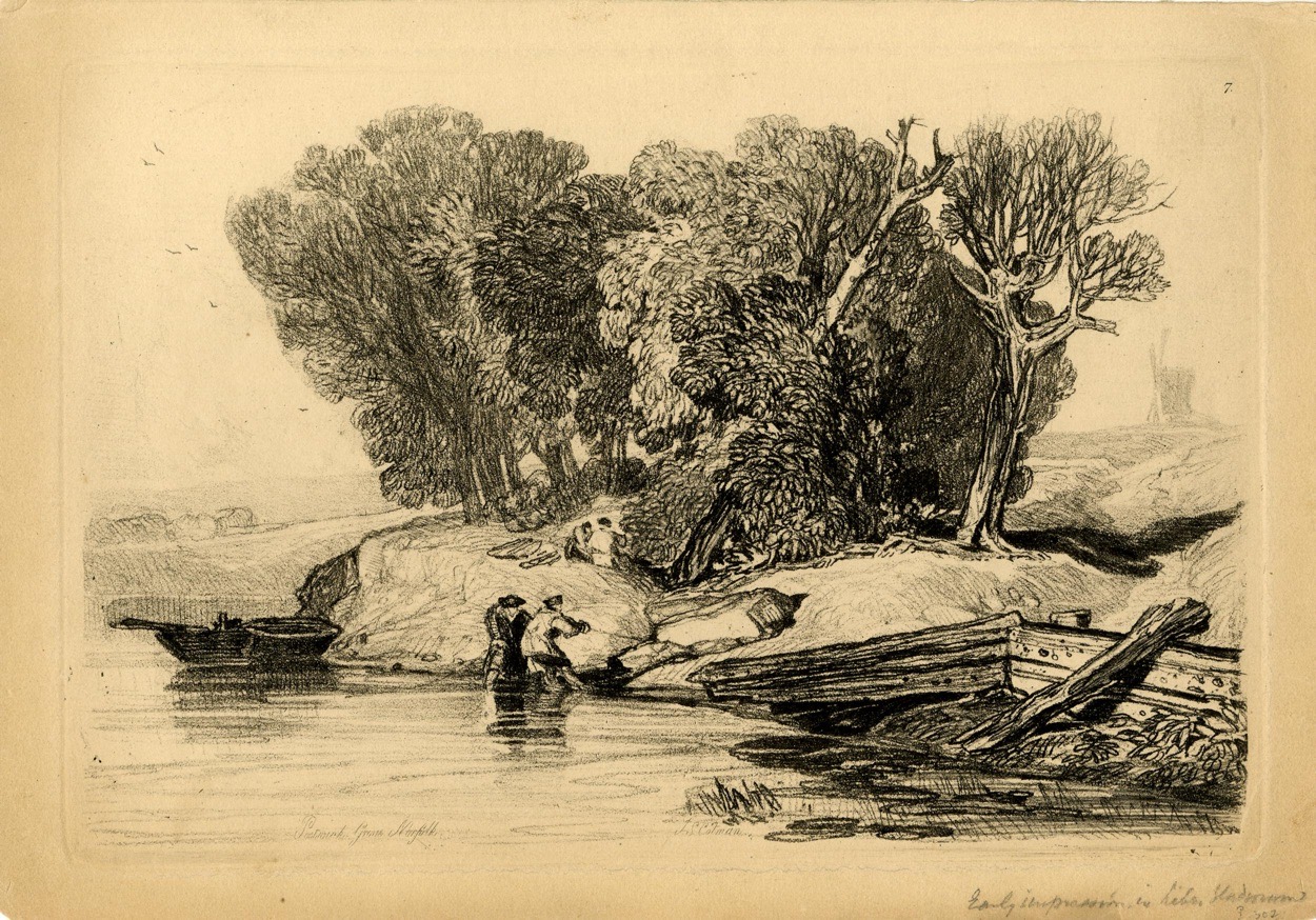
I like this print which is in the collections of the British Museum as it’s painted at Postwick Grove. I’d never heard of this place until we walked through it on Saturday, but it’s a once quiet area of the city where painters would come and be inspired by the peace and countryside. These painters would have also walked the similar route to the one we did on our 22-mile walk (more on that soon), although they didn’t have to cross the Norwich Southern Bypass.
The print was produced by John Sell Cotman and there’s no precise production date, just sometime between the dates of 1813 and 1838. Handily the museum knows that it’s from before 1838 as Cotman included it in a book which he produced in that year, the ‘Liber Studiorum – A Series of Sketches and Studies’ published by HG Bohn. The print isn’t on display in the museum and was acquired by them in 1902 from James Reeve, a long-time custodian of the Norwich Castle Museum.
This is what the artists would have seen at Postwick Grove, with the railway line to Reedham and Great Yarmouth to the top of the image, but it’s missing the huge dual carriageway which now ploughs vertically through the area. The addition of the Norwich Park and Ride parking area hasn’t done much for the peace and quiet either, but there is still an element of tranquility left.
The Dictionary of the Vulgar Tongue was first published at the end of the eighteenth century, and given that the Coronavirus crisis is giving too much time to read books, I thought I’d pick a daily word from it until I got bored…..
Caudge-Pawed
Definitions don’t get much shorter than this, it simply means “left-handed”. There seems nearly no mention of this phrase in the printed record and I was hoping to work out how this quirky term had evolved. That plan failed, as all I can see is that it was in use between the sixteenth and nineteenth centuries.
I did discover though, whilst trying to see if this derived from cats paw somehow, that cats are left or right-handed. This, I have decided, is more interesting to me than what I had set out to find. So, I have no idea how this phrase evolved, but I will now watch cats to see whether they are left-handed or right-handed.
I’m not intending to write a food blog, but I felt the need to comment on these. I accept there are many more important things in the world to write about than the snack component of a Co-op meal deal, but notwithstanding that, these really are a complete waste of time. How can you possibly manage to have a product that is high in fat, high in saturates and quite high in salt to taste completely bland? There was no discernible taste to the pork, let alone a pleasant peppery or vibrant aftertaste.
But what puzzled me is how on earth this rubbish managed to win a bronze award at the British Pie Awards. Then it becomes clearer when I visit their web-site. I had assumed that Bronze would be third-placed. However, this would be wrong. In the 2019 awards, there is a section on pork pies and there is one gold winner, thirteen silver winners and twenty-five bronze winners. How many awards do they need to give out?
I can’t check the 2017 awards, when according to the label these pies stormed into bronze place, as the link on the British Pie Awards web-site is broken for that year. So, what the Co-op are saying about their pies is that three years ago, the pies managed to come in the top forty in the country. And, to be honest, I think they were lucky to manage that.
The Dictionary of the Vulgar Tongue was first published at the end of the eighteenth century, and given that the Coronavirus crisis is giving too much time to read books, I thought I’d pick a daily word from it until I got bored…..
Cathedral
Simple definition to this one, “cathedral” means in this context something which is “old-fashioned, such as a cathedral-bedstead”. The word itself derives from Greek, with the Latin word “cathedra” meaning seat, which became the seat of the Bishop, which is the Cathedral. But, in this context, I can’t see that this phrase was ever much used, all references to cathedral bedsteads simply lead to on-line versions of this dictionary.
But, I’ve taken a real liking to using this word. If I want to criticise something (or more likely someone) as being old-fashioned, I can refer to them as having cathedral thinking. They’ll think I mean elegant or authoritative, but I’ll actually just mean out-of-date. Marvellous.
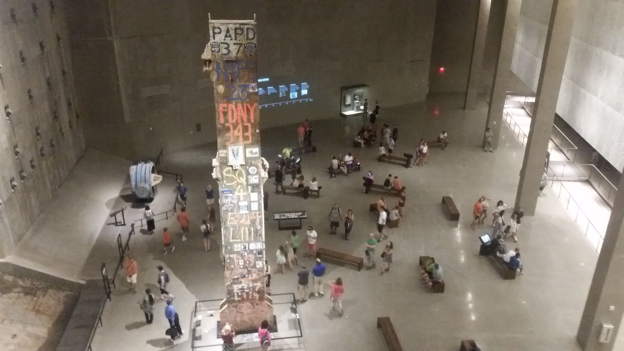
These photos are from 2015, so as another advance warning, their quality is pretty low. The fire truck belonged to New York City Fire Department Ladder Company 3 and it arrived at the North Tower of the World Trade Center on 11 September 2001.
The fire truck had two crews on as they were changing shift when the call came through and it parked on West Street whilst the fire-fighters went to investigate the unfolding disaster.
The fire-fighters got to around the 35th floor of the building and were killed when the building collapsed. The fire-fighters from this truck included Captain Patrick (Paddy) J. Brown, Lt. Kevin W. Donnelly, Michael Carroll, James Raymond Coyle, Gerard Dewan, Jeffrey John Giordano, Joseph Maloney, John Kevin McAvoy, Timothy Patrick McSweeney, Joseph J. Ogren and Steven John Olson.
The fire truck itself was crushed when the tower fell on it and when the site was being cleared, it was moved to JFK Airport where it remained for around a decade. It was moved to the National 9/11 Memorial in 2011, where it remains today.
This is a short documentary clip about Patrick Brown which was made by his sister, with a recording of the call he made from within the building. His call was very calm, polite and professional, a remarkable undertaking given what he must have been seeing.