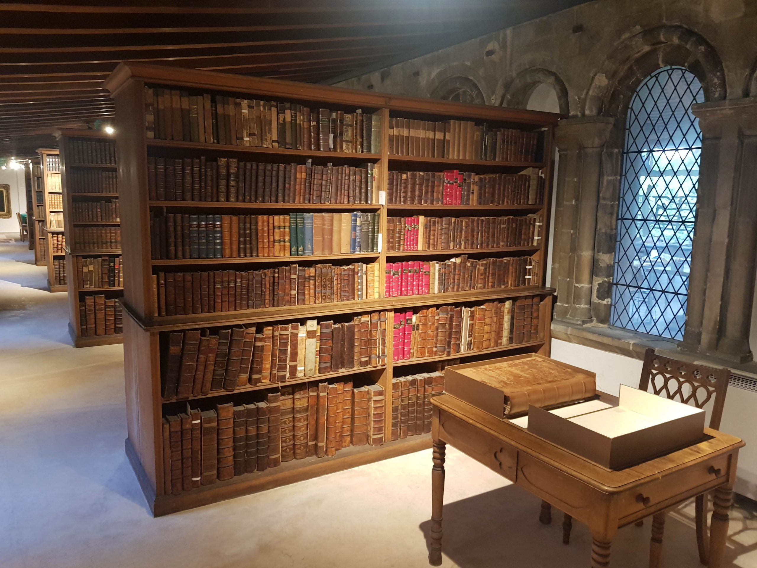
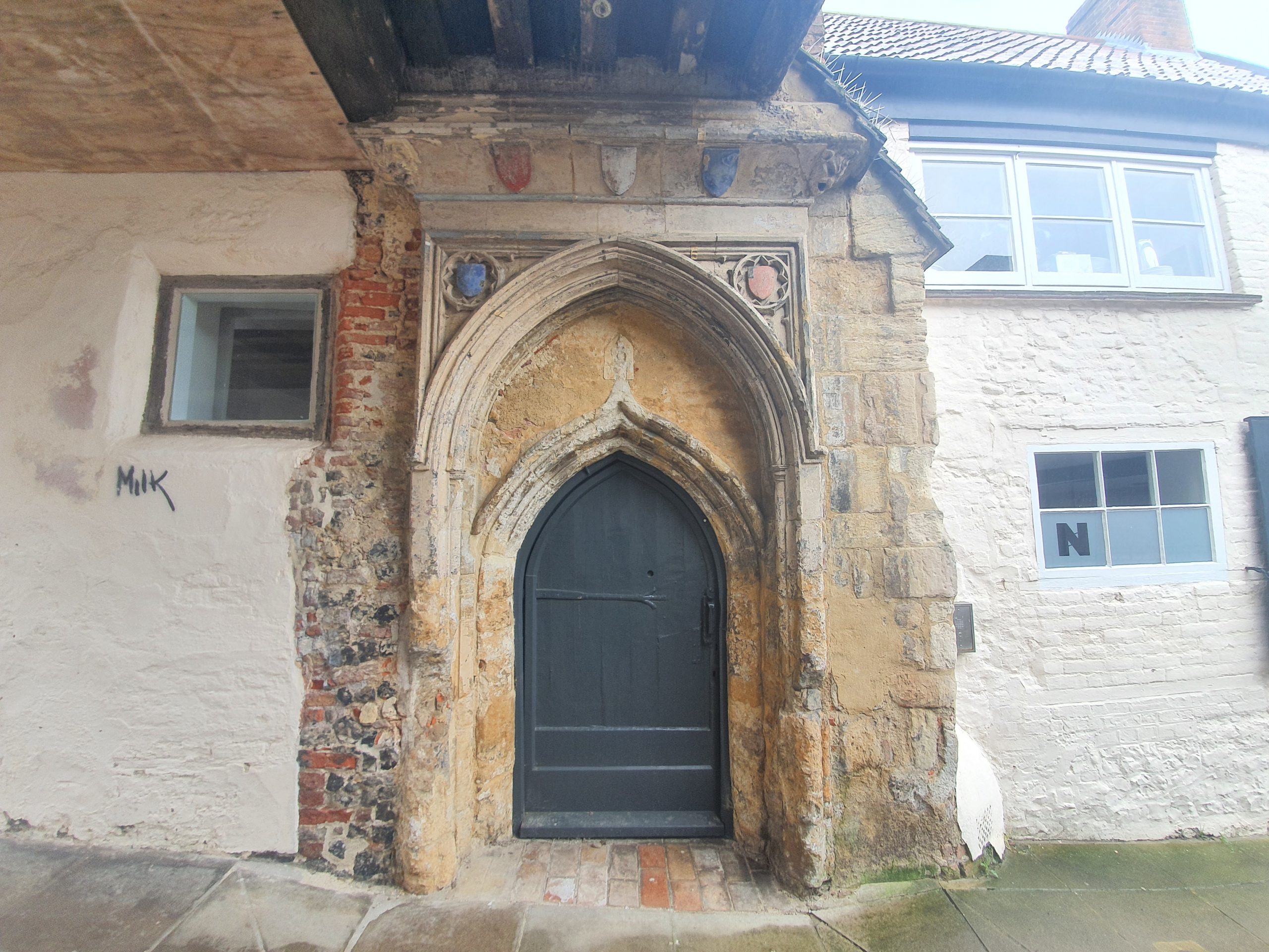
This photo is from one of my visits to Norwich Cathedral Library, a beautiful part of the building that I’d very much recommend. Anyway, the reason for this blog post is because of the rather lovely virtual tour that the cathedral has unveiled.
Available for free at https://www.cathedral.org.uk/visit/virtual-cathedral-tour, it allows people to use their phones or laptops to explore the Cathedral. The quality of the imagery is excellent and it’s a quite marvellous alternative since sections of the building aren’t currently open to the public. It would be really positive if more historic buildings could be shown in this way, especially if some more behind the scenes sections were also shown.
A recent wooden carving of Colenso which is on display at St. Mary’s
It’s clear from items around St. Mary’s Church in Forncett St. Mary that they’re rather proud of John William Colenso, their former rector who went on to become the first Bishop of Natal.
One of the displays at St. Mary’s.
Colenso was born in Cornwall in 1814 and was educated at St. John’s College, although this whole process required some considerable financial initiative to self-fund. He was the Second Wrangler at Cambridge University, meaning that he received the second highest marks for maths, so there’s little doubt he had lots of academic ability. Anyway, after some time spent teaching, he decided to take on the role of rector at St. Mary’s Church in 1846.
It was reported in the local press that Colenso had taken over the Rectory at Forncett St. Mary and become rector, with a value of £979. The position of rector back then wasn’t one which required any religious qualifications, it was more a way of living and the role had to be purchased. It wasn’t essential then for rectors to be ordained, although Colenso was, he had been ordained by the Lord Bishop of Ely in May 1840.
Colenso spent seven years at St. Mary’s, before being invited to become the first Bishop of Natal, a post he took up in June 1853. His interest in the well-being of the Zulu ethnic group was notable, and caused some local opposition. Another issue was that Colenso had a mathematical background and was interested in fact and logic, so he had some issues with some of the text in the Bible. He wrote in his book “Pentateuch and Book of Joshua Critically Examined” that he had concerns and he also stated that he opposed the idea that sinners should be eternally punished.
There were attempts to remove him from his post and Robert Gray, the Bishop of Cape Town, the man who had encouraged Colenso to go to Natal, now decided that he should be charged with heresy. The situation wasn’t, to be honest, entirely ideal for the church. Colenso was found guilty of heresy, then the Church of England decided that they had no jurisdiction and so reversed their decision. Colenso was sort of sacked in 1869, but also sort of retained his role, all caused by creating a dual system and a divided church. The Cathedral of Natal today recognises both sides in the whole debate, so healing has finally taken place.
Colenso was interested in the matter of polygenism, a belief that different races were created separately by God at the same time. Often used to promote racial inequality, Colenso came from the angle that everyone should be equal because they were created equal. Although this field has been rejected now by science, Colenso did much work on ensuring that the rights of everyone in South Africa were looked after, and that wasn’t universally accepted at the time (nor indeed for a long time after).
Colenso died on 20 June 1883 in Durban at the age of 69, still in his role as the Bishop of Natal. This takes me back to the church in Forncett St Mary, which feels a very long way from South Africa. Colenso had married Sarah Frances Bunyon in 1846, the same year he took over the rectorship at St. Mary’s, and they had five children. One of those children, Harriette Colenso, became a Christian missionary in South Africa, and another, Frances Colenso, became an historian of the Zulu Wars.
On 22 June 1883, the Eastern Daily Press published an article on Colenso’s life, noting how the Church in South Africa had been split into two following the debates that he had raised. The newspaper noted that he was “an ardent defender of the African against the white man” and how “his sympathies often lay with the Africans”. The parish register for the church of St. Mary is in the possession of the Norfolk Record Office and Colenso’s name is present at nearly every baptism that took place during the years he was there, a seemingly very meticulous rector. And he could have had a good living in Forncett St. Mary for very many years, but he decided to spread the Christian message in South Africa, so I can imagine that he was quite a character.
This is the pretty little church of Forncett St. Peter’s, located a short distance away from St. Mary’s. The fortunes of these churches have perhaps been reversed over recent years, with St. Mary’s going from being derelict to now being repaired and restored, whilst St. Peter’s is literally falling apart.
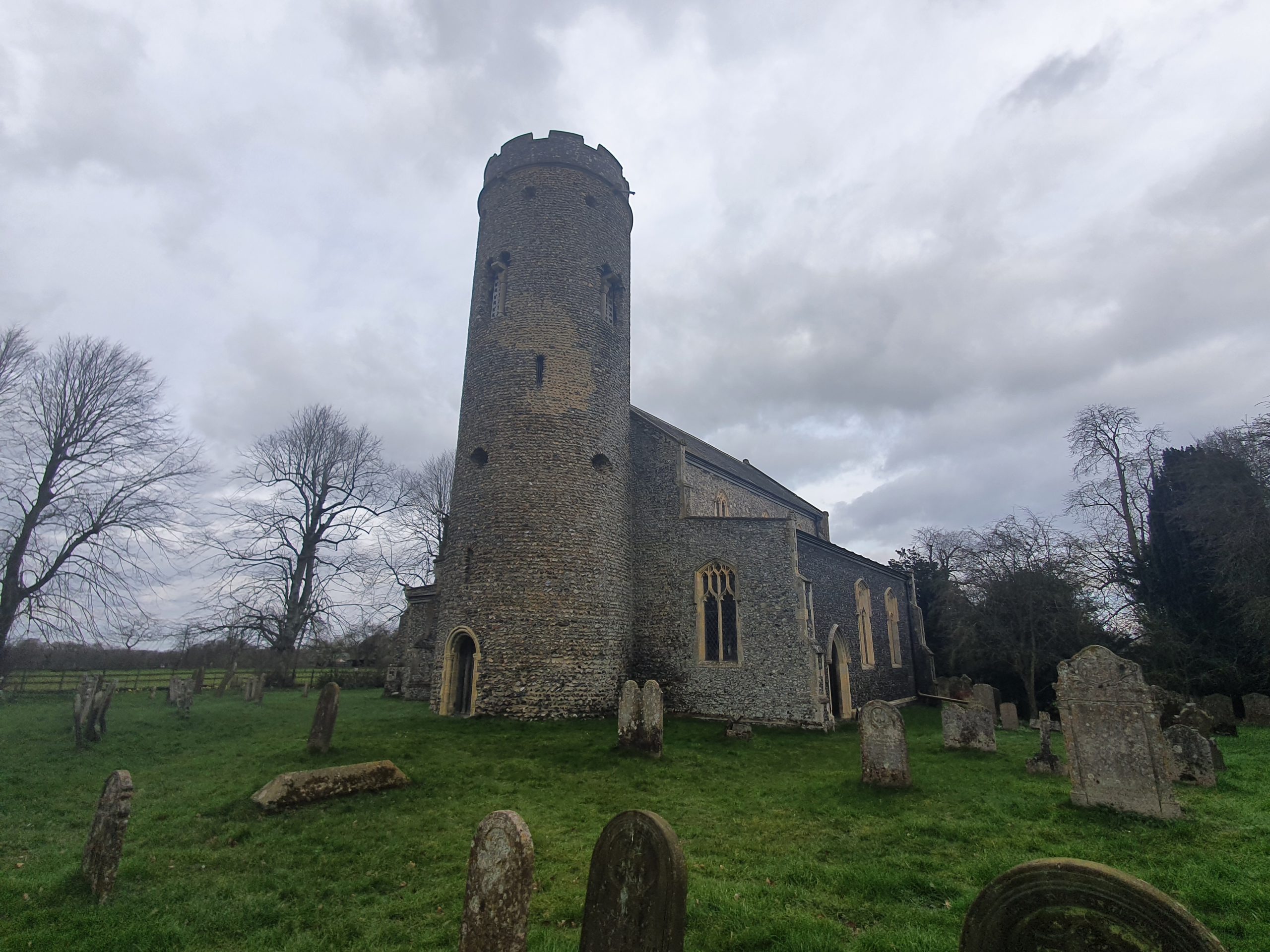
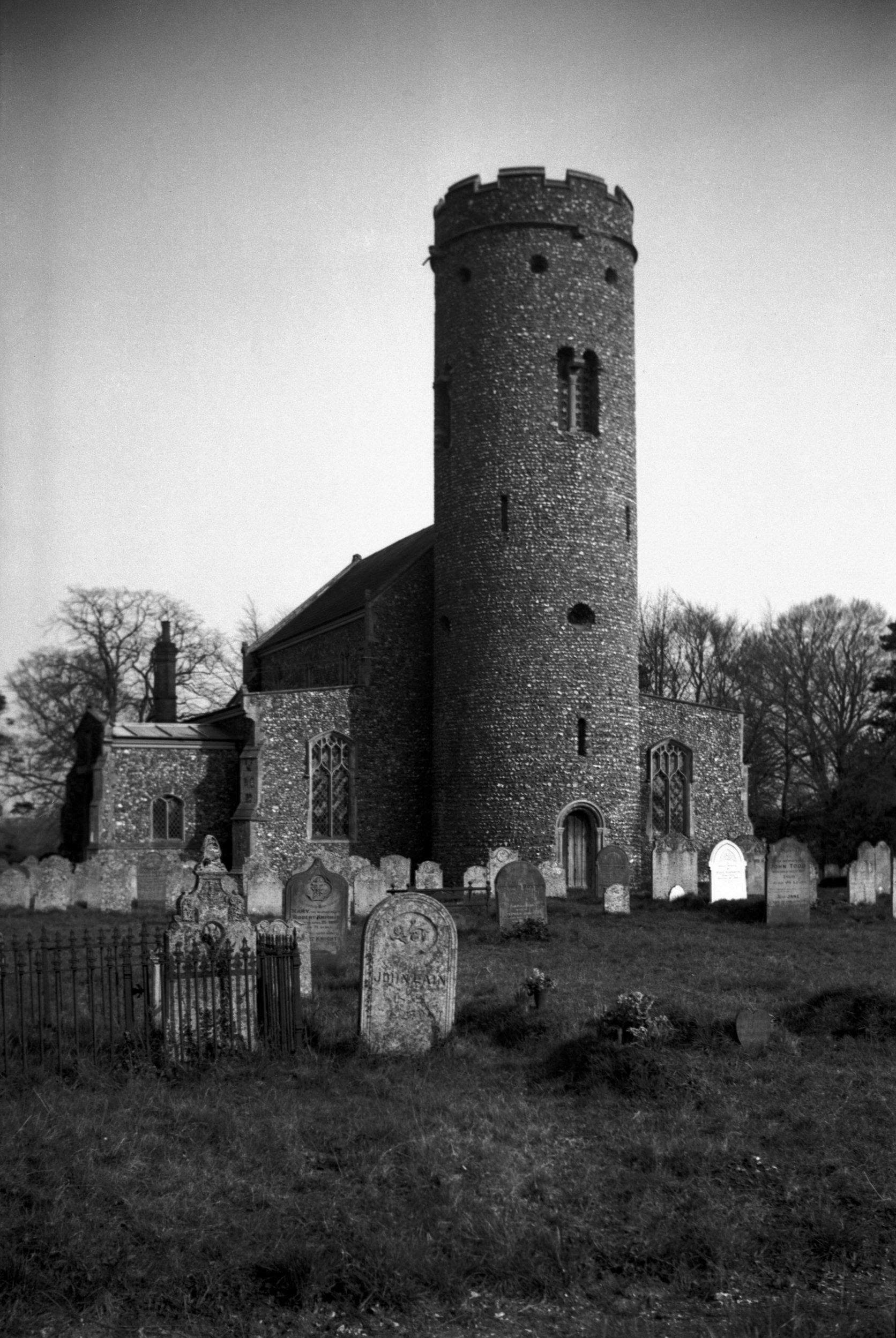
What is clearly evident when approaching this stone tower is that it’s remarkable, and very different to other round towers in Norfolk. There are Saxon windows visible within it, there’s a Norman style door at the base and it doesn’t look overly repaired. Indeed, this tower dates from around 1000AD (that’s what the church think, other historians place it a bit later, but I like the church’s guess), making it over 1,000 years old, another remarkable survival. This heritage means this is one of the best preserved Saxon round towers in the entire country, with the church noting there’s an old medieval staircase inside that can be viewed by appointment.
The side of the round tower, with the Saxon window visible in the middle, and the listed building record also notes that the upper windows have evidence of reused Roman brick. George Plunkett took a photo of the church shortly before the beginning of the Second World War and, unsurprisingly, not much has changed since then. I should have noted the existence of this photo earlier, as I could have taken a photo from the same place to see if any of the gravestones had been lost (I need to get out more….), but that treat can be for another day. I thought it was quite evocative just thinking that 1,000 years ago that there were workmen standing in this exact place on ladders and wooden scaffolding who were building this tower.
The chancel of the church and for anyone who finds these things interesting, take a closer look at that chancel wall for something……
The church has some makeshift ways of dealing with drainage and those areas are out of bounds for safety reasons.
I didn’t note this when walking around the church, only when reading the listed building record did I go back to take photos. But, there’s the old window, with the Priest’s Door having been punched through in the thirteenth century.
There’s the outline of it.
Unfortunately, the church has been closed since 2020, as sections of plaster fell off the wall and the building wasn’t considered safe. The damp evident in the porch is perhaps the least of their problems at the moment, as the church needs £750,000 for its restoration efforts.
Although the damage to the porch isn’t ideal, but the church’s web-site mentions it’s much wider than this:
“The church is now in desperate need of major repairs and renovations. Most important is the need to make the building watertight – extensive areas need re-roofing, failing lead work needs replacing and faulty gutters, down-pipes and surface drains need repair or replacement. Structural deterioration and cracking of external stone and flint-work has meant that areas of the churchyard have had to be cordoned off in case of falling masonry. Windows, cracked internal masonry, collapsing floor surfaces and areas of death-watch beetle all pose major challenges. The wonderful 15th century Drakes Tomb is suffering from cracking and discolouration. Once the structural work has been completed redecoration will be essential and the remarkable set of carved pew ends can be repaired.”
The church’s fund-raising efforts are underway, but this sounds like a project that will take many years to bring to a conclusion, but I hope that they are able to make progress in securing donations.
An 1857 sign from the Incorporated Society for Building and Churches, an organisation which has been providing grants for churches since 1818. It was an unfortunate situation that many churches at this time decided that they would go in for pew rental to raise money, an opportunity for the wealthy to get places in church at the front whilst the poorer were shoved at the back somewhere. The tide on this started to turn in the middle of the nineteenth century and churches started to end the practice, although some parishes were rather more forward thinking than others.
The Norfolk Chronicle had noted in July 1849 that the interior of the church had been “much improved by the removal of the old pews and the substitution of new oak benches”. There’s an old plan of the church from the mid-nineteenth century on the Lambeth Palace Library archives web-site, but their database has been down for a few hours, so I can’t link directly.
I didn’t really understand this church when looking around it, there was a feel of some rather stark and blunt repairs to the building and an interior which seemed a little whitewashed. But, equally, it was in a good state of repair, a big effort had been made to put up some boards with some history and it all seemed in order. The true story of this church is though remarkable, it has been saved by the community after having fallen derelict. I’m deeply impressed at what has been done here over the last few years, and it explained why so many repairs had been needed. All really quite wonderful. Simon Knott has some photos of the state that this church was in just a few years ago and George Plunkett has a photo from 1992.
The church on an old tithe map and it’s set back a fair way from the road.
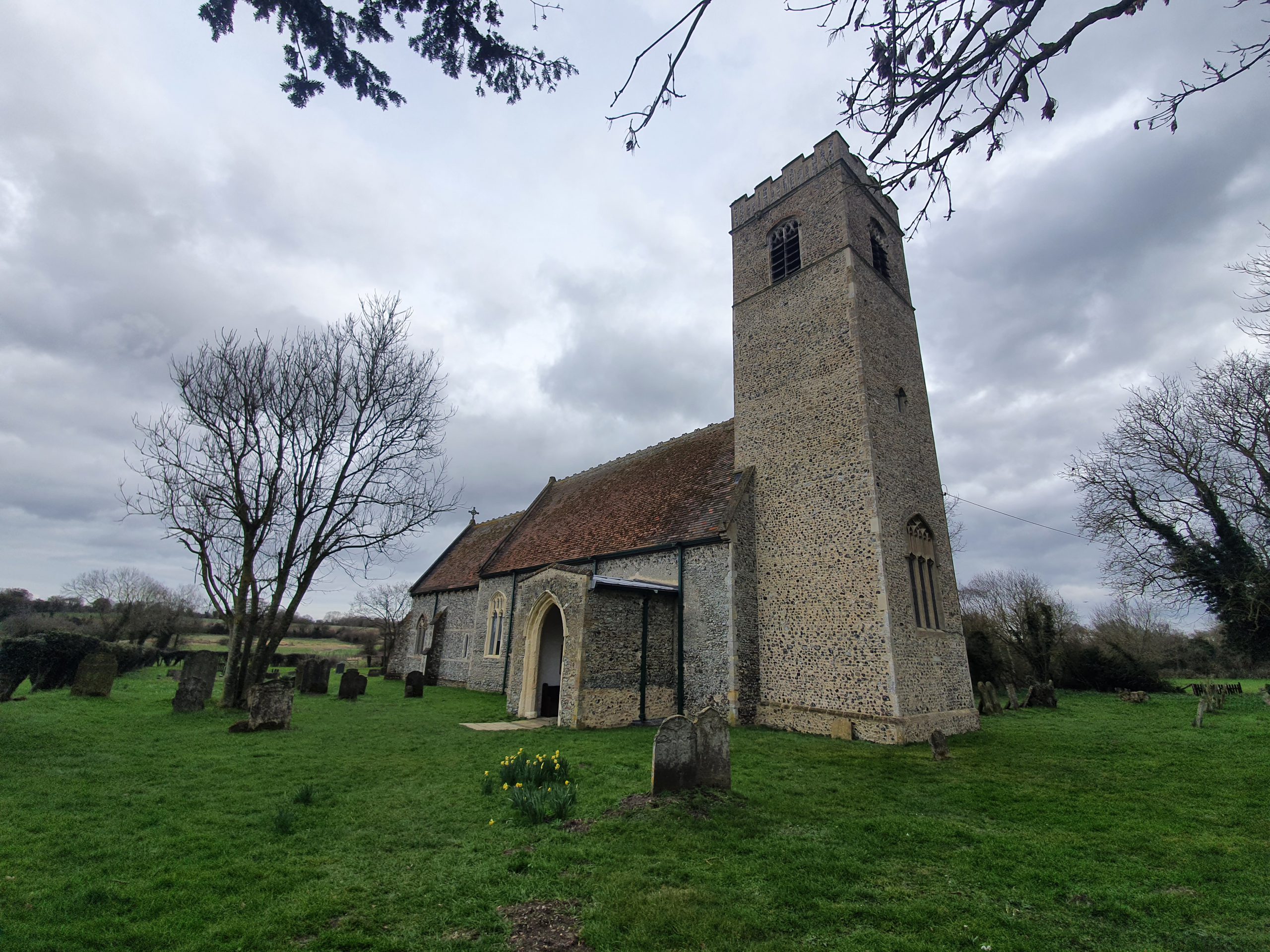
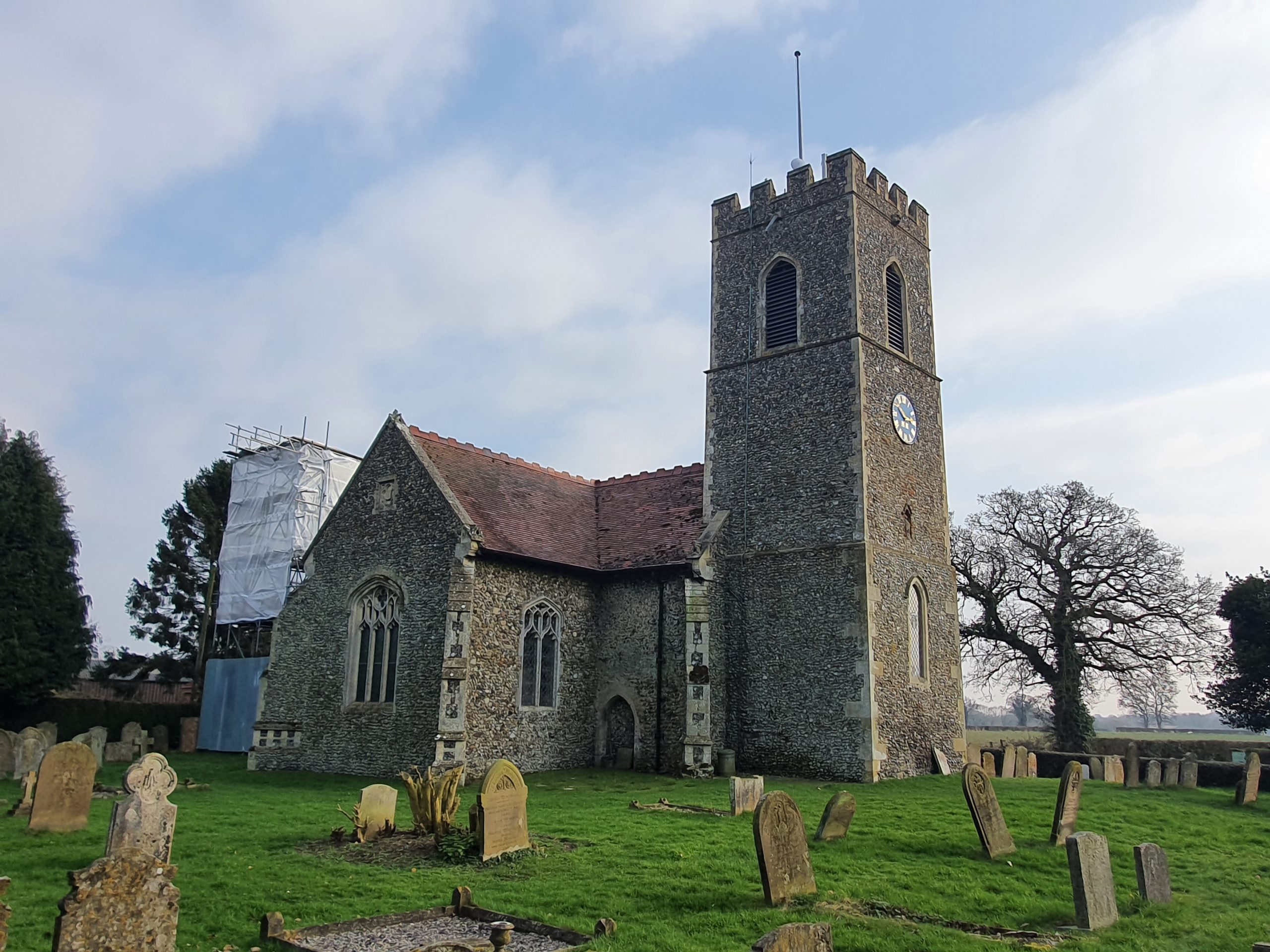
The church had fallen into a state of disrepair even though it is Grade I listed, with the bulk of the building dating to the thirteenth century, but the tower is a fifteenth century replacement from what stood before. The listed building record notes though that some elements of the nave are from the eleventh century, survivors of the earlier church.
The chancel, which was repaired during an extensive 1869 restoration, led by the Reverend J Cooper. There were no end of events that took place in 1868 to raise funds for the repairs, showing some of the community effort that has again been notable in recent years.
The Norwich Mercury reported in April 1870 about the reopening of the church and I like their general comment that “advantage has been taken of the necessary alterations and re-buildings which churches require to graft upon them the whims and fancies of architects, so that we have had a series of abominations perpetrated, at which none are now more ashamed than the clergymen themselves”.
Fortunately, the newspaper liked the work that had been done at St. Mary’s, commenting that the architect JP Pearce had “followed and adhered to the plan of the original building”. The work had cost £1,000 and the chancel in particular had been heavily restored and a new chancel arch added, with new carvings and stoneworks throughout the church. The newspaper remarked that the thatched roof which “gave the church a poverty stricken look” had been replaced and new Staffordshire tiles had been laid in the chancel and nave.
A blocked-up window, perhaps a victim long ago of wanting a window with a more modern design.
The porchway has now been repaired and is in a good state of repair given how it looked just a few years ago in Simon Knott’s photo.
The church was open and it one of those atmospheres which just felt welcoming, and I liked how there were some history boards up giving further information about John William Colenso. He was the rector of this church between 1846 and 1853 and he went on to become the first Bishop of Natal, in South Africa, a role he remained in until 1883.
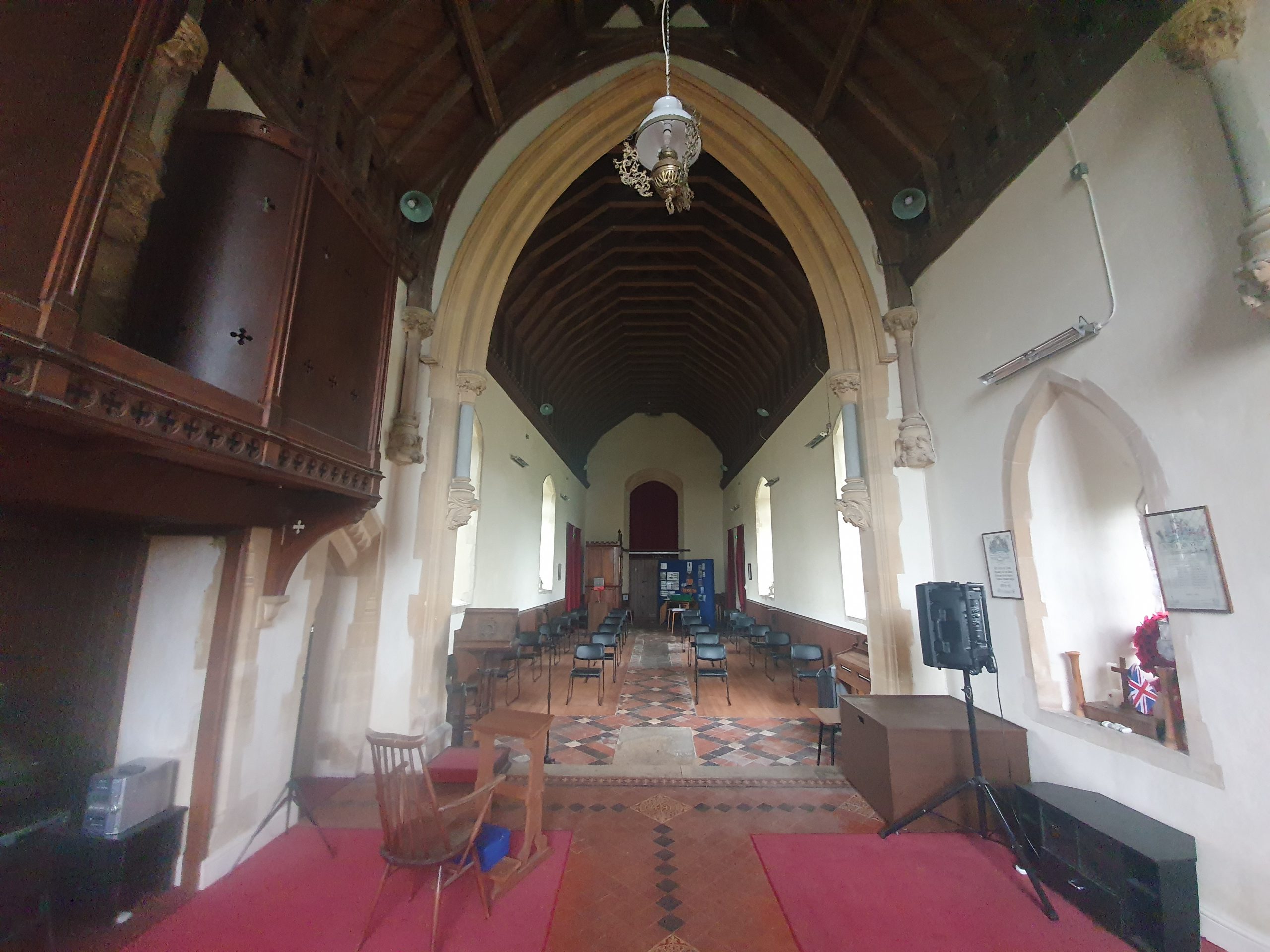
The inside of the church, looking towards the tower. The floorboards have had to be replaced as they had become damaged during the period that the church was derelict, but some of the tiles from the 1869 restoration are still visible.
And looking along the nave into the chancel.
There’s something really quite environmental (if that’s the right word there, perhaps not) about how someone’s remains can help the growth of a fine tree. I didn’t notice any early burials, so everything was from the nineteenth century onwards, but there’s an interesting note at the Heritage Norfolk web-site which mentions:
“Burials did take place prior to this period but headstones were rarely used and multiple burials often occupied the same plot.”
This helps answer my ongoing question about why are there are often so few headstones in churchyards in Norfolk, and perhaps it’s for the same reason here, that headstones were rarely used and the graves not always carefully marked.
The new lych gate, with a chunky bench, all of which offers a positive first impression for visitors to the church.
All in all, this is a glorious restoration and saving of a church which had become redundant in 1985 and then sadly vandalised in the years that followed. It’s disappointing that the Church of England abandoned this church, and they were talking about turning the building into a holiday cottage at one stage. Fortunately, things are much better again today, and what a marvellous community effort to bring this church back from the brink.
And a new little project that Jonathan and I are undertaking because this lockdown is clearly here for at least a few more weeks. It’s a bit niche (our project I mean, not the lockdown), I’ll accept that, but there we go. Effectively, it’s walking around Norwich, ancient parish by ancient parish and seeing what is there now compared to a map from the 1880s (the map above is from 1789, but the one from the 1880s is more detailed, which is why we used that). There’s a PDF of these boundaries to provide some extra background to this whole project.
St. Julian is the eight parish we’ve visited and as can be seen from the above PDF, it’s split into two separate areas, with St. Etheldreda in the middle. Given the complexity of that, this post is just about the most northern of the two sections of the parish and the one containing St. Julian’s Church. The other half we’ll do next week (I can imagine the excitement that everyone has already…… or perhaps not…..).
This is the Waterfront on King Street, a live music venue and club, with this artwork at the front giving some examples of bands and singers who have performed there.
This is the Waterfront’s riverside drinking area, which is all rather lovely, and it’s on the site of the old mortuary.
This is Abbey Lane (formerly known as Cockey Lane), with the Waterfront on the left-hand side, looking back towards King Street. It’s also where St. Clement’s Church once stood, in the former parish of St Clement at Conesford. It was united with the parish of St. Julian in 1482, but the church remained open, but fell out of usage in the 1560s. The building was still there in the eighteenth century and it’s though some parts of it might remain underneath the nineteenth century structure of the Waterfront. To add to the mortuary situation, there were numerous burials found here in the 1960s in the former churchyard.
This is the next street along, Hobrough Lane, and this would have once led down to a ferry which crossed the River Wensum. Once the frontages on King Street would have had residential properties that the wealthy lived in, but over the centuries it all became more of an industrial area.
This area has now been cleared, but this would have been Greenman Yard and there was a pub, the Green Man, standing where that wall is. This was a pub from the mid-eighteenth century until it was demolished just before the war and George Plunkett took a photo of it in 1936. I’ve written this before, but Norwich is so very fortunate to have had George Plunkett, as I can’t imagine there would have been many other photos taken of this pub.
Much has been written elsewhere about Dragon Hall (not least this rather lovely volunteer guide from 2005), so there’s little need for me to add a great deal here. It’s a former medieval hall of national importance which was constructed in the early fifteenth century. Although it was constructed as a grand hall for a wealthy man, Robert Toppes, it got sub-divided up over the centuries as King Street became a place more for industry than decadent living. It’s a slight miracle that the building didn’t fall down by the early twentieth century and it was in quite a state. Properties behind the building were removed as part of slum clearance, but the council had the foresight to save Dragon Hall (a name it was given in the 1980s) and take it into their own ownership. Some forward thinking individuals turned this into a museum and its change into the National Centre for Writing is a slightly retrograde step in my view (I’d have liked the building to have remained a museum so its fine interior was accessible to the public), but in all fairness, the new organisation does allow visits to see inside.
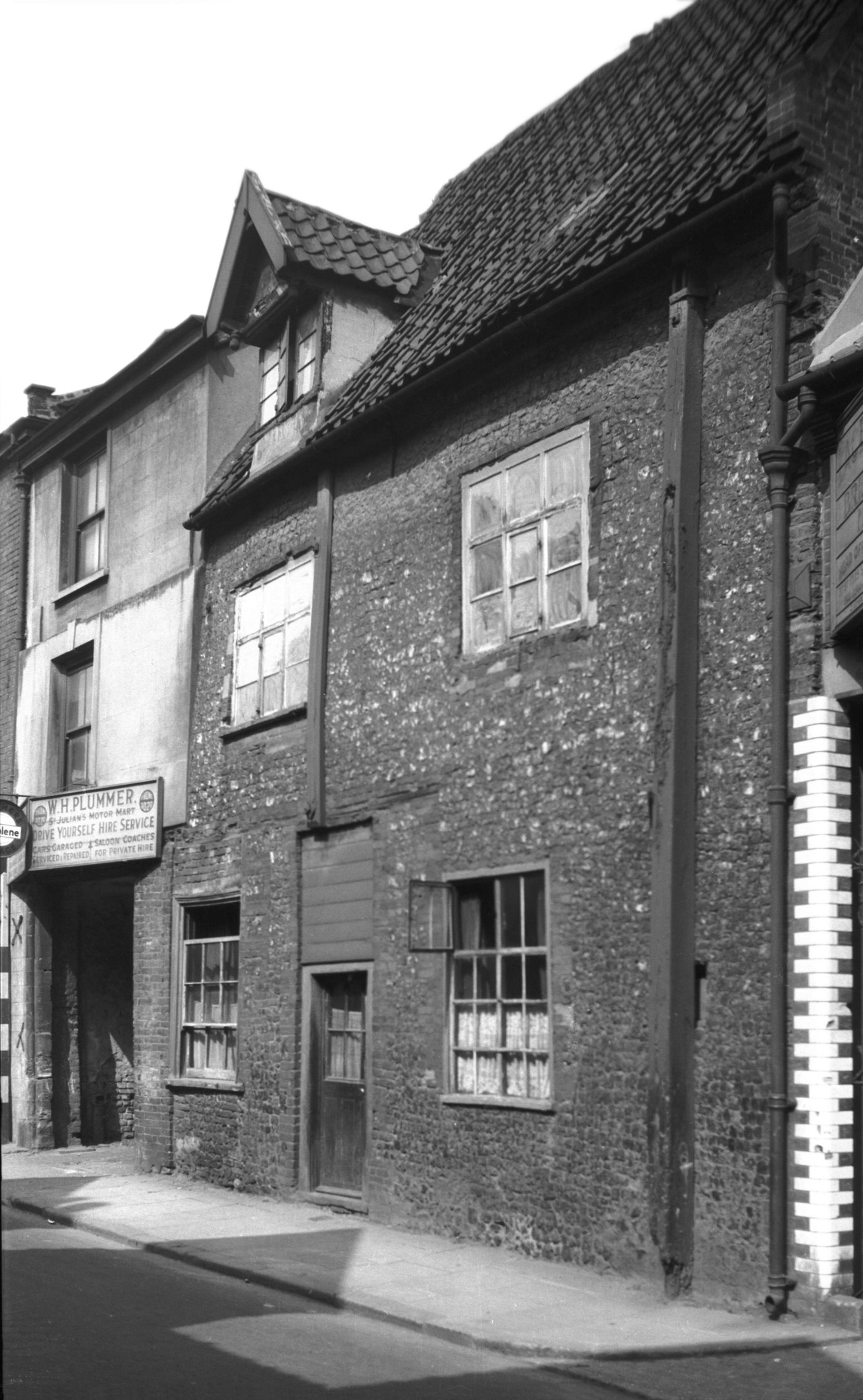
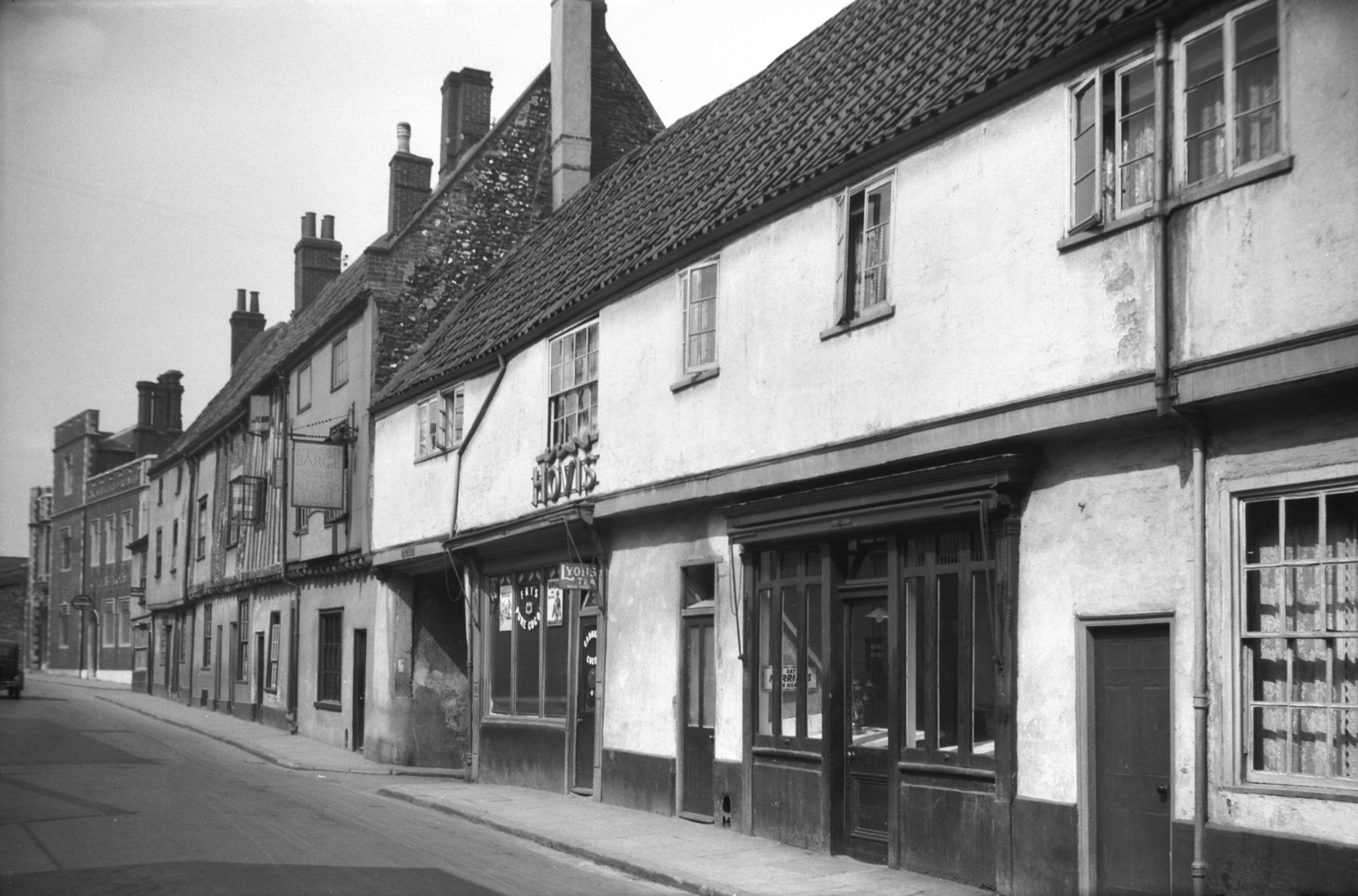
The building to the right (125-129 King Street) on the above photo is historically interesting, but it has been rather marred by the lower floor windows that have been punched into it. I remember this building as BB Adams, the electrical retailer, but it’s been boarded up for some time now. It looked much better as it was in this 1936 photo from George Plunkett.
The entrance to Old Barge Yard, which takes its name from the pub which traded here from the middle of the nineteenth century until it closed in 1969. The window seats from the Old Barge Yard pub are apparently still visible inside the building.
Old Barge Yard, which did lead to the River Wensum, although it has now been blocked off.
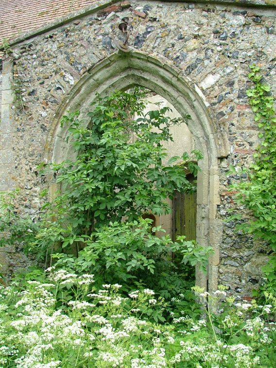
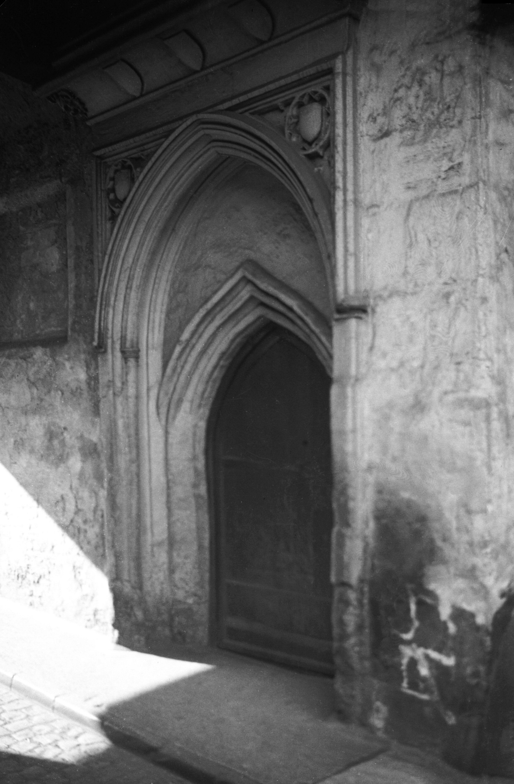
One of the old doorways into Dragon Hall and this dates to the early fourteenth century when the building was being constructed, although the decoration is from the fifteenth century. George Plunkett has a photo of the doorway taken in 1935.
Looking back along Old Barge Yard, towards King Street.
This was the area behind Dragon Hall which was cleared during the slum removals of the 1930s. The entire site, including the flats behind, are now part of the Saint Anne’s Quarter project.
Back on King Street, opposite Dragon Hall, is this entrance to Drays Yard. Although it has an historic sounding name, this isn’t original and is a new construct.
St. Julian’s Alley and that wall to the left is a bit of a survivor. It isn’t the former wall of a building, just something that was built around a property boundary, so it’s done well to be kept and integrated into the newer structure behind it.
This area hasn’t changed much over the centuries, it’s the churchyard of St. Julian’s Church and the alley named St. Julian’s Alley goes off to the left, straight ahead and to the right. George Plunkett has a photo from 1938 of the building which is behind where I’m standing, although this has now gone and there’s a modern residential property there now.
St. Julian’s Church, from which the parish takes its name. As I visited here a few weeks ago, I’ll just link into that blog post. George Plunkett has a photo from 1946 which shows the damage which had been done to the building during the air raids, and the city is fortunate that this church was reconstructed.
This is St. Julian Alley which now ends at Rouen Road, a poorly designed area of the city which has seen housing replaced by car parking and uninspiring buildings. This alley once led on to Crusoe Street.
This is the view when standing outside of St. Julian’s Church, along what is now Kilderkin Way, but which was once the King Street Old Brewery. Thorn Lane used to stretch from Ber Street to King Street, so would have run through the middle of this site, but only the upper end of Thorn Lane remains. Most of this lies in another parish, so I’ll come back to this in the future. But, as an example, this is what Thorn Lane used to look like in 1938. This is a nicely designed street though which fits into the area well.
Walking back to King Street, this is a former entrance to the school which sat behind St. Julian’s Church. More on this in a moment.
Looking back down to King Street.
This is the same alley as in the above photo from the other end, and it’s called St. Julian’s Alley, which complicates things a little as that’s also the name of the neighbouring alley mentioned earlier.
This is the site of the school behind St. Julian’s Church, and the one that was accessed through the bricked up gate. I’m not entirely sure why the school is no longer here, perhaps destroyed by the bombing during the Second World War which destroyed most of the church. This is now a housing development called King’s Gate on the map, but is named as St. Cecilia’s Court on the road sign. I imagine that the latter is correct.
There were two school buildings within the complex, a larger one and a smaller one, the latter survives. It’s now used by the Sue Lambert Trust, a charity who help those who have suffered from sexual abuse.
The photos of the school site were taken on what is now Music House Lane, named after the historic building in the parish of St. Etheldreda. This is a new name, as this street was once the lower part of Horn Lane, which stretched from Ber Street to King Street.
This photo is taken from Rouen Road, the new road that was built ploughing through housing that was torn down, looking towards King Street. Someone standing here 100 years ago would have seen St. Julian Street to the left, Horn Lane in front of them (and behind them) and Burleigh Street to the right.
This is the former route of Horn Lane, and also the edge of the parish boundary. It’s now been blocked off and turned into a walkway, although Horn Lane does continue on the other side. That section of the lane has retained its name, but that’s in a different parish and a story for another day.
It’s hard to imagine that this was once a thriving community, with people living on what was Garden Street, Bartholomew Street, St. Julian Street and Crusoe Street.
Walking back down to King Street, that concluded this little meander. King Street is in pretty decent shape in historic terms, so much has been saved there, although there are numerous clumsy planning decisions which have led to some incongruous buildings popping up. The buildings on the site of the King Street Old Brewery are also decent and have retained some interesting architecture, but the area the council decided they’d demolish to build a giant car park is really an eye sore as it stands.
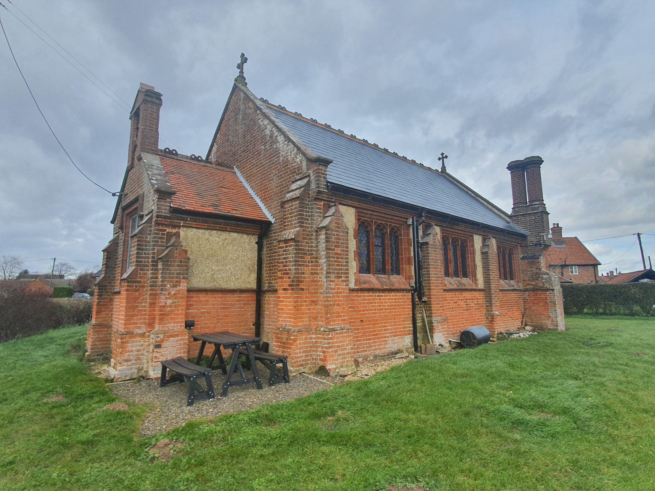
There are two medieval churches nearby, but this chapel at ease was built in 1904 to serve the growing residential community in Forncett End.
The church had just been built when this map was produced, showing the growth of housing in this area.
The foundation stone of the church was laid on St. Peter’s Day, 29 June 1904. Media reports at the time noted that the residents had needed to walk two miles each way to get to either Forncett St Peter’s Church or Forncett St Mary’s Church, so a new building had been desired for some time. It was only though when the livings of these two churches were merged that the finances allowed for the construction of this new building.
All very Victorian/Edwardian in design, the project was expected to cost £700 in total, which was raised by subscription, fetes, concerts and numerous bazaars. The new church was designed to seat 110 people, with red brick used in the construction and Cossey brick windows. The work was undertaken by Messrs James & Chellis Humphreys, following plans drawn up by Arthur J Lacey, the Diocesan Surveyor.
All of the money to construct the church hadn’t been received by the time the building got underway, so it was decided to construct the nave and porch in the first wave, with the second wave adding the chancel. As can be seen, the chancel never got built and the church now has to repair and replace this wooden end from time to time.
This church was perhaps fortunate to have been built when it was, as the religious fervour of the nineteenth century was starting to fade away. In the decades that followed the great medieval church of Forncett St. Mary became derelict, and only recently has it been saved for the future. Instead of being a chapel at ease for the bigger churches, this is now a convenient size to hold services in, likely quite a cosy atmosphere. It never got its chancel, and I don’t suppose ever will, but at least it remains in use by the local community.
This is All Saints Church in Tacolneston and I was a little disappointed that it wasn’t open, but rather more disappointed to read in numerous places on-line that this parish has been, shall we say, perhaps slightly overly keen to keep their building closed to visitors over the last few years.
On this, I’d add:
“Our churches belong to everyone. Each stone marks the location where history happened and tells of a significant event in our nation’s story. They are steeped in history. And their architecture will inspire you. Few historic buildings are as easy to visit as a parish church. They are open and welcoming to all. During the week, many churches are unlocked during daylight hours, and those that are not have details on display of where a key can be found.”
This is the Church of England policy on opening churches, and pandemic aside, I hope there’s more progress in this area over the next few years.
Why does one church need three scratch dials (or mass dials for those who prefer that)? I have a theory that it’s because one might have been rendered over or just not seen as accurate as it needed to be. There’s something rather quite lovely though that these have likely been here since the medieval period, and were once really useful ways of knowing when the next service was going to be.
Old graffiti inside the porch.
The south aisle and the south porch. The building itself mainly dates from the fourteenth and fifteenth centuries, although these was a previous church here on this site before then. Francis Blomefield, the reliable Norfolk historian noted in the mid-eighteenth century that this church had been reconstructed in 1503 and he mentioned that the church was thatched when he visited.
Why is there a kitchen sink at the base of the tower? I don’t know…. For those whose eyes aren’t drawn to this eyesore at the base, the tower itself was built in stages between the fourteenth to sixteenth centuries.
The north doorway, with some random lump of metal by its side.
The priest’s door.
A rather pretty little churchyard. The rear section of the church was partly covered by ivy until recently, fortunately now removed.
And, I have no idea. The random bits and pieces around the church made it feel like something of an art installation.
Inside the church there is an historic section of the rood screen, an old font and numerous other interesting items of note, and hopefully I’ll get chance to go back when the building is open to see them.
On the 29 to 31 May 2021, the LDWA’s 100 mile event will be taking place. Unfortunately, national restrictions mean that the Y 100 Sir Fynwy won’t be taking place as hoped, when in more normal times the South Wales group would have welcomed hundreds of walkers. Instead, there is the chance for entrants to walk a 100-mile route of their choice anywhere in the country, so the event has more of a national feel this year. And it’s fine to enter to do a shorter distance, with anyone walking 50 miles in 24 hours qualifying for the 2022 Trans-Pennine 100.
I’m taking part in the 100 and I’ve been compiling some resources relating to that. When the new LDWA web-site is launched, this and lots more other material relating to the event will be copied there. Over the next few weeks, I’m speaking (well, writing) to entrants on the 100 and following their efforts up to, and after, the big day. We’ll be using the text from these interviews and updates on social media and also perhaps in Strider, the LDWA’s rather excellent magazine which is sent to our 10,000 members. Hopefully it’ll help inform, educate and inspire others to take part or become involved with the LDWA in other ways.
For anyone who wants to take part in the event, have a look at the SI Entries page, or further information at the LDWA’s web-site.
This interview is with Caroline Tennant from East Lancs group and it’s her first go at the 100, and I’m in a similar situation, as 55 miles will all be new territory to me as well. Not that this is all about food of course, but I like the mention of pies.
How many 100s have you completed in the past?
None, this is my first attempt. I started thinking about 100s a few years ago, looking at 2022 to be my first try. Then I decided I wanted to recce the Y 100 Sir Fynwy, just in case. When the virtual event opened, I jumped at the opportunity.
If Covid rules allow, you are walking as a group of eight from East Lancs group. Are you hoping this plan keeps you sane and encouraged?
There are a number of East Lancs members walking various routes for the virtual 100. Our little group is, currently, made up of eight of us that have all walked and entered various events together, none of us have ever completed a 100 before and we are mostly at the slower end of the walking scale. We plan to walk together, as a team, rather than at our own individual paces.
Being of a wide range of backgrounds, ages and experience, we always have something to talk about. And a sense of humour is essential. I’m not sure anyone else would tolerate my listing, charts, maps and incessant organising. I’m hoping we all keep each other entertained to pass the time and get through the miles. I don’t think any of us are sane to begin with, so that’s not an issue.
What has appealed is the chance to give it a go, even if we don’t succeed. Not having a limit on entries gives people an opportunity to give it a go, on their own terms. We might not all get to 100 miles, but we will go as far as we can, which I think together might be further than we all think.
What route are you planning to take?
We are doing a route connecting three of our homes/gardens, allowing us to have 3 checkpoints with good facilities and food. We tried to have a range of terrain to keep it interesting. Canals, parks, moorland, riverbanks, hills and few sights to keep both our feet and our heads entertained. The route is centred at Rivington, extending out to Hoghton Tower, Tockholes, Smithills, Haigh Hall, Yarrow Valley and Cuerden Valley.
What other support are you hoping to have on the route?
Between our three home checkpoints, the route has been planned to go via various shops, cafes and even a motorway service station. Whilst we will have to carry a certain amount, we have plenty of opportunity to resupply on the way. There will be a couple of people on standby for emergency rescues, which hopefully we won’t need. And two long suffering husbands, who are cooking dinner and breakfast for us.
Are you following a GPX route, a map, or do you already know your route well?
Hopefully, between us, we should know the route well as it is all very local to us. We will have the GPX, maps and a brief description to refer to. What we think we know well may be very different on the day, depending on the conditions, and more so once we are tired.
What training are you undertaking at the moment?
Planning and recceing the route has been a great opportunity to up the mileage. My plan is to just keep walking and get the miles in.
Do you think this will be easier or harder than the actual 100 that is traditionally held?
Being able to choose our route and having been able to recce is a huge advantage. I think what will make it harder is not having the support of marshals and competitors on the day. Whilst we will have each other to cheer ourselves on, there is nothing more encouraging than being met by a cheerful marshal, brandishing crumpets, at 2am.
What food treats are you taking with you?
Salt and vinegar crisps, cheese and jam sandwiches, custard. But not together.
What tactics do you think you’ll use if you feel like giving up on the walk?
Stubbornness and possibly some general shouting (with my hands on my hips). A few years ago, I tore a quote out of a walking magazine and stuck it to my fridge. The gist being, “Pain and tiredness are temporary, just keep going. But always stop for a cup of tea when you can”. I spent much of my first 50 repeating that to myself and drinking tea. I suspect this 100 may be the same. Either that or singing Monty Pythons “I’ve got two legs” to myself. It’s the only song I know all the words to. Hopefully the 8 of us will pull each other through and I won’t have to resort to singing.
Are there any wildlife that you’re concerned about meeting on the walk? Sheep, cows, snakes, pigs, or anything else?!
Having been whacked in the face with the poop covered tail of a bull and survived, I’m not too worried. Though it does freak me out when my head torch reflects of sheep eyes in the dark. Are they really just sheep, or something more sinister?
Do you have any foot care tips?
Keep toenails short and use Vaseline and taping, if needed. Wear decent socks, there is nothing worse than a lumpy or threadbare sock for causing problems. On the event, see to any issues as soon as they arise.
Would you say you’re looking forward to it?
Yes. I don’t know what will happen, it’s all new territory after about 55 miles. But I’m really looking forward to giving it a bash, in very good company. We will get each other through. And there are pies to be had at Pike Cottage.
Do you have a time in mind of how long it’ll take you to finish?
In theory I think we will be looking at about 42-44 hours. Who knows in reality?
Do you have any advice for others, one top tip about long distance walking?
Keep eating and drinking throughout, even when you don’t want to. And take a few photos because you won’t remember half of it properly afterwards.
What would you say to anyone thinking about entering the 100, or thinking about doing a 50 mile challenge event, who might be a bit nervous?
Go for it. You can walk further than you think you can. Build up from shorter events. And if you don’t finish, you can always try again. At the very least, you will have met some lovely LDWA people and been well fed. I can’t wait for LDWA events to start again properly!
On the 29 to 31 May 2021, the LDWA’s 100 mile event will be taking place. Unfortunately, national restrictions mean that the Y 100 Sir Fynwy won’t be taking place as hoped, when in more normal times the South Wales group would have welcomed hundreds of walkers. Instead, there is the chance for entrants to walk a 100-mile route of their choice anywhere in the country, so the event has more of a national feel this year. And it’s fine to enter to do a shorter distance, with anyone walking 50 miles in 24 hours qualifying for the 2022 Trans-Pennine 100.
I’m taking part in the 100 and I’ve been compiling some resources relating to that. When the new LDWA web-site is launched, this and lots more other material relating to the event will be copied there. Over the next few weeks, I’m speaking (well, writing) to entrants on the 100 and following their efforts up to, and after, the big day. We’ll be using the text from these interviews and updates on social media and also perhaps in Strider, the LDWA’s rather excellent magazine which is sent to our 10,000 members. Hopefully it’ll help inform, educate and inspire others to take part or become involved with the LDWA in other ways.
For anyone who wants to take part in the event, have a look at the SI Entries page, or further information at the LDWA’s web-site.
And this interview is with Julie Cribb, the new national chair of the LDWA, and she’s on top form (I have already received Twixes, she’s world class at her role)! I’m pleased to say that the crowds of mourners wailing and crying following the departure of Dave Morgan as national chair have now dispersed from the streets of Norwich, they’ve now been energised with hope for the future. Julie has been the rather excellent, and I won’t say formidable (as that makes her sound scary, and she’s not!) groups’ secretary for the last few years and will be much missed in that role. Anyway, that’s enough praise, I don’t want to look fawning.
Incidentally, Julie must also have a better support team than Nathan and I are planning for our walk, because there’s no way ours is good enough to stop us giving up….. I’m very excited about the shortbread in 2024, although a little less excited about the haggis (unless it comes in some form of pastry covering, which improves most food, even vegetables).
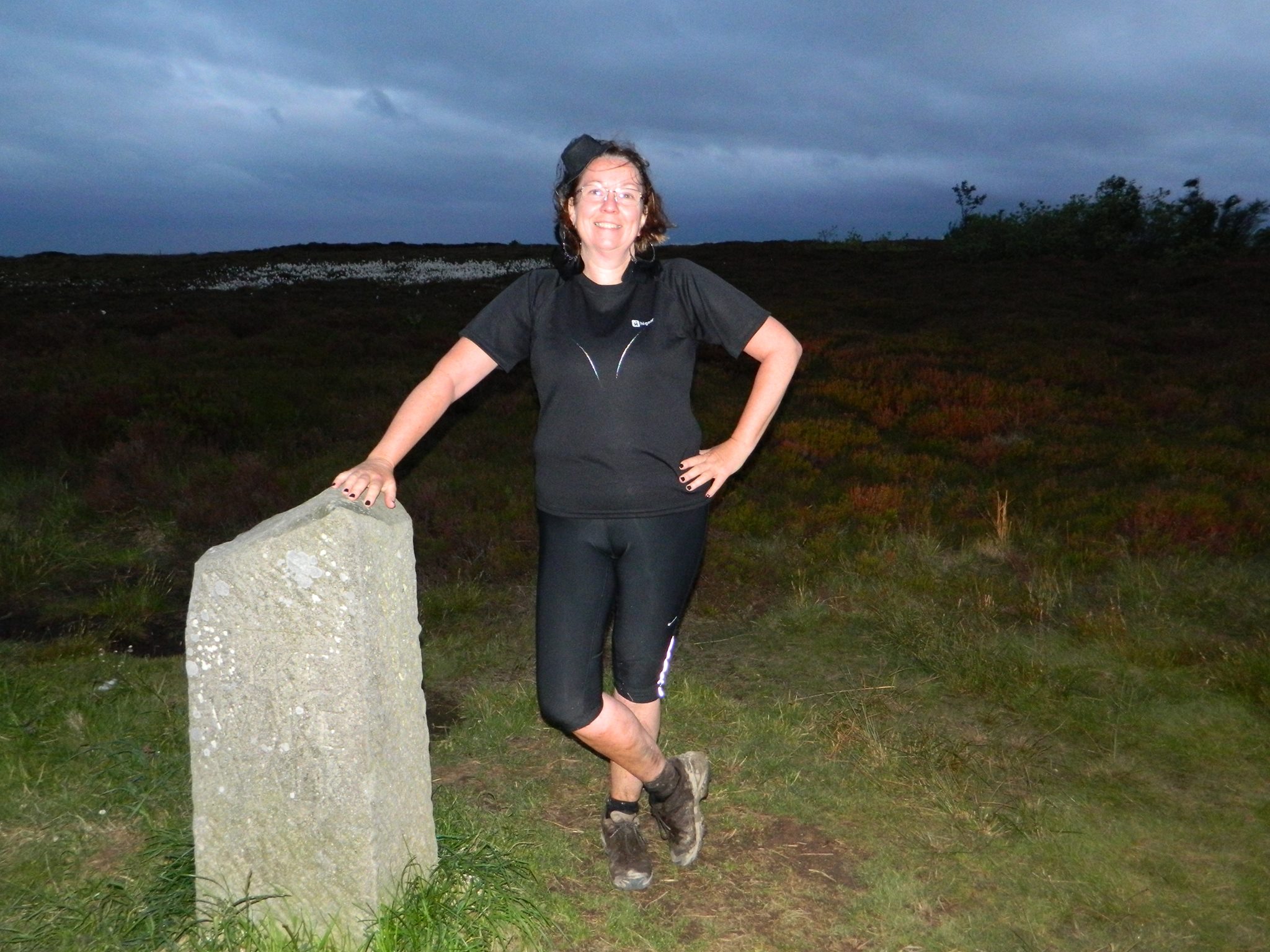
This photo is of Julie during the Lyke Wake Walk, which she very bravely did in all black, with a little hat and black lace veil, black lace gloves and black nail varnish and make up and big black feathery earrings – as she notes definitely befits the Coffin Walk. And Julie admits to getting some strange looks. And before Nathan asks, no, we’re not.
Is this your first 100?
No – I started the Dorset 100 but withdrew just before the breakfast stop – don’t ask – that’s another (long) story! [don’t worry, I’ll get the gossip on that in due course] I have done non-LDWA long distance events in the past though and have really enjoyed those.
What route are you planning to take?
I live in Inverness, about 10 miles from Loch Ness. There are three trails that now make up the Loch Ness 360 route – The Trail of the 7 Lochs, the South Loch Ness Trail and the Great Glen Way. By joining these I can make up around 90 miles and by adding on around 10 miles at the end by finishing over the Iron Age Hill Fort and going along to the end of the Caledonian Canal it should be 100+ miles by the time I get back home. It also means I pass a really good cafe and a McDonalds just before the end! Don’t know if I’m allowed to name names? [well, I do, quite frequently, and perhaps even obsessively]
Are you following a GPX route, a map, or do you already know your route well?
All 3. I have all the maps and we are recceing the whole route over 7 sections, getting the gpx plots as we do the recces. I have walked all of these trails many times, but usually in the opposite direction to that which I’ll be doing on the event.
What training are you undertaking at the moment?
We are recceing a section every other weekend and doing longer walks or hill walks in the weekends in between. I’d like to build up to 30 mile walks during March and April before tapering in May, when I plan to do a long distance path covering around 10-15 miles a day for 14 days. We are also recceing the probable night sections at night.
Do you think this will be easier or harder than the actual 100 that is traditionally held?
Much easier. Travelling from Inverness to anywhere else usually means leaving at least two days beforehand and a long drive or train journey, then a couple of nights in a strange bed and getting up at an unearthly time to get to the start and register. Unless you carry all your food you need to depend on what the checkpoints offer – which is usually great – but often not what I would choose myself. Doing it this way I can sleep in my own bed, get up and start when I want, not be stiff from travelling, eat and drink what I want more or less when I want and give instructions to my support team to not let me give in!
Your group, North West Grampian, is organising the 100 event in 2024 (the Speyside 100), how much work is that entailing so far? Any suggestions at this stage about what food treats the entrants might expect?
We suspended planning in 2020 due to Covid and the deferment of the YSF100, so at the moment we have an Organising Group, a route, an HQ and most of the checkpoints covered. We are about to get started again with planning meetings. As far as tasty treats go – Haggis of course (only kidding). Lots of shortbread and tablet (like fudge but different) and depending on catering regulations in 2024 we will have our Dream Team back in the kitchen at event HQ.
As an aside, will your route in 2024 be really hilly?
It’s on the border of the northern Cairngorm – nuff said! [hmmmm, it’s not selling it to me as someone from Norfolk, so I’ll focus on the food side of things….]
What food treats are you taking with you?
Cheese straws, rice pudding, hot cross buns with cheese and jam, mini-melton pork pies and Percy Pigs. My back up team will hopefully be able to provide burgers, pizza and other hot food by order for the main meal stops. We are hoping the cafes in Fort Augustus will be open for breakfast on the day. [some nice choices there! Although there’s arguably more to doing an event than just thinking about the food]
Will there be any whisky consumed en route?
I don’t take alcohol during a walk but there will be several cans of draught Guinness in the fridge for the finish and if I make the 100 there will even be a bottle of bubbly on ice.
What tactics do you think you’ll use if you feel like giving up on the walk?
I have an A4 laminated sheet with inspirational and motivational sayings that my daughter has strict instructions to wave under my nose at every checkpoint! My main technique though is to walk to the next end of section. Never look too far ahead and then you can always make it. I like doing complicated planning and calculations in my head while I walk to pass the time too. And there may be others around – it’s a popular time on popular trails.
Are there any wildlife that you’re concerned about meeting on the walk? Sheep, cows, snakes, Loch Ness monsters, pigs, or anything else?!
Nessie is our friend and I’ll be joining her for a swim at the end to ease my tired legs :-). Not really concerned about meeting anything though the eyes in the night can be a bit startling at times. I try to avoid frogs – but that’s another story too!
Do you have any foot care tips?
I am definitely not the one to give out foot care tips – my feet have been in a terrible state since a very wet walk on the Lairig Ghru several years ago and they never recovered (at least I didn’t try hard enough to let them mend before trashing them again and again!)
Will you have anyone cheering you on and giving encouragement during the walk?
Our ‘bubble’ walk and swim buddy is planning on doing two sections with us (one of my daughters is going to try the 100 but will be happy to get to over 50), perhaps going into the first night and then the last 20 miles. My eldest daughter will be main car back up, catering manager and chief cheerleader. My husband will also support when he can. Youngest daughter will deliver and collect our canine walking companion from time to time on sections he will be safe on. He is always fun to walk with.
Would you say you’re looking forward to it?
Tremendously. It’s a walk – who wouldn’t be? [I’m dreading the damn thing, but I’m sure I’ll enjoy it when I get going]
Do you have a time in mind of how long it’ll take you to finish?
I’d like it to be 37-40 hours but we have agreed we will try and stay together through the first night if possible – so timing may be different to planned.
Do you have any advice for others, one top tip about long distance walking?
Set out to enjoy it and take it stage by stage but don’t stop too long at any point as it’s amazing how time can add up over a number of checkpoint stops.
What would you say to anyone thinking about entering the 100, or thinking about doing a 50 mile challenge event, who might be a bit nervous?
It’s a walk – don’t overthink it and you may even enjoy it. After all you have nothing to lose – what else would you be doing that weekend that you can’t do another time?
Finally, congratulations on becoming LDWA chair, how have you enjoyed your first few days?
Thank you. I’ve focussed on two main things – taking over the social media accounts from David and getting to grips with those and getting to know the NEC members and their roles better on a one-to-one basis. I have thoroughly enjoyed doing both but will probably have to get on with some real work soon!
This is the gravestone of James Ebden, located in All Saints Church in Wreningham. It caught my eye as the right-hand side of the grave was never filled in, a husband and wife that aren’t both listed.
James Ebden was buried on 7 March 1836 and the church’s burial record notes that he was aged 59, although the grave says that he was aged 60. A little unusually in terms of the records of this church, but James’s residence was listed as being in Lakenham and not in the village itself.
The name of James’s wife was Bathsheba Bates (a religious name that wasn’t uncommon, but is much rarer today), which isn’t perhaps entirely clear from the grave itself, and the couple had been living at Portland Place in Lakenham. She was buried in the church on 30 December 1859, but her name doesn’t appear on the list of gravestones which have survived.
There seem to be two possible outcomes here, since I can’t imagine she ever remarried and she never changed her surname. She was either buried with her husband, but there was no money to complete the inscription, or, she was buried elsewhere in the graveyard without a stone because no-one realised to connect the couple.
One source notes that the couple had one child, James Ebden (1811-1874) and at first sight that would make the situation strange, as this situation would have been something that he could have resolved. However, the only James Ebden listed as alive in Norfolk in 1871 was at Bethel Hospital which was then listed as a lunatic asylum (better known now as a mental health hospital) in Norwich, which might explain why he hadn’t intervened.
There’s some guesswork here from me, but I suspect that the couple have been buried together, but there was no money to pay for the stone to be inscribed, hence why it was never completed. I do rather quite hope that the couple were reunited in death.