Author: admin

  • GeoGuessr – The Joy of the Random…..

    GeoGuessr – The Joy of the Random…..

    A couple of years ago, Nathan and myself set ourselves a plan to use GeoGuessr to pick a random location in the UK and then just go to it. The plan was that everywhere had a story and that the journey there would be part of that. We completed two of these and were pleased at how they turned out, with our third location already planned. Unfortunately, the situation meant in 2020 that we never got to go to that location, that’s been postponed for a future date when we can get there. It’s an awkward place to get, so it’s not one that can be quickly reached in a day.

    But, undeterred, we’ve formulated a plan to do a version using a Norfolk specific map on GeoGuessr, visiting five random locations in Norfolk in one day using only public transport. Again, as of early February 2021, we can’t do this either as random trips on public transport aren’t allowed, but hopefully lockdown will lighten and we can get going with this plan soon enough. Not least because these challenges involve a fair chunk of walking, primarily because public transport in Norfolk is pretty dreadful. And that walking is useful (well, essential), we’re walking the LDWA 100 in May….

    So, I need a new interim plan until lockdown is loosened, one which ensures I am getting enough exercise for that LDWA 100, but without going on public transport or needlessly walking where others are likely to be. So, I’m switching this plan down to just a Norwich specific map on GeoGuessr. Users can create their own area, so I’ve created an area which is something like within what I would call the outer ring road (I don’t think that’s what it’s actually called).

    This is my area, with a potential 1,400 locations. Some will be easy to reach, others a bloody nightmare, although that’s half the excitement and way of getting my walk mileage up a bit. I shall be trying to rope other people into this plan (so far Nathan, Jonathan and Liam have been dragged into this), I mean it’ll be a lovely day out (well, maybe). Five random locations in the area selected in advance, which can be walked in any order and there’s my own mini challenge. Not exactly riveting I accept, but it’ll do…..

    I’ve added in my own extra challenges to this whole arrangement to liven it up. If one of the five locations is within 150 metres of a chip shop or a church, then I’m going to it. And if it’s within 150 metres of a pub, then I’ll go to it (or, more realistically it’ll be shut so I’ll have to take some delicious craft beer to have instead, as it’s important to support the brewing industry in some form). I’ll also be diverting slightly to ensure I see five listed buildings that I haven’t visited before as well as finding routes which aren’t likely to be busy.

    So, I still think that any adventure such as this will enable me to find out something new about the local area and there’s always a story to be told of some sort. I’ll use Komoot to plot the route between the five points, it seems to do a nice job of finding interesting walking routes and not just putting me on main roads. How lovely   🙂

    WALK 1 (just me)

    WALK 2 (with Nathan, using a smaller map area)

    WALK 3 (with Nathan, using a smaller map area)

    WALK 4 (with Liam)

  • London – Greenwich (Borough of) – National Maritime Museum (Nelson’s Death Coat)

    London – Greenwich (Borough of) – National Maritime Museum (Nelson’s Death Coat)

    This is “one of the most iconic items in our collections” the National Maritime Museum note, the uniform which Admiral Horatio Nelson was wearing when he died. Vice Admiral Nelson was killed on 21 October 1805 during the Battle of Trafalgar, when a bullet fired from the French ship Redoutable hit his left shoulder. The damage done was fatal and Nelson was aware of this immediately and he’s quoted as saying “Hardy, I do believe they have done it at last, my backbone is shot through”. He was carried off to get medical help, stopping en route whilst he gave advice to others whilst the battle continued, dying around three hours after he was injured.

    It was suggested to Nelson that he perhaps shouldn’t wear medals on board the ship as it made him stand out to the opposing forces, who could target him. However, removing them was a slight faff as they were sewn on and such was the inaccuracy of weaponry at this time, Nelson didn’t seem to fear much. The ones on display here are those which were on the coat when he died, but they themselves were replicas.

    It’s possible to see on the coat a hole where the bullet hit Nelson on the shoulder, making this a slightly grim exhibit, albeit one of national importance. There are also blood marks on the sleeve, which aren’t particularly visible, although it’s thought that these are likely that of Nelson’s secretary, John Scott, who had died about an hour before. Scott’s body’s had been thrown into the sea but blood remained on the deck and Nelson fell onto that spot when he was hit.

    The coat was given to Lady Emma Hamilton, who was Nelson’s mistress, but she was in a slight predicament that the Government excluded her from events, and her own husband wasn’t best pleased at this entire situation. She sold the coat in 1814 to help pay off some of her debts and it was later repurchased by Prince Albert, who gave it to Greenwich Hospital.

    Copyright of the Royal Collection Trust

    One of the joys of history is that most things entwine with each other, although that’s sort of literally the case here. The bullet which killed Nelson, along with bits of his coat that got caught up with it, are exhibited at the Queen’s Guard Chamber at Windsor Castle. It was taken from Nelson’s body by William Beatty, the doctor of HMS Victory, who decided that he quite fancied having a souvenir of the whole incident. He wore this locket for the rest of his life, but when he died his family donated it (probably with some relief) to Queen Victoria.

    As an aside, Nelson didn’t want his body chucking overboard as the usual way of getting rid of dead bodies. So, it was Beatty was put Nelson’s body in a barrel of brandy to preserve it whilst the ship set sail back for England. During this period of transportation the gases from the body forced the lid of the barrel off. It’s said that the sailors guarding the barrel were rather surprised by this occurrence….

  • London – Islington (Borough of) – Edward Johnston Memorial at Farringdon Station

    London – Islington (Borough of) – Edward Johnston Memorial at Farringdon Station

    Just in case anyone thinks I’ve started travelling again, these are photos from a very quiet Farringdon underground station last month. And this is the sort of slightly niche memorial that I like, a quite glorious addition to what would otherwise be a sterile corridor area. It’s also perhaps not really apparent what it is at first, I like a bit of depth to things such as this.

    The memorial was unveiled in 2019 and was designed by Fraser Muggeridge and it honours the work of Edward Johnston (1872-1944). Johnston was commissioned by Frank Pick to design a new typeface for the London Underground and it started to appear across the network in 1916. The London Underground roundel concept wasn’t designed by Johnston, but he was responsible for its design evolution and how it appears today. The London Transport Museum has more information about the roundel and Johnston’s influence on it.

    The typeface was initially planned to just be used on London Underground posters, but it was seen to be clean and tidy, so its use was extended to nearly all signage. This memorial has been designed to look like the printing blocks that were once used, hence why it looks back to front.

    As an aside, this memorial was unveiled by Sir Peter Hendy, someone who has a long interest in the fabric and heritage of transport in London. I remember when I was at an underground station in 2013 (I’ve forgotten which) where there was an issue where everyone needed to leave. I sought help from a staff member, and by chance I managed to get assistance from Hendy who was there offering customer service help. He knew exactly what buses I needed to get and had a formidable knowledge of the network, although I suppose that’s inevitable given that his career was spent in buses and he was heading TFL. Anyway, because I like to report excellent customer service to companies, I filled in the TFL customer service feedback form and I got an template e-mail back the next day that my positive comments had been forwarded onto the staff member……

  • Norwich – Rosary Cemetery (James Light)

    Norwich – Rosary Cemetery (James Light)

    Located at Rosary Cemetery in Norwich, this is the grave of James Light, who was born in Southampton in 1849, the son of Isaac Light and Lucy Light. Isaac and Lucy (nee Sillince) had married on 4 July 1847 in Southampton.

    At the 1851 census, James lived at St Faith’s Lane in Norwich with his parents, and they were lodging with another family. Isaac Light was an engine driver on the railways and he would have been one of the first to have that role in Norfolk, as the first line in the county was Yarmouth & Norwich Railway which opened in 1842. I’m not sure why the family made a move from Southampton, but perhaps it was so that Isaac could secure employment in this new industry.

    By the time of the 1861 census, James and his parents were living at Garden Street in the city, along with their other children, Emma, Richard and George. They had moved to Wilderness Place by 1871, with Isaac, Lucy, James, Richard and George living there. Isaac, James and Richard were all working for the railways and although I’m guessing here, I suspect they would have found this a more exciting job to have than some others which were available at the time (mostly shoe manufacture in Norwich). The railways were still relatively new and exciting, there must have been something of an element of adventure and a knowledge that the railway network was expanding.

    However, bad things were to take place. Whilst working as a fireman on the train, James died on 10 September 1874 at the age of 25 in what is known as the Thorpe rail accident. This incident, which took place near what is now known as the Rushcutters pub, caused the death of 25 people and over 75 others were injured. It occured when a mail train and a passenger train hit each other head on due to some confusion and poor communications. When the crash took place it was the second worst rail incident that had taken place in the country in terms of fatalities, with more people having died only at the Abergele rail crash of 1868. One of the legacies of this major incident at Thorpe was the introduction of the tablet system, to try and prevent head-on crashes.

    I’ve marked the scene of the crash on the above map from the 1920s, which was very close to the Rushcutters, although the pub was known as Thorpe Gardens at the time. The coroner at the time insisted during the trial that the phrase “railway accident” wasn’t to be used, it was to be referred to as “a railway collision”. Shortly after, he said “it is due to the public to know how this collision did happen, whether it was through carelessness or accident; though I am afraid we cannot bring it to the latter, for everything at present appears to contradict that”. It’s clear that the coroner didn’t intend to oversee a whitewash with his inquest.

    The saddest element was the identification of the dead. For James, this was done by his brother Richard, who said:

    “I live in Wilderness Place, King Street and I am a fireman. The deceased James Light was my brother. I have identified his body lying here. My brother was a fireman in the employ of the Great Eastern Railway Company. He was twenty-five years of age and lived at Wilderness Place”.

    This must have been a hugely emotional task for Richard to perform, especially as he had the same job on the railways as his brother.

  • Norwich – Bridewell Prison Door

    Norwich – Bridewell Prison Door

    And today’s post is about a door-frame. Content doesn’t get more interesting than this….. OK, it does, but I still like this door and I’ve only recently noticed that it exists.

    Perhaps the best description of this door is from George Plunkett, who noted:

    “Descending St Andrew’s Hill from London St, there is about halfway down on the left a wooden doorway thought to date from about 1490, the former entrance to the Bridewell. Its spandrels, carved to resemble foliage, support a large wooden grille enclosed within the doorframe. This grille, which in unglazed, is of Gothic design and consists of two large lights, each divided into four smaller ones by slender mullions which interlace at the top like tracery in a church window. Sadly two of these mullions have gone since the 1930s; in view of the extreme rarity of such a doorway one would like to see it sympathetically repaired and conserved to prolong its existence for a few more centuries.”

    And he’s quite right, he has a photo from 1935 and it shows that bits have gone missing since then, having previously managed to survive several centuries. And I’m not sure what that bloody awful box is doing to the left of the doorway, it hardly ignites a feeling of beauty and history.

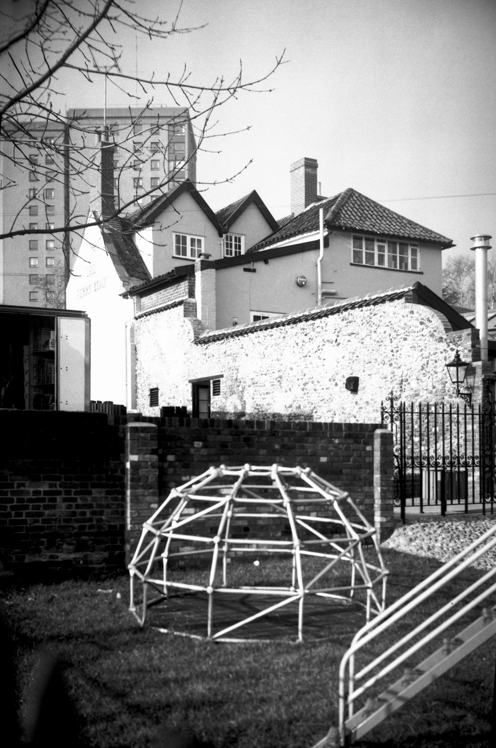
    These Norwich Lanes tablets (or slabs, whatever they’re called) very often give details of where pubs once stood, but this is a handy reminder that this door was once the entrance to Bridewell Prison. And if this excitement about the door isn’t enough, here’s some more about the flint wall on the same building, with a bit more history about the prison. I think I need to get out more….

  • Norwich – St. Julian’s Church

    Norwich – St. Julian’s Church

    It’s not known who the church of St. Julian is named after, it could either be Julian the Hospitaller or Julian of Le Mans. I hope that it’s the former, as he’s the Patron Saint of travellers and he’s venerated in Malta, where there’s a town called St. Julian’s which is named after him. The church seem less convinced, they think it’s of Julian of Le Mans….. Anyway, I walked by here a couple of weeks ago and hadn’t realised it would be open, so I had a little meander inside.

    Much has changed from this nineteenth century map of the church, with St. Julian’s Alley now reached off of Rouen Road.

    The church was heavily restored between 1868 and 1870 under the supervision of Walter Emilius McCarthy. The chancel was reconstructed and there was some modernisation to the building, similar to what Victorians did to other churches across the country. Here though, the work was overdue as the church had been allowed to fall into a state of disrepair before the work was undertaken.

    Unfortunately, nearly all of what is visible today is a post-war reconstruction as the building was nearly entirely destroyed during the Second World War, on 27 June 1942. The church has been restored to mostly look like as it did before it fell, but the tower wasn’t restored to its original height. It was the only badly bomb damaged church in Norwich to be rebuilt, even though others had more structurally left standing. This is mostly, and indeed likely entirely, due to the connection with Mother Julian.

    One discovery which was made were the Saxon windows that had been covered up in later restorations and which have now been made visible again. One example in the main photo of the church’s frontage above is the small circular window which are likely late Saxon.

    The main doorway of the church, which needed to be repaired following the war damage. George Plunkett has, of course some marvellous pictures of the church before it was damaged, as well as during the restoration.

    1937 – church before war damage

    1946 – church reduced to rubble

    1952 – reconstruction of north side of church

    1962 – completed church after rebuild

    The nave of the church.

    The chancel of the church.

    The church’s font was originally located at All Saints’ Church in the city.

    This door is from the nearby St. Michael at Thorn Church which was also damaged during the Second World War, but despite the tower remaining, the whole building was pulled down. The site is now used as the EDP’s car park and although I understand that there was a problem with the high number of churches already being under-used in Norwich, not keeping at least the tower was I think a mistake. But there was a desire to entirely redevelop that area of the city, something not really done that well in my view and it would have preferable to at least keep the streetlines.

    The door is though quite marvellous, it dates from the first half of the twelfth century and it’s now the entrance into the chapel of Julian of Norwich.

    This is the chapel of St. Julian, which is where Julian of Norwich was an anchoress where she lived in total seclusion whilst praying and writing. This chapel is a new addition, there were some foundations found during the excavations of the church following the war damage and it was thought they might have been from Julian’s cell. It was thought appropriate to build a chapel on those foundations, and I must say this is a gloriously peaceful little room.

    She has the honour of being the first known woman in England to have written a book, known as the Revelations of Divine Love (of which much more on Wikipedia). There’s also more about Julian of Norwich at the church’s web-site.

  • Norwich – Rosary Cemetery (George Johns)

    Norwich – Rosary Cemetery (George Johns)

    This is the gravestone of George Johns, located in the Rosary Cemetery in Norwich. George was born in Ludham in 1833, the son of John Johns, who was an innkeeper. George trained as a carpenter, but for reasons unknown, perhaps by necessity or in search of adventure, he decided to embark on a new career in the military.

    George joined the Royal Regiment of the Horse Guards on 9 October 1862, at the age of 31. His army records show that he was 6 foot tall (well, 5 foot 11 and 3/8 inches which seems ridiculously precise to me) and had brown hair. His service record seems a bit patchy, and there’s an absence without leave in there.

    George, who by now had retired from the army, married Lydia Bond, who was 12 years younger than him, on 22 October 1874. Eugene had already been born on 16 December 1870, which is perhaps the reason that George thought he’d better request to leave the army.

    At the 1881 census, George was living with Lydia and his 10 year old son Eugene at 3 Chester Place in Norwich. This road still exists, it’s located off of Earlham Road, near to the Roman Catholic Cathedral. Indeed, when George and his family were living here, work would have been taking place to demolish the Norwich City Gaol which was on the site to replace it with the Cathedral.

    The three family members were also living in the same location in 1891, with George still working as a starch maker and Eugene was now working as a shoe maker. I do wonder what someone like Eugene would have been doing today, perhaps a computer programmer or working in finance, there would be plenty of choice. For men in the late nineteenth century in Norwich, the choice was often limited to work in the shoe trade.

    George died on 19 May 1892, at the age of 59 years old and Lydia, George’s wife, died on 25 May 1922.

    Eugene married Kate and at the 1901 census, he was living with her at 12 Patteson Road, along with their children Harry, Hilda, George and Ivy. Eugene is listed on the 1939 register, by this time retired from the shoe industry, living with his wife Kate at 45 Midland Street in Norwich. Eugene’s home on Midland Street was only a two or three minute walk from where he had lived at Chester Place for many years. Eugene died in 1959, at the age of 89.

  • Dictionary of the Vulgar Tongue – Day 278, 279 and 280

    Dictionary of the Vulgar Tongue – Day 278, 279 and 280

    The Dictionary of the Vulgar Tongue was first published at the end of the eighteenth century, and given that the current health crisis is giving too much time to read books, I thought I’d pick a daily word from it until I got bored…. And to catch up after getting behind with these posts, and because I’m getting towards the end of the book, I’m doing three days at once now. How lovely….


    Rabbit Catcher

    There is very little that I can add to this definition, but it seems to have been quoted by Grose before any other source and doesn’t seem to have ever been used that widely. Anyway, it’s simply defined as “a midwife”. I think that’s rather lovely…..


    Rack Rent

    This is defined by Grose as “rent strained to the utmost value. To lie at rack and manger; to be in great disorder”. Firstly, this makes me wonder about the phrase ‘rack rate’, which is the hotel’s full-price room rate. Nearly every source on-line claims that this phrase originates from when the hotel would place its price by the rack behind the hotel reception. I suspect they’re all possibly wrong, it perhaps comes from the same phrase origin as Grose refers to.

    Incidentally, there are a few pubs which have been known as the ‘Rack and Manger’, a phrase that is mentioned in the description. A pub name which means ‘to be in great disorder’ sounds exciting.

    But, back to the main phrase, which originates from the rack that was used to torture people, which was in use from the seventeenth century (the phrase, not the torture device). The phrase used to be relatively common, but has now mostly fallen out of usage over the last century as can be seen from the above Ngram from Google.


    Rag Water

    Grose is back to alcohol with this definition, which is “gin, or any other common dram: these liquors seldom failing to reduce those who drink them to rags”. The phrase evolved from poor quality alcohol of any type and the terminology was used from the end of the seventeenth century to somewhere in the middle of the nineteenth century. The reason Grose focused on gin is that this was the common drink that was abused at the time, leading to the Gin Craze which caused such problems during the eighteenth century. I wonder if the phrase might be repurposed today to describe certain types of lager…..

  • Norwich – Rosary Cemetery (Arthur Thomas Woodard)

    Norwich – Rosary Cemetery (Arthur Thomas Woodard)

    Arthur Thomas Woodard was born on 6 June 1873, the son of John and Charlotte Woodard. He was baptised at St John de Sepulchre Church in Norwich on 27 August 1879.

    At the 1881 census, Arthur was living with his parents at Brown’s Yard, off St. Stephen’s Street in Norwich. Later renamed Mansfield Court, this was all swept away with the post-war widening of St. Stephen’s Street. Arthur’s father John was working for the railways, and Arthur had numerous siblings also living in the same property, namely William, Elizabeth, Robert, Jemima and Mary Ann.

    Arthur served in the Royal Navy on HMS Abdiel and his service number was 350238. HMS Abdiel was a minelayer which launched in October 1915 and it laid 6,293 mines during the course of the First World War.

    Arthur died on 10 March 1918, at the age of 45. Arthur was a 2nd class sick berth steward and although the ship was involved in dangerous military action, his death followed a heart attack he had on board. Arthur’s job title sounds like it was something akin to a cruise ship, but here it’s just the rank for what is better known today as medical assistants. The ranks were, from more junior to senior, 1st & 2nd class boys, sick berth attendant, sick berth attendant 2nd class, sick berth attendant 1st class and chief sick berth steward.

    At the time of his death, Arthur’s parents were living at 11 Thorn Lane in the city and his father had to sign this letter to confirm the details of what they wanted on their son’s grave. I can’t quite imagine the emotions that parents and loved ones went through when sending these forms back to the Imperial War Graves Commission. It’s nice though to see that someone is still tending his grave, with Arthur being one of 31 Commonwealth War Graves at the cemetery.

  • LDWA 100 – Training Walk 10 (Finding the Source of the River Yare Part 2)

    LDWA 100 – Training Walk 10 (Finding the Source of the River Yare Part 2)

    This was our tenth walk in preparation for the 2021 LDWA 100.


    WALK NUMBER: 10 (Finding the Source of the River Yare Part 2)

    DISTANCE COVERED: 14.7 miles

    NUMBER OF NATHAN’S FRIENDS WE “ACCIDENTALLY” BUMP INTO: 1 (might have been someone I knew)

    SUFFICIENT BEER CONSUMED: No (all the pubs are shut)

    PUBS VISITED: 0 (not through choice)

    WEATHER CONDITIONS: Dry

    ATTACKED BY ANIMALS: No

    NUMBER OF SNAKES SEEN: 0


    The eagle eyed reader will note that the 14.7 miles has been split across two posts. Some might suspect that this was because I couldn’t be bothered to post about the entire walk in one go, but I repeat that it was to add suspense. Or something like that….. Anyway, the first post ended with Nathan faffing about crossing a puddle.

    At the moment, we’re on the right of the above map (moving left) and we were able to track the river for the first stretch.

    A frosty scene….

    We were able to continue by the river, although there were stretches that were particularly muddy. Slightly amazingly, neither of us fell over during the day. There weren’t that many other walkers along this little stretch, but that’s probably because they didn’t feel that sludging through this was ideal entertainment.

    Long before this health predicament I had been planning to be in Las Vegas at this time, accidentally ordering a sack of burgers at White Castle. As an aside, this is why the United States is so exciting, where else can you buy a sack of burgers? And yes, this is a real thing, anyone interested can Google it. I could have been playing video poker in Excalibur, getting free beer and popping into Banger Brewing later in the day after a ride on the Deuce (not Douce). Instead, I was walking on mud, but I think I was still enjoying it.

    Here we came across a little problem. That’s the path.

    The Yare had entirely burst its banks at this point and the footpath wasn’t even visible, let alone walkable. It’s evident in the map image, we could no longer walk by the river and instead had to head back inland (not sure that’s the right word there, but it sounds more exotic) towards Eaton Golf Course.

    Instead and so no-one feels that they’re missing out, here’s a photo of that exact stretch of flooded route that we walked last June. It was less moist then.

    Don’t fear, I didn’t linger on the railway line.

    On the above map, the blocked footpath meant we couldn’t track the river, but we did walk back down to it (on the left-hand side) to try and explore it a little bit. This was always a closed loop we’d have to go back up from, but it was part of our policy of walking by all the bits of river that we could. I got a bit muddled up here and tried to walk the wrong way along a path that looked interesting, and I’ll have to credit Nathan for noticing that I was trying to go back in the same direction we’d just walked from. He can be quite observant.

    For anyone who wants to see the map click on the above image (and to read about how one child said this area was “very wild”) to see where the footpath was meant to be.

    Nathan set off to explore the area and I pretended that I was Stewart Ainsworth from Time Team. For those who never watched that, Stewart is the guy who looked at the wider environment, often looking for evidence of raised land where historically people would have walked so that they didn’t get their feet wet. To cut a long story short, all the terrain was flat, I forgot that I was in Norfolk. So whilst Nathan was sinking into mud, I concluded this strategy of mine was failing. It wasn’t possible to get to the river here. Well, not without sinking anyway and although I wondered what Nathan would look like if he sank three feet into the ground, I thought it would all be too much hassle to fix. And that kid was right (not Nathan who is nearly 30, I meant the one who was featured on the sign), it was very wild around here.

    After spending some time helpfully smashing the ice to help the local wildlife (I’m not sure we worked out what help we actually were, but there’s something satisfying about making a hole in ice), we decided we’d seen enough of this meadow.

    We (well Nathan did, I was looking for a big stick to break the ice with) did spot the river and although it’s hard to see, it’s the water course at the back of this photo. We only knew it was the river as we could see it flowing at some speed.

    So, we retraced our steps (visible on the right of the above map) and then walked into the wealthy Norwich suburb of Eaton. We lost sight of the river at this stage, but it was nice to see civilisation again after our time in the wilderness. OK, I accept we had hardly been walking in the Amazon, but it’s all relative and I have to try and make a walk around Norwich sound as exotic as possible.

    This is St. Andrew’s Church in Eaton and it’s rare to see a thatched church in the area around Norwich. The bulk of the church dates from the thirteenth century and there are some wall paintings inside which I’ve looked at before and had no idea what they were portraying.

    I think I annoyed Nathan by applauding an extension they had put on the back as meeting my design requirements (where the old meets the new….), whereas I didn’t like the one at the church where he got married. He’s getting very protective of that church….

    We might have seen someone we knew at this stage, as we saw someone waving and calling out. Then they looked grumpy and walked off before we worked out who it was. Hopefully it was one of Nathan’s friends who was annoyed and not someone that I might know. If it was someone I knew calling over, then hello   🙂

    We thought at this stage that we’d pop into Waitrose. Now, given that Nathan and I are hardened walkers ready to take on the 100 in a few months, we feel that we’re competent navigators who are experienced and confident. We then couldn’t find our way into Waitrose and got entirely muddled up, which frankly wasn’t ideal. As an aside, and without being rude, whoever is in charge of signage at this Waitrose is a bloody idiot. Right, moan over.

    The true measure of a shop is the quality of their craft beer selection. Although not world class and lagging behind Morrison’s, this wasn’t a bad effort. Anyway, Nathan and I decided that Waitrose was too decadent for us (I still feel I’m an imposter going into M&S, let alone Waitrose) and so we continued on our walking expedition.

    This was the path at the rear of Waitrose and there is a path which leads from here to the UEA. We were a little concerned at first as this was not an ideal situation in terms of the mud, but it transpired that this was the only problematic stretch.

    This is the stretch to the A11 and it hadn’t flooded at all, which was rather lovely.

    I’m not a bike expert, but this could have done with a service, perhaps using the scheme promoted by the Government which nearly no-one was able to get.

    The bridge looks quite ugly here with the graffiti and rickety metal structure shoved on the side.

    It’s more pleasant from the other side and this is Cringleford Bridge which was built in 1520 and extended in 1780. The previous bridge had been lost to floods in 1519, which probably annoyed the locals at the time. This was once on the main road, but there’s a new road bridge on the nearby A11 to relieve the traffic on this one. Of relevance to our walk, the listed building records notes that “the southern bank of the river Yare is now the boundary of the City of Norwich”.

    A previous flood level marker on the bridge. Fortunately, the water wasn’t quite that high when we meandered along the route.

    The bench didn’t seem correctly proportioned to me.

    This is the next stretch of the path, which sticks by the river and leads into the University of East Anglia (UEA).

    This was our final stretch on this walk, and that stretch from the bridge to the lake is visible on the above map. The big lump of water is the UEA lake, with the university buildings just above it towards the top of the map.

    I’ve never seen a dog entry point into a river, but it didn’t seem like a bad idea. I thought at first it was something that snakes had created for themselves, so I was pleased it was a less dangerous type of animal (although knowing someone that has been bitten by a dog recently, she might not agree).

    I noticed there was a little stretch off the main path which stuck close to the river. We went down there, but didn’t get far as there was a tree in the way further down.

    A little pier on the lake with the UEA buildings behind. As one of the university’s leading alumni, I didn’t note Nathan gazing longingly at the buildings, but perhaps he was inwardly excited to be back.

    This is the ‘Man of Stones’ bronze sculpture designed by Laurence Edwards and installed here in 2019.

    We didn’t need to cross over here for the purposes of our walk, although we might have had a little meander on the other side if it had been open.

    I was quite glad that it was shut, as it’s called the Mathematical Bridge and this might have over-excited Nathan given his maths degree. I can imagine him walking over 25 times to celebrate just how mathematical it was.

    It is called the Mathematical Bridge due to its construction being comprised of only straight lines and this mathematical structure is meant to surprise and delight people as the average person might think from its design that it would collapse. Anyway, it’s closed as it’s collapsing, but once they’ve fixed the foundations it’ll be open again. I hope the bridge that my civil engineer friend Liam is currently building doesn’t suffer from the same fate, but I’m sure he’s got that under control.

    I wanted to carry on by the river, but it was getting muddier.

    At this point, we’re on the left-hand side of the lake. The path that was too muddy to follow would have allowed us to carry on by the river, but instead we took a parallel route (well, sort of parallel) route towards Earlham.

    This was too difficult to cross as the water was deeper that it looks in the photo. I know this as I tried to walk across it. Nathan, who can sometimes be more sensible than me, held back looking concerned. He was right (hopefully he won’t notice me writing that).

    A bushy tree. Anyway, at this point we had gone off track and so we’ll be back soon to try and carry on along the path that we couldn’t walk this time. And then we’ll walk further down the River Yare and I can imagine how excited everyone must be to read about that……