
And a new little project that Jonathan and I are undertaking because this lockdown is clearly here for at least a few more weeks. It’s a bit niche (our project I mean, not the lockdown), I’ll accept that, but there we go. Effectively, it’s walking around Norwich, ancient parish by ancient parish and seeing what is there now compared to a map from the 1880s (the map above is from 1789, but the one from the 1880s is more detailed, which is why we used that). There’s a PDF of these boundaries to provide some extra background to this whole project.
St. Julian is the eight parish we’ve visited and as can be seen from the above PDF, it’s split into two separate areas, with St. Etheldreda in the middle. Given the complexity of that, this post is just about the most northern of the two sections of the parish and the one containing St. Julian’s Church. The other half we’ll do next week (I can imagine the excitement that everyone has already…… or perhaps not…..).

This is the Waterfront on King Street, a live music venue and club, with this artwork at the front giving some examples of bands and singers who have performed there.

This is the Waterfront’s riverside drinking area, which is all rather lovely, and it’s on the site of the old mortuary.

This is Abbey Lane (formerly known as Cockey Lane), with the Waterfront on the left-hand side, looking back towards King Street. It’s also where St. Clement’s Church once stood, in the former parish of St Clement at Conesford. It was united with the parish of St. Julian in 1482, but the church remained open, but fell out of usage in the 1560s. The building was still there in the eighteenth century and it’s though some parts of it might remain underneath the nineteenth century structure of the Waterfront. To add to the mortuary situation, there were numerous burials found here in the 1960s in the former churchyard.

This is the next street along, Hobrough Lane, and this would have once led down to a ferry which crossed the River Wensum. Once the frontages on King Street would have had residential properties that the wealthy lived in, but over the centuries it all became more of an industrial area.

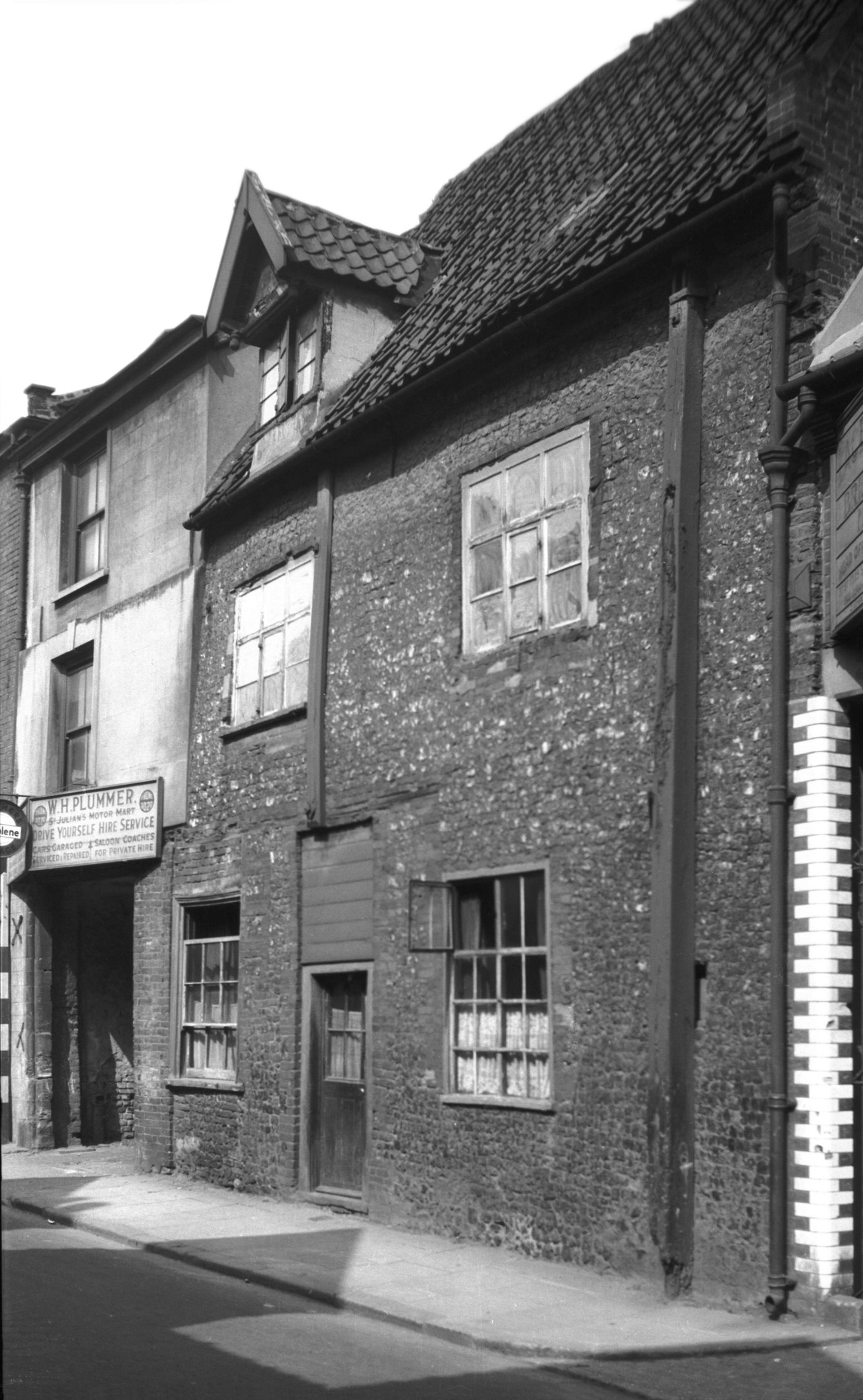
This area has now been cleared, but this would have been Greenman Yard and there was a pub, the Green Man, standing where that wall is. This was a pub from the mid-eighteenth century until it was demolished just before the war and George Plunkett took a photo of it in 1936. I’ve written this before, but Norwich is so very fortunate to have had George Plunkett, as I can’t imagine there would have been many other photos taken of this pub.

Much has been written elsewhere about Dragon Hall (not least this rather lovely volunteer guide from 2005), so there’s little need for me to add a great deal here. It’s a former medieval hall of national importance which was constructed in the early fifteenth century. Although it was constructed as a grand hall for a wealthy man, Robert Toppes, it got sub-divided up over the centuries as King Street became a place more for industry than decadent living. It’s a slight miracle that the building didn’t fall down by the early twentieth century and it was in quite a state. Properties behind the building were removed as part of slum clearance, but the council had the foresight to save Dragon Hall (a name it was given in the 1980s) and take it into their own ownership. Some forward thinking individuals turned this into a museum and its change into the National Centre for Writing is a slightly retrograde step in my view (I’d have liked the building to have remained a museum so its fine interior was accessible to the public), but in all fairness, the new organisation does allow visits to see inside.
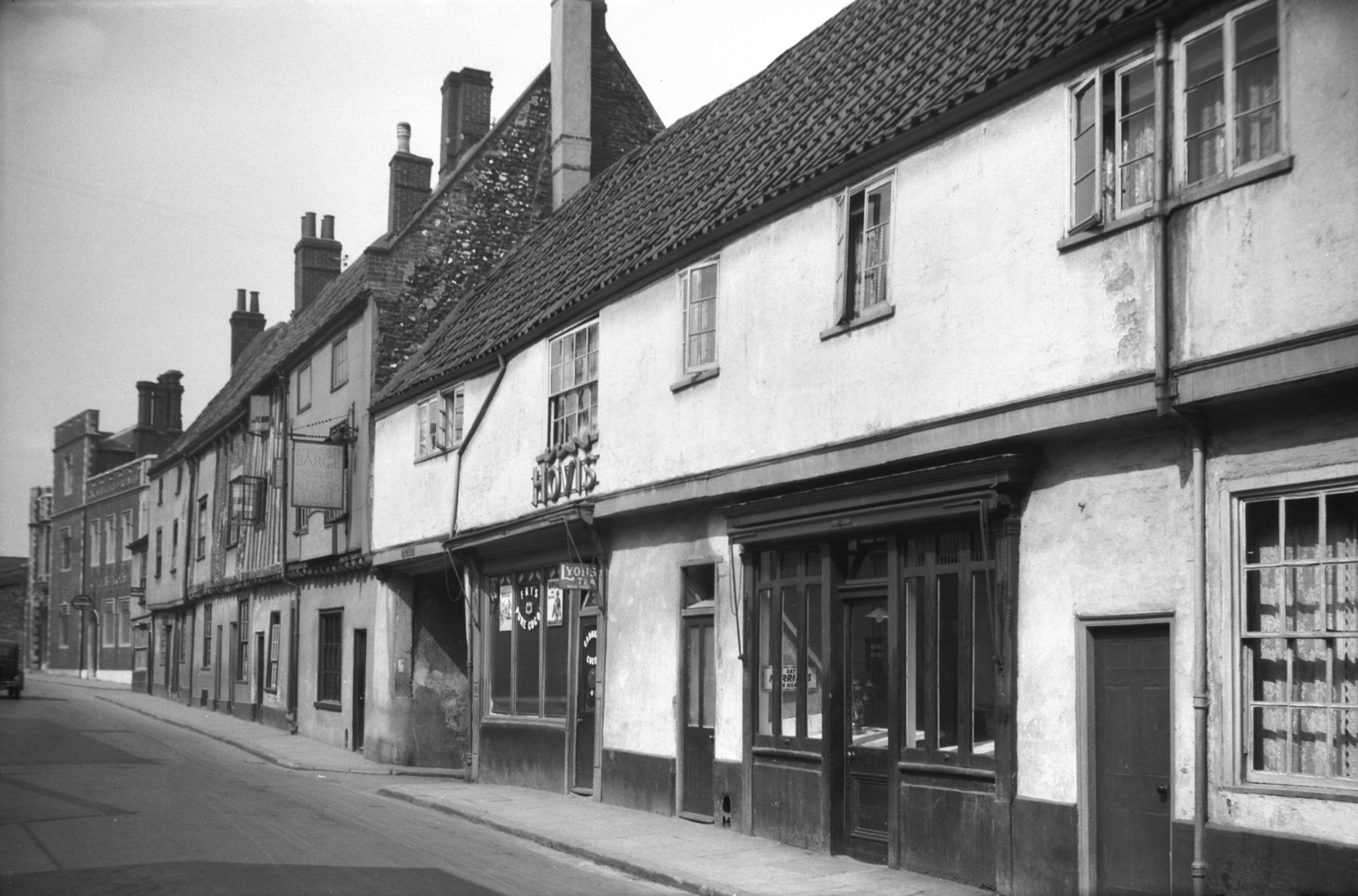
The building to the right (125-129 King Street) on the above photo is historically interesting, but it has been rather marred by the lower floor windows that have been punched into it. I remember this building as BB Adams, the electrical retailer, but it’s been boarded up for some time now. It looked much better as it was in this 1936 photo from George Plunkett.

The entrance to Old Barge Yard, which takes its name from the pub which traded here from the middle of the nineteenth century until it closed in 1969. The window seats from the Old Barge Yard pub are apparently still visible inside the building.

Old Barge Yard, which did lead to the River Wensum, although it has now been blocked off.

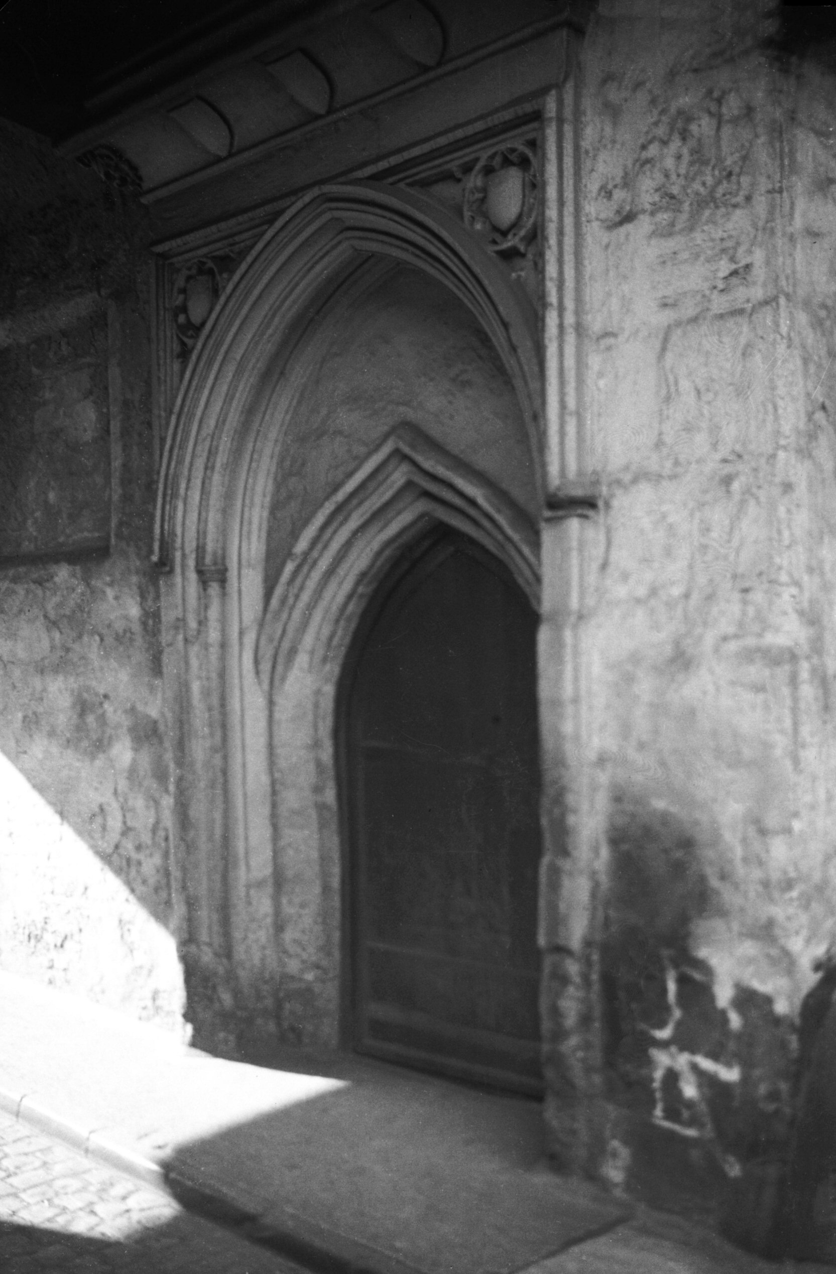
One of the old doorways into Dragon Hall and this dates to the early fourteenth century when the building was being constructed, although the decoration is from the fifteenth century. George Plunkett has a photo of the doorway taken in 1935.

Looking back along Old Barge Yard, towards King Street.

This was the area behind Dragon Hall which was cleared during the slum removals of the 1930s. The entire site, including the flats behind, are now part of the Saint Anne’s Quarter project.

Back on King Street, opposite Dragon Hall, is this entrance to Drays Yard. Although it has an historic sounding name, this isn’t original and is a new construct.

St. Julian’s Alley and that wall to the left is a bit of a survivor. It isn’t the former wall of a building, just something that was built around a property boundary, so it’s done well to be kept and integrated into the newer structure behind it.

This area hasn’t changed much over the centuries, it’s the churchyard of St. Julian’s Church and the alley named St. Julian’s Alley goes off to the left, straight ahead and to the right. George Plunkett has a photo from 1938 of the building which is behind where I’m standing, although this has now gone and there’s a modern residential property there now.

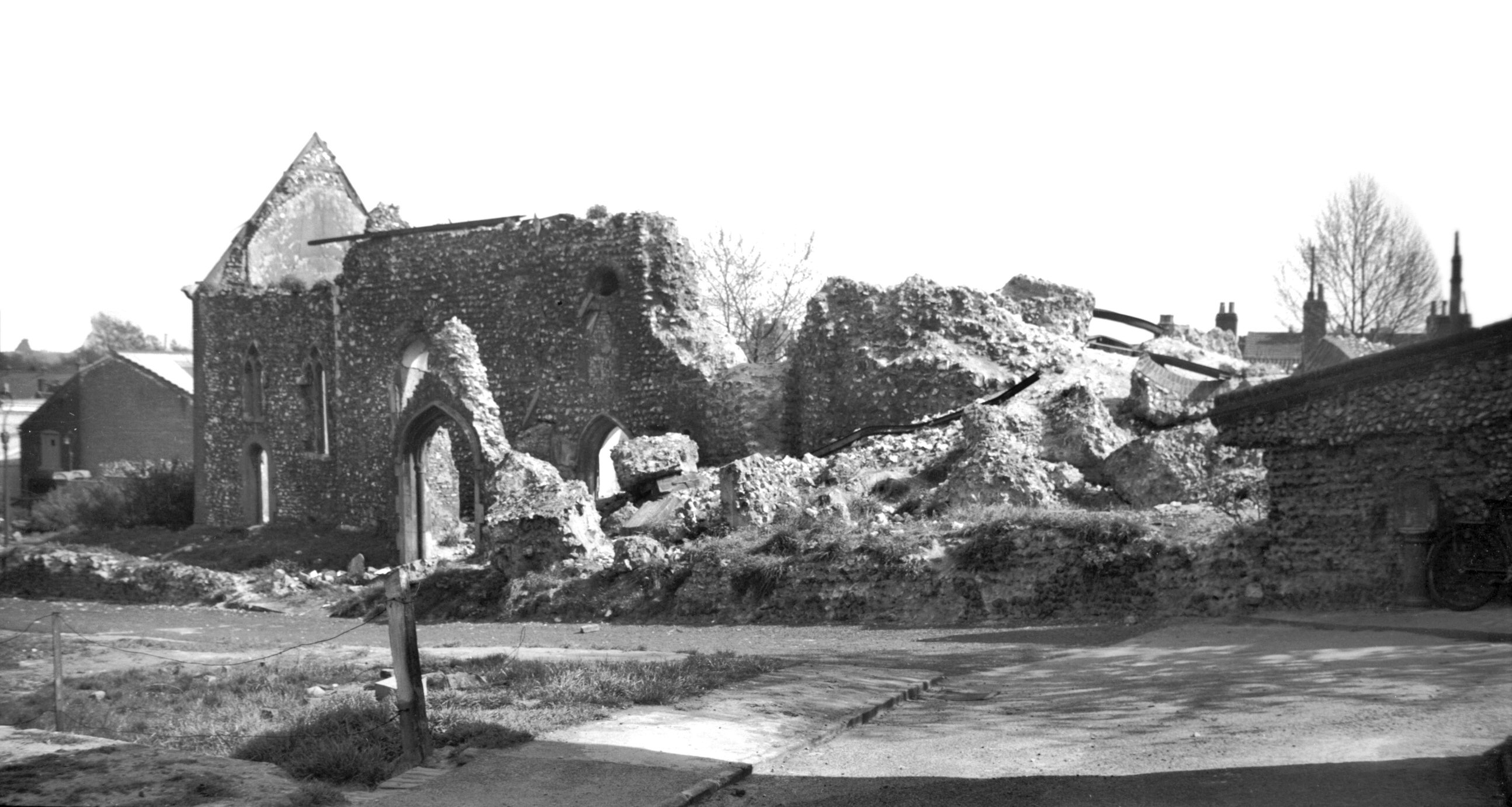
St. Julian’s Church, from which the parish takes its name. As I visited here a few weeks ago, I’ll just link into that blog post. George Plunkett has a photo from 1946 which shows the damage which had been done to the building during the air raids, and the city is fortunate that this church was reconstructed.

This is St. Julian Alley which now ends at Rouen Road, a poorly designed area of the city which has seen housing replaced by car parking and uninspiring buildings. This alley once led on to Crusoe Street.

This is the view when standing outside of St. Julian’s Church, along what is now Kilderkin Way, but which was once the King Street Old Brewery. Thorn Lane used to stretch from Ber Street to King Street, so would have run through the middle of this site, but only the upper end of Thorn Lane remains. Most of this lies in another parish, so I’ll come back to this in the future. But, as an example, this is what Thorn Lane used to look like in 1938. This is a nicely designed street though which fits into the area well.

Walking back to King Street, this is a former entrance to the school which sat behind St. Julian’s Church. More on this in a moment.

Looking back down to King Street.

This is the same alley as in the above photo from the other end, and it’s called St. Julian’s Alley, which complicates things a little as that’s also the name of the neighbouring alley mentioned earlier.

This is the site of the school behind St. Julian’s Church, and the one that was accessed through the bricked up gate. I’m not entirely sure why the school is no longer here, perhaps destroyed by the bombing during the Second World War which destroyed most of the church. This is now a housing development called King’s Gate on the map, but is named as St. Cecilia’s Court on the road sign. I imagine that the latter is correct.

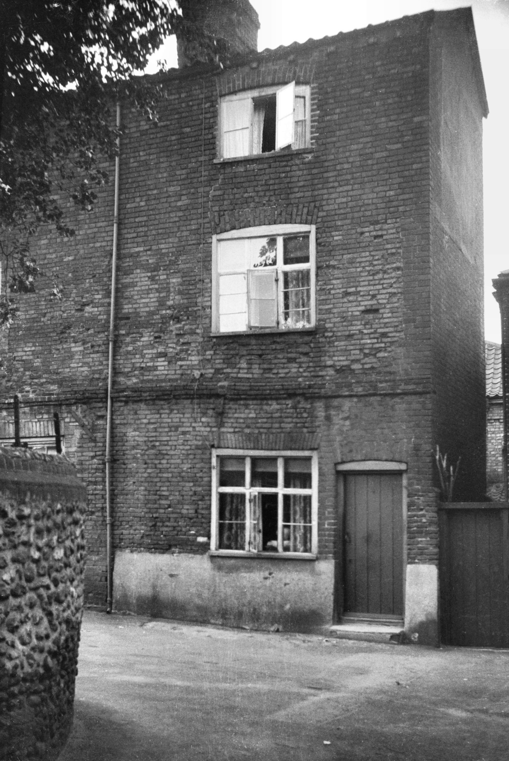
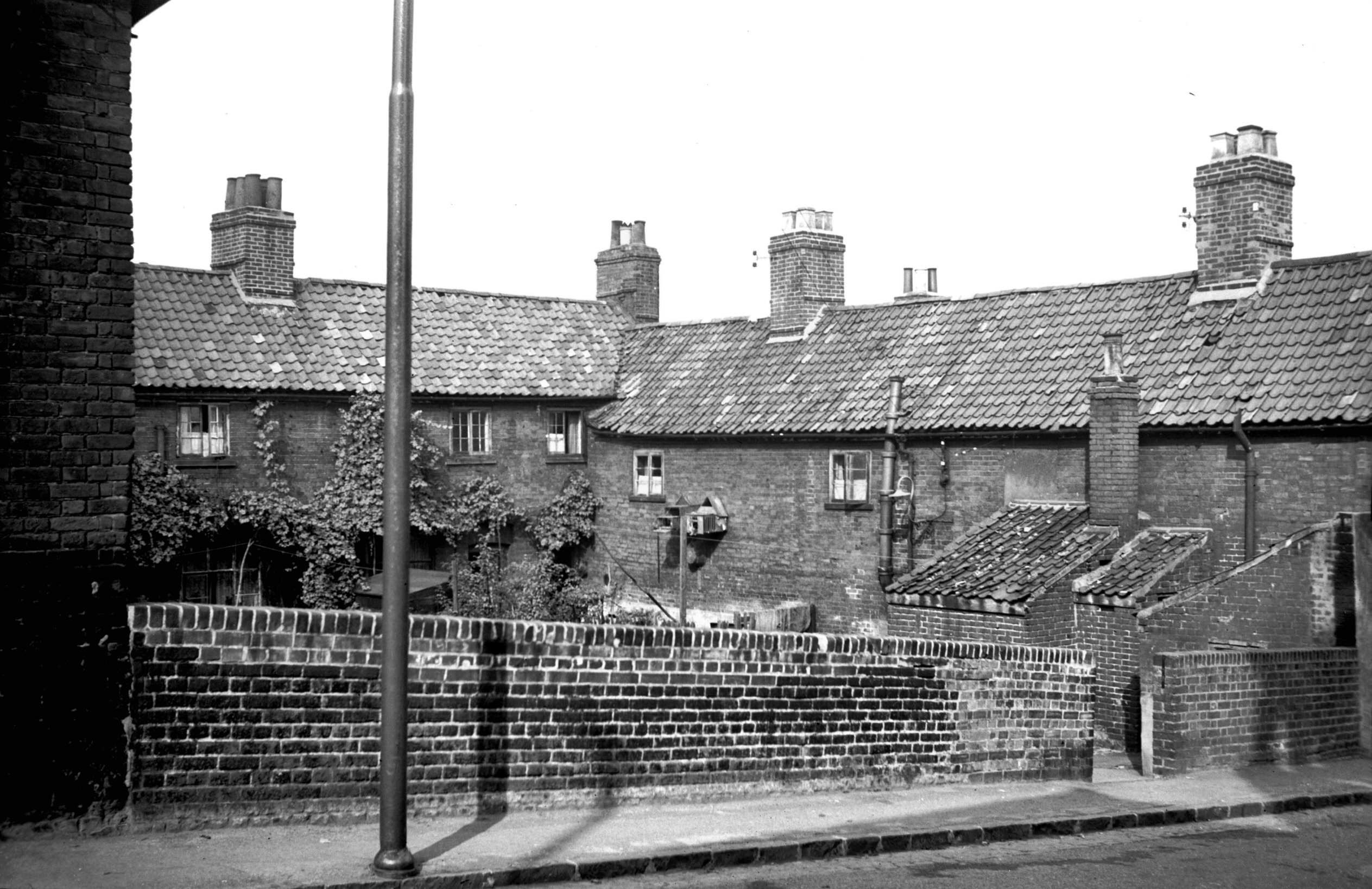
There were two school buildings within the complex, a larger one and a smaller one, the latter survives. It’s now used by the Sue Lambert Trust, a charity who help those who have suffered from sexual abuse.

The photos of the school site were taken on what is now Music House Lane, named after the historic building in the parish of St. Etheldreda. This is a new name, as this street was once the lower part of Horn Lane, which stretched from Ber Street to King Street.

This photo is taken from Rouen Road, the new road that was built ploughing through housing that was torn down, looking towards King Street. Someone standing here 100 years ago would have seen St. Julian Street to the left, Horn Lane in front of them (and behind them) and Burleigh Street to the right.

This is the former route of Horn Lane, and also the edge of the parish boundary. It’s now been blocked off and turned into a walkway, although Horn Lane does continue on the other side. That section of the lane has retained its name, but that’s in a different parish and a story for another day.

It’s hard to imagine that this was once a thriving community, with people living on what was Garden Street, Bartholomew Street, St. Julian Street and Crusoe Street.
Walking back down to King Street, that concluded this little meander. King Street is in pretty decent shape in historic terms, so much has been saved there, although there are numerous clumsy planning decisions which have led to some incongruous buildings popping up. The buildings on the site of the King Street Old Brewery are also decent and have retained some interesting architecture, but the area the council decided they’d demolish to build a giant car park is really an eye sore as it stands.