Streets of Norwich – Stepping Lane
Part of my Streets of Norwich project…. [updated in April 2024]
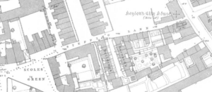
There’s not much of Stepping Lane left that was here in this 1880s map and it’s now less than half of its previous length. A clumsy post-war rebuilding plan of the area meant that nearly all of the property here was demolished, Scoles Green is under a car park and Rouen Road ploughs right through the middle of the lane’s former route. I have no idea what the mention on the map of ‘site of Hendon’s City House’ is referring to.
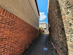
The entrance to the lane from King Street, with the plot on the left-hand side once being the Steam Packet public house. George Plunkett, as usual, has a suitable photo here, taken looking back towards King Street. I like the quirky buildings which were once here, at least the older wall on one side has survived.
In March 1873, it was reported in the Norwich Mercury that:
“For auction, all those four cottages, in eight tenements, in Stepping Lane, with garden ground and use of yard, in the occupation of Robert Eagle, Widow North, Samuel Pyne, Widow Edwards, Widow Francis, Widow Southgate, Widow Sword and Widow Thompson, at rental amounting to £31 8s 4d per annum. This lot is leasehold from the Dean and Chapter of Norwich for a term of 40 years from the 7th December 1862.”
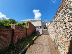
And that’s about as far as the lane goes now, running into a lane called Normans Buildings, a throwback to when that was a street with residential properties on. It’s not exactly somewhere to make a special visit to if I’m being honest.


