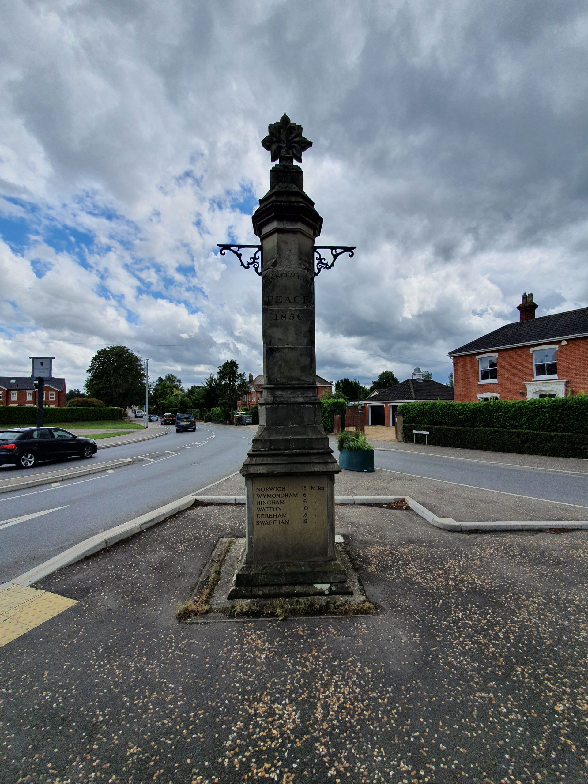
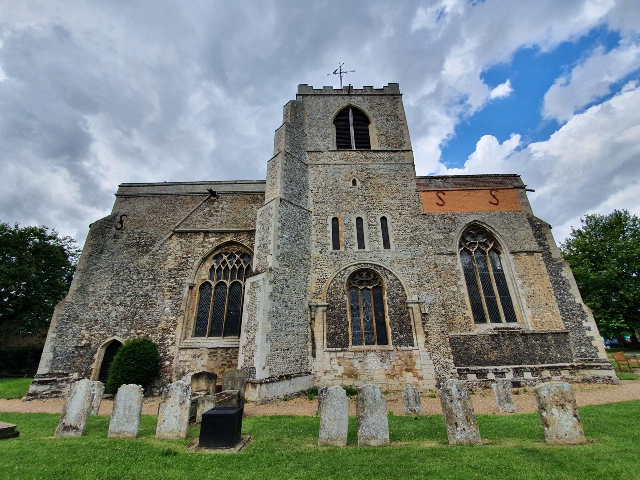
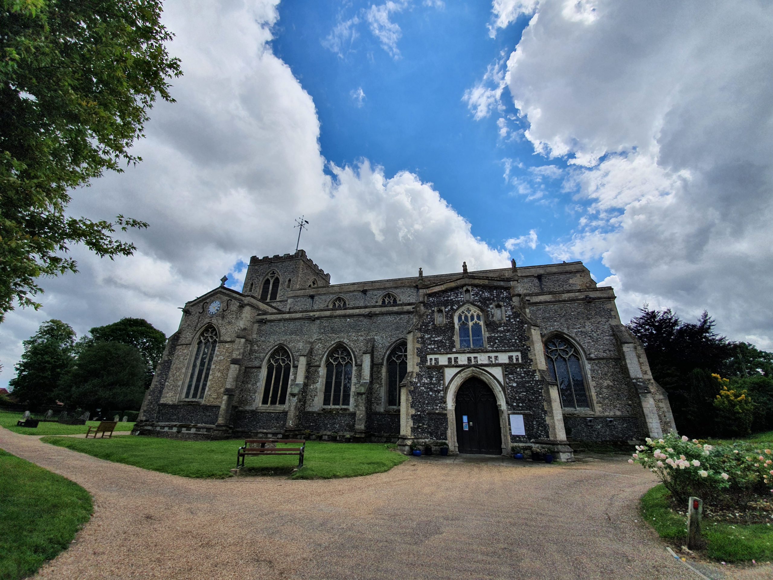
Category: UK

  • Bristol – Hampton by Hilton – An Update

    Bristol – Hampton by Hilton – An Update

    A few weeks ago, I was in the stage of being very pleased at how efficient and honourable many hotels were being at cancelling hotel stays. A couple of hotels explained to me that they were struggling, so I’ve postponed rather than cancelled a few of my stays as I appreciated their honesty.

    As over 1,500 people saw judging from the page views number, I also posted positively about Hampton by Hilton in Bristol, they cancelled on me and confirmed promptly themselves they’d refund in full. Hotels.com also confirmed this, and explained that the refund had been completed. Then, and the story is quite long and I’m not repeating it in full just yet, hotels.com explained that the hotel had seemingly changed its mind.

    After weeks of confusion, hotels.com confirmed that the hotel is refusing a refund and is offering only a heavily restricted voucher instead. I’m not at all content at this sort of behaviour, it puts people off booking hotel rooms at a time when the hospitality industry needs all the support that it can get.

    So, I’ve asked the two press offices for permission to post from some of their e-mails, which are a convoluted mess of chaos and confusion. I don’t much mind long delays, as this is a difficult time when hotels are suffering, but this sort of deliberate obfuscation isn’t perhaps ideal and reflects badly on the hotel industry.

  • Lingwood – Lingwood Railway Station

    Lingwood – Lingwood Railway Station

    We meandered on a training walk for the LDWA 100 through the village of Lingwood, about eight miles from Norwich, which retains its railway service on the Norwich to Great Yarmouth line.

    Not much has changed in terms of the railway in Lingwood, although some of the associated buildings have fallen out of use.

    The station building survives and is now a B&B, remaining in use for passengers until the 1960s. The railway station was originally built in 1882 by the Great Eastern Railway (GER) and it sits between the stations of Brundall and Acle. The railway station building isn’t currently listed and perhaps it and the associated structures should be.

    The station’s only platform. In 1891, GER allowed the placing of a box at the railway station where locals could deposit information about the local workhouse, a building which had been constructed in 1837. It’s a reminder of the community value that the stations once had, with the workhouse buildings surviving until 1976, when they were demolished for housing for the elderly.

    The train line, looking towards Great Yarmouth. In February 1888, a man was killed when crossing the line to get home, leading to a bizarre situation involving a smacksman named William Benns. He saw the man, Richard Frosdick, had been injured and likely killed without the train driver knowing, but only mentioned this to a station porter after Benns had realised that he had missed his own train. Benns then went to the pub for three hours to wait for his next train and he made no inquiries as to what had happened.  The coroner referred to the behaviour of Benns as “extraordinary and inhuman”, with suggestions made that perhaps Benns knew more than he was willing to admit to.

    A short distance from the railway station is this building where the crossing operator would once have lived and worked from. A new crossing system has just been installed by Network Rail (not least because a train ran into it a few years ago), so it all looks new and shiny, with the crossing until very recently being operated manually. This three-bedroom cottage is still owned by Greater Anglia and is currently available to be rented for £5,000 per year, it would prove handy for those who use the railway frequently.

    Also looking new and shiny is the train itself, heading from Norwich to Great Yarmouth.

    Hopefully looking back on these photos in a few years, rules and requirements such as this will be just a distant memory. At the moment, we can’t use the railway network for the purposes of getting to and from walks, but hopefully that situation will change in the relatively near future.

  • Brundall – Brundall Gardens Railway Station

    Brundall – Brundall Gardens Railway Station

    We went through this railway station on our third training walk for the LDWA, it’s one of two stations in Brundall.

    Brundall Gardens is a little unusual as a railway station as it’s a more modern station that was added to an existing line. It was built in 1924 on the Norwich to Great Yarmouth line, located around four miles from Norwich and less than one mile from Brundall’s main railway station. On the above map from 1900, the railway station is just above the field which is numbered 7.

    Standing on the southern platform, this is the line to Great Yarmouth. Operated by London and North Eastern Railway (LNER), the railway station opened on 1 August 1924 to allow access to the nearby 76-acre site of Brundall Gardens. It was originally known as Brundall Gardens Halt and was renamed as simply Brundall Gardens in 1948.

    The gardens that the railway station was built for had been purchased by Michael Beverley in the 1880s and he had laid them out to include waterways and lakes. Frederick Holmes-Cooper, who had made his money from the cinematic industry, bought them in 1921 and the gardens were being visited by 60,000 people in 1922. The installation of the railway station cost £1,733 and Cooper gave LNER £150 per year to fund a stationmaster. There’s a map of the gardens at http://www.brundallvillagehistory.org.uk/maps.htm.

    Still standing on the south platform, this is the line to Norwich. A booking office was placed on the north platform, with a waiting room and passenger accommodation installed on the south platform. Only the booking office now remains, other than for a basic shelter on the south platform.

    On the footbridge, looking in the direction of Great Yarmouth.

    On the footbridge, looking in the direction of Norwich.

    There’s a footpath that goes from Postwick towards the station.

    A section from the 1939 LNER railway timetable.

  • Brundall – Church of St Michael and All Angels

    Brundall – Church of St Michael and All Angels

    We visited here on our third training walk for the LDWA 100 next year, and it’s the Church of St Michael All Angels on the edges of Brundall, in what is the deserted medieval village of Braydeston. Although nothing now remains of Braydeston, this settlement was listed in the Domesday Book in 1086 and it’s known that there were ten households here in 1428. The date of this means that the village wasn’t abandoned due to the Black Death, it was probably just a change in either the fishing or farming needs of the local community.

    The village of Braydeston was located in the field by the church and this building dates to the thirteenth century, although has some Saxon structure within it. For such a relatively small settlement, it’s a substantial church and the tower was added later following a bequest from John Berney in 1440. The roof line of the church was also lifted at the same time at what appeared to be the height of the building’s fortunes.

    Due to the current situation, there was no access to the interior of the church, but it does hold one of the few bread ovens which remain in church buildings.

    An early medieval doorway which was bricked up in the nineteenth century. The church had fallen out of usage in the seventeenth century, but as part of the Victorian resurgence of religion, services were again held here and a new organ was installed.

    One of the railed-off tombs.

    I’ve seen many grave markers like this, although they’re normally older. This one commemorates the life of Elizabeth Mary Theobald and Harold Thomas Theobald.

    At the front of the church, there was a footpath query in the early twentieth century, something a little rarer then. This related to the meadow path which crosses into Brundall and although it was defined as a footpath, cars started to use it, not least hearses getting to the church. The local council said that cars could use the track, although wiser heads have since prevailed and it’d be quite difficult to get a hearse along that track today.

  • London – British Museum (Postwick Grove, Norwich)

    London – British Museum (Postwick Grove, Norwich)

    I usually visit the British Museum three or four times a year, something which is a little difficult to do with the current virus situation, primarily because it’s shut. However, they’ve placed hundreds of thousands of images on their web-site, so this will have to do me for the moment. The images can be used non-commercially, as long as the British Museum is credited. So, this is their credit.

    I like this print which is in the collections of the British Museum as it’s painted at Postwick Grove. I’d never heard of this place until we walked through it on Saturday, but it’s a once quiet area of the city where painters would come and be inspired by the peace and countryside. These painters would have also walked the similar route to the one we did on our 22-mile walk (more on that soon), although they didn’t have to cross the Norwich Southern Bypass.

    The print was produced by John Sell Cotman and there’s no precise production date, just sometime between the dates of 1813 and 1838. Handily the museum knows that it’s from before 1838 as Cotman included it in a book which he produced in that year, the ‘Liber Studiorum – A Series of Sketches and Studies’ published by HG Bohn. The print isn’t on display in the museum and was acquired by them in 1902 from James Reeve, a long-time custodian of the Norwich Castle Museum.

    This is what the artists would have seen at Postwick Grove, with the railway line to Reedham and Great Yarmouth to the top of the image, but it’s missing the huge dual carriageway which now ploughs vertically through the area. The addition of the Norwich Park and Ride parking area hasn’t done much for the peace and quiet either, but there is still an element of tranquility left.

  • Caistor St Edmund – War Memorial (Walter Ellis)

    Caistor St Edmund – War Memorial (Walter Ellis)

    Walter Ellis is one of the names listed on the war memorial in Caistor St Edmund.

    Walter Ellis was born in 1897, the son of George and Eliza Ellis who lived in Markshall which is effectively part of Caistor St Edmund. He joined the 5th Battalion of the Norfolk Regiment and was killed in action in Palestine, on 19 April 1917.

    There was a major action, which was the Second Battle of Gaza, which took place between 17 and 19 April 1917 between the British Empire and France against the Ottoman Empire and the Germans. The 54th (East Anglian) Infantry Division were part of the military force, with the Norfolk Regiments losing a large number of men.

    I’m not sure that Walter lies entirely at peace at Gaza War Cemetery, which is in the troubled Gaza Strip and which has been damaged twice by Israeli bombs over recent years, although they paid for the repairs to be completed to the graves. He’s a long way from home here in a place that he perhaps hadn’t even heard of when he was sent to fight there.

  • Streets of Norwich – St. John’s Street

    Streets of Norwich – St. John’s Street

    Part of my Streets of Norwich project….

    There’s not much to write about St. John’s Street, which is located off of Mountergate. The current St. John’s Street used to be called Orchard Street (named after the Orchard Tavern pub), and the rest of it has since been lost to development.

    The buildings that were either side of what was Orchard Street have also gone, with car parking on the right-hand side and Parmentergate Court housing project on the left-hand side.

  • Streets of Norwich – St. Martin at Palace Plain

    Streets of Norwich – St. Martin at Palace Plain

    Part of my Streets of Norwich project….

    I’ve realised today how little bloody attention I pay to things, given that I’ve been calling a road I thought that I knew by the wrong name. It’s only a marginal error, but I’m moderately irritated that I hadn’t realised, Bishopgate ends earlier than I thought and becomes St. Martin at Palace Plain. Now, this is hardly of much relevance to anything of global importance, but the quirky layout is due to how things have shifted over the last century.

    In the above map, St. Martin at Palace Plain covers part of the square, then the road down to where it looks like there is a pub in the middle of the road, before going up to another pub. Today, that is the entrance to the courts and the road and Worldsend Lane have all gone, so St. Martin at Palace Plain is effectively just the stump of road between the church and the entrance to the Bishop’s Great Gate and not that much further. Indeed, I’ve noticed that some properties have been moved out of St. Martin at Palace Plain on the listed buildings register and placed under other streets.

    But, despite this street now just being a bit of a stump, it has a tremendous amount of history packed into it.

    This is the view from the end of St. Martin at Palace Plain, looking down towards Bishopgate.

    The sun gave me problems taking this photo, but this is the Bishop’s Gate, a structure constructed in 1436 to give access to the Bishop’s Palace. I’ve been in the chapels at the top of the Erpingham Gate and the Ethelbert Gate, but I don’t know what the set-up is with this one. The old Bishop’s Palace is now used by Norwich School, but there’s a new palace used by the bishop which is just the other side of this gate.

    This is St. Martin’s Church, which has spent its lifetime literally overshadowed by the cathedral. No longer really having any congregation of its own as the nearby housing had gone, the church stopped being used for services in 1971. Since then it has been used to store church furniture, as offices for the Probation Service and is now used by the Norwich Historic Churches Trust. More on this in another post as I’ve been on a guided tour of this church, and it’s one of my favourites in the city.

    This was once the wall of the Bishop’s Palace, although there has been some building just inside of it over the last century.

    On the wall in the previous photo is this plaque, which marks where Lord Sheffield was killed during Kett’s Rebellion in August 1549.

    The Kett’s Rebellion was started by the desire of some landowners to enclose land for their own financial benefit. That’s a slightly shortened version of the enclosure process, but that’s the upshot of it. The locals didn’t like that, so on 8 July 1549 some denizens at Wymondham ripped up the landowners’ lovely new fences. The owner of the manor of Wymondham was Robert Kett, who should have been most aggrieved at the damage done to property. But, he decided to back the rebels and he became their leader.

    Kett decided that he would march on Norwich to show the authorities that the locals weren’t happy and that it was the poorest who would suffer the most. Perhaps unfortunately for him, he had thousands of people with him, turning a little local dispute into one of the largest protest marches that East Anglia had ever seen. He reached Bowthorpe, a suburb of Norwich today, on 9 July 1549 and Sir Edmund Wyndham, the Sheriff of Norwich, popped out to tell Kett that he should perhaps go home. Kett ignored that.

    Instead of going home, Kett led his men to set up camp at Mousehold Heath, on the edges of the city centre, on 12 July 1549. Although this location was outside of the city walls, it offered views into Norwich and this is where they established their camp for six weeks whilst issuing their demands for a fairer society. By now, there were 16,000 people at this camp, which was presenting a problem for Norwich, as although it was the second-largest city in the country at the time, it still only had a population of 12,000.

    The authorities agreed to listen to the demands that Kett had, which took some time, as there were 29 grievances that Kett wanted dealing with. Some of these were fiercely ambitious and only one related to the enclosure process, which is what had started this all off. During this time, the city hadn’t closed off its gates, so the people at the camp could enter Norwich to buy food and supplies, with something of a party atmosphere going on at Mousehold Heath by all accounts.

    On 21 July 1549, the city authorities got fed up with this and they shut the gates. Faced with the camp having to break up due to a lack of supplies, Kett led an attack on the city. Despite having a strong artillery and city defences, Kett’s rebel forces won and took control of the city. This was a serious threat to King Edward VI now, so he ordered 1,500 troops led by the Marquess of Northampton to retake Norwich.

    The relevance of this story to the street I’m writing about is that one of the military leaders was Lord Sheffield. He had had what I assume was a lovely breakfast at the Maid’s Head, a hotel which is still trading today, and led a mounted attack on rebels to force them back along St. Martin’s at Palace Plain to Bishopgate and then back out of the city. Unfortunately, he fell off his horse into a ditch. The rules of engagement at the time said that in such circumstances, the fallen man should be taken and held for ransom. Unfortunately for Lord Sheffield, a butcher decided to hit him on the head and kill him. And, today the location of Lord Sheffield’s death is marked by the plaque on the wall.

    Just to finish the tale, the rebels could never win this, the Monarch was too strong. He despatched the Earl of Warwick and 14,000 men, including some rather rough mercenaries, to take back control (there’s a phrase….) and after a series of battles, the rebels lost. Although the Earl of Warwick’s army lost 250 men, there were over 3,000 rebels killed during the fighting. Many surviving rebels were promptly executed and Robert Kett and his brother William were taken to the Tower of London to face trial. They were, unsurprisingly really, found guilty and Robert Kett was sent back to Norwich to be hanged on the walls of Norwich Castle, whilst his brother was hanged on the west tower of Wymondham Abbey.

    Was the rebel sacrifice worthwhile? Probably not. Little changed, other than the city announced it would mark a day of celebration every year on 27 August to celebrate the defeat of the rebels, with this party carrying on for well over a century.

    Anyway, after that story, back to St. Martin’s at Palace Plain. The other building that is now situated off this road is the modern court complex, which has one of the city’s oldest buildings in its cellar, the Norman House. But more of this when I find those photos….

  • Caistor St Edmund – Origins of Village Name

    Caistor St Edmund – Origins of Village Name

    Further to my riveting post about Caistor St. Edmund (by riveting, I mean not especially riveting), I like that the village has retained its full name. This is primarily likely because of the other Caister in Norfolk, so although the spelling is different, differentiating the two locations has probably proved useful over the centuries, so there’s Caistor St. Edmund and Caister-by-the-sea.

    Both places are named Caistor/Caister for the same reason, it’s the old English word for a Roman fort, although it might once have been spelled in different ways, such as caester or castre. The Romans themselves called it Venta Icenorum, meaning the ‘marketplace of the Iceni’.

    The surname Caister, and its variants, derives from the same meaning and it’s most common in England, Canada, the United States, Italy, South Africa, New Zealand, and for reasons unknown, Ecuador. What’s even more interesting, to me anyway, is that by looking at a map of England and its surnames, there is a basic correlation between where Roman sites once were and where people live today with the surname Caister.

    The St. Edmund bit is because the parish was owned by the Abbey of Bury St. Edmunds, with the village church also dedicated to St. Edmund. The village is also commonly known as St. Edmunds, although I’m not sure that anyone much minds which one is used. But, I’m sticking to St. Edmund since it seems to be the official version.

  • Caistor St Edmund – War Memorial (J. Derek Corrould Warren)

    Caistor St Edmund – War Memorial (J. Derek Corrould Warren)

    J. Derek Corrould Warren is one of the names listed on the war memorial in Caistor St Edmunds.

    John Derek Corbould Warren, who was known as Derek, was born in Surrey in 1899, the son of the Rev. John Corbould Warren of Caistor Hall and Agnes Elizabeth Corbould Warren. This was a wealthy family, and although the father was the vicar, he was actually also the Lord of the Manor and owner of much of the village. There was a set-up at the time where the land-owner could appoint whatever vicar that they wanted, hence his appointment was likely partly self-awarded. But, more about him in another post, as he was one of the most important figures in the village over the last century.

    Derek was killed at the age of 18 following a riding accident whilst training at Sandhurst, dying at Surbiton Cottage Hospital on 10 July 1917. His name doesn’t appear on the Commonwealth War Graves web-site, likely because the circumstances of his death meant that his body could be brought back to be buried in the churchyard at Caistor St Edmund. He joined the army early on during the war, serving as a cadet at the Royal Military Academy in Sandhurst. It must have been a difficult day for his father, the Reverend John Corbould Warren, as when he conducted the service at the unveiling of the war memorial in 1922, he knew that his son’s name was on it. Derek was his only son, although he had a daughter, Enid, who later married and lived at Caistor Hall.