Category: Norfolk

  • Fundenhall – St. Nicholas’s Church (Gerard Barton)

    Fundenhall – St. Nicholas’s Church (Gerard Barton)

    This memorial tablet commemorating the life of the Reverend Gerard Barton is located on the wall of St. Nicholas’s Church in Fundenhall.

    The tablet usefully explains the significance of Gerard’s contribution towards the church, namely that:

    “As a layman, in the absence of a resident minister, he was a father to the people, restored this church and for fourteen years was a bright example of truth, uprightness and charity to all around”.

    Gerard was born on 19 September 1834 in Stoughton, Sussex, the son of John Barton and Frances Barton. He married Elizabeth Hazard in 1856 and they had twelve children between the years of 1858 and 1879. The youngest, Conrad Barton, was born at Freiburg in Baden where Gerard was serving as a Chaplain. He returned back to Fundenhall where he continued to live in The Grange (a building which is still standing today) and the family clearly retained some wealth given that they had six servants at the property at the 1881 census.

    The church was in the 1850s crumbling and in risk of collapse if nothing was done about it. Barton was the main funder of the entire project and it was he who commissioned Richard Phipson to undertake the repair and restoration work. It was only in the last fifteen years that another restoration project was necessary, thanks to the funding that he provided back in the 1860s.

    Gerard died at his house at 10A Kirkley Cliff in Lowestoft on 6 October 1889, at the age of 55. As an aside, one of his daughters, Madeline Barton, married William Horace Lascelles (1868-1949) and his half-brother was Henry Lascelles, whose son married Princess Mary, who was the daughter of King George V.

  • Fundenhall – St. Nicholas’s Church

    Fundenhall – St. Nicholas’s Church

    It’s fair to say that this church in the Norfolk countryside isn’t typical of the area in terms of its design and its central tower. There’s something quite magnificent about it though, that tower makes quite a statement. And another statement that this church made was that it was open to the public and seemingly proudly so. Other nearby churches weren’t open and we met someone who commented that the building’s keyholder wasn’t letting them in even though they were only a few doors down. The current Covid-19 situation is inevitably going to cause issues, but these stories of churches remaining firmly closed to other than the select few are perhaps far too common. However, there were no access issues at Fundenhall, it seemed to be a place that the Church of England was proud of.

    The glorious central tower is original, dating to the twelfth century, although the top section may be later.

    Potential tragedy hit this church in 2004 when it was forced to close due to falling masonry. This Norman period church is not in an area which is surrounded by residential properties and there are multiple other churches within easy walking distance. That put a pressure on the congregation beyond what they might reasonably have been expected to cope with. But, with some ingenuity and support of the Lottery Heritage Fund, individuals and businesses, they were able to get the repairs completed and re-open the building in May 2010. It was no quick fix either, the repair and restoration work cost £250,000. The church was fortunate, if the falling masonry had been twenty or thirty years earlier, then this building might not have been repaired.

    The north side of the church, although since Heritage Lottery funding has allowed the construction of a rear car park, entrance is mostly through the south side of the building. The porch is now closed off to the public, but is architecturally of little interest since it was added in the nineteenth century. The bulk of the building, excluding the tower, dates from the fourteenth century.

    A now blocked window on the church’s north side.

    Since a visit I made to a church last week which pointed out medieval graffiti, I’ve been on the lookout for it. The cross appears to be pretty old to me (I’m not sure that this is a phrase used by professionals, but there we go) and was perhaps once covered in limewash.

    I was pleased to see a Norman style doorway, but this according to the listed building record is an actual Norman doorway that is unmoved from its current position.

    The inside of that same doorway and that wooden door is of some considerable age.


    The beauty of this church wasn’t limited to the exterior as the interior was bright and open. The rood screen might have gone, but the surround (or coving I think it’s called) has survived, so that must be from before the Reformation. Older books, not least Blomefield, suggest that this rood loft was more complete in the eighteenth century and painted work was still visible. There was an extensive nine-month long repair project which took place in 1869, where there was also some re-ordering and so it seems likely that the damage was done then.

    A newspaper report from the Norfolk News in 1870 is more generous, talking of the Portland cement used in the chancel and the retiling of the nave with Minton tiles. It’s added that the rood loft was protected by taking it down and moving it to the west end of the church, but there’s an awful lot of “new” things being mentioned in the report, a logical indication of how much has been lost.

    The original drawing made by the architect Richard Phipson from that 1870 renovation, with the big new oak benches visible. I wonder where they are today, as they appear to have only been removed in the recent repair work to the church as they’re in George Plunkett’s photo from 1996. There’s an old photo of the interior of the church here.

    This is rather lovely, it was funded by the Heritage Lottery Fund and local families, entitled “Reconnecting with Fundenhall’s Fallen” and was created by Kate Munro.

    That’s much friendly than a “do not touch” sign, I like it.

    Looking back down the nave.

    This was the entrance to the rood stairs and also to the tower, a handy advantage in having a central tower. The bells are still in the tower and can be rung, although there was a little incident in 1 August 1885 when John Atkins “let go of the bell rope, fell backwards and expired”.

    The font is from the fifteenth century, so that was here whilst the Reformation was taking place and parts of the building were being torn down around it. The location of the font has been moved from its previous place at the rear of the nave.

    Some of the old flooring is visible through this panel, although it was a bit misted up and so not entirely clear.

    The chancel.

    The priest’s door leading off of the chancel.

    There were numerous eighteenth century graves in the churchyard, but more of these in later posts. For anyone engaged in the detail of the church’s architectural history, there’s a comprehensive document which was produced in 2007 during the restoration work.

  • GeoGuessr (Norwich Version) – Walk 5

    GeoGuessr (Norwich Version) – Walk 5

    I already have a better explanation (well, longer explanation anyway) for this plan. In essence, whilst lockdown is on, I need to find ways of walking nearby to Norwich in quiet areas for my LDWA 100 training. So, I’m using GeoGuessr to pick out five random locations within a certain area which I’ve defined and then walking to them, to see what kind of story I can uncover.

    The five random locations, all fairly close to the city centre, so this ended up being a walk of just under seven miles. Nathan was helpfully understanding when I turned up late as I bumped into (not literally) someone I knew.

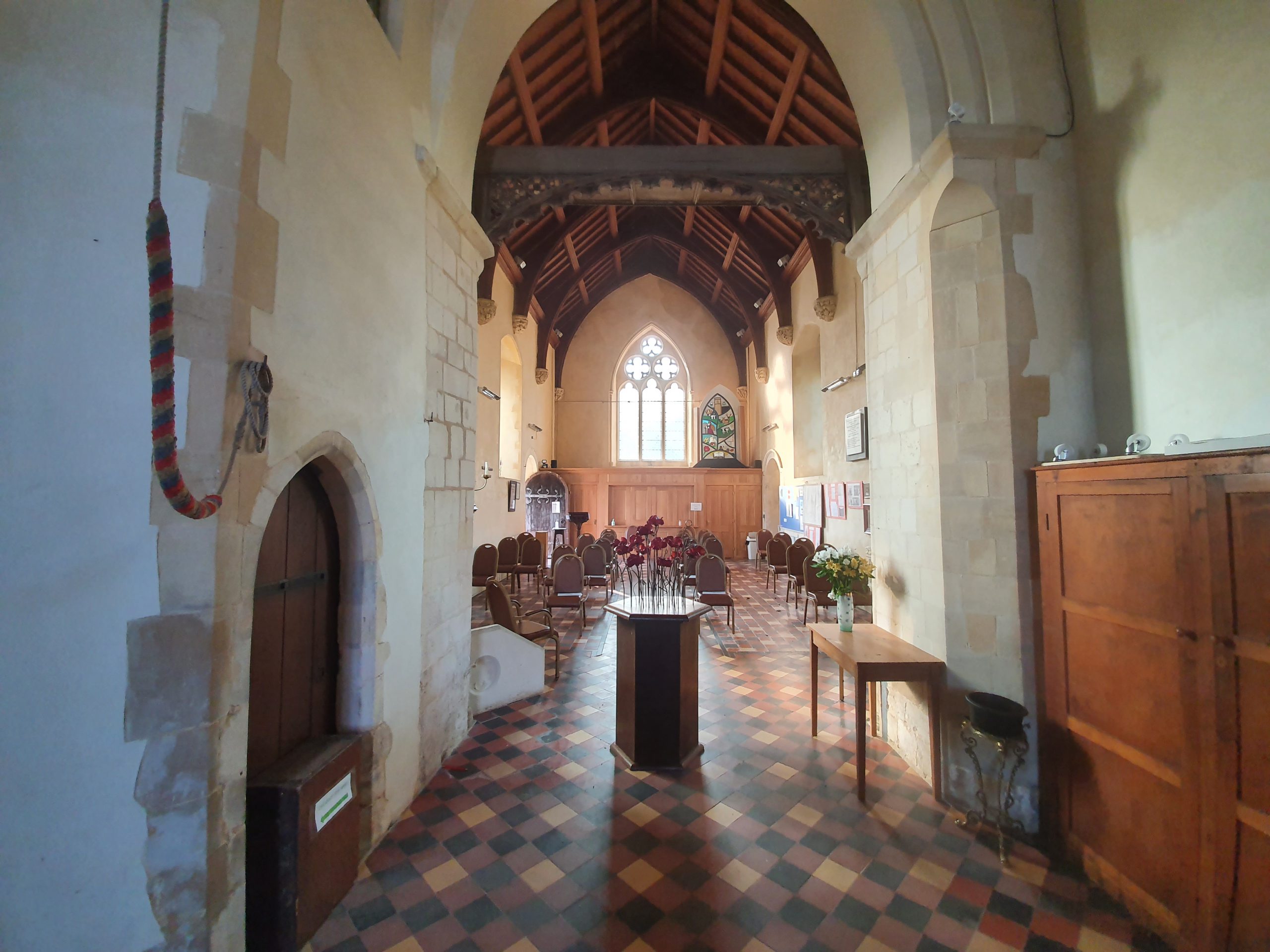
    It’s a little difficult to find anything new in the centre of Norwich given how much I’ve been traipsing around it, so the more mundane may become more predominant. But, perhaps there’s something just as magical about these old stones under the road surface than a building that was constructed at the same time. The paving here on Barrack Street is likely the best part of a century old and it was part of a long roadway down towards the River Wensum, although it’s mostly gone now.

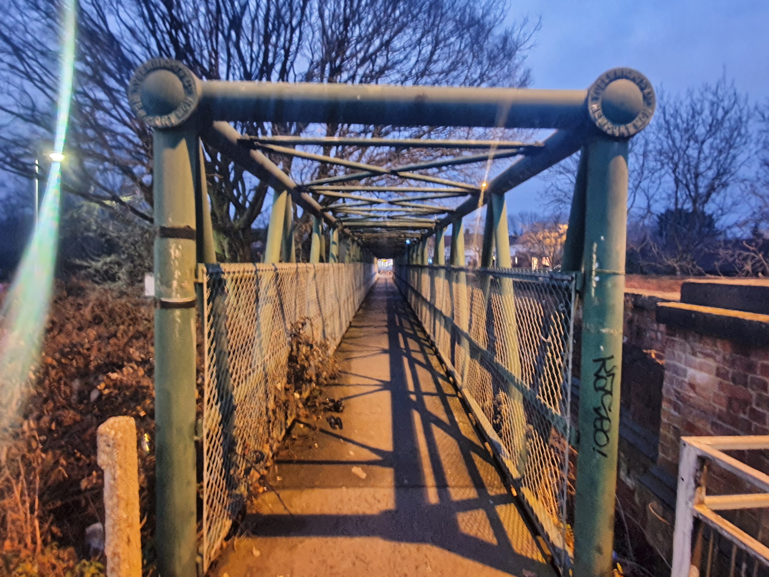
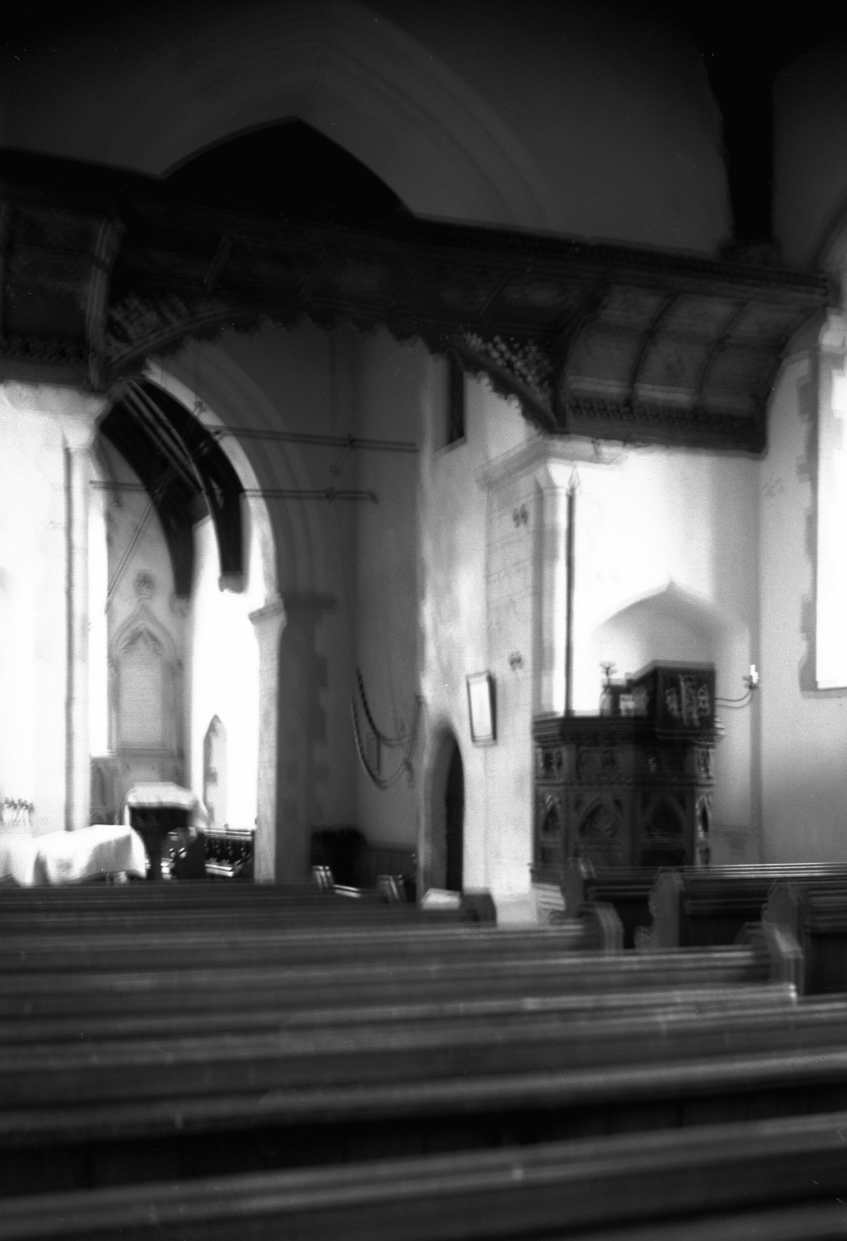
    This was the first location, Whitefriars Bridge, which I’ve written about before…..

    This, until recently, was the Del Ballroom on Waggon and Horses Lane which was used until 2013 as a dance studio. Norwich City Council decided that as there was a dance studio nearby, this interesting and quirky building could be torn down, despite some local objections from nearby property owners. I suppose it’s not a hugely historic building, as it was only built in the 1930s, but it added some character to the local area. The seven new properties they’re cramming into the site don’t have car parking provided and no right to a permit, so it’s all quite environmental in terms of not adding cars to the roads of Norwich. Anyway, I digress……

    Our second location and this photo was taken from just outside the rather lovely Strangers’ Hall Museum. The Strangers were Dutch Protestants who were invited to live in Norwich by the city authorities and so many came that they eventually comprised a third of the city’s population. They did much to boost the textile trade in Norwich and also helped the local economic situation, with relatively little evidence of any animosity between locals and incomers. There’s a strong legacy in the city today of Dutch style buildings and it was the migrants that brought over canaries, which is the city’s football symbol today.

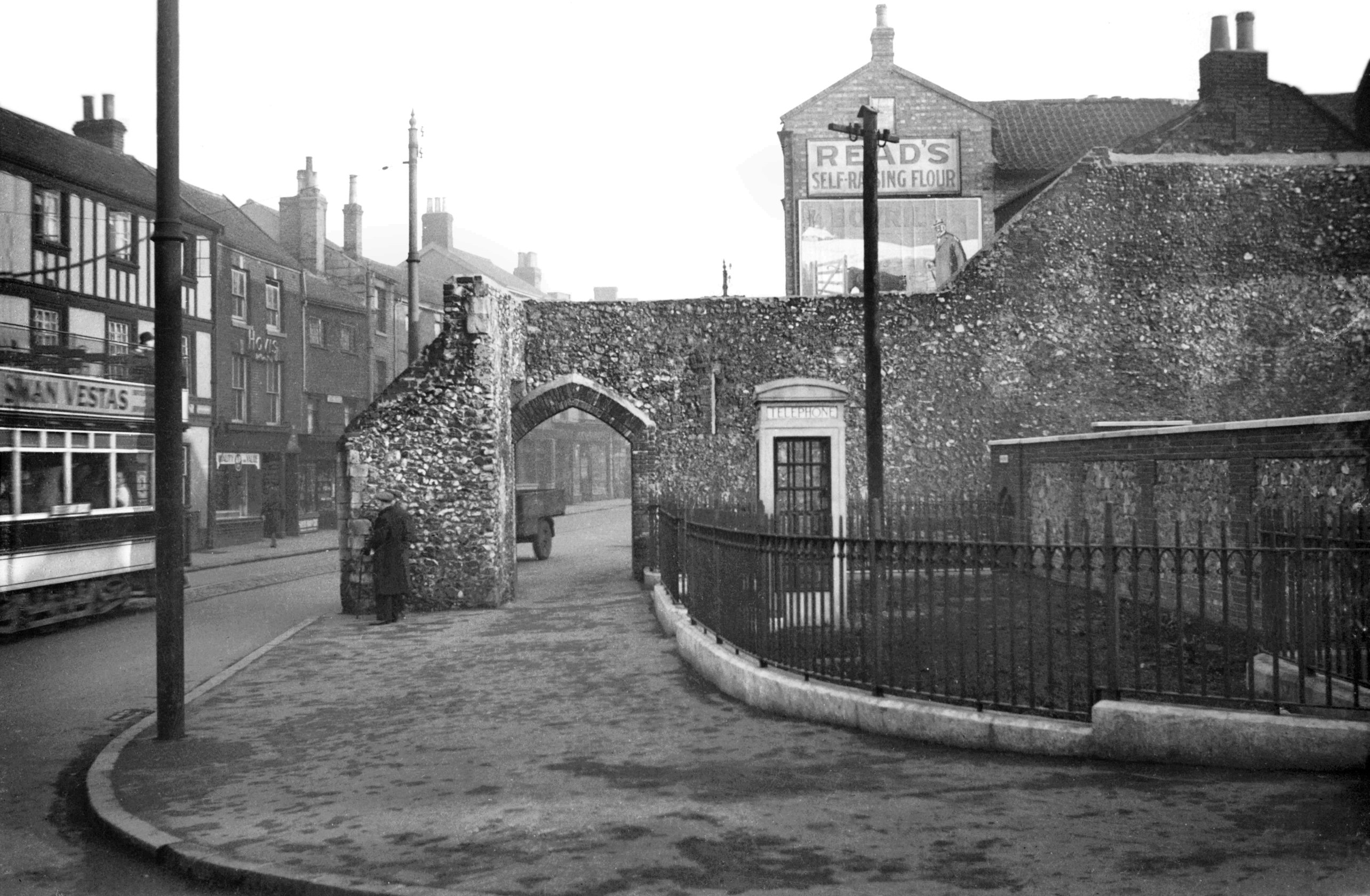
    This is the former site of St Benedict’s Gate, also known as Bennet Gate and Westwyk Gate, which was demolished at the end of the eighteenth century. A little bit of this gate survived until the Second World War air raids destroyed it, as can be seen in this George Plunkett photo. Today, the route of the city wall and the outline of the city gate is marked out in brick paving which is always a marvellous idea.

    The line of the wall looking up towards Grapes Hill.

    Our third location, the former Britannia pub.

    The pub was opened in 1975 and closed again in 2000, now being used for housing. It’s really not the most attractive of buildings, but I’m sure that the city council thought that this was marvellous when they approved it in the early 1970s. The pub was built to replace the Sandringham Arms, an interesting Victorian building which had been a licensed premises since the 1860s.

    The Rose Valley Tavern, or whatever name they’ve fiddled it about to now, which has been a licensed premises since the mid-nineteenth century.

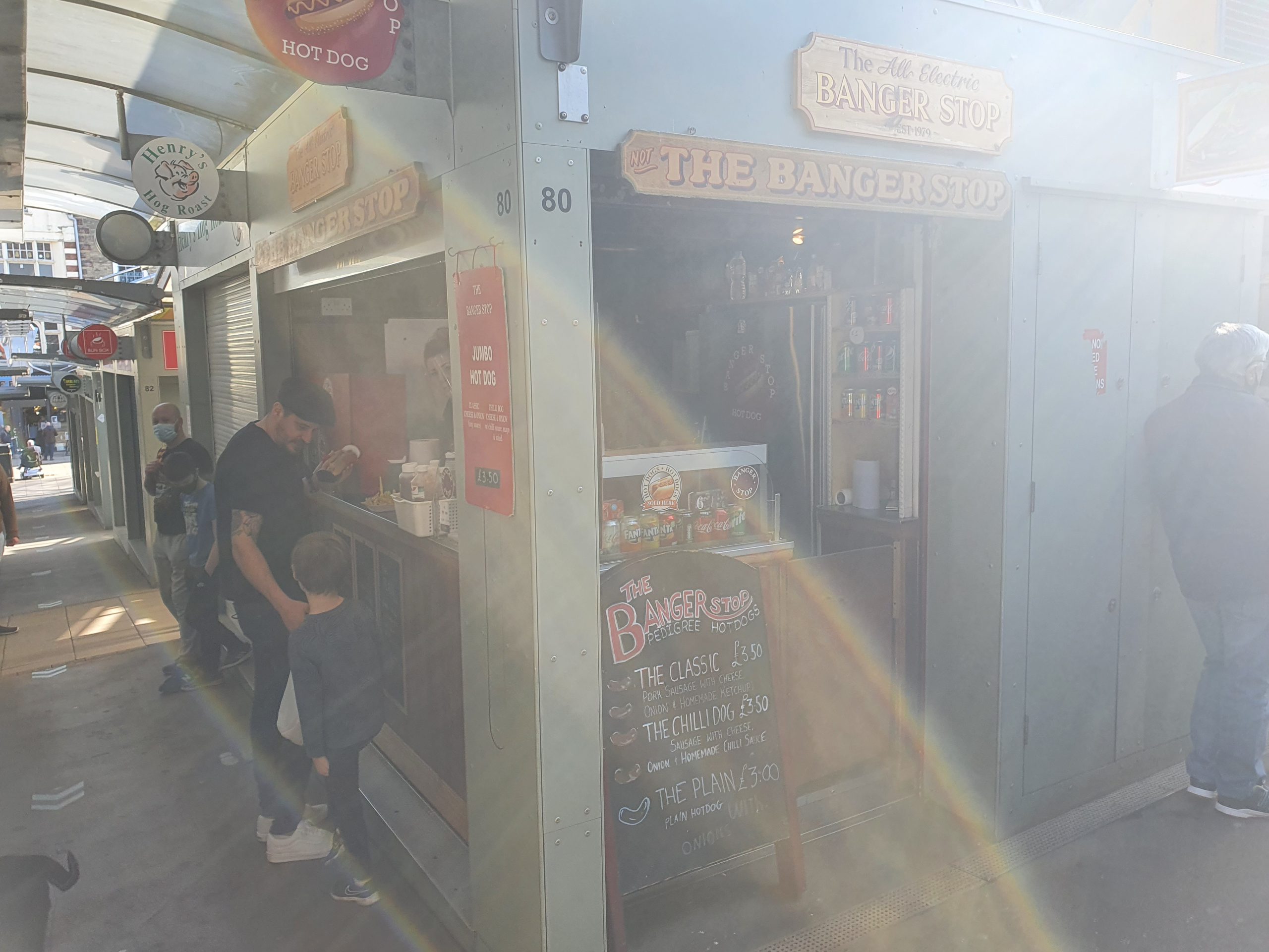
    And Nathan had put chips on the agenda for the evening’s walk, which was a most useful idea. I’ve never been here before, so another first, this is Lee’s Fish Bar on Chester Street.

    Full marks for presenting chips (and a battered sausage) like this, they were much easier to eat and this is proper innovation as far as I’m concerned. Also, I discovered that they had given me scraps with the chips, and I very much like them. I was in rather a good mood with Nathan for some time after this little meal. The chips were quite salty, but I liked that, indeed, they catered very well for me here.

    Fourth location, which is Leopold Road. I’m not going to comment on the history of this road as I didn’t pay any attention to it at the time, so that would be a bit fake….

    This is the railway crossing which goes under Hall Road, although the line isn’t there any more, it led into what was Norwich Victoria Station. This was a complete mistake IMO to remove, as the lines connected in, so the city could have trains running into the centre of Norwich, opposite the bus station. An integrated public transport policy. Although, it’s important to note that passenger services ended here over 100 years ago, in 1916, and the station was used primarily for goods transportation after that.

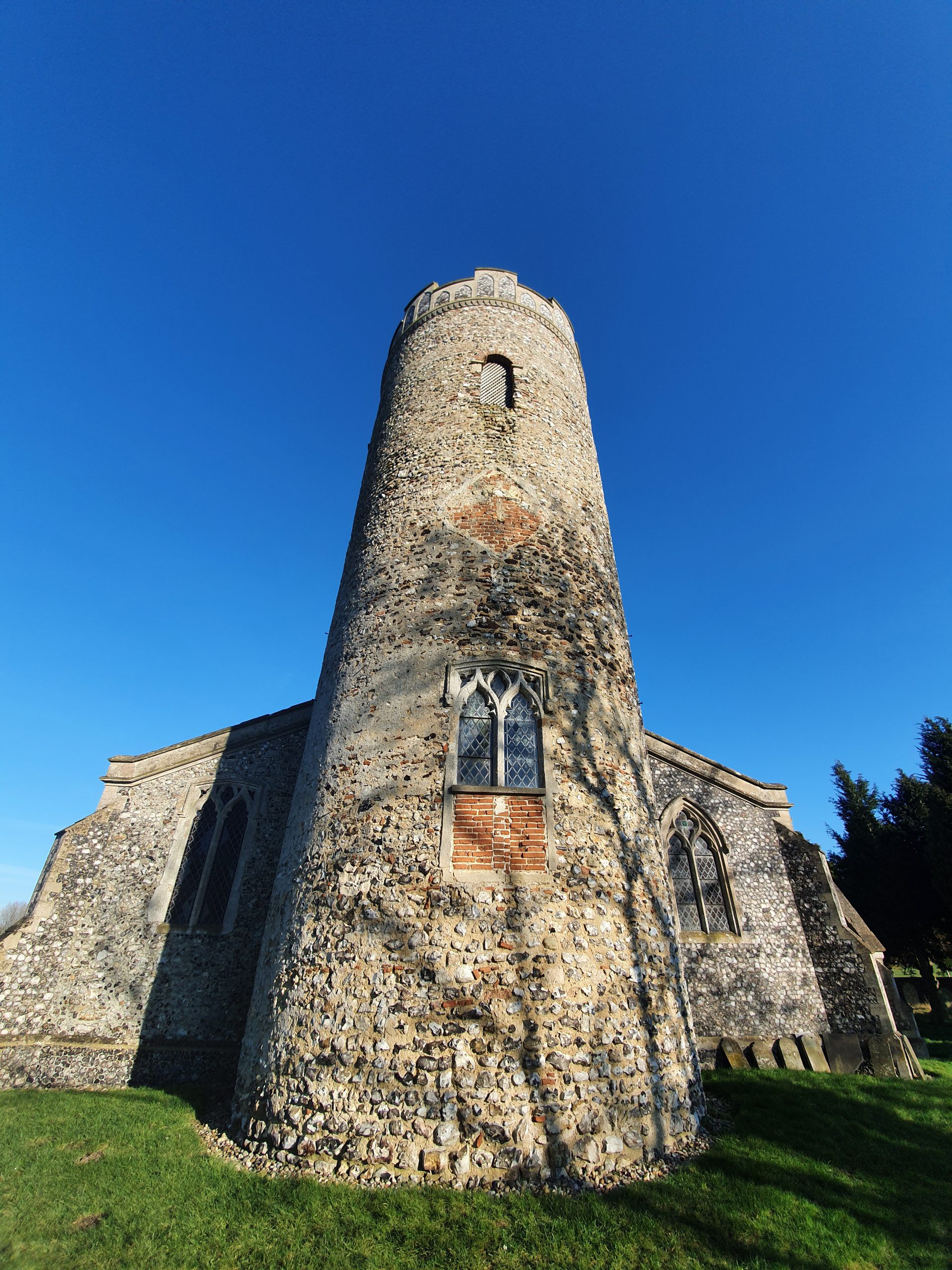
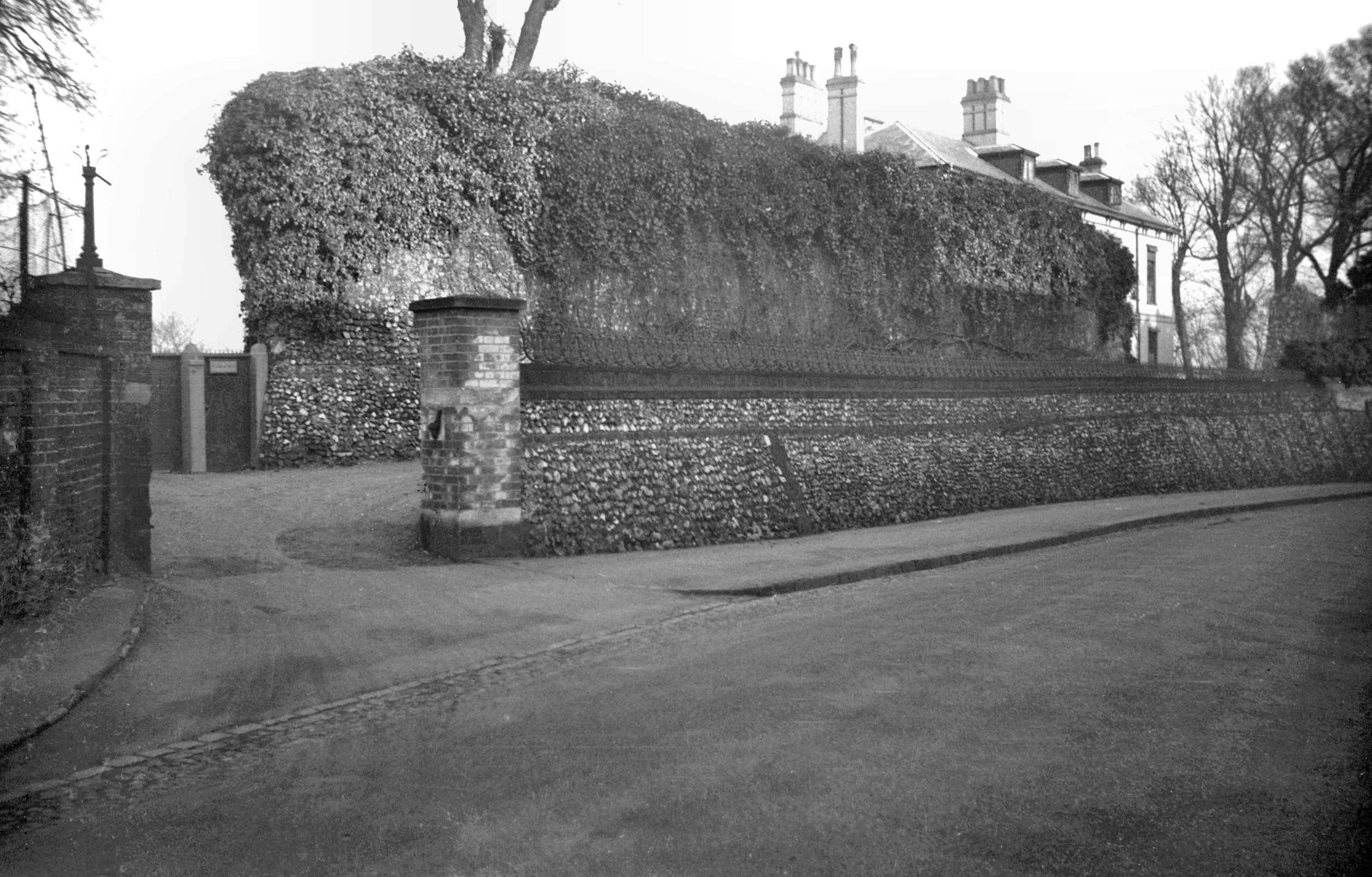
    Nathan was doing the navigation for the evening and he excelled himself (I hope he doesn’t read this, he’ll quote that for ages) in the choice of route towards our fifth location. This is the former city wall at Carrow Hill and George Plunkett took a photo here in 1934 when it was covered in rather more ivy.

    At this point it was dark and we were navigating by torch light down this hill Nathan had chosen, but it took us under Wilderness Tower. I promise that I won’t enter this photo for any photography competitions.

    There are some reasonable views of the city from up here.

    And then by Black Tower, although I accept that there’s not a great deal of detail visible in the photo. I’ll walk by here again in the day to take some more photos I think.

    And we dropped down to near Norwich City Football Club for our fifth location and I’m unsure why GeoGuessr keeps giving random locations around here. I have more photos of the side of Morrison’s than is healthy for someone in their late 30s / early 40s…..

    Anyway, this was an easy way to add a few more miles of walking in, as it’s really not long until the LDWA 100….. The weather was mild, which was fortunate, as it’s annoying to get drizzle when trying to get chips on the go.

  • Haveringland – St. Peter’s Church (Cecil Albert Mace)

    Haveringland – St. Peter’s Church (Cecil Albert Mace)

    This is the grave of Cecil Albert Mace, located at St. Peter’s Church in Haveringland. Cecil was born on 21 February 1907 and was the son of Henry Mace and Alice Mace (nee Hawkins). The family lived at 48 Canterbury Place, later moving to 61 Exeter Street, with Cecil going to Heigham Street Infants School and then St Stephen’s Infants School.

    At the 1911 census, the family were living at 61 Exeter Street, with Henry and his wife both being 31 and he was working in the boot trade. The children were Henry (aged 9), Ernest (aged 6), Cecil (aged 4), Walter (aged 2) and Alice (new-born). This census listed how many children had died, which was relatively high at the time, but Henry and Alice hadn’t lost any. I can imagine they were pleased with Alice to at least get a girl in the family, after four boys.

    At the age of 18, Cecil joined the Royal Tanks Corps on 24 January 1924, enlisting at St. Stephen’s in Norwich and being given service number 2208658.

    Cecil married Eva Mary Harrison in 1933 at St. Stephen’s Church in Norwich, although sadly his father had died by this time. Eva was aged 23, having been born in 1910, and she was working as a domestic servant, whilst Cecil’s occupation was listed as a motor driver. The couple were living at 28 Shadwell Street in the city and the marriage was witnessed by Albert Harrison and George William Hensley. As an aside here, I wrote briefly about Shadwell Street a few days ago.

    Cecil joined the Royal Air Force Volunteer Reserve, service number 902706, assisting the war effort given his previous military experience. Cecil died on 23 August 1947 at the age of 40. Unfortunately, none of the usual databases give any information as to what happened and it’s rare not to have a cause of death for an airman. There don’t seem to be any media reports of the death, which means it’s probably more likely a death from natural causes rather than being killed in a military accident. I’m also unsure why he was buried at St. Peter’s, which at the time was effectively the church on the airfield, given that he was married, but perhaps it all just felt more appropriate to the family.

    The grave registration form for Cecil and Jeffrey Edwards.

  • Haveringland – St. Peter’s Church (Jeffrey Neil Edwards)

    Haveringland – St. Peter’s Church (Jeffrey Neil Edwards)

    This is the military grave commemorating the life of Jeffrey Neil Edwards and it’s located at St. Peter’s Church in Haveringland.

    Jeffrey was born in West Ham (then in Essex) in 1922, the son of Arthur Edwards and Ethel May Edwards (nee Roberts), of Wanstead in Essex. He became a Flying Officer service number 172240, flying with the 157th squadron of the Royal Air Force. His home address was listed as 8 Cambridge Park in Wanstead, which was the residence of his parents.

    Jeffrey was named in Despatches on 5 February 1944 for his bravery, something for which his parents must have been enormously proud of. Sadly, Jeffrey was killed on the night of 22nd/23rd December 1944 when returning from an enemy raid in his Mosquito TA392 RS-K aircraft. He reported to Flying Control that he was having problems with the ailerons and the aircraft crashed at the airfield also killing his pilot Flight Lieutenant W Taylor. There’s a report of the crash at the Aviation Safety web-site.

    The military grave record, with Jeffrey dying at the age of just 22. The probate details were confirmed in 1946, with Jeffrey’s assets of £332 18s 6d being transferred to his father, Arthur.

  • Haveringland – St. Peter’s Church (Bithiah Howard)

    Haveringland – St. Peter’s Church (Bithiah Howard)

    This stone is located just outside the porch of St. Peter’s Church in Haveringland. It’s an interesting first name, I think it’s Bithiah, but there’s more on Wikipedia about this. Although the burial records survive at Norfolk Record Office, the actual church mostly doesn’t as it was rebuilt in the 1850s (other than the tower).

    I suspect that this stone was once above a tomb inside the church, which would explain why it has survived in good condition since Bithiah’s death in 1769 (or more precisely, she died on 31 December 1769 and was buried on 3 January 1770). Personally, I don’t think this stone should be outside, it’s part of the heritage of the church and so would be better off inside and protected.  I’m only guessing, but the stone was probably broken on lifting it in the 1850s and so they just removed it. It’s also missing from the comprehensive list of memorials which the church prepared in 1981.

    Bithiah was born in 1693, but, unfortunately, other than finding her name in the parish death register (and I had to search it manually as the transcriber couldn’t read it), I can’t find anything else. I think there are problems with the transcribing of that first name, there are all manner of variants out there. The nature of the stone suggests that the family likely had some wealth and was perhaps connected with Haveringland Hall.

  • Haveringland – St. Peter’s Church

    Haveringland – St. Peter’s Church

    Initially, not a lot made sense about this church as the road layout was illogical and the building was set back about 200 metres from the road. It’s not entirely normal for a church to be located at the end of a long concrete (or whatever it is) track and nor for there to be such a lack of road access.

    This is though the answer, the airfield of RAF Swannington, which was in use between 1944 and 1947. There were plans to turn it into a larger airfield after this, but those plans didn’t come to fruition and the land was sold by the RAF in 1957 and the land returned to agriculture. The church is just visible on the above map (which is an Ordnance Survey map, just out of copyright) on the extreme right-hand side.

    We pondered whether this was wide enough to be a runway, it didn’t feel quite right in terms of the size, but it was the map which confirmed that this was the perimeter of the airbase. Sections of the runways themselves are still visible on overhead maps, but not to the size that they once were.

    Some of the memorials relating to the airbase.

    Onto the church, I saw this and was a little disappointed as it’s just Victorian (not that everything Victorian is bad, but it does mean the medieval heritage of the building isn’t going to be there). With the exception of the tower, the church was demolished and rebuilt in 1858 by the owners of the nearby, and now demolished, Haveringland Hall. The listed building record notes that the thirteenth century font has been kept, but everything else is Victorian. The church was locked, but I’m not entirely sure that there was much to see inside.

    Ignoring all the nearby concrete of the former airfield, it’s a remote and quite charming area.

    A gateway that has long since fallen into disuse.

    The porchway is Victorian, but that tower looks magnificent. It was noted in a newspaper article in the 1890s that the scale fern that was on the building had now been removed, a decision which was probably beneficial to the structure of the church. It’d have been a shame if that tower was covered in ivy, not just as it would be damaging to the stonework, but because it’d hide the beautiful round tower.

    Some of the Victorian stonework on the side of the porch.

    So, onto the round tower, which dates from the eleventh century. It’s one of the oldest surviving round towers in the country, although they faffed about with the top of it during the Victorian rebuild.

    I think that’s Roman brick.

    The window height has been changed on the tower and bricks placed under the new window, but it gives it all some character. Some of the tower has been rendered, likely in the 1850s, although some of that has since fallen away and not been replaced.

    I’m not quite sure what all of these metal attachments are to the church tower. Perhaps they were used to stabilise the tower whilst they were demolishing the rest of the building in the Victorian period, or as some sort of support for plants. Although the bulk of the historic church has been lost, at least this tower remains, having spent centuries looking over agricultural workers and then for a few years there were military aircraft taking off in its shadow. The tower at least is perhaps an unlikely survivor, but at nearly 1,000 years old it’s not looking in bad condition.

  • Norwich – Banger Stop

    Norwich – Banger Stop

    I haven’t paid much attention to Norwich Market in the past, for no obvious reason than I’m not sure I realised how wide a choice of food and drink they had there (to be fair, it’s near Grosvenor and so I hadn’t realised I needed to go elsewhere). Having meandered around the various chip stalls over recent weeks, I thought I’d pop to Banger Stop today.

    The city’s market has been in its current location for 900 years, which is a fair run I think it’s reasonable to say. George Plunkett has a photo of the market from 1939, not long before the war broke out, and Banger Stop is located roughly where the group of three people are in the photo.

    As someone who gets confused by too many options being available, I quite liked the precision here with the choices marked on the boards of:

    (i) The Classic – pork sausage with cheese, onion and homemade ketchup (£3.50)

    (ii) The Chilli Dog – as above, but with chilli sauce (£3.50)

    (iii) The Plain – just the sausage and onions (£3)

    There was a nice welcome, and I didn’t struggle to decide to go for the chilli dog, although I was initially concerned about how much of it I’d manage to drop on myself. Fortunately, some forward planning has taken place here with the packaging with the provision of a little box surround for the hot dog to avoid unnecessary spillages. I was charged £3, perhaps because I didn’t need any cheese, and the stall accepts cards which is rather handy. Everything was also clean and organised, especially important during these challenging times….

    I thought it was all entirely acceptable and sufficiently filling, the sausage is made just for this stall on the market and isn’t bought in, it was also hot without burning me. The red pepper chilli sauce wasn’t particularly hot in terms of spice, but added some texture to the arrangement and onions also bring a little extra taste. Definitely all rather lovely, and it’s worth having a little hunt for within the market.

  • Norwich – Thomas Want Abandoning His Family

    Norwich – Thomas Want Abandoning His Family

    200 years ago this week, the Norfolk Chronicle published a story about about how Thomas Want, a former school master in Norwich, had cleared off and left his wife and four children. This was certainly a problem as far as the city was concerned, as the Corporation would now have to fund these children and I can’t imagine they’d have been thrilled at that thought. So, the hunt for him started, and it appears that he had run off with this woman who had a hawker’s licence.

    I like a story and so I wanted to know more about this little arrangement, although the documentary chain of evidence was always going to be a little limited. Thomas had married Frances Oldman in St. Stephen’s Church in Norwich (the one in front of the Chantry shopping centre with a path leading to it through the graveyard) on 3 June 1806, so they had been married for fifteen years.

    Francis Arthur Want was born on 24 July 1810 and baptised on 17 August 1810 at St. Stephen’s Church. Frances Lucinda Want was born on 10 November 1811 and baptised on 17 November 1811, this time at St. George Colegate Church. Jane Pearcy Want was born on 21 June 1816 and baptised on 30 June 1816, this time at St. Martin at Palace Church. There should be another child, since the newspaper mentioned he had left four, but I can’t find details of that, although I imagine they were born some time around 1814.

    Francis Arthur Want married and became a railway station master in Burton upon Trent in Staffordshire, with none of his children being named after Thomas. Frances Lucinda Want never married, going to work as a servant cook, she died in Middlesex in February 1894. Jane Pearcy Want married Robert Newman in Cromer on 4 October 1841 and they lived in the town, with none of their children being named after Thomas. It is this lack of naming their children after Thomas that makes me suspect that the children didn’t have a great deal of respect for their father.

    Moving back to Thomas’s wife, Frances. There are no suitable candidates showing on the 1841 census, so I’m fairly sure she died before then. And there is a burial of a Frances Want at Old Lakenham Church in Norwich on 26 August 1822 and I’m going to assume that this was the wife that Thomas left behind. She died just a year after her husband left her and, perhaps not unsurprisingly, I can’t find any record of a gravestone. I can’t imagine that anyone would have had any money to pay for one.

    Back to Thomas, he was 42 when he went missing, so he was a fair bit older than Frances, having been born in around 1779. He was a schoolmaster from at least 1812 to 1815 at the academy on St. George’s Plain which was a boarding school for young gentlemen. As for his death, the only one I can find that fits anywhere in the country is the Thomas Want who was buried in Norwich on 17 September 1844. I have yet to discover what happened to Thomas after he went off with this woman with her hawker’s licence, but I don’t feel that he ever went back and his voyage of passion will perhaps remain a mystery to history.

  • Norwich – Thomas Edgar Stealing from the Coach and Horses

    Norwich – Thomas Edgar Stealing from the Coach and Horses

    Continuing with my theme of events that happened 150 years ago today, the Norfolk Chronicle reported in late February 1871 that Thomas Edgar had been charged and tried for the theft of a scarf from the Coach and Horses pub on Red Lion Street whilst the owner was playing skittles. I’d never realised that pub existed and it suggests an answer to a question I had of whether skittles was commonly played in Norwich in the past.

    Anyway, back to the details of the court case, although this was just the first hearing. Thomas Edgar, who lived at Crook’s Place (that unfortunate fact isn’t lost on me…..), visited the Coach and Horses pub and I suspect he didn’t plan any nefarious activity when he arrived. However, Frederick Leech (named as William Frederick Leach in another newspaper) who lived at Oxford Street, located off Unthank Road, had arrived with his expensive cashmere scarf. I’ve got a picture in my mind of what I imagine he was like, but others can draw their own mental image here….. Leech was enjoying a game of skittles and had placed his scarf neatly on his hat and put that on a table. After a while of enjoying his game of skittles (the paper didn’t mention the score) he realised that his scarf had gone missing and he then saw Edgar rushing out of the pub looking suspicious. Leech left the pub and tried to follow Edgar, but lost him and so he contacted the police. The police rushed out and found Edgar and the missing scarf at Crook’s Place, which sounds some rather excellent detective work. Edgar’s defence was that he was drunk, which doesn’t seem unreasonable as far as excuses go.

    For some more information about this, I had to jump forwards a month to late March 1871 when the full trial took place. More details came out, including that Edgar had offered to look after the hat and scarf, which doesn’t seem to be a very subtle way of pinching something. The detective work from the police was explained, a police officer and a man called Piggin had followed Edgar to his home and this wasn’t some brilliant piece of guesswork. Edgar’s defence was accepted, which was that he was so drunk he didn’t know what he was doing. These were ferocious times in terms of sentencing though, and when Edgar was found guilty, he was sent to prison with hard labour for six months. The additional reporting also noted that Leech (or Leach) was an ironmonger and Thomas Edgar was aged 21.

    Rolling back a little here, the pub itself, the Coach and Horses. This was located at 3 Red Lion Street and it’s still there today, although it’s now a Bella Italia having ceased being a public house in around 1984. The building was constructed by the brewery at the beginning of the twentieth century, on the site of an older building and the one where Edgar pinched the scarf from. And we also know that the pub had a skittle alley judging from the events of that night, and it also had a three dimensional bas relief panel by notable local artist John Moray-Smith. That is now sadly lost, although there’s one of his works remaining at the nearby Woolpack pub.

    Back to Thomas Edgar though. He was born in 1849, the son of Matthias Edgar and Mary Ann Edgar and at the 1861 census he had four older brothers and sisters. Mary Ann was from Devon and the two oldest children had been born in Plymouth, but Thomas was born in Norwich. The family at this stage lived at 44 King Street (probably not where most people would think this was, but more on this in a moment) and Matthias worked as a brush maker.

    The 1871 census isn’t entirely helpful about where he lived, since he was in the city gaol, which was at that time at the end of Earlham Road (or St. Giles’s Street at the time, before a bloody great road was built at Grapes Hill orphaning the end of it), which is now the site of the Roman Catholic Cathedral.

    We do know from the newspaper that he had been living at Crook’s Yard and this is where things got a little confusing for me, as I’ve now discovered that there were two King Streets in Norwich at that time. Not the Upper King Street and King Street that we have today, which are still really the same road. Some bloody idiot had built a King Street and a Queen Street (ignoring the fact that these street names already existed) near to where the Norfolk & Norwich Hospital was located in the city centre. This clearly caused complete confusion at the time as records from the time are all over the place, but wiser heads prevailed and King Street was renamed Shadwell Street and Queen Street was renamed Nicholas Street. In the above map, Crook’s Yard (or Crook’s Place) is the road leading off from the right. It’s possible that this name confusion meant that Thomas was still living with his parents at this time on King Street.

    At the 1881 census, Thomas was living with his mother at 44 King Street and he was working as a waiter. By 1901, Thomas was now married and living (alone, for reasons unknown if he was married) at 86 Shadwell Street and was working as a fruit-seller. Thomas died in the city in 1910, at the age of 61, and there is no mention of his death in the local press. At a guess, 44 King Street and 86 Shadwell Street were probably the same house, but either way, they would have been demolished after the Second World War.

    But, the element of all this that I quite like is the thought of the atmosphere in the Coach and Horses in the city 150 years ago. I’m not sure that skittles is played much anywhere, not least because it’s quite space consuming, but there’s an equivalence with bar billiards. And I can imagine a similar set of circumstances playing out, someone leaving their expensive cashmere scarf out (and I can think of a couple of friends who would turn up at the pub with something like that….) and finding that it was stolen. Thomas Edgar doesn’t seem to have been a particularly bad person, he certainly didn’t have a long life of crime after this incident. And I’ve tried to work out the route that he would have taken from the pub back to his house (I bet he went down St. Stephen’s, walking by where there is a Greggs today), perhaps testament to the reality that I need to get out more.