This is the eighth week of our plan to eat at every food stall at Norwich market this year.

This is the menu at Taste of Shanghai with some tempting options there on the menu board and the prices looked reasonable so my initial impressions were positive.

The server was friendly and helpful, always good to be welcomed with a smile and eye contact, and she took the order in an interested manner. Nathan ‘social butterfly’ Hensley of course sort of knew the man preparing the food, so that all added to the engagement. There is absolutely nothing on either menu board that I wouldn’t have been pleased to try, this is a menu that to me seemed exciting and very much my type of thing.

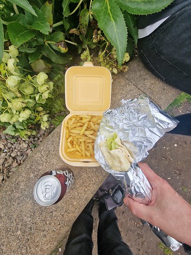
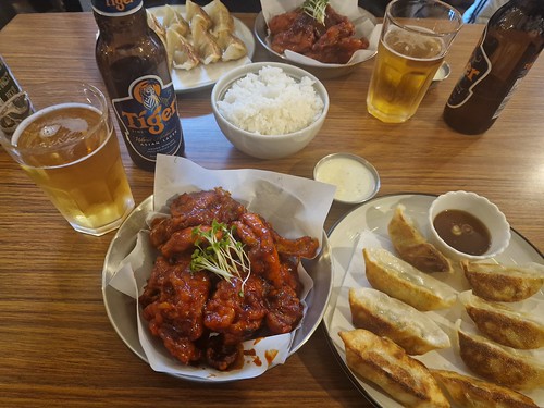
I ordered the black pepper chicken with rice which was £7 and it was a delight to see that everything was freshly made. There’s a five to ten minute wait for food, but I’d far wait for that short period of time and have something fresh. I also liked that they didn’t take payment, with cards being welcomed, until after the food was served, I thought that was a nice little touch. The extras were also keenly priced, including drinks for £1 each which is towards the lower end of the scale for the market.

Nathan approved of his sweet and sour chicken, which was £6 for what was a generous portion. I liked how his sweet and sour chicken friend asked him if he would like chilli with the meal, a little bit of personalisation there.

Enough about Nathan and back to me. My black pepper chicken was well presented with crispy onions on top and a free spring roll, which was a handy little starter. The portion size was generous, there was plenty of chicken which was tender and moist, the rice was fluffy, the crispy onions added texture and there was some salad element to complete the mix. The sauce was rich and peppery and it coated all of the chicken with everything served at the appropriate temperature. There’s also no MSG used in the preparation of the food which suggests to me a more authentic experience.
I’m very much sold on this venue, the service was personable and immediate with the food being well presented and having a depth of taste and flavour. This is Norwich market at its best, that kind of interaction between the chef and customer, providing excellent quality for a reasonable price. Seeing food being made fresh is a bonus and I think it adds to the anticipation and excitement of the whole arrangement. The food was filling and although there is no seating or leaning area at this stall, there are always places to stand around the market out of the way of other people.
The reviews for this venue are nearly entirely positive, indeed there are just two negative reviews amongst the many five star ones and I can imagine how disappointed the owner is with them judging by their response. Not wishing to overly dwell on them, but one is:
“Rachel Irons : Really disappointing! The wait was very long, and then the result was verging on disgusting, we didn’t eat any, neither me nor my friend liked it. We ordered chicken katsu and it was so sweet almost like a desert ! The rice was over cooked and mushy and the sauce really ruined it. Nice people, cheap but not nice.”
The reply:
“Hi, Rachel
We are sorry for your unpleasant experience. As you can see we cook for our customers with one to one service. It might take time to wait during the busy time. Sometimes even bit longer. We use the high quality chicken. Also the sauce is our standard. It is our very popular trademark. We fully understand we can’t satisfied everyone but majority. And as the result you are not happy with the way of our taste. We will be happy to give you full refund. You can come to our stall at anytime with no prove. Your interest is always our priority. Thanks!
15/01/2023
Hi, Rachel
Happy New Year.
Had a review of the ratings for our services. You are the only customer we haven’t heard any reply from you. As we promised that your refund is always available. And we really don’t want to let anyone down. Maybe one day you will find your favourite food in our stall when you come again. All the best to you. Many thanks:)”
I feel their pain, but each to their own as individuals can of course leave their feedback in whatever form they like, but this tells me how much the owners seem to care about the customer experience that they tried so hard to respond, albeit to no avail. But, not dwelling on the negative, this feels a much more typical review and is one that I agree with:
“The boss has a good service attitude and is very enthusiastic. The food is good and cheap is a rare snack that makes my eyes shine. Compared with some flashy restaurants, this small shop gave me many more surprises and surprises.”
Overall, I’d definitely say that this is one of my favourite stalls of our expedition so far, I can imagine that I’ll be back again to start working through some of their other options. I was surprised and delighted, a very impressive little stall and I look forwards to returning.