Category: LDWA

  • LDWA 100 – Training Walk 9 (Finding the Source of the River Yare Part 1)

    LDWA 100 – Training Walk 9 (Finding the Source of the River Yare Part 1)

    This was our ninth walk in preparation for the 2021 LDWA 100.


    WALK NUMBER: 9 (Finding the Source of the River Yare Part 1)

    DISTANCE COVERED: 14.7 miles

    NUMBER OF NATHAN’S FRIENDS WE “ACCIDENTALLY” BUMP INTO: 1 (might have been someone I knew)

    SUFFICIENT BEER CONSUMED: No (all the pubs are shut)

    PUBS VISITED: 0 (not through choice)

    WEATHER CONDITIONS: Dry

    ATTACKED BY ANIMALS: No

    NUMBER OF SNAKES SEEN: 0


    Above is a photo of the railway lines in Norwich. I had tried to get a photo of a train in, but the bloody thing moved too quickly. I don’t think a career in photography is really for me, unless I specialise in taking photos of train lines.

    Anyway, an explanation of our plan. A couple of weeks ago we started our walk to find the source of the River Wensum. The lockdown means that we can’t use public transport or really walk that far from Norwich, so later parts of that expedition (I say expedition as we’ll likely make it one, everyone else would call it a walk) are for the future. Today, we decided to start a similar project to follow the route of the River Yare to its source somewhere near Dereham.

    I’ve split the walk from today into two parts, mainly to increase the suspense of the whole thing for anyone reading. As a spoiler, don’t get too excited for part two. Nathan refused to investigate a seemingly mystical water feature which was bubbling (I thought if he put his head in it then he might find a solution to the problem) and neither of us fell over. We did have a couple of incidents in Waitrose (including a moderately embarrassing navigational error), but that might be as exciting as the second part gets. Anyway, let’s focus on the first part of today for now.

    For anyone wanting to follow along, we started walking along the river just past Redwell Brewing’s Taproom.

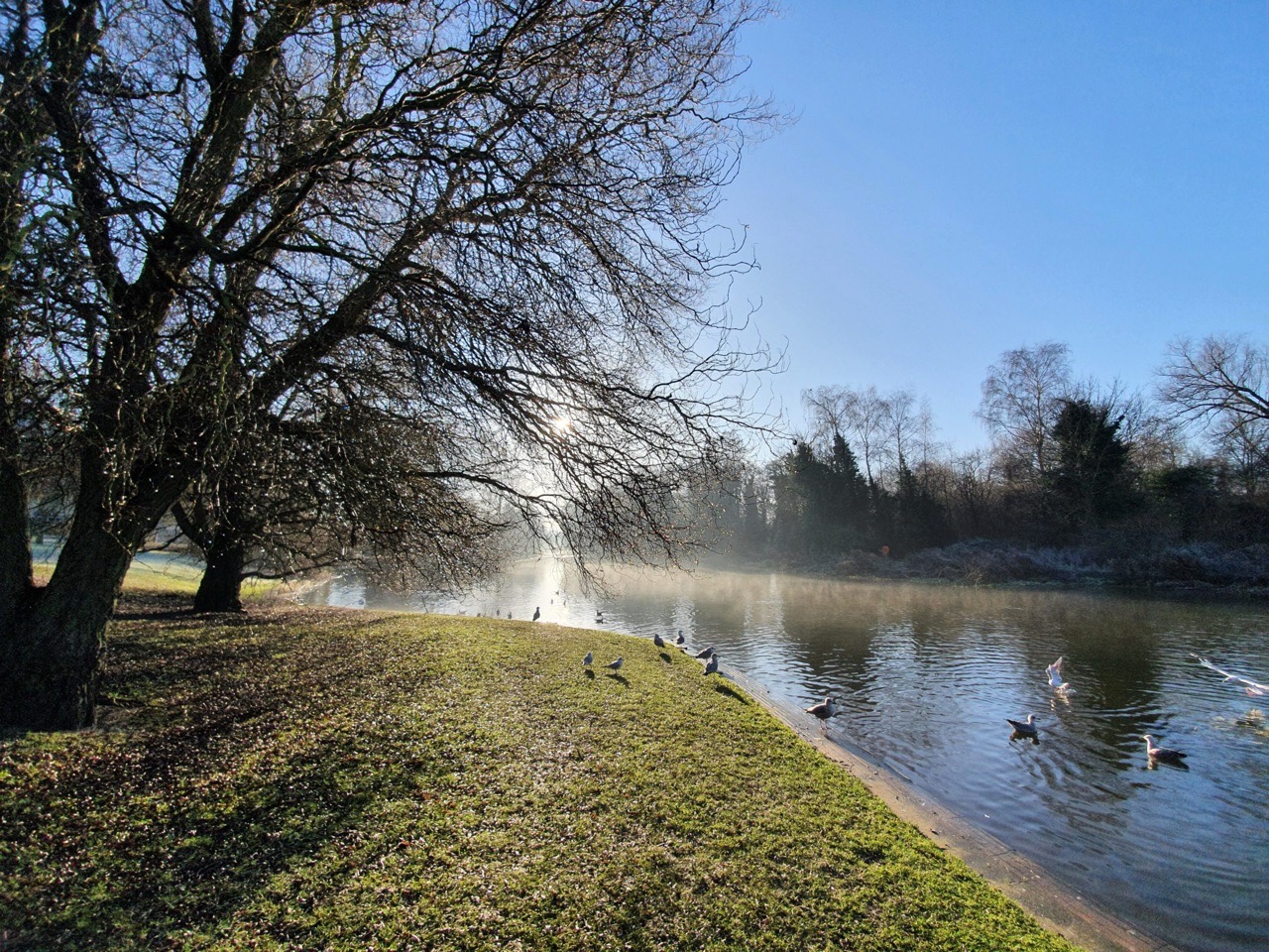
    It was a frosty morning and this is the Yare near to where Bev lives (not that near, I don’t want to encourage sightseers to her property) which is in a rather decadent part of Norwich. If anyone does want to know where Bev lives, she’s got a reputation in the village, so just knock on a random door and ask.

    This stretch of the River Yare is by Mill House, at Trowse Millgate.

    I took a lot of photos today of river scenes, probably too many if I’m being completely honest. Here are some of the frosty ground as I thought that it might look a little mystical. Our policy for the day was to stick as near to the river where we could, although in places that was obviously impossible. We don’t try and stick by the river if there’s a chance of falling into it or being arrested for trespass.

    The river splits before Old Lakenham, the River Tas goes off south and the Yare cuts through the village. Above is Mill House on Mansfield Lane in Old Lakenham.

    The Cock pub is still abandoned and there have clearly been intrusions inside, so I wonder whether the building can ever re-open as a licensed premises.

    This was a stretch of the river where we struggled to stay near to, as buildings in Lakenham are built to the river’s frontage. We went down Sandy Lane and Cooper Lane to try and see a bit of river, but we were conscious that a railway line meant we’d have to backtrack.

    We didn’t expect such a long stretch of boardwalk, which was slightly worn in places, but it is clearly still being repaired. Breaking the ice never loses its appeal, probably the sign of a feeble mind or something, but there we go. I presented some rather fascinating bits of ice to Nathan, who carried them about for a bit before throwing them away. We discovered some interesting mini piers that jutted out into the River Yare, and pretended that one was Great Yarmouth Pier. It was a little pathetic, but imagination is the key as they always say.

    This stretch took us from Asda (well, the Greggs next to Asda) and down Hall Road. It’s evident from the above map how far we strayed from the river at this point.

    Nathan’s doing his vegan thing so he made do with a vegan sausage roll and a vegan steak bake. I went for a chicken bake with chicken, as it seemed wrong to pass by Greggs and not to quickly pop in. Service was quick, the food was delicious and the chicken bake was hot. All rather lovely.

    The route of Hall Road has changed slightly as the railway bridge can’t support the volume of traffic that today is rushing hurriedly towards Greggs. So, they changed that bit of the road to be called “Old Hall Road”. Clever thinking…..

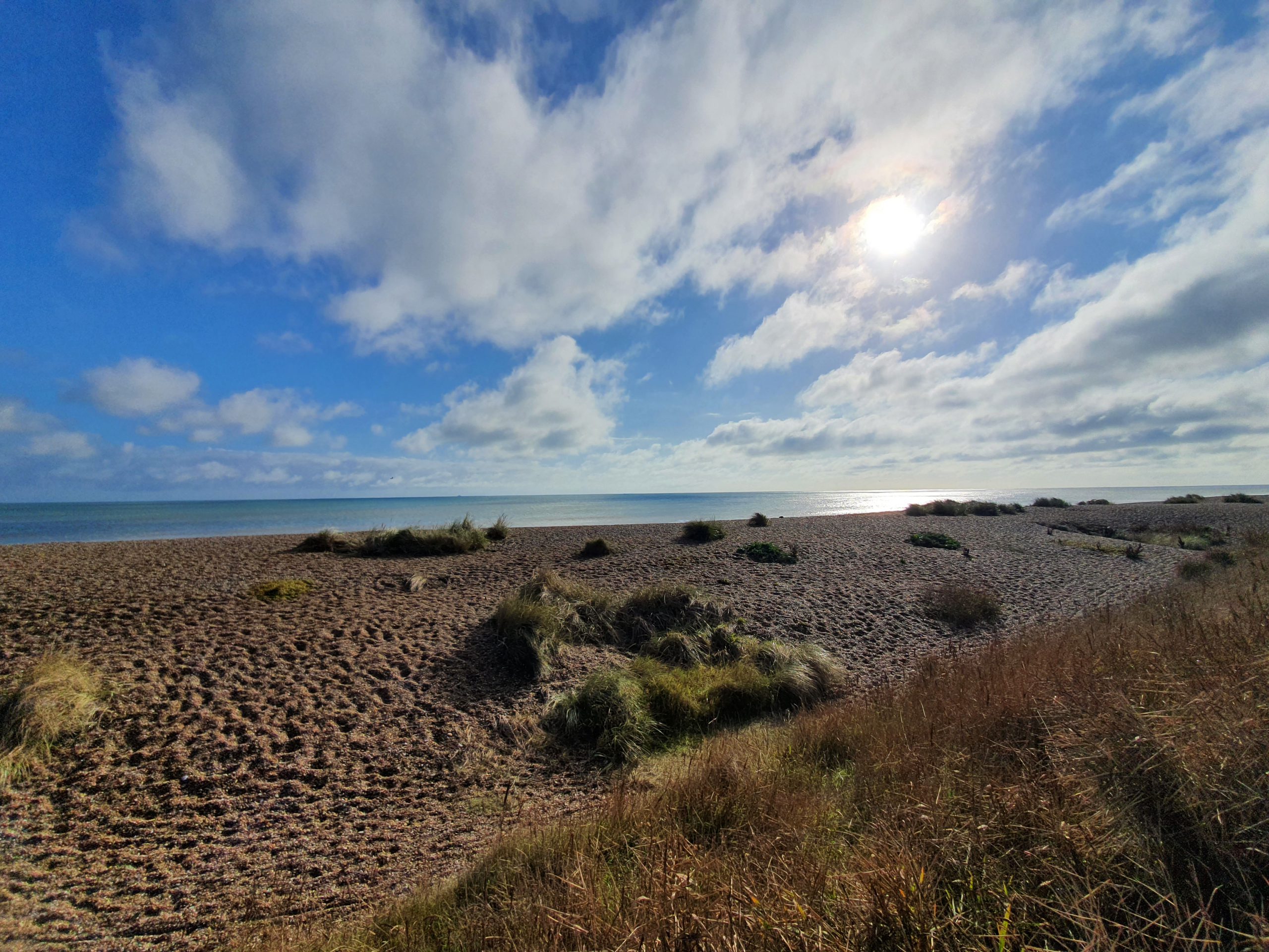
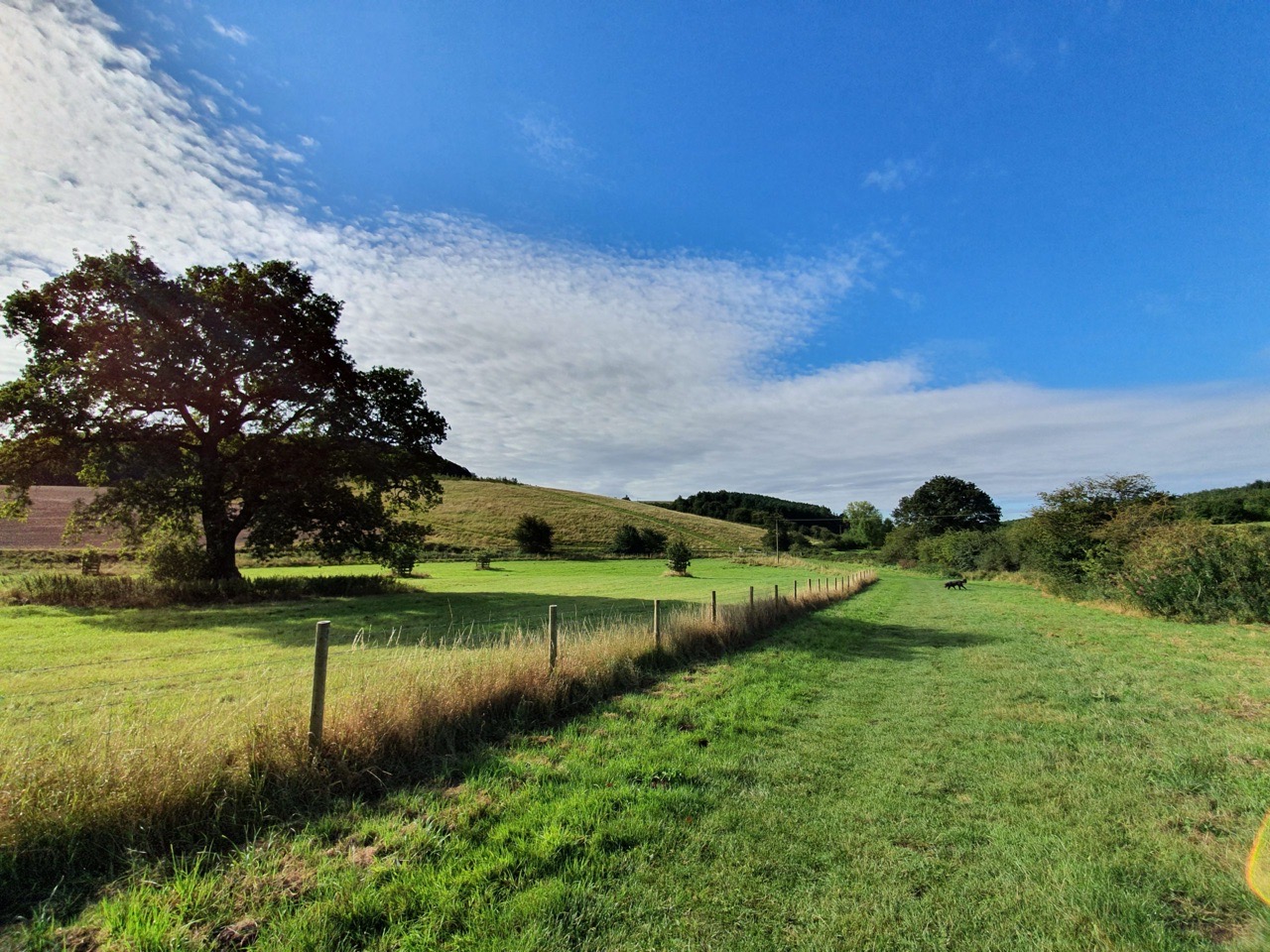
    This photo was taken from the Ipswich Road, near to the Marsh Harrier pub. It looks scenic, but behind me was a road that seemed to have more cars on than the M25. I exaggerate slightly, but this wasn’t quite the rural idyll it might appear.

    I like the language used here. “If the cows become a bit lively”…. By this, they mean the bloody things are charging towards you at some considerable pace. Fortunately, the cows were hibernating so they didn’t cause us a problem.


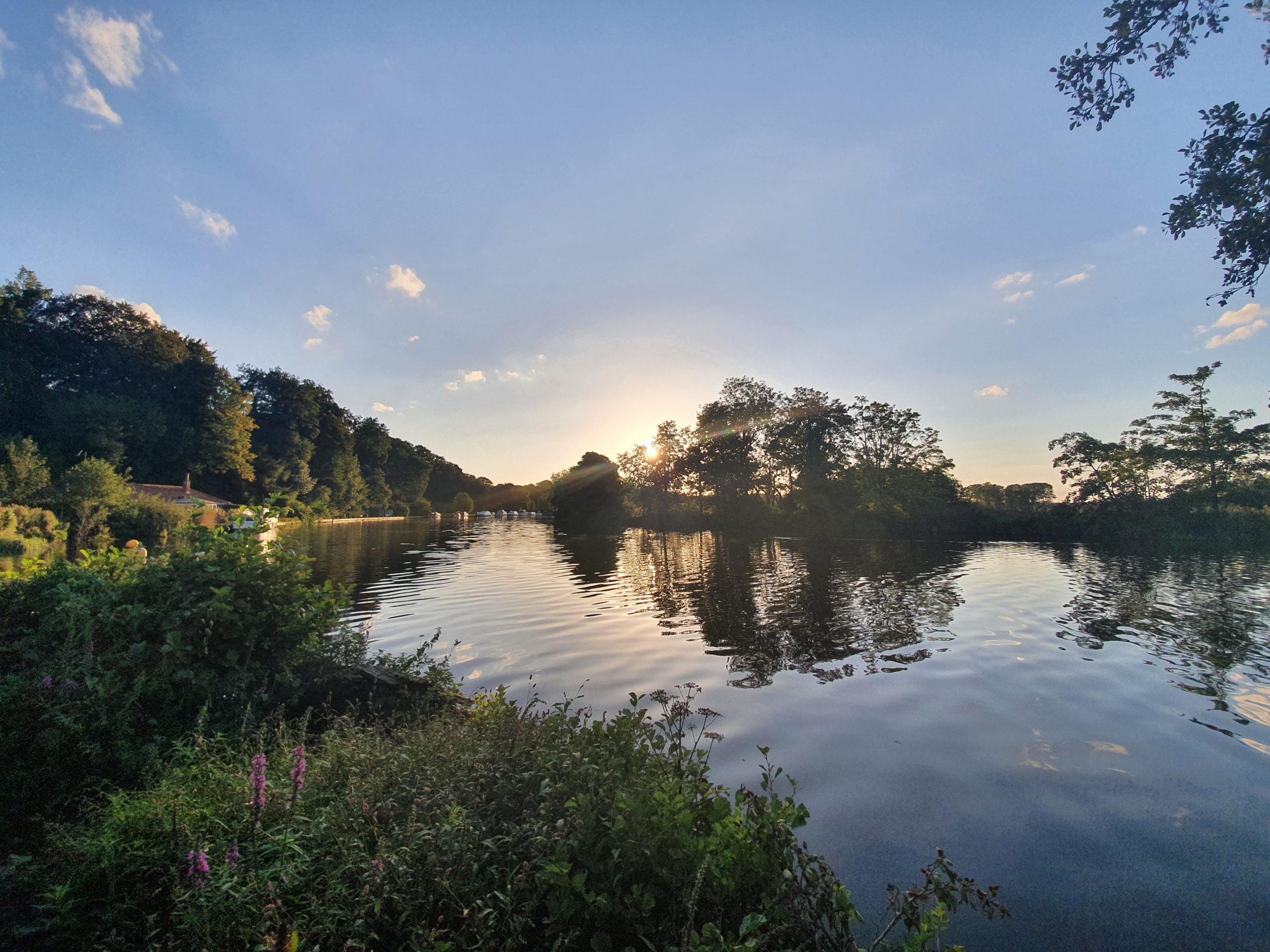
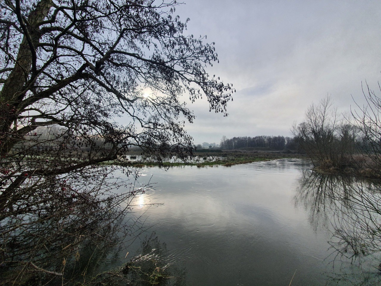
    These photos are all of Marston Marsh and some of the paths here were inaccessible, so we got pushed back from the river a little in places.

    Good job that Clive wasn’t here. He’s still annoyed at the swan that knocked him out of a canoe about five years ago and that story still lives on in Hike Norfolk. Not least because people keep writing about it.

    Marston Marsh is a floodplain that covers 26 hectares, which is also used as grazing land in the summer.

    I had a look at what the city council said about this site, which included:

    “Also included in the site are some small areas of damp woodland.”

    I can confirm that there were small areas of damp woodland. Indeed, there were large areas of damp everything.

    “There are five wildlife ponds.”

    To be honest, there was one big huge pond.

    “Species of interest include: water voles, otters (probable), orchids, as well as general good marsh flora, dragonflies. Geese use site in winter and a snipe was also recorded this winter.”

    And what you can expect to see….. Nathan has found some binoculars at his house, but forgot to bring them. I don’t know what he was expecting to see through them anyway other than a flood. There were some people looking like they were bird spotters and although that’s an admirable interest no doubt, it’s not one which overly intrigues me. Unless they’re penguins or something in the marshes, that would have attracted my interest. Anyway, I digress. I’m still pondering what this “probable otter” is, he sounds challenging.

    Here comes Bear Grylls.

    Nathan lifted his arms up so they didn’t get wet in the water. I didn’t say anything, I didn’t want to sound judgemental. The observant reader will note how moist the whole area was.

    Anyway, on this bombshell, I shall save the second half of the walk for another post.

  • LDWA 100 – Training Walk 8 (Finding the Source of the River Wensum Part 1)

    LDWA 100 – Training Walk 8 (Finding the Source of the River Wensum Part 1)

    This was our eighth walk in preparation for the 2021 LDWA 100.


    WALK NUMBER: 8 (Finding the Source of the River Wensum Part 1)

    DISTANCE COVERED: 15.1 miles

    NUMBER OF NATHAN’S FRIENDS WE “ACCIDENTALLY” BUMP INTO: 1 (they didn’t recognise Nathan)

    SUFFICIENT BEER CONSUMED: No (all the pubs are shut)

    PUBS VISITED: 0 (not through choice)

    WEATHER CONDITIONS: Sun

    ATTACKED BY ANIMALS: No

    NUMBER OF SNAKES SEEN: 0


    Finding the source of the River Wensum. It’s not exactly the exploration of the Amazon I will admit and I’m not sure that Michael Palin will be making a television series of this. But, travel is limited at the moment and so Nathan and I had this plan to walk to the source of the Wensum which is off somewhere near Fakenham.

    However, it became apparent that using public transport or getting a lift back from Fakenham isn’t really within the current rules on travel. So, we decided to split the walk up into different sections and today we followed the River Wensum from Norwich, where it ends when it meets the Yare, to a point a few miles away and then we planned just to walk back. I thought we saw more history and river than we had anticipated, so it was a useful exercise. It means that there will be a part two (and maybe part three) to this plan, but it won’t be until we’re allowed to use public transport again.

    This was the starting point of the walk, part of the city wall and it’s actually not far from the River Wensum. We didn’t follow the Wensum for the first part of this walk, instead joining it further along as we wanted to avoid the city centre at the moment.

    These photos are all from the river section at Wensum Park, which looks rather beautiful in the morning. Best known now as where Nathan dumps his unwanted bread into the river, this stretch of land was purchased by the city council in 1907. This was rather forward thinking of them, a useful amenity for the people of Norwich and they built a swimming pool, paddling pool and wading pools for the locals to use. The locals responded to this by using the swimming pool as a refuse tip, so a new plan was put forwards by the council to use the area as a public park. Designed by Captain Sandys-Winsch and constructed with unemployed labour, the park was opened in 1925 and it remains in use for that purpose today.

    Just a little further along the river, this looks quite remote, but it’s actually next to the Recycling Centre at Mile Cross.

    We did plan, many years ago, to come to the Gatehouse Pub at some point, partly as it’s on the CAMRA Regionally Important Historic Interiors list. Now that we finally get here the damn thing is of course shut, but we’ll go back when pubs re-open. The pub has a large beer garden which stretches down to the Wensum and it’s built on the site of a former toll-house.

    A stretch of the Wensum just off Hellesdon Road. It was around here that I started to try and break the iced up sections at the side of the river like some kid…. I got bored of that quite quickly when I realised that I might fall into the mud.

    I read the other day in the newspaper that there are parakeets flying about all over England, which is giving some concern as they’re not a native species. And there were several in the trees here, I think they’re rather interesting birds which add some character, but maybe their invasive behaviours upset seagulls or something. Nathan used his wooing skills, which seemed to be similar to the random noises he makes to his cat, to charm the parakeets down. It didn’t work. I pretended that I thought Nathan was like Bill Oddie and it was very surprising to me the birds didn’t flock down.

    A little collection of cut down trees.

    This is the river at the junction with Hellesdon Road, near to where Marriott’s Way is. We didn’t walk on Marriott’s Way (the former railway line that got shut down in the 1960s) on the way out, instead remaining on the other side of the river bank.

    This was rather lovely for Nathan, back to where he got married last year.

    The medieval standing cross in the churchyard. The lower section is thought to have been in situ for over 700 years.

    The village sign.

    It’s now been converted into residential properties, but this was Hellesdon Mill, a formidable building.

    We did have a plan to investigate this area as it’s by the river, but it’s owned by the Environment Agency and they’ve kept their bridge firmly locked to discourage anyone from crossing it. We didn’t try.

    These photos are of Drayton Green Lanes, an area of walking that we hadn’t noticed on the map, but which let us get close to the river. It’s really nicely looked after and some volunteers from Norwich Fringe Countryside Management Project recently fixed some damaged boardwalk under the supervision of Drayton Parish Council. This bit of land, which it appears no-one ever claimed ownership of, was a quite welcome surprise.

    The walk into Drayton along Low Road, which meant that we could see the river on our left. I must admit to getting quite into this whole project by this point as although I live near to the River Wensum, it suddenly seemed to be quite magical as we walked along it towards its source. To be honest, I think I need to get out more……

    I had hoped that E Pratt and Co were doing some delicious sausage rolls as their reviews looked rather positive. They’re a local butcher, but the situation was confused (well, I was confused, which doesn’t take much) and I came to the conclusion they weren’t selling hot food as despite a carvery sign the menu boards were all for raw meat. Delicious as that probably was, I thought better of it. Marginally disappointing, I was hoping it’d be as good as Greggs.

    I did try and find some food in the Applegreen petrol station instead, but it appeared to me from the pricing that Harrods had done a take-over of the premises. There was a Tesco next door, but I didn’t want to go shopping for the sake of it at the moment when all I had wanted was chips or a sausage roll. So, I bravely left Drayton with no food.

    This is the stretch of the Wensum between Drayton and Costessey Mill. The river has been diverted, likely a very long time ago, so there are two stretches here, one which is likely the original course of the Wensum and another which is what powers the mill.

    The mill here has gone, destroyed in a fire in the 1920s.

    Nathan navigating a minor tributary of the Wensum.

    This is St. Edmund’s Church in Costessey, which I visited briefly on Steve’s walk last year. The building’s history puzzled me, I’ll have to read up about it as there seem to be numerous additions from different periods. In short, there has likely been a church here since Saxon times, but the current one is mostly from the thirteenth century, albeit with a Victorian restoration.

    I hadn’t noticed this before, in memory of 10 members of 564 Bomb Squadron who crashed in Carr’s Hill Wood in Costessey on 7 March 1945. There was a campaign for the footpath to this site to be kept open, as it was on permissive land and the owner wanted it closed off. I don’t know what came of that, as the permissive path ceased in 2017, but I’ll find out.

    An unusual positioning of some of the older graves.

    Nathan was fascinated with the grave of Wandering Wal, and it sounds like this man had an eventful and interesting life.

    I assumed when walking by this building that it was a Victorian school, but it’s actually a hall which I think is linked to the Our Lady and St Walstan Roman Catholic Church which is located opposite.

    Although we had to walk back to Norwich at this point, nothing of huge interest happened although we discovered just how many people are walking along Marriott’s Way. And, the point of this walk was to follow the route of the River Wensum, so in a future blog post, we will continue our trail from where we finished and pick up the story again as we head off from the Taverham area. For anyone who looks on a map, they might notice that we didn’t get very far along the River Wensum, but there’s no need to rush adventure….

    As for our training for the LDWA 100….. This seems to be creeping up on us if I’m being honest and I’m not entirely sure that we’re filled with optimism. We’re confident of completing 60 miles, but more than that will be down to the Gods. Well, I say Gods, but I more mean our feet. Anyway, we’ll see what happens, but we’ve been very brave so far. There were no injuries today, other than Nathan’s slightly dodgy knee, and at least that bodes well (the no injuries part that is)

  • LDWA 100 – Bad and Good News

    LDWA 100 – Bad and Good News

    This is another in my series of posts about walking the LDWA 100 in 2021.

    The bad news is that the LDWA 100 won’t be taking place in Wales, which is a great shame for the organisers who had already put back their event by one year due to the health crisis. At the time, it seemed almost implausible that things wouldn’t have returned to normal by a year later, but events have gone in a direction that couldn’t be expected. So much time spent by the organising committee, but hopefully members will experience the route suggested in the future as a walk across a few days (unless they want to go round it in 48 hours…).

    But, enough negativity as this is a positive event! It all means that there’s a Plan B, and this was the announcement from the LDWA:

    “Due to the continued uncertainty about the COVID-19 pandemic the organising committee of the Y 100 Sir Fynwy have reluctantly concluded that it is impossible to hold the original Y 100 Sir Fynwy with any confidence that it will be able to take place.

    To avoid a second year without a 100 mile event, with the agreement of the LDWA National Executive Committee, it has been decided to hold a Virtual Y 100 Sir Fynwy event. The main points are:

    To be held on the weekend of 29th to 31st May 2021
    Entrants to choose their own route of at least 100 miles
    The 100 mile route to be completed in 48 elapsed hours
    Open to all LDWA members
    No qualifying event required
    No limit on number of entrants
    Successful completion will count towards 10/20/30/40 Hundred awards
    Entry via SI Entries only, entry fee £20
    Entrants will be required to provide evidence that 100 miles has been covered
    Certificate and badge for successful completion
    Completion of at least 50 miles in 24 elapsed hours will qualify for the 2022 Trans Pennine 100″

    Virtual in this sense is being used to mean that people can follow their friends (or people who aren’t their friends) take part in their own personal 100-mile route. It still means that there will be a lot of brave people walking the 100 miles, that bit unfortunately isn’t virtual…. The plan that Nathan and I have is to walk Wherryman’s Way, meander around Whitlingham Lake a few times, go back home for a little rest (since we live nearby which is handy), then walk along some former railway lines. They’re handy these railway lines, flat and everything…. And there’s a lot of flat on this route, which makes things so much easier in my view. And our route will ensure that there are Greggs and pubs along the way, so we’ll have to time that carefully.

    Dave Morgan, the courageous and energetic national chair, has made clear that walking on flat for 100 miles is very difficult. Well, he’s right, anyone can walk up and down hills, this will be a true challenge for those of us completing it in Norfolk…. But we don’t go on about our bravery.

    So, this all means that our plan to complete the event will unfold during early 2021, including the route that we propose. I’m intending to see how many friends can line the route (to reward and comment on our bravery), becoming the new checkpoint crew and offering us food and drinks (and praise). I shall be spending a lot of time on ensuring that the food is nutritional and healthy, so there will be absolutely no junk. Indeed, this will require the bulk of our planning time, but food and drink is essential to finish a walk like this.

    Will we complete it? Who knows, but there are some advantages for us walking it like this. This is my first 100, and to be honest, maybe my last. Remember Adam Dawson’s 100 interview? I subscribe to that theory. But, maybe I’ll become all “I must do this every year, it’s so fun”. But I doubt it, because 100 miles is a long way….

    Anyway, I digress. Doing it this way means that we are unlikely (although I don’t put it past us) to get lost, since we’ll know the route. We can change the route to suit our needs and also, I understand, start a little earlier in the day than the usual fixed time. Home will be on the route, which helps in terms of having more socks, shoes and anything else to change into, giving that bit more flexibility than the actual event. I mentioned I hadn’t done a 100 before, and this is what will be useful here, I don’t have to carry everything ‘just in case’ I need it which is what I’d have done in Wales.

    Checkpoints are wonderful to get moral support on, but we’ll do our best to recreate that experience with friends and anyone who else who is nearby and bemused. I’ll be taking photos and making short videos around the event, so people can compare my efforts with that of Dave Morgan, who will be doing the same. He’ll be all inspirational and have videos of valleys and lakes (and rain, he’s doing it in Wales) whereas I will concentrate on food and drink, as well as being grumpy. But, as they say (I don’t know who they are here) everyone walks the 100 in their own way.

    Anyway, what can possibly go wrong?

  • LDWA – Group Walking Stopped Again

    LDWA – Group Walking Stopped Again

    This is sad to see (the 3rd December update at https://www.ldwa.org.uk/library/coronavirus2020.php), hopefully it can be resolved to allow larger groups to start walking again soon in a safe manner. I have a 100 to walk in May 2021……

  • LDWA 100 – Training Walk 7 (Flower of Suffolk Anytime Challenge)

    LDWA 100 – Training Walk 7 (Flower of Suffolk Anytime Challenge)

    This was our seventh walk in preparation for the 2021 LDWA 100.


    WALK NUMBER: 7 (Flower of Suffolk)

    DISTANCE COVERED: 27.8 miles

    NUMBER OF NATHAN’S FRIENDS WE “ACCIDENTALLY” BUMP INTO: 0 (but we weren’t in Norfolk)

    SUFFICIENT BEER CONSUMED: Yes (enough on Saturday to last us into Sunday)

    PUBS VISITED: 1

    WEATHER CONDITIONS: Sun, rain, sun, rain, sun, rain

    ATTACKED BY ANIMALS: No

    NUMBER OF SNAKES SEEN: 0 (although we did try)


    And so for some background…. This was the seventh training walk for the LDWA 100 walk that Nathan and I are planning, although we had Liam with us as well on this one. It’s the Flower of Suffolk anytime challenge, an LDWA event that takes place in normal times on the first Sunday in October every year. I enjoy this as I sit with my feet up thinking about how far everyone else is walking, whilst I’m eating chocolate and jelly babies. It’s because some of us can’t take part in the event itself because we have to marshal, it’s a sacrifice that I just have to make.

    But, since this bloody health situation means that we can’t hold the actual event, we have instead put on the walk as an anytime challenge. Thanks to the wonderful Peter, Chelle, Hilary and others involved in ensuring that this could take place. I will also complain at this point about Nathan, who promised me a quick drink on Saturday lunch-time, which ended up being about nine hours of drinking. Which reminds me, I must post about a certain beer I liked at the Artichoke, but more on that another time.

    So, Liam drives us to Dunwich, ready to take part in the walk. We stopped en route so Nathan could have a little walk about the road to prepare himself for the day. The walk itself starts by the ruins of Greyfriars Monastery, which is in the photo above. I admit to being a history geek (I know, I need to get out more) and Dunwich has no shortage of that.

    I went overboard with photos and took 180 of them. This was, I admit, bloody ridiculous. But they’re in time order (no jumping about the day, I have been very careful with that) in this post, showing the variety of landscapes and terrains we meandered through. We chose the 26 mile route rather than the 18 mile route, as, to be honest, we’re brave. Nathan was also in charge of navigation, since this is his first challenge event and we couldn’t be bothered. Annoyingly, he was actually quite good at that. I say we couldn’t be bothered, Liam probably wanted to, so what I mean here is that I couldn’t be bothered.

    I had the brightness on my phone turned low to save the battery, meaning I forgot about my shadow being in some photos.

    Dipping down to the sea.

    The beach.

    The beady eyed readers from LDWA N&S might notice here that we weren’t meant to be on the beach at this point. It was a minor navigational blunder of no-one’s fault and it was nice to have a meander by the beach.

    Liam looking for snakes. I was ready to take a photo of one of the area’s 60-feet long adders jumping out. We saw one mouse despite looking under several, that was the limit of the excitement.

    Moist.

    We had a little bit of a problem here, although this photo doesn’t do justice to the issue. The water came up to around Liam’s knees in the section before and for those who can see my Facebook page I posted the video of Nathan and Liam crossing a treacherous bit. It was like the mud run again, which we should have actually been on today if it hadn’t of been cancelled. Anyway, Nathan made that video adult rated by swearing as he went across……

    The rain stopped and started, but this did mean that we saw a fair few rainbows. We had a lunch stop here as it was after 12:00 and Nathan had to tip all of the water out of his shoe caused by the aforementioned issue.

    This is near Sizewell power station.

    Stormy skies.

    A field.

    A rather lovely cow. It’s amazing how close I’m prepared to get to a cow when there’s a fence between it and me. I’m scared of these huge animals usually, they always seem ready to charge whenever I look at them.

    Different terrain….

    Can anyone see the flaw with the pub’s QR code? It could have been worse, they could have used a Good Pub Guide flyer I suppose.

    This is usually where the LDWA checkpoint is, at the Eel’s Foot Inn. Unfortunately, Liam had forgotten his mask and it was pouring down with rain, so we decided against stopping here. Nathan wasn’t thrilled, but Liam’s incompetence was fortunate as we probably didn’t really have time to stop here. This is around nine miles into the walk as well, so it’s a bit early on to get too settled. Although given half a chance, we probably would have got settled here quite quickly.

    Rainbow and farm machinery.

    Boardwalk and I’m pleased to say that none of us went sliding off them.

    An annoyingly placed tree. Nathan was the only one wearing shorts, but he mostly got away with that with only a few minor nettle issues throughout the day. And he hardly complained.

    Mud. No-one fell in the mud, it was quite an elegant performance from all of us to be honest.

    More mud, but this time surrounded by some nice trees.

    Reeds.

    Some kind of mushroom thing. It looked delicious, but I have a rule of not eating anything from foliage or shrubs on a walk, with the exception of blackberries. I can eat several bushes full of those. I did get a few blackberries on this walk, but just a small number and I suspect they’ll be the last that I encounter this year.

    We battle on. Incidentally, Nathan isn’t bored and looking at his phone to entertain himself, he was navigating.

    The open skies of East Anglia….

    Water.

    I very much liked this photo (I’m good at self-congratulation) and it’s my new header photo.

    Water.

    Sea. This time it was on the GPX route we were meant to be on.

    This was quite a sad sight. It’s Walberswick Village Hall and this is usually where the Flower of Suffolk starts and ends. The anytime challenge starts at Dunwich (well, it starts anywhere really, but that’s where we recommend), but for most people on the actual event, reaching here in the afternoon (or evening) means you get a lovely hot meal, chocolate, cake, biscuits, jelly babies and maybe a banana if I haven’t managed to get them sent off to checkpoints away from me.

    We popped to the Anchor next door, but it was only open to those who had pre-booked. This was moderately confusing, as we would have sat outside, so it was unclear why we couldn’t go in, but I don’t know the layout and perhaps that was impossible. The pub claims to have a world class beer menu and I initially dismissed that, but looking at their on-line menu, it’s much better than I expected (not sure on world class, but it’s well above average). Anyway, if a pub is doing brilliantly and is packed to capacity in these troubled times, that’s marvellous, although it gave us a dilemma as we wanted a drink.

    Luckily, the Bell Inn was open and ready to seat us. This resolved the drink problem.

    The beer was Nathan’s, Liam had a coffee (we didn’t comment) and I limited myself to a Coke which I hoped was sufficiently sugary. And the bacon fries and scampi fries were mine. Well, obviously.

    The observant will note that it was starting to get dark by the time we left the pub. This wasn’t ideal.

    The final few miles of the walk….

    Looking back towards Southwold.

    And looking forwards to the car, only about three miles left at this point.

    Just what I didn’t want to see. I made sure to stay as far away from the heather as possible and we sent Liam to the front, in case a group of snakes teamed up to launch a joint assault. I know there’s limited scientific evidence for this, but I’m very aware of how sneaky snakes can be.

    We didn’t see any snakes….

    I didn’t have a head torch. I don’t really plan ahead. But we all had mobile phones with torches on which don’t exactly light the area up, but they cast sufficient light on the ground to ensure we didn’t stand on a snake.

    A tree. In the nearly dark Suffolk countryside.

    A mill. Although apparently it’s not a mill and is something to do with drainage. It’s not something that worries me either way, but it’s important to be accurate and the route description has been very careful with that.

    I had hoped that this photo would turn out better than it did, but it’s of St. James’s church in Dunwich.

    And there we are, all done!

    I made Liam stop at McDonald’s at the way home. I needed a decadent treat. The others were getting their evening meals of meatballs (for Nathan) and roast something or other (for Liam) and I pretended to be jealous. Secretly, I was quite happy with this and 12 hours of sleep when arriving home.

    Anyway, that’s another 27.8 miles (we walked a bit further than the actual distance of the Flower of Suffolk) out of the way and it was a most lovely day. Towards the end of the walk we decided not to do any more long distance walks as they were too tiring, but we had changed our minds by the end of the drive back to Norwich. I just never learn.

  • LDWA Training Walk – Wherryman’s Way (Second Time of the Year)

    LDWA Training Walk – Wherryman’s Way (Second Time of the Year)

    I completed the 37.5 miles of Wherryman’s Way a few weeks ago with Nathan, but the calling of the wild (not that the river banks of Norfolk are that wild) was too strong so I decided to do it again. This time with Rob Newell, the 100-expert (well, he’s done two, and that’s more than me).

    The start of the day didn’t begin quite as well as we would have liked, as Greater Anglia cancelled their train to Great Yarmouth. So, that meant a quick dash to the bus stop to get the First Bus to Great Yarmouth, which was on time and really useful, although it added a couple of miles onto our walking journey.

    We (by we, I mean me) hoped to stop off at Greggs in Great Yarmouth before leaving and Google said it should be opening, even with their new hours. We got there, and it was shut. Livid was not the word….. But, I found a shop and bought some healthy crisps and chocolate, ready to sustain me through the day. We then walked back past Greggs and it was now open and fully stocked. Grrrrr.

    Anyway, this is the start point of the 37.5 mile walk. I won’t go into huge detail, as I’ve walked it before and did that then, so will limit myself to general observations. I was slightly short on sleep and Rob had a cold, so there were times during the day when our energy waned a little. However, in general, it was all a successful meander around Norfolk and we were fortunate with the weather. It was never too hot and there was no rain at all, which was ideal.

    Unlike the problems on the previous walk, there were no overgrown areas this time, so we weren’t delayed or inconvenienced. Norfolk Trails have done well, there are only some minor issues along the route, but nothing that impedes access. We were also fortunate not to see too many dangerous animals, although there were some cows on the river bank. Rob didn’t seem worried, but I was, so we dipped down onto the road to avoid them. We did though see a dead grass snake later on and although I hate snakes, I don’t like seeing any dead animal.

    The Reedham ferry was busy, but as foot passengers we didn’t have to queue, unlike the cars who did have a bit of a wait. Our stop at the Co-op in Loddon was problem-free, and I was able to get a Guinness West India Porter as my lunch-time reward. From then on, there weren’t really any problems or issues, although I did put a blister plaster on my heel when I wasn’t happy it was rubbing. I’m writing this the following morning and I have no issues now, so that worked sufficiently well. We got back just as it was getting dark, knocking an hour off the time that Nathan and I did a few weeks ago.

    So, another lovely day out, with 40 miles churned through for each of us during the day. Anyway, here are some photos…..

  • LDWA 100 – Training Walk 6 (National Forest Way and 8 Pubs)

    LDWA 100 – Training Walk 6 (National Forest Way and 8 Pubs)

    This was our sixth walk in preparation for the 2021 LDWA 100.


    WALK NUMBER: 6 (National Forest Way, Branston, Burton and Swadlincote)

    DISTANCE COVERED: 21.2 miles

    NUMBER OF NATHAN’S FRIENDS WE “ACCIDENTALLY” BUMP INTO: 0 (but we weren’t in Norfolk)

    SUFFICIENT BEER CONSUMED: Yes

    PUBS VISITED: 8

    WEATHER CONDITIONS: Fair

    ATTACKED BY ANIMALS: Yes

    NUMBER OF SNAKES SEEN: 0


    It’s been a while since we went on what might be defined as a training walk, but we bravely decided to go out of the county for this one, to Derbyshire and Staffordshire.

    This is the YHA where we were staying. More on this later….. Incidentally, since I get a bit complainy later, I would add here that the staff at the hostel were friendly and it was one of the quieter ones that I’ve visited.

    And the trek started by walking into the village of Overseal, where the pub the previous evening hadn’t quite met our expectations. More about that in another post though….

    The weather looked favourable in the morning and we were following the National Forest Way from Overseal into Branston, a section which was about 15 miles.

    My navigation was excellent and we strolled past lakes, trees and fields confident in our direction. By excellent, I mean generally excellent, there were a few fields which proved to be confusing.

    Walking through some crop things.

    The trail was relatively well signed throughout, other than when someone had built a reservoir across the path. But I’ll come onto that later. The Best Kept Villages trail is a nine-mile circular walk that takes in Coton, Botany Bay, Netherseal and Lullington.

    The path went off into the trees near to Rosliston Forestry Centre. It got a bit muddy here.

    And a rather pleasant lake.

    By now, it was 11:30 and we were approaching the village of Rosliston. So we faffed about by going to the Co-op and looked around a church, as that meant we could visit our first pub of the day which opened at 12:00. Incidentally, the Co-op sausage roll was packed with 7% pork and it was a pretty dreary affair. But, at least it was hot. The village needs a Greggs is all that I’ll say here.

    The main excitement of our outdoor lunch spot wasn’t though waiting for the pub. It was watching Nathan preening himself with tissues. Some mud had splattered up his leg and so he purchased a multi-pack of about 8,000 tissues that didn’t even fit in his bag. Not through choice, more because that was all that they had left. So, he confidently cleaned his shoes confident that we wouldn’t be going through any more mud. This was aspirational to say the least.

    The Bull’s Head in Rosliston and I will write all of these pubs up separately, but for now, I’ll limited myself to brief comments. We liked this place as it was quiet, traditional, laid-back and seemed like a competently run village pub. It was also a chance to get a pint of Marston’s Pedigree.

    The next stretch of path was from Rosliston to Walton-on-Trent. Here we are in the above photo with Bear Grylls battling through the undergrowth and hardly complaining about the nettles and thistles. I didn’t say anything and just let him get on with it.

    We had a little incident here. Let me paint a picture of what was in the next field. Imagine a field full of cows in our way. Right, that’s the picture painted. That is undeniably a bloody inconvenience as I don’t like cows (nothing personal, they’re just big and threatening) and Nathan is hardly a cow whisperer. These big muddy patches are a legacy of the cows stampeding around the corner and we wanted to avoid that.

    So, we decided we’d ignore the National Forest Way and just go down a track via a farmer’s field. This was easier said than done as the farmer wasn’t fussed about mud as they no doubt get about their land using a tractor. And then we had the delight of the farmer watching us, more puzzled than angry I’m pleased to say. So, we admit that his cows scared us and we want to use his farm to get out. The farmer was willing to deal with this crisis dumped upon him, and so we were shown the muddy path to escape. I suspect he thought that we were idiots.

    I’ve never heard of Joseph Heler Cheese, but I liked the farmer who let us escape without being trampled by a herd of cows, so I’ll eat some if I see it.

    We debated whether or not we should go into the Swan at Walton pub, but not for long, so we went in. For another pint of Pedigree, albeit served in a London Pride glass from Fuller’s. This tasted the same as the previous Pedigree and we were fortunate to get space in the beer garden as inside was full. Nathan’s shoes were also covered in mud, which he half-arsedly tried to clean again before we went in, so probably best we were outside away from their clean floor. The food coming out from the kitchen looked all rather lovely, but I had a pasta salad from the Co-op and Nathan had a scotch egg from the Co-op so we didn’t want to be too decadent by buying a rather lovely looking burger as well.

    I had to have a quick look at the church opposite to the pub, some interesting history there. More on that in another post, as my posts about churches aren’t exactly the most stimulating content to some people (everyone) so I’ll contain myself here.

    The bridge we crossed into a new county. There were a family the other side who looked moderately annoyed that we were on the path. But we ignored them and started to get ready for our river walk.

    Incidentally, this is the change in county from Derbyshire to Staffordshire. As an aside, Staffordshire is home to the marvellous Keele University, so this sign is a distraction.

    This bit puzzled us. We might be two of the finest minds in the long-distance walking community (I hope no-one else from the LDWA reads this as I’m clearly lying here) but our route seemed to be flooded. After some investigation, it was less flooded by recent rain, and more flooded as there is a reservoir built on the route. After we stopped for lunch by a bench looking at this irritating dollop of water dumped down, we meandered around it. It took ages and the signage wasn’t great.

    Back to walking by the River Trent. The pleasing thing was that we could still get around the lake, as otherwise it would have been a fair amount of road walking.

    Even the railway crossing had moved, they’d built this instead of expecting people to walk across the track. It was also here that it decided to rain, the only really bad weather that we had in the day. It started to rain three seconds after I took my coat off, which annoyed me and humoured Nathan.

    The path goes across a housing estate at this point. I say path, but I more mean stream with some delicately placed bricks to walk on.

    We had now reached the town of Branston and this was enormously exciting as this is where the pickle first came from. Branston Pickle is a food of the Gods, so we were delighted and honoured to be in such an historic place. There are no Good Beer Guide pubs in Branston, despite my hope they’d serve a marvellous Ploughman’s lunch with pickle. So, we opted for the Blacksmiths Arms. The first pint we ordered was not well-kept, and despite Nathan trying to battle through it, I have a very developed beer palate and I sent mine back. Nathan decided to keep testing his pint before sending his back. The staffing was friendly through and it got us out of the rain. Despite trying not to order Pedigree, we got another pint of it here, so our third of the day and it tasted like the other ones.

    I’ve commented on numerous occasions over the last week about how Greene King really aren’t very innovative in their management of pubs, with beer choices being often way below par in my view. So, this is a great innovation, someone has paid for a support centre to deal with customers who have been traumatised by Greene King pub experiences.

    I have no idea why Punch Pubs have that logo, but this is a PubCo that really needs putting out of its misery. Anyway, let’s not get political here.

    Walking into Burton was quite exciting, as this is the brewing centre of the UK. And there were no shortage of Good Beer Guide pubs for us to go in. This is the Last Heretic, an excellent micropub that I’ll write about separately, and we moved away from Pedigree at last to Antracite. As a pub, this was really was a treat and I hope that it can go from strength to strength as it’s a location that Burton should be proud of.

    After the Heretic, we walked around the corner to the Roebuck Inn and had a Theakston’s Old Peculier, a beer I’m rather partial to. The pub was friendly, you could play football in the toilets and it’s another justifiable entry into the Good Beer Guide.

    The Burton brewery of the huge Molson Coors.

    Opposite the brewery was this marvellous pub, although we were disappointed that they weren’t doing their home-made Scotch eggs. The rum porter I had was rich and delightful, so lots more about this pub in another post. This was our sixth pub of the day and we were going to pop to the Wetherspoons in Burton for a quick snack, since we couldn’t eat in the Coopers Tavern. The Wetherspoons looked a bit full, and just a little raucous so we went to McDonald’s, which was annoying as they were shoving all their customers into the same area and hidden the toilets. The wrap of the day was delicious though, so I forgave them.

    Nathan, who is obsessed with buses, took control of getting us to Swadlincote. He did tell me all about the bus we were on and who made it, when and where, but I didn’t bother listening.

    Our seventh pub of the day was Bodell’s, where there was a decent choice of beers, although I thought they were being served just a little too cold. Anyway, more on that another time. I’d add that Nathan will get annoyed if I mentioned that his sports casual outfit (or sports sports outfit as he called it) was probably looked at by customers in pubs since it was Saturday night. But I didn’t say anything.

    Our final pub of the day, and pint number eight, was the Wetherspoons in Swadlincote and it was by now just before 23:00. They were serving reduced priced curries, so what better thing to have at this time of night than a £3.99 chicken vindaloo? This was one of the better JD Wetherspoon outlets and not a bad place at all to end the day.

    Then it was just a three-mile walk back to the accommodation from Swadlincote. Nathan was livid at this bus stop opposite a bus stop, but he calmed himself down after a while at the lack of bus stop planning.

    The story should end here really, it took us an hour to get back, so we reached the YHA at around 01:30. Now, I’m very forgiving, but it’s fair to say that the YHA here failed us. They had told us the door code when we checked in, but they didn’t make any reference to it changing every day. The new set-up also means you leave the YHA via the back door, so it’s actually essential to tell people at check-in that it changes, otherwise they can’t possibly know.

    To cut a very long story short, the YHA emergency number wasn’t answered, the YHA itself didn’t answer and there were no clues as to how to get into Fort Knox. I became expert at checking every door in the building and managed to get into the meeting rooms section of the building, but this didn’t allow access to the main area. I was considerably annoyed at this situation, as it was avoidable by either having an emergency contact who answered, or not putting people in this position in the first place. A YHA in the middle of the country will likely frequently have walkers or cyclists coming back late, but I won’t dwell on this.

    After debating what to do, my investigations continued and banging on a door did manage to get the YHA custodians out, much to my relief. It’s fair to say they knew that I wasn’t best pleased, but it did mean that we could get back in and life was again back to some sort of normality. They were keen to explain that code to the corridor upstairs had changed as well, but since that corridor has a door where the lock doesn’t work anyway (it just opens without the code), I wasn’t going to overly concern myself about this. Nathan was back in his bunk bed (this in itself says a lot about the luxury accommodation that we had chosen) by 02:00 and all was well with the day. Well, all was well with the night.

    YHA debacle aside (and I can’t see Nathan going back, but I have to since I’ve got numerous YHA bookings ahead) this was a marvellous day. It goes to show what thirsty work this walking is, since we had to go into eight pubs (plus a McDonald’s and a Co-op) to stay hydrated, but that’s very important. I think we probably meant to order half-pints, but we got muddled up and never managed to do that. The total walk distance was 21.2 miles and we’re now prepared for the LDWA 100. Well, we’re not, we spent most of the day practicing our pub skills, but it was still a very brave effort.

    Very lovely.

  • LDWA 100 – Q & As with Tara Williams

    LDWA 100 – Q & As with Tara Williams

    This page is all part of my effort to walk the 2021 LDWA 100.

    This is part of my little series in asking those who have completed the 100 just how they did it, and whether it’s an entirely good idea. This set of answers is from Tara Williams, who perhaps sensibly thought that just one of these 100s was enough, but then decided that perhaps she’d do more. I’m still sure I won’t be doing that, I just have to remember to stand firm on this… (which incidentally is what I’ll probably do on the 100 rather than walking because I’m quite good at standing). Anyway, I digress.

    Incidentally, I’m now moderately worried about toenails, Chelle Armour mentions those as well when talking about the 100…. I like the whiskey bit though, although mine will be beer, but the logic holds. And I’ll be amazed if Nathan doesn’t have a tantrum when we walk it, and I doubt I’ll be a bundle of joy either.

    Q. When was your first 100?

    Having discovered the LDWA in 2007, my first 100 was the Wessex in 2009.

    Q. When you finished your first 100, did you think you’d do another?

    I had stated categorically that I was doing ONE (and ONLY one) 100…I completed the Wessex…job done…or so I thought…

    Q. When you e-mailed me about answering some questions you mentioned you’d had some tears and tantrums on the 100. This sounds just like what I’m hoping to have, tell me more.

    The 100 reaches parts of you that other events just do not reach. It can take you to some amazing highs but also some very deep, dark recesses of the mind. The tears can be due to pain, suffering, self pity, fear or just the sheer joy of knowing that you are within stumbling distance from the end.

    The 100-related tantrums can rival a 2-year old in their ferocity. The best one was having completed the Housman 100 (2011) and then finding my travel tickets in my bag, having been ‘abandoned’ by my partner…whhhomppp…I went off like a rocket, no holding back. FULL on tantrum…for which I was congratulated (by a lovely lady in the first aid room, whose name I cannot recall…but I am guessing that she remembers me!) as it was pretty spectacular from someone who has just finished the 100!

    Q. What would you pick at a checkpoint, two sausage rolls, one chicken bake or one steak bake?

    In the early stages, I keep it savory to prevent the sugar rush and save that for the later stages…when I need it. Sandwiches (especially the ones at the Devon and Cornwall group CP, although their CP is later in the event), quiche etc to start then after about 50 miles, anything and everything…and all at once! The only non-negotiable is my large slug of Whiskey at the breakfast stop. That tradition started on the Heart of Scotland 100 and was actually what got me out of the breakfast CP and on the road again.

    Q. How important are the marshals to you at checkpoints on longer challenge events?

    Very, very, VERY important!

    Q. Are there moments that you’ve nearly retired from a walk only to then finish? How do you get that mental strength?

    That will be most events! There are a lot of mind over matter situations on events. Usually a ‘pep talk to self’ will do it but when a ‘diva meltdown’ threatens there is always the thought of the people who have had to walk hundreds of miles when fleeing war, famine etc. They did not have all my nice kit and a welcoming checkpoint every few miles. That usually kicks me into gear again…feeling rather ashamed of my (self-inflicted) predicament.

    Q. Have you hallucinated towards the end of a walk?

    Yes, during a walk, I saw a deer fence which went up, up, uphill and through a never-ending bog…and it was raining…and the deer fence continued, and so did the hill… If you were on that 100 (HoS), you will know exactly what I mean but it was (unfortunately) REAL!

    Q. Are you more reliant on the route description or the GPX file?

    Route description – it has been written to get us round so I will use it. I am not a fan of GPX…but could change my mind rapidly if I was asked that question when I am lost!

    Q. What are your top tips for footcare on the 100?

    Accept the fact that your feet will never be the same again! A few days before, cut your toenails short, remove any rough edges and paint them a BRIGHT colour. That way, if you arrive at a CP (Aberfeldy on the 2010 HoS) and remove your sock to get the ‘stone’ out, you will easily see that one bright pink splodge is missing…and will be able to spot it and retrieve it quickly…before anyone notices that your toenail has just gone flying across the floor!

    Q. Have you been scared of a sheep / cow / snake / pig / seagull or similar on a challenge walk?

    Llamas and anything that looks like a sheep/camel cross can usually be very territorial or just plain angry!

    Q. To those people who are thinking about taking part in their first challenge event, maybe just 18 miles, what advice would you give them?

    Everything you do in life starts out with taking the first step. You do not know what you are capable of until you try…and then are usually very surprised at what you CAN do.

  • LDWA 100 – Q & As with Ken Falconer

    LDWA 100 – Q & As with Ken Falconer

    This page is all part of my effort to walk the 2021 LDWA 100.

    This is part of my little series in asking those who have completed the 100 just how they did it, and whether it’s an entirely good idea. Adam Dawson wasn’t perhaps sure after his one and only completion, but Ken Falconer, a stalwart of the LDWA, certainly is given the number of 100s that he has completed. As Ken notes below, he’s completed 34 of these events, which makes him just about the most qualified person to ask about the 100s.

    Everyone walks these events differently, but the thought of not having the GPX to rely on frightens me just a little, but Ken has coped perfectly well without it. Assuming that next year’s event goes ahead, Ken is doing the marshals’ version of the walk, which is the same one that Nathan and I are completing. I suspect Ken will be quite a bit faster than us, although I also think that everyone else will be quite a bit faster than us so this isn’t really saying much.

    There are a few questions I didn’t ask Ken, but this is because he’s put together a marvellous post together about how to walk the 100, which is at https://www.ldwa.org.uk/library/hundredsurvival/hundredsurvival.php, which is essential reading for all potential entrants.

    Q. When was your first 100?

    Snowdonia 100, 1983

    Q. When you finished your first 100, did you think you’d do another?

    Not for the week after finishing my first, but after that I never looked back.

    Q. How many 100s have you now completed?

    34, of which 21 were Marshals’ 100s

    Q. What would you pick at a checkpoint, two sausage rolls, one chicken bake or one steak bake?

    Probably the chicken bake.

    Q. Is there any part of the UK where you haven’t walked a 100 but would like to?

    The 100s I have done have provided a pretty good geographical coverage of the nicest walking parts of the UK.

    Q. How important are the marshals to you at checkpoints on longer challenge events?

    Very important – their care and encouragement really spurs one on.

    Q. Are there moments that you’ve nearly retired from a walk only to then finish? How do you get that mental strength?

    No. But there was one 100 (the 2017 North York Moors) when I should not have retired at 80 miles and have regretted it ever since. I ignored my own advice that I should rest for a time and then seen how I felt. As soon as I got back to HQ I was walking again without difficulty.

    Q. Have you had a walk where it has rained nearly constantly? How did you deal with that practically and mentally?

    The one that I remember as particularly wet was the 1985 Yorkshire Dales 100 – I don’t think that it stopped raining much at all and it was also windy. The 1983 Snowdonia was also rather wet. Apart from these it has rarely rained for more than about 12 hours in all. At the other extreme I suffered considerably from heat on the 1992 Invicta and the 2018 Cinque Ports.

    Q. Have you hallucinated towards the end of a walk?

    No, though I know several people who have. It’s usually on the second night that walkers start to hallucinate – and I have never gone into the second night, though I can see this coming in the future!

    Q. Are you more reliant on the route description or the GPX file?

    I’ve never used GPX files. I carry a map case to display the route description on one side and the 1:25,000 OS map on the other.

    Q. Do many people have a thirty-minute or so sleep at checkpoints? Do you recommend that?

    I know that some people lie down for a while – if people feel they need it they should do so. I would not personally try sleeping unless I was in fairly bad shape.

    Q. Have you been scared of a sheep / cow / snake / pig / seagull or similar on a challenge walk?

    On the 2013 Camel-Teign I (and others) were attacked walking through a farmyard by an aggressive turkey! On another 100 I had to move slowly through a herd of cows that were blocking the exit gate to a field.

    Q. How long do you take physically, and mentally, to recover after completing the 100?

    I’m usually a bit stiff for a day or two, but no blisters since my first 100 when I wore heavy boots. My mind ceases to be fogged after a good night’s sleep.

    Q. To those people who are thinking about taking part in their first challenge event, maybe just 18 miles, what advice would you give them?

    Think of the walk in stages, keep in mind that it’s just 3 miles to the next checkpoint and not that it’s 14 miles to the end. Above all enjoy it: the views, the wildlife, the company, the checkpoints – and the satisfaction of finishing.

  • LDWA 100 – Q & As with Adam Dawson

    LDWA 100 – Q & As with Adam Dawson

    This page is all part of my effort to walk the 2021 LDWA 100.

    This is part of my little series in asking those who have completed the 100 just how they did it, and whether it’s an entirely good idea. This is from Adam Dawson, known by many for his huge contribution to the LDWA’s web-site, who has a view on 100s that is more akin to mine than some other people who have answered questions. This is that I will only be doing one as they sound very difficult indeed. There are some people who tell me something like “you’ll love it, you’ll be doing it every year”. I bet I won’t….

    Anyway, I digress, so back to Adam and his kind offer to answer my questions.

    Q. When was your first 100?

    Hadrian Hundred, 2019

    Q. What training did you do before your first 100?

    I recce’d the route over 5 days, a couple of months earlier. Then I tried to go on LDWA social walks a few weekends before the event. I also found running uphill was very good for developing stamina and the ability to “dig deep” in the tricky sections of the 100 itself

    Q. When you finished your first 100, did you think you’d do another?

    No, and I still think that. I don’t think that the human body is really designed to walk that far, and I don’t think it’s good for you to do it repeatedly. I have marshalled at the end of a couple of hundreds, and to be honest I was a bit shocked by the condition of some of those staggering over the finishing line.

    Q. What would you pick at a checkpoint, two sausage rolls, one chicken bake or one steak bake?

    Probably the steak bake if those were the only three choices. But ideally I’d like spaghetti and flapjack in the earlier checkpoints, and jelly and custard at the later ones (because it’s easier to eat and I found I was feeling nauseous towards the end)

    Q. Do you carry an item of food or drink that helps you get round? I’m going with jelly babies…..

    TBH, SIS energy gels keep me going between CP’s. I alternate between the regular ones, and the caffeinated ones

    Q. How important are the marshals to you at checkpoints on longer challenge events?

    Totally. 110%!

    Q. Are there moments that you’ve nearly retired from a walk only to then finish? How do you get that mental strength?

    No – I’ve never nearly retired from a challenge walk, though there have been occasions on LDPs after hours and hours of freezing rain when I’ve had work hard to find the strength to carry on. Especially when you know you only have a cold wet tent and damp sleeping bag to welcome you at the end. Usually I have to carry on as I’m in a remote spot with no escape, so dropping out really isn’t an option.

    Q. Have you hallucinated towards the end of a walk?

    No – but on the last stage of the Hadrian Hundred I noticed that I could hear snoring somewhere nearby. I realised that there wasn’t anyone around, and that actually it was me. I had fallen asleep while walking.

    Q. Are you more reliant on the route description or the GPX file?

    Almost exclusively the GPX. I read the RD for general background info about the route and to get the exact Grid Refs of the checkpoints, but that’s about all

    Q. If the Wales 100 goes ahead in 2021, will it rain?

    Yes

    Q. What are your top tips for footcare on the 100?

    Keep your feet dry. I wear a combination of sealskinz socks and goretex boots, which usually works well. Wet feet = blisters

    Q. Have you been scared of a sheep / cow / snake / pig / seagull or similar on a challenge walk?

    Not personally on a challenge walk. Though I remember on the Founders a few years ago we had to do a hasty route diversion after a farmer introduced a herd of frisky bullocks into a field right in the middle of the route, the day before the event. I have been mobbed by cows a couple of times on LDPs and it can be a bit of an alarming experience. Nowadays, I always try and plan an escape route when crossing a field of cows. Farmyard dogs can be a bit scary, too

    Q. Is entering the 100 a good idea? Asking for a friend…..

    Yes. You will feel a lifelong sense of satisfaction at having done it.

    Q. To those people who are thinking about taking part in their first challenge event, maybe just 18 miles, what advice would you give them?

    Don’t give up. Just think how good you will feel when you have finished. Also, you will never have to do it again!