As I’ve mentioned on at least 72 occasions on this blog, I completed the LDWA 100 a few weeks ago. Which it has been widely and universally acknowledged was very brave. And it has also become apparent that nearly no-one actually thought I’d finish, and it seems a few bets were lost. I like being understated and unpredictable though 🙂
But, enough about me. There were two walks that I was visiting this weekend, the one along Peddars Way and the North Norfolk Coast path which was being walked by Jayne and Malcolm. There was another in Suffolk being walked by Jane, Simon H, Simon C, Paul, Michael, Hilary, Roger and Yvonne. The first of those two walks I was visiting on both days, the second of the two walks I was visiting on the Sunday.

Susanna kindly escorted me along to see Jayne and Malcolm, and by chance it was agreed that it best to meet them near to the McDonald’s at Swaffham, which is next to the Peddars Way. Dave Morgan mutters and moans about Peddars Way as a trail, but I ignore that, as if he hasn’t got some mountain to climb he gets temperamental and doesn’t appreciate the beauty of flat fields. Us hardened walkers don’t need mountains, we level-headed Norfolk folks just require one level. Although actually, Liam and I cycled all 49 miles of Peddars Way in one day once, and I complained for most of it, although that’s primarily because 49 miles is a very long way to cycle.

The end of that bike ride in 2009…..
Anyway, I digress.

Susanna and I found a spot to wait along one of the lovelier parts of the Peddars Way, which is namely a section that wasn’t in the bright sun. And Malcolm and Jayne swept by, in far too healthy a state for my liking given they’d already walked nearly 30 miles.

This is a little further along the Peddars Way, just before Castle Acre. I remember this as Liam likes cycling through this…..

And there we are, from 11 years ago…… A little trip down memory lane there. I’ve digressed again.

The route that Jayne and Malcolm took wasn’t entirely dissimilar to this, starting from Peddars Way near Thetford, then going north, popping into Hunstanton to add distance, before walking back along the coast path.

It was a very hot day, which I think I mentioned on a few occasions….. Malcolm seemed to like the blazing heat, but I think it might have exhausted some walkers as it can sap energy if it’s too hot.

Here they are walking into one of the little checkpoints organised by the quite incredible Dawn, who was running their support team. This was me done for day one, with thanks to Heather for getting Susanna and myself back to the car, all much appreciated. Although our attempt to find the shoe that had gone flying off Heather’s bag at some point was unsuccessful.

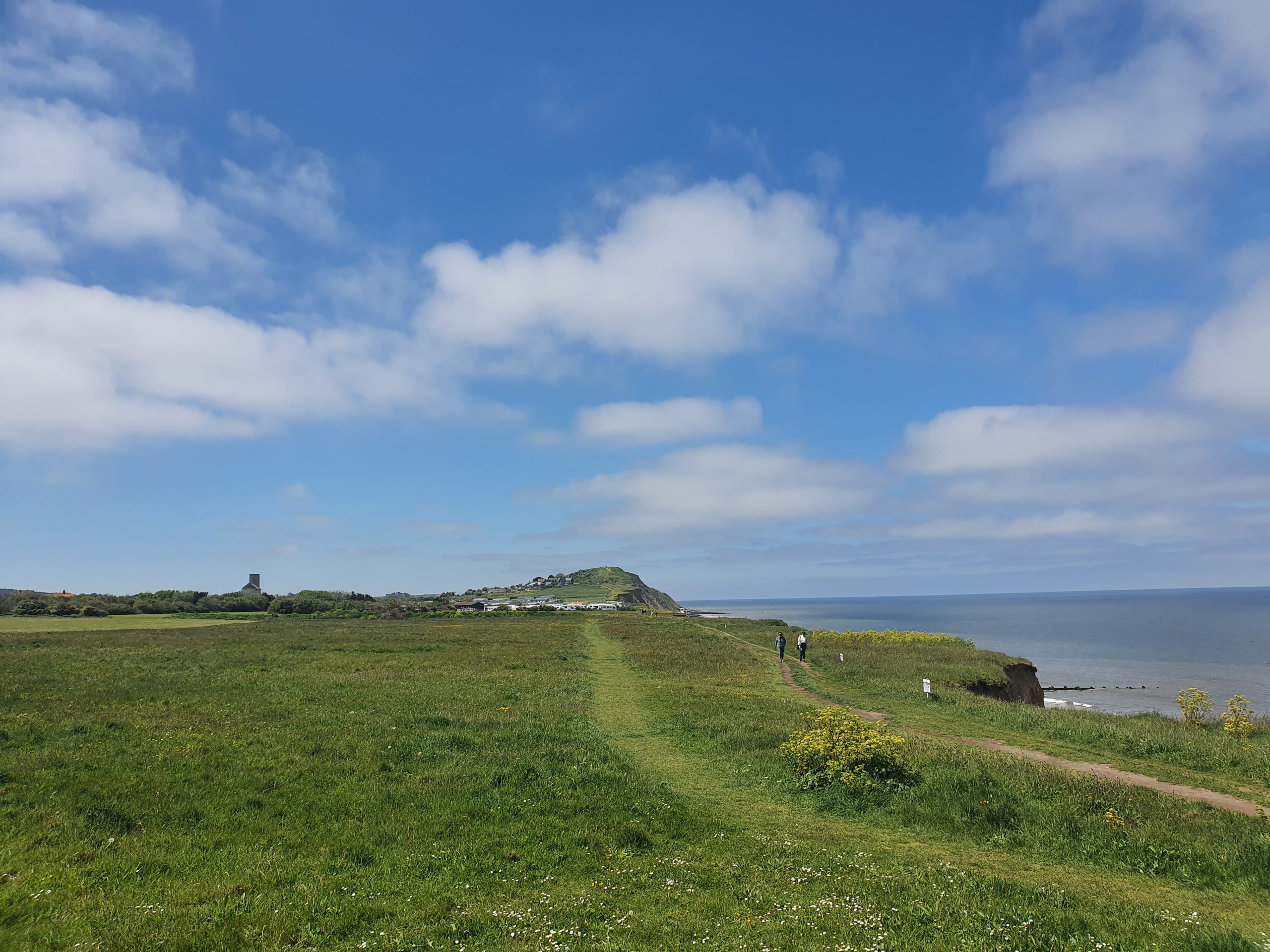
Here we are in North Norfolk on Sunday morning, with many thanks to Richard for taking me. In the background, looming high about the landscape, is the mountain of Beeston Bump. This mountain strikes fear into the heart of Norfolk walkers, towering above the footpath. And, Jayne and Malcolm decided that they’d summit this. Tough people…..

I was busy taking photos of the beach and sea, promptly nearly missing Jayne and Malcolm walk by. It’s that kind of care and attention that I can offer to events…..

The salubrious surroundings of the West Runton car park, listening to the car park attendant shouting at visitors. He scared me and I don’t even have a car…. There’s nothing like the welcome to the North Norfolk coast of an official shouting and gesticulating at a visitor “come back here, don’t you dare park there, come back” because a poor driver had got confused as to the admittedly confusing arrangements there were in place. Anyway, that has little to do with this post.
Jayne had a deserved little sit down, whilst worrying if I had eaten enough. I’m not sure that’s quite how the marshalling support system works, but I had a lovely custard tart, sixteen cheese straws and eight date balls. Jayne took a croissant to eat at an unstated future point of the walk.

Whilst moving to the next checkpoint set-up, Richard and I popped to McDonald’s in Cromer en route, which is one that I’ve never visited before. They’ve got one of the worst Covid-19 handling arrangements I’ve seen, involving more touchpoints and corralling customers towards each other than they had before the outbreak. Very bizarre set-up. Anyway, it’s a relatively new McDonald’s and I rarely go to them in the UK (other than twice this weekend), as pubs are usually too tempting. Staff were friendly though and the food was brought out promptly, which was useful as the confusing ordering set-up had put us in danger of missing Jayne and Malcolm in Overstrand.

More of the coastline, it was a beautiful route which they were walking.

I think this is Overstrand, and it’s somewhere around the 95 mile mark for our brave entrants. Brian and Kathleen had joined the walk to help, and they’d been assisting overnight, and it was a delight to see them given they’d helped me just a few weeks before. The LDWA has some really lovely people in it.

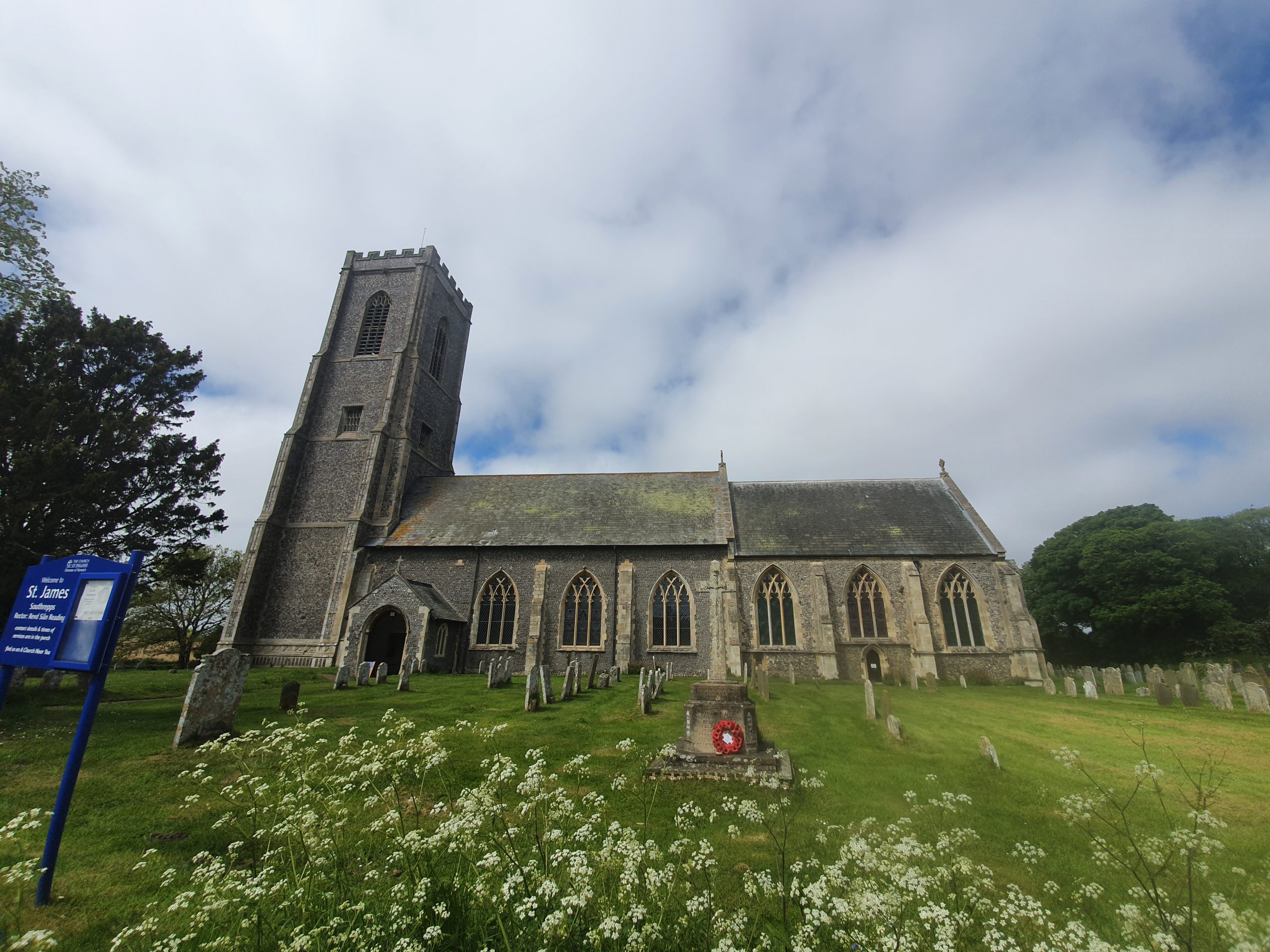
And there they are in Southrepps, going past the church which is often used as a checkpoint in the Winter Poppyline challenge event that the Norfolk & Suffolk group hold. That was the end of Jayne and Malcolm’s walk, 100 miles successfully completed in a very good time that I think was just over 32 hours. That is an excellent pace, showing what sort of times are achievement when entrants walk on the flat, something for us to consider when Norfolk & Suffolk group hold the event in 2025 at the AYCE 100.
The timing of this walk ending was very convenient, as it meant we could then go and see the group that was still walking near Ipswich. Thanks to Richard for his assistance in getting there, his support was much appreciated by the LDWA, and myself.

This is Sproughton church which is near to Ipswich, a countryside setting which is surprisingly near to a built-up urban area. On this walk, Hayley and Yvonne had dropped out before we could get there, but not before posting some huge distances themselves. Still going were Jane, Roger, Simon, Michael, Hilary and Paul, with Simon C having walked a shorter distance. I had thought that Hayley and Jane were only ever walking 60 miles or so, which is a massive walk in itself. However, Jane was still going. I was impressed.

It would be impossible not to single out Jane for one of the bravest walks that I’ve seen. Despite being in pain at 90 miles (and indeed before, but that’s when I saw her) she still persisted with the walk. I couldn’t have done that, huge credit to her for achieving that. And of course, the others were doing marvellously as well, with Simon struggling slightly, but that wasn’t a surprise as he had clearly pushed himself to match my time of a few weeks ago.

I’ve never walked along this stretch of the River Gipping, but it’s quite beautiful and we saw very few other people. It was lovely also to see Chelle and Fred for the last few miles, as unfortunately Chelle’s foot didn’t allow her to take part in the event this year. I heard a rumour that instead she’s walking the 100 twice next year.

Simon had a wait and a think by the river. He’d sort of agreed to take Jane on nine holidays if she could walk the last nine miles in, so he had a lot to think about, especially if they were camping holidays.

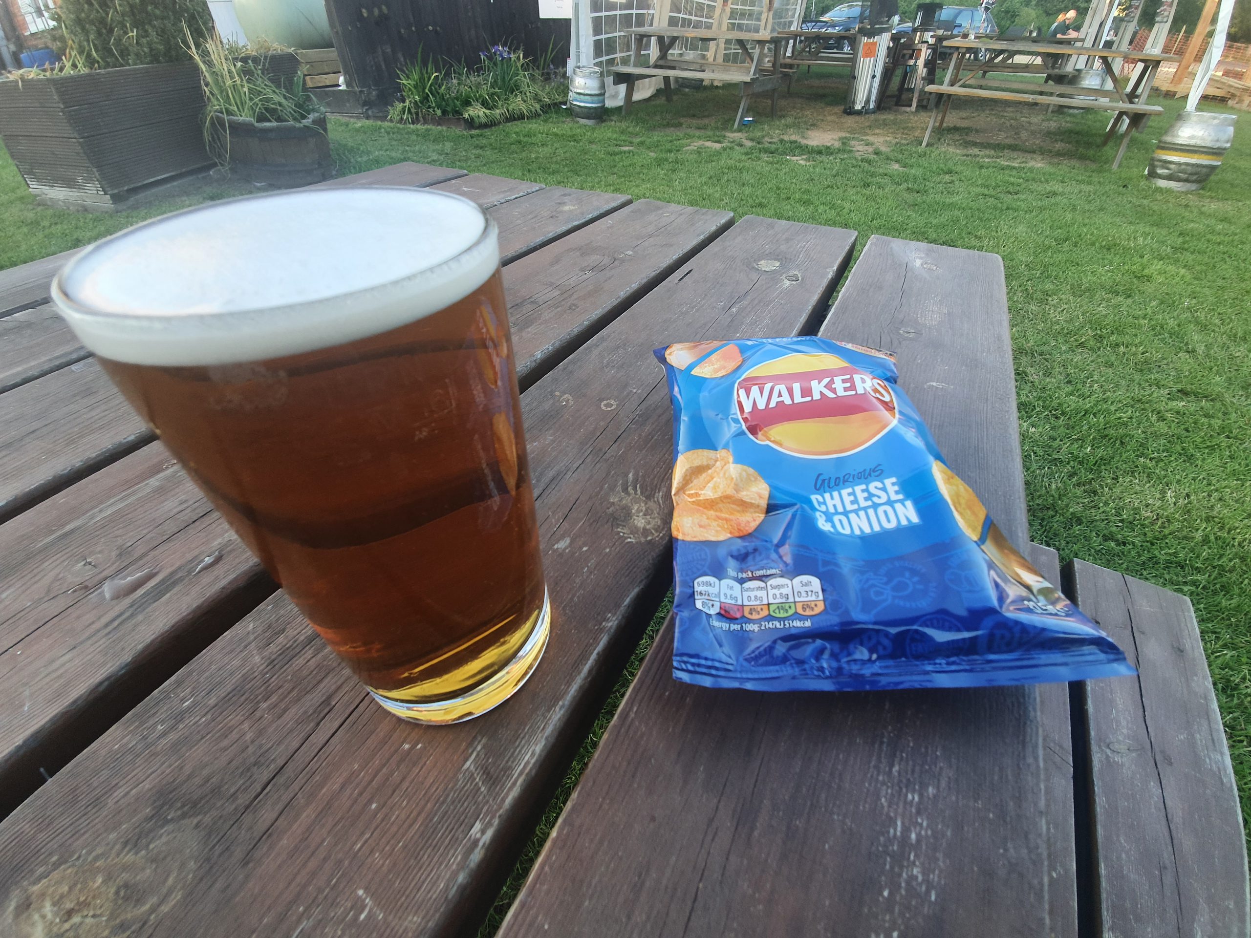
Richard and I had time to pop into the Sorrel Horse Inn, which was rather pleasant, but I’ll write about that separately as to not to distract myself writing about the appropriate temperature of beer in the middle of a walking post. It was a refreshing stop, as all this walking had worn me out. It was also another opportunity to try and update LDWA social media about the event, something I had been trying to do all weekend. It was a challenge, given just how many walks were taking place and seeing just how many photos were coming in. Thanks to Michael and Dave for their support with this, much appreciated.

And look at the bravery as Jane battles on. She was at around the 95 mile mark at this point. She’s going to have to win some sort of award.

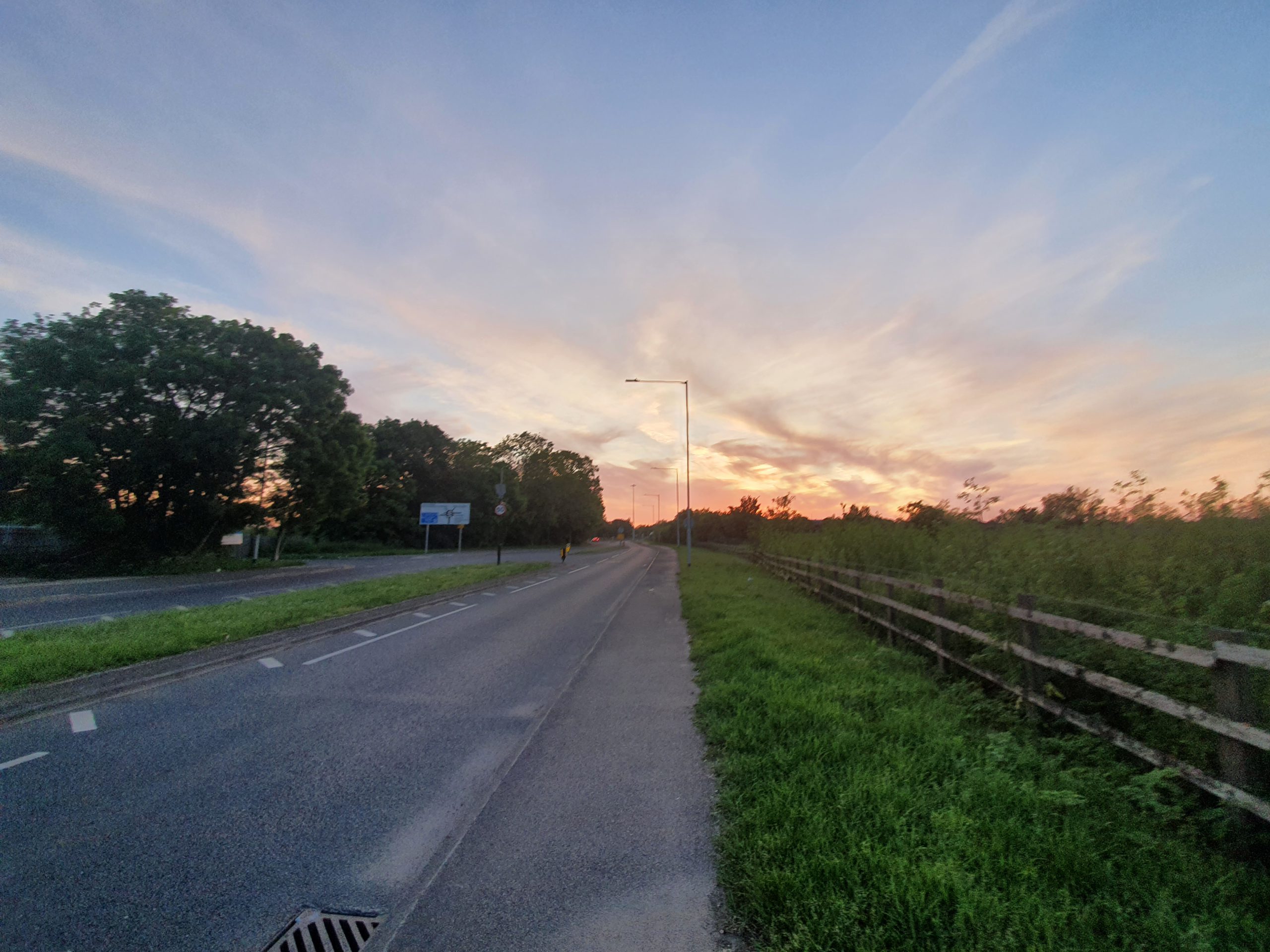
The sun was slowly starting to set, it really was a beautiful evening. It was sunny throughout much of the country during the weekend, even in South Wales, where I was told it always rains. And, at that point, I’d like to thank South Wales for their quite wonderful organising of this event. The national pandemic meant they didn’t get to hold the event in 2020 or 2021, a real blow given their years of planning to host the national LDWA 100. Their volunteers have been so warm and helpful, I do hope there’s another event held there in the future. Also, Jeremy and Chris from Norfolk & Suffolk group were walking the planned route in Wales as their LDWA 100 effort, and they got over 60 miles in, another marvellous achievement.

Something like 96 miles done now and although Jane was struggling, the pace remained steady.

Jane was surprised and delighted to see a hill, but there were steps up it.

This isn’t exactly a photo that will win a prize to go on the LDWA membership card next year, but here are Jane and Simon walking in for the final stretch. At this point, I’d say that Jane was looking quite energetic and ready to go. Unfortunately, she still had to walk another 0.5 miles around the garden when we got to the finish point, just to tick the distance off as being over 100 miles. It seems ridiculous to see people walking around a garden, but it’d be soul destroying to walk the event and then find you’d actually only gone 99.8 miles. To the outside world, it’d make little difference perhaps as it’s still such an amazing distance, but to a walker, it really isn’t ideal.

And in! Roger, Simon, Jane, Hilary, Paul and Michael all completed the walk, so it was a delight for me to see them all come in having finished the LDWA 100. It was nice to see Yvonne as well who was fortunately still in good shape, although I’m not sure yet on her thoughts about walking the event in future. Maybe best to ask in a few weeks.
And then they were all safely home. I’m not sure that I was much use in the whole arrangement, but I wanted to be present given the help that others had given to me on my 100 walk a few weeks ago. I think it’s also becoming apparent which of us are retiring from walking 100 events and which of us are just going to keep taking part every year.
As the outgoing chair of Norfolk & Suffolk group (what a marvellous two years it has been for everyone!) I’m incredibly proud of everyone who took part in our area. To Hayley and Yvonne on their 60 mile achievements (or around that, sorry if it was longer!) and to Jayne, Malcolm, Jane, Simon, Roger, Paul, Michael and Hilary for their 100 mile achievements. And, not to forget my 100 achievement of course, as I haven’t mentioned that for a few paragraphs. It was quite emotional to see so many completions locally, and also to hear of how entrants had been getting on around the country. The LDWA community came together, whether it was walking or supporting the walkers. How very lovely.