

OK, this isn’t exactly fascinating content, I just liked how the tree roots had forced the concrete and bricks apart. I’m easily pleased….
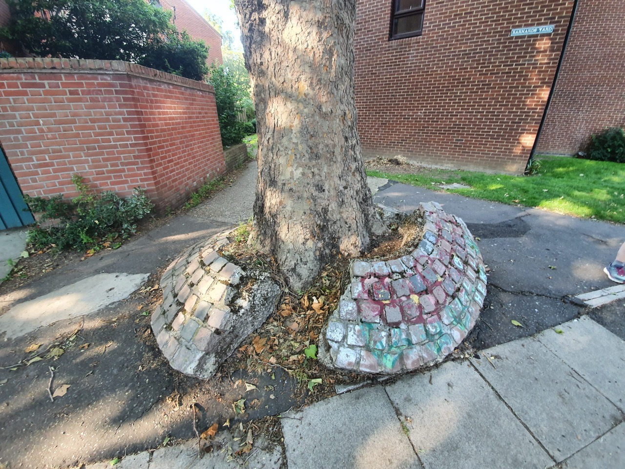
OK, this isn’t exactly fascinating content, I just liked how the tree roots had forced the concrete and bricks apart. I’m easily pleased….
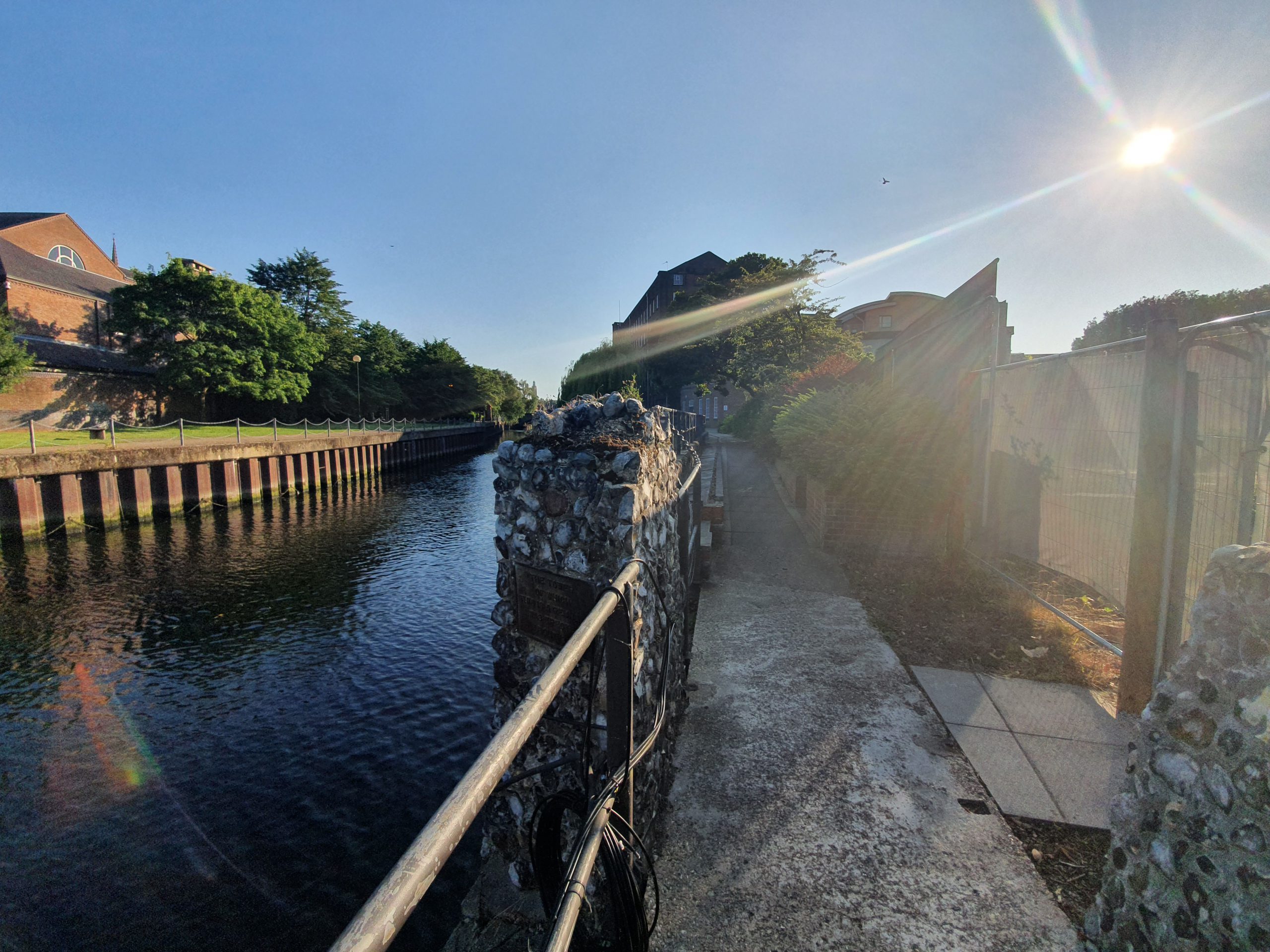

When walking in the city yesterday, Ron pointed out a sign which marked the remains of one of Norwich’s defensive towers. Although I knew about the line of the city wall, evident in the above map, I hadn’t paid much attention to the tower itself.

The tower, first erected in 1347, is just visible in this photo. It’s not known whether this tower pre-dates the wall behind it, as this was the final stretch of city wall that was completed and that work took place in the 1340s. It was likely they were constructed at the same time, and it would have been a boom tower which gave access to the walkway on the city wall.

This is on the north side of the River Wensum, with the riverside footpath going through the former tower.

I’d never noticed this sign before.

Another view of the tower.

It’s not possible to examine the rest of the city wall at the moment, as there’s a construction project going on along Barrack Street, but I imagine this will be treated sensitively as part of the works. There’s a lot more information about this stretch of wall at https://www.norwich.gov.uk/site/custom_scripts/citywalls/01/report.php.
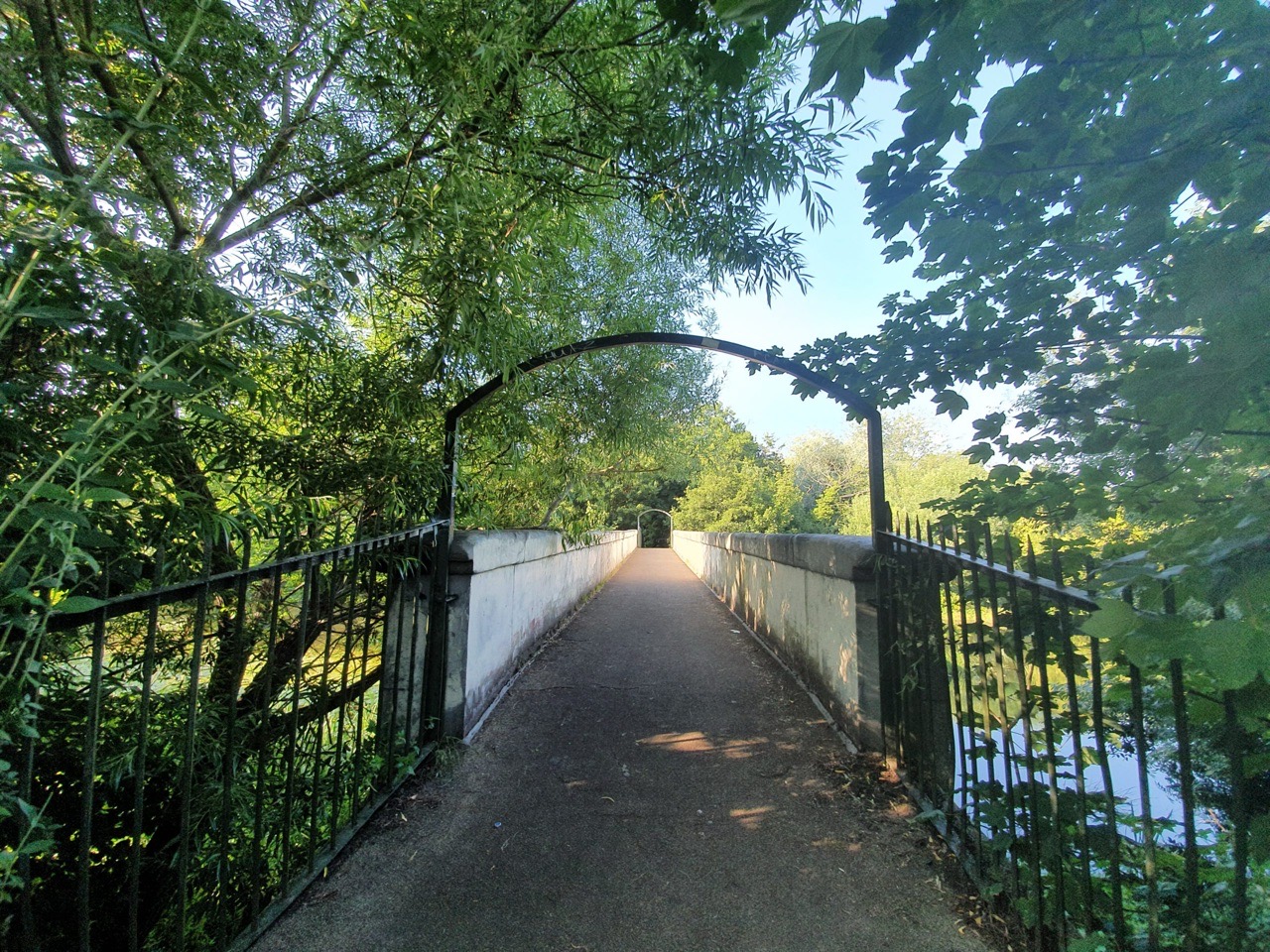

Long ago there was a ferry here, connecting what is now Heigham Street with Drayton Road, across the River Wensum. Initially, there were plans at the beginning of the twentieth century to build a roadway at this site, but the levels weren’t right and so a 6-foot wide pedestrian footbridge was installed instead.

At 12 noon on 15 December 1909, Dolphin Bridge was opened by the city mayor Ernest Egbert Blyth.


The views along the River Wensum from the bridge. The bridge takes its name from the nearby Dolphin Inn on Heigham Street, which was the former summer home of Bishop Joseph Hall, the then Bishop of Norwich who saw the puritans attack Norwich Cathedral. This rather grand property was used as an inn from the early seventeenth century and remained as a pub until 1999.
In January 1932, Robert Nelson, a milk roundsman (a lovely word for someone who performed a milk round) from 53, Philadelphia Lane in Norwich was fined 2s 6d for cycling along the footbridge. This does seem slightly harsh, but perhaps they had a wave of cyclists upsetting pedestrians.


Frederick Horace Claxton is commemorated at Skeyton War Memorial, the son of George Philip Claxton (born on 2 January 1860) and Emily Claxton (born on 18 January 1863).
This was a family of farm labourers, although there was a limited amount of other employment in the area that would give many other options. In the 1911 census, there were six people living in the Claxton household, George who was 51 at that time and Emily who was 48. Their children were Philip who was 18, Frederick who was 14, Ada who was 11 and there was also Emily’s mother who lived with them, Marie Saunders who was 79 and was born in Swanton Abbott. George, Philip and Frederick all worked at this stage as farm labourers. It was a large family though, at the 1901 census, the older children of George and Emily also lived with them then, Maud, Thomas and George.
Frederick was born on 19 April 1896 and was baptised with that name on 22 April 1896, although he was listed as Horace in the 1901 census. When the First World War started, he signed up and perhaps was excited by the adventure and chance to be with his friends. He joined the Norfolk Regiment, before later transferring to the Northumberland Fusiliers, in the 1/4th Battalion.
Frederick died on 29 October 1916 and his body wasn’t recovered, but he is commemorated at the Thiepval Memorial. This memorial in France commemorates the 72,315 men who died during the Battle of the Somme and whose remains weren’t found.
The 1939 register shows that Frederick’s parents, George and Emily, were living on their own in Neatishead. Frederick’s father, George Philip Claxon, died towards the end of 1945 at the age of 85. I wonder what he thought about seeing another conflict break out across Europe, thinking about the loss of his son just under 30 years before.
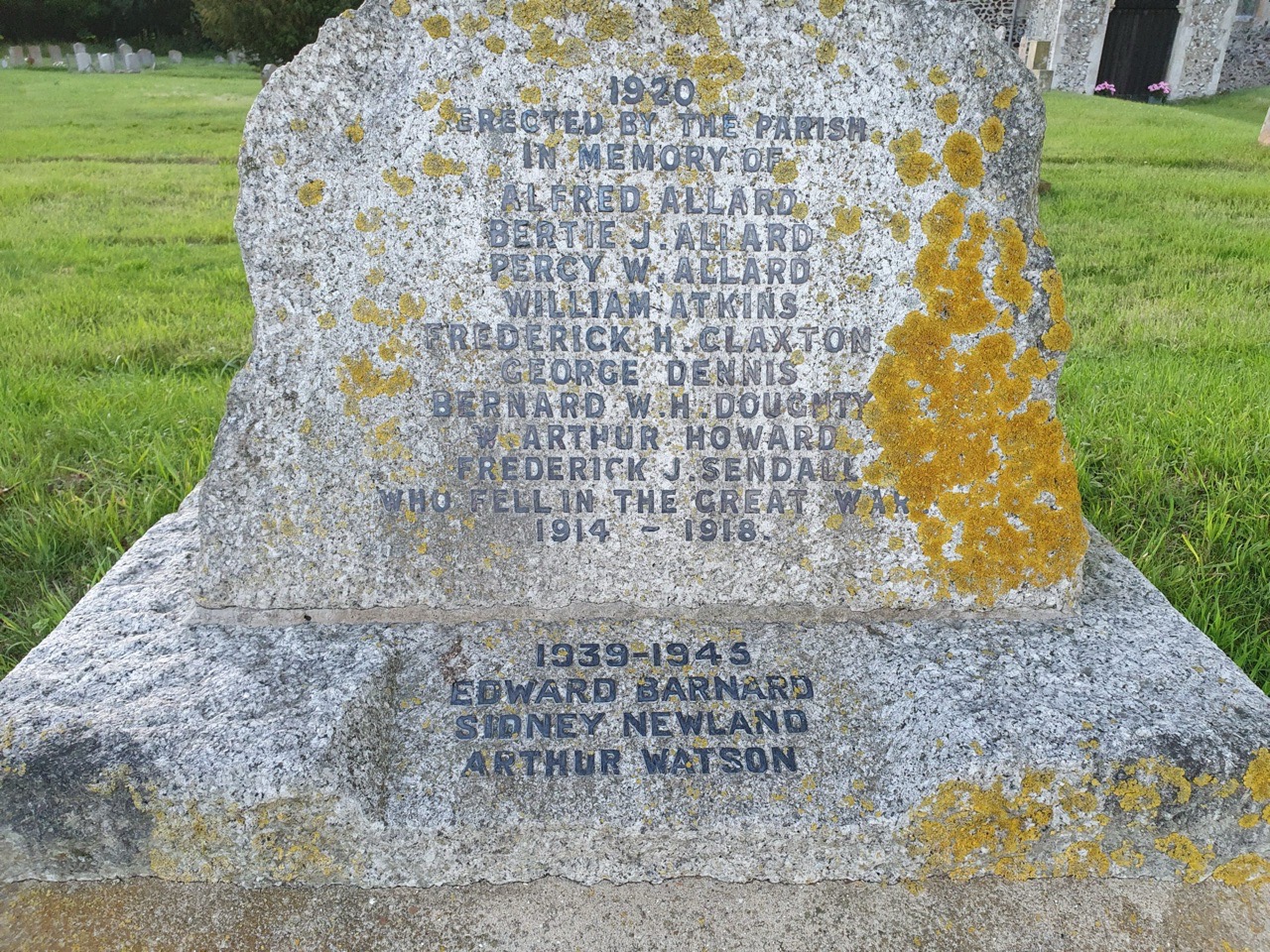

There are three brothers listed at the war memorial in Skeyton, Alfred Allard, Bertie Allard and Percy Allard. Sons of Edward John Allard and Ann Elizabeth Allard, Percy was the youngest of the family and at the 1911 census he was 11 years old and listed as being at school.
Now, I have to say, the bravery of Percy becomes evident taking into account he was 11 at the census, but managed to join the British Army in 1915 despite not being 18. No doubt wanting the same excitement as his brothers, he signed up by giving a false age. The army found out in 1916 and he was kicked out and sent home, although there was clearly a blind eye turned to many of these youngers and in one case the army managed to recruit a 12-year old.
Percy was though allowed to rejoin the army in late 1917 and this was despite knowing by then that his two older brothers had been killed. He joined the 6th battalion of the Queen’s Royal West Surrey Regiment and he went to fight on the western front. Percy took part in the Battle of Amiens, fought between 8 and 12 August 1918, but he was killed on 10 August at the age of 18.
Percy is commemorated at the Vis-en-Artois British Cemetery in France, never knowing that the Battle of Amiens was a victory for the allies which was important in speeding up the end of the First World War. Seeing these names on war memorials is one thing, but discovering the bravery that someone like Percy showed is another. But at what a tragic cost to his parents, the third of their sons to be killed.
I posted earlier about Alfred Allard, one of three brothers killed during the First World War, and commemorated on the war memorial at Skeyton. Bertie’s parents were Edward and Ann, with the 1911 census showing him still living at home with them, whilst he worked as a farm labourer.
Bertie John Allard entered the First World War with his service number of 85139, joining the 209th Field Company of the Royal Engineers. This company was one of three formed in Norfolk as a result of Kitchener’s request for more troops, with the three units becoming 34th division from 1915.
Bertie died, aged 23, on 1 June 1916 as a result of shelling and he was buried at Buire-sur-l’Ancre Communal Cemetery in France, one of just six Commonwealth soldiers to be buried there. His brother Alfred died just five days later in Mesopotamia, so their parents would have likely found out about both deaths at around the same time.
One of the saddest elements of the war memorial in Skeyton is that it commemorates three members of the Allard family who died, all brothers. They are Gunner Alfred Allard, Driver Bertie John Allard and Private Percy Walter Allard.
The parents of the men were Edward John Allard (born in 1853) and Ann Elizabeth Allard, who were living at Workhouse Corner in the village at the time of the 1911 census. At the 1911 census, there were five people living at that household, Edward John Allard, Ann Elizabeth Allard, Bertie John Allard, Kathleen Hetty Allard and Percy Walter Allard. Rolling back to the 1901 census, this shows that the family was bigger, with Edward and Ann as the parents, along with their children Louisa, Alfred, Alice, Bertie, Kathleen and Percy, along with their grandchild Spencer.
Alfred Allard, service number 30620, worked as a farm labourer before he went off to war. He joined the 72nd Heavy Battery of the Royal Garrison Artillery and was sent off to Mesopotamia, alongside men who had come from India and who formed the British Indian Army. It’s hard to imagine what a young man from a rural Norfolk village must have made of this, fighting the Turkish army in what is now Iraq.
Alfred would have seen the defeat of the British by the Turks in early 1916, in what turned into something of a capitulation in some aspects. He didn’t see the British fight back and gain back control in 1917, as he died on 6 June 1916 at the age of 28. I’m unsure of the reason for his death, as it didn’t appear to occur during military action, but he could have been wounded in the earlier conflict, or just became unwell.
Alfred is buried at Basra War Cemetery, but for the moment, this is not a peaceful location. The cemetery has been badly vandalised and desecrated and the Commonwealth War Graves Commission is doing everything it can to try and restore it. There is security fencing up and efforts are being made to get contractors in to restore the site, but it remains closed to the public and will likely remain so for some time.

Skeyton’s war memorial is located in front of the village church, commemorating the nine men who lost their lives in the First World War and the three men who lost their lives in the Second World War. The memorial is a listed monument and is in the form of a Celtic cross with the image of a sword.
Perhaps the most noticeable element of this war memorial are the three Allard brothers who died during the First World War, although more on them in a separate post. The memorial was installed here in 1920 and for friends and relatives of those who had died, this is all that they had because bodies of the dead weren’t brought back.
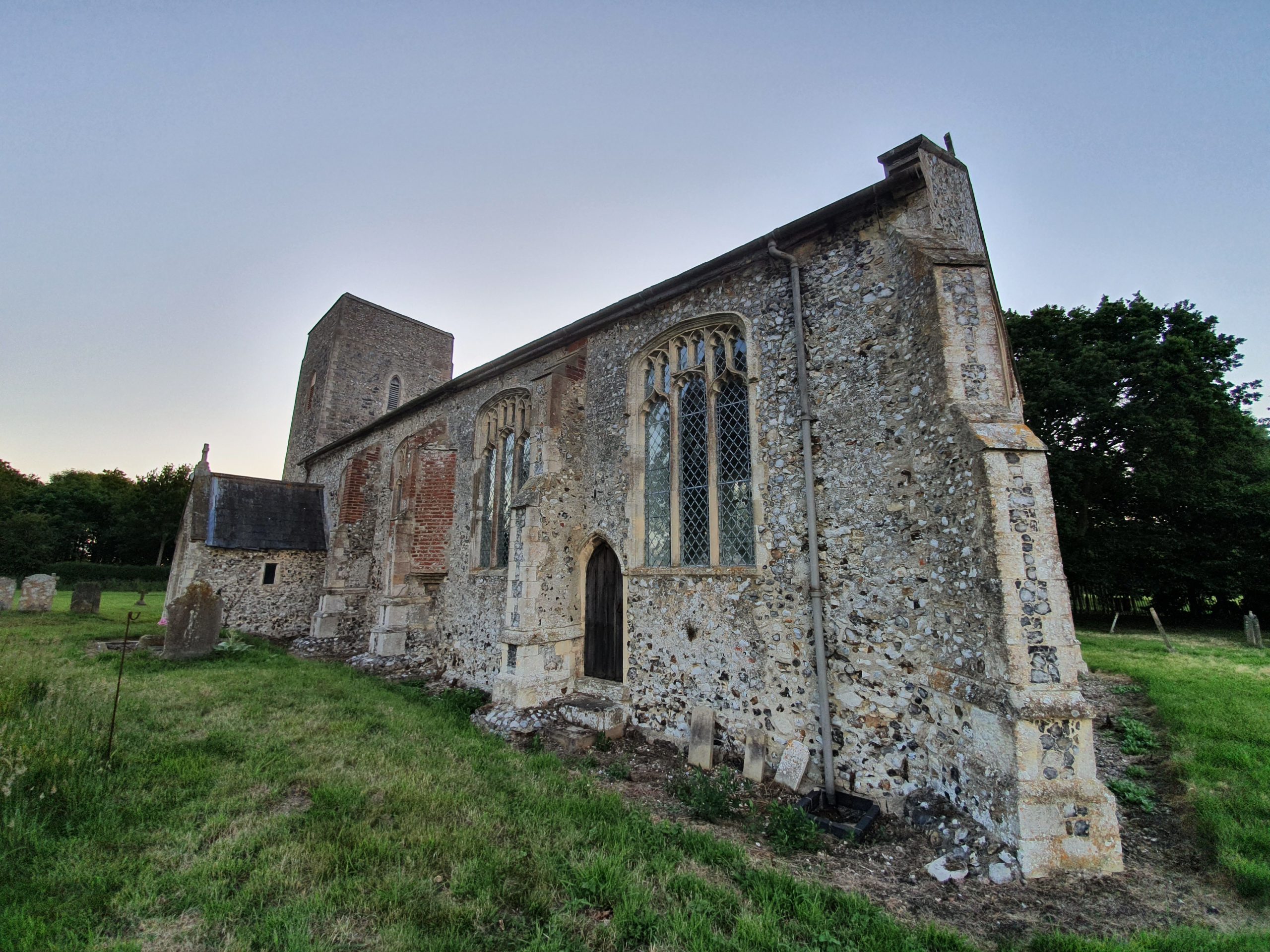

There’s something of a majestic beauty about Skeyton Church, pretty much alone in the landscape and there was likely an Anglo-Saxon church here. The current building is primarily from the late twelfth and early thirteenth centuries, although the church was reworked in the fifteenth century, including with the installation of the large nave windows.

The tower which was rebuilt in the fifteenth century and has meant that it’s all a bit off-centre.

One thing that I’ve seen posted relatively frequently over recent years is how people in the past respected religious buildings and wouldn’t have caused any damage to them. Unfortunately, this wasn’t the case and the newspapers are littered with cases of churches being vandalised. The Morning Post reported in January 1826 that “on Saturday night last, or on Sunday morning, some evil disposed persons broke the windows of Skeyton Church; they took the road to Aylsham, breaking windows in almost every house they passed; great hopes are entertained that such cowardly miscreants will be brought to justice”.


Some of the monuments in the graveyard are looking a bit bedraggled, but I like that they’re still there and haven’t been moved away to make things easier for the church to flatten out the ground.

Unfortunately, the current health situation means that churches are still generally closed, although the interior was apparently mostly redesigned in the early nineteenth century and not a great deal has changed since then. They were proud at the time of the carefully designed church benches installed in the nave, with their carved endings, whilst the former box pews were removed.

There was a modernisation and renewal of the building in 1937, which had apparently become unsafe, with the Bishop noting that “they had followed the way of their ancestors in renewing the white walls, this bringing light and brightness into the church”. I suspect their ancestors would have had wall paintings which were hidden under whitewash, but it’s interesting how once churches were colourful and heavily painted, but tastes evolved to just wanting white paint.
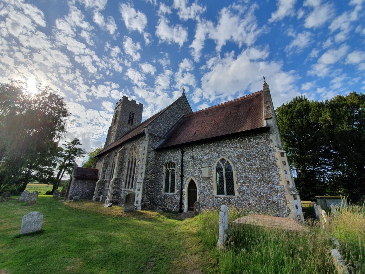

Although there was a previous church on this site from the Anglo-Saxon period, the current nave mostly dates to the fifteenth century and until relatively recently, the church would have been thatched. What is noticeable is that the chancel is at an angle to the nave, which the listed building record explains is known as a weeping chancel. The chancel was rebuilt in the 1880s (there’s a plan from 1887 here), using stone from the former chancel, likely on the foundations of the old structure.
Ian Hinton, from the UEA although he doesn’t specifically mention Lamas, wrote a document about weeping chances and there seems to be no single reason as to why they were constructed like that. It doesn’t seem that anyone knows why the chancel here is built like this, although Hinton gives plenty of suggestions as to why churches were once constructed in this manner.

The church tower, which was partly rebuilt in the 1880s.

The lean is also visible from the north side, with one of the doors bricked up. Incidentally, this church is sited in a rather tranquil location and it is also located by the peacefully flowing river.

This is a scratch dial, or a mass dial, and since the one at Ingham Church was explained to me by a guide, I’ve started to notice more of them. They are used as a sundial for canonical hours and there would have been a peg in the hole which would have cast a shadow. Having written that though, this one looks quite new and so is probably from the late nineteenth-century renovation.

I thought that this was quite a graceful tree in the churchyard.

Always sad to see stones broken, but at least they haven’t been turned into paving slabs.

The south porch which was renovated in 1977 for the Queen’s Silver Jubilee which the listed building record notes has a coffin lid step.

Sadly, I suspect that the readable element on this stone won’t last much longer.