Category: Norfolk

  • Norwich – Earlham Cemetery (Walter Harry Loades)

    Norwich – Earlham Cemetery (Walter Harry Loades)

    This is the war grave of Walter Harry Loades, located at Earlham Cemetery, but not in the main Commonwealth War Graves section.

    Walter was born in 1894, the son of Joseph and Caroline Loades (nee Chatton). He had an older brother, Sidney, and a younger brother, Reginald, and they lived at 24, Brunswick Road in Norwich (in a property which looks on Google Maps to have been pulled down). Walter worked as a clerk and I’d like to think that his life was peaceful (well, he was single anyway).

    Unfortunately, the First World War meant that Walter had to enlist, and as his service records have survived, there’s plenty of information about what happened next. He saw a medical officer in Grantham on 26 May 1916, with Walter bring described as healthy. The records are detailed enough for us to know that he was 5’6″ tall, with a 33 inch chest and a weight of 9.7 stone.

    He joined the machine gun corps and was sent as part of the British Expeditionary Force to serve in France. The records note that he was on a boat from Folkestone to Boulogne on 17 July 1916, then he was transferred to nearby Camiers the day after. On 23 July 1916, Walter joined his company, but was sent to a field hospital on 2 November 1916 with scabies, a common problem in the trenches.

    After returning to his company, Walter was badly wounded on 16 February 1917, with gunshot wounds to his legs, face, elbow and mouth. He was sent for medical treatment to the hospital shop Gloucester Castle on 9 March 1917, then transferred two days later to the Mill Road Infirmary in Liverpool. He remained there until 23 May 1917 when he moved back to his home county and the Norfolk War Hospital (later better known as St. Andrew’s Hospital) where he remained until 5 September 1917.

    Unfortunately, his medical situation remained dire and he was transferred to Tooting Hospital for treatment. He died there on 11 September 1918 at 15:00 with the doctor noting that his ‘spastic paraplegia’ was the cause of death. Walter was buried at Earlham Cemetery on Tuesday 17 September 1918 at 12:00 with his family present at his burial. The War Office seemed unaware of the burial and when enquiring was told that Walter’s father, Joseph, had arranged the burial for his son. This likely explains why this grave is in a different part of the graveyard to the war burials, with the headstone I assume being added at a later date.

    The declaration signed by Joseph on behalf of his deceased son, confirming the death and having that witnessed by Alfred Gates, the Vicar of Lakenham, who lived at 7 Newmarket Road in Norwich. Joseph died in the first part of 1939, so at least never saw the outbreak of another war which he thought his son had died in order to prevent. I can’t help but feel that this must have been endlessly traumatic for the family, not just a death but watching their son seriously injured for such a long period.

  • Norwich – Earlham Cemetery (Henry Rowles)

    Norwich – Earlham Cemetery (Henry Rowles)

    This is the war grave of Henry Rowles, located at Earlham Cemetery, but not in the main Commonwealth War Graves section. There’s not much information on this gravestone, nor indeed on the Commonwealth War Graves web-site, and I had expected another story of a young life cut short. Instead, I’ve been on an unexpected journey with Henry….. (and I hope I’ve got this story right).

    Henry Rowles was born in Witney on 17 February 1857, the son of Henry and Elizabeth Rowles. In 1861, he’s listed as living with his parents and siblings on the High Street in Witney, with his father working as a fuller. Things went a bit awry and at the 1871 census, Henry was listed as residing at Her Majesty’s Pleasure at Oxford County Gaol (which only finally closed in 1996). He had robbed a counting house with a friend called Henry Davis and was sentenced to four months imprisonment with hard labour. A Henry Rowles was executed at the same prison a few years later for murder, but they don’t appear to be linked.

    Anyway, by the 1881 census, Henry’s teenage waywardness had been rewarded (or punished, depending on how you look at it) when he was serving Her Majesty in the Dragoon Guards, training in Aldershot. For reasons unknown, he met Emma Jackson in Norfolk and they were married in 1883, being listed as living in Queen’s Road in 1891 along with their only child, Frederick.

    By the 1901 census, Henry had moved to 9 St Mary’s Alley in Norwich with his now much larger family, although he had lost two children. Bringing this story forwards to the First World War, it appears that he enlisted in the Royal Defence Corps. This was a unit that had former soldiers in, or soldiers who were too old, who weren’t sent overseas but instead performed guard duty roles in the UK, such as guarding bridges, structures or prisoners of war. It’s likely that Henry was doing the latter, as that’s what most members of the Corps were doing.

    When in service for the 155th company of the Royal Defence Corps, Henry died on 8 November 1918 with the flu, with his body being returned to Norwich for burial. Unfortunately, his military records have been lost and so there’s a chunk of the story here that can’t be told. But, I imagine Henry was an interesting character……

  • Norwich – Earlham Cemetery (Robin Henry Hubert le Brasseur)

    Norwich – Earlham Cemetery (Robin Henry Hubert le Brasseur)

    This is the war grave of Robin Henry Hubert le Brasseur, located at Earlham Cemetery, but not in the main Commonwealth War Graves section. Robin was born in 1884 in Hampstead, London, the son of Robert and Agnes le Brasseur.

    Robert le Brasseur was clearly a wealthy man, he had founded the law company Le Brasseur and Oakley in 1881, which still exists today in the large legal business now named RLB Law. In 1891, the family were living at 63, Belsize Avenue, with three servants supporting them. They’re also listed on something new to me, which is the 1893 Westminster Roman Catholic Census. The family were living at the same location in 1901, although things must have been going well, as they now have five servants to serve their every need and whim.

    The family then moved to Carey Street in London, which by chance I visited a few weeks ago in the hunt of the Victorian Star Yard toilets. I would say that the le Brasseurs might have used these toilets, but I suspect they probably didn’t, not given the huge property which they owned.

    But, back from this decadence to Robin. He was educated at Wimbledon College and although I can’t find his war records on-line, he joined the RAF and soon became a Lieutenant. By 1916, he was part of the No. 16 Squadron of the Royal Flying Corps, a dangerous unit to be in as flight technology was hardly developed at that point.

    Despite the dangers of his job, Robin didn’t die in a plane crash, but during a period when he was off-duty following service in France. Robin was travelling from Cromer to Norwich, but the tyre burst on his car near to the Plough & Shuttle public house in Marsham (that pub is still there, it changed name to the Flags in 1985 and then to the Plough Inn in 1999) which led to his car crashing into a house. The local press reported that Dr. Morton and Dr. Little came from Aylsham to assist, with Robin being taken by “a motor ambulance” to the Norfolk War Hospital (which later became known as St. Andrew’s Hospital in Norwich, which closed in 1998). Robin died at 7am the following morning, 24 May 1916, aged 31.

  • Norwich – Earlham Cemetery

    Norwich – Earlham Cemetery

    I’ve never visited Earlham Cemetery before, so I decided to meander along today as part of my walk from the city centre.

    This is North Lodge, built in 1855 and this entrance to the graveyard was for religious non-conformists. The building was used by the superintendents, one at each lodge, who resided and worked from the building.

    South Lodge, also built in 1855, which came onto the market in 2015 when it was sold by Norwich City Council, after having not been lived in since the 1920s. This was the property used by the superintendent at the Church of England entrance to the cemetery.

    These two photos are from the Jewish area of the cemetery.

    This is the Catholic chapel, with this and the Jewish cemetery mortuary chapel being the only two nineteenth religious buildings on site left. The beautiful Church of England and non-conformist dual chapel arrangement in the centre of the graveyard were ripped out in the 1960s and replaced by a crematorium designed by David Percival. Percival also designed St. Augustine’s Swimming Pool (since demolished) and the former Norwich Central Library, the one I liked and which unfortunately was destroyed by fire in 1994.

    One of the iron grave location markers.

    The Commonwealth War Graves area, although there are also some stones of others who died during the First and Second World Wars dotted around the cemetery. I’ve discovered since visiting that there’s an old military graves area, which I didn’t notice whilst meandering around. I’ll have to go back at some point to have a look at that (and I did, more about that here).

    The crematorium gardens. And below, just a few random photos from the cemetery grounds. It’s a huge site and although there were plenty of people walking around, it’s such a large cemetery that it still felt quiet and peaceful. A lot of the crosses on graves seem to have been tipped over to prevent them falling, but the general maintenance around the entire cemetery seems excellent.

  • Norwich City Centre to Earlham Cemetery (and back)

    Norwich City Centre to Earlham Cemetery (and back)

    I decided last week to make an effort to walk to some of the places in Norwich which I haven’t managed to go to, or haven’t realised existed until recently. I called them micro-adventures, although they’re not overnight ones. I’ll be glad when Nathan and I can get going on the next GeoGuessr challenge (where we select a random location using GeoGuessr and just go there on public transport and see what happens), I liked those  🙂

    Anyway, I was more on the lookout for things that I’ve never noticed before, so this walk was a little random. But there we go….

    I’ve walked by this sign in the Cathedral Close many times before and never noticed this plaque noting where the Cathedral Bell Tower used to be. Unfortunately, the tower was taken down in the late sixteenth century, otherwise it could have made for quite the sight for those entering the Close.

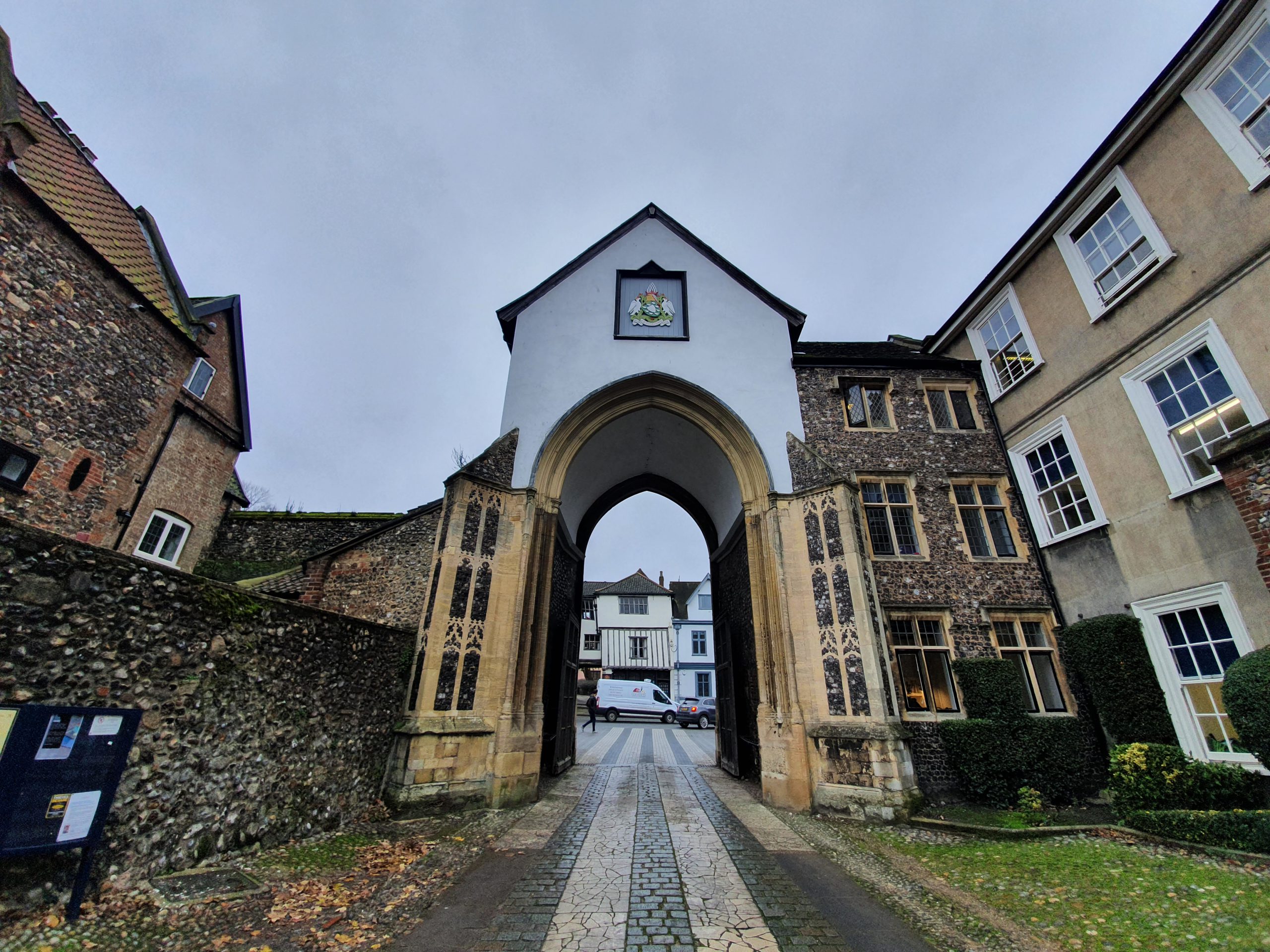
    At the moment, due to the latest reconstruction of Tombland (which seems to partly involve changing the last reconstruction from a couple of years ago), the Erpingham Gate in the above photo is temporarily taking all the traffic into the Close whilst the Ethelbert Gate is closed.

    This cut-through between Tombland and Princes Street shows the slightly wonky nature of the buildings here. I’ve walked this many times, I just like it….

    A plaque for the Maddermarket Theatre that I’ve never noticed before. As the sign notes, the theatre’s building started off as a Roman Catholic Chapel at the end of the eighteenth century, before becoming a theatre in the early twentieth century.

    And a sign noting where William Kemp morris danced his way to Norwich, apparently jumping over the wall of St. John the Baptist church to finish his adventure in 1600.

    The cut through underneath the church tower of St. John the Baptist Church.

    Another one of the city’s interesting markers showing where pubs once stood, in this case, the Farriers Arms between 1830 and 1895.

    In this case, the pub is actually still there, now trading as the Belgian Monk.

    A mural on the back of a wall on what I think might be the rear of Guildhall Tesco Metro, depicting the Castle, Cathedral and City Tower, part of the ‘City of Stories’ tagline.

    And another new one on me, this plaque is located on Dove Street and notes that it’s where Anthony de Solempne set up his printing business when he moved to Norwich from the Netherlands. It was de Solempne who printed the first book in Norwich, Belijdenisse Ende, a book in Dutch meaning ‘a Confession of Faith’.

    The Roman Catholic Cathedral in Norwich was designed by George Gilbert Scott, also called St. John the Baptist, with this one being the second largest Catholic Cathedral in the country. Last time I went here it was on a guided tour on the Heritage Day Open Weekend and the guide fell down the stairs. Which wasn’t ideal.

    I think I had known this but forgotten, but the Cathedral was built on the site of the City of Norwich Gaol, open between 1827 and 1881.

    The prison isn’t on many maps I usually use, but it is visible on this mid-nineteenth century tithe map.

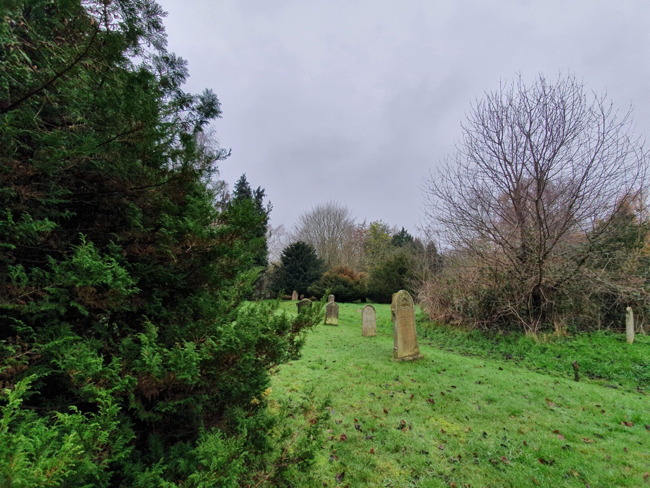
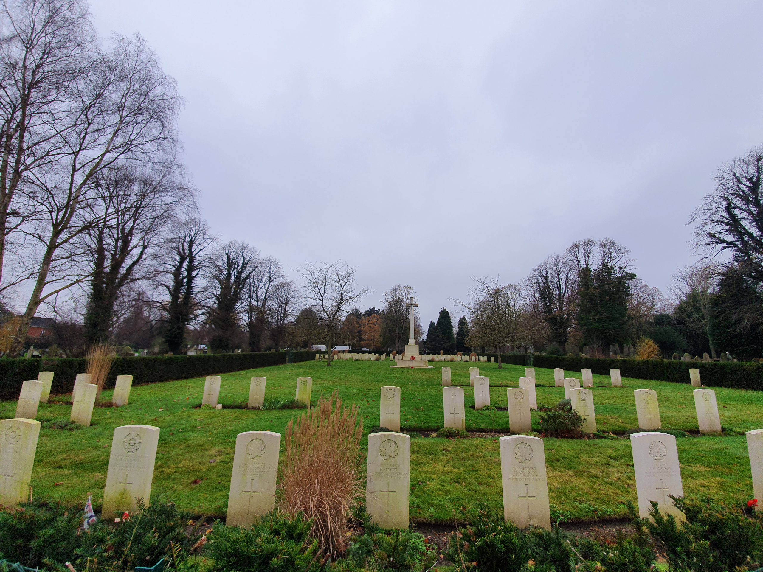
    I’ll write more about Earlham Cemetery in separate posts, but this is the war graves area. There was a friendly lady who was clearing weeds and tending the graves who noticed I was intrigued by the Polish graves and she pointed out where the German ones were. I only noticed later that there was a Commonwealth War Graves Commission van nearby, she seemed a very good representative of this enormously worthwhile organisation.

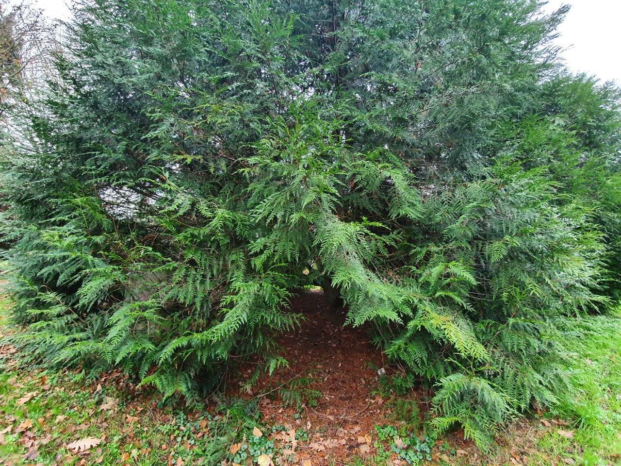
    A lot of the cemetery feels quite remote, but it’s well tended and cared for.

    One of the more impressive tombs. I went to look at the Jewish section of the graveyard and managed to get a little lost in the crematorium gardens, which were rather peaceful with the water fountain and quiet feel. I didn’t want to trample over their grass, so went back the way I came and managed to only just avoid a funeral procession.

    This is the site of the historic Earl of Leicester pub which the city council gave approval to demolish in 2005. What a marvellous idea that was, here it is in 2020 (the big green bit with nothing on it, not the houses behind it). I’m slightly surprised that the city council hasn’t tried to build a car park on the site.

    Unfortunately, Brasov Restaurant has now been closed and the building is being refurbished into something new.

    And this is the former JD Wetherspoon’s City Gate, which closed about ten years ago.

    The new student accommodation building that has been built on what was the car park to Toys ‘R Us. It’s in my opinion a depressing looking building, devoid of interest and entirely ignoring the city wall in front of it. Alumno Group, who designed the building, must have been delighted when this got approved by Norwich City Council. Anyway, I’m sure that it’s lovely inside.

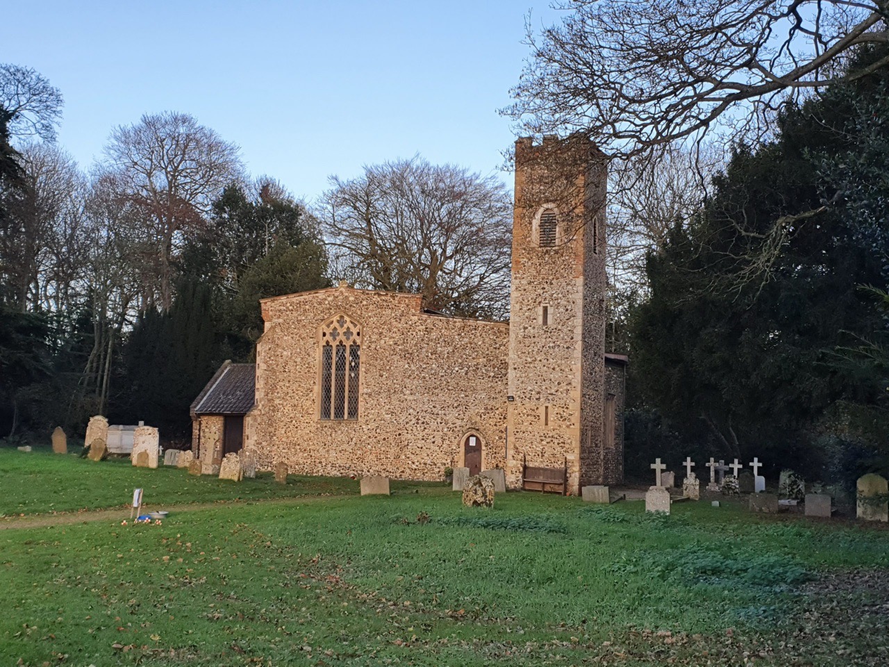
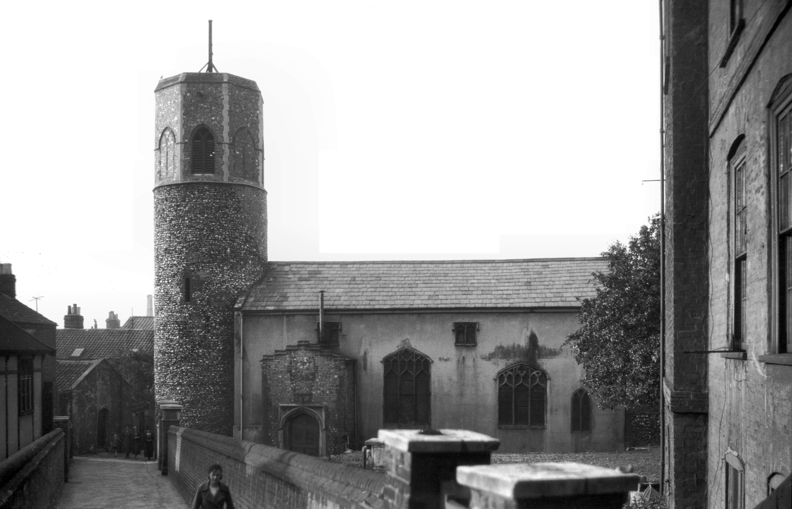
    I’ve never gone to investigate St. Benedict’s Church Tower and it’s hard to imagine that this is the same church as appeared in George Plunkett’s photo from 1934.

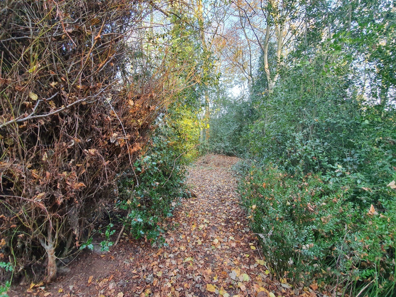
    Hales Court, which isn’t a path that I’ve seen before. Today it connects Cleveland Road with Chapel Field North, but the former road is relatively new, this was previously just all housing.

    Excuse my lack of graphical skills, but the green line is the old route of Hales Court and I took the photo from where that small red blob is. As may be evident, I’ve marked this map up myself and didn’t get professional help.

    And this is where Hales Court meets Chapel Field North.

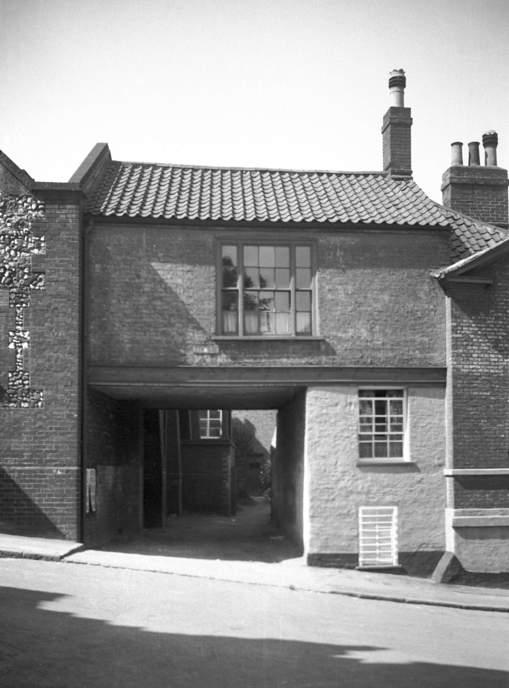
    Cow Yard, which has now been rebuilt behind that gate following the demolition of some older residential properties. George Plunkett has a photo of this from 1936.

    Something else that I’ve never noticed before, a plaque to the artist Henry Ninham who lived here.

    And here’s the house that Ninham lived in.

    An old stone sign embedded into the wall at Ninhams Court.

    Now renamed after the artist, this was formerly known as Master’s Court.

    And that put me back into Norwich city centre, having managed to see numerous pieces of history that I’ve paid no attention to before. It reaffirms my theory that there are always new things out there to discover, even in familiar areas, even if they are a little niche. The walk was about 5.5 miles and I spent a little longer in the cemetery than I had anticipated, but more on that in later posts…

  • Lamas – St. Andrew’s Church (1887 plan)

    Lamas – St. Andrew’s Church (1887 plan)

    This is the rather beautiful St. Andrew’s Church in Lamas, notable perhaps because of its off-centre chancel. And below is a plan of the church rebuild in 1887, with the kinked chancel particularly noticeable. The design of this plan was by Herbert J Green (1851-1918) and although the chancel was rebuilt, it was constructed on top of the previous structure.

  • Panxworth – All Saints Church (1846 plan)

    Panxworth – All Saints Church (1846 plan)

    I haven’t seen this plan before, it’s of the new nave for Panxworth Church which was designed by James Watson in 1846. It’s clear to see just how the Victorians got so many of these designs produced, it’s a generic plan which was rolled out. In the case of Panxworth, the building of the new section of the church was almost speculative as there wasn’t a congregation to support it and the nave has since been demolished.

  • Hainford – All Saints’ Church (the new one) – plan of building

    Hainford – All Saints’ Church (the new one) – plan of building

    This is the plan that John Brown (1805-1876) drew for the building of the new All Saints’ Church in Hainford, dated 1837 and so just before construction of the new church began. There were 74 seats on the pews, 201 free seats and 80 seats for children (these were located in the transept).

  • Spixworth – Name Origin

    Spixworth – Name Origin

    The above photo was taken from the graveyard of the rather lovely St. Peter’s Church in Spixworth. And this is what The Concise Oxford Dictionary of English Placenames writes about the village’s name:

    Spixworth, Norfolk. Spikesuurda in Domesday Book, Spicasurda in 1163 and Spicheswrtha in the twelfth century. Spic’s Word, the first element being a nickname, perhaps derived from spic ‘bacon’, or simply ‘bacon farm’.

    Firstly, that’s an interesting place to live, somewhere called bacon farm. Rolling back a bit though, the worth is from the Anglo-Saxon ‘weorthig’, meaning a protected place or some form of enclosed land. So, the meaning is either an enclosure belonging to a person called Spic, or, as suggested, a bacon farm (and the German word for bacon is still ‘Speck’). I think I prefer the bacon farm theory.

  • Spixworth – St. Peter’s Church

    Spixworth – St. Peter’s Church

    One exciting element about old buildings is that they often just don’t make sense (OK, they do to experts, but I mean make sense to me). There have been centuries of bits being added on, changed, removed, refurbished and faffed about with, ending up with a church that looks like this. But, this Grade I listed church is very much unique, and is more beautiful because of that.

    It took me a while to fully understand this building, but in the above photo, the vestry is on the left, then the nave with the larger window, then the south aisle and then the tower. The chancel is behind the nave and the tower once stood separate from the main part of the church. It is though likely that the tower was once connected to an older church, from the early Norman period, that was entirely removed.

    The dating is more complex, but the base of the tower was likely first, then the nave and chancel are fourteenth century, the south aisle is fifteenth century, the rebuilt tower is from the same period (although the different brickwork is from when the top of the tower fell down in the early nineteenth century) and the vestry is much newer (some records say late nineteenth century and some early twentieth, but I doubt it makes much difference to anything….). Or, that’s my best understanding of what is a complex building way beyond my architectural knowledge….

    This is the chancel, at the rear of the church.

    And, from the other side of the building, that’s the tower at the rear, then the south aisle in the middle and the side of the chancel on the right. The Victorians didn’t maul this building about too much, indeed the church was restored during this period since the roof was falling down and this wasn’t seen as ideal….

    An old pew being repurposed as an outdoors seat.

    Little stones, which I suspect would have been moved about by two boys that I know….

    The church has this rather lovely woodland trail, with burials alongside part of it.

    This is an internal note from the 1960s now released by the Church of England, although I’m not sure that the denizens of Spixworth would be delighted at the description of their “silly little tower”.