Category: Norfolk

  • Forncett St Mary – St. Mary’s Church

    Forncett St Mary – St. Mary’s Church

    I didn’t really understand this church when looking around it, there was a feel of some rather stark and blunt repairs to the building and an interior which seemed a little whitewashed. But, equally, it was in a good state of repair, a big effort had been made to put up some boards with some history and it all seemed in order. The true story of this church is though remarkable, it has been saved by the community after having fallen derelict. I’m deeply impressed at what has been done here over the last few years, and it explained why so many repairs had been needed. All really quite wonderful. Simon Knott has some photos of the state that this church was in just a few years ago and George Plunkett has a photo from 1992.

    The church on an old tithe map and it’s set back a fair way from the road.

    The church had fallen into a state of disrepair even though it is Grade I listed, with the bulk of the building dating to the thirteenth century, but the tower is a fifteenth century replacement from what stood before. The listed building record notes though that some elements of the nave are from the eleventh century, survivors of the earlier church.

    The chancel, which was repaired during an extensive 1869 restoration, led by the Reverend J Cooper. There were no end of events that took place in 1868 to raise funds for the repairs, showing some of the community effort that has again been notable in recent years.

    The Norwich Mercury reported in April 1870 about the reopening of the church and I like their general comment that “advantage has been taken of the necessary alterations and re-buildings which churches require to graft upon them the whims and fancies of architects, so that we have had a series of abominations perpetrated, at which none are now more ashamed than the clergymen themselves”.

    Fortunately, the newspaper liked the work that had been done at St. Mary’s, commenting that the architect JP Pearce had “followed and adhered to the plan of the original building”. The work had cost £1,000 and the chancel in particular had been heavily restored and a new chancel arch added, with new carvings and stoneworks throughout the church. The newspaper remarked that the thatched roof which “gave the church a poverty stricken look” had been replaced and new Staffordshire tiles had been laid in the chancel and nave.

    A blocked-up window, perhaps a victim long ago of wanting a window with a more modern design.

    The porchway has now been repaired and is in a good state of repair given how it looked just a few years ago in Simon Knott’s photo.

    The church was open and it one of those atmospheres which just felt welcoming, and I liked how there were some history boards up giving further information about John William Colenso. He was the rector of this church between 1846 and 1853 and he went on to become the first Bishop of Natal, in South Africa, a role he remained in until 1883.

    The inside of the church, looking towards the tower. The floorboards have had to be replaced as they had become damaged during the period that the church was derelict, but some of the tiles from the 1869 restoration are still visible.

    And looking along the nave into the chancel.

    There’s something really quite environmental (if that’s the right word there, perhaps not) about how someone’s remains can help the growth of a fine tree. I didn’t notice any early burials, so everything was from the nineteenth century onwards, but there’s an interesting note at the Heritage Norfolk web-site which mentions:

    “Burials did take place prior to this period but headstones were rarely used and multiple burials often occupied the same plot.”

    This helps answer my ongoing question about why are there are often so few headstones in churchyards in Norfolk, and perhaps it’s for the same reason here, that headstones were rarely used and the graves not always carefully marked.

    The new lych gate, with a chunky bench, all of which offers a positive first impression for visitors to the church.

    All in all, this is a glorious restoration and saving of a church which had become redundant in 1985 and then sadly vandalised in the years that followed. It’s disappointing that the Church of England abandoned this church, and they were talking about turning the building into a holiday cottage at one stage. Fortunately, things are much better again today, and what a marvellous community effort to bring this church back from the brink.

  • Norwich History by Parish : St. Julian (Section 1/2)

    Norwich History by Parish : St. Julian (Section 1/2)

    And a new little project that Jonathan and I are undertaking because this lockdown is clearly here for at least a few more weeks. It’s a bit niche (our project I mean, not the lockdown), I’ll accept that, but there we go. Effectively, it’s walking around Norwich, ancient parish by ancient parish and seeing what is there now compared to a map from the 1880s (the map above is from 1789, but the one from the 1880s is more detailed, which is why we used that). There’s a PDF of these boundaries to provide some extra background to this whole project.

    St. Julian is the eight parish we’ve visited and as can be seen from the above PDF, it’s split into two separate areas, with St. Etheldreda in the middle. Given the complexity of that, this post is just about the most northern of the two sections of the parish and the one containing St. Julian’s Church. The other half we’ll do next week (I can imagine the excitement that everyone has already…… or perhaps not…..).

    This is the Waterfront on King Street, a live music venue and club, with this artwork at the front giving some examples of bands and singers who have performed there.

    This is the Waterfront’s riverside drinking area, which is all rather lovely, and it’s on the site of the old mortuary.

    This is Abbey Lane (formerly known as Cockey Lane), with the Waterfront on the left-hand side, looking back towards King Street. It’s also where St. Clement’s Church once stood, in the former parish of St Clement at Conesford. It was united with the parish of St. Julian in 1482, but the church remained open, but fell out of usage in the 1560s. The building was still there in the eighteenth century and it’s though some parts of it might remain underneath the nineteenth century structure of the Waterfront. To add to the mortuary situation, there were numerous burials found here in the 1960s in the former churchyard.

    This is the next street along, Hobrough Lane, and this would have once led down to a ferry which crossed the River Wensum. Once the frontages on King Street would have had residential properties that the wealthy lived in, but over the centuries it all became more of an industrial area.

    This area has now been cleared, but this would have been Greenman Yard and there was a pub, the Green Man, standing where that wall is. This was a pub from the mid-eighteenth century until it was demolished just before the war and George Plunkett took a photo of it in 1936. I’ve written this before, but Norwich is so very fortunate to have had George Plunkett, as I can’t imagine there would have been many other photos taken of this pub.

    Much has been written elsewhere about Dragon Hall (not least this rather lovely volunteer guide from 2005), so there’s little need for me to add a great deal here. It’s a former medieval hall of national importance which was constructed in the early fifteenth century. Although it was constructed as a grand hall for a wealthy man, Robert Toppes, it got sub-divided up over the centuries as King Street became a place more for industry than decadent living. It’s a slight miracle that the building didn’t fall down by the early twentieth century and it was in quite a state. Properties behind the building were removed as part of slum clearance, but the council had the foresight to save Dragon Hall (a name it was given in the 1980s) and take it into their own ownership. Some forward thinking individuals turned this into a museum and its change into the National Centre for Writing is a slightly retrograde step in my view (I’d have liked the building to have remained a museum so its fine interior was accessible to the public), but in all fairness, the new organisation does allow visits to see inside.

    The building to the right (125-129 King Street) on the above photo is historically interesting, but it has been rather marred by the lower floor windows that have been punched into it. I remember this building as BB Adams, the electrical retailer, but it’s been boarded up for some time now. It looked much better as it was in this 1936 photo from George Plunkett.

    The entrance to Old Barge Yard, which takes its name from the pub which traded here from the middle of the nineteenth century until it closed in 1969. The window seats from the Old Barge Yard pub are apparently still visible inside the building.

    Old Barge Yard, which did lead to the River Wensum, although it has now been blocked off.

    One of the old doorways into Dragon Hall and this dates to the early fourteenth century when the building was being constructed, although the decoration is from the fifteenth century. George Plunkett has a photo of the doorway taken in 1935.

    Looking back along Old Barge Yard, towards King Street.

    This was the area behind Dragon Hall which was cleared during the slum removals of the 1930s. The entire site, including the flats behind, are now part of the Saint Anne’s Quarter project.

    Back on King Street, opposite Dragon Hall, is this entrance to Drays Yard. Although it has an historic sounding name, this isn’t original and is a new construct.

    St. Julian’s Alley and that wall to the left is a bit of a survivor. It isn’t the former wall of a building, just something that was built around a property boundary, so it’s done well to be kept and integrated into the newer structure behind it.

    This area hasn’t changed much over the centuries, it’s the churchyard of St. Julian’s Church and the alley named St. Julian’s Alley goes off to the left, straight ahead and to the right. George Plunkett has a photo from 1938 of the building which is behind where I’m standing, although this has now gone and there’s a modern residential property there now.

    St. Julian’s Church, from which the parish takes its name. As I visited here a few weeks ago, I’ll just link into that blog post. George Plunkett has a photo from 1946 which shows the damage which had been done to the building during the air raids, and the city is fortunate that this church was reconstructed.

    This is St. Julian Alley which now ends at Rouen Road, a poorly designed area of the city which has seen housing replaced by car parking and uninspiring buildings. This alley once led on to Crusoe Street.

    This is the view when standing outside of St. Julian’s Church, along what is now Kilderkin Way, but which was once the King Street Old Brewery. Thorn Lane used to stretch from Ber Street to King Street, so would have run through the middle of this site, but only the upper end of Thorn Lane remains. Most of this lies in another parish, so I’ll come back to this in the future. But, as an example, this is what Thorn Lane used to look like in 1938. This is a nicely designed street though which fits into the area well.

    Walking back to King Street, this is a former entrance to the school which sat behind St. Julian’s Church. More on this in a moment.

    Looking back down to King Street.

    This is the same alley as in the above photo from the other end, and it’s called St. Julian’s Alley, which complicates things a little as that’s also the name of the neighbouring alley mentioned earlier.

    This is the site of the school behind St. Julian’s Church, and the one that was accessed through the bricked up gate. I’m not entirely sure why the school is no longer here, perhaps destroyed by the bombing during the Second World War which destroyed most of the church. This is now a housing development called King’s Gate on the map, but is named as St. Cecilia’s Court on the road sign. I imagine that the latter is correct.

    There were two school buildings within the complex, a larger one and a smaller one, the latter survives. It’s now used by the Sue Lambert Trust, a charity who help those who have suffered from sexual abuse.

    The photos of the school site were taken on what is now Music House Lane, named after the historic building in the parish of St. Etheldreda. This is a new name, as this street was once the lower part of Horn Lane, which stretched from Ber Street to King Street.

    This photo is taken from Rouen Road, the new road that was built ploughing through housing that was torn down, looking towards King Street. Someone standing here 100 years ago would have seen St. Julian Street to the left, Horn Lane in front of them (and behind them) and Burleigh Street to the right.

    This is the former route of Horn Lane, and also the edge of the parish boundary. It’s now been blocked off and turned into a walkway, although Horn Lane does continue on the other side. That section of the lane has retained its name, but that’s in a different parish and a story for another day.

    It’s hard to imagine that this was once a thriving community, with people living on what was Garden Street, Bartholomew Street, St. Julian Street and Crusoe Street.

    Walking back down to King Street, that concluded this little meander. King Street is in pretty decent shape in historic terms, so much has been saved there, although there are numerous clumsy planning decisions which have led to some incongruous buildings popping up. The buildings on the site of the King Street Old Brewery are also decent and have retained some interesting architecture, but the area the council decided they’d demolish to build a giant car park is really an eye sore as it stands.

  • Forncett End – St. Edmund’s Church

    Forncett End – St. Edmund’s Church

    There are two medieval churches nearby, but this chapel at ease was built in 1904 to serve the growing residential community in Forncett End.

    The church had just been built when this map was produced, showing the growth of housing in this area.

    The foundation stone of the church was laid on St. Peter’s Day, 29 June 1904. Media reports at the time noted that the residents had needed to walk two miles each way to get to either Forncett St Peter’s Church or Forncett St Mary’s Church, so a new building had been desired for some time. It was only though when the livings of these two churches were merged that the finances allowed for the construction of this new building.

    All very Victorian/Edwardian in design, the project was expected to cost £700 in total, which was raised by subscription, fetes, concerts and numerous bazaars. The new church was designed to seat 110 people, with red brick used in the construction and Cossey brick windows. The work was undertaken by Messrs James & Chellis Humphreys, following plans drawn up by Arthur J Lacey, the Diocesan Surveyor.

    All of the money to construct the church hadn’t been received by the time the building got underway, so it was decided to construct the nave and porch in the first wave, with the second wave adding the chancel. As can be seen, the chancel never got built and the church now has to repair and replace this wooden end from time to time.

    This church was perhaps fortunate to have been built when it was, as the religious fervour of the nineteenth century was starting to fade away. In the decades that followed the great medieval church of Forncett St. Mary became derelict, and only recently has it been saved for the future. Instead of being a chapel at ease for the bigger churches, this is now a convenient size to hold services in, likely quite a cosy atmosphere. It never got its chancel, and I don’t suppose ever will, but at least it remains in use by the local community.

  • Tacolneston – All Saints Church

    Tacolneston – All Saints Church

    This is All Saints Church in Tacolneston and I was a little disappointed that it wasn’t open, but rather more disappointed to read in numerous places on-line that this parish has been, shall we say, perhaps slightly overly keen to keep their building closed to visitors over the last few years.

    On this, I’d add:

    “Our churches belong to everyone. Each stone marks the location where history happened and tells of a significant event in our nation’s story. They are steeped in history. And their architecture will inspire you. Few historic buildings are as easy to visit as a parish church. They are open and welcoming to all. During the week, many churches are unlocked during daylight hours, and those that are not have details on display of where a key can be found.”

    This is the Church of England policy on opening churches, and pandemic aside, I hope there’s more progress in this area over the next few years.

    Why does one church need three scratch dials (or mass dials for those who prefer that)? I have a theory that it’s because one might have been rendered over or just not seen as accurate as it needed to be. There’s something rather quite lovely though that these have likely been here since the medieval period, and were once really useful ways of knowing when the next service was going to be.

    Old graffiti inside the porch.

    The south aisle and the south porch. The building itself mainly dates from the fourteenth and fifteenth centuries, although these was a previous church here on this site before then. Francis Blomefield, the reliable Norfolk historian noted in the mid-eighteenth century that this church had been reconstructed in 1503 and he mentioned that the church was thatched when he visited.

    Why is there a kitchen sink at the base of the tower? I don’t know…. For those whose eyes aren’t drawn to this eyesore at the base, the tower itself was built in stages between the fourteenth to sixteenth centuries.

    The north doorway, with some random lump of metal by its side.

    The priest’s door.

    A rather pretty little churchyard. The rear section of the church was partly covered by ivy until recently, fortunately now removed.

    And, I have no idea. The random bits and pieces around the church made it feel like something of an art installation.

    Inside the church there is an historic section of the rood screen, an old font and numerous other interesting items of note, and hopefully I’ll get chance to go back when the building is open to see them.

  • Wreningham – All Saints Church (James Ebden)

    Wreningham – All Saints Church (James Ebden)

    This is the gravestone of James Ebden, located in All Saints Church in Wreningham. It caught my eye as the right-hand side of the grave was never filled in, a husband and wife that aren’t both listed.

    James Ebden was buried on 7 March 1836 and the church’s burial record notes that he was aged 59, although the grave says that he was aged 60. A little unusually in terms of the records of this church, but James’s residence was listed as being in Lakenham and not in the village itself.

    The name of James’s wife was Bathsheba Bates (a religious name that wasn’t uncommon, but is much rarer today), which isn’t perhaps entirely clear from the grave itself, and the couple had been living at Portland Place in Lakenham. She was buried in the church on 30 December 1859, but her name doesn’t appear on the list of gravestones which have survived.

    There seem to be two possible outcomes here, since I can’t imagine she ever remarried and she never changed her surname. She was either buried with her husband, but there was no money to complete the inscription, or, she was buried elsewhere in the graveyard without a stone because no-one realised to connect the couple.

    One source notes that the couple had one child, James Ebden (1811-1874) and at first sight that would make the situation strange, as this situation would have been something that he could have resolved. However, the only James Ebden listed as alive in Norfolk in 1871 was at Bethel Hospital which was then listed as a lunatic asylum (better known now as a mental health hospital) in Norwich, which might explain why he hadn’t intervened.

    There’s some guesswork here from me, but I suspect that the couple have been buried together, but there was no money to pay for the stone to be inscribed, hence why it was never completed. I do rather quite hope that the couple were reunited in death.

  • Ashwellthorpe – Village Sign

    Ashwellthorpe – Village Sign

    As another one of my random asides, I thought that this was one of the more interesting and creative village signs that I’ve seen. Village signs became popular in the early twentieth century when King Edward VII saw a sign in Norfolk that he liked and he thought that they were a marvellous idea, so the numbers spread quickly.

    I thought that this was all rather modern in how it looked.

    However, the sign was created back in 1977 to mark the Queen’s Silver Jubilee, and it appears to be well ahead of its time. The current sign is some sort of more plastic replacement for the original which seems to have somehow fallen apart in the 1990s, but the design was kept exactly the same (I think).

    All Saints Church stands behind the village sign.

    This depicts the tombs of Sir Edmund de Thorpe and Lady Joan de Thorpe (and dogs at their feet), located in the church.

    A reference to the Knyvett Letters, which included correspondence from Oliver Cromwell.

    And perhaps my favourite, the dragon door knocker thing (that’ll have to do as my technical explanation) from inside the church.

    And here’s the real one. Unfortunately, the church was locked so I couldn’t get photos of the tombs.

    Definitely a very creative village sign, with the style of font (I mean in terms of printing, not the font in the church) still feeling modern.

    Also, whilst trying to search for more information about this sign, I found an article from the Sunday Mirror in 1978 which noted:

    “Farmer Cyril Muskett has dropped plans for a US trip by Concorde and is giving the money to his local parish church at Ashwellthorpe in Norwich for their church repairs”.

    What a very admirable decision.

  • Wreningham – All Saints Church (John Henry Ireland)

    Wreningham – All Saints Church (John Henry Ireland)

    There are two Commonwealth war graves listed in the churchyard of All Saints Church in Wreningham, and neither of them have the traditional shape and style of stone as the families must have opted for something unique. This made identifying them a little more difficult, although fortunately the CWGC provide details of their approximate location in the churchyard. For anyone wanting to find this grave, it’s in the north-east part, behind the church and just a short walk from the chancel.

    This grave commemorates the life of John Henry Ireland, the son of William and Sarah Alice Ireland. It also lists the death of his younger brother, Robert, who died on 12 October 1916 and is commemorated at the Thiepval Memorial in France. There was also another brother who went to fight in the war, but he survived the conflict.

    This makes the 1911 census relevant, and indeed poignant, as it is a snapshot of time for this family when there was perhaps lots of hope for the future. The family lived in Wreningham, with William (aged 56) working as a farmer, Sarah Alice (aged 51) looking after the house, William John (aged 26) working as a groom and cowman, Robert Ireland (aged 21) working as labourer, Martha (aged 14), John Henry (aged 11) who was at school and Florence (aged 7). In total, William and Sarah Alice had ten children, of whom one had died by the time of the 1911 census.

    When the First World War broke out, John Henry would have been 15 and it must have all felt very distant for him, although his brothers were already off to war and so he would have been aware of what was going on. Perhaps early on he was quite excited about going to fight alongside them, but his brother’s death in 1916 must have been very tough to deal with. And John reacted to that by still going to serve his country, a decision of some bravery.

    During his time in the military, he served as a private in the 7th battalion of the Royal West Surrey Regiment, with service number 70053. I don’t know what he was doing in that regiment (I have little knowledge of the make-up of regiments during this conflict), but this had been formed as one of the new armies (or the Kitchener Army). Unfortunately, his war records haven’t survived, another loss during the Second World War air raids over London.

    The grave gives more information than usual about the events that led to the death of John. It notes that he was injured at Albert in France on 2 August 1918, which is part of the Somme region. He was unfortunate, the Hundred Days Offensive started in early August 1918 and was the last major conflict on the western front that took place during the First World War. John was returned home to the UK from France, but he then died of his wounds in Newport, Wales on 26 November 1918. John died at the age of just 19. His body was then returned to the village where he grew up, and probably had rarely left before he went off to war.

    The 1921 census will be published in early 2022 and for this family, the ten years were certainly ones that they could never have been imagined when they completed their previous forms a decade before. The two young men were injured very close together, although a couple of years apart, as Thiepval is only about five miles from Albert.

  • Norwich – Speeding, Road Rage and Hit & Run in 1871

    Norwich – Speeding, Road Rage and Hit & Run in 1871

    150 years ago this week, there was a case heard in the Shirehall in Norwich with a Mr. J. Longs in the chair and it’s quite an early case that combines speeding, road rage and hit & run. I’m not sure that I’ve read about an earlier case involving these breaches of road etiquette, but I’m sure that Colonel Custance wasn’t entirely pleased to hear about this incident.

    Incidentally, the above image is from Attlebridge, on the old Norwich and Fakenham turnpike road, although I don’t know where exactly the accident took place.

    I shall quote the case from the Norwich Mercury:

    “William Dann, teamman, in the employ of Colonel Custance, was charged with driving furiously on the Norwich and Fakenham turnpike road on Tuesday last, and causing wilful damage to a cart driven by Mary Ann Fisher, of Reepham. It appeared that the complainant was driving home from Norwich when she overtook the defendant, who was at that time driving quietly. After passing him, however, defendant whipped his horses and dashed along, apparently with the view of getting before the complainant, who drew close to the edge of the road, but could not avoid a collision.

    The result was that defendant’s wagon caught the wheel of complainant’s cart, smashing it to pieces. The woman was thrown out of her cart, and became unconscious, but notwithstanding this, the defendant drove on without rendering any assistance. The amount of damage the defendant had already agreed to pay, and pleading guilty to the charge, he was now fined 5s and £1. 9s. 6d costs”.

  • Norwich History by Parish : St. Etheldreda

    Norwich History by Parish : St. Etheldreda

    And a new little project that Jonathan and I are undertaking because this lockdown is clearly here for at least a few more weeks. It’s a bit niche (our project I mean, not the lockdown), I’ll accept that, but there we go. Effectively, it’s walking around Norwich, ancient parish by ancient parish and seeing what is there now compared to a map from the 1880s (the map above is from 1789, but the one from the 1880s is more detailed, which is why we used that). There’s a PDF of these boundaries to provide some extra background to this whole project.

    St. Etheldreda is the seventh parish we’ve visited and is one of the smallest in terms of its physical size. When we started this parish I had wondered whether there would be much of interest, as great swathes of it have been destroyed and replaced with modern housing. However, some elements remain and it was a suitably intriguing challenge to work out where the roads once were in relation to where we were standing.

    As for the destruction of much of this parish, which was partly pre-war slum clearance, partly air raid damage but mostly post-war clearances. It’s easy to be critical of the council that they destroyed so much history, but that should be tempered with the situation that they had residents needing decent housing, they had war-damaged properties and also poor quality housing. It’s too simplistic perhaps to just condemn the council for bull-dozing history given the limitations that they had.

    However, even after noting that, I personally think that the council made substantial mistakes with this huge rezoning. They retained little, with most streetlines being lost and the heritage they could have saved was just bulldozed away. There was all manner of local opposition and numerous historic buildings were lost, despite the hopes of locals that they could be saved. The council by all accounts disregarded these attempts to save elements of the area, which is perhaps a great shame.

    So it all means that there is no anchor to the past, they created a new community that feels a little separate from Norwich city centre, despite it being a very short walk away. The council demolished Mariners Lane which connected King Street to Ber Street and broke the direct link between the two areas. Instead, they ploughed a new street, Rouen Road, through the middle of what was once housing which now has several car parks and under-used sites along it.

    It appears from the media that the reason that the council did this was because they initially expected the site to be entirely reused, even as a university site, although the University of East Anglia were attracted by more spacious surroundings outside the city centre. This would therefore make more sense in terms of demolishing the area, although perhaps the council might have got clarity on that before tearing everything down.

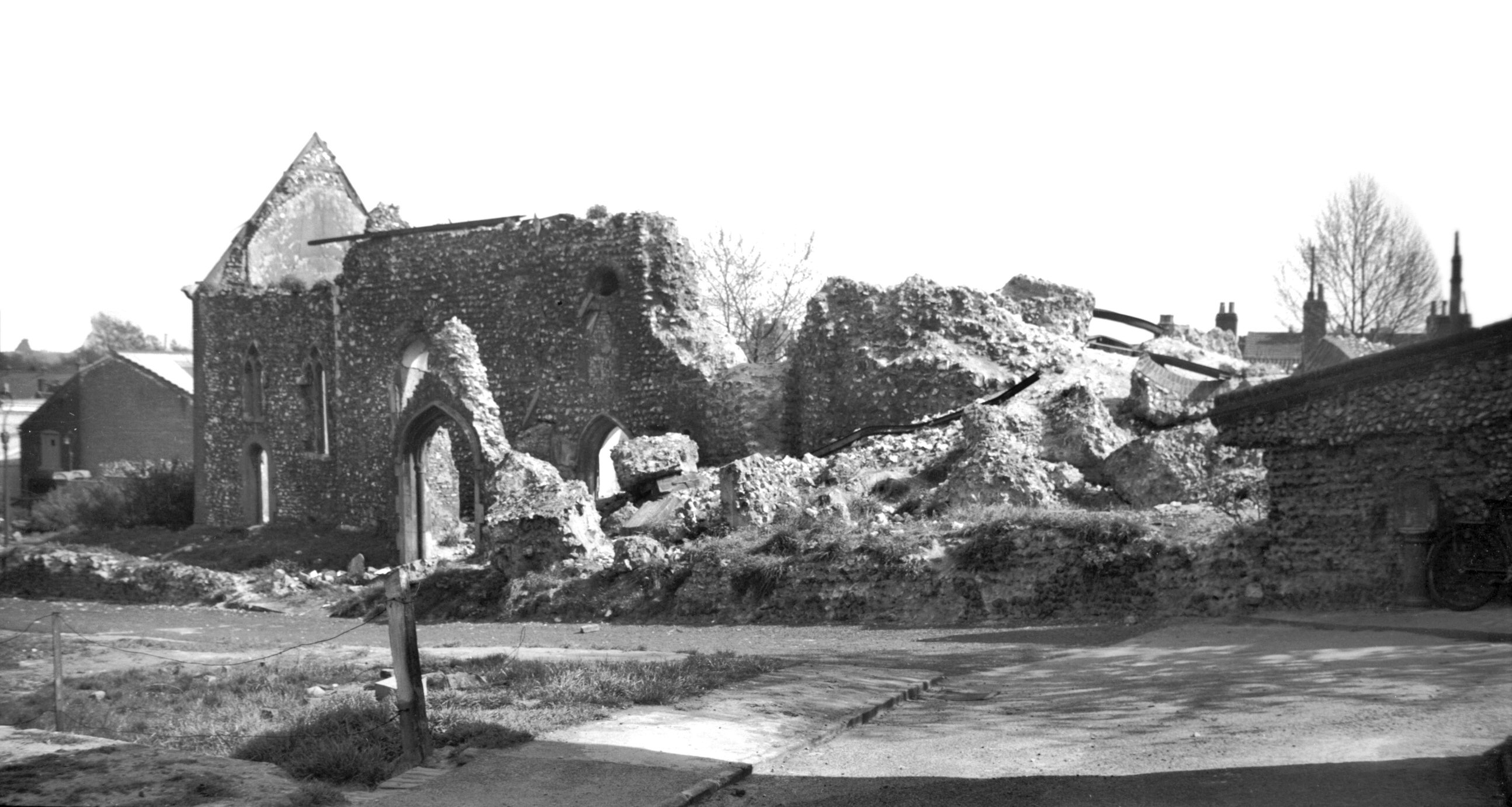
    The EDP has a photo of what this area looked like in the early 1960s, and that street heading down to the middle of the photo is Mariners Lane.

    And here is that same location today, Mariners Lane, which is now a cul-de-sac leading off from Ber Street. This is in St. John De Sepulchre parish though, so we mostly ignored this today.

    This photo is taken at the base of the hill, looking at Normandie Tower, which is I think the only tower block in Norwich City Centre. I initially thought that this piece of hill was original, but it isn’t, this is where Mariners Lane came down.

    This photo is taken in the same place as the previous one, but facing the other way and looking at Rouen Road.

    Clicking on the above map makes it bigger. I was standing on the final T of “William Street” on the map when taking the photos, with Normandie Tower being pretty much on top of Compass Street.

    Now standing on Rouen Road at what appears to be some sort of temporary bus station that First have created for themselves, with Normandie Tower in the background.

    This is the route of Mariners Lane, now demolished here.

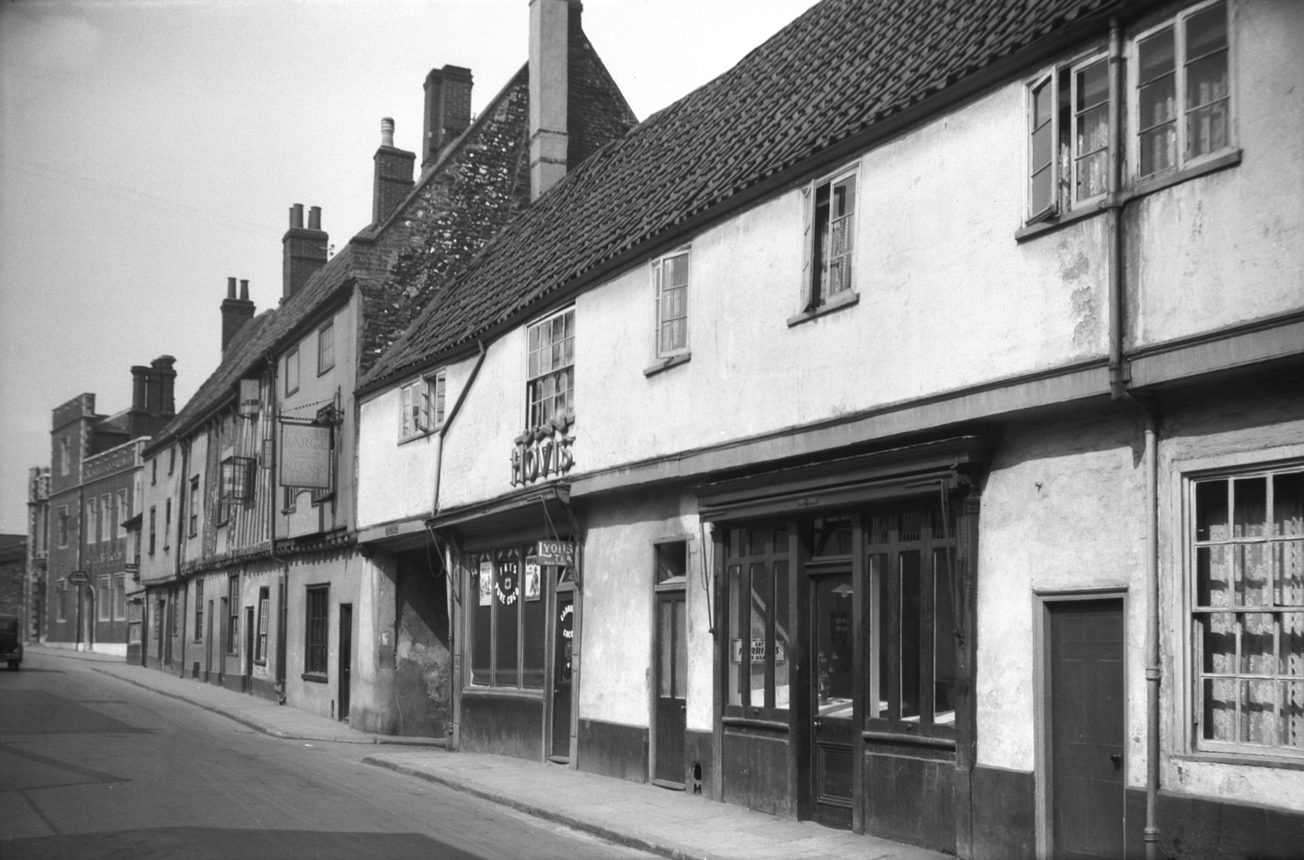
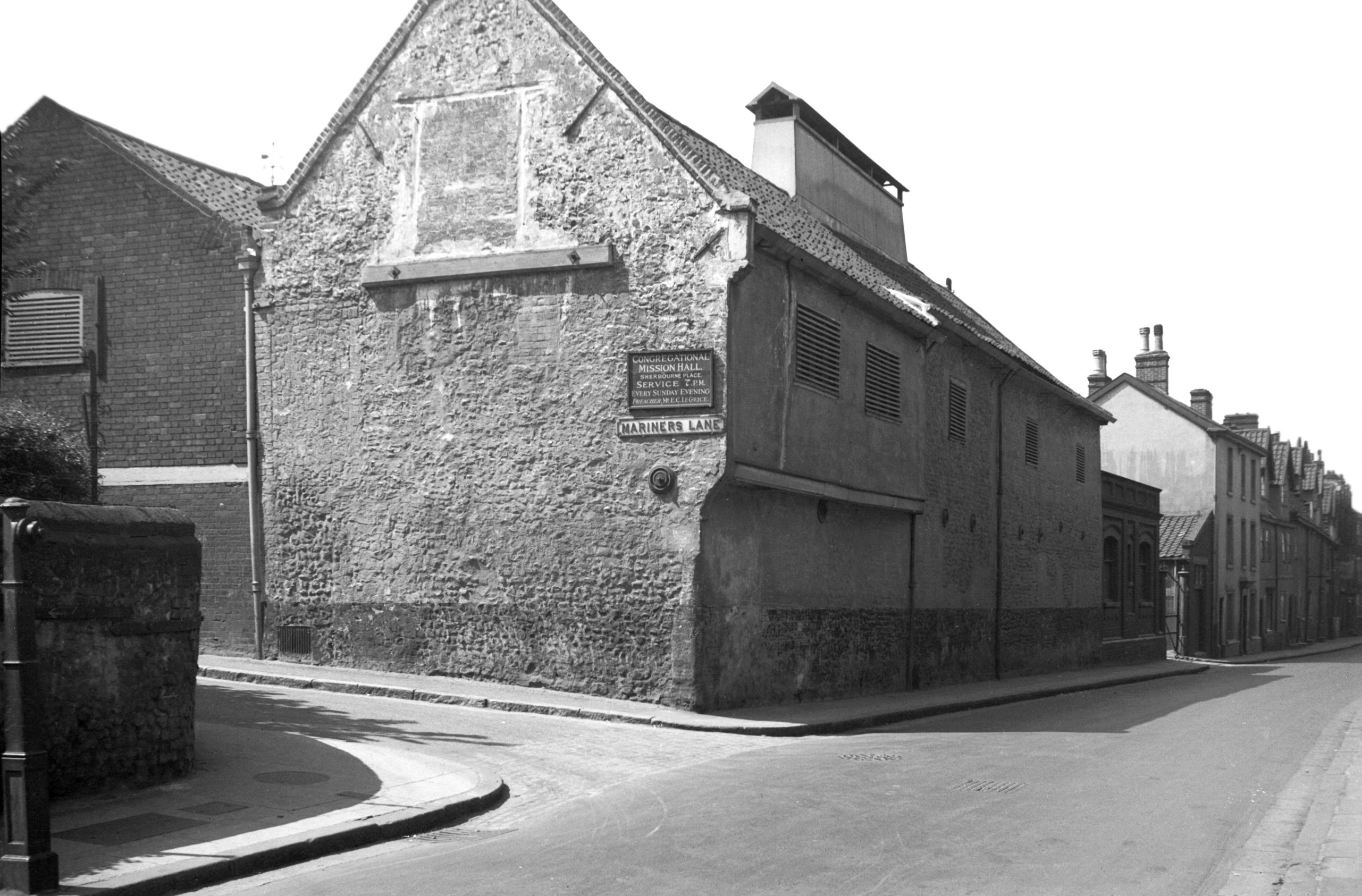
    This photo is taken in (nearly) the same place as that taken by George Plunkett in 1935. On his photo, it’s possible to see the sign for the Congregational Mission Hall at Sherbourne Place where services took place on Sunday evenings at 19:00. This has now been demolished, as have all of the malthouses which stood along here.

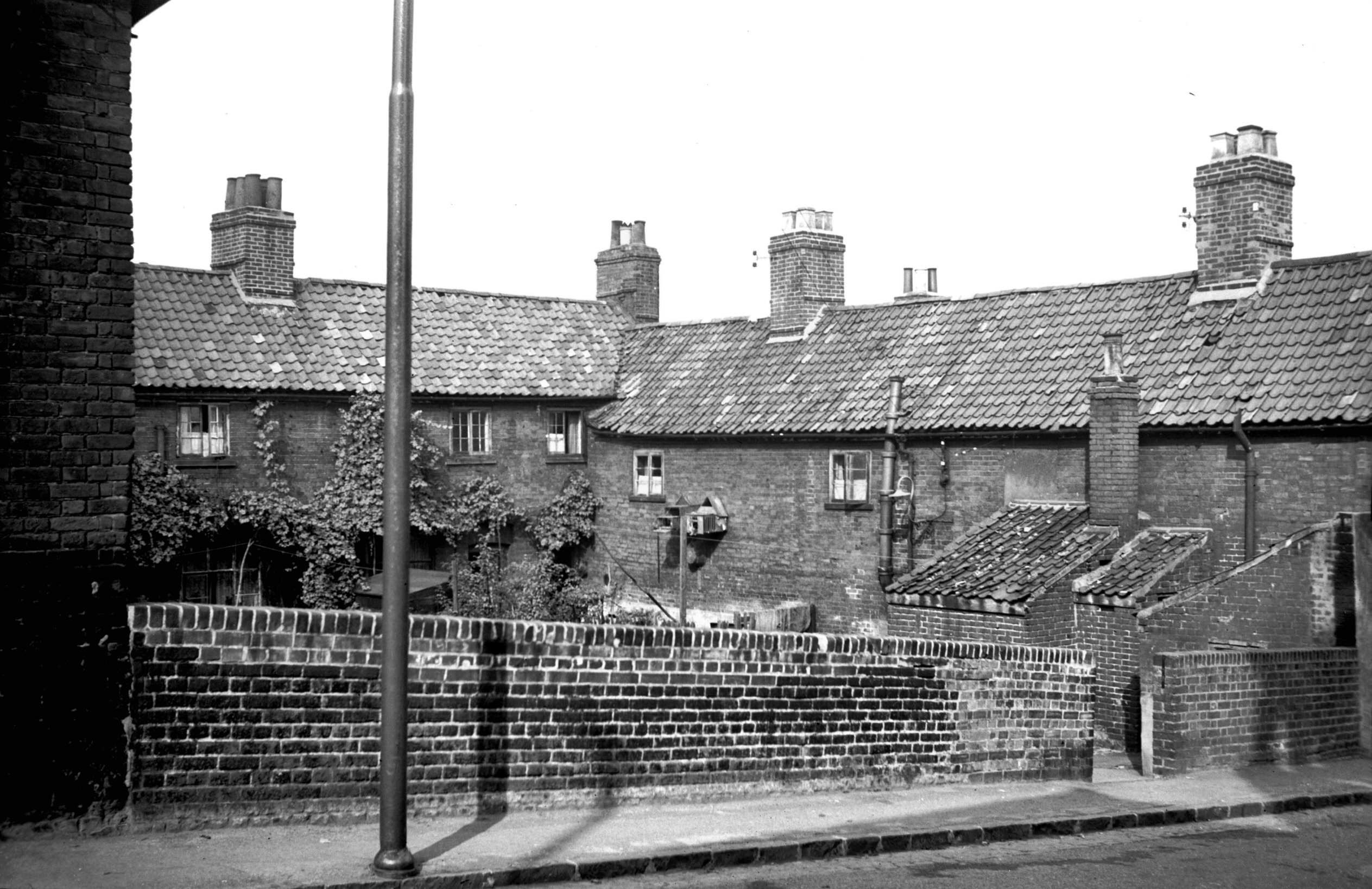
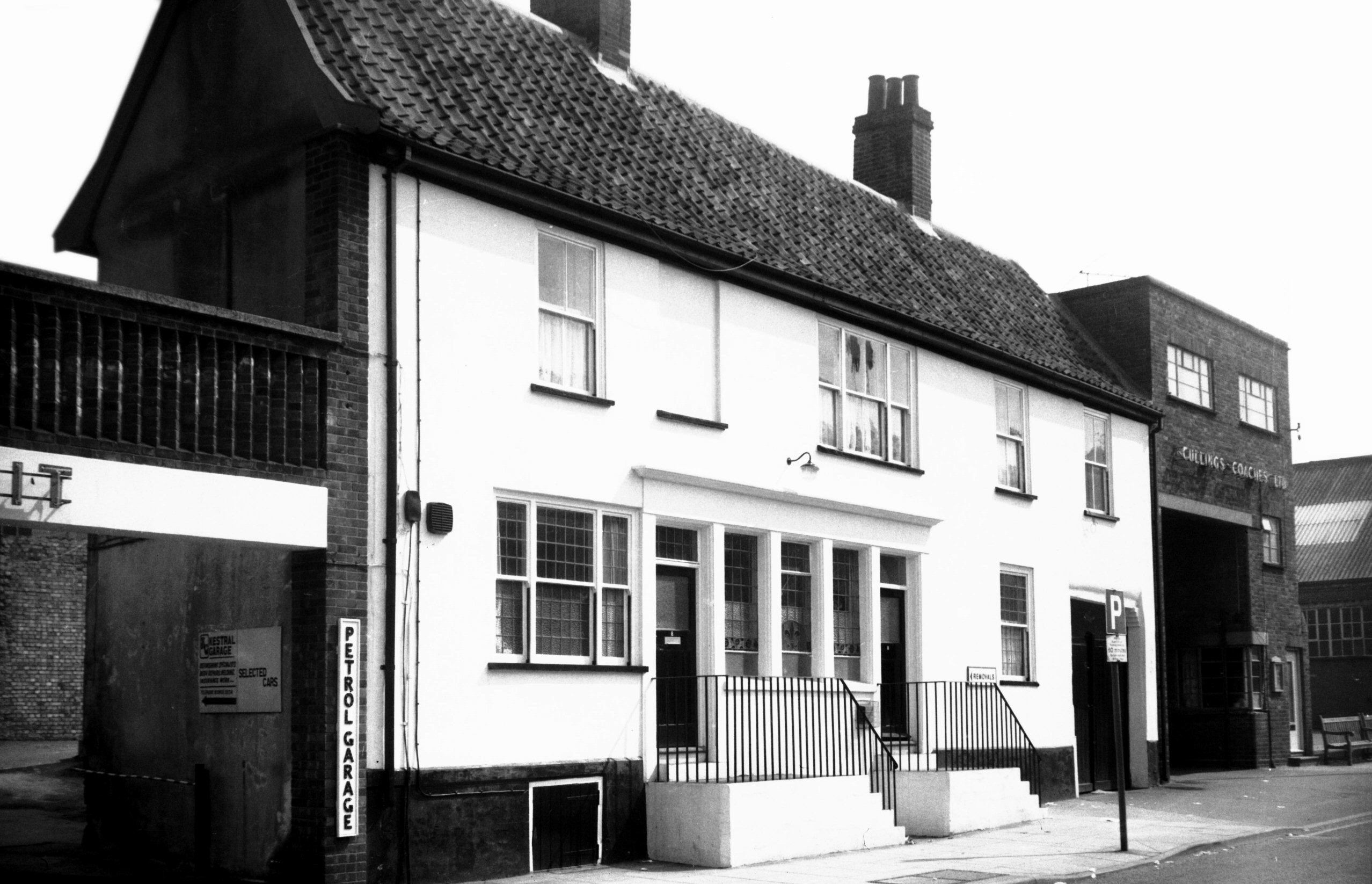
    This is where the malthouses once stood. The buildings on the right are the rear of the properties fronting onto King Street. The council tore down many buildings along King Street, but on numerous occasions there was local opposition which ensured that the properties were maintained. Although King Street might have lost some of its history, it hasn’t been decimated.

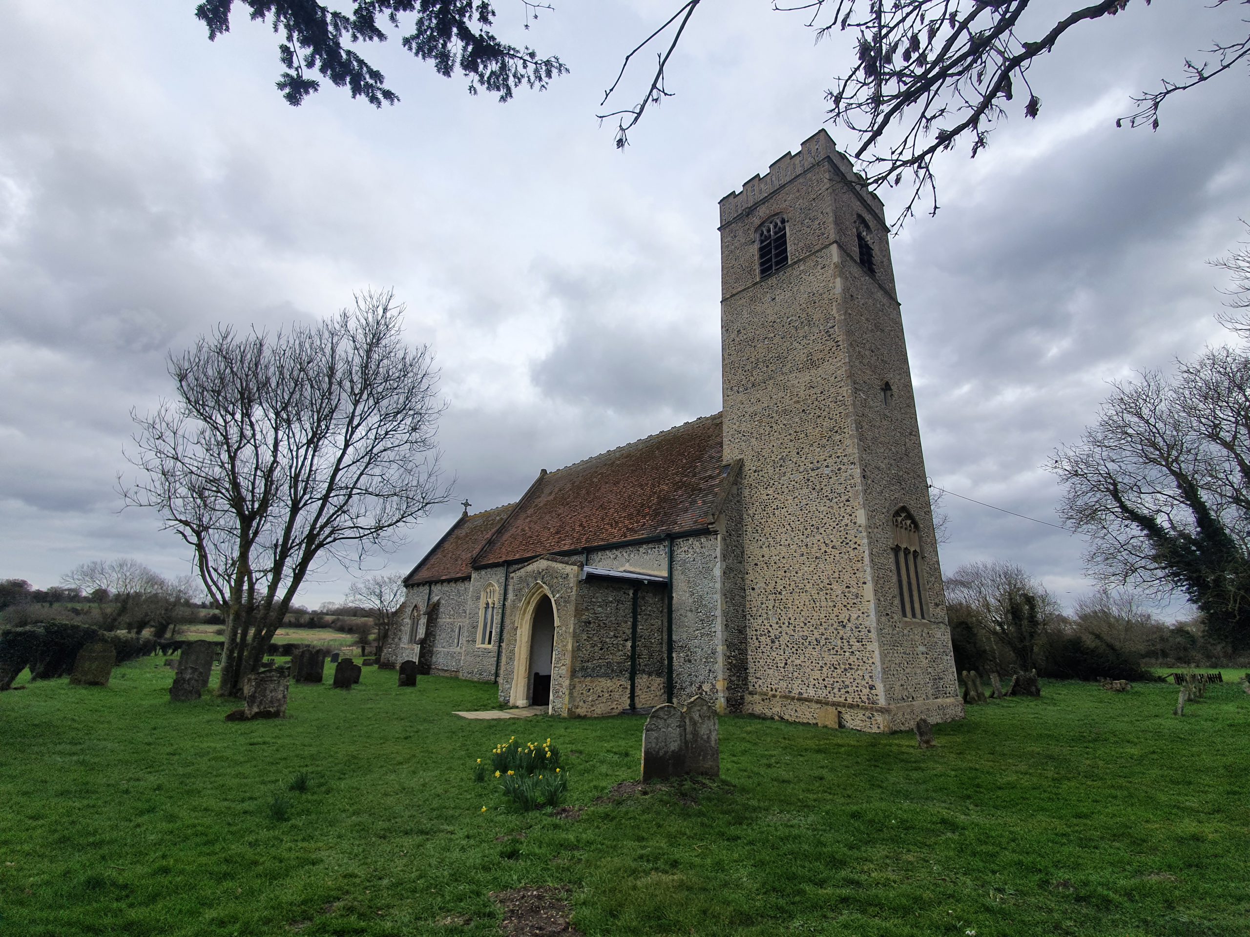
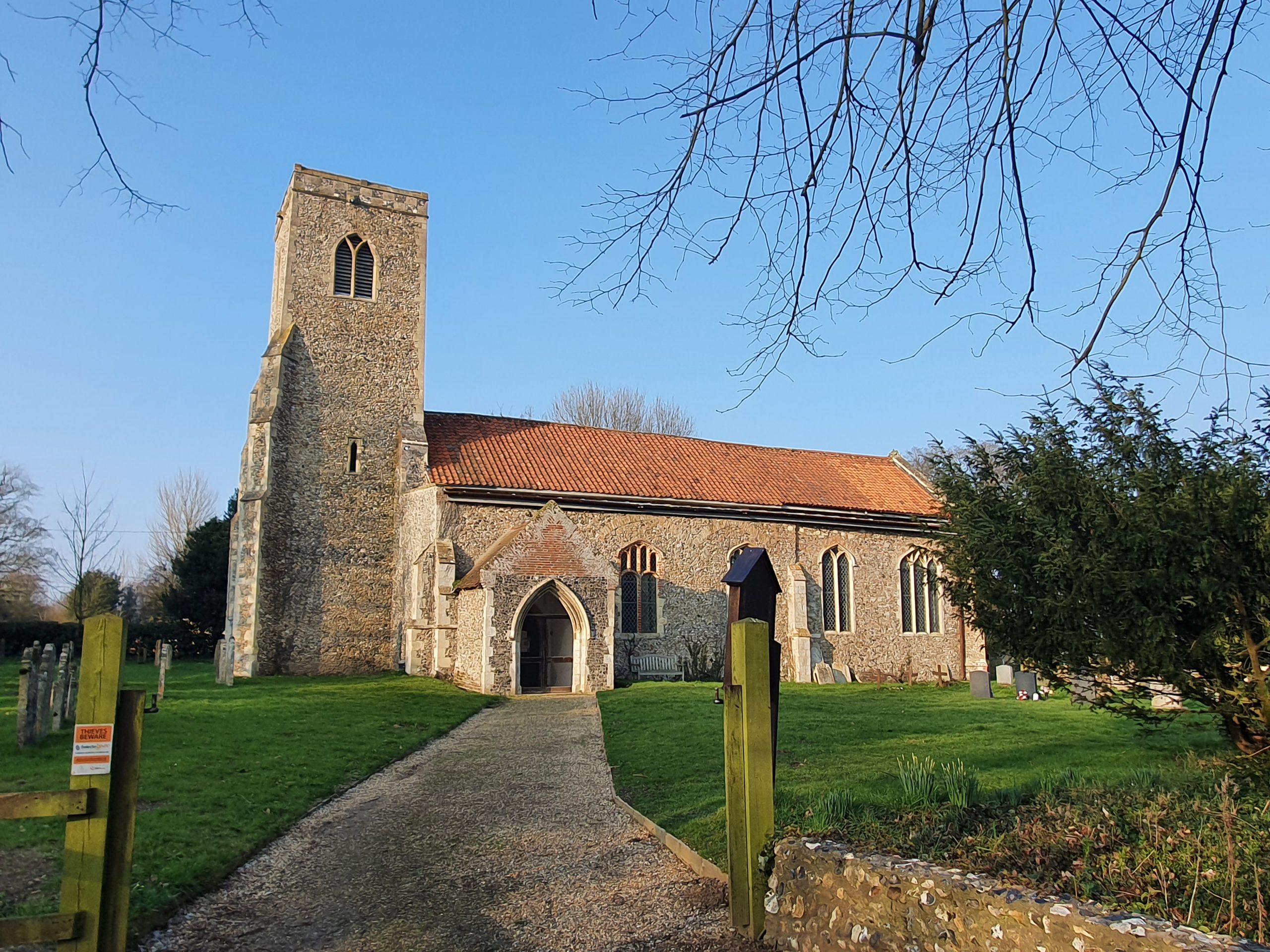
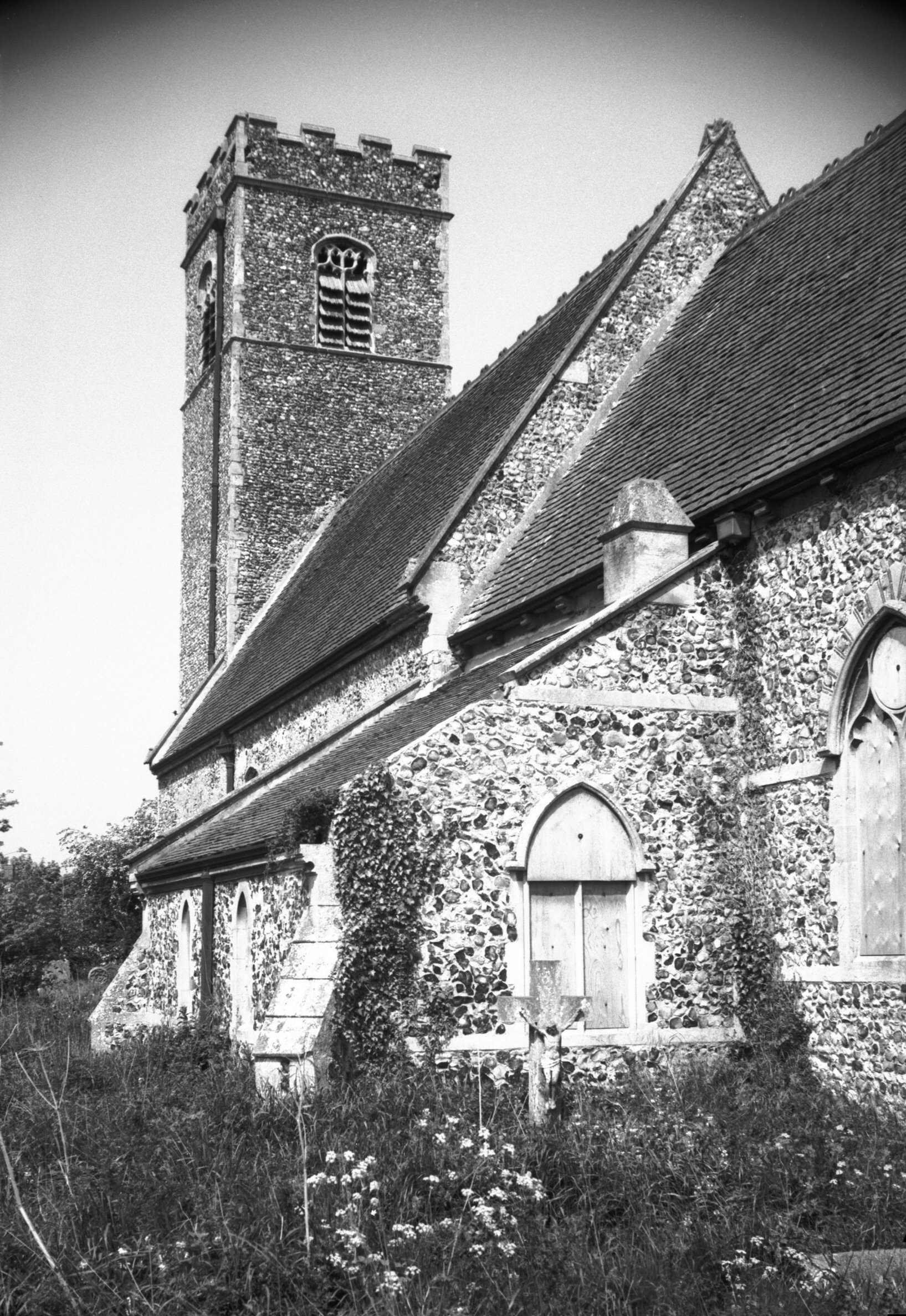
    This is the church from which the parish takes its name, a now redundant (in religious terms) Grade I listed building which dates from the twelfth century, with additions made in the fourteenth century and a substantial Victorian restoration. It’s now in use by an arts organisation and I’ve been inside on a heritage day weekend, I’ll retrieve my photos from that weekend at some point.

    The churchyard is in quite a state in numerous different ways, not least because some of these littered about the place.

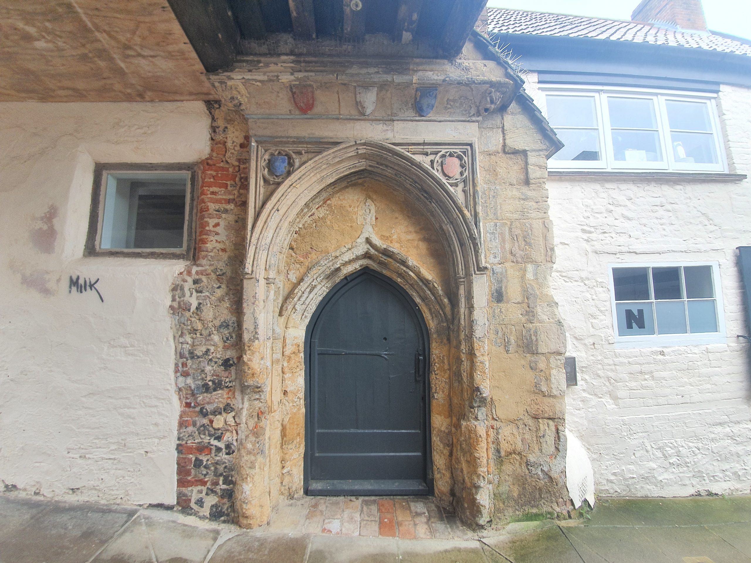
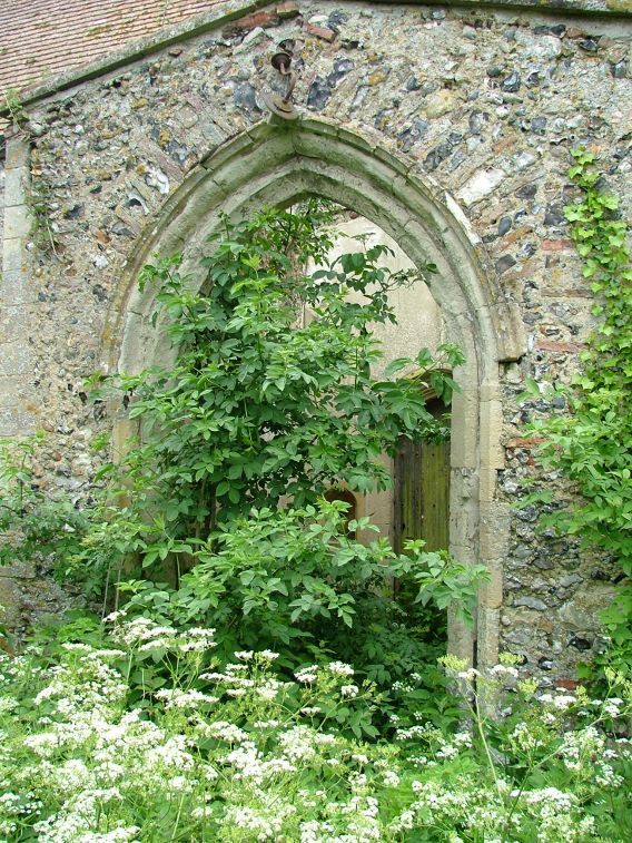
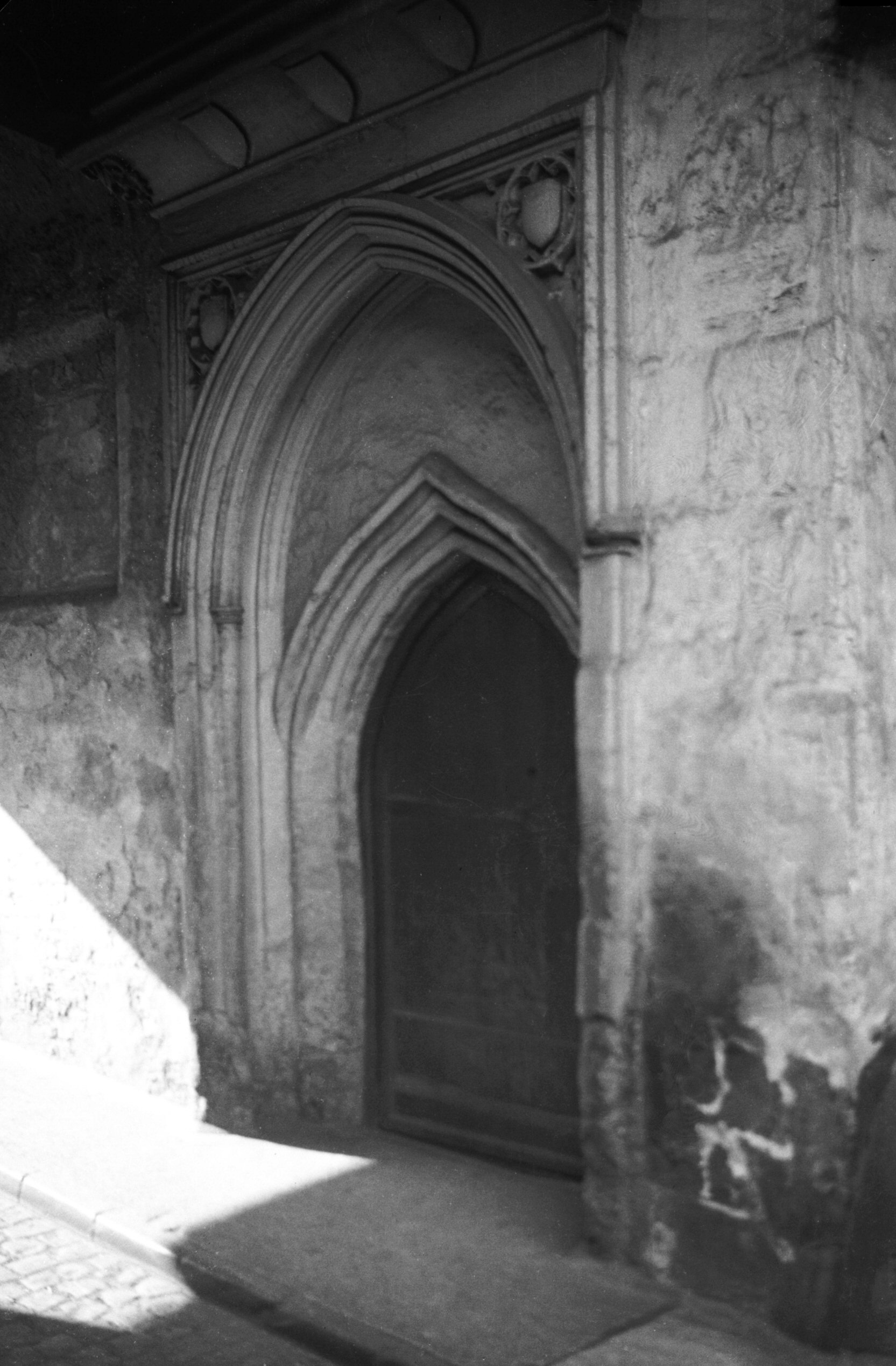
    The Norman style doorway, which is actually probably Norman……

    A photo taken from the grounds of Normandie Tower, looking back into the churchyard.

    The church, looking quite pretty here. The roof was thatched until the Victorian restoration.

    Something doesn’t feel right about this being here, I’m wondering whether this has been moved from inside the church. It might have been on top of a box tomb, but I’m not convinced this was its original placement.

    A broken stone in the churchyard.

    The north side of the church.

    I am still yet to be convinced that using gravestones as some sort of garden feature is appropriate or respectful. Others may have different views.

    This is the end of the parish, and the Ferry Boat Inn is at the rear, across the parish border. And an explanation of that, the parish of St. Julian’s is located both to the north and south of the St. Etheldreda parish, it’s a strange split. Anyway, somewhere on the left the Rainbow pub stood until 1959, which backed onto the parish boundary.

    This car park is on the former site of the Crown Brewery, which occupied a large site along the river from the early nineteenth century. The National Archives note that “the Crown Brewery was gradually acquired by the firm of brewers known variously as Baseley, Youngs and Roe, Youngs and Burt, Crawshay and Youngs, and Crawshay, Youngs and Youngs, in the years” and it closed in the middle of the twentieth century. A few of the buildings from that period survive and the brewery also owned the Music House building, more of which later on in this post.

    Photos from the Crown Brewery site, with the River Wensum visible.

    Some decoration in the foliage.

    A mural on the wall, with some not ideally placed bins. I understand that this was designed by Walter Kershaw in 1984 and it features numerous elements of Norwich’s history. The mural is on the reverse of the building, so it’s not visible from King Street itself.

    The buildings on the right, 176-178 King Street, are also visible in George Plunkett’s photo from 1936.

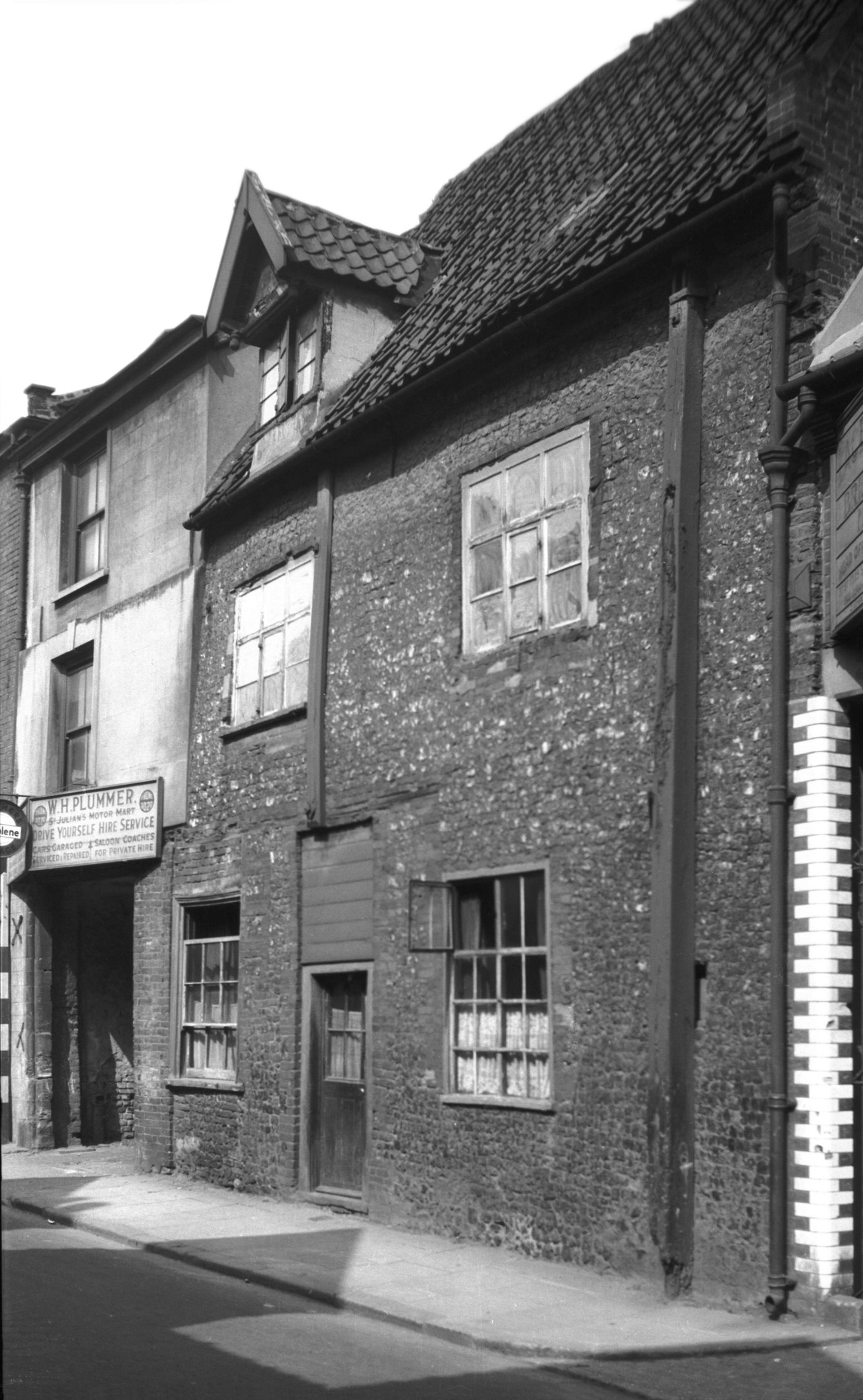
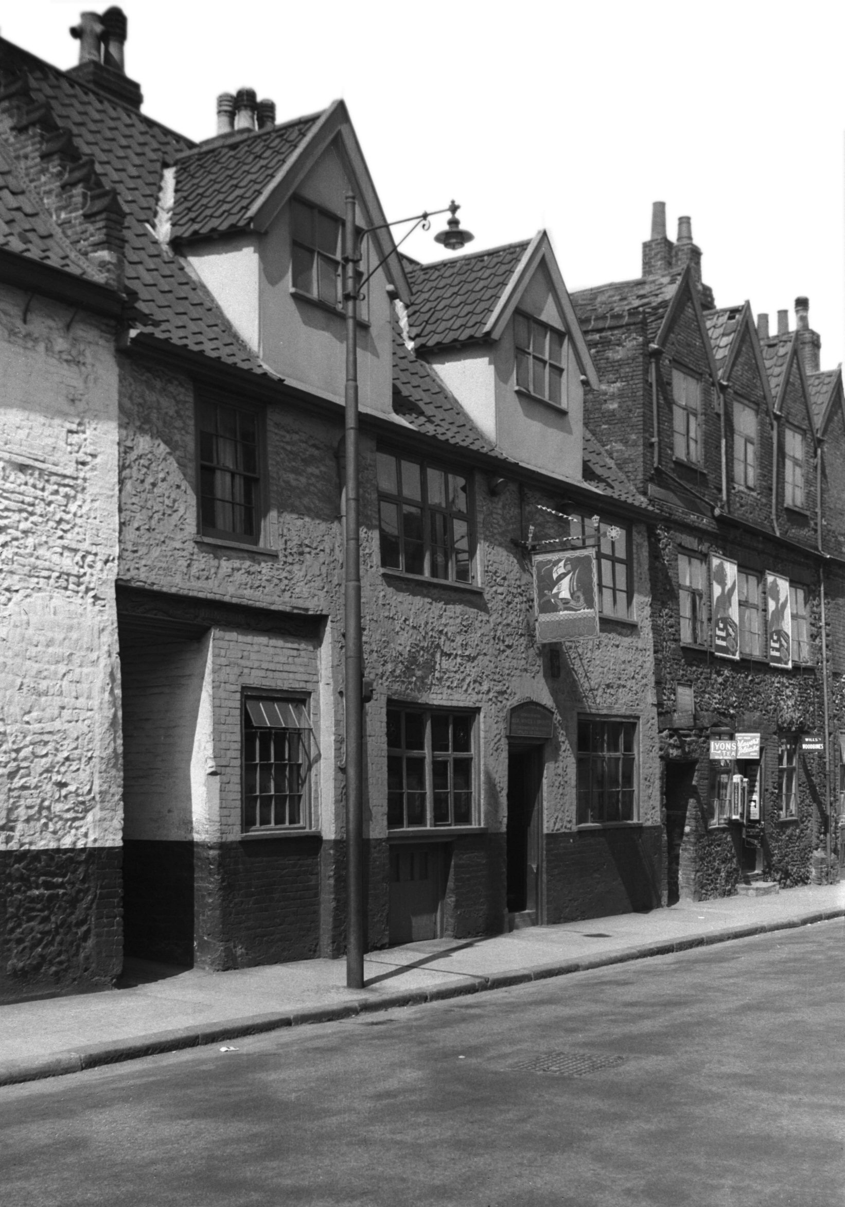
    This is the former Ship pub and another loss, in my opinion, to King Street as this would have made for a quite marvellous licensed premises. George Plunkett yet again helps me here, this is the pub in 1939 and the EDP have one from a not dissimilar period.

    Not only will I link to George Plunkett’s marvellous photos, I shall also quote his text about this:

    “The yard to its south has at some time been partly built over, so that while formerly wide enough for the passage of carts it will now accommodate only pedestrians. The finely carved lintel above bears a design of foliage together with the rather contradictory inscription “Princes In”; it is believed that this was brought here at some time from the famous inn of that name, first mentioned in 1391, which once stood in St George Tombland parish on the north side of Princes Street”

    It’s also quite visible in this photo just how the width has been narrowed.

    The old name of the yard.

    Inside the yard, which is blocked at the end and there’s nothing older behind these buildings, it’s all been demolished.

    The old entrance to the Ship Inn, which ceased being a licensed premises in 1969.

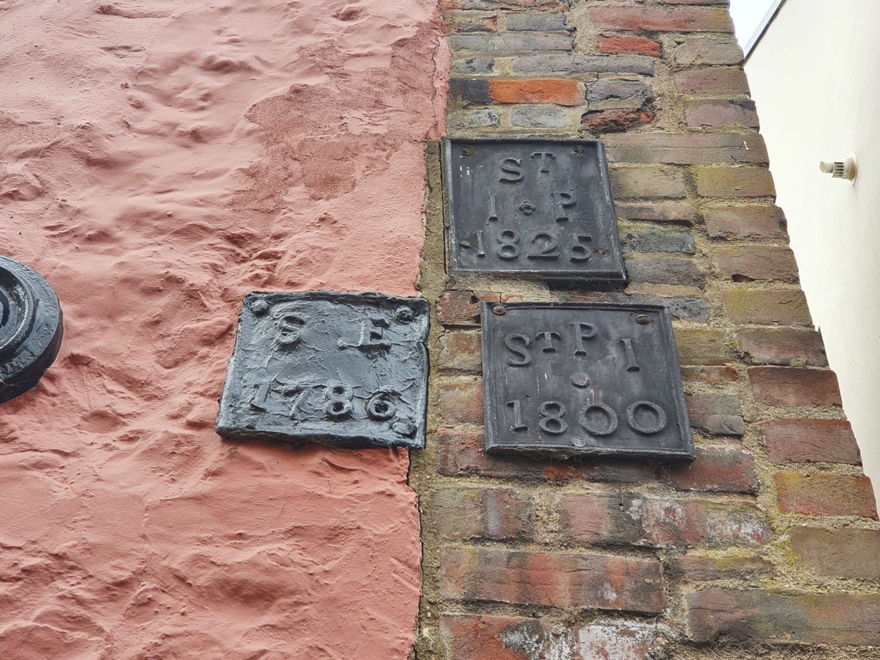
    Wooo!!! Some survivors on the outside of the pub, with our parish of St Etheldreda on the left hand one from 1786. The two on the right both relate to the parish of St. Julian (the J was once used more interchangeably with the I) but in two different formats, one from 1800 and the other from 1825.

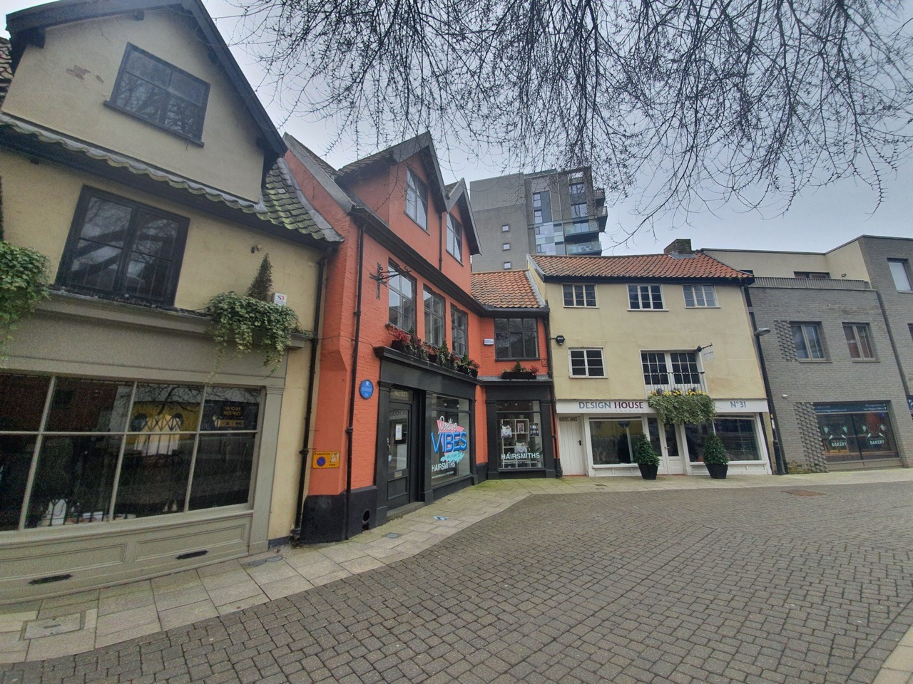
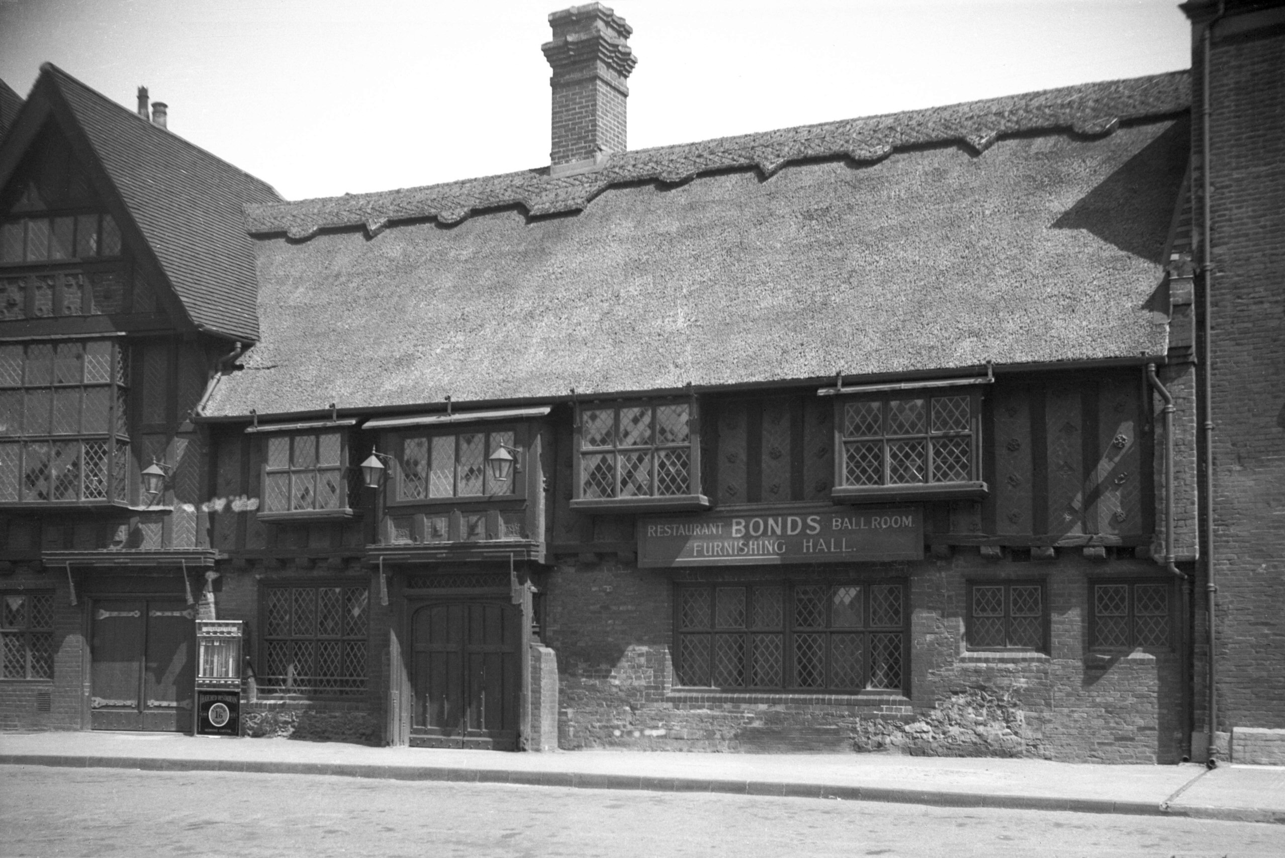
    On the other side of the road from the Ship Inn is 167 King Street, or the Music House. This is also on the edge of the parish boundary and some of this structure dates to the twelfth century. The undercroft is now Jurnet’s Bar and is full of character and history, taking its name from a man known as Jurnet the Jew, who purchased the building from John Curry in 1225. Once a house for the wealthy, this area became a little less glamorous over time, so the building was split up into tenements in the eighteenth century. It is the only non secular building from the twelfth century to survive in Norwich and it’s used today by Norfolk County Council. Behind here was the Crown Brewery, who owned the building for much of the nineteenth and early twentieth centuries.

    These parish boundary markers are on the Music House, with the parish of St. Julian off towards the left of this photo and this has markers from 1789 and 1825, with the marker for St. Etheldreda dating to 1786. I like that one of these iron parish boundary markers was placed here in the year of the French Revolution, that’s a quite remarkable survival really given everything else that has changed in this area.

    And a look back down towards the parish of St. Etheldreda, a really quite fascinating section of street.

  • Norwich History by Parish : St. John Baptist Timberhill

    Norwich History by Parish : St. John Baptist Timberhill

    And a new little project that Jonathan and I are undertaking because this lockdown is clearly here for at least a few more weeks. It’s a bit niche (our project I mean, not the lockdown), I’ll accept that, but there we go. Effectively, it’s walking around Norwich, ancient parish by ancient parish and seeing what is there now compared to a map from the 1880s (the map above is from 1789, but the one from the 1880s is more detailed, which is why we used that). There’s a PDF of these boundaries to provide some extra background to this whole project.

    St. John Baptist Timberhill is the sixth parish we’ve done this for and, again, there’s substantially more history than I can mention in this post, a reminder of just how much heritage remains in Norwich. As can be seen in the above PDF, these boundaries are not that neat and they follow the lines of buildings that have long since gone. I’m generally spelling Timber Hill as two words, but views on this seem to differ, but I won’t let it overly worry me…..

    This is the area of Norwich that we were meandering around. And, this parish was difficult to follow, not least because the entire cattle market area to the north of the former parish has disappeared and has been replaced by the Norwich Castle Quarter shopping centre, but also because the Rouen Road area has been entirely changed in post-war developments.

    Starting off at St. John the Baptist Church, which was open and offering a friendly welcome. I took numerous photos in the church, but I’ve written about this building before and shall just refer back to that. Nearly no graves remain in the churchyard, but they appear to have been removed long ago, and little of the exterior remains. The church’s tower collapsed in 1784, during a period when many Church of England buildings were neglected as the number of people attending services started to fall, and it was never replaced.

    We first went to the southern end of the parish, which is now the beginning of Ber Street, but this section was once considered to be part of Timber Hill. Also visible in the above photo is the entrance to White Hart Yard, which was named after the pub which once stood at its entrance. The pub closed in 1940 for the duration of the war, but it was then bomb damaged and became derelict, so that re-opening never happened.

    This is perhaps something of a loss, this was the Kings Arms and George Plunkett took a photo of it in 1979. It had traded as a pub since the first few years of the nineteenth century, was damaged during the Second World War, but then repaired and it remained open until 1968.

    The former Cullings Coaches building, a independent bus company which operated from Norwich.

    The parish boundary stops about here somewhere where it meets St. Michael at Thorn parish. The back of these buildings on Ber Street would have once been yards which stretched back some distance, but this has all gone now, and that’s the back of the Archant building at the rear.

    This is on the other side of Ber Street and is the Bonds building (operated by John Lewis) and this is a post-war building as their rather lovely previous shop got destroyed during the Second World War. George Plunkett has a photo of the Bonds building from 1935, which would have perhaps been one of the iconic images of the city if it had survived the war.

    Bonds (or John Lewis) today, although the area on the right is in a different parish, but there was no evidence of any old parish markers here to show where that line was exactly.

    We then went back to St. John the Baptist Church and walked back towards the city centre along Timber Hill. This is a vastly improved road and the city council have done a decent job here, with pedestrianisation making it a much more walkable area and there are numerous cafes and restaurants along here. Older photos show a busy road and pedestrians shoved to one side, so this is a more pleasant area to be now.

    The entrance to Scotts Court, not to be confused with Scotts Yard on nearby Ber Street. On the other side of the road here is the Castle Quarter shopping centre (formerly the Castle Mall) which means little original from this area remains.

    And a parish marker at last and many of them have gone missing from this area, with PAS meaning the Parish of All Saints.

    The entrance to Lion and Castle Yard, which leads off Timberhill and is in the parish. It takes its name from the Lion and Castle pub which was located here between 1822 and 1925, with a sign also noting that the lion and castle are on the city’s coat of arms.

    This building in the yard is one of the few thatched structures that still remain in Norwich and it is now one single property that was combined from two seventeenth century cottages. The building was restored by the Norwich Preservation Trust in 1996 and it’s likely that weavers would have once lived in the properties. George Plunkett took a photo of this location in 1935 and the area has a rather different feel today to back then.

    Back on Timber Hill, this is the former Baptist Particular Chapel, which was originally built as a warehouse in the eighteenth century. It was purchased by the Particular Baptists in 1832 for £1,150 and then converted into a chapel, a usage that it retained until 1975. More recently it has been converted into a restaurant and bar.

    Looking back up Timber Hill, with the Murderers Pub on the left.

    This is the birthplace of Sir Arthur Michael Samuel (1872-1942), who was the first Jewish Lord Mayor of Norwich. He later became the Conservative MP for Farnham, the Secretary of Overseas Trade between 1924 and 1927 and then the Financial Secretary to the Treasury until 1929.

    This is where Timber Hill meets Orford Hill and George Plunkett took a photo in 1984 of that stag being lifted onto the roof. There’s a blue plaque on that building which noted that George Walpole, the Earl of Orford (1730-1791) was seen as a bit of an eccentric at the time, but he gave generously to public subscriptions to fund planning improvements. This section of the street, which is also where three parishes meet, was renamed from Hog Hill to Orford Hill in his honour.

    Orford Street, looking down towards Farmers Avenue.

    The Bell Hotel from the Orford Street side. This large building is no longer a hotel and is operated as a JD Wetherspoon pub and is one of their first in the country to have opened outside of London. Sections of the structure remain from the fifteenth century and it has been known as the Bell (or the Blue Bell) since at least 1696. Revolutionary groups met here in the eighteenth and nineteenth centuries (and frankly, I can think of a few that have met here over the last few years, but that’s a different matter) and it was also used by the American Women’s Army Air Corps during the Second World War.

    The front of the pub, from Castle Meadow.

    The rather grand entrance, which was formerly the way into the stables of what was then a coaching inn.

    This area has all changed now, with Norwich Castle in the background, Farmers Avenue now has the Castle Quarter structures on it.

    The entrance to Orford Hill on the right, but once again, everything behind that has changed with the shopping centre development.

    The entrance to the cinema.

    This is the only remaining older section of this road, with what was Number 12 at the rear, a now permanently closed restaurant that was located in a building with parts remaining from the seventeenth century.

    The rear of Number 12.

    This building, 18 Golden Ball Street, was saved and now sits a little awkwardly within the Castle Quarter shopping centre structure. George Plunkett took a photo of this property in 1936, but everything else around here has gone. To the left of these structures is St. John the Baptist Church, where we started our little meander.

    There’s also a parish boundary marker located on the front of the building and I wondered whether it was put there as part of the renovation and heritage of the building. However, it’s also visible in the old photo from George Plunkett and it stands for St. John Timber Hill.

    The Archant building, which is perhaps not the most liked structure in terms of its design, but is something a little different and I’m sure it’ll become an important part of the architectural history of the city. Long since the home of the EDP, the building was sold by their owners Archant in 2019 to Alan Boswell Insurance, but they retain a floor in it. New ways of working and changes to regional newspapers (primarily they don’t sell many now) meant that Archant didn’t need as much office space, hence the downsizing arrangement.

    Paid for by Archant, or Eastern Counties Newspapers as they were, this sculpture is by local man Bernard Meadows (1915-2005).

    The car park of the Archant building, where once there was housing.

    This is Paradise Place which is an old name for the streets here, but they were changed in the post-war period when a new housing development was placed here. Personally, I think this area has been botched in terms of its atmosphere (given there’s a busy road and big car park by it), as it doesn’t feel like part of the city and the old streetlines were lost. However, I’m sure that the quality of housing is better than what was here before, so the residents were perhaps rather quite pleased. And, I do like old streetlines to be maintained, so perhaps I’m just being biased.

    And that concludes another parish, one which isn’t necessarily geographically huge, but which again contains a fair chunk of history. As usual, I’ve had to omit many stories from this account as there are far too many to tell, but it’s a reminder of just how much there is remaining in Norwich from the past.