Category: Parishes of Norwich

  • Norwich History by Parish : St. Michael at Thorn 1/2

    Norwich History by Parish : St. Michael at Thorn 1/2

    And a new little project that Jonathan and I are undertaking because this lockdown went on for longer than we had anticipated, so we had time to do this. It’s a bit niche (our project I mean, not the lockdown), I’ll accept that, but there we go. Effectively, it’s walking around Norwich, ancient parish by ancient parish and seeing what is there now compared to a map from the 1880s (and the 1920s). There’s a PDF of these boundaries to provide some extra background to this whole project.

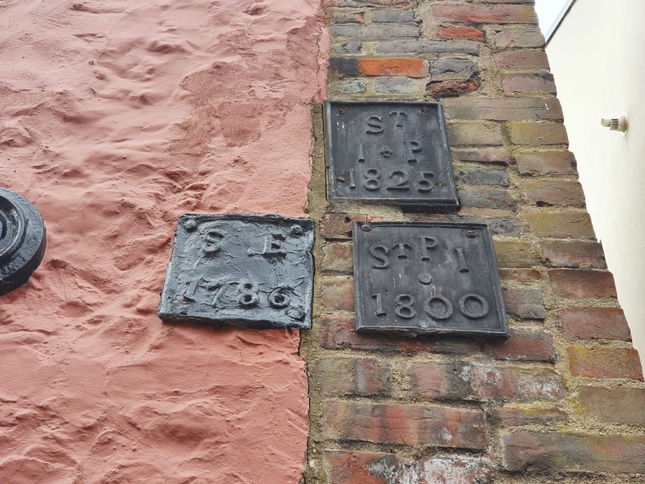
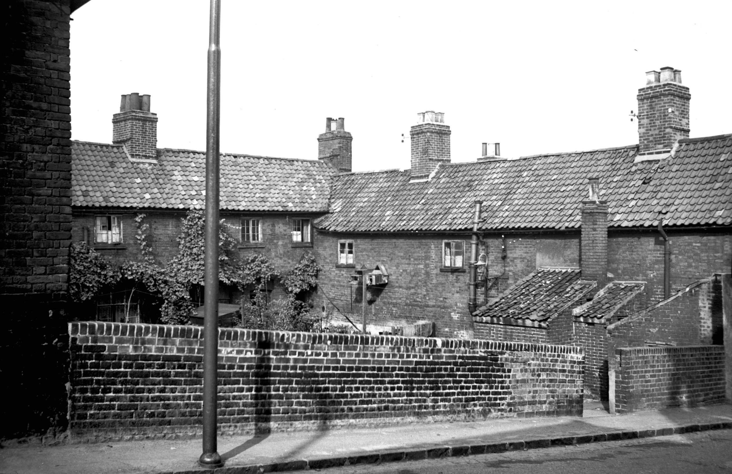
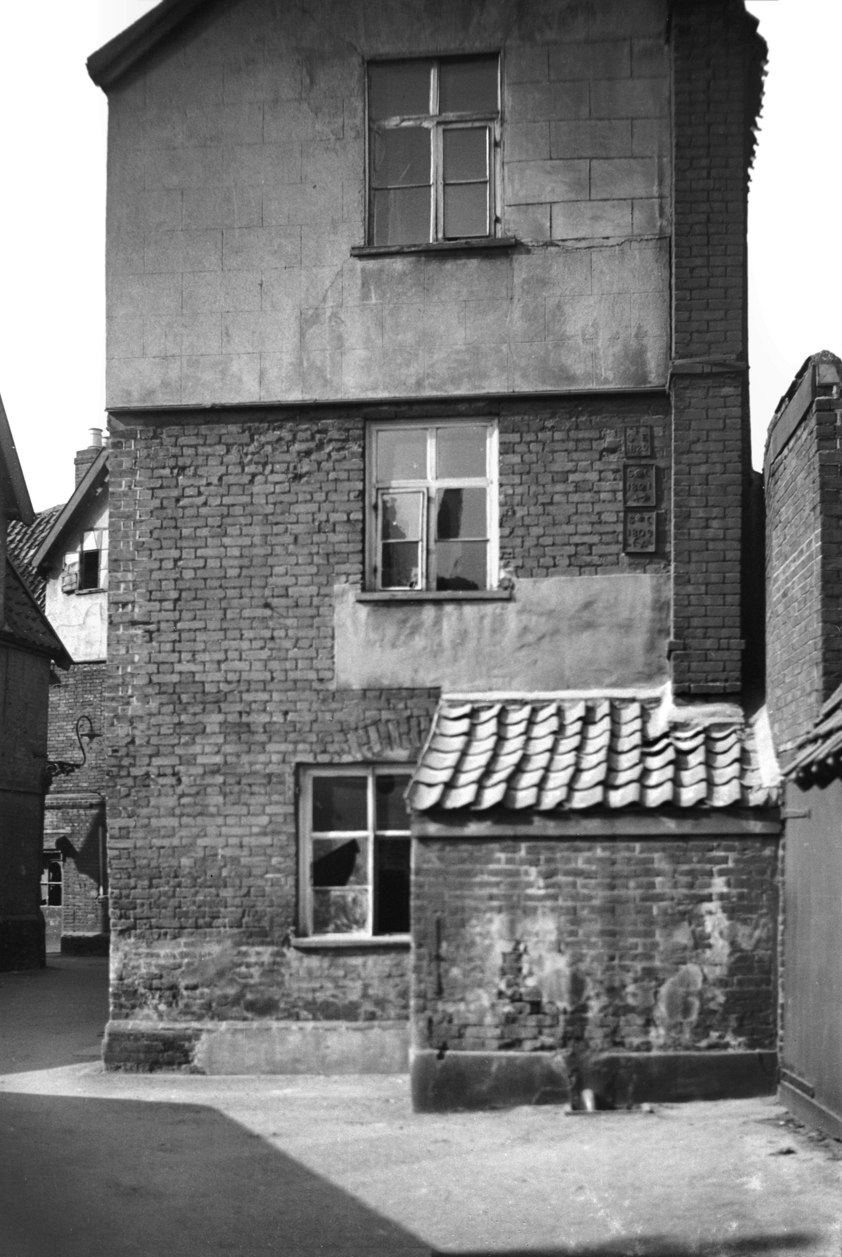
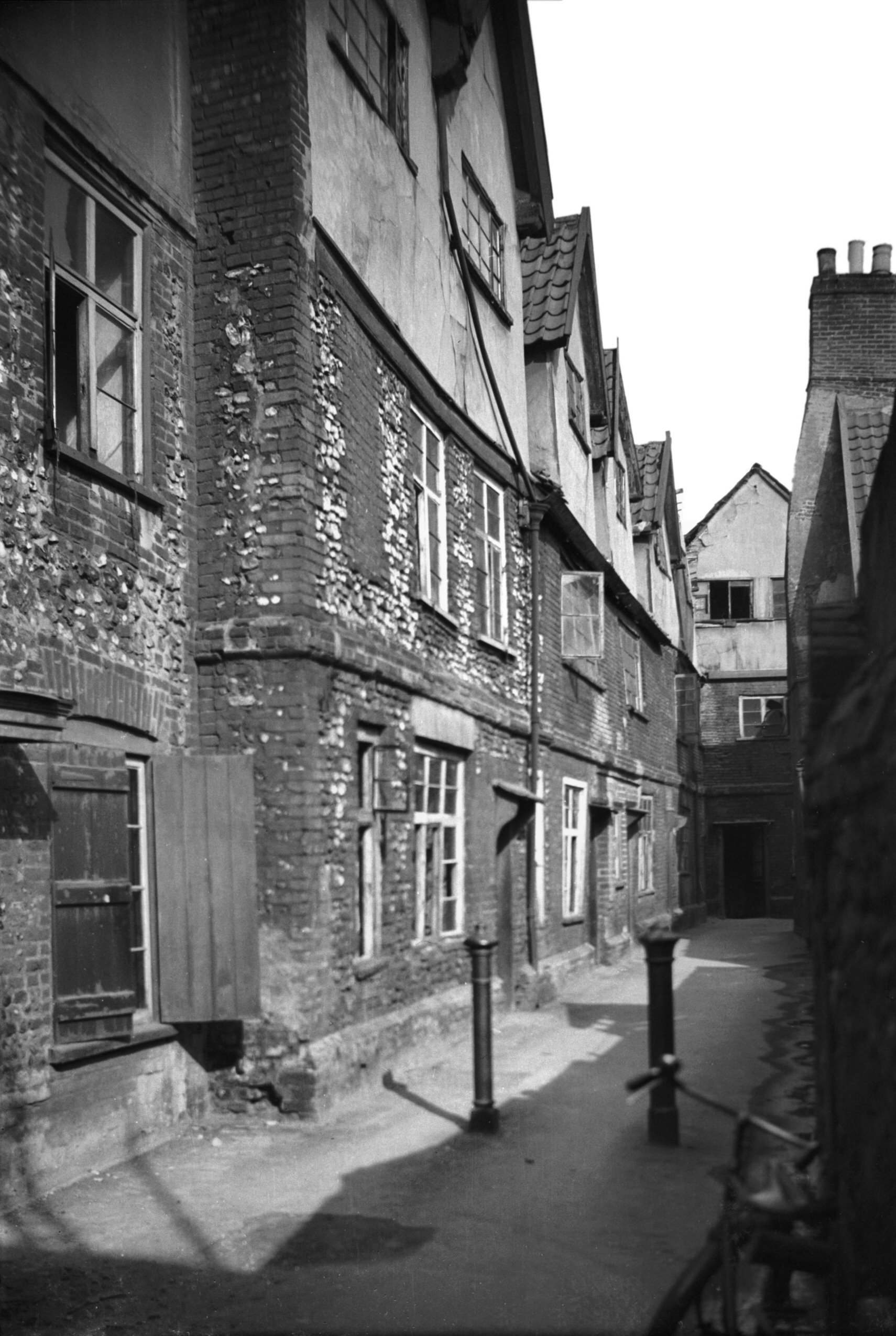
    This week’s meander was around the parish of St. Michael at Thorn and this is one that has been badly hit by a combination of war damage and what I would consider to be quite incompetent city planning. The church was damaged during the Second World War, but it could have been replaced or the tower saved. Instead, the site was tarmaced over and turned into a car park. Housing and pubs on the other side of Thorn Lane were torn down in the 1960s and replaced with a small number of commercial units, but mostly more car parks. There are relatively few old buildings surviving on either side of Ber Street and the entire area between Surrey Road (sometimes now all referred to as Surrey Street) and Ber Street has been flattened to build car parks. All of the yards were removed and no parish boundary markers remain today that we could find.

    Such is the devastation caused by the demolition, not one single listed building seems to remain in this parish. However, there is some good news, there is another part of St. Michael at Thorn parish which is near to the castle, separated by St. John Baptist Timberhill parish, so that’s where we will visit next week.

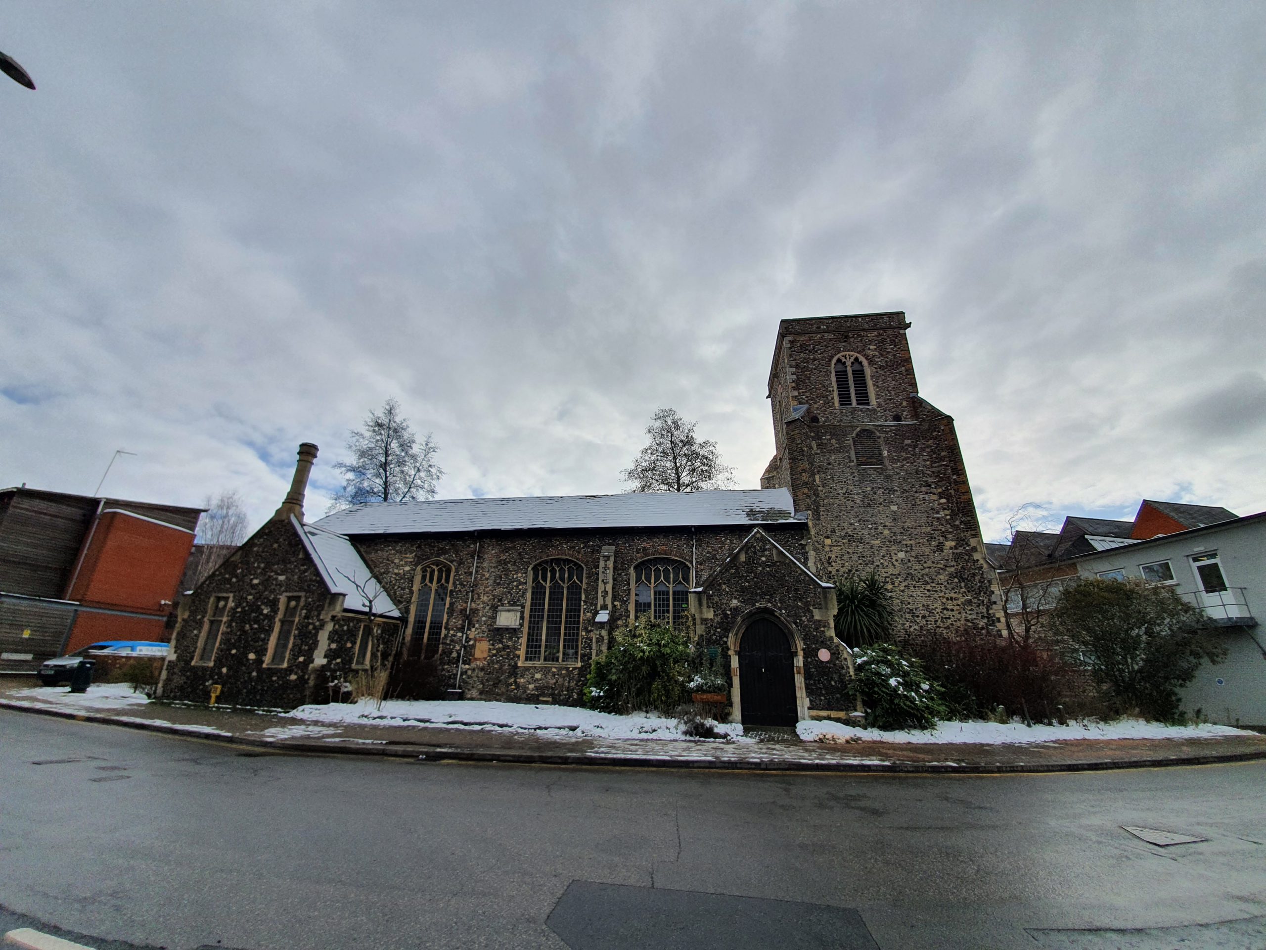
    The centre of this parish is (or was) St. Michael at Thorn parish church, located on Thorn Lane. Or, as some local wit has amended it to here, Thorne Lane. The church was originally known as St. Michael on the Hill, but also as St. Michael Spinas, which is the Latin word for thorns. So, they’ve named a church as it had a load of thorn bushes in the churchyard, which were also still there in nineteenth century accounts.

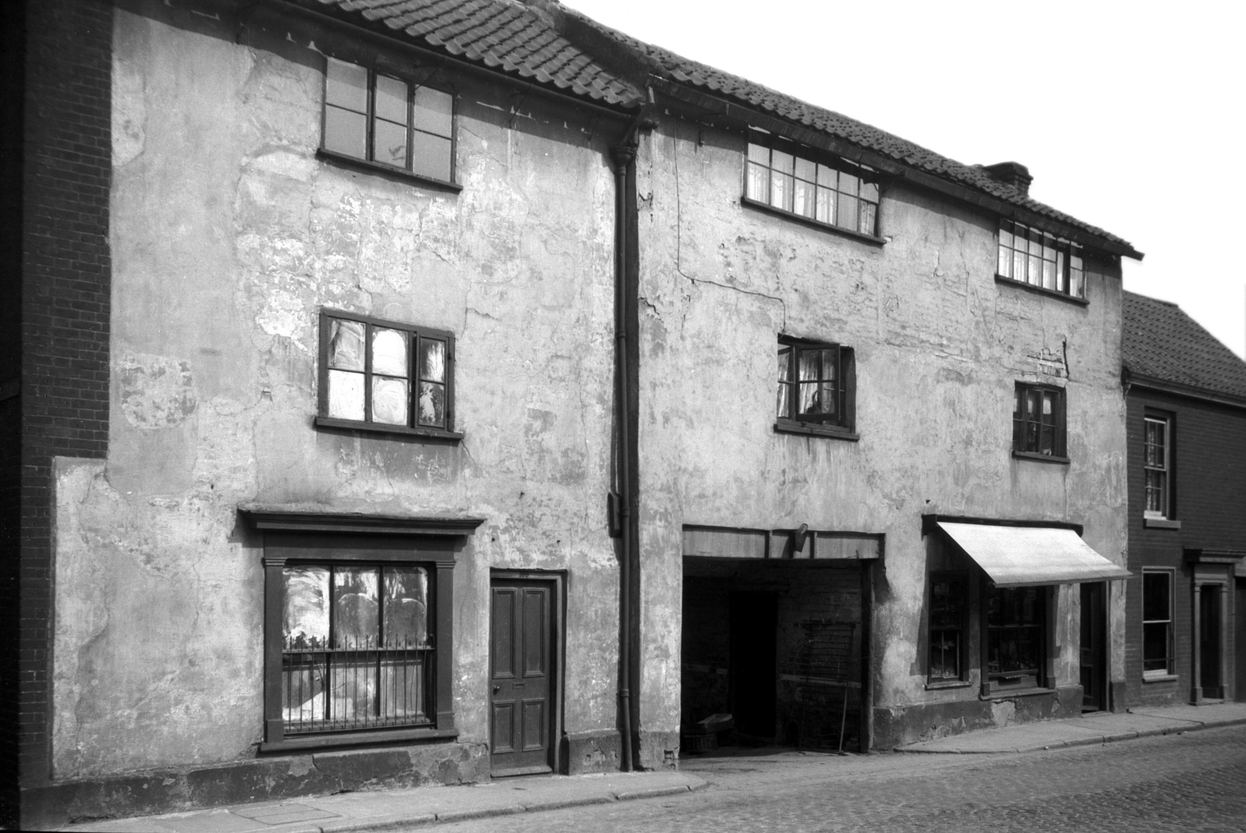
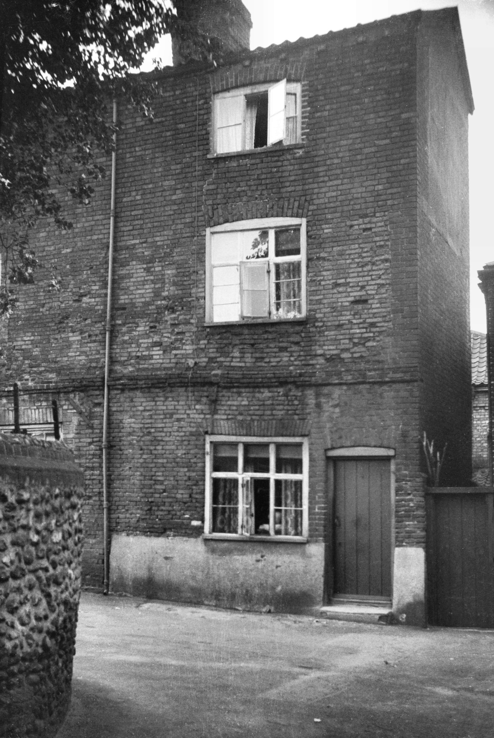
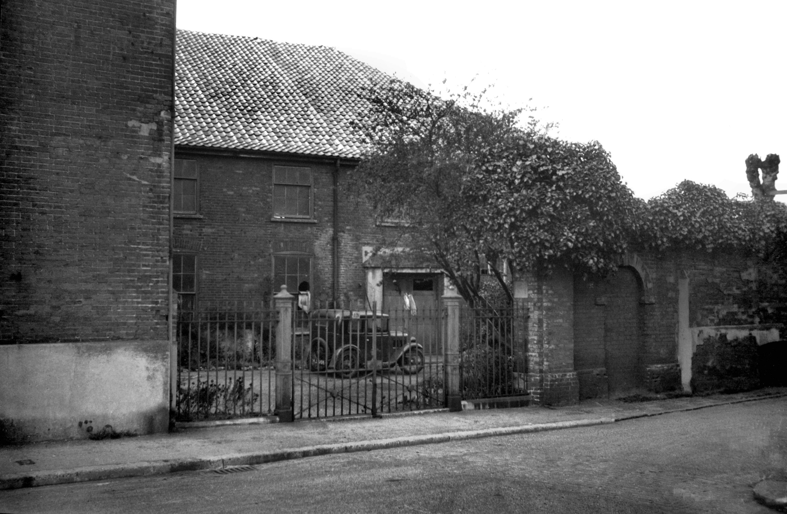
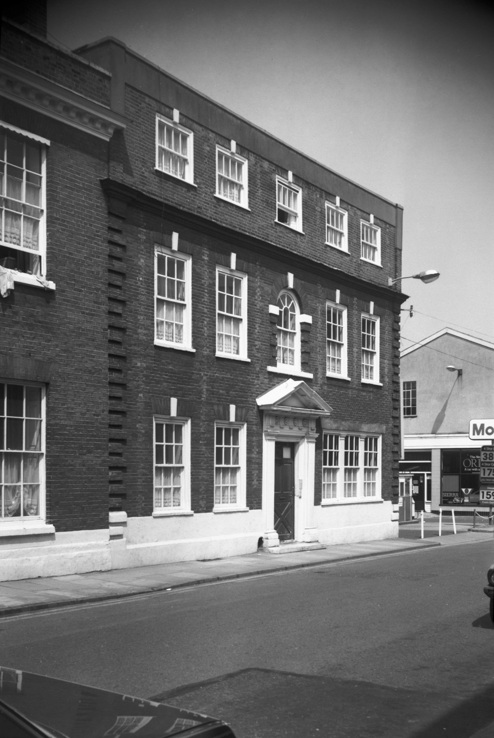
    This is the corner of Rouen Road and Thorn Lane, the edge of the parish. Only this frontage is located within the parish, but this was all Paradise Place which was an area of much denser housing. It retains the same name today, but there’s more greenery and this is some of the limited amount of new property that has been constructed in this parish over recent decades.

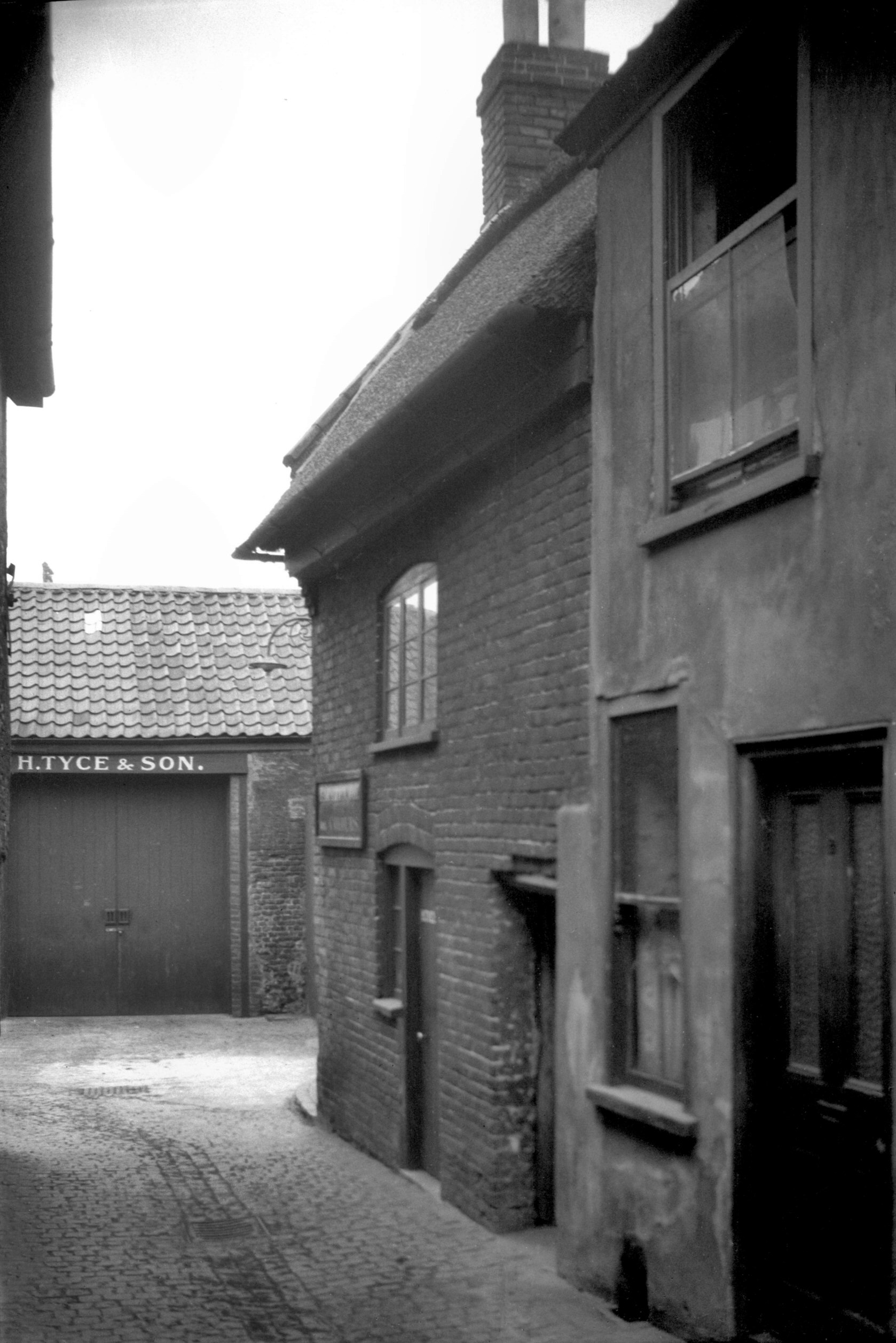
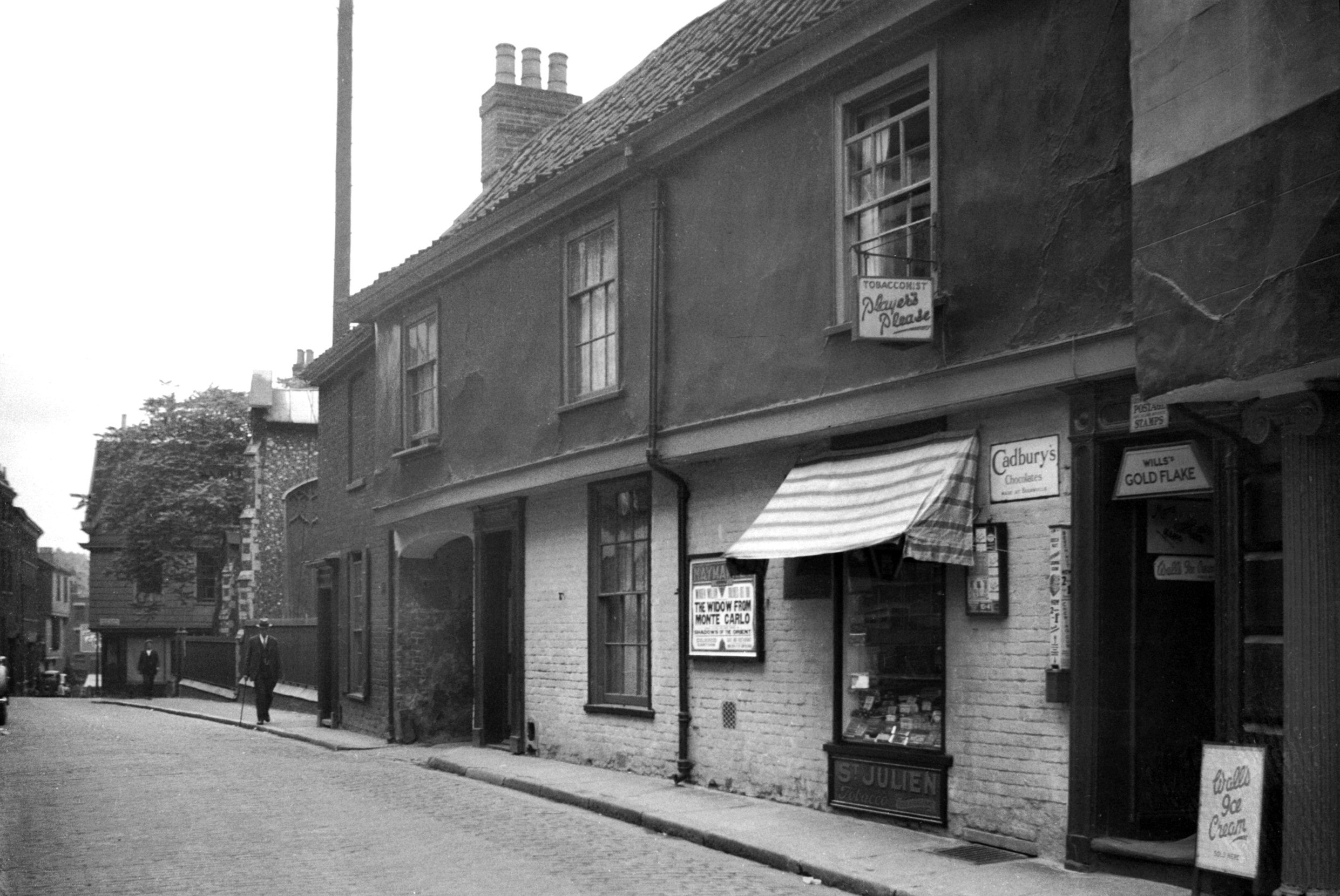
    Thorn Lane used to carry on to the left and go down to King Street through the old brewery, but post-war redevelopments have seen that link removed. There’s a photo from around 1910 of Kahler and Sons bakers, which was pretty much in the centre of my photo above.

    This map from 100 years ago is hard for anyone today to be able to place into the current landscape, but the top section (on the left) of Thorn Lane is still there, and King Street is still there on the right of the map. Rouen Road ploughs through the middle of the map today, roughly where the ‘A’ in Thorn Lane is located on the map.

    This is today the entrance to the EDP’s car park, but it was once where Bacon’s Square was located, named after Nicholas Bacon’s house which was located nearby. Just to the right of this, George Plunkett took a photo in 1937 (whilst standing on Thorn Street) of what was then Middle Square.

    A rather faded sign which notes the church that was once here.

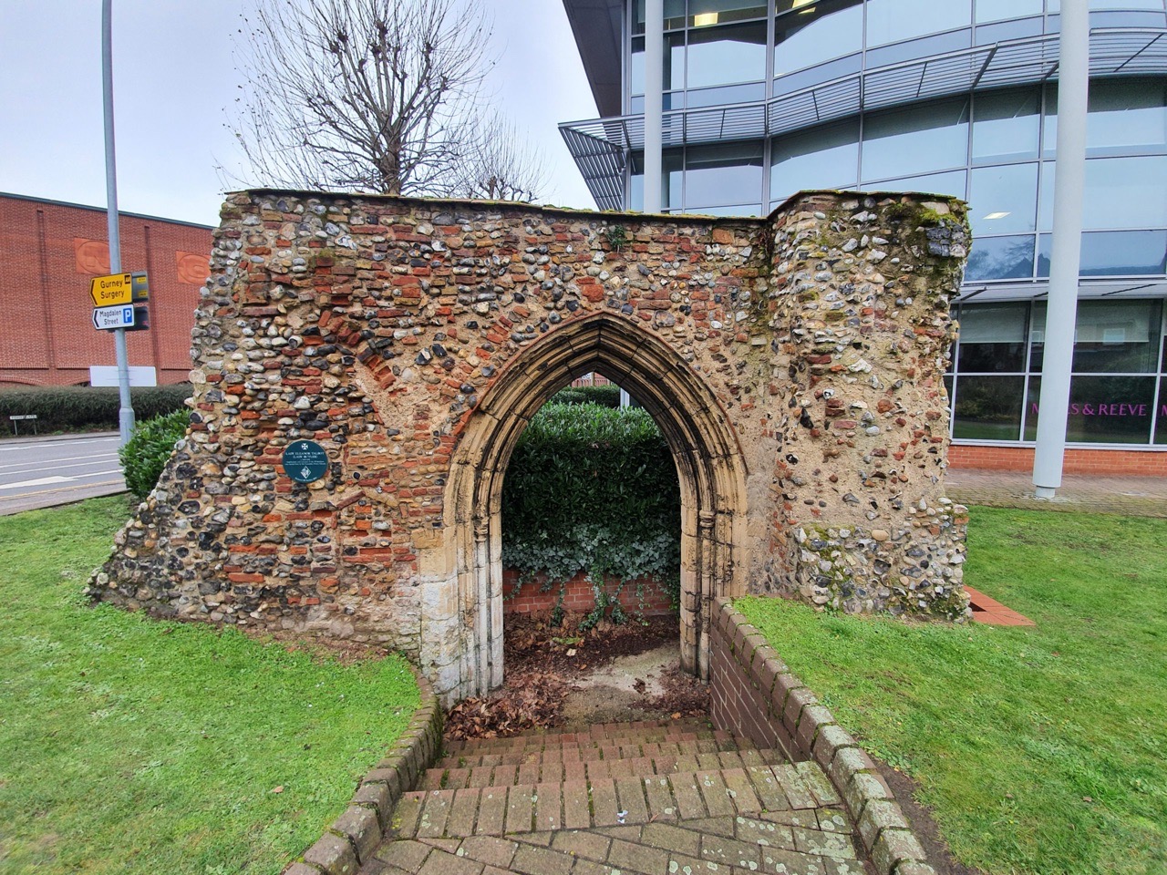
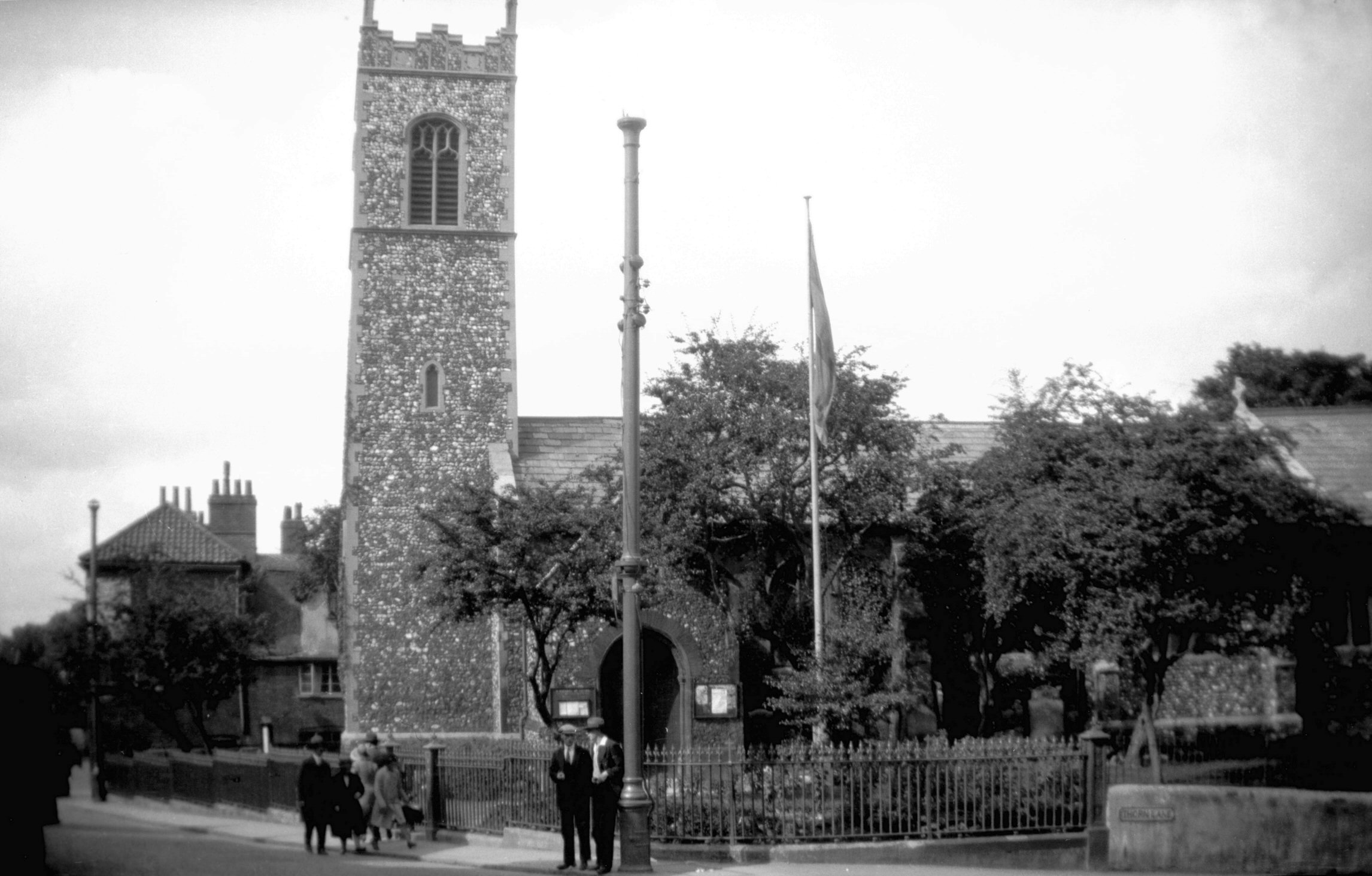
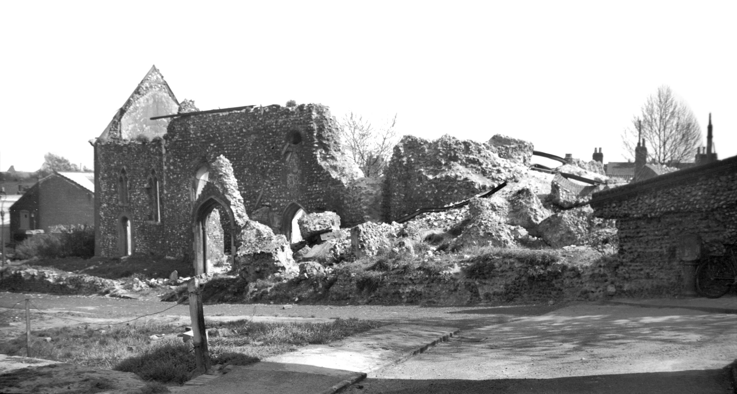
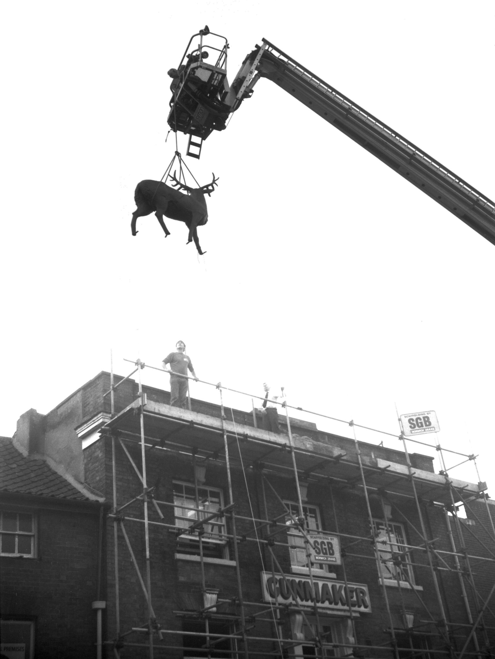
    This is a planning mistake, and quite a sizeable one in my view. George Plunkett shows what was here in the 1930s, which was St. Michael at Thorn church from which this parish takes its name.

    There was likely a church here from the late Saxon period, but it was rebuilt in the medieval period and a steeple added in 1430 following another major rebuilding effort.

    There was another substantial renovation which took place in the Victorian period, with this plan dating from 1870. It could be argued that this didn’t go entirely to plan, as the tower fell down on 3 November 1886 which wasn’t at all ideal, especially as it took some of the nave with it. The cost of this restoration, which restored the tower to its previous appearance with the exception of the pinnacles and a parapet, cost £500 and the church struggled to raise this. I have some sadness here to think of how much people struggled to raise this money for their church, which they viewed as important and wanted to be successful. They did well though, the damage was repaired within one year of the tower collapse and the service at its reopening was very well attended.

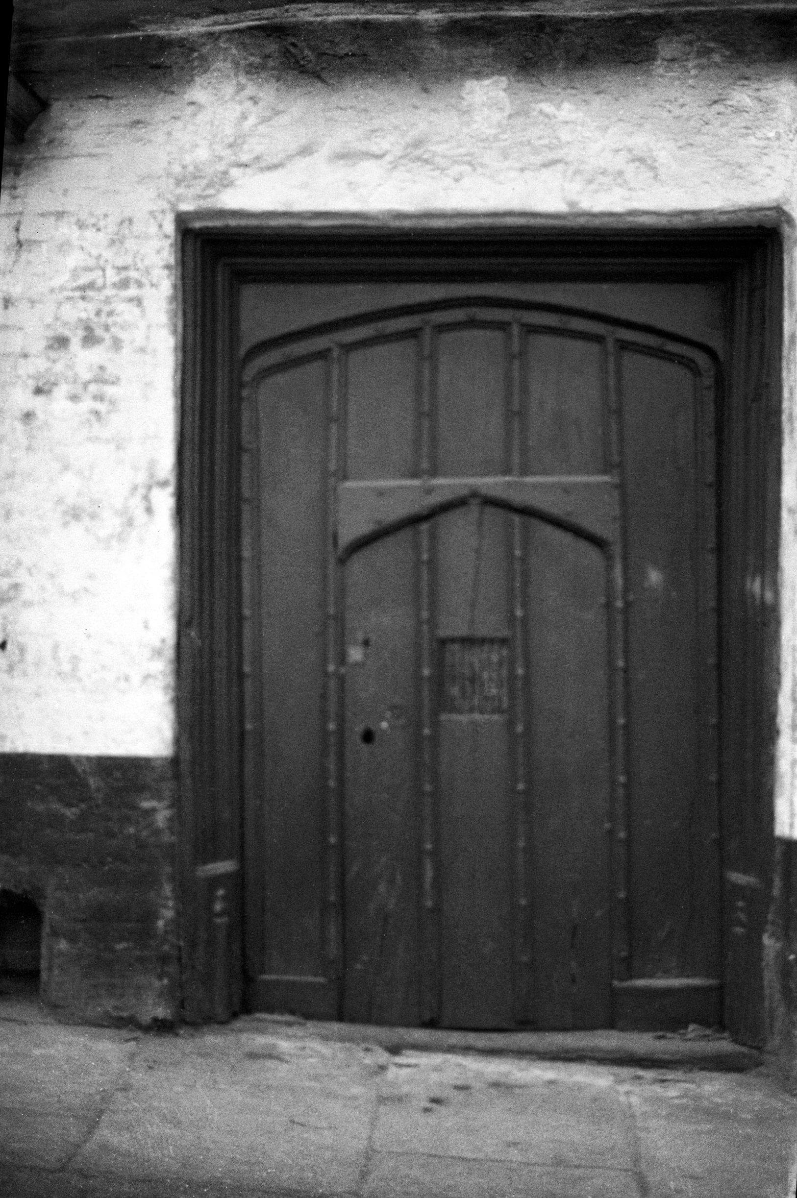
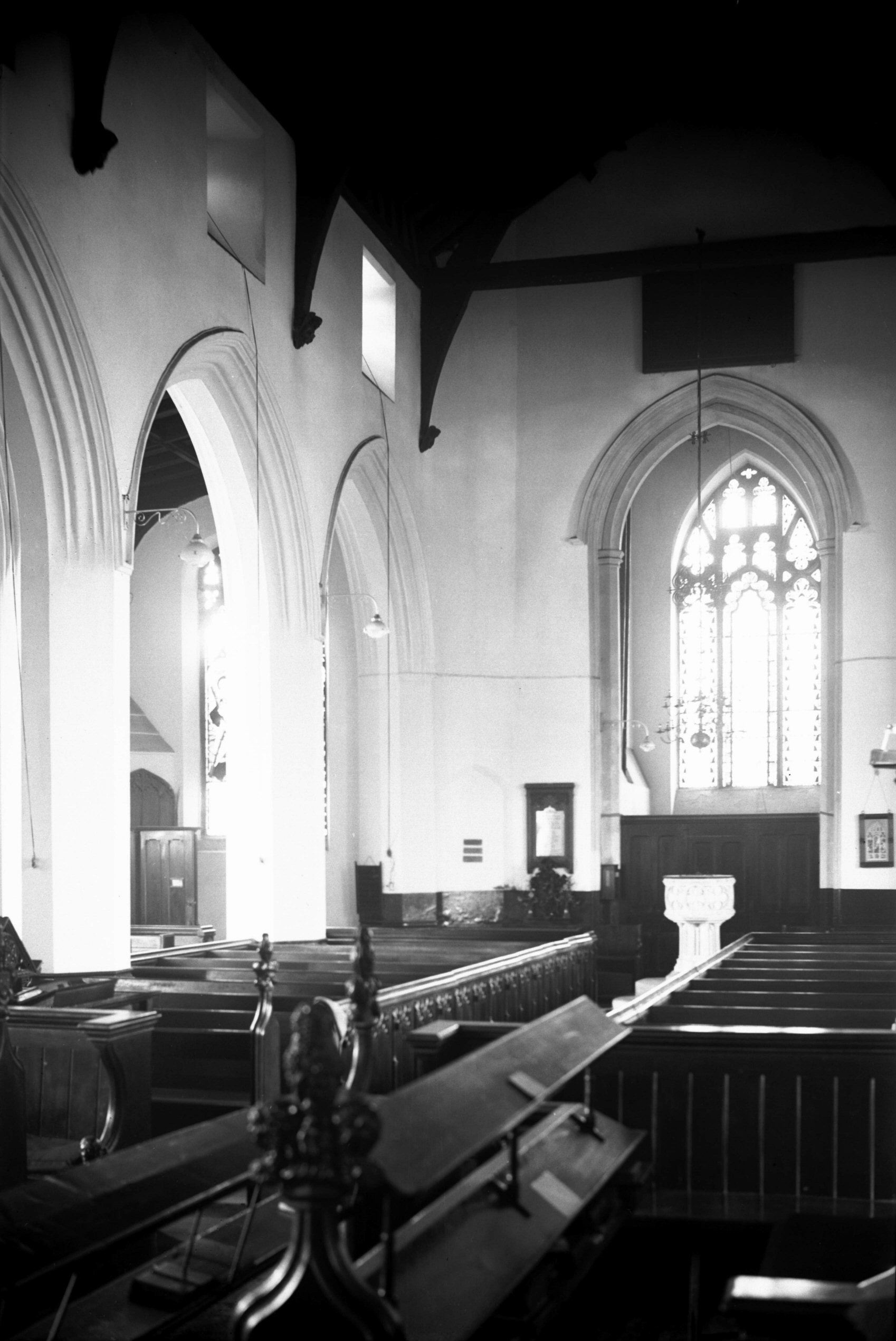
    The nave and chancel of the church was destroyed during air raids during the Second World War, but the tower survived. There was talk of rebuilding the church in 1948 and costings were drawn up, but this was at a time when there were enough churches in Norwich and there wasn’t enough support for its reconstruction. Just down the road, St. Julian’s Church had also been damaged and it was decided that only one church needed saving. Indeed, the door from St. Michael’s was used as part of that reconstruction, so at least something remains. The Church of England had the power though to do more here, they were quick to demand locals pay money that they didn’t have to repair the church in times of need not that many decades before, but they abandoned it with perhaps undue haste. Anyway, George Swain took a photo of the doorway in 1952, just before it was moved.

    As for the reuse of this site, I think it was idiocy to turn this entire area into a car park. It could have been turned into a play park as happened at St. Paul’s church in the city, something that was a useful amenity to the local population. It was decided to save the towers at St. Bartholomew’s Church in Heigham and St Benedict’s Church on the street of the same name, so that could have been done here.

    Located over the road from the church, likely where the residential home is now located on the corner, was a grand house. Blomefield notes:

    “The house over against the church with a large garden, of 3 or 4 acres thereto belonging was anciently John Corbet’s; then Edward Southwell’s, after that Alderman Tho. Grene’s; after that Sir Nicholas Bacon’s city house; and during the time Bishop Reynold’s was repairing the palace, he dwelt there; it was a grand house, but is now converted into small tenements.”

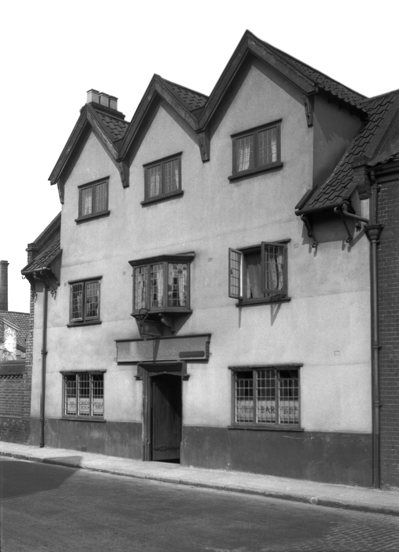
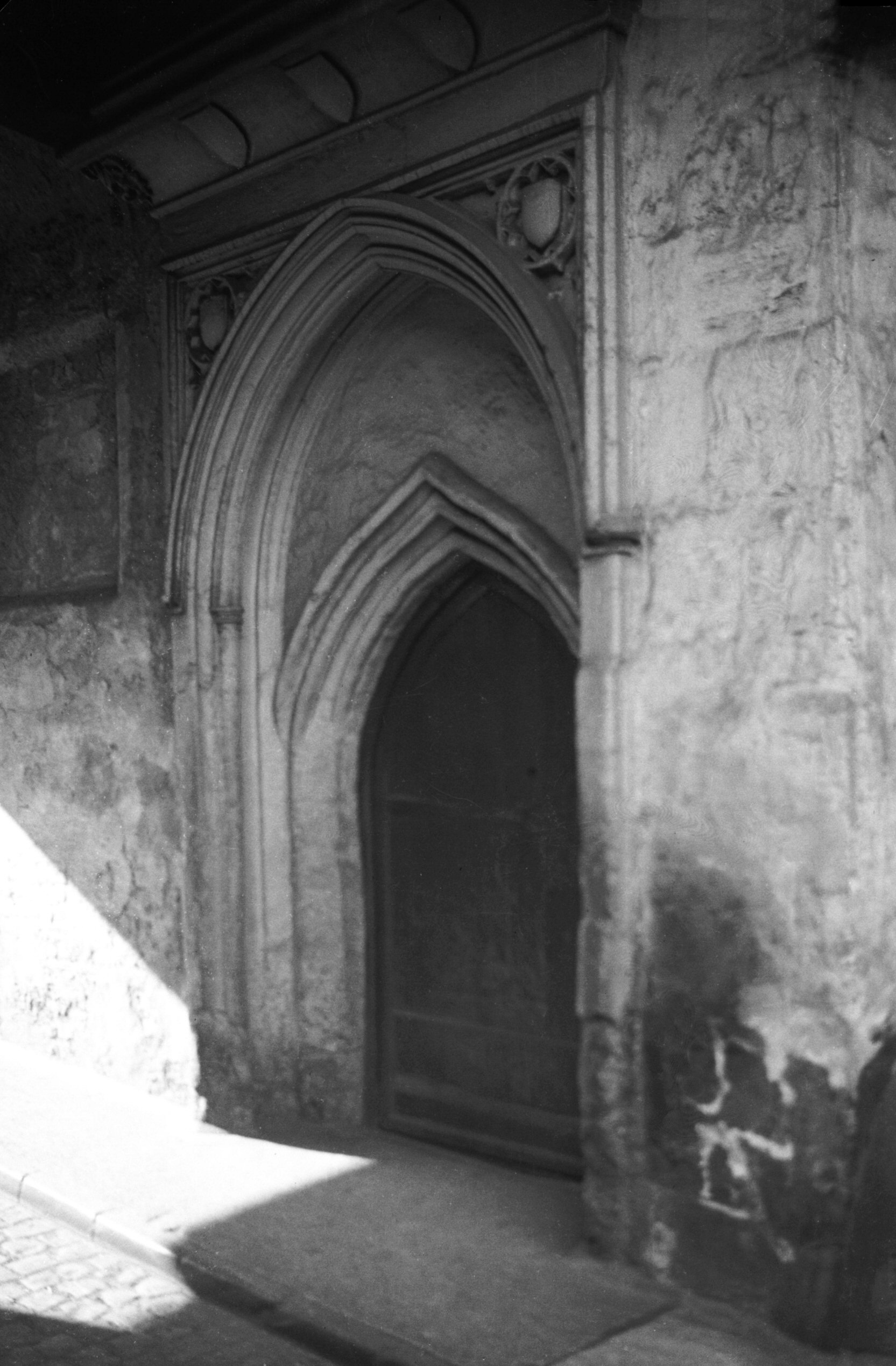
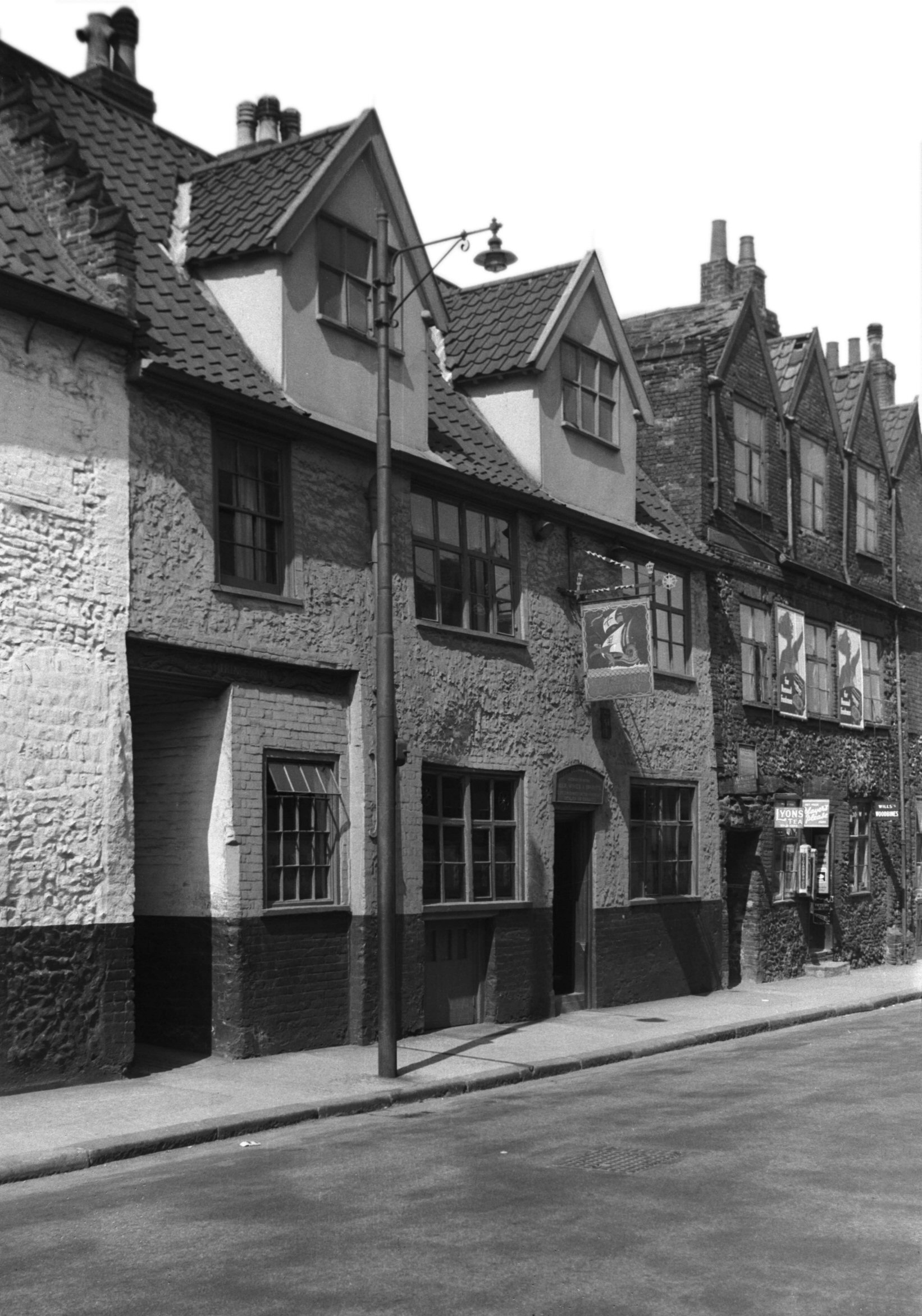
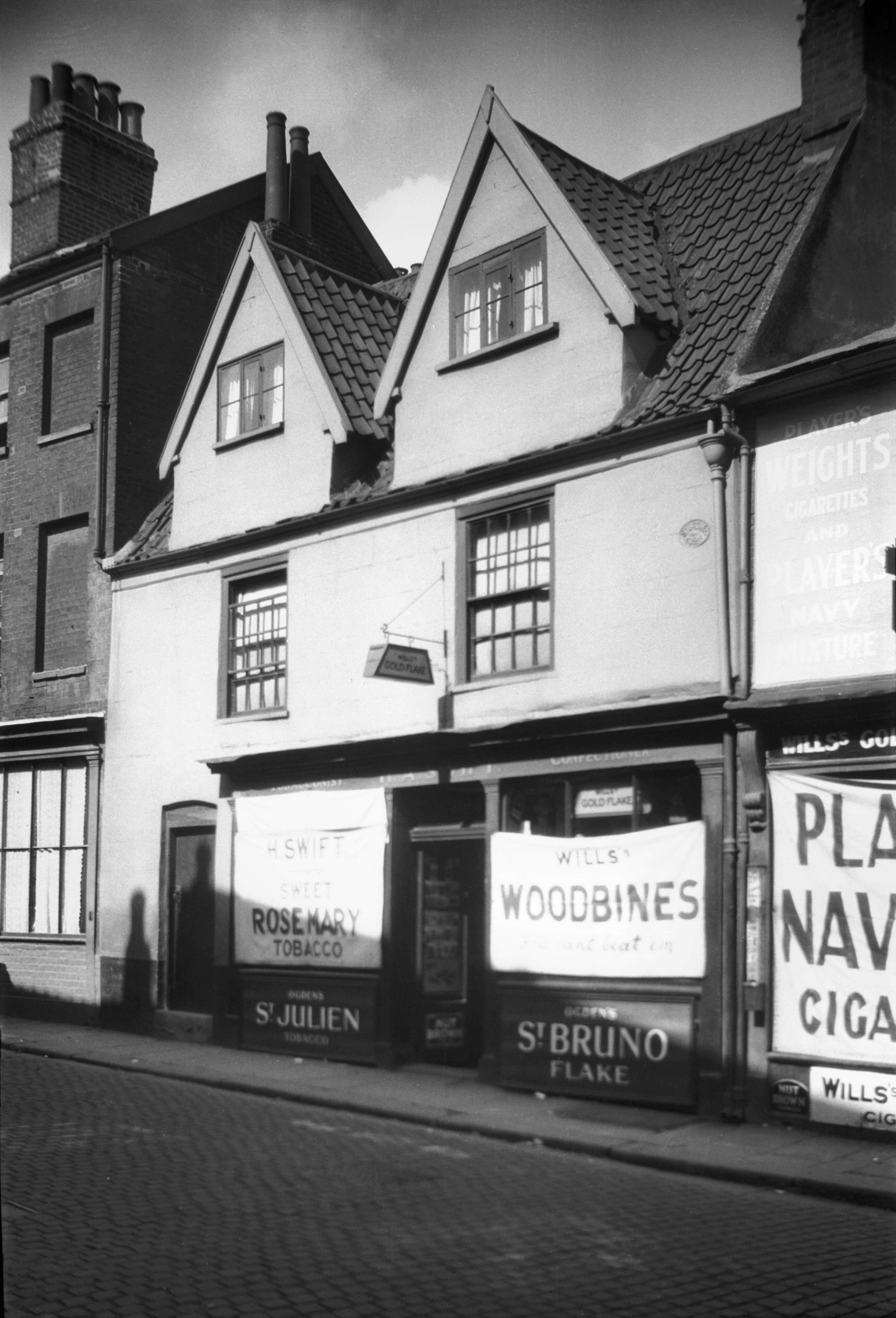
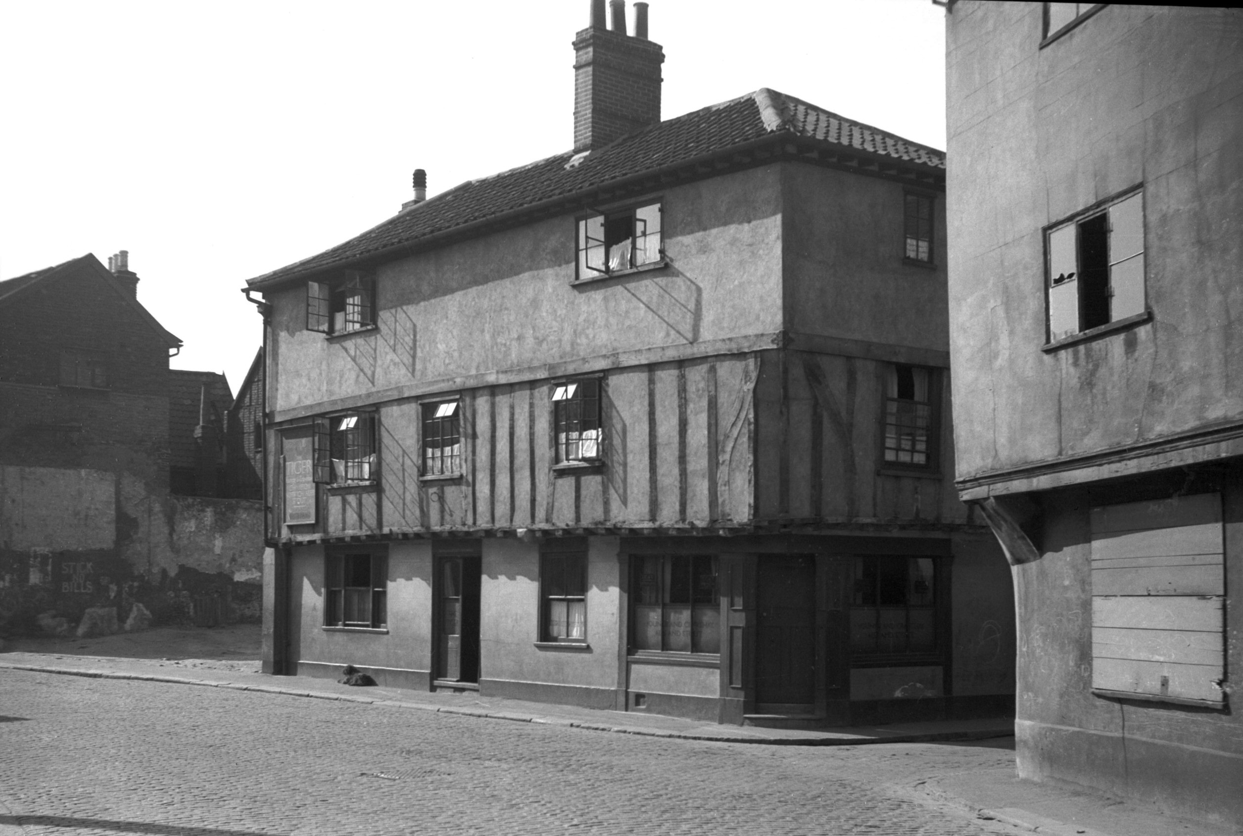
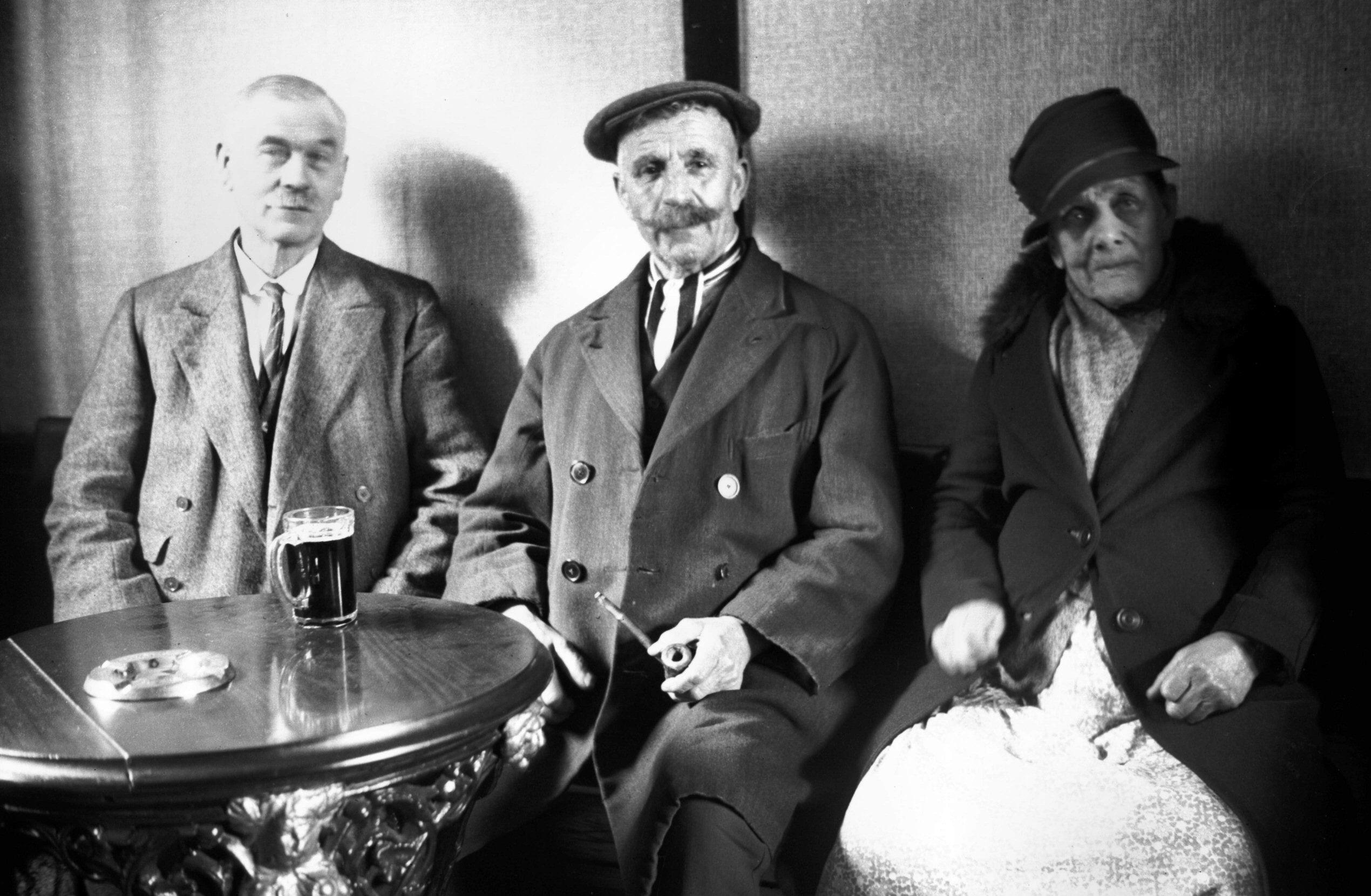
    Located next to the church, and bordering onto the parish of St. John the Baptist, was the Windmill pub and then two doors down from that was the Exhibition Tavern. The Windmill pub had traded as a licensed premises from at least 1760, but the building was damaged during the Second World War and the City Corporation compulsorily purchased it in 1958. They then demolished it in 1970, but George Plunkett has a photo of Windmill Alley which he took from the churchyard in 1937 and that shows the rear of the pub. The Exhibition Tavern traded from the 1860s, but was closed in the early twentieth century when it was decided nationally to reduce the number of licensed premises.

    For anyone who doubts the number of pubs in Victorian Norwich, this is what existed around St. Michael’s church in the 1870s, the PHs being public houses and the Tavs being Taverns. All I can say is what a time to be alive…..

    I don’t know why there’s a Christmas tree stuck on the side of this building in April, but this is located opposite the end of Thorn Lane.

    A sculpture which was installed here in 1999, which I’ve never entirely understood. Given that, I’ll just quote what Norwich City Council say about it:

    “The railings combine forms which reflect the tree-trunks and leaves with mechanically inspired springs and zigzag forms. They were created both for and with the residents of Brooke Place responsible for modelling the roundels in clay which were then cast in bronze and fixed to the railings.”

    Brooke Place stands today in the vicinity of where Brooke Yard was once located, although none of the streetlines match up.

    This is Brooke Place today, with the access road to it (on the John Lewis side) once being the route of Berry’s Court.

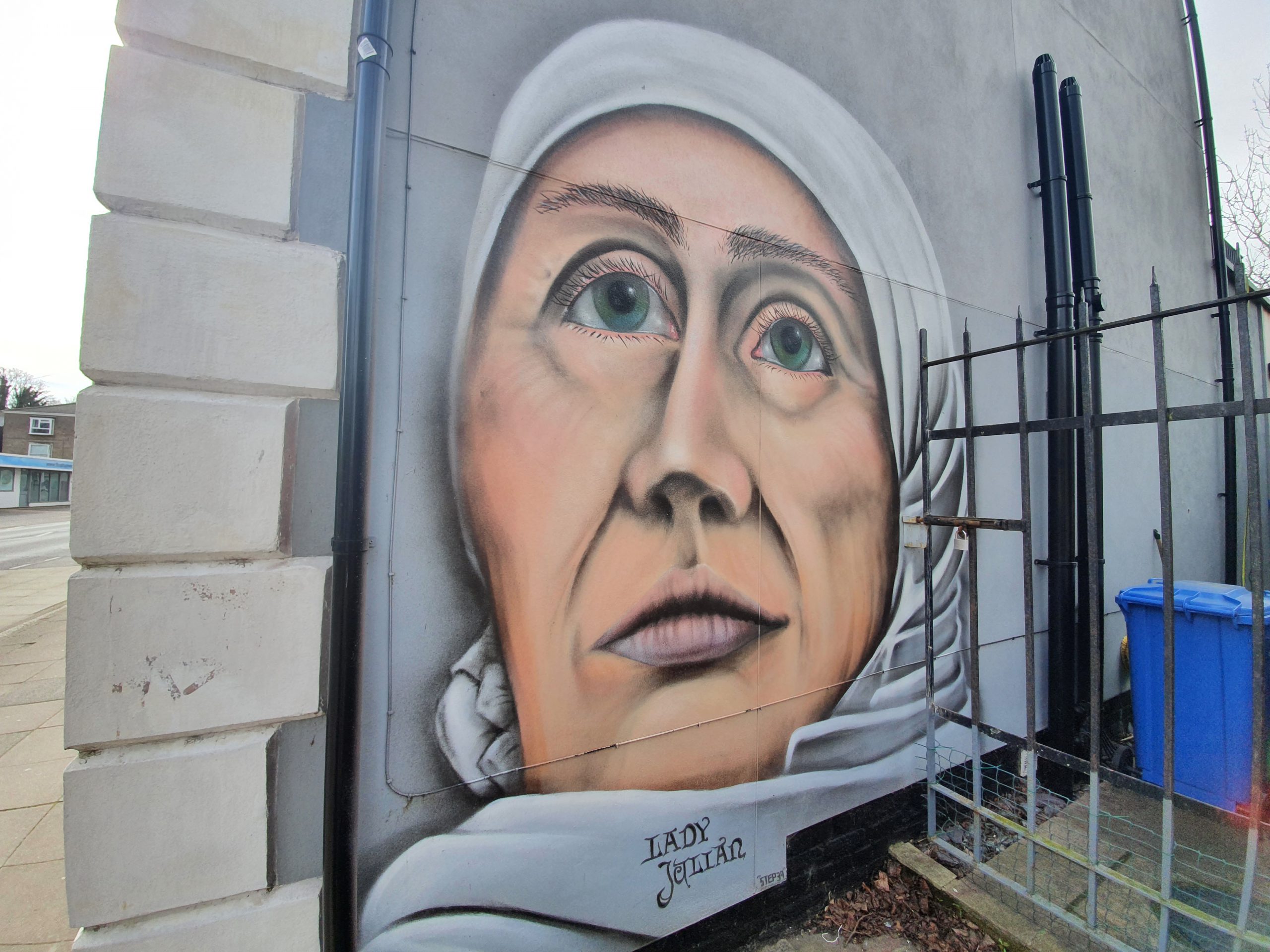
    Some street art of St. Julian of Norwich.

    This is Surrey Grove, a route that has been here for a few hundred years, although it was once a tree lined route on either side. It’s all a bit less salubrious today.

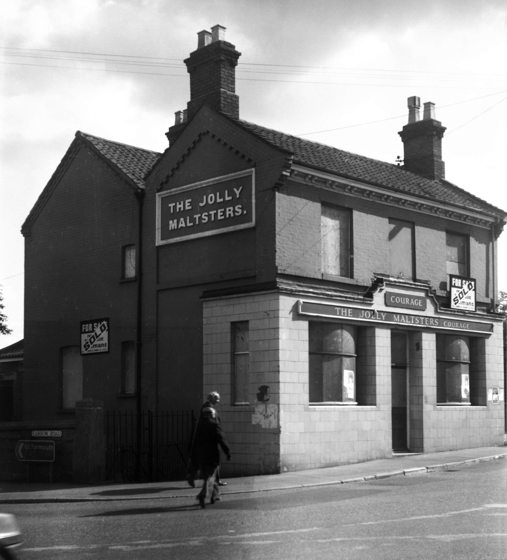
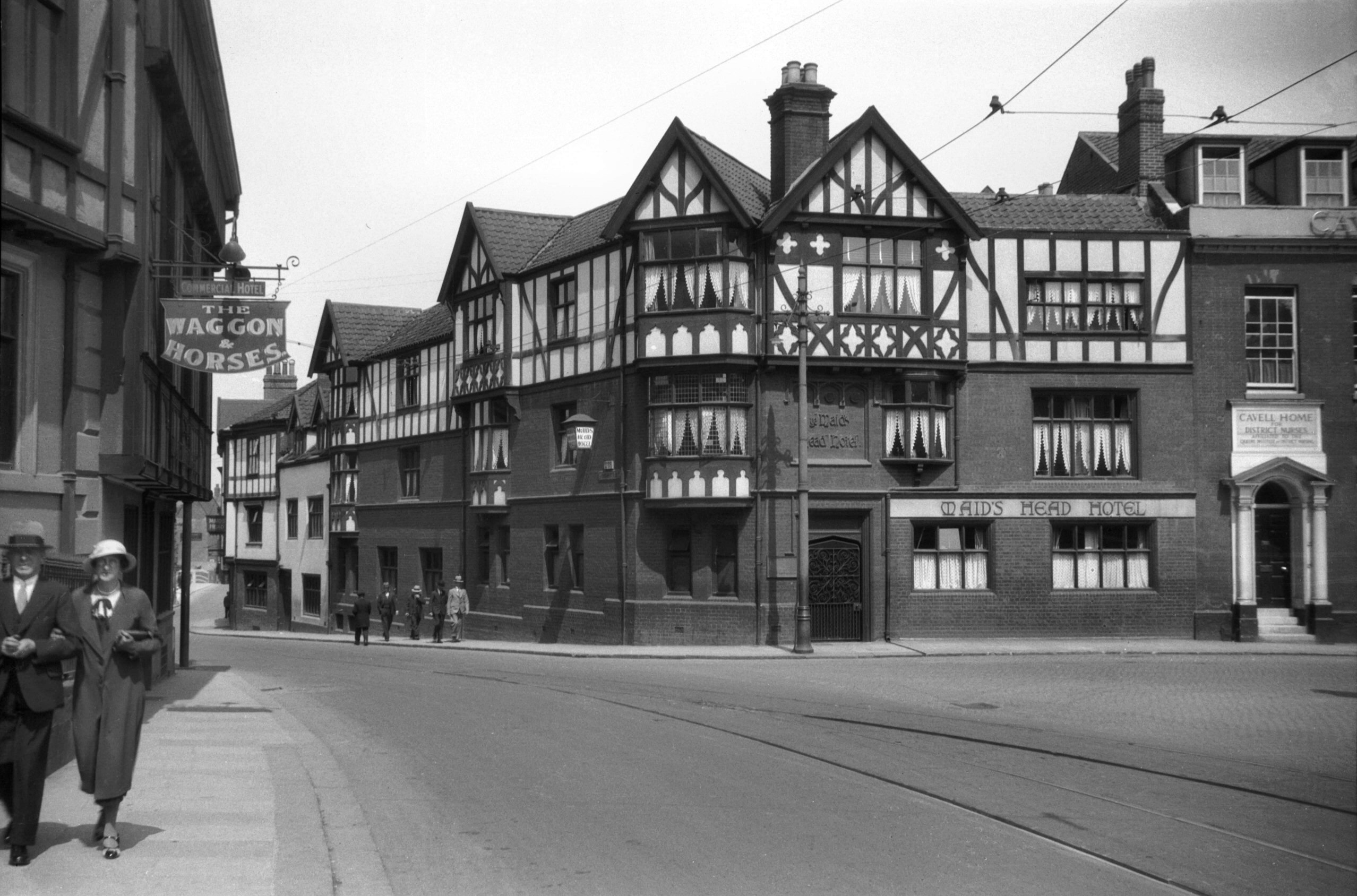
    The parish reaches Surrey Street, but on the left hand-side of Surrey Grove the only building that is part of the parish is now called the Surrey Kitchen & Bar, or what I still consider to be the Surrey Tavern. This has been a pub since at least the 1850s, and despite some regular brief periods of closure over the last couple of decades, it is continuing to trade.

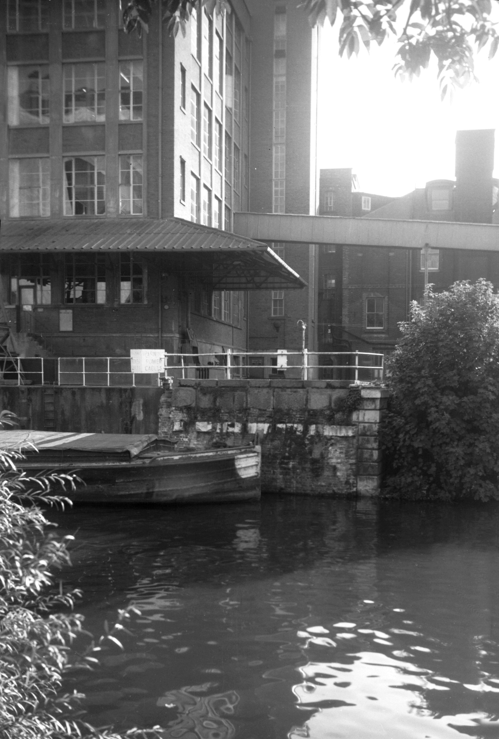
    This ugly building (I think it’s ugly anyway….) is Norfolk Tower and is one of the tallest in Norwich, being the home of BBC Radio Norfolk between 1980 and 2003, when the corporation decided it needed some of the most prestigious office space in Norwich in the new Forum. The parish incorporated some of this building, but then cut back in, so it didn’t go far down Surrey Road (or Surrey Street for those who prefer that).

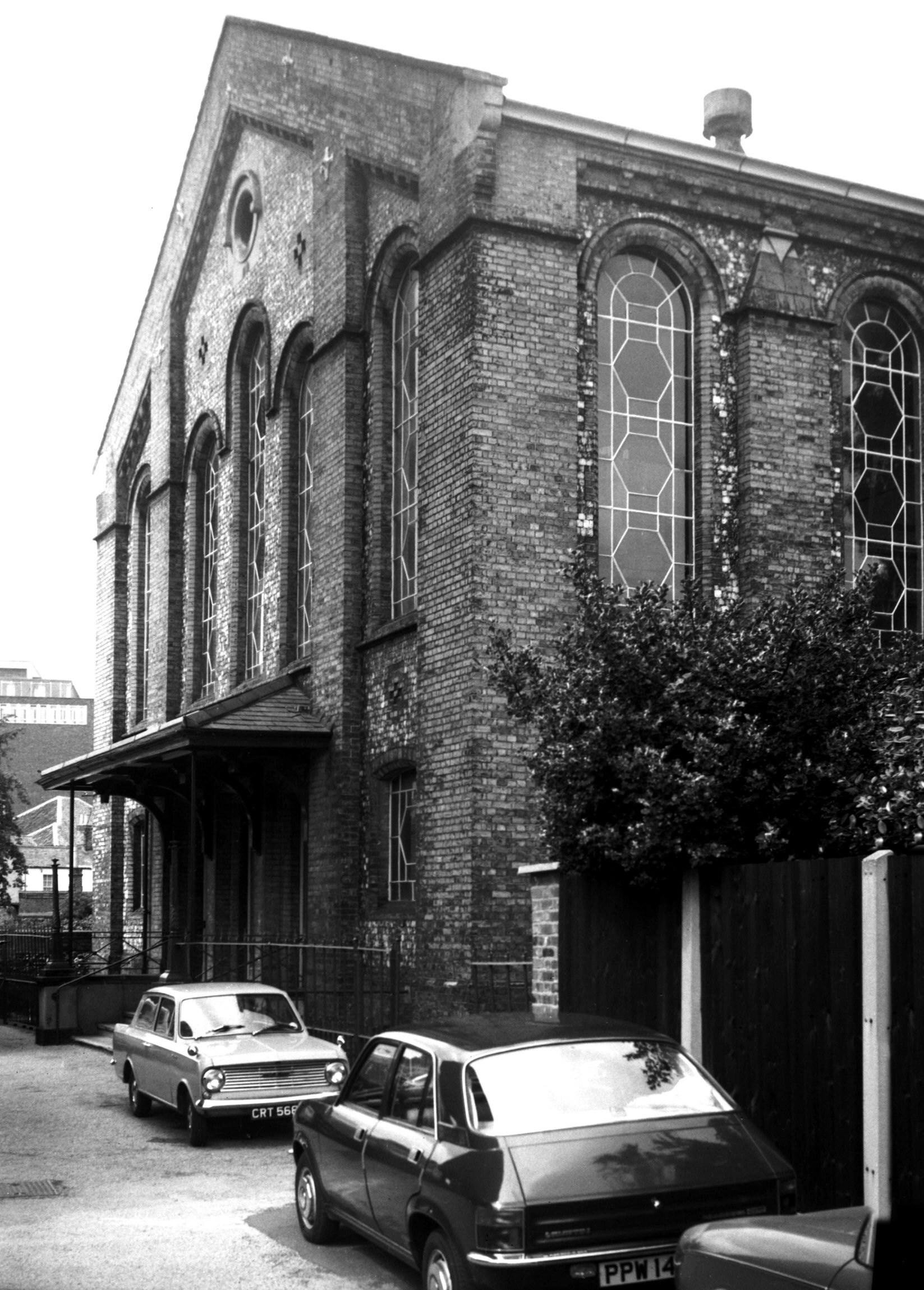
    Behind Norfolk Tower is another car park, but this was once where a large baptist church built in 1854 with seats for 1,400 people was located. George Plunkett took a photo of the building in 1979, but it was demolished in 1986. Some of the church might just have projected into the building on the left-hand side, although that’s another car park, this time for John Lewis.

    A closed footpath behind John Lewis, although I’m not sure where it normally leads to, unless it’s into the shop. I didn’t investigate given the signage.

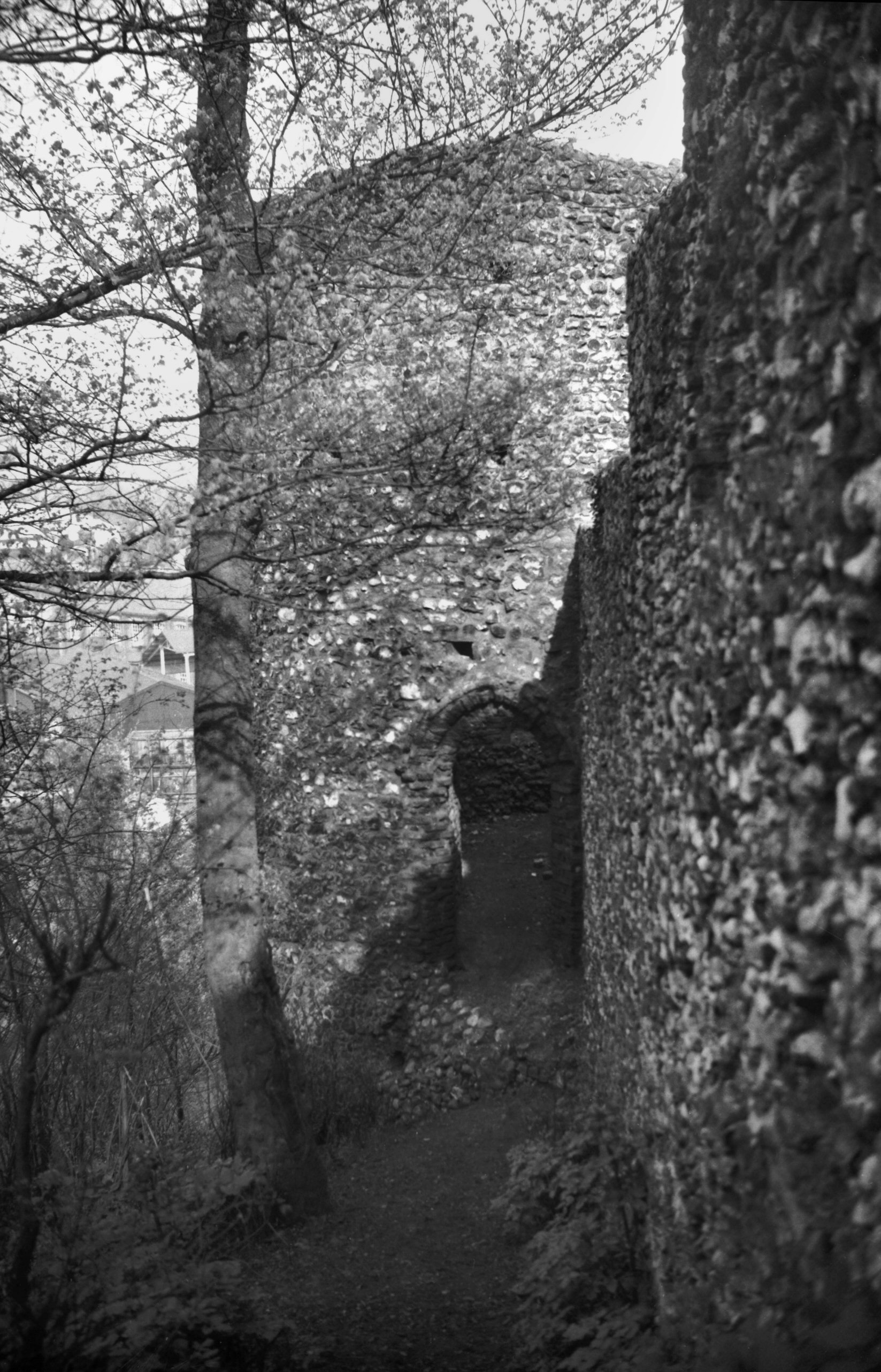
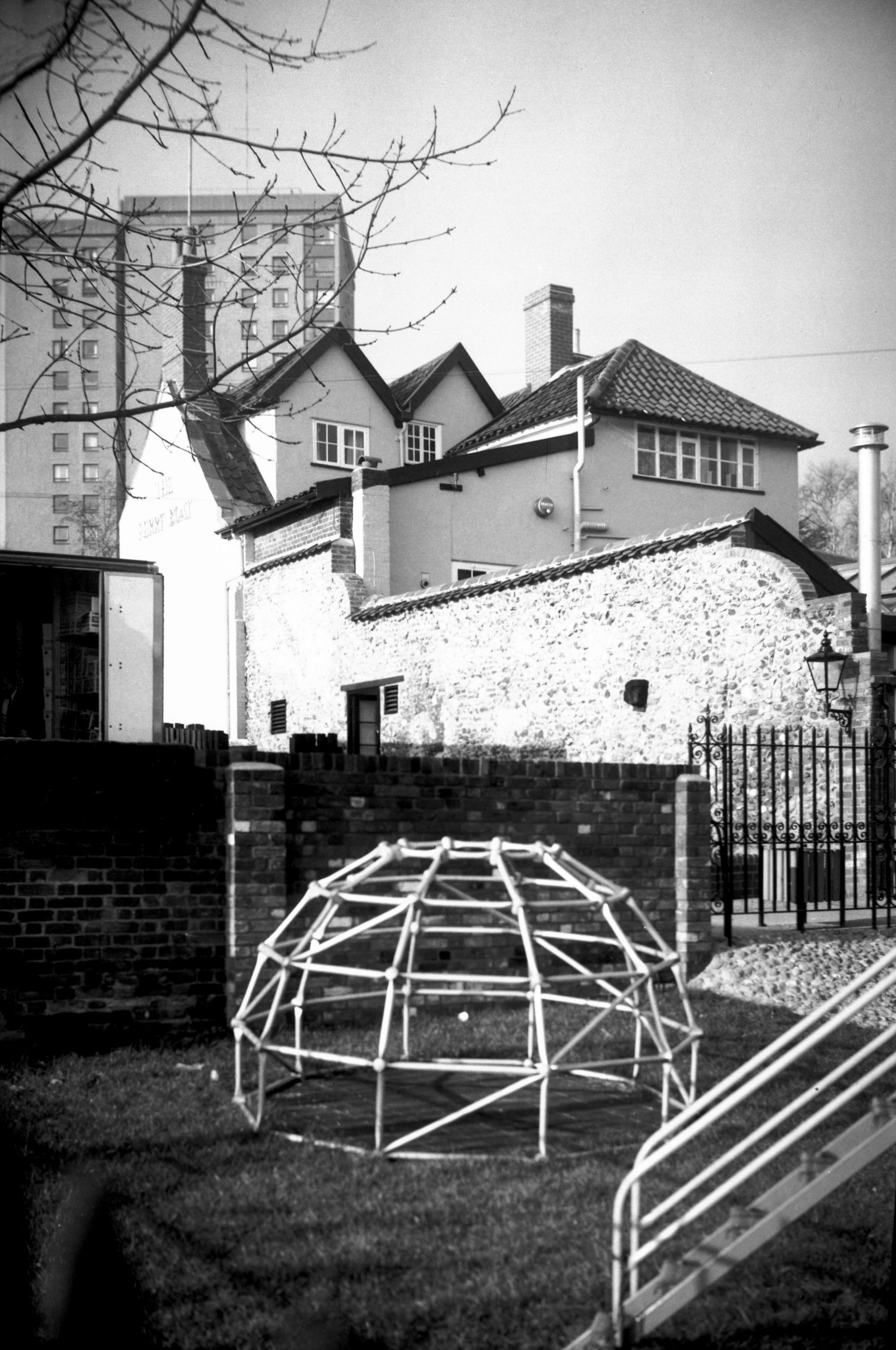
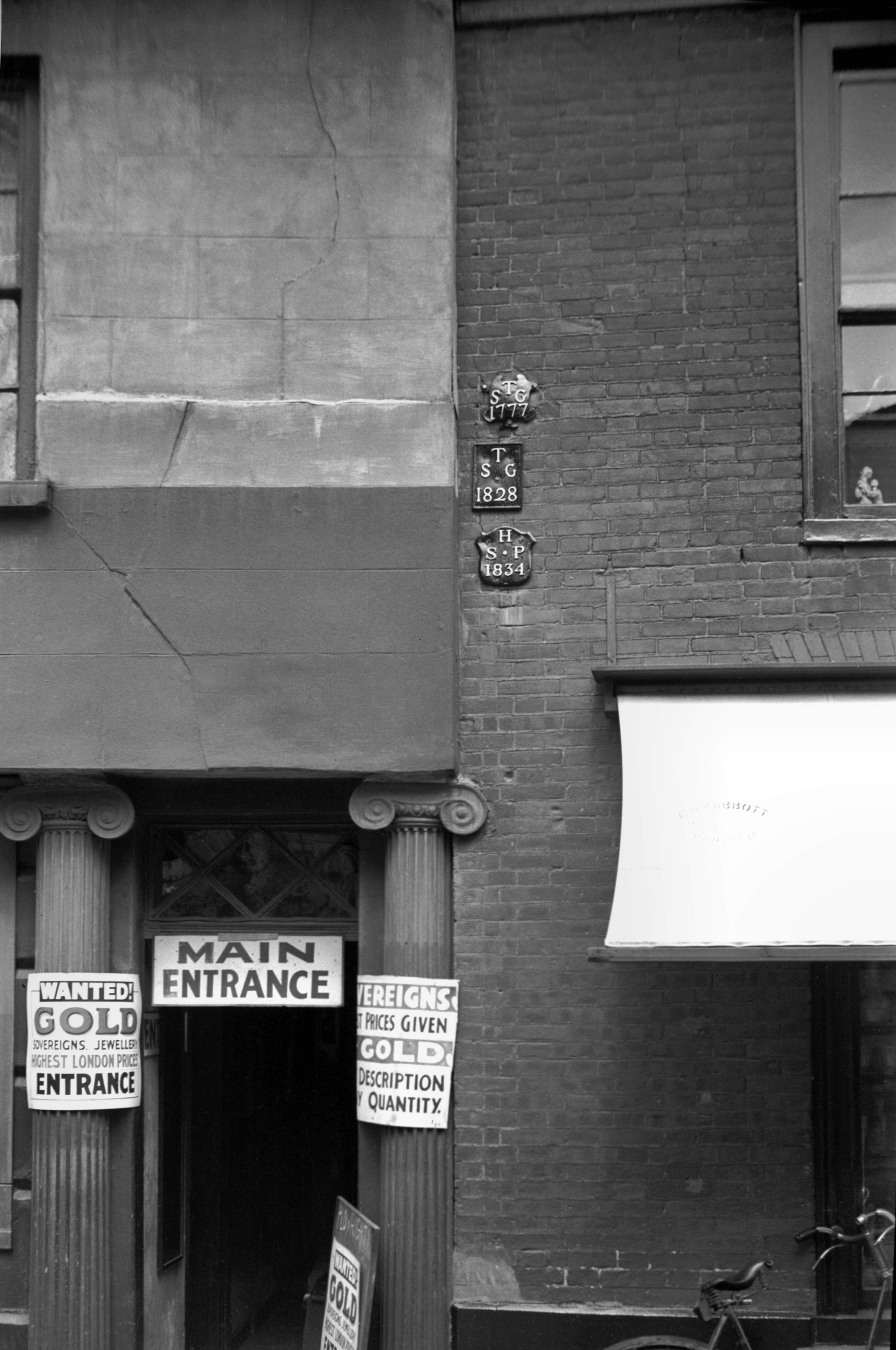
    The wall here by the car park was pretty much the oldest thing remaining in this area since the council have allowed everything else to be demolished.

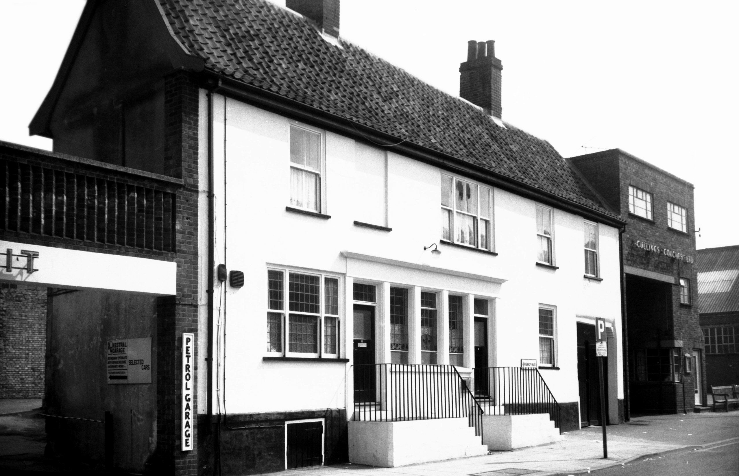
    This was once Glasswells Furniture Store, which opened in 1984. The building was later used as a temporary lending library following the disastrous fire which destroyed Norwich central library in August 1994.

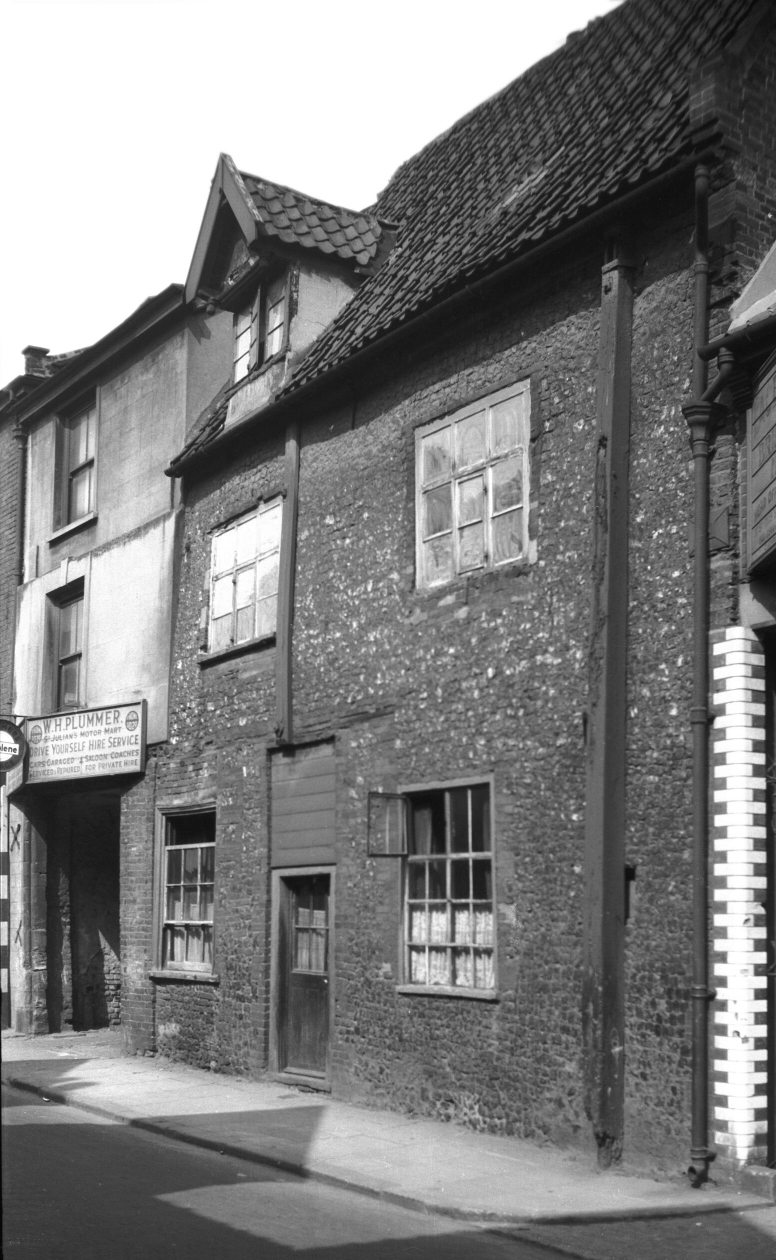
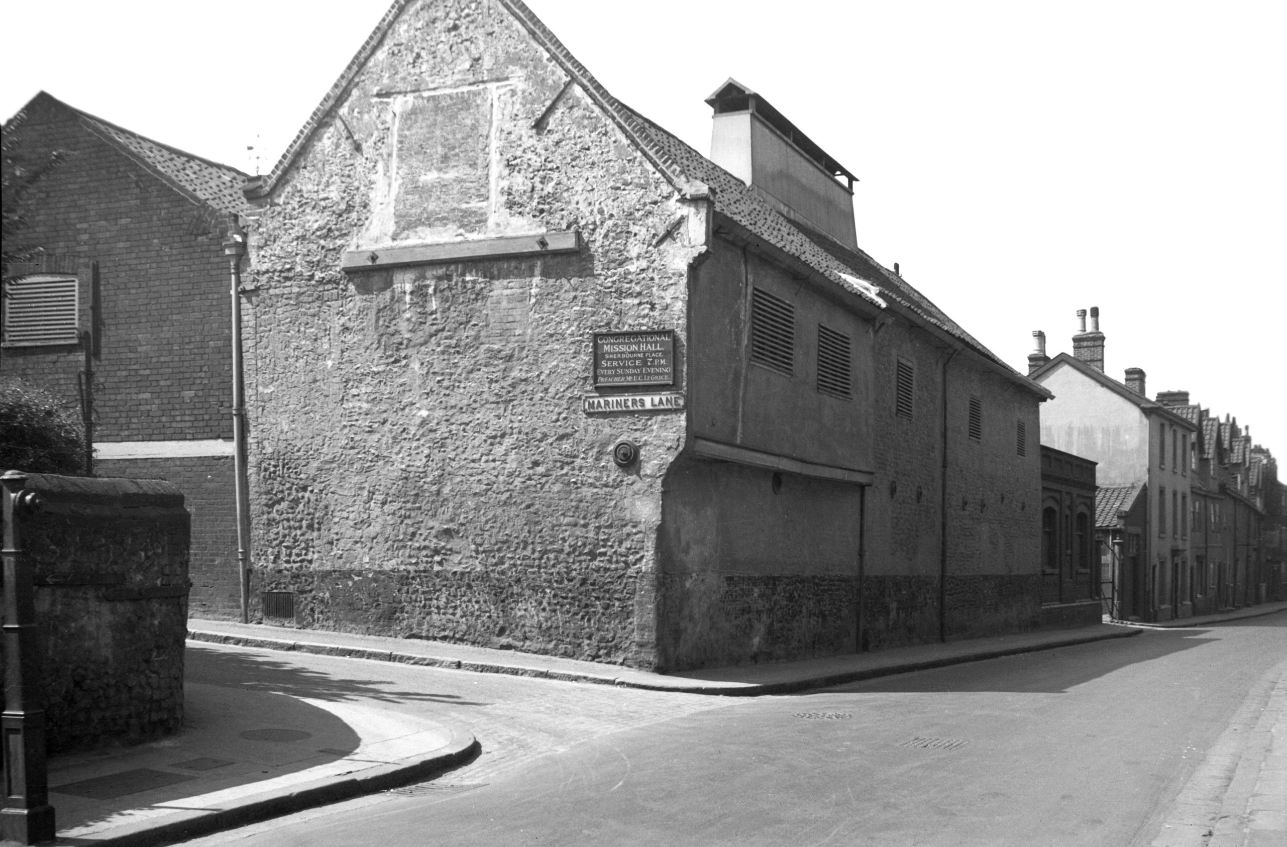
    The path which runs behind the properties facing onto Ber Street, connecting Horns Lane with Thorn Lane. Incidentally, there used to be a Twitters Court located just by here, that would have been a popular location today if it had survived. Although I suppose people would have kept pinching the street sign, so perhaps it’s best not to be there any more.

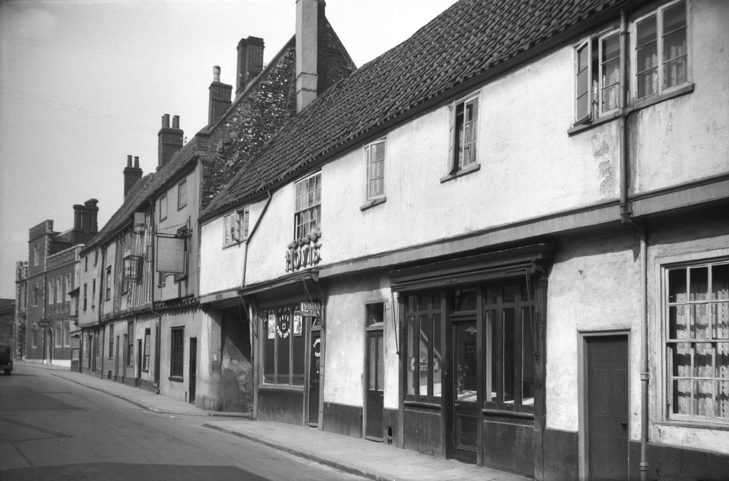
    Just to the right, there was a Victorian urinal, handy given how many pubs were in this vicinity. And just by where that sign is today, that would have been the entrance to the Rose Tavern, which was open from the 1850s to around 1910.

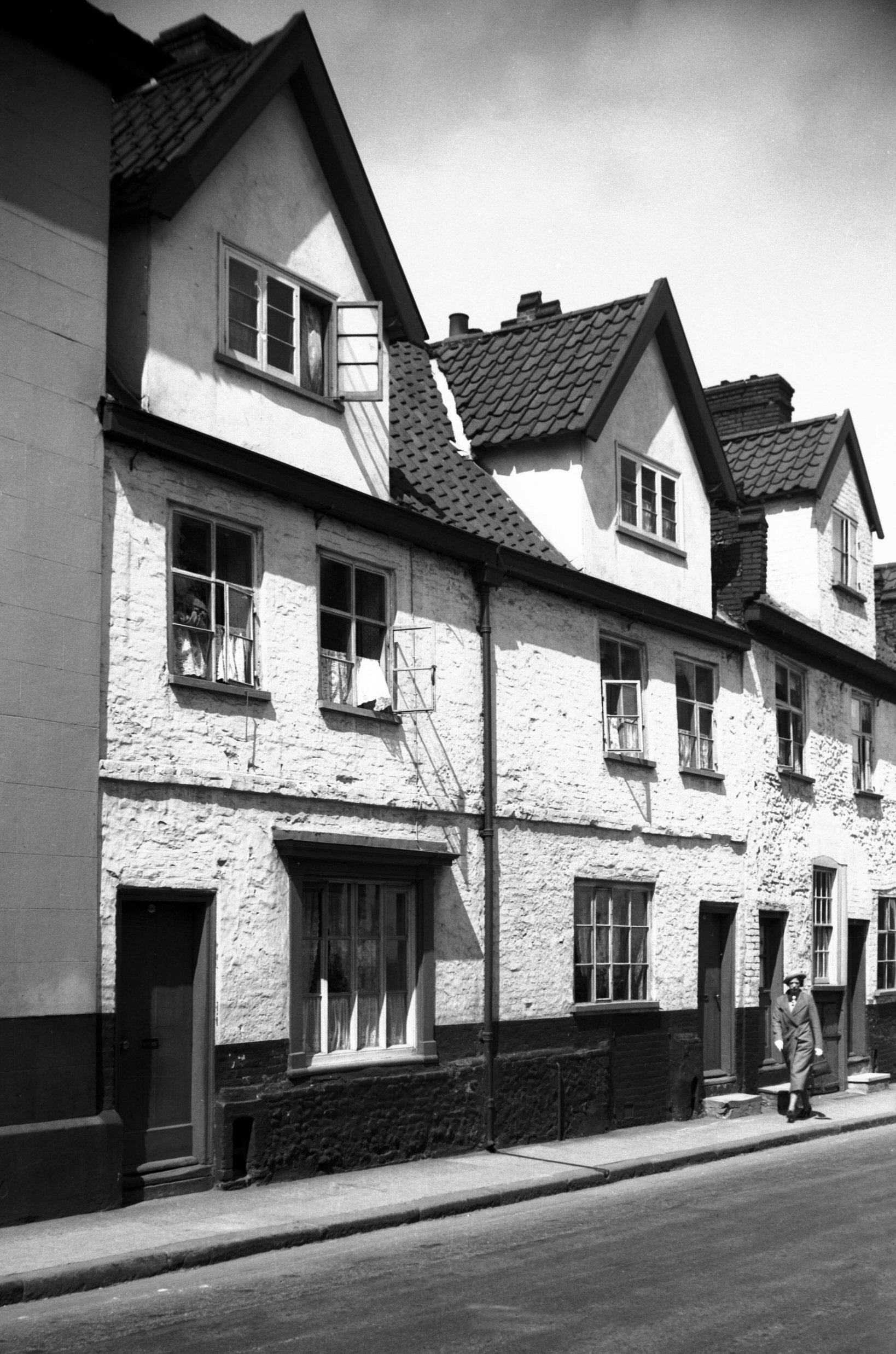
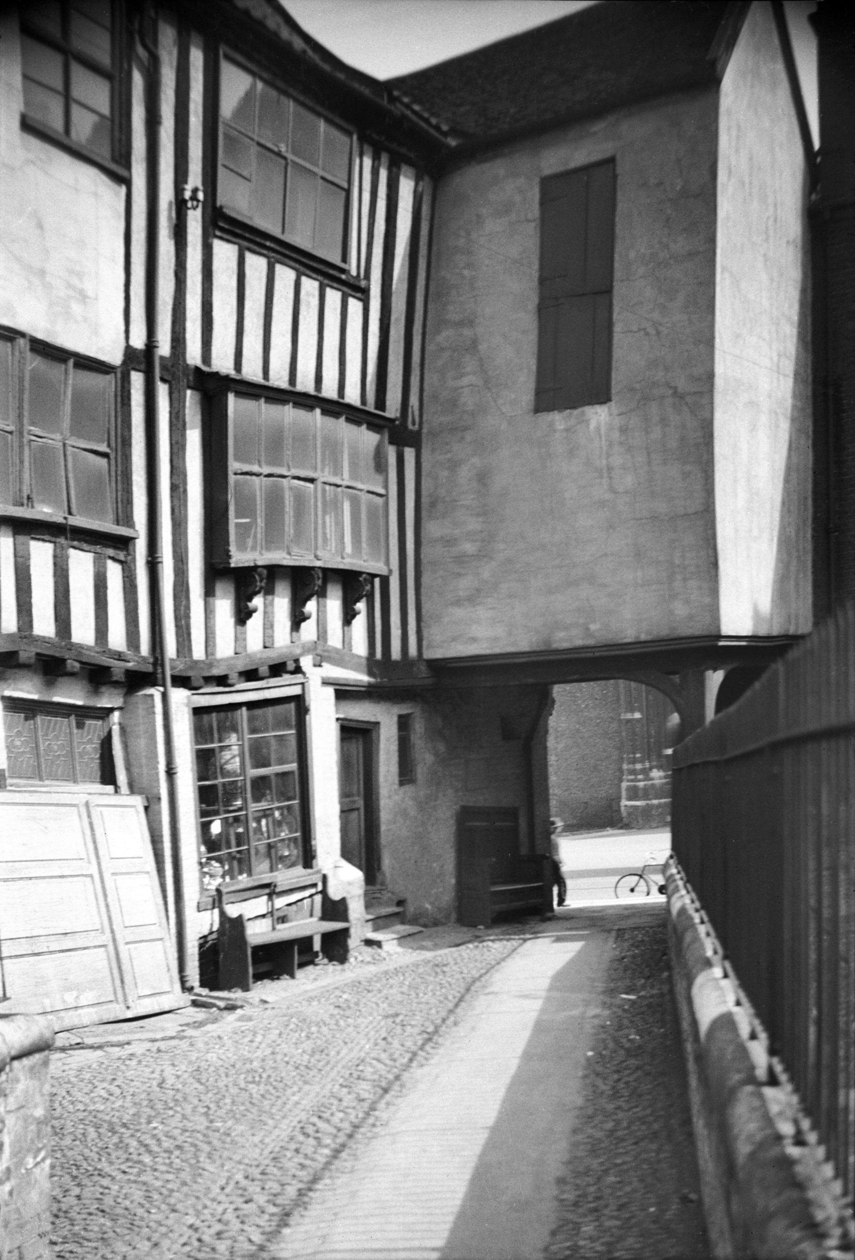
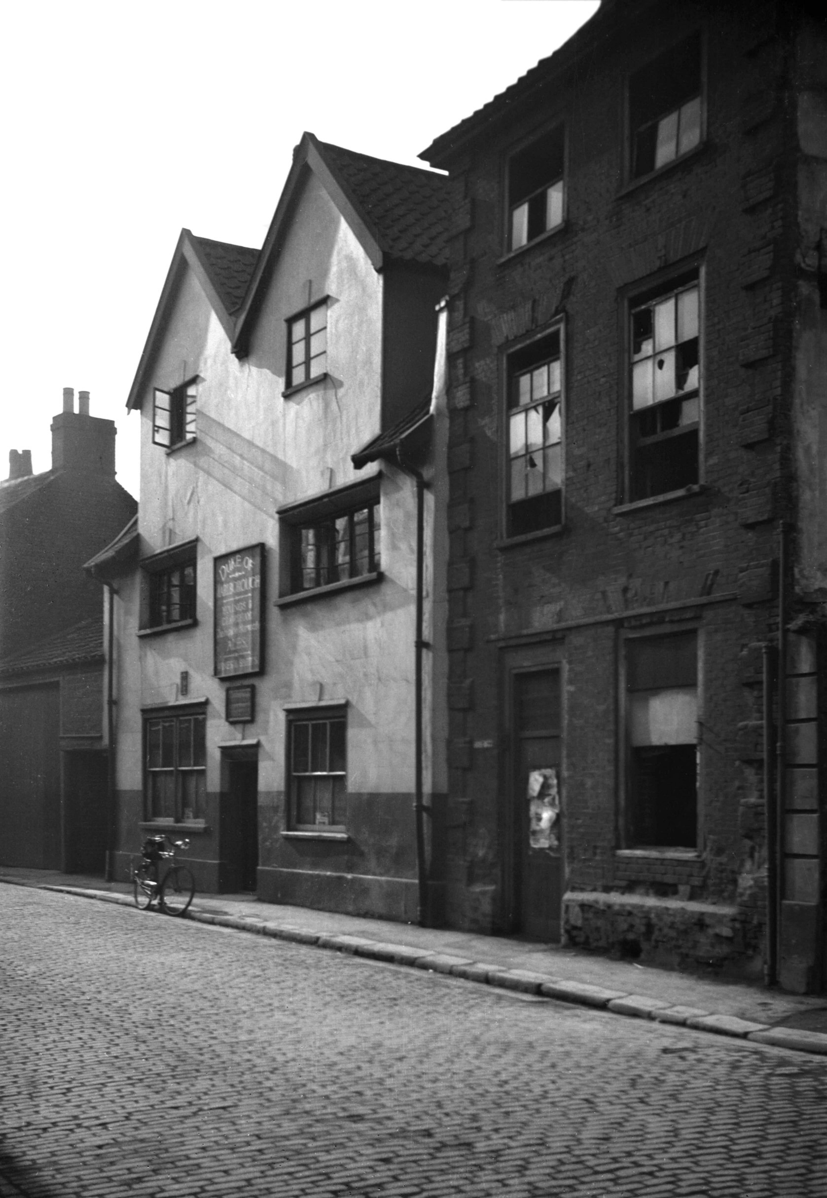
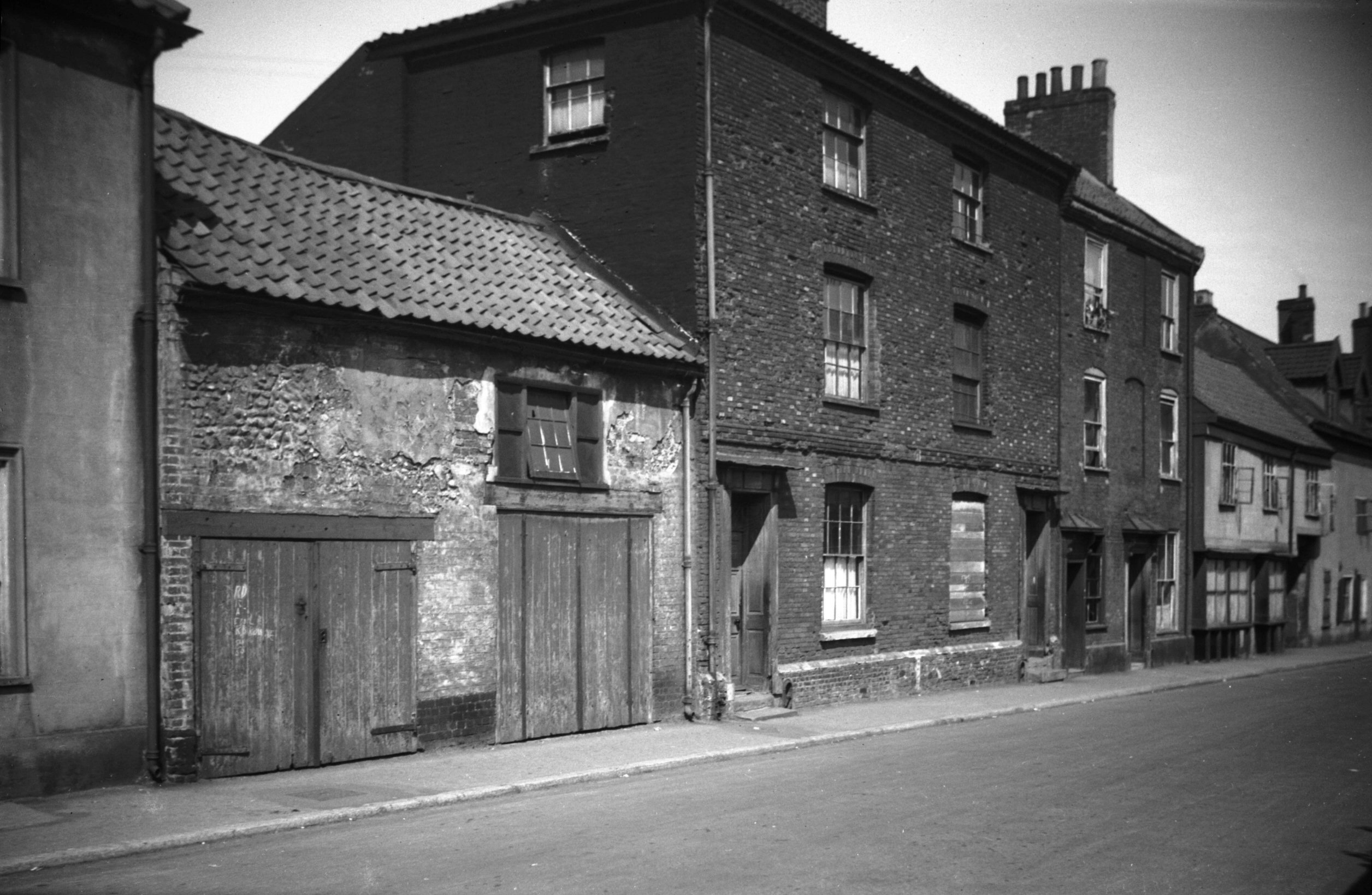
    Around ten metres further down the road, this is where the Bartholomew Tavern would have stood, a pub that was open from the 1850s until the 1960s. Here’s a photo of it from the 1930s, with the entrance to Bartholomew Street being about where that tree is in the above photo. There’s an interesting dip in the road in that 1930s photo, I hadn’t noticed that before in any images.

    I like it when councils keep street lines when redeveloping an area, it anchors the area to the past even if the buildings are nearly all changed. And, I’ve never paid much attention to Garden Street, but after some checking on a dual map, it’s in exactly the same place as it once was when there was housing in the area. Indeed, the area in front of this sign was once a corner pub, the Carpenters’ Arms. This means that there were three pubs within literally throwing distance.

    There’s more information about the Carpenters’ Arms, including a photo, at Norfolk Pubs. The pub closed in 1963, so that the council could build a lovely new car park. One thing you can’t criticise Norwich City Council for is their determination to ensure there is always somewhere for people to park their car in Norwich.

    This is Garden Street today and I can see that an effort has been made to bring some light commercial zoning into the area. But, this was perfectly good housing and I think it should have remained for that usage. Instead, it’s mostly now all car park.

    That’s another parish done, and there’s surprisingly little history still remaining here, much less than I had expected for an area so close to the city centre. Next week, the other part of the parish which I hope is more history and less car park.

  • Norwich History by Parish : St. Peter Southgate

    Norwich History by Parish : St. Peter Southgate

    And a new little project that Jonathan and I are undertaking because this lockdown is clearly here for at least a few more weeks. It’s a bit niche (our project I mean, not the lockdown), I’ll accept that, but there we go. Effectively, it’s walking around Norwich, ancient parish by ancient parish and seeing what is there now compared to a map from the 1880s (and the 1920s). There’s a PDF of these boundaries to provide some extra background to this whole project.

    Today’s meander was around the parish of St. Peter Southgate, which sits at the southern end of King Street, connecting to the parish of St. Julian’s. This parish has retained much of its medieval character, not least the city walls which run straight through the middle of St. Peter Southgate. The church itself has mostly gone, but some of the structure remains and the churchyard is now partly used as a playground. Some of the riverside buildings have also gone, but equally, many have been turned into residential properties. The old road structure and layout remains in place here, with the exception of Carrow Bridge which has moved location slightly. Overall, I do like this part of Norwich, and it has some extensive views over the city centre.

    The parish cuts across the Read Mills development, with the Malt House, Ferry Yard, Albion Mill and Spooner’s Wharf all being in this parish, and Cannon Wharf is in St. Julian’s parish. I quite like this development, there’s a mixture of old and new, with some redeveloped buildings and some new build. George Plunkett has a photo here from 1968. The sad loss here is the pub that stood at the edge of this development where it joins onto Carrow Bridge, as this used to be the Kingsway Pub (photo from 1938) which traded from 1935 until 2001 and was demolished in 2005.

    The Reads Mill development is on the site of where St. Olave’s Church once stood. St. Olave was a Scandinavian saint and this church was here in Saxon times, but there’s documentary evidence that it stood here between 1186 and 1210. It’s not known when the building was demolished, but it was before 1345. I mentioned to Jonathan that I was confused why the wall opposite, Southgate Lane, had chunks of what looked like Caen stone from the Cathedral, but it seems that it might well have been taken from this church.

    I rather like these steps, well worn over the decades, and they’re at the entrance to Southgate Lane.

    The old sign still hanging onto the flint wall.

    This is the path which leads onto Bracondale and Ber Street. There was an entrance to St. Peter’s churchyard somewhere on the wall to the left, but it appears this was rebuilt in the late nineteenth century and so any evidence of that has gone.

    This is the church from which the parish takes its name, St. Peter Southgate, and it was the most southerly church within the city walls. This is all that remains of it today, but it was still standing (sort of, bits were falling off which isn’t ideal) in the 1880s. There was some talk at the time of saving it, but there were enough other churches in the area, so it was mostly demolished in 1887. What is quite exciting is that there was some archaeological work here in 1997 and they found that some of the structure had been left buried underground and they also found the former medieval pathway to the church.

    What remains today is the lower part of the tower, but this is what it looked like in the middle of the nineteenth century. The main structure of the building was fourteenth century, although there was likely another church on the site before that, with some redevelopment taking place in the earlier sixteenth century.

    This is where Argyle Street joins Southgate Lane. There were residential properties here until not long ago, but they were demolished as there appears to be some subsidence issues.

    Back on Southgate Lane, these properties were built on at the same time as Alan Road and Stuart Road (more on which later in this post), all part of the Colman development. These three properties are located on the former site of the rectory of St. Peter Southgate Church.

    For those who think Norfolk isn’t hilly, they should walk about a parish built onto the side of what I consider to be a mountain. This is still Southgate Lane and its near vertical incline (or what I consider vertical).

    Southgate House, but the edge of our parish is about here, so I’ll cover the rest of this area in another post. The reason that the parish line is along here is that this is the ridge which runs along this part of the city, and it formed quite an obvious boundary between the lower and upper parts of Norwich in this area.

    Now on Carrow Hill, this is the remains of the city wall which was constructed in the thirteenth and fourteenth centuries to keep dangerous people out of Norwich.

    A fair chunk of the wall stands in this part of the city, I think it’s one of the best preserved parts. Most other parts of the wall have only survived because buildings have been built up against them, but this has generally damaged the wall and development takes it toll on structures like this. Here’s a George Plunkett photo from 1934 of this section of wall.

    Until recently this was Carrow Hill Hostel, but was previously a private residence known as the Wilderness. It was constructed in the middle of the nineteenth century, with a later extension added at the end of the same century. Unfortunately, it is now boarded up, but would make a quite wonderful home given its views over the city. Or, actually, it would make a nice Greggs.

    I have to be honest and mention that this isn’t necessarily the nicest part of Norwich, there’s a fair amount of vandalism and anti-social behaviour here. I’m fairly sure that this isn’t where the railings should be either.

    The Black Tower, which was once the home of the city constable. By the eighteenth century the original defensive purpose of the tower had been lost and it was turned into a snuff mill, although the structure was modified in the nineteenth century to remove most remnants of that usage.

    The base of Black Tower which was used in the sixteenth century to hold the bodies of plague victims.

    Inside the Black Tower, but it’s gated off to prevent anyone getting in.

    Walking down the path by the city walls.

    The views over Norwich are extensive here, although a little hidden by the trees at the moment. Little has really changed in this part of Norwich, also named the Wilderness, over the last few hundred years.

    More fence smashed off from somewhere.

    I don’t know who is in charge of the maintenance here, but the wooden support rails have been damaged or have just fallen off through age.

    More of those Norwich views.

    The remnants of a bike. There’s quite an assortment of junk down here, including some wheelie bins that some resident is likely quite annoyed to have lost.

    This is Wilderness Tower, which sits further down the hill to Black Tower, and takes its name from this area which as mentioned earlier is also known as the Wilderness. This doorway is visible in George Plunkett’s photo from 1965, where the path down doesn’t look quite as easy to navigate as it is today.

    And more litter…..

    Looking back up the path, this route is I think often overlooked by visitors to the city who might not think to come to this part of Norwich.

    At the base of Wilderness Tower.

    The path narrows here and returns back down to King Street.

    Alan Road, built by the Colman family, and this was named after Alan Cozens-Hardy Colman.

    This road backs onto the hill, with both the Black Tower and the Wilderness Tower in the distance.

    The base of the hill at the end of Alan Road.

    The back alley between Alan Road, on the left, and Stuart Road, on the right. Morrison’s might want to pop down to this little vicinity to collect several of their trolleys which have been abandoned.

    This is the wall that separates Stuart Road from the former churchyard of St. Peter Southgate.

    And now into the Colman family built Stuart Road, which is named after James Stuart, who married Laura Colman. He’s also linked with Stuart Court and Stuart Gardens in the city centre.

    And this road runs parallel to Alan Road.

    One area that has changed over the last 100 years is the moving of Carrow Bridge and more on its former location later. This new bridge required a section of road to be built from King Street to the River Wensum, although there was already a road on the other side that led to the river. As the plaque notes, the bridge was opened by HRH Edward Prince of Wales on 27 June 1923.

    Standing on the current bridge, it’s possible to see where the predecessor was, as it’s by that red life buoy (click on the above image to even get a chance of seeing that…).

    The pilot’s office (I have no idea if that’s appropriate terminology, but it’s the shed thing that the person who moves the bridge up and down sits in) which I’m not sure is used very regularly any more.

    This is Carrow Bridge House, used by the master or pilot of the bridge, which was sold off in 2017, reaching the sum of £250,000. It’s currently boarded up and will probably end up as some Airbnb arrangement.

    This is back on King Street and was until relatively recently the site of the Jolly Maltsters public house. I read that this was pulled down for road improvement works that never took place, but that might just be a false rumour. It’s a shame the pub was lost, especially since the Kingsway pub opposite was also taken down. George Plunkett, as ever of course, has photographed it, and here’s the Jolly Maltsters in 1983.

    The former city walls leading down to the river. This work on the walls seems to have been going on for some considerable time, but perhaps the current pandemic has caused a delay.

    There is a boom tower on either side of the river here, in place of the walls. The boom is a chain which would be slung across between the two towers, making it impossible for enemy boats to sail into the city.

    One of the converted riverside buildings and I know a little about this development. It’s been a little bit fraught throughout and although these older buildings look fine aesthetically, the construction of the site wasn’t perhaps always ideal. It’s a decent location though by the river, but I wonder about the long-term sustainability of some of the new build flats that have been put up.

    I mentioned earlier that the bridge has moved and there’s a plaque which is a reminder of what the old one looked like.

    George Plunkett has a photo from 1964 of what the stone footing of the bridge looked like on this side of the river.

    These are the buildings that remained part of the industrial site until recently, but will likely end up soon as a residential development. I don’t want to write much about Colmans at this stage, because most of these buildings are in Bracondale parish and I don’t want to confuse myself in advance of writing about that area. However, Colmans built their first factory in Norwich in 1854 and they only left in 2020, meaning this entire site is likely to be part of a major new development. There’s a plan being put forward which would see 4,000 homes being constructed here and some talk of a marina. I hope it has a Greggs.

    The Granary View development, with the new section on the left hand side, and the buildings on the right which back onto the river are mostly renovated from older structures. The road to the left at the front of the photo leads to King Street and to the right (and out of shot, but by that yellow grit bin) is the site of the former bridge.

    Our parish boundary comes to an end around here, where it becomes the parish of Bracondale. However, that is outside of the city centre parishes, so this was the edge of Norwich as far as those boundaries went, just outside of the line of the old city walls.

    Looking up Carrow Hill.

    I’m slightly puzzled that this building doesn’t appear to be listed, but it’s the Carrow Hill school which was opened by Colmans to help educate the children of their workforce. Colmans had an excellent reputation for this, as well as for their efforts to construct decent housing for their employees. The school opened in the 1860s, but it stopped being used for that purpose in 1919. Colmans kept hold of the buildings and used them for research laboratories and for Sunday school gatherings, finally selling off the buildings to be used as offices in 1962. There were some extensive allotments here, but they are now under a new residential development.

    The stone isn’t the easiest to read, but I think it says infants. I doubt many infants would work that out….

    A reminder of the air raid that killed five employees of Colmans, namely Maud Balaam (aged 40), Maud Burrell (aged 37), Bertha Playford (aged 19), Gladys Sampson (aged 18) and Bessie Upton (aged 36).

    Norwich is definitely not flat, this is the city centre taken from Carrow Hill.

    And to end the walk, a meander back down to King Street using a different set of steps. This is all, I think, a quite lovely area (bar the vandalism and fly tipping).

  • Norwich History by Parish : St. Julian (Section 2/2)

    Norwich History by Parish : St. Julian (Section 2/2)

    And a new little project that Jonathan and I are undertaking because this lockdown is clearly here for at least a few more weeks. It’s a bit niche (our project I mean, not the lockdown), I’ll accept that, but there we go. Effectively, it’s walking around Norwich, ancient parish by ancient parish and seeing what is there now compared to a map from the 1880s (the map above is from 1789, but the one from the 1880s is more detailed, which is why we used that). There’s a PDF of these boundaries to provide some extra background to this whole project.

    St. Julian (the exclave) is the ninth parish we’ve visited and as can be seen from the above PDF, it’s split into two separate areas, with St. Etheldreda in the middle and I’ve already covered the main part which includes St. Julian’s Church. This post is the southern part, and there is nearly nothing left from even 100 years ago. In the main, I’d say that someone who lived here 100 years ago wouldn’t be able to recognise what stands today, as the majority of roads in this section of the parish have been removed and changed.

    To start off, I’ll try and explain what is happening in this area and the above is a dual map, with 1920s mapping on the left and the current mapping on the right (click on the image to make it larger). There are a few constants here, which are Ber Street on the left of the map, Argyle Street in the middle and King Street on the right. The southern part of St. Julian’s parish doesn’t have a church in it, it’s at the base of the hill (so the buildings on Argyle Street) to the River Wensum.

    This collection of sheds is along the former route of Compass Street, which connected Argyle Street to Mariners Lane. This is what the council planners have delivered for the people of Norwich, here’s what was here before. Others can decide which they prefer.

    The base of the hill, this section was Arthur Street.

    This is standing on what was Compass Street looking towards Argyle Street, which is still there, although with no older buildings on it.

    Normandie Tower stands 16 storeys high and was completed in 1966. I’ve never been convinced that this entirely fits into the landscape of Norwich, but the city council likely thought it was a marvellous idea. It’s the same height as Winchester Tower, in another part of Norwich, which are the tallest buildings in the city with the exception of Norwich City Hall. Geoffrey Goreham took a photo of Normandie Tower being constructed.

    Argyle Street, and this is perhaps one of the better known streets in the country as it was the scene of a large squat between 1979 and 1985. The short story is that a decision was made to save this one section of the city from destruction, as great swathes of nearby residential developments were pulled down, in many case ignoring substantial local opposition. However, to cut a long story short, various council decisions saw the community shunted out and they were left with a squat. There were some initial plans to formalise this arrangement, but the Government wouldn’t let the council do this. After much faffing about, the bailiffs took control of the buildings and demolished them, replacing these Victorians buildings that had survived the slum clearances to be lost in the mid-1980s.

    Some of the council’s replacement buildings from the 1980s have recently been pulled down as there are subsidence problems in the area. There are now plans for a replacement development and I note that the city council is requiring:

    “The design of development must respect the adjacent wooded ridge and the setting of neighbouring listed and locally listed buildings.”

    I think it’s fair to say that the council finally and belatedly recognises the importance of this area, but sadly much heritage from the village on the hill has all now gone for good. There’s a much longer account of how the council managed to get into this fiasco at https://issuu.com/alstokes/docs/argyle_street_ which is written by Al Stokes.

    And here’s what the street looked like in 1962, which I think all looks quite attractive.

    The base of the ridge, which is the rear of the parish boundary.

    I’m not an expert in old walls, but this is probably a supporting wall from the 1960s, but it might have an older structure behind it as this slope is natural and not caused by building work.

    Moving away now from the Argyle Street area, this is Cannon Wharf which lies between the River Wensum and King Street. It retains the name of the previous building and it’s the final building in St. Julian’s parish before it becomes St. Peter Southgate parish. Norfolk Heritage Explorer notes:

    “An excavation in 1997 discovered buried soils dating from the early Norman period, demonstrating that intrusive modern development has not destroyed the earliest archaeological deposits in this area. These deposits were overlain by a medieval stone building which may have been partly destroyed during Kett’s rebellion in 1549. Finds from the site include Late Saxon and medieval pottery and 12th century leather working debris. Excavation in 2007-2008 has also recovered evidence of revetment and deposits laid in order to raise the level of the foreshore of the River Wensum in the 11th-13th centuries, as well as the possible remains of a landing stage. Later medieval and post medieval features included a flint boundary wall and further possible landing stages, and the remains of industrial buildings and services dating to the late 19th and 20th century were also uncovered.”

    This is one of only two older buildings in this southern section of St. Julian’s Parish, known as Cannon Cottage.

    The cottage is now used for holiday lets, which is a shame as it would have made for a nice residential property.

    The frontage onto King Street, although the interior has been heavily changed. The building was heavily restored to ensure that it survived and I like that it has been kept, at least something of a constant in an area that has nearly all been bulldozed.

    The original building date of 1847 is visible.

    The fenced off area is likely because there’s a hot tub in there and they didn’t want people watching from the bridge.

    Norwich is twinned with Novi Sad in Serbia and this bridge was named after that connection.

    The bridge is for pedestrians and cyclists only and not for road traffic (I approve), having opened in 2001. Constructed by May Gurney at a total cost of £800,000 it’s apparently an asymmetric cable stayed swing footbridge, which probably means more to my friend Liam (who is currently building a bridge, or more likely drinking tea thinking about building a bridge).

    There’s foot access to the Wensum by the side of the bridge, looking left towards Norwich Riverside.

    And looking right towards Carrow Road, which is Norwich City’s football ground.

    This has been the scene of much controversy and delay over recent years, the former car park of the Ferry Boat Inn in Norwich. The former Greene King pub shut a few years ago, meaning that every pub along the main part of King Street has now been shut down, with a new project called King’s Bank now underway here. This project means the structure of the pub will remain, but it won’t be used as a licensed premises, instead the site will have 41 homes on it.

    This is the former line of King Street, there’s now a junction here with Rouen Road on the left and King Street on the right. This is roughly where 195 to 197 King Street stood, a not particularly exciting building which George Plunkett photographed in 1936.

    The side of the Ferry Boat Inn, George Plunkett took a photo here in 1936 and he also has one from behind the pub dating from 1987. There’s a photo from AA King of this area from the 1940s, although taken from the other direction to my photo.

    And the pub itself, which is the only other building that survives in this part of the parish. It open as a licensed premises in the middle of the nineteenth century and closed, initially temporarily, in 2006. For a while in 1988 the pub’s landlord was Steve Wright, the Ipswich mass murderer. It’s a shame that this won’t continue to be a pub, as it once occupied something of an enviable river position.

  • Norwich History by Parish : St. Julian (Section 1/2)

    Norwich History by Parish : St. Julian (Section 1/2)

    And a new little project that Jonathan and I are undertaking because this lockdown is clearly here for at least a few more weeks. It’s a bit niche (our project I mean, not the lockdown), I’ll accept that, but there we go. Effectively, it’s walking around Norwich, ancient parish by ancient parish and seeing what is there now compared to a map from the 1880s (the map above is from 1789, but the one from the 1880s is more detailed, which is why we used that). There’s a PDF of these boundaries to provide some extra background to this whole project.

    St. Julian is the eight parish we’ve visited and as can be seen from the above PDF, it’s split into two separate areas, with St. Etheldreda in the middle. Given the complexity of that, this post is just about the most northern of the two sections of the parish and the one containing St. Julian’s Church. The other half we’ll do next week (I can imagine the excitement that everyone has already…… or perhaps not…..).

    This is the Waterfront on King Street, a live music venue and club, with this artwork at the front giving some examples of bands and singers who have performed there.

    This is the Waterfront’s riverside drinking area, which is all rather lovely, and it’s on the site of the old mortuary.

    This is Abbey Lane (formerly known as Cockey Lane), with the Waterfront on the left-hand side, looking back towards King Street. It’s also where St. Clement’s Church once stood, in the former parish of St Clement at Conesford. It was united with the parish of St. Julian in 1482, but the church remained open, but fell out of usage in the 1560s. The building was still there in the eighteenth century and it’s though some parts of it might remain underneath the nineteenth century structure of the Waterfront. To add to the mortuary situation, there were numerous burials found here in the 1960s in the former churchyard.

    This is the next street along, Hobrough Lane, and this would have once led down to a ferry which crossed the River Wensum. Once the frontages on King Street would have had residential properties that the wealthy lived in, but over the centuries it all became more of an industrial area.

    This area has now been cleared, but this would have been Greenman Yard and there was a pub, the Green Man, standing where that wall is. This was a pub from the mid-eighteenth century until it was demolished just before the war and George Plunkett took a photo of it in 1936. I’ve written this before, but Norwich is so very fortunate to have had George Plunkett, as I can’t imagine there would have been many other photos taken of this pub.

    Much has been written elsewhere about Dragon Hall (not least this rather lovely volunteer guide from 2005), so there’s little need for me to add a great deal here. It’s a former medieval hall of national importance which was constructed in the early fifteenth century. Although it was constructed as a grand hall for a wealthy man, Robert Toppes, it got sub-divided up over the centuries as King Street became a place more for industry than decadent living. It’s a slight miracle that the building didn’t fall down by the early twentieth century and it was in quite a state. Properties behind the building were removed as part of slum clearance, but the council had the foresight to save Dragon Hall (a name it was given in the 1980s) and take it into their own ownership. Some forward thinking individuals turned this into a museum and its change into the National Centre for Writing is a slightly retrograde step in my view (I’d have liked the building to have remained a museum so its fine interior was accessible to the public), but in all fairness, the new organisation does allow visits to see inside.

    The building to the right (125-129 King Street) on the above photo is historically interesting, but it has been rather marred by the lower floor windows that have been punched into it. I remember this building as BB Adams, the electrical retailer, but it’s been boarded up for some time now. It looked much better as it was in this 1936 photo from George Plunkett.

    The entrance to Old Barge Yard, which takes its name from the pub which traded here from the middle of the nineteenth century until it closed in 1969. The window seats from the Old Barge Yard pub are apparently still visible inside the building.

    Old Barge Yard, which did lead to the River Wensum, although it has now been blocked off.

    One of the old doorways into Dragon Hall and this dates to the early fourteenth century when the building was being constructed, although the decoration is from the fifteenth century. George Plunkett has a photo of the doorway taken in 1935.

    Looking back along Old Barge Yard, towards King Street.

    This was the area behind Dragon Hall which was cleared during the slum removals of the 1930s. The entire site, including the flats behind, are now part of the Saint Anne’s Quarter project.

    Back on King Street, opposite Dragon Hall, is this entrance to Drays Yard. Although it has an historic sounding name, this isn’t original and is a new construct.

    St. Julian’s Alley and that wall to the left is a bit of a survivor. It isn’t the former wall of a building, just something that was built around a property boundary, so it’s done well to be kept and integrated into the newer structure behind it.

    This area hasn’t changed much over the centuries, it’s the churchyard of St. Julian’s Church and the alley named St. Julian’s Alley goes off to the left, straight ahead and to the right. George Plunkett has a photo from 1938 of the building which is behind where I’m standing, although this has now gone and there’s a modern residential property there now.

    St. Julian’s Church, from which the parish takes its name. As I visited here a few weeks ago, I’ll just link into that blog post. George Plunkett has a photo from 1946 which shows the damage which had been done to the building during the air raids, and the city is fortunate that this church was reconstructed.

    This is St. Julian Alley which now ends at Rouen Road, a poorly designed area of the city which has seen housing replaced by car parking and uninspiring buildings. This alley once led on to Crusoe Street.

    This is the view when standing outside of St. Julian’s Church, along what is now Kilderkin Way, but which was once the King Street Old Brewery. Thorn Lane used to stretch from Ber Street to King Street, so would have run through the middle of this site, but only the upper end of Thorn Lane remains. Most of this lies in another parish, so I’ll come back to this in the future. But, as an example, this is what Thorn Lane used to look like in 1938. This is a nicely designed street though which fits into the area well.

    Walking back to King Street, this is a former entrance to the school which sat behind St. Julian’s Church. More on this in a moment.

    Looking back down to King Street.

    This is the same alley as in the above photo from the other end, and it’s called St. Julian’s Alley, which complicates things a little as that’s also the name of the neighbouring alley mentioned earlier.

    This is the site of the school behind St. Julian’s Church, and the one that was accessed through the bricked up gate. I’m not entirely sure why the school is no longer here, perhaps destroyed by the bombing during the Second World War which destroyed most of the church. This is now a housing development called King’s Gate on the map, but is named as St. Cecilia’s Court on the road sign. I imagine that the latter is correct.

    There were two school buildings within the complex, a larger one and a smaller one, the latter survives. It’s now used by the Sue Lambert Trust, a charity who help those who have suffered from sexual abuse.

    The photos of the school site were taken on what is now Music House Lane, named after the historic building in the parish of St. Etheldreda. This is a new name, as this street was once the lower part of Horn Lane, which stretched from Ber Street to King Street.

    This photo is taken from Rouen Road, the new road that was built ploughing through housing that was torn down, looking towards King Street. Someone standing here 100 years ago would have seen St. Julian Street to the left, Horn Lane in front of them (and behind them) and Burleigh Street to the right.

    This is the former route of Horn Lane, and also the edge of the parish boundary. It’s now been blocked off and turned into a walkway, although Horn Lane does continue on the other side. That section of the lane has retained its name, but that’s in a different parish and a story for another day.

    It’s hard to imagine that this was once a thriving community, with people living on what was Garden Street, Bartholomew Street, St. Julian Street and Crusoe Street.

    Walking back down to King Street, that concluded this little meander. King Street is in pretty decent shape in historic terms, so much has been saved there, although there are numerous clumsy planning decisions which have led to some incongruous buildings popping up. The buildings on the site of the King Street Old Brewery are also decent and have retained some interesting architecture, but the area the council decided they’d demolish to build a giant car park is really an eye sore as it stands.

  • Norwich History by Parish : St. Etheldreda

    Norwich History by Parish : St. Etheldreda

    And a new little project that Jonathan and I are undertaking because this lockdown is clearly here for at least a few more weeks. It’s a bit niche (our project I mean, not the lockdown), I’ll accept that, but there we go. Effectively, it’s walking around Norwich, ancient parish by ancient parish and seeing what is there now compared to a map from the 1880s (the map above is from 1789, but the one from the 1880s is more detailed, which is why we used that). There’s a PDF of these boundaries to provide some extra background to this whole project.

    St. Etheldreda is the seventh parish we’ve visited and is one of the smallest in terms of its physical size. When we started this parish I had wondered whether there would be much of interest, as great swathes of it have been destroyed and replaced with modern housing. However, some elements remain and it was a suitably intriguing challenge to work out where the roads once were in relation to where we were standing.

    As for the destruction of much of this parish, which was partly pre-war slum clearance, partly air raid damage but mostly post-war clearances. It’s easy to be critical of the council that they destroyed so much history, but that should be tempered with the situation that they had residents needing decent housing, they had war-damaged properties and also poor quality housing. It’s too simplistic perhaps to just condemn the council for bull-dozing history given the limitations that they had.

    However, even after noting that, I personally think that the council made substantial mistakes with this huge rezoning. They retained little, with most streetlines being lost and the heritage they could have saved was just bulldozed away. There was all manner of local opposition and numerous historic buildings were lost, despite the hopes of locals that they could be saved. The council by all accounts disregarded these attempts to save elements of the area, which is perhaps a great shame.

    So it all means that there is no anchor to the past, they created a new community that feels a little separate from Norwich city centre, despite it being a very short walk away. The council demolished Mariners Lane which connected King Street to Ber Street and broke the direct link between the two areas. Instead, they ploughed a new street, Rouen Road, through the middle of what was once housing which now has several car parks and under-used sites along it.

    It appears from the media that the reason that the council did this was because they initially expected the site to be entirely reused, even as a university site, although the University of East Anglia were attracted by more spacious surroundings outside the city centre. This would therefore make more sense in terms of demolishing the area, although perhaps the council might have got clarity on that before tearing everything down.

    The EDP has a photo of what this area looked like in the early 1960s, and that street heading down to the middle of the photo is Mariners Lane.

    And here is that same location today, Mariners Lane, which is now a cul-de-sac leading off from Ber Street. This is in St. John De Sepulchre parish though, so we mostly ignored this today.

    This photo is taken at the base of the hill, looking at Normandie Tower, which is I think the only tower block in Norwich City Centre. I initially thought that this piece of hill was original, but it isn’t, this is where Mariners Lane came down.

    This photo is taken in the same place as the previous one, but facing the other way and looking at Rouen Road.

    Clicking on the above map makes it bigger. I was standing on the final T of “William Street” on the map when taking the photos, with Normandie Tower being pretty much on top of Compass Street.

    Now standing on Rouen Road at what appears to be some sort of temporary bus station that First have created for themselves, with Normandie Tower in the background.

    This is the route of Mariners Lane, now demolished here.

    This photo is taken in (nearly) the same place as that taken by George Plunkett in 1935. On his photo, it’s possible to see the sign for the Congregational Mission Hall at Sherbourne Place where services took place on Sunday evenings at 19:00. This has now been demolished, as have all of the malthouses which stood along here.

    This is where the malthouses once stood. The buildings on the right are the rear of the properties fronting onto King Street. The council tore down many buildings along King Street, but on numerous occasions there was local opposition which ensured that the properties were maintained. Although King Street might have lost some of its history, it hasn’t been decimated.

    This is the church from which the parish takes its name, a now redundant (in religious terms) Grade I listed building which dates from the twelfth century, with additions made in the fourteenth century and a substantial Victorian restoration. It’s now in use by an arts organisation and I’ve been inside on a heritage day weekend, I’ll retrieve my photos from that weekend at some point.

    The churchyard is in quite a state in numerous different ways, not least because some of these littered about the place.

    The Norman style doorway, which is actually probably Norman……

    A photo taken from the grounds of Normandie Tower, looking back into the churchyard.

    The church, looking quite pretty here. The roof was thatched until the Victorian restoration.

    Something doesn’t feel right about this being here, I’m wondering whether this has been moved from inside the church. It might have been on top of a box tomb, but I’m not convinced this was its original placement.

    A broken stone in the churchyard.

    The north side of the church.

    I am still yet to be convinced that using gravestones as some sort of garden feature is appropriate or respectful. Others may have different views.

    This is the end of the parish, and the Ferry Boat Inn is at the rear, across the parish border. And an explanation of that, the parish of St. Julian’s is located both to the north and south of the St. Etheldreda parish, it’s a strange split. Anyway, somewhere on the left the Rainbow pub stood until 1959, which backed onto the parish boundary.

    This car park is on the former site of the Crown Brewery, which occupied a large site along the river from the early nineteenth century. The National Archives note that “the Crown Brewery was gradually acquired by the firm of brewers known variously as Baseley, Youngs and Roe, Youngs and Burt, Crawshay and Youngs, and Crawshay, Youngs and Youngs, in the years” and it closed in the middle of the twentieth century. A few of the buildings from that period survive and the brewery also owned the Music House building, more of which later on in this post.

    Photos from the Crown Brewery site, with the River Wensum visible.

    Some decoration in the foliage.

    A mural on the wall, with some not ideally placed bins. I understand that this was designed by Walter Kershaw in 1984 and it features numerous elements of Norwich’s history. The mural is on the reverse of the building, so it’s not visible from King Street itself.

    The buildings on the right, 176-178 King Street, are also visible in George Plunkett’s photo from 1936.

    This is the former Ship pub and another loss, in my opinion, to King Street as this would have made for a quite marvellous licensed premises. George Plunkett yet again helps me here, this is the pub in 1939 and the EDP have one from a not dissimilar period.

    Not only will I link to George Plunkett’s marvellous photos, I shall also quote his text about this:

    “The yard to its south has at some time been partly built over, so that while formerly wide enough for the passage of carts it will now accommodate only pedestrians. The finely carved lintel above bears a design of foliage together with the rather contradictory inscription “Princes In”; it is believed that this was brought here at some time from the famous inn of that name, first mentioned in 1391, which once stood in St George Tombland parish on the north side of Princes Street”

    It’s also quite visible in this photo just how the width has been narrowed.

    The old name of the yard.

    Inside the yard, which is blocked at the end and there’s nothing older behind these buildings, it’s all been demolished.

    The old entrance to the Ship Inn, which ceased being a licensed premises in 1969.

    Wooo!!! Some survivors on the outside of the pub, with our parish of St Etheldreda on the left hand one from 1786. The two on the right both relate to the parish of St. Julian (the J was once used more interchangeably with the I) but in two different formats, one from 1800 and the other from 1825.

    On the other side of the road from the Ship Inn is 167 King Street, or the Music House. This is also on the edge of the parish boundary and some of this structure dates to the twelfth century. The undercroft is now Jurnet’s Bar and is full of character and history, taking its name from a man known as Jurnet the Jew, who purchased the building from John Curry in 1225. Once a house for the wealthy, this area became a little less glamorous over time, so the building was split up into tenements in the eighteenth century. It is the only non secular building from the twelfth century to survive in Norwich and it’s used today by Norfolk County Council. Behind here was the Crown Brewery, who owned the building for much of the nineteenth and early twentieth centuries.

    These parish boundary markers are on the Music House, with the parish of St. Julian off towards the left of this photo and this has markers from 1789 and 1825, with the marker for St. Etheldreda dating to 1786. I like that one of these iron parish boundary markers was placed here in the year of the French Revolution, that’s a quite remarkable survival really given everything else that has changed in this area.

    And a look back down towards the parish of St. Etheldreda, a really quite fascinating section of street.

  • Norwich History by Parish : St. John Baptist Timberhill

    Norwich History by Parish : St. John Baptist Timberhill

    And a new little project that Jonathan and I are undertaking because this lockdown is clearly here for at least a few more weeks. It’s a bit niche (our project I mean, not the lockdown), I’ll accept that, but there we go. Effectively, it’s walking around Norwich, ancient parish by ancient parish and seeing what is there now compared to a map from the 1880s (the map above is from 1789, but the one from the 1880s is more detailed, which is why we used that). There’s a PDF of these boundaries to provide some extra background to this whole project.

    St. John Baptist Timberhill is the sixth parish we’ve done this for and, again, there’s substantially more history than I can mention in this post, a reminder of just how much heritage remains in Norwich. As can be seen in the above PDF, these boundaries are not that neat and they follow the lines of buildings that have long since gone. I’m generally spelling Timber Hill as two words, but views on this seem to differ, but I won’t let it overly worry me…..

    This is the area of Norwich that we were meandering around. And, this parish was difficult to follow, not least because the entire cattle market area to the north of the former parish has disappeared and has been replaced by the Norwich Castle Quarter shopping centre, but also because the Rouen Road area has been entirely changed in post-war developments.

    Starting off at St. John the Baptist Church, which was open and offering a friendly welcome. I took numerous photos in the church, but I’ve written about this building before and shall just refer back to that. Nearly no graves remain in the churchyard, but they appear to have been removed long ago, and little of the exterior remains. The church’s tower collapsed in 1784, during a period when many Church of England buildings were neglected as the number of people attending services started to fall, and it was never replaced.

    We first went to the southern end of the parish, which is now the beginning of Ber Street, but this section was once considered to be part of Timber Hill. Also visible in the above photo is the entrance to White Hart Yard, which was named after the pub which once stood at its entrance. The pub closed in 1940 for the duration of the war, but it was then bomb damaged and became derelict, so that re-opening never happened.

    This is perhaps something of a loss, this was the Kings Arms and George Plunkett took a photo of it in 1979. It had traded as a pub since the first few years of the nineteenth century, was damaged during the Second World War, but then repaired and it remained open until 1968.

    The former Cullings Coaches building, a independent bus company which operated from Norwich.

    The parish boundary stops about here somewhere where it meets St. Michael at Thorn parish. The back of these buildings on Ber Street would have once been yards which stretched back some distance, but this has all gone now, and that’s the back of the Archant building at the rear.

    This is on the other side of Ber Street and is the Bonds building (operated by John Lewis) and this is a post-war building as their rather lovely previous shop got destroyed during the Second World War. George Plunkett has a photo of the Bonds building from 1935, which would have perhaps been one of the iconic images of the city if it had survived the war.

    Bonds (or John Lewis) today, although the area on the right is in a different parish, but there was no evidence of any old parish markers here to show where that line was exactly.

    We then went back to St. John the Baptist Church and walked back towards the city centre along Timber Hill. This is a vastly improved road and the city council have done a decent job here, with pedestrianisation making it a much more walkable area and there are numerous cafes and restaurants along here. Older photos show a busy road and pedestrians shoved to one side, so this is a more pleasant area to be now.

    The entrance to Scotts Court, not to be confused with Scotts Yard on nearby Ber Street. On the other side of the road here is the Castle Quarter shopping centre (formerly the Castle Mall) which means little original from this area remains.

    And a parish marker at last and many of them have gone missing from this area, with PAS meaning the Parish of All Saints.

    The entrance to Lion and Castle Yard, which leads off Timberhill and is in the parish. It takes its name from the Lion and Castle pub which was located here between 1822 and 1925, with a sign also noting that the lion and castle are on the city’s coat of arms.

    This building in the yard is one of the few thatched structures that still remain in Norwich and it is now one single property that was combined from two seventeenth century cottages. The building was restored by the Norwich Preservation Trust in 1996 and it’s likely that weavers would have once lived in the properties. George Plunkett took a photo of this location in 1935 and the area has a rather different feel today to back then.

    Back on Timber Hill, this is the former Baptist Particular Chapel, which was originally built as a warehouse in the eighteenth century. It was purchased by the Particular Baptists in 1832 for £1,150 and then converted into a chapel, a usage that it retained until 1975. More recently it has been converted into a restaurant and bar.

    Looking back up Timber Hill, with the Murderers Pub on the left.

    This is the birthplace of Sir Arthur Michael Samuel (1872-1942), who was the first Jewish Lord Mayor of Norwich. He later became the Conservative MP for Farnham, the Secretary of Overseas Trade between 1924 and 1927 and then the Financial Secretary to the Treasury until 1929.

    This is where Timber Hill meets Orford Hill and George Plunkett took a photo in 1984 of that stag being lifted onto the roof. There’s a blue plaque on that building which noted that George Walpole, the Earl of Orford (1730-1791) was seen as a bit of an eccentric at the time, but he gave generously to public subscriptions to fund planning improvements. This section of the street, which is also where three parishes meet, was renamed from Hog Hill to Orford Hill in his honour.

    Orford Street, looking down towards Farmers Avenue.

    The Bell Hotel from the Orford Street side. This large building is no longer a hotel and is operated as a JD Wetherspoon pub and is one of their first in the country to have opened outside of London. Sections of the structure remain from the fifteenth century and it has been known as the Bell (or the Blue Bell) since at least 1696. Revolutionary groups met here in the eighteenth and nineteenth centuries (and frankly, I can think of a few that have met here over the last few years, but that’s a different matter) and it was also used by the American Women’s Army Air Corps during the Second World War.

    The front of the pub, from Castle Meadow.

    The rather grand entrance, which was formerly the way into the stables of what was then a coaching inn.

    This area has all changed now, with Norwich Castle in the background, Farmers Avenue now has the Castle Quarter structures on it.

    The entrance to Orford Hill on the right, but once again, everything behind that has changed with the shopping centre development.

    The entrance to the cinema.

    This is the only remaining older section of this road, with what was Number 12 at the rear, a now permanently closed restaurant that was located in a building with parts remaining from the seventeenth century.

    The rear of Number 12.

    This building, 18 Golden Ball Street, was saved and now sits a little awkwardly within the Castle Quarter shopping centre structure. George Plunkett took a photo of this property in 1936, but everything else around here has gone. To the left of these structures is St. John the Baptist Church, where we started our little meander.

    There’s also a parish boundary marker located on the front of the building and I wondered whether it was put there as part of the renovation and heritage of the building. However, it’s also visible in the old photo from George Plunkett and it stands for St. John Timber Hill.

    The Archant building, which is perhaps not the most liked structure in terms of its design, but is something a little different and I’m sure it’ll become an important part of the architectural history of the city. Long since the home of the EDP, the building was sold by their owners Archant in 2019 to Alan Boswell Insurance, but they retain a floor in it. New ways of working and changes to regional newspapers (primarily they don’t sell many now) meant that Archant didn’t need as much office space, hence the downsizing arrangement.

    Paid for by Archant, or Eastern Counties Newspapers as they were, this sculpture is by local man Bernard Meadows (1915-2005).

    The car park of the Archant building, where once there was housing.

    This is Paradise Place which is an old name for the streets here, but they were changed in the post-war period when a new housing development was placed here. Personally, I think this area has been botched in terms of its atmosphere (given there’s a busy road and big car park by it), as it doesn’t feel like part of the city and the old streetlines were lost. However, I’m sure that the quality of housing is better than what was here before, so the residents were perhaps rather quite pleased. And, I do like old streetlines to be maintained, so perhaps I’m just being biased.

    And that concludes another parish, one which isn’t necessarily geographically huge, but which again contains a fair chunk of history. As usual, I’ve had to omit many stories from this account as there are far too many to tell, but it’s a reminder of just how much there is remaining in Norwich from the past.

  • Norwich History by Parish : St. George Tombland

    Norwich History by Parish : St. George Tombland

    And a new little project that Jonathan and I are undertaking because this lockdown is clearly here for at least a few more weeks. It’s a bit niche (our project I mean, not the lockdown), I’ll accept that, but there we go. Effectively, it’s walking around Norwich, ancient parish by ancient parish and seeing what is there now compared to a map from the 1880s (the map above is from 1789, but the one from the 1880s is more detailed, which is why we used that). There’s a PDF of these boundaries to provide some extra background to this whole project.

    St. George Tombland is the fifth parish we’ve done this for and, again, there’s substantially more history than I can mention in this post, a reminder of just how much heritage remains in Norwich.

    The parish of St. George Tombland isn’t large geographically, but there are over thirty listed buildings in what is a relatively small area.

    A map of the area from the late nineteenth century.

    We started in Tombland itself, slightly challenging as there’s an extensive renovation of the area taking place at the moment. This area was the heart of Anglo-Saxon Norwich and was where their market was located. Its name origin is from the Viking word ‘tom’ meaning an empty space rather than a tomb as in grave. Tombland was also at the effective centre of the four Anglo-Saxon settlements of Coslany, Conesford, Norwic and Westwic. When the Normans took over the city they moved the centre of their settlement to be at Norwich Castle, although Tombland remained as a market area.

    There were until very recently underground public toilets here, although they’ve long since been closed, and the council’s plan is to open the area up with its renovation project. Tombland had, unfortunately, all become a little run down and wasn’t a pleasant place to sit. Visible in the background are the phone boxes, which are listed, and an old water fountain.

    The buildings on one side of Tombland have been built against the wall of the Cathedral Close.

    The parish boundary is to the right of this doorway, which leads to St. Mary the Less Church.

    For many years this has been Prezzo, although it was announced this week that the restaurant is now permanently closed in Norwich, meaning both the chain’s outlets in the city have gone. The building itself was a former residential property and it’ll be interesting to see what its future is.

    Looking towards the eastern side of Tombland.

    Today a Japanese restaurant, this is 6 Tombland which was built as a residential property in the eighteenth century.

    Turning the corner into Princes Street, of which the section further down is in the parish of St. Peter Hungate. The white-fronted building on the right is 26 Princes Street, a residential property built either in the late sixteenth or early seventeenth century. The building behind it, facing the churchyard of St. George, is 1 Tombland Alley and that was built in the seventeenth century, also as a residential property. Access to that property is now only possible by going through 26 Princes Street. George Plunkett took a colour photo of these buildings in 1936 and not much has really changed.

    The entrance to Plumbers Arms Alley, which I’ve written about before…..

    The parish boundary with St. Peter Hungate and there is a link on that page to a photo George Plunkett has showing that there were three of these markers here until not that long ago.

    Looking back down Princes Street towards Tombland, with nearly all the properties on the left hand side being listed.

    That bulging window (I admit that’s probably not the technical term) is delightful. It’s located at 18 Princes Street and the window dates from the eighteenth century.

    The small area of churchyard in front of the church of St. George, from which the parish takes its name. Not many gravestones remain here, but the soil is piled up a little, with no doubt many hundreds of burials having taken place in this small area until the practice was stopped in the middle of the nineteenth century.

    Inset into the church is this memorial to Mary Barber, who died in 1689. I find these are really useful ways of connecting with the past, people who lived and worked in Norwich over three centuries ago. Times were turbulent in the seventeenth century with civil war and the the battle over religion being major issues for the people of the country, there must have been great uncertainty. And life, as with Mary who died aged 32, was often short.

    Looking towards the south side of the church of St. George. It’s Grade I listed and there has likely been a church on this site since the late Anglo-Saxon period. The current structure dates from the fourteenth and fifteenth centuries, with the tower dating from 1445 and then having major repairs in 1645. There’s a monument of note inside from 1617 which commemorates the life of Thomas Anguish (more on whom further down this post).

    Unfortunately, the church is closed at the moment, but public entrance is usually allowed. This is the northern side of the church, where a path cuts across which is known as Tombland Alley. There were iron railings on the church side, but these were removed during the Second World War to be used as part of the war effort. The north porch of the building has been closed off and is now in use as a small chapel.

    The rear of Augustine Steward’s House which dates from the mid-sixteenth century. This is a substantial building, and quite a survivor, with three floors and a basement, stretching back some way from its frontage onto Tombland. The property takes its name from the man who commissioned it, Augustine Steward, who was the Sheriff of Norwich in 1526 and Mayor of Norwich in 1534, 1546 and 1556. It’s thought that the building was completed in 1549, although it was in a state of some disrepair towards the end of the nineteenth century and needed substantial renovation. The roof was also badly damaged during a fire which took place in 1944. There’s a George Plunkett photo of these properties which he took in 1935.

    Augustine Steward’s house is to the left and straight ahead is Tombland and Norwich Cathedral. There’s something quite delightful about the wonkiness of these buildings and how repairs have had to work around these little idiosyncrasies.

    This was once the house of Christopher Jay, the Mayor of Norwich, and he wanted something quite grand at the entrance to his residence. So, he installed statues of Hercules and Samson, likely in around the late 1640s. They have become something of a Norwich icon, but the two wooden statues there now are modern replacements. The originals were removed in the 1990s and were left to dry out by Norfolk Museums Service so that they could be restored and put on display. It was discovered that the statue of Samson was covered in sixty layers of paint and was original, dating to 1647, although Hercules was a Victorian replacement. The building which they’ve guarded has been used for multiple usages, including perhaps most famously a nightclub for some decades. There was some controversy, and perhaps quite rightly, when these statues were painted red when a restaurant took over the premises a few years ago.

    Next door is the Louis Marchesi pub, which has been a licensed premises since around 1770, when it was known as the Waggon & Horses. There was previously a fourteenth century building here and the crypts of that were retained when the newer structure was added on top and the Tudor effect is fake and dates to the early twentieth century. The pub was renamed the Louis Marchesi in 1976 and changed again to the quite drab name of Take Five in 2004, but since 2017 the Louis Marchesi name is back.

    Louis Marchesi (1898-1968) was a local man and he founded the Round Table movement, a charitable organisation for young men. Wikipedia notes that Marchesi was also the man who came up with the “There are things we must do, there are things we can do and there are things we should do”, although I haven’t checked that little bit of information….

    Today this is known as Waggon and Horses Lane, after the pub (before it was renamed to the Louis Marchesi), but it was previously referred to Elm Hill Lane and it connected to Elm Hill Street at its other end. This was all a bit confusing, so Elm Hill Street became known simply as Elm Hill, and this street was renamed.

    The Black Horse pub, the section on the left which until recently was the Black Horse bookshop and is now an Indian restaurant.

    This was Jonathan’s favourite discovery of the day and I must admit, I’ve never noticed it here. It’s the “Black Horse Skittle Saloon”, the former skittle alley of the Black Horse pub. There’s plenty more information about the Black Horse at the Norfolk Pubs web-site.

    The main part of the building is now an opticians, but the black horse remains.

    The parish boundary cuts across Wensum Street and includes the rear of the Maid’s Head hotel.

    The frontage of the Maid’s Head hotel, which claims to be the oldest hotel in the UK. I think that’s perhaps a little arguable (more on that on the Guardian’s web-site), but there’s certainly a long heritage to this building and a long history of hospitality. The hotel notes on its web-site:

    “The first Norman Bishop of Norwich, Herbert de Losinga had his original palace here, so we base our claim on the site’s continuous use for hospitality since the middle of the 1090s.”

    They also have some old images of the hotel, both internally and externally. The mock Tudor frontage on this section dates from the 1890s and George Plunkett has a photo of this side of the hotel which he took in 1934.

    This door is a modern recreation and it’s to note that Thomas Anguish (1538-1617), the Mayor of Norwich in 1611, lived here. Anguish left money in his will for a children’s hospital and this was founded in 1618, the year after his death.

    This is the rear of the Maid’s Head and the old map notes that there was a Bishop’s Palace in this area, which fits in with the information provided by the hotel itself. I feel that I need to learn more about this, as I didn’t know that such a building ever existed on this site.

    The Erpingham Gate isn’t in the parish, but the boundary reaches the wall.

    The statue of Edith Cavell, which was moved here a few years ago from the traffic island that was located a short distance away. It’s easier to see the statue in its current location, as there’s less chance of being run over, but George Plunkett has a photo from 1932 which shows its former position in front of the Maid’s Head.

    Edith Cavell (1865-1915) was the first of four children of the vicar of Swardeston and she worked in this area and in Brussels in a role looking after children. She then trained as a nurse and worked in London and Manchester, before moving permanently to Brussels, which would have been quite an adventure for the time. She decided to stay in Brussels to help British and French soldiers, which included hiding over 200 of them from the Germans. Someone betrayed her to the Germans and she was sentenced to death by a military court, being shot at dawn on 12 October 1915. She was buried at Norwich Cathedral on 15 May 1919 following a memorial service which took place in Westminster Abbey.

    Cavell’s death was used as propaganda by the British and the allies, to show the horrors of the Germans in shooting a nurse. There was significant international condemnation for the Germans and numerous attempts were made by countries to get the execution suspended. This wasn’t one of those decisions which was undertaken by an impulsive German soldier, this was a real dilemma for the German authorities who gave consideration to what they were doing. They didn’t want Cavell inspiring a wave of young women to offer resistance to the Germans, so they went ahead with the execution as a warning of what would happen to others who sought to repeat her rebellious efforts.

    This stretch of wall behind Edith Cavell’s monument had buildings that joined onto it in the past and although they’ve now been swept away, some of the marks are still visible.

    Most of the Edith Cavell branding has been removed from the pub, having been replaced by Prime Restaurant signage. The Norfolk Pubs web-site mentions that it was opened in the mid-nineteenth century when it was known as the Tombland Stores until 1879, then the Army & Navy Stores until 1981 before taking its current name (bar a short spell as Coles).

    The bottle and jug entrance to the pub, for those customers who wanted to take beer away with them, with what is likely Victorian etching which has survived the decades.

    And that’s another parish done, surprising me that there were a considerable number of historic bits and pieces that I hadn’t noticed before, not least some of the graves around the church of St. George and also the skittle alley at the rear of the Black Horse.

  • Norwich History by Parish : St. Peter Hungate

    Norwich History by Parish : St. Peter Hungate

    And a new little project that Jonathan and I are undertaking because this lockdown is clearly here for at least a few more weeks. It’s a bit niche (our project I mean, not the lockdown), I’ll accept that, but there we go. Effectively, it’s walking around Norwich, ancient parish by ancient parish and seeing what is there now compared to a map from the 1880s (the map above is from 1789, but the one from the 1880s is more detailed, which is why we used that). There’s a PDF of these boundaries to provide some extra background to this whole project.

    St. Peter Hungate is the fourth parish we’ve done this for and although it’s relatively small in size, it has got some considerable heritage packed into it. There’s substantially more history than I can mention in this post, a reminder of just how much heritage remains in Norwich.

    The parish boundaries map.

    And a map of the area from the 1880s.

    The parish boundary goes right through the middle of this building, better today known as the Halls and it’s where Norwich Beer Festival is held. It’s actually though two buildings, St. Andrew’s Hall on the left and the building off to the right is Blackfriars’ Hall. We ignored the former today, as it’s in a different parish, just looking at Blackfriars’ Hall which is named after the Dominican Order which took over here in 1307. There’s imagery of inside of Blackfriars’ Hall on their official web-site.

    The area next to Blackfriars’ Hall, which isn’t accessible to the public, but the parish boundary runs through the middle of it, along the line of the concrete wall.

    This keyboard mould was pushed into the concrete in around 2000 by Molly Sole, a local art student, and there was a wave of public interest about it in 2020.

    Formerly one residential property, this house has now been divided into two and in the nineteenth century a corner shop was opened. It’s been used for numerous purposes since then, including as a cafe.

    At the top of Elm Hill, a pair of eighteenth century residential houses, with a plaque noting that the Friars de Sacco settled in a property on this site which was given to them by William de Gissing in around 1250.

    The rear of Blackfriars’ Hall, this is the most complete friary complex remaining in the country. Volunteering at Norwich Beer Festival has numerous exciting benefits, including free beer and food (and meeting people and all that stuff), but also being able to explore this wonderful building.

    The entrance to Monastery Yard.

    This area is now a car park (I think the city council have a plan for Norwich to become the European City of Car Parks), but there were residential properties which were on the left-hand side here. On the right-hand side is a monastery chapel which was built by Father Ignatius (more on him later), but which was forced to close in 1876.

    The rear wall of Monastery Street and there used to be residential properties which backed onto it.

    It’s now possible to walk by the River Wensum, but there were once buildings all along here which went down to the riverside. The situation here was that in the medieval period there were some grand properties owned by wealthy merchants on Elm Hill and they would have gone down to the river. Over time, these rear areas were filled with often poor quality residential properties and industrial buildings accessed by courts and yards, most of which were pulled down during slum clearances.

    This was once Crown Court Yard and its entrance remains, but the buildings have gone and it’s just a car park now. This really isn’t a great use for a site such as this in a prime part of the city.

    This is the remains of Towler’s Court which connects from the river to Elm Hill, with the buildings here being demolished as part of the 1920s slum clearances.

    And these are the parish boundary markers on Elm Hill, with the boundary of St. Simon and St. Jude on the left from 1842, and St. Peter Hungate on the right from 1814 and 1834. The parish boundaries are rarely logical, twisting and turning through buildings, so these iron markers really were essential.

    And the same parish boundary markers on the other side of the road, a real legacy of this system of dividing up the city.

    37 Elm Hill, with an entrance to Norris Court Gardens.

    Elm Hill is one of the more historic streets in Norwich and there are numerous Tudor buildings and undercrofts along here. So, what did the city council want to do in the 1920s? They proposed demolishing the properties along here so that they could build a swimming pool. Fortunately, local opposition and the intervention of the Norwich Society saw off these misguided plans and fortunately this marvellous area survived.

    Some on the council were entirely blindsided by the local opposition, with Mr Manning saying in a council meeting in 1926:

    “The city would be purer and better if the site was cleared. It is one of the festering sores in the city and the council would be well advised if they cleared the whole of the street away and made a public restplace”.

    Just weeks later, the city said that it was reversing its decision and the City Engineer was drawing up plans to restore the frontage of the buildings along Elm Hill, working with William Weir, the architect to the Society for the Preservation of Ancient Buildings.

    As an aside, there was a meeting in early 1926 held by the Norfolk and Norwich Archaeological Society and the chairman said that he was hopeful that there were some members of the Labour Party present. The chair said that he was aware that it wasn’t everyone in the Labour Party who wanted old buildings pulled down as “some members in the Labour Party were now very cultured and fond of anything artistic and antique”.

    I mentioned Crown Court Yard earlier in this post, and this is the sign visible from Elm Hill.

    And the entrance to Crown Court Yard from Elm Hill, not that there’s much of a yard to go through to.

    Looking back down Elm Hill.

    There’s a parish pump and an elm tree, although both are modern replacements.

    An old doorway with a plaque commemorating the life of Father Ignatius (1837-1908) who was an Anglican Benedictine monk who wanted to bring back the monastery system. He purchased this house on Elm Hill, definitely suitably located given he could see Blackfriars’ Hall from his window, which must have been a constant inspiration. George Plunkett has a photo from 1935 of this doorway.

    Briton’s Arms is currently closed and is for sale, after being run by sisters Sue Skipper and Gilly Mixer for 45 years. The building likely dates to the middle of the fourteenth century and was a beguinage, or a house for religious women. It was the only house in the street to survive the fire in 1507 and for the next couple of centuries it was used by barbour surgeons and individuals involved in the wool trade. Timothy Gridley, a woolcomber, was perhaps the first landlord here when he was listed as a licensee in 1760. The pub was initially known as the Kings Arms, being changed to the Briton’s Arms in the early part of the nineteenth century. It remained in use as a pub until 1945, when it became a restaurant and cafe.

    Looking back down Elm Hill.

    A drawing, from around the same spot as the above photo, drawn in the 1920s as part of the plan to restore the street.

    The porchway of St. Peter Hungate, the first church in the country to be repurposed when it was declared redundant in 1936. It housed a museum of church art, an inspired and forward-thinking idea, but sadly it closed in 1995. Now under the management of the Norwich Historic Churches Trust, the church is now home to Hungate Medieval Art, a charity which promotes the city’s medieval history.

    Inside the porch, which can’t be accessed and I took this photo through the gate…. I will at some point hopefully find my photos of when I visited this church during the Flintspiration weekend in 2017. There are some photos of how the church looked on the web-site of Hungate Medieval Art.

    There may have been a church on this since the Anglo-Saxon period, although most of the current building dates to the fifteenth century. Much of the cost of this was paid for by John Paston and Margaret Paston, best known perhaps for the Paston Letters. The chancel and tower had been built in 1431 under the supervision of Thomas Ingham, although the chancel had to be rebuilt in 1604 when it fell down, which wasn’t entirely ideal. The church tower was shortened at the beginning of the twentieth century and the belfry was also knocked down, a period when the building was in generally a poor state of repair.

    The chancel end of the church with the graveyard behind, which is currently inaccessible to the general public.

    This building is on Prince’s Street and it used to be a shop, visible in this 1936 photo from George Plunkett. We went to stand by the entrance to where the shop was, but there’s no trace of it left at all, although the grate is in the same place.

    Two more parish markers, St. George Tombland 1777 and St. Peter Hungate from 1834. George Plunkett has a photo of these from 1934, and unfortunately one has gone missing, as his photo showed a St. George Tombland 1828 marker as well.

    Located on a new building on the other side of Princes Street is this parish boundary marker from 1834, a real survivor since this had to be taken off an older building and placed onto its replacement.

    And that was the end of our little tour, which was quite a moist expedition given the amount of rain. There are 16 listed buildings in this one parish and the streetlines haven’t really changed in this parish for over 500 years, so it’s an area of the city that is worth meandering to.

  • Norwich History by Parish : St. Edmund

    Norwich History by Parish : St. Edmund

    And a new little project that Jonathan and I are undertaking because this lockdown is clearly here for at least a few more weeks. It’s a bit niche (our project I mean, not the lockdown), I’ll accept that, but there we go. Effectively, it’s walking around Norwich, ancient parish by ancient parish and seeing what is there now compared to a map from the 1880s (the map above is from 1789, but the one from the 1880s is more detailed, which is why we used that). There’s a PDF of these boundaries to provide some extra background to this whole project.

    St. Edmund is the third parish we’ve done this for and it’s been the most challenging in terms of trying to compare it to the past, since there’s nearly nothing left with the exception of the medieval church itself.

    On the above map from the 1880s, the street of Fish Gate is at the base (now known as Fishergate), Peacock Street is at the left hand side (now known as Blackfriars) and Cowgate Street is on the right hand side (now known as Whitefriars). All of the buildings inside of that have gone, demolished as part of slum clearances, property redevelopment and road building. This entire site is now taken over by Smurfit Kappa, or the building perhaps still better known by most as the Norwich Corrugated Board, or NCB building.

    The premises of Smurfit Kappa, who produce various types of packaging. Once on this site there were schools, shops and residential buildings, including the courtyards known as Staff of Life yard and Fleece Yard.

    This is the side of the factory and this rather resolved a query we’d had the previous week. The factory wasn’t built in the 1980s as I had thought, it had been refronted in the 1980s and this older part of the building shows the original element of the structure.

    Rather helpfully, a staff member from the company came out at this point, as I don’t think they get many tourists taking photos of their building. It’s lovely, but I suspect more people take photos of Norwich Cathedral and Norwich Castle. What the helpful staff member did provide us with were photos of what the building used to look like, and there’s a walkway here over the road that I didn’t know about.

    This is another photo provided, showing the factory after it had been refronted, with the walkway now removed. The factory building which that walkway led to has now been demolished and has recently been replaced by residential properties. It was also nice for the two long-standing staff members to help us in this quest, they’d worked there for a considerable period of time and added lots of context to how the area had developed. I also very much appreciated their sending me the photos of the site, the one above shows just how much this area has changed, along with the roundabout to the top of the photo which was built for the inner ringroad.

    This is what was formerly known as Peacock Street, which I’ve written about before. These properties are standing on the site of the former Tiger Inn, demolished for road widening in 1936. George Plunkett’s photo of the building shows just what impressive buildings the council has pulled down in its quest to satisfy car drivers.

    Over the road is Hansard Lane, which I’ve written about before.

    This is the the church of St Edmund, from which the parish takes its name. The church has a small footprint with nearly no graveyard, although it perhaps had one in the medieval period. The church became redundant in the late nineteenth century, one of the early casualties of the sheer volume of churches that Norwich had. There has been a church here since the Anglo-Saxon period, but the current structure is from the fifteenth century onwards. The Anglo-Saxon origins are pretty certain, as the church is dedicated to Edmund the Martyr, the Saxon King of the East Angles. Inside the building, there’s a single nave and chancel, with the porch visible in the left of the above photo dating from the nineteenth century.

    Although the building is Grade I listed, it wasn’t far from being demolished in the early 1970s, following a Church of England which seemed to have forgotten that it was the protector of historic churches. Fortunately, the community took an interest into what the church was planning with its disposal of buildings, and it was saved. It’s currently used as a Christian house of worship once again, although has been used for storage and also as the Norwich Pregnancy Crisis centre.

    A shed at the rear of the church which is of no historic interest, I just liked the icicles…. I’m so easily pleased.

    The church was once surrounded on three sides by a factory building which is visible from the overhead photo earlier on. Today these are riverside residential properties and it’s impossible to walk along the river here as it’s gated off.

    It’s possible to reach the river as there’s a car park behind the GP’s surgery.

    The view of the River Wensum.

    Back on the other side of Fishergate, this is the area behind what was Thompson’s Yard, all now council housing which seems to date from around the 1970s. It’s all sadly devoid of history.

    I quite like little stumps of former buildings, a reminder of what was once here. George Plunkett is of help here (yet again), the rest of the building is in one of his photos from 1936. The now demolished building was once the Rampant Horse pub, which had been a licensed premises since the early nineteenth century and was closed in 1912, another pub lost in the wave of forced pub closures.

    The building still standing next to this stump of wall was also a pub, the Duke of Marlborough, at 29 Fishergate and George Plunkett excels himself again by providing a photo of the landlord and customers in the pub in March 1939. This pub had started to serve customers from 1708 and traded until its closure in 1952.

    It’s hard to establish where the parish boundaries were, but I’ve decided that some of Thoroughfare Yard was probably in the parish of St Edmund. The Church of England don’t supply boundaries of this particular parish, which is likely as the church isn’t in their use any more, and the definitive map doesn’t have them on, so they must have shifted at some stage.

    It’s George Plunkett who once again helps me here, as he has a photo from 1936 which has the parish plates visible, and one of them marks the parish boundary of St Edmund.

    Thoroughfare Yard goes through to Magdalen Street, but I feel I need to investigate it further on a future expedition to ascertain whether those parish plates are still visible (likely not, as the buildings have gone), or where these parish boundaries were. For the moment, here’s another photo from 1936 that George Plunkett took of how the yard once looked.

    So, this wasn’t the most historic of areas that we’ve covered so far, but there were elements that remain from the past. Thanks again to the staff of Smurfit Kappa for their assistance, much appreciated! And, after this walk we went to get chips, just in case anyone wondered.

  • Norwich History by Parish : St. Martin at Palace

    Norwich History by Parish : St. Martin at Palace

    And a new little project that Jonathan and I are undertaking because this lockdown is clearly here for at least a few more weeks. It’s a bit niche (our project I mean, not the lockdown), I’ll accept that, but there we go. Effectively, it’s walking around Norwich, ancient parish by ancient parish and seeing what is there now compared to a map from the 1880s (the map above is from 1789, but the one from the 1880s is more detailed, which is why we used that). There’s a PDF of these boundaries to provide some extra background to this whole project. Our first parish was St. Helen’s and this is the neighbouring parish of St. Martin at Palace.

    The precise ward boundaries are in the PDF above, but this is the area of Norwich that we had a little meander around.

    This is an area that neither Jonathan or I were aware of, despite my having walked by it hundreds of times. It’s located in front of the courts complex in Norwich and it’s the former site of the Tabernacle. This church, which held 1,000 people, was opened in 1753 and there’s plenty of information about the history of the building at https://ukwells.org/wells/the-tabernacle-norwich.

    The 200th anniversary of the building wasn’t the most fortunate, as it was entirely demolished in 1953 as it had fallen into a state of disrepair. The demolition was perhaps a mistake, this would have remained an interesting and quirky building if it had been allowed to stand. George Plunkett has a photo of what it looked like in 1941 and to give an idea of where it stood, that kerb on the bottom right hand side of the photo is where the Adam and Eve pub is located today.

    Nearly nothing remains of the Tabernacle, but this now quite damaged tablet is visible in the area where the house next to the tabernacle stood.

    Jonathan noticed a giant rat just before I decided I needed to have a look at this grave, but I braved the area anyway. There is very little I won’t brave for the sake of historical investigation. Well, not snakes though, I wouldn’t have gone in here if it had been ridden with snakes.

    This whole area of land is now used by the courts, but 100 years ago this was the site of a large gas works. The road in the foreground is modern, but at this end it follows the route of the old World’s End Lane. The area to the left is now just left empty, but this is where it fronts onto Bishopgate today, although the buildings that George Plunkett took a photo of in 1936 have been demolished. I’m really not sure that the courts need such a large car park, there’s definitely space for a Greggs or something here.

    This might not be much to look at, but underneath here is the Norman House (https://www.norwich360.com/normanhouse.html). I visited here on a Heritage Open Day, it’s well worth going to see for those who can, and I’ll put photos up in due course from when I went. Upstairs in the court area there’s also the Arminghall Arch.

    This is the Bishop’s Gate (and is where the street Bishopgate gets its name, although I think most people would guess that) which is Grade I listed and was constructed in around 1436. Just behind it is the new Bishop’s Palace, but this was also the entrance to the old Bishop’s Palace, today part of Norwich School.

    And I have managed never to notice this sizeable building which is attached to the Bishop’s Gate. This is a medieval barn and granary, although it was much changed in the eighteenth, nineteenth and twentieth centuries and is now offices. This also leads to the area where St Matthew the Apostle’s church once stood, long since demolished. The former churchyard, which was formerly left as a park, has now been built on by the council.

    St. Martin’s Vicarage, serving the church that this parish takes its name from and is located opposite, St. Martin’s at Palace Plain. The building dates to the middle of the nineteenth century, although there was another building here before that.

    St. Martin’s at Palace Plain church, which ceased to be used for services in 1971 and was later converted to be used by the Probation Service. It’s now used by the Norwich Historic Churches Trust as their base, and access is encouraged (well, not at the moment, but it will be again when normality resumes). There’s a George Plunkett photo of the interior from 1938, it’s quite a charming and well-ordered church.

    When the building was being converted to better suit its new office usage, which as an aside was done quite sensitively, there was an archaeological dig underneath the floor. This discovered that there were once two Saxon wooden churches on this site, with the foundations of the current church dating from the eleventh century. Most of the current structure dates to the fifteenth century, although following a little incident in the 1840s when the nave and chancel fell down (which wasn’t ideal), with a Victorian restoration of the structure. The slum clearances of the 1930s swept away much of the church’s congregation, so it did well to manage to survive as a working parish church until the beginning of the 1970s.

    The chancel wall, with the graves having been removed from their original place and shoved up against the church.

    A garage type arrangement, visible on the left of the photo, has been inserted under the churchyard. This road is now private access to the courts, but it was once the end of World’s End Lane, so effectively the church site was in the middle of a traffic island.

    The parish boundary takes in territory across the River Wensum, requiring a walk over Whitefriars Bridge. I’m not sure why it does this, I assume it was some medieval way of trying to balance out the population sizes between churches.

    All that remains of the Anchorite House, part of the Whitefriars Monastery, which stood here between 1256 and 1538.

    When younger, I thought that this was the National Coal Board building, which isn’t perhaps a bad guess. It’s actually the premises of Norwich Corrugated Board (well, Smurfit Kappa now, which goes to show that putting a company name on a building in brick isn’t perhaps ideal when the ownership changes) in what is an unusually large manufacturing building still in the centre of the city. More about this in the parish we visited the week after….

    The corner area here now has a modern building on it, but this was the site of a shoe factory a century ago. The street here is now known as Whitefriars, although it has historically been known as Cowgate. When the council smashed through the area with their new road, it split Cowgate into two, hence why this section has now been given the new Whitefriars name.

    This is Whitefriars Bridge, which has also historically been known as St. Martin’s Bridge. It was first constructed in around 1110, but this story is best told by the formidable George Plunkett (and he has a photo of the bridge from 1933):

    “Whitefriars Bridge is one of several in Norwich rebuilt during the 20c. Formerly known as St Martin’s bridge, it is first mentioned in a grant made by King Henry I to Bishop Herbert de Losinga shortly after 1100. In 1290 it was washed away by a great flood, and there are records of it having to be rebuilt at different times throughout the centuries. The earlier ones would have been wooden constructions; during Kett’s rebellion in 1549, we are told, the bridge was deliberately demolished with the dual purpose of impeding the rebels and using its timbers to strengthen the nearby city gates. In 1591 a more permanent edifice was built of stone, with a single pointed arch. This survived until replaced by the present bridge designed by Arthur E.Collins, City Engineer, and built by unemployed labour under a skilled foreman. It is of concrete reinforced by 1.5 inch steel bars and faced with mica quartz and white cement. The first half was opened to traffic on 19th February 1925. Its span of about 80 feet is some 50 feet wider than that of its predecessor.

    It was said at the time that the stones of the old bridge would be marked in order that it could be re-erected on a different site, but this was never done. Several suggestions have been put forward as to their fate, one of the least plausible being “that they happened to fall into a wherry as it passed under the bridge” and were conveyed by water to Wroxham and Horning to be used as foundations for riverside bungalows. It sees more likely that some at least were taken from the bridge to the Corporation Depot at Infirmary Square (now Starling Rd), and were later moved to another store at St Martin at Oak Wall Lane, finally ending up as foundations for roadworks on Aylsham Rd.”

    Now known as Quayside, this row of houses facing the river are around 100 years old. Although it wouldn’t have been possible at the time, there’s a path now along the river for those want to walk along it, a project which must have showed considerable foresight to establish.

    Pyes Yard, which has also been known as Fyes Yard and Pyes Court. In 1938, there was a slum clearance of the 17 houses down here, so everything of historic interest down to the river is lost. George Plunkett took a photo shortly before the area was condemned, which might have today made for some rather beautiful townhouses with a little (well, quite a lot) of modernisation.

    The old signage to the yard.

    The buildings facing Palace Plain have survived, even if the yards behind them have now been taken down. The white building on the left is 1 and 2 Palace Plain, originally built in the seventeenth century, then used as a shop before more recently being incorporated into an office building. The white building in the centre of the photo is what is historically known as the White Lion pub which has been a licensed premises from the mid eighteenth century and which was originally built in the sixteenth century as a residential property. When the courts were opened in 1985, the pub name was changed to the Wig and Pen, perhaps to tempt the wealthy lawyers and judges over. The red brick building on the right of the photo is Cotman House, originally built in the eighteenth century as a residential property.

    Cotman House is so named as John Sell Cotman (1782-1842) lived at the property. He was one of the artists who was part of the Norwich School of Painters, one of the first local art movements in the UK. The group was originally led by John Chrome, before Cotman took over to keep the informal movement going, although it fell apart a bit when he moved to London.

    The back of what was Busseys, the Ford car dealership, whose city centre land no doubt just became worth far more for building than it did for selling cars. The street that runs behind the back of these buildings, connecting Bedding Lane to Pigg Lane, is Joseph Lancaster Way.

    I’m not entirely confident that I know why this modern street has been given this name, so I’ll have to make a guess. The area behind Busseys was once a school and there is a Joseph Lancaster who was important in the nineteenth century for the establishment of more modern educational methods. He’s known for the phrase “a place for everything and everything in its place”, which makes him sound rather organised…. Anyway, I’ll probably find out that it’s been named after some local councillor, but that’s the best reasoning I’ve got as to the naming of the street.

    The building in the centre is 17 Palace Street, which dates from the eighteenth century, although the range stretching back a little at the rear is from the seventeenth century. The building next to it is modern and is where the entrance to Busseys once was, and George Plunkett has a photo of that from 1987.

    That concluded the day’s historical activities, we then went to try Ron’s Chips.