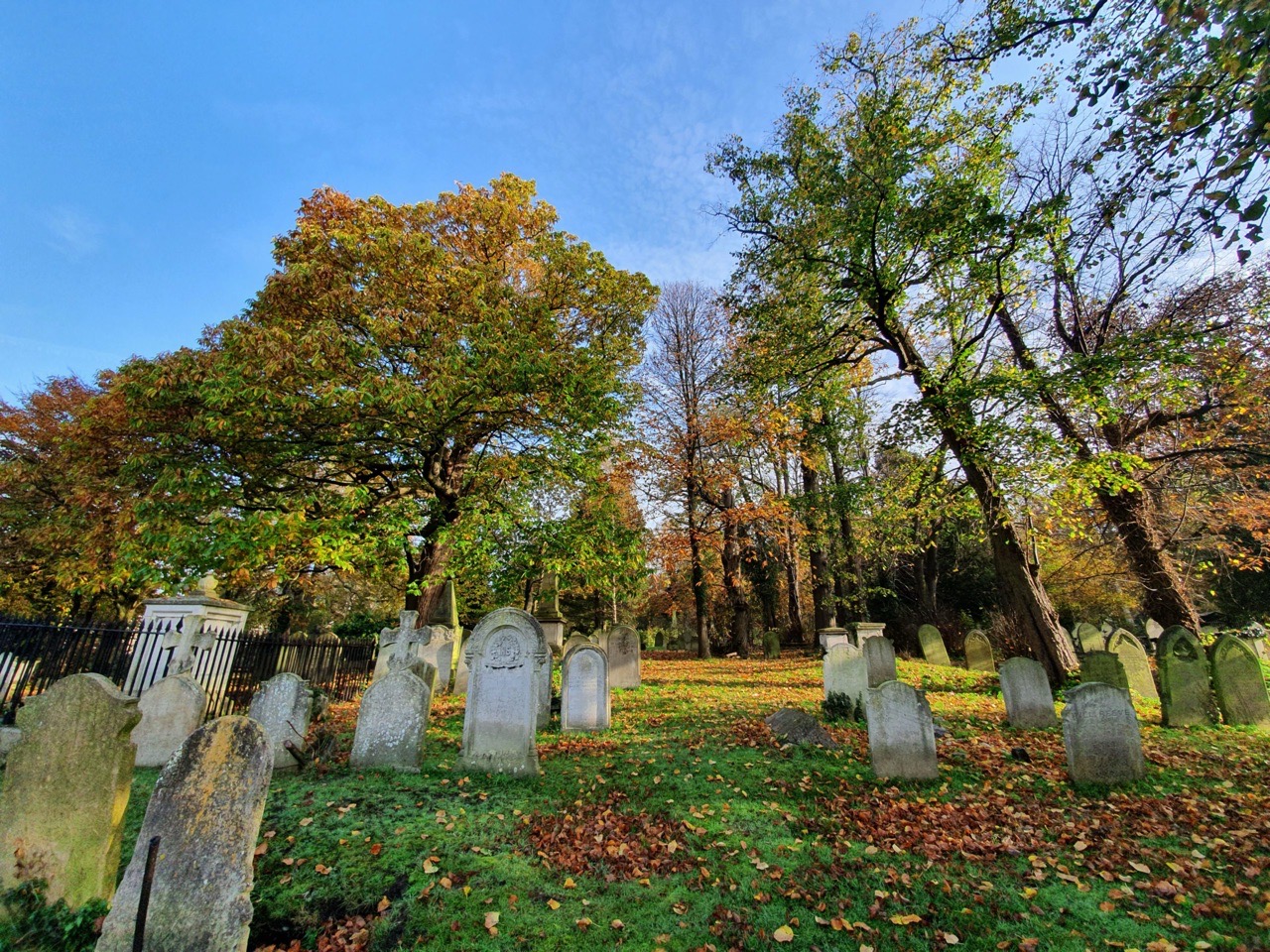
Since I’ve been grounded again by the Government, I thought I’d meander around the Rosary Cemetery located near to me in Norwich, in an attempt to see what stories lie there. It might not be the most fascinating blog content, but it’ll keep me quiet for a few weeks….

I find myself drawn to gravestones such as this, which have been knocked out of position by a large tree growing up amongst them. There’s something quite reassuring about the circle of life that a body can provide nutrients to a tree like this, it’s almost as though the remains here are an integral part of the tree. Anyway, that’s a bit too figurative I think, so back to normality.

This is the grave of Thomas Poole and his wife Mary Poole (nee Daniel). Thomas was born in around 1796 in Witham which was marked in the 1851 census as being in Cambridgeshire (there’s a Witham in Essex and in Lincolnshire, I’m not sure which one it refers to). Mary was born in around 1788 in Rollesby and Thomas and Mary married in Fakenham on 19 April 1813.
At the 1851 census Thomas was living with his wife Mary and their servants Mary Southgate (aged 22, a cook born in Swardeston) and Susan Cullings (aged 15, a housemaid born in Poringland). They were living at 5, The Crescent, which is a grand house which still stands near to the Chapelfield Shopping Centre or whatever it’s called now.
Thomas died in Lakenham on 19 December 1860 at the age of 64. His probate was completed on 24 August 1861 and showed he had assets of up to £4,000 (about £240,000 in today’s money).
So far, this story doesn’t seem to be too out of the ordinary. However, the Norwich Mercury ran a story on 22 December 1860 with the title of “An extraordinary suicide”. This took place at Harford Bridge Meadows, somewhere near I think to where the Marsh Harrier pub is today.
There were a couple of witnesses, with the first being Arthur John Codling. He noted that Thomas was “behaving himself in a very singular manner by the water” and he partly dressed and then undressed, before jumping in the water. Codling said “he fell into the water and when we got to the place, in about three or four minutes, we saw the body sinking in the middle of the stream. We did not go in the water to attempt to get it out, but we gave an alarm. None of us ventured into the stream. I am not a swimmer myself, and should not be able to render assistance in an emergency of this description”.
The coroner, William Wilde, was furious with this witness, saying that “if he had been there, old as he was, he would have rescued the deceased from the water and not left him there to drown”. He added that “this was a most extraordinary and painful case and one that no-one would have supposed would have been permitted to occur anywhere else in England”.
It’s fair to say that Codling and Wilde then had an argument. Wilde asked why Codling hadn’t rescued him, to which he replied that “it was an oversight”. If reported correctly, that’s some bloody oversight. He added in his defence that he had helped to get the body out, to which Wilde replied “if the same amount of exertion had only been made at first, the deceased would in all probability be alive now”. The coroner’s jury agreed that this would be recorded as a suicide by drowning, whilst in an unsound mind.
Mary died on 2 April 1863 in what must have been a difficult few final years for her. In the 1861 census, she remained in the same property on The Crescent, this time living with servants Sarah Harbone (aged 29) and Hannah Daines (aged 17). Her own probate, published on 20 May 1863, listed a wealth now of just £200, considerably lower than when her husband had died.
As an aside, only in the last few years has the Church of England allowed burials in its graveyards for suicides, so locations such as the Rosary Cemetery would have been important in cases such as this. More importantly perhaps, this is an early example of what must have been a mental health problem. I don’t know why Thomas was in this state of mind, as at first sight, he seemed to be financially well-off. But, history hides many things, and this was certainly a tragic case as the coroner noted.
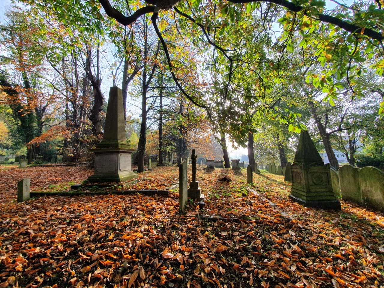
It’s a reminder about the stories there are in cemeteries, I only looked into this as I was intrigued by the tree growing by the grave. A sad story, but one that happened and shouldn’t be forgotten.