Category: UK

  • Lakenham – Church of St. John the Baptist (John Mackie)

    Lakenham – Church of St. John the Baptist (John Mackie)

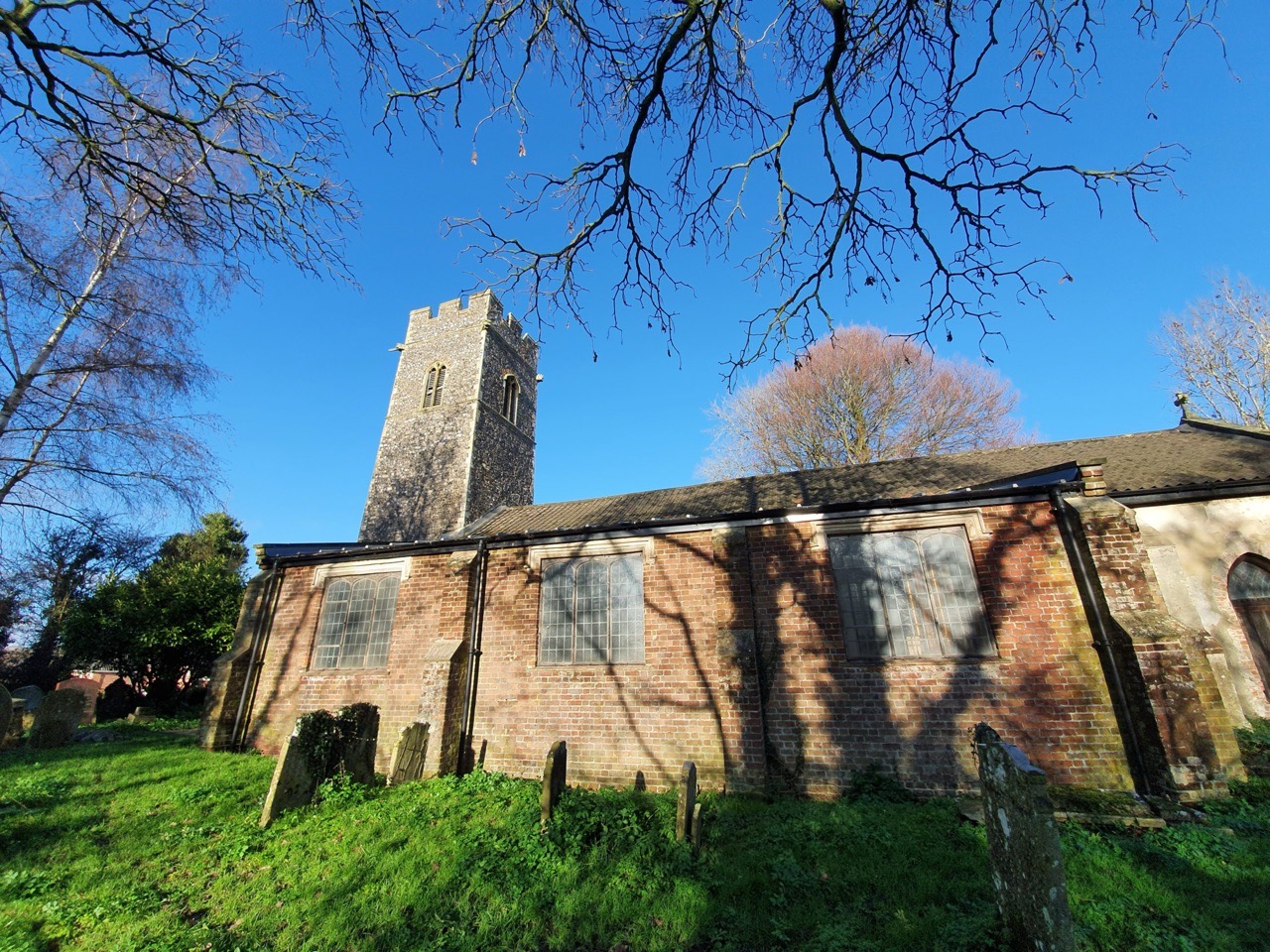
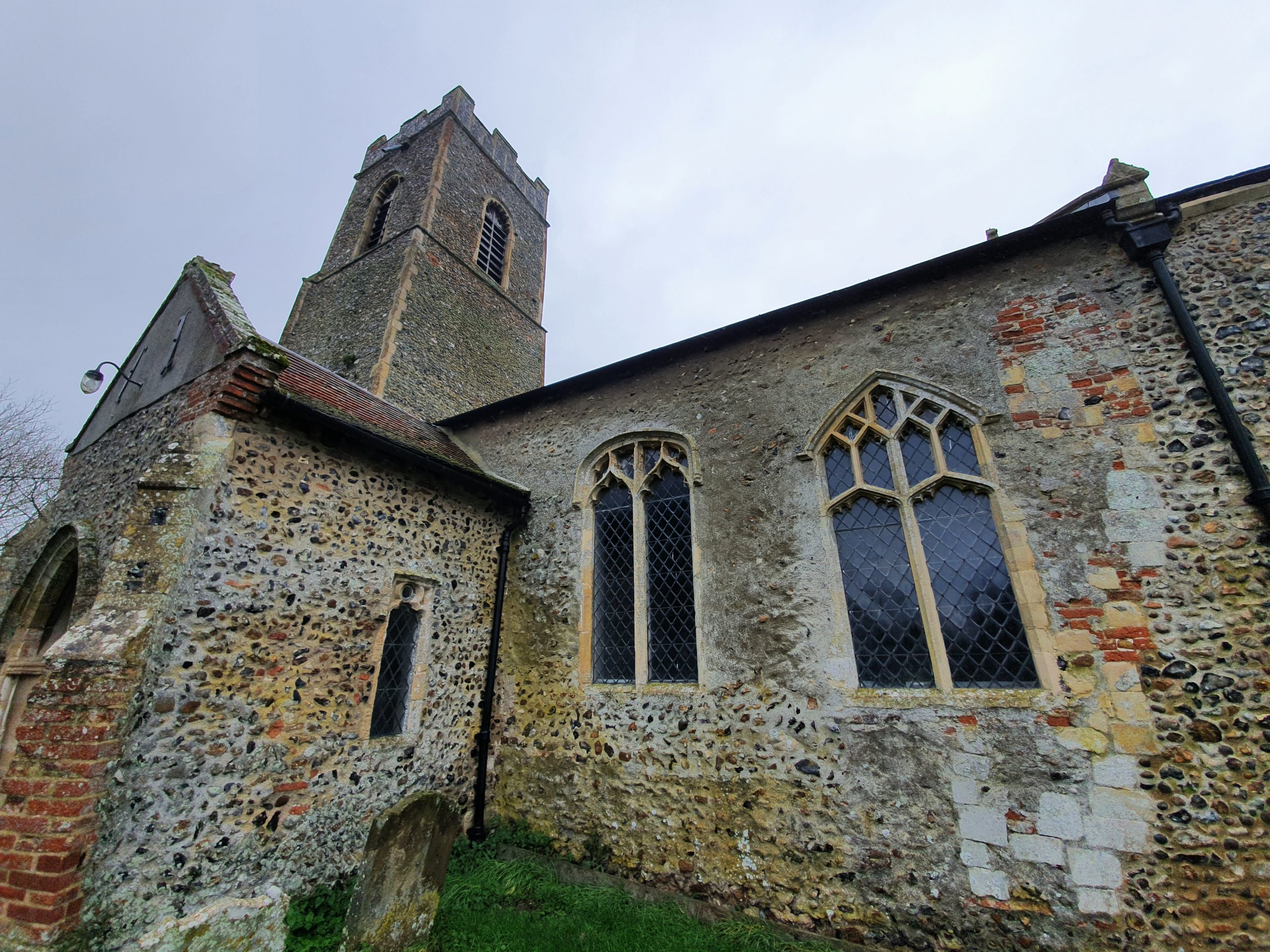
    It’s fair to say that I wasn’t over-excited about this church, but the churchyard of St. John’s has some interesting graves. This one puzzled me because of just how well it has been preserved. It stands on top of bricks and looks almost new, despite it dating back to 1796. I’m unsure of why this is, it gives the impression of having been moved from inside, but there’s no obvious evidence that this is what has happened.

    Anyway, it’s the tombstone of John Mackie, as well as two of his children who died in their infancy, Mary and Charles. John married Mary Aram at this church on 8 January 1778. Mary, who is buried with her father, had been baptised on 4 August 1782, but she sadly died at the age of two and was buried at the church on 16 November 1784. Charles, also buried with his father, died at the same age, being buried on 17 March 1791.

    I’m unsure how many children the couple had, but this is the baptism record for John and Mary’s son, also named John. He was baptised at the church on 29 March 1785, a reminder of how important St. John’s Church would have been to the family. Unfortunately, the younger John didn’t have that long a life, he died at the age of 33 in 1818.

    John worked as a seedsman and this is one of the ads that he placed in the Norfolk Chronicle in 1788. He must have been reasonably well known locally, as he never placed his address in these adverts, but I think his nursery was on the Ipswich Road. That means it would have likely had a prominent location for those entering and leaving the city.

    It was reported in the Norfolk Chronicle on 22 October 1796 that John had died, noting “Monday last died, Mr. John Mackie, nursery and seedsman, near this city, aged 53; whose abilities in his profession, attention to business, and obliging liberal behaviour, was exceeded only by his affection and tenderness to a disconsolate wife and family”.

    The expense of the tombstone suggests that John wasn’t a poor man and his trade seems to be one which afforded him some luxuries. He also seemed to breed spaniels, as there are numerous adverts relating to that in the local press. His business survived though after his death, it was taken on by family members who kept the Ipswich Road site operational. It evolved into Mackie and Ewing’s Nursery and the business was still trading in the late nineteenth century.

  • Norwich – Breath by Paul de Monchaux

    Norwich – Breath by Paul de Monchaux

    Just to show how little attention I pay to things sometimes, this sculpture has been here since 2011 and I’ve never really paid it the slightest bit of attention. It was commissioned by the council as part of the process of modernising the site of the city’s war memorial.

    The war memorial was first unveiled in 1927, when it was located outside of the Guildhall (photo here) and it was moved in front of Norwich City Hall in 1938 (photo here). In 2011, the war memorial was moved slightly to face the other way, looking at Norwich City Hall, with this bronze sculpture placed where the memorial had once stood. The move was requested by veterans, as the memorial wasn’t being treated with respect by those who found themselves sitting near to it, so it needed a more fitting location.

    The stone on the pavement noting the sculpture. The bronze sculpture is meant to show the connection between life and death, although I have to be honest and note that I struggle to see what the artist had in mind here. However, I like the concept and the motto notes “the living honour the dead, only a breath divides them”. It was quite a brave commission though, and there is something in the thought that it was only chance that divided those who lived and those who died in war.

    The official information about the sculpture notes:

    “Breath is made up of two elements: a tall central slab, flanked on each side by seven ‘leaves’ whose geometry suggests growth. The central element reflects Lutyens’ stone of remembrance”.

    The war memorial itself was designed by Edwin Lutyens, one of the great architects of his generation. What I hadn’t realised until today is that he designed Castle Drogo, which is I think my favourite National Trust property. Although this isn’t perhaps Lutyens’s crowning glory, the thing leaks terribly and it’s costing the National Trust a small fortune to fix.

    Anyway, I digress. I like the boldness of this sculpture and the concept is one that’s perhaps worth pondering.

  • Norwich City Centre to Whitlingham (and back)

    Norwich City Centre to Whitlingham (and back)

    One of the locations that I wanted to visit was Old Lakenham parish church, so that was where Nathan and I headed today on a minor little walk.

    The Cock at Lakenham is looking ever more derelict and it’s got easy access via that open window. Well, not necessarily easy access for me, but for anyone who can climb things.

    This is St. John the Baptist and All Saints Church that I had been meaning to visit and it’s located on top of a hill in a prominent location. Unfortunately, the church is now surrounded all on sides by housing and feels a bit forlorn. It was also not the pretty building that I was expecting, it’s covered in render which makes it look like a house extension from the 1970s. Given the remote and interesting location on a hilltop, it was slightly disappointing.

    One of the most unimpressive priest’s doors that I’ve seen on what is a medieval church.

    This is perhaps the most beautiful angle possible for this church, but that aisle extension is out of place.

    The church tower which is a fifteenth century rebuild, with the main part of the church dating from the thirteenth century, albeit with many ugly additions.

    I found it hard to see behind the render to see the beauty if I’m being honest. St. Mark’s church was opened in the 1840s as a Chapel of Ease and that meant that St. John’s lost a little of its relevance. The two churches are relatively far away from each other, St. Mark’s is up near the Rose pub, but this was nearer to where the centre of Lakenham had moved to.

    There were several interesting graves I’ll write about later on. There are six war graves here, although we could only find three of them. Some of them don’t have the distinctive war grave style, so finding them all would have been challenging.

    Standing at the bottom of the hill, it all felt more of a castle site than a church. There have been some Roman finds at the top of the hill and I can imagine that the Saxons had some dealings here as well.

    The River Tas at Old Lakenham, where it meets the River Yare a little further upstream.

    Fancying a little adventure, we decided to see if we could walk down the riverside path and it did prove to be possible. Although, only just, and it did involve wading through some rather large puddles of water. And indeed some minor lakes rather than puddles. We agreed between us that we had been very brave and noted that no-one else seemed stupid enough to try and make their way along the flooded path.

    Normally it’s possible to walk across this field, which connects back into Whitlingham Lane. We were able to walk some of it, but it had only just opened up as there was a closure order marked up which had just expired.

    Despite having written about this structure earlier in the year, I forgot the history here, and this is the former Trowse Newton Hall and its associated chapel.

    The fields at Trowse, which look quite peaceful. In reality, there were a lot of people around and it’s one of the reasons that I rarely go to Whitlingham now. Cars are given priority along Whitlingham Lane, making it quite hard to socially distance whilst walking down the pavement.

    Nathan had brought a few beers with him, which we had sitting on a bench drinking out of KFC cups. Not the most decadent and I think we rather gave false hope to some people that there was a KFC nearby. The cafe at Whitlingham Lake is still open, although there was a long queue, and rather helpfully the toilets were also open. Drinking on a park bench isn’t ideal, I’ll be pleased when pubs are open once again.

    And the sun which was starting to set…..

    This wasn’t a long walk, just under nine miles, but we have agreed that we will have to rather up our walk distances in preparation for the LDWA 100….

  • Norwich – River Wensum Following Christmas Rain

    Norwich – River Wensum Following Christmas Rain

    There is some flooding further down the River Wensum following the recent rain in Norfolk, but it’s not overly high in the city centre. I shall brave the Norfolk countryside over the next few days to see how sodden that is.

    Taken from Foundry Bridge, at the end of Prince of Wales Road, the river is high but hasn’t burst its banks.

    The still closed Red Lion on the left.

    Taken from the other side of Bishop Bridge.

    Looking towards Riverside Road.

    The bench is now quite moist….

    Water on the Norwich School playing fields, with the middle patch of water being where the tennis courts were 100 years ago.

  • Norwich on Boxing Day in 2020

    Norwich on Boxing Day in 2020

    primark23

    This was the queue for Primark in Norwich just a couple of days ago, when the city was in Tier 2. Below are photos from today, Boxing Day, with a Norwich in Tier 4. Much quieter than I had anticipated, with little open other than Five Guys and Costa.

    20201226_114528

    20201226_114304

    20201226_114238

    20201226_114221

    20201226_114004

    20201226_113937

    20201226_113932

    20201226_113842

  • Walk Around Bungay and South Elmham

    Walk Around Bungay and South Elmham

    This walk was from a couple of days ago with my friend Rob, starting in Earsham and then going to see the new bridge that has been installed, before walking around The Saints and then returning to the bridge. It wasn’t the dryest of days, but Bungay is in the national press today due to flooding, so it could have perhaps been worse.

    Earsham was the start and end point of the walk, wet at the beginning and the rain started to pour down just as we arrived back. There’s been a church here since the Saxon period, although the current structure is from the twelfth century with bits added on and restored since.

    My trip to get the day’s lunch was delayed slightly as they couldn’t get the till to turn on. I don’t think the Bungay Shopper themselves would claim that they have a range of high quality artisan food and drink, but it was convenient and cheap.

    I’ve never seen Bungay Castle, I hadn’t realised it was visible from the footpath. It was financed by Roger Bigod of Norfolk and was constructed just after the Norman Conquest. It fell out of use many centuries ago, being owned by the Dukes of Norfolk from 1483, but the family gave it to the town in 1987.

    Flixton Road Mill, built in 1830 and now converted into residential accommodation.

    The temperature was quite warm, although there were occasional showers.

    A rainbow appeared between the rain showers.

    We visited three churches on the walk, all of which were open to go inside. This is St Margaret’s Church in Ilketshall St Margaret and more of this in another post. But, the highlights here are what I think is a Saxon window in the tower and the completely ridiculous decision made by English Heritage to render the tower. They accepted this was in error and it is neither historically accurate nor particularly beautiful. But, it’s there now, part of the church’s story.

    I rather liked the path in the above photos, I think from the width it’s a former drovers’ road. One of those routes which could have easily have become a road.

    Fortunately, the mud in Suffolk isn’t generally too clay-like (unless certain parts of Essex…..), otherwise this could have been an annoying walk across a field with mud welding to my boots.

    Part of my lunch from the Bungay Shopper….. Very decadent.

    Streams and ponds that are often low in water certainly aren’t at the moment.

    Some aggressive looking sheep.

    I’m not sure of the age, but this road bridge looks to have some history to it. A nice feature to have in the garden as well.

    St. Peter’s Church in South Elmham.

    St. Peter’s Brewery, which was founded in 1996, and occupies a site which includes an ancient thatched barn and St. Peter’s Hall. The brewery own one just pub in the country, which I have meant to go to, it’s located in Farringdon in London.

    Norfolk and Suffolk can be hilly. Well, relatively hilly.


    One of the reasons we went on this walk was to see the new bridge which has been installed here on the Angles Way. This map (in .pdf format) shows the temporary route which the broken bridge caused. It took six years for this bridge to be replaced and numerous local politicians were involved, and the Ramblers really engaged with the process.

    The area was a little more moist than was ideal, perhaps the bridge set-up wasn’t ideal, but the main thing is that the Angles Way route has now been restored. Fortunately, that water wasn’t too deep.

    This is Rob’s route of the walk, I like the colours showing when we were walked a little quicker.

  • South Elmham – St. Michael’s Church

    South Elmham – St. Michael’s Church

    Perhaps the best known fact about the parish of St. Michael in South Elmham is that it’s one of the Thankful Villages, as it lost none of its men during the First World War. And, on top of that, it lost none during the Second World War, one of only 14 villages in the country to be this fortunate.

    I was walking in the area with my friend Rob, who mentioned he saw that they were putting new render on the church last year. It is unusual to see a church with such a modern render, as the Victorians frequently stripped it off as part of their modernisations. I do prefer seeing the stone behind the render, but it was a protective layer against water ingress and so churches are a little vulnerable without it.

    I’m not a rendering expert, but this looks neat and clean. It’s not quite visible from this photo, although it is from the one below, that the church used to have a thatched roof.

    This is the other side of the church, where there is no render, with the wall looking faintly ridiculous and more like something constructed for a shed.

    There are no windows on this chancel wall, some of that brickwork at the top looks alarmingly modern and it’s all a bit botched. But, such is the necessity to patch up buildings that have structural issues, although some render here might make the whole edifice look much more appealing. The process of restoration must be frustrating, the church received some extensive work in the early part of the twentieth century, which was much damaged during the storms of February 1906.

    The end of the chancel and it’s evident visually that the current building is leaning somewhat in places. And, it’s possible to see the buttressing efforts from previous generations, in their attempt to protect the church.

    I found this a rather pretty chancel, despite having no windows on the side walls. Unlike some of the quite sterile designs of some Victorian chancels, the history here is evident.

    The chancel wall is leaning, but has been repaired to some extent recently. I’m unclear what that larger bricked up door is, I can only assume that it led to some sort of chantry chapel arrangement.

    I do like brick flooring, I think it adds to the atmosphere of the church. There’s one prominent tombstone in the nave, with the bodies of Henry Lone who died in 1727, and his wife Rebecca, who died in 1735. The glass in the windows is quite plain, although that’s because much was lost during the Second World War, but that has meant that the interior is brighter.

    The ladder to the top of the tower.

    The church’s font dates to the fifteenth century.

    This is one of the most beautiful church arches that I’ve seen recently, an original Norman decorated surround which is probably from the twelfth century. The door itself is modern, but the eye is drawn to the arch. Well, mine was.

    And a slightly quirky sundial on the exterior of the church.

    I thought that this was a quite beautiful church, even ignoring some of the patched walls and that part of the building was leaning. That all adds to the historical attraction of the church, it hasn’t been overly mauled about by the Victorians (although they did replace the seating and boarded up some of the roof) and it still feels medieval. The churchyard is moated, which is an historic quirk by nature of being next to a common, and the church itself is Grade I listed.

    The first child to be baptised in the church’s fifteenth century font would have been a Catholic and the religious set-up would have been different. But yet, there’s that reassuring feeling that really not much has changed in this church since then. If the parents of that child being baptised looked up and down the church as it is today, I suspect they wouldn’t have been much surprised at the changes. Well, unless someone got a phone out and took a photo, but otherwise, this is a little piece of what England was once like.

  • Norwich – Earlham Cemetery (Thomas Alfred Tyrrell)

    Norwich – Earlham Cemetery (Thomas Alfred Tyrrell)

    This is the war grave of Thomas Alfred Tyrrell, buried in the older military graves area of Earlham Cemetery. The volume of records that remain about an individual varies so much, there is nearly nothing on some poor souls, whereas for others the documentation is extensive. And this is so for Thomas, whose military records remain intact from his service during and before the First World War.

    Thomas was born in Dereham in 1877, the son of John Tyrrell and Mary Ann Tyrrell. After briefly working in the shoe industry, he signed up (being given the service number 4080) to join the military on 29 September 1894, opting for a short service option of seven years with colors and five years in the reserves. It was noted at Thomas’s medical that he was 5’4″ in height, he weighed 9.3 stone, had brown eyes and dark brown hair.

    During his service (and he served with the 1st, 2nd and 3rd Norfolk Regiments), Thomas served in Calcutta (now Kolkata) and Barrackpore in India, amongst many other locations. I’m fascinated by what he and other soldiers would have made of that experience, but as an adventure, I think it must have been one of the most exciting possible for someone without any other financial means at the time. Otherwise, for those from Norfolk, it would likely be employment as an agricultural labourer or in the shoe industry.

    Thomas left the military in early 1907, but he signed up again to serve in Section D of the Army Reserves on 1 July 1907. He had married on 24 June 1907, although this was pre-planned and he didn’t hate the situation so much that he immediately to enlist again. He married Ethel Georgina (born on 31 December 1889) at St. Paul’s Church in Norwich, now sadly demolished, and she was ten years younger than him. Their first child was born on 18 February 1908, Alfred Thomas.

    At the 1911 census, Thomas, his wife and his son were all living at 2 White Entry Yard, which was located just off Bull Close. As a little aside, this would have been very convenient for the Leopard and Plasterer’s, as well as three other nearby pubs which were open when Thomas was living there.

    Thomas was discharged on 26 January 1915, being declared as “physically unfit for war service” and he had experienced numerous illnesses and ailments during his time in the military. This included a period at the Cliff Hospital in Felixstowe between 17 and 27 November 1914, suffering with rheumatism.

    More of a technicality I understand, but under the Military Service Act of 1916, Thomas was called in once again on 19 July 1916 and given a new service number, 20999. He served at home between then and 15 December 1916, before being discharged again. During this time he became a father for a second time, with Ethel Violet being born on 29 August 1916. By now he had moved to 5 Compass Street, located off King Street, now directly underneath Normandie Tower. He had returned to work as a boot maker and his military records show that he had served in total for 18.5 years.

    Thomas died on 14 August 1920 and this would have been linked to an injury caused during military service. What is puzzling is that the grave notes he was aged 41, which is incorrect by two or three years. Errors aren’t uncommon, but the details of these stones were usually checked with family members, but perhaps a mistake or omission was made.

    At the beginning of the Second World War, the mother and daughter, both named Ethel, were living in the same location on Compass Street. The younger Ethel had married as her surname was Baker, and she worked as a cardboard box maker, living until 2007. Thomas’s wife, Ethel Georgina, died in Norwich in 1975, which was 55 years after her husband.

  • Norwich – A New Public Cemetery at Mousehold Heath (1848)

    Norwich – A New Public Cemetery at Mousehold Heath (1848)

    Thanks to Google and archive.org, this short book from 1848 is available on-line. The book contains a proposal to turn land at Mousehold Heath into a cemetery, something which wasn’t enacted, although Earlham Cemetery opened in 1856 to deal with the issues raised in this book.

    The author of this book isn’t given, but it was addressed to the Lord Bishop of Norwich, who was then Edward Stanley. The author painted a clear picture of the situation in Norwich churchyards at the time:

    “In many of the Norwich churchyards the soil is now almost level with the windows; piled up four, five or six feet above the original surface with the ashes of the dead, which are allowed to lie undisturbed for a period far too short for total decay of the corpse and its tenement”.

    That’s not an ideal situation and nor was the outbreak of cholera in 1848, which strengthened the author’s case. Indeed, the Home Secretary actually forced the council’s hands, saying that churchyard burials in Norwich must stop by 1855 because of the cholera issue.

    The author of the book suggested:

    “There is lying, hardly beyond the precincts of Norwich, within half a mile of the Cathedral, a tract of land, which I can hardly be wrong in stating as comprising from 100 to 200 acres, not only uncultivated but wholly unproductive; bearing only thorns and briers; the stones and gravel extending to the very surface”.

    He added that the owners of the land, who were the Church of England, had granted permission for it to be used, but they wanted in recompense:

    “Funds to be appropriated towards the establishment and maintenance of a National School in the neglected, and wellnigh near heathen, district of Pockthorpe”.

    This is a slightly blunt way of describing the area of Pockthorpe…. (it’s around where Norwich Puppet Theatre is, Silver Road and the area at the base of Mousehold Heath).

    The author’s vision of how the new cemetery should turn out was modern and indeed the basis of how the new wave of burial grounds were built. The Rosary Cemetery had already opened by this time, with a chapel and plenty of space allocated for burials. The author noted though the necessity for two rooms to place the dead body before burial, saying a requirement was:

    “Two large rooms for the dead, to which a corpse may be removed shortly after death, till the time of interment; one being set apart for those who have died of a fever or other infectious disease. I would make this a very principal point. Nothing can be more distressing than the state of many a poor man’s family after a death has taken place, and before the body can be interred. I speak only from what I have myself seen in country parishes: often is a man and his wife and a large family of children – some perhaps nearly grown up – living in two rooms, or perhaps even in one, with the corpse of one of its members occupying one out of the two or perhaps three beds, and this perhaps in the hottest weather of summer”.

    There was also an interesting observation about the difference between English graveyards, which the author noted were “little else than a passage leading to it, or a large enclosure overgrown with weeds and rank grass”, compared to European graveyards which were more spacious and were destinations in their own right.

    The proposals for this cemetery were that it should be primarily for the Church of England, along the lines of Mill Road Cemetery in Cambridge where each parish received its own chunk of land. When Earlham Cemetery was opened, there was though much more room provided for dissenters. So, although the burial needs of the city of Norwich were resolved in the 1850s, this was an interesting proposal. There had been suggestions of using Mousehold Heath as a site for burials since the late eighteenth century, proposals which were never enacted.

  • South Elmham – St. Peter’s Church

    South Elmham – St. Peter’s Church

    The rain cleared a bit by the time that we got to St. Peter’s Church in South Elmham, a church where it’s hard to see how its small parish was ever able to support it.

    The tower is in need of some attention, the foliage growing on it will eventually start to cause structural damage.

    The four-stage tower, likely from the late fourteenth century.

    The fourteenth century porchway, with the carved stone faces still visible.

    There have been some rather crude repairs here over the years and I wonder whether they just rendered over that to hide the patchwork of stone. There have been some recent repairs to the end chancel wall, which have now been completed

    This external chancel wall doesn’t look overly exciting perhaps, but it’s where the chantry was installed in the late fifteenth century and would have been located on this patch of greenery. There would have been a large opening in the wall here and it held the tombs of John Tasburgh and his wife, Margery Tasburgh. The chantry was damaged during the Commonwealth period and later became left open to the elements, with the tombs damaged. The structure was taken down in the 1830s, although the remains of the doorway are visible.

    The church has an interesting photo in the chancel which explains a little more about the history of this wall. To the left, out of shot, is the former chantry arch, but visible here is the coursed flint from the twelfth century forming most of the wall, with the higher thirteenth century wall visible at the top of the two windows when the building was heightened.

    Looking down the nave of the church, which has been heavily Victorianised inside.

    The chancel arch is from the fourteenth century and fortunate that the rood screen is still in place.

    It’s a well proportioned chancel.

    The open base of the tower is visible at the rear and the font is from the fifteenth century.

    Some decorative arrangement in the chancel, likely the base from the chantry tombs.

    I have no idea what this hole in the wall near to the door is doing…..

    Published in the 1840s, this text by the author of a history of Suffolk is a reminder that theft from churches is nothing new:

    “In the year 1819, while the writer was visiting this parish, collecting the materials which form the matter of the present notice, a person of gentlemanly address drove up to St. Peter’s Hall, tenanted by the late Mr. Alden, the then churchwarden, inquiring if the church contained any brass effigies, as he was travelling through the country collecting such records of ancient families, with a view to their cleaning and restoration, promising to return them shortly to their original places. St. Peter’s church afforded nothing to add to his collection, having been already stripped by some earlier iconoclast. The writer remembers that the applicant’s gig-box was half full of brass effigies, which it is vain to hope ever found again their respective matrices. The observation is simply recorded to expose a system of plunder once recklessly pursued, and to warn all churchwardens to repulse applications of a like nature.”