
And a new little project that Jonathan and I are undertaking because this lockdown is clearly here for at least a few more weeks. It’s a bit niche (our project I mean, not the lockdown), I’ll accept that, but there we go. Effectively, it’s walking around Norwich, ancient parish by ancient parish and seeing what is there now compared to a map from the 1880s (the map above is from 1789, but the one from the 1880s is more detailed, which is why we used that). There’s a PDF of these boundaries to provide some extra background to this whole project. Our first parish was St. Helen’s and this is the neighbouring parish of St. Martin at Palace.

The precise ward boundaries are in the PDF above, but this is the area of Norwich that we had a little meander around.

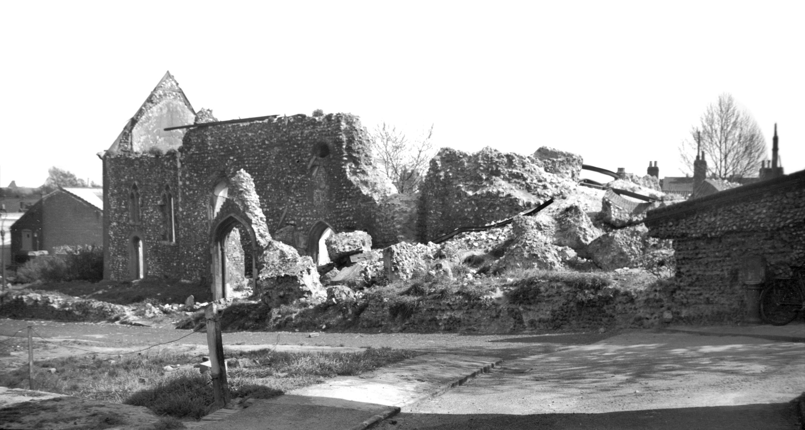
This is an area that neither Jonathan or I were aware of, despite my having walked by it hundreds of times. It’s located in front of the courts complex in Norwich and it’s the former site of the Tabernacle. This church, which held 1,000 people, was opened in 1753 and there’s plenty of information about the history of the building at https://ukwells.org/wells/the-tabernacle-norwich.
The 200th anniversary of the building wasn’t the most fortunate, as it was entirely demolished in 1953 as it had fallen into a state of disrepair. The demolition was perhaps a mistake, this would have remained an interesting and quirky building if it had been allowed to stand. George Plunkett has a photo of what it looked like in 1941 and to give an idea of where it stood, that kerb on the bottom right hand side of the photo is where the Adam and Eve pub is located today.

Nearly nothing remains of the Tabernacle, but this now quite damaged tablet is visible in the area where the house next to the tabernacle stood.

Jonathan noticed a giant rat just before I decided I needed to have a look at this grave, but I braved the area anyway. There is very little I won’t brave for the sake of historical investigation. Well, not snakes though, I wouldn’t have gone in here if it had been ridden with snakes.

This whole area of land is now used by the courts, but 100 years ago this was the site of a large gas works. The road in the foreground is modern, but at this end it follows the route of the old World’s End Lane. The area to the left is now just left empty, but this is where it fronts onto Bishopgate today, although the buildings that George Plunkett took a photo of in 1936 have been demolished. I’m really not sure that the courts need such a large car park, there’s definitely space for a Greggs or something here.

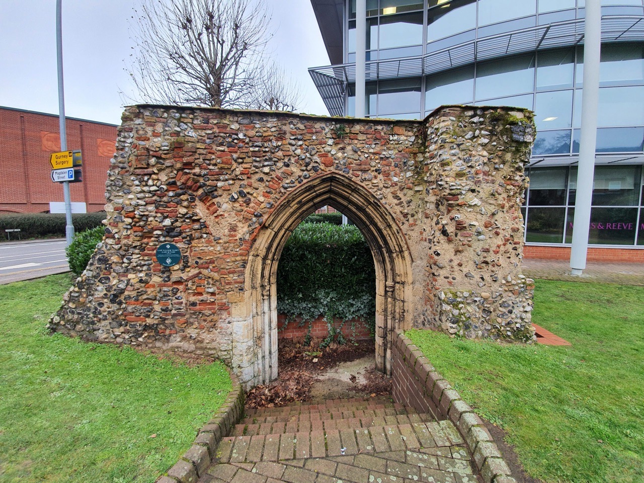
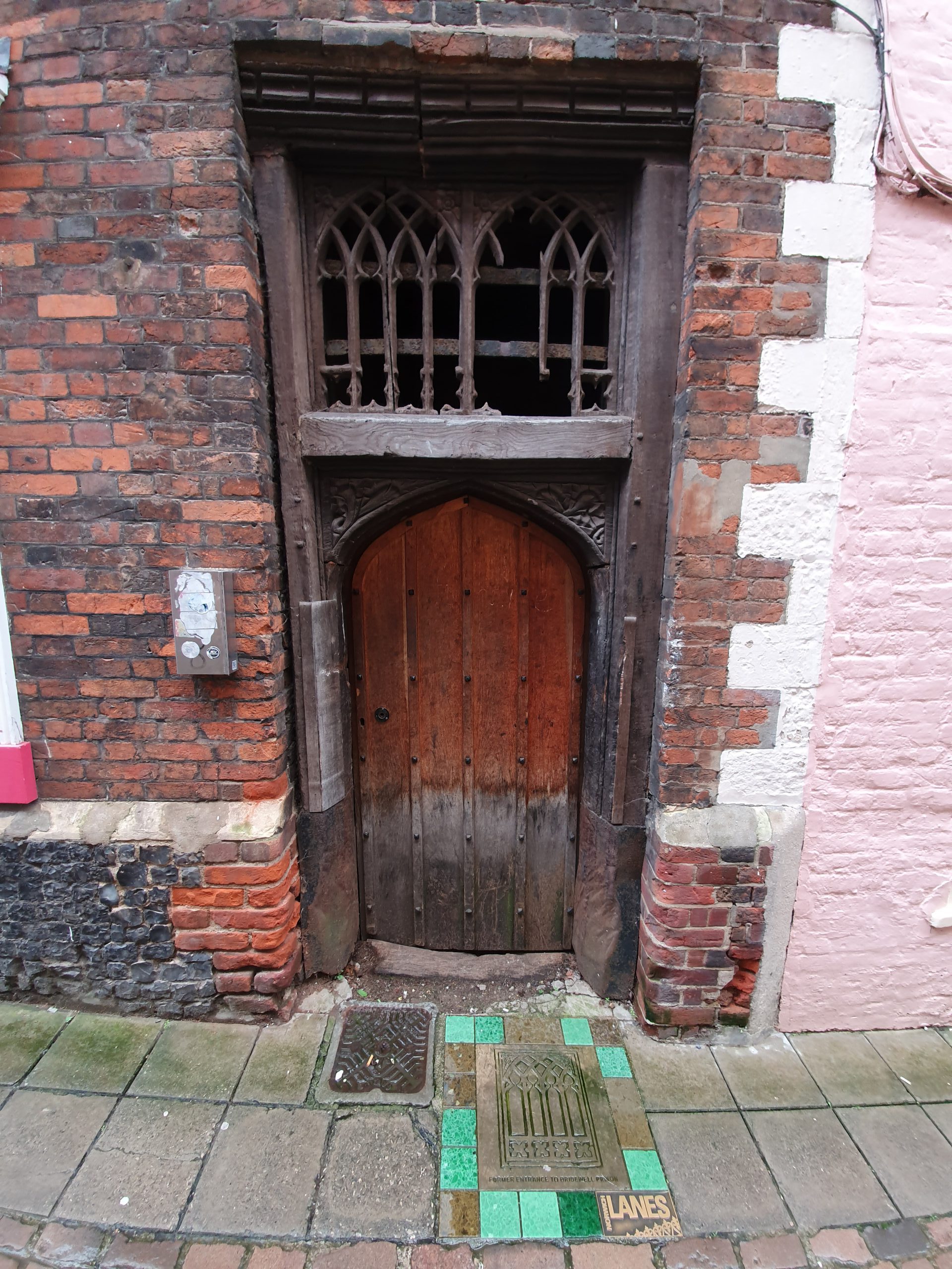
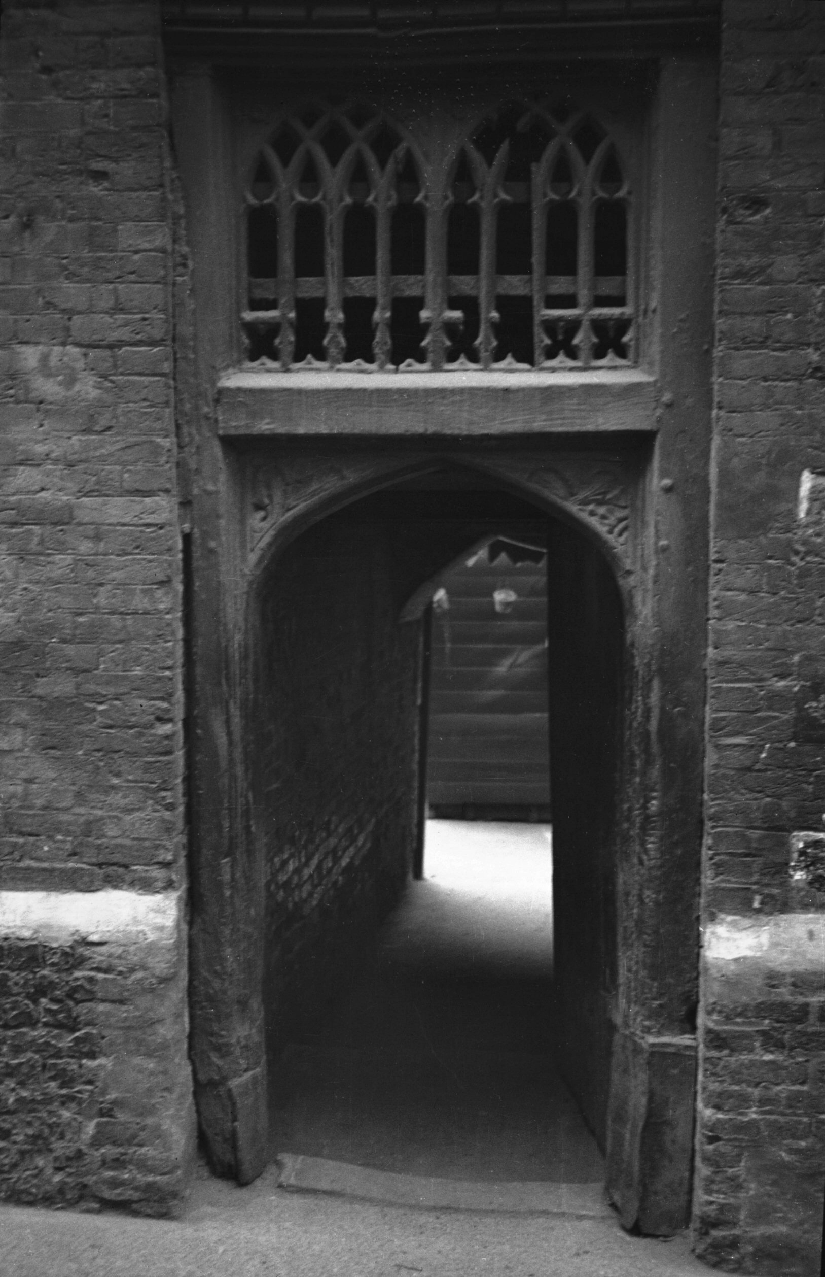
This might not be much to look at, but underneath here is the Norman House (https://www.norwich360.com/normanhouse.html). I visited here on a Heritage Open Day, it’s well worth going to see for those who can, and I’ll put photos up in due course from when I went. Upstairs in the court area there’s also the Arminghall Arch.

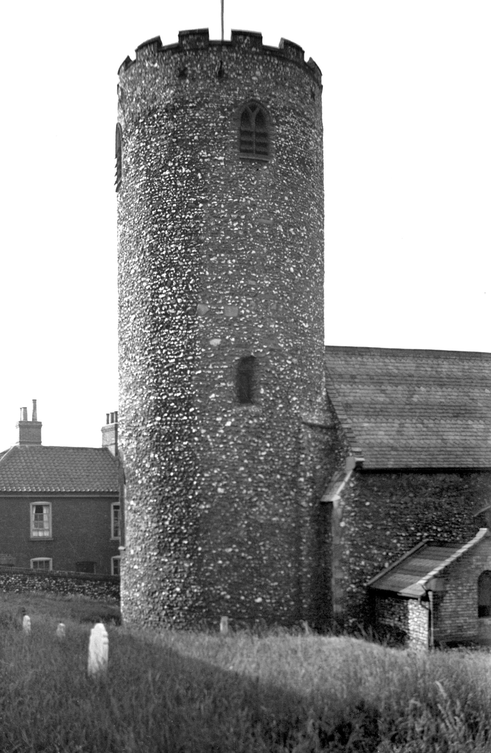
This is the Bishop’s Gate (and is where the street Bishopgate gets its name, although I think most people would guess that) which is Grade I listed and was constructed in around 1436. Just behind it is the new Bishop’s Palace, but this was also the entrance to the old Bishop’s Palace, today part of Norwich School.

And I have managed never to notice this sizeable building which is attached to the Bishop’s Gate. This is a medieval barn and granary, although it was much changed in the eighteenth, nineteenth and twentieth centuries and is now offices. This also leads to the area where St Matthew the Apostle’s church once stood, long since demolished. The former churchyard, which was formerly left as a park, has now been built on by the council.

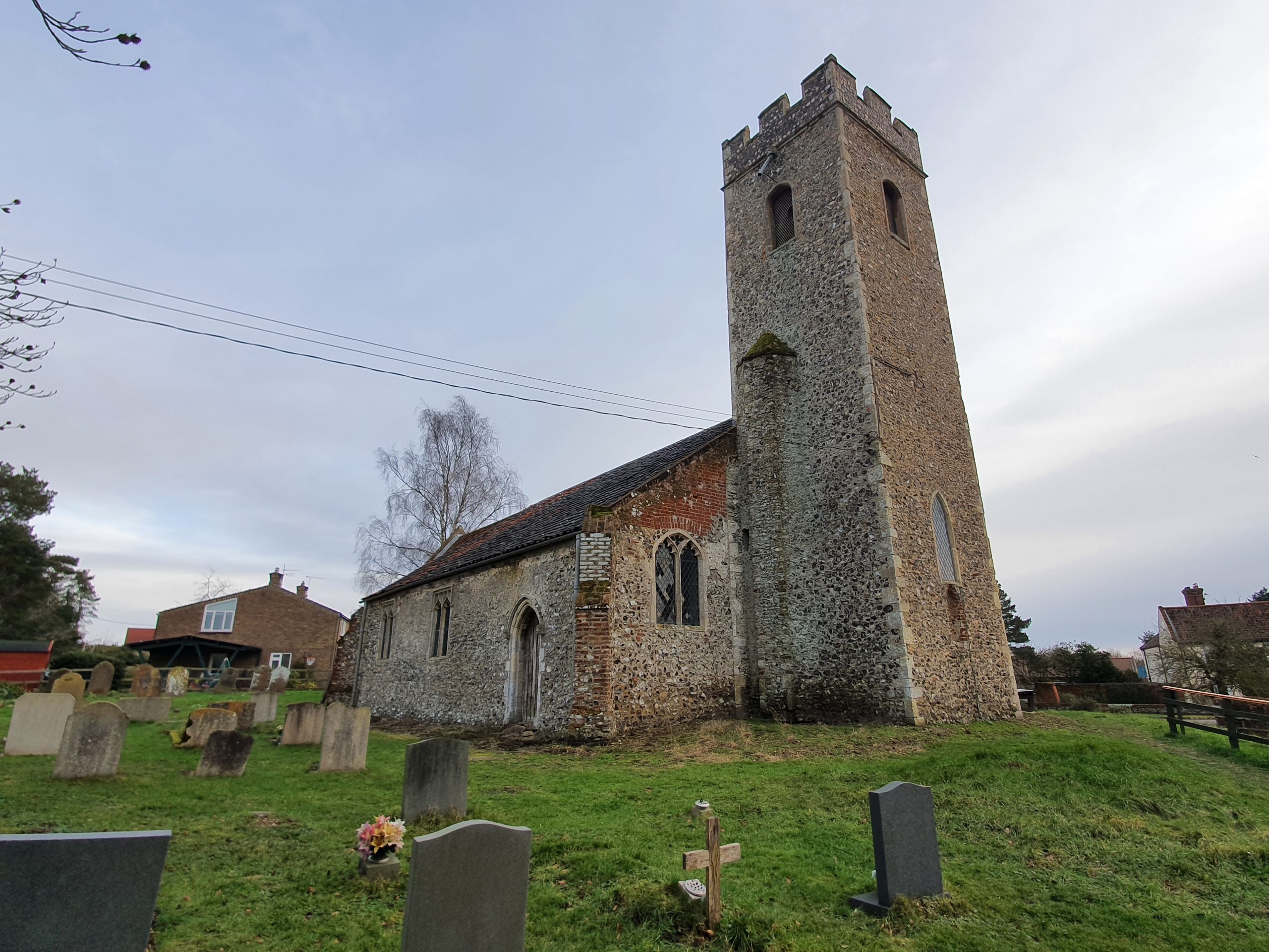
St. Martin’s Vicarage, serving the church that this parish takes its name from and is located opposite, St. Martin’s at Palace Plain. The building dates to the middle of the nineteenth century, although there was another building here before that.

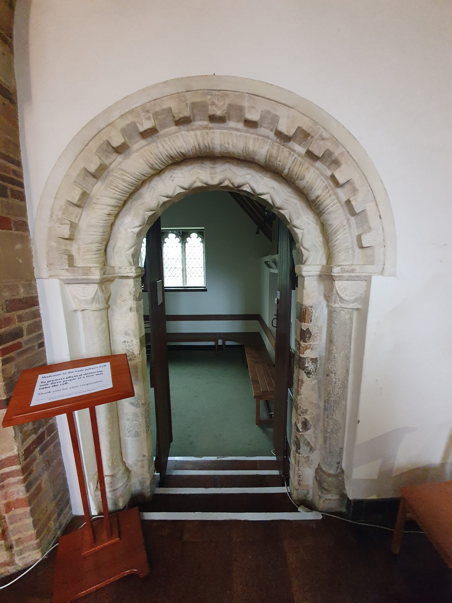
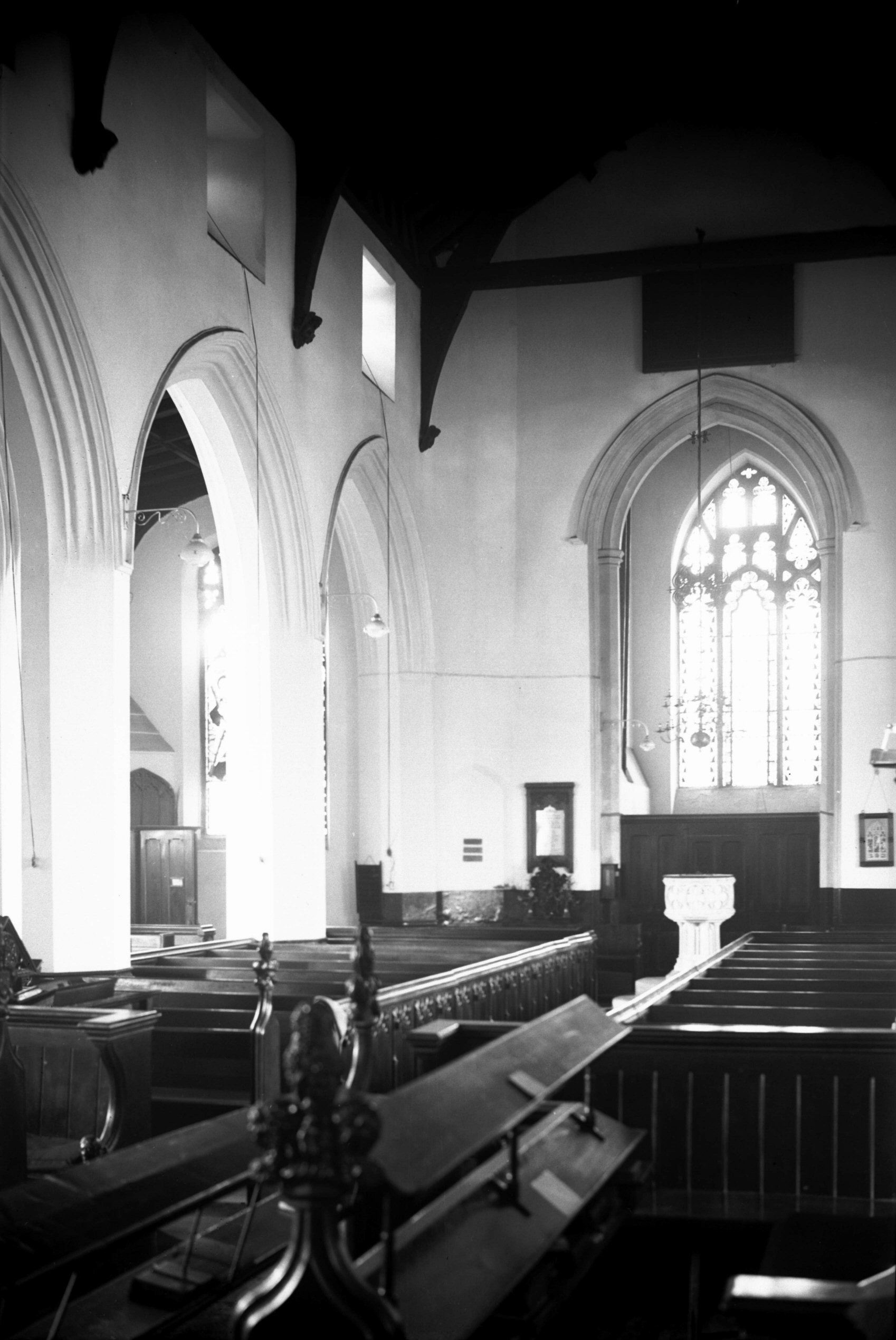
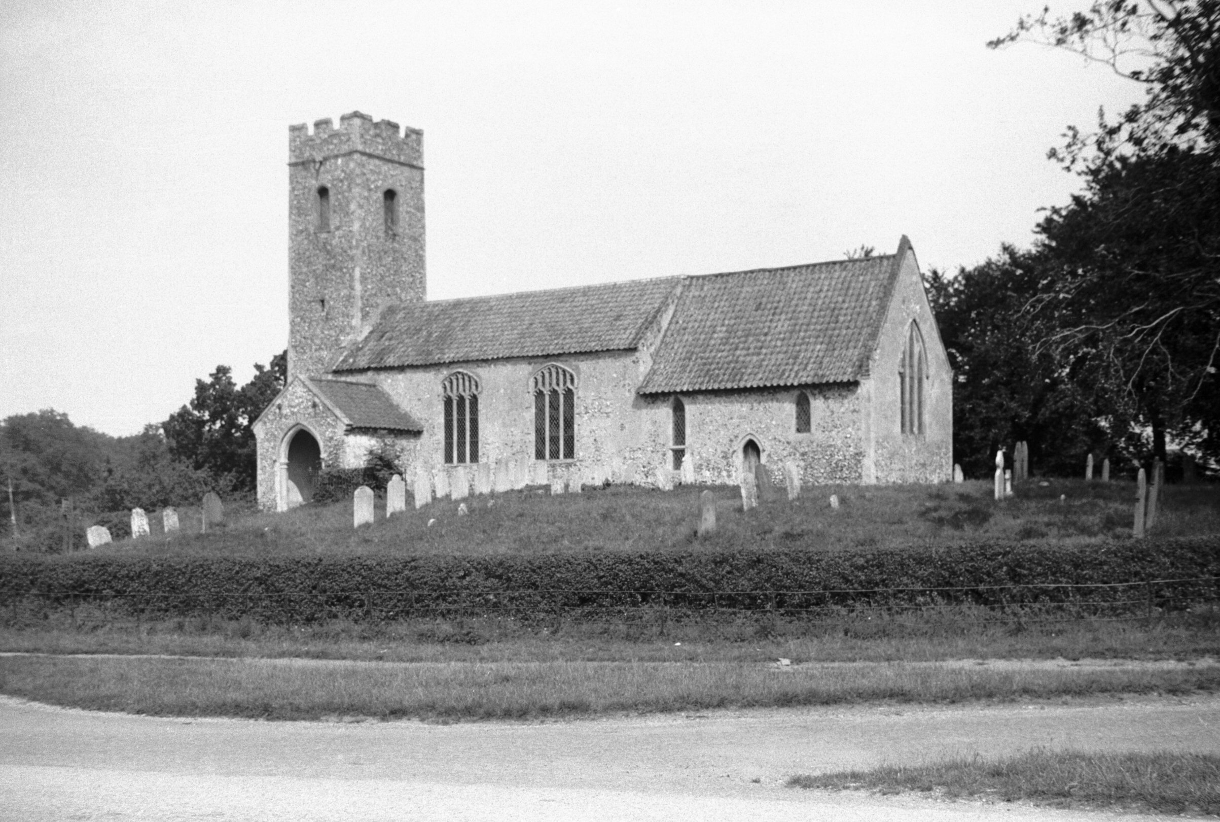
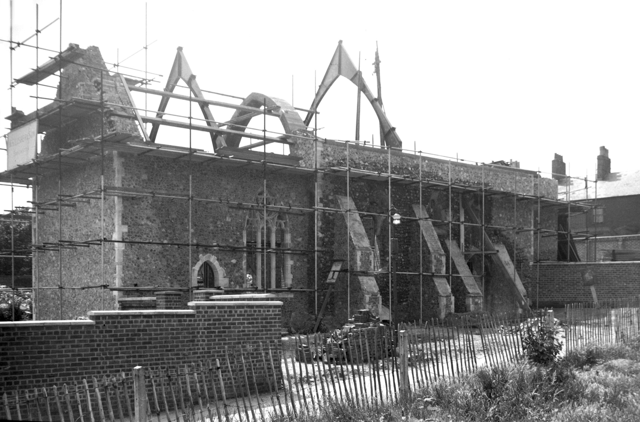
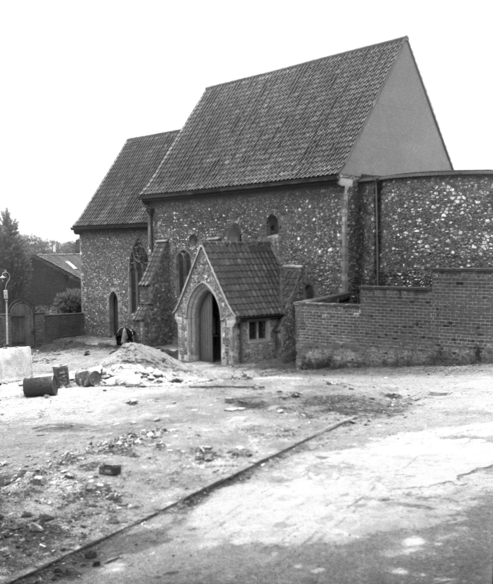
St. Martin’s at Palace Plain church, which ceased to be used for services in 1971 and was later converted to be used by the Probation Service. It’s now used by the Norwich Historic Churches Trust as their base, and access is encouraged (well, not at the moment, but it will be again when normality resumes). There’s a George Plunkett photo of the interior from 1938, it’s quite a charming and well-ordered church.
When the building was being converted to better suit its new office usage, which as an aside was done quite sensitively, there was an archaeological dig underneath the floor. This discovered that there were once two Saxon wooden churches on this site, with the foundations of the current church dating from the eleventh century. Most of the current structure dates to the fifteenth century, although following a little incident in the 1840s when the nave and chancel fell down (which wasn’t ideal), with a Victorian restoration of the structure. The slum clearances of the 1930s swept away much of the church’s congregation, so it did well to manage to survive as a working parish church until the beginning of the 1970s.

The chancel wall, with the graves having been removed from their original place and shoved up against the church.

A garage type arrangement, visible on the left of the photo, has been inserted under the churchyard. This road is now private access to the courts, but it was once the end of World’s End Lane, so effectively the church site was in the middle of a traffic island.

The parish boundary takes in territory across the River Wensum, requiring a walk over Whitefriars Bridge. I’m not sure why it does this, I assume it was some medieval way of trying to balance out the population sizes between churches.

All that remains of the Anchorite House, part of the Whitefriars Monastery, which stood here between 1256 and 1538.

When younger, I thought that this was the National Coal Board building, which isn’t perhaps a bad guess. It’s actually the premises of Norwich Corrugated Board (well, Smurfit Kappa now, which goes to show that putting a company name on a building in brick isn’t perhaps ideal when the ownership changes) in what is an unusually large manufacturing building still in the centre of the city. More about this in the parish we visited the week after….

The corner area here now has a modern building on it, but this was the site of a shoe factory a century ago. The street here is now known as Whitefriars, although it has historically been known as Cowgate. When the council smashed through the area with their new road, it split Cowgate into two, hence why this section has now been given the new Whitefriars name.

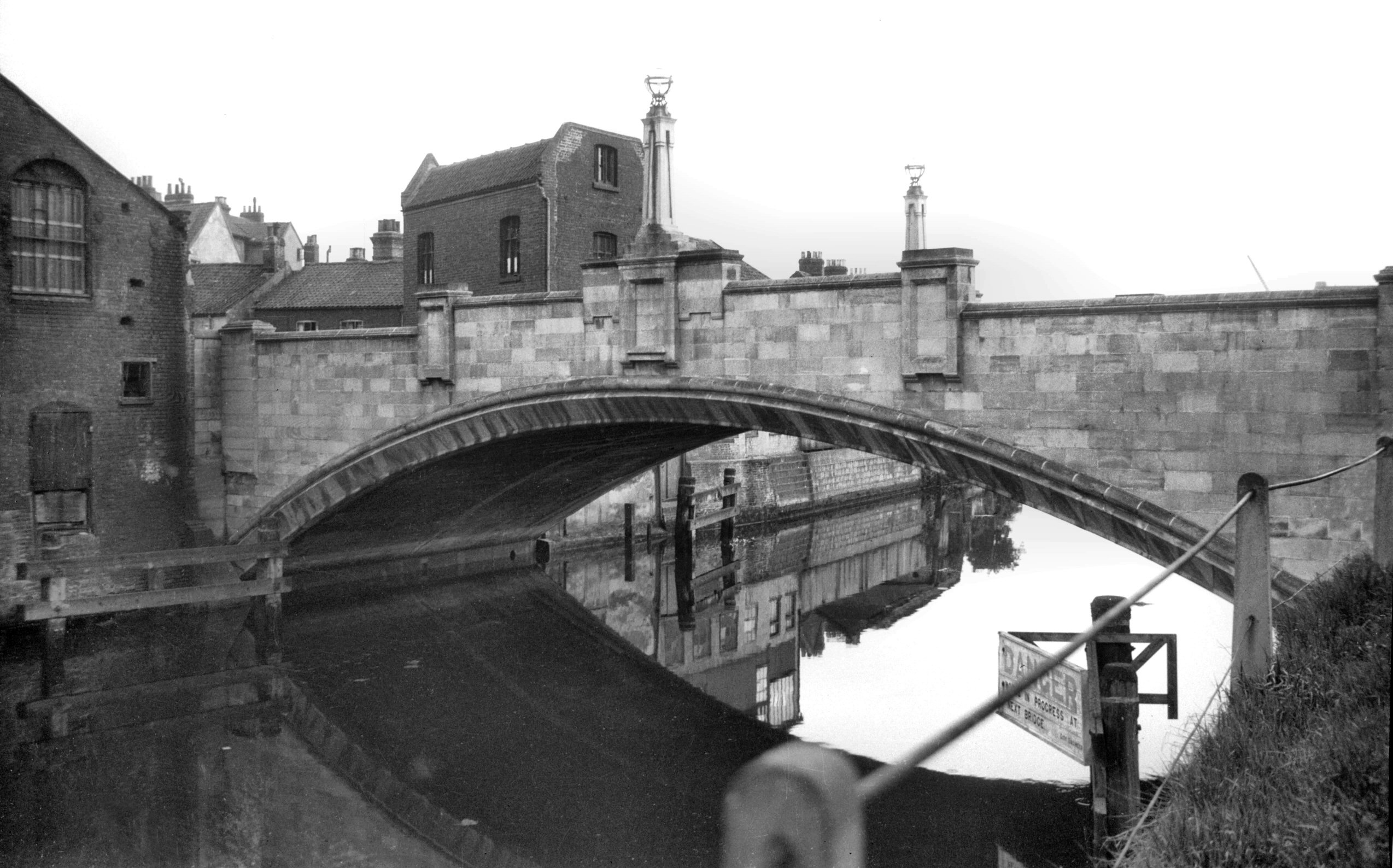
This is Whitefriars Bridge, which has also historically been known as St. Martin’s Bridge. It was first constructed in around 1110, but this story is best told by the formidable George Plunkett (and he has a photo of the bridge from 1933):
“Whitefriars Bridge is one of several in Norwich rebuilt during the 20c. Formerly known as St Martin’s bridge, it is first mentioned in a grant made by King Henry I to Bishop Herbert de Losinga shortly after 1100. In 1290 it was washed away by a great flood, and there are records of it having to be rebuilt at different times throughout the centuries. The earlier ones would have been wooden constructions; during Kett’s rebellion in 1549, we are told, the bridge was deliberately demolished with the dual purpose of impeding the rebels and using its timbers to strengthen the nearby city gates. In 1591 a more permanent edifice was built of stone, with a single pointed arch. This survived until replaced by the present bridge designed by Arthur E.Collins, City Engineer, and built by unemployed labour under a skilled foreman. It is of concrete reinforced by 1.5 inch steel bars and faced with mica quartz and white cement. The first half was opened to traffic on 19th February 1925. Its span of about 80 feet is some 50 feet wider than that of its predecessor.
It was said at the time that the stones of the old bridge would be marked in order that it could be re-erected on a different site, but this was never done. Several suggestions have been put forward as to their fate, one of the least plausible being “that they happened to fall into a wherry as it passed under the bridge” and were conveyed by water to Wroxham and Horning to be used as foundations for riverside bungalows. It sees more likely that some at least were taken from the bridge to the Corporation Depot at Infirmary Square (now Starling Rd), and were later moved to another store at St Martin at Oak Wall Lane, finally ending up as foundations for roadworks on Aylsham Rd.”

Now known as Quayside, this row of houses facing the river are around 100 years old. Although it wouldn’t have been possible at the time, there’s a path now along the river for those want to walk along it, a project which must have showed considerable foresight to establish.

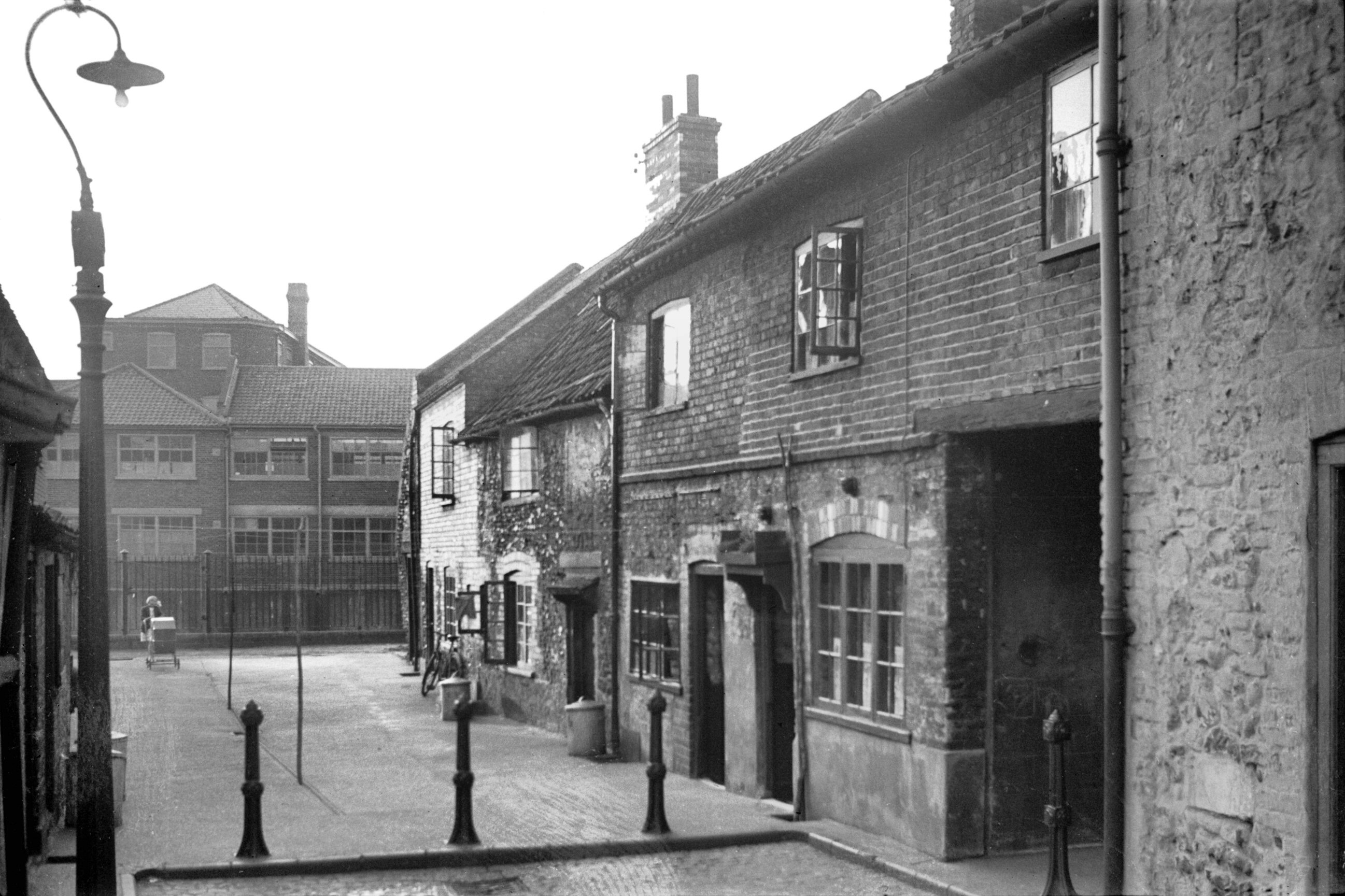
Pyes Yard, which has also been known as Fyes Yard and Pyes Court. In 1938, there was a slum clearance of the 17 houses down here, so everything of historic interest down to the river is lost. George Plunkett took a photo shortly before the area was condemned, which might have today made for some rather beautiful townhouses with a little (well, quite a lot) of modernisation.

The old signage to the yard.

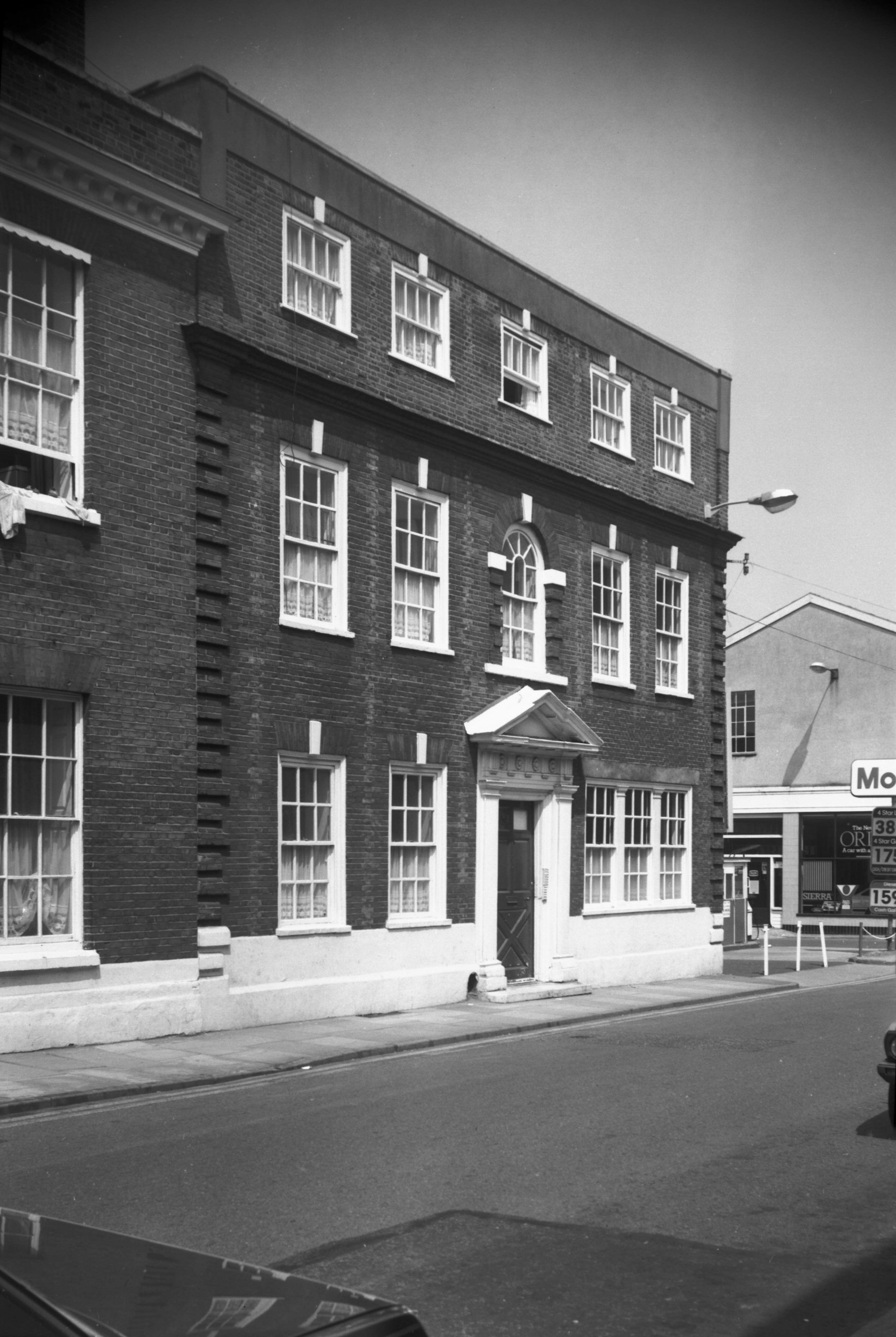
The buildings facing Palace Plain have survived, even if the yards behind them have now been taken down. The white building on the left is 1 and 2 Palace Plain, originally built in the seventeenth century, then used as a shop before more recently being incorporated into an office building. The white building in the centre of the photo is what is historically known as the White Lion pub which has been a licensed premises from the mid eighteenth century and which was originally built in the sixteenth century as a residential property. When the courts were opened in 1985, the pub name was changed to the Wig and Pen, perhaps to tempt the wealthy lawyers and judges over. The red brick building on the right of the photo is Cotman House, originally built in the eighteenth century as a residential property.

Cotman House is so named as John Sell Cotman (1782-1842) lived at the property. He was one of the artists who was part of the Norwich School of Painters, one of the first local art movements in the UK. The group was originally led by John Chrome, before Cotman took over to keep the informal movement going, although it fell apart a bit when he moved to London.

The back of what was Busseys, the Ford car dealership, whose city centre land no doubt just became worth far more for building than it did for selling cars. The street that runs behind the back of these buildings, connecting Bedding Lane to Pigg Lane, is Joseph Lancaster Way.

I’m not entirely confident that I know why this modern street has been given this name, so I’ll have to make a guess. The area behind Busseys was once a school and there is a Joseph Lancaster who was important in the nineteenth century for the establishment of more modern educational methods. He’s known for the phrase “a place for everything and everything in its place”, which makes him sound rather organised…. Anyway, I’ll probably find out that it’s been named after some local councillor, but that’s the best reasoning I’ve got as to the naming of the street.

The building in the centre is 17 Palace Street, which dates from the eighteenth century, although the range stretching back a little at the rear is from the seventeenth century. The building next to it is modern and is where the entrance to Busseys once was, and George Plunkett has a photo of that from 1987.
That concluded the day’s historical activities, we then went to try Ron’s Chips.


