Author: admin

  • LDWA 100 – Training Walk 12

    LDWA 100 – Training Walk 12

    This was our twelfth walk in preparation for the 2021 LDWA 100.


    WALK NUMBER: 12 (The Wroxham Wander)

    DISTANCE COVERED: 18.5 miles

    NUMBER OF NATHAN’S FRIENDS WE “ACCIDENTALLY” BUMP INTO: 0 (but see below)

    SUFFICIENT BEER CONSUMED: No (all the pubs are shut)

    PUBS VISITED: 0 (not through choice)

    WEATHER CONDITIONS: Dry and surprisingly warm

    ATTACKED BY ANIMALS: No

    NUMBER OF SNAKES SEEN: 0


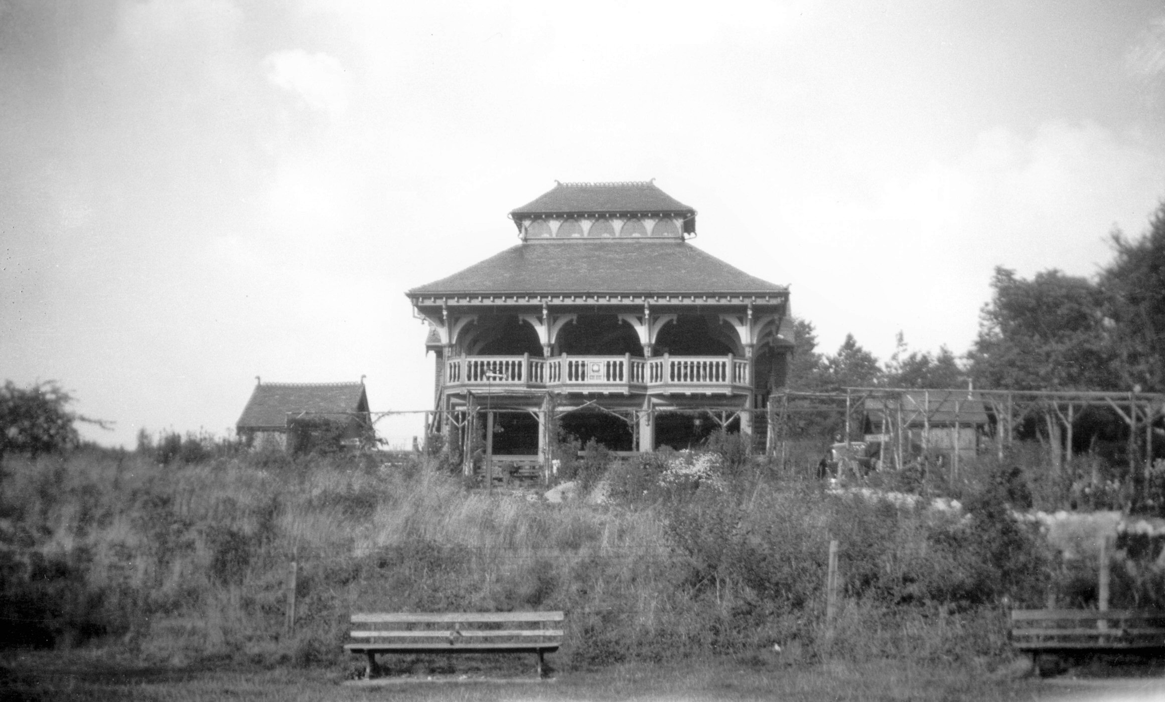
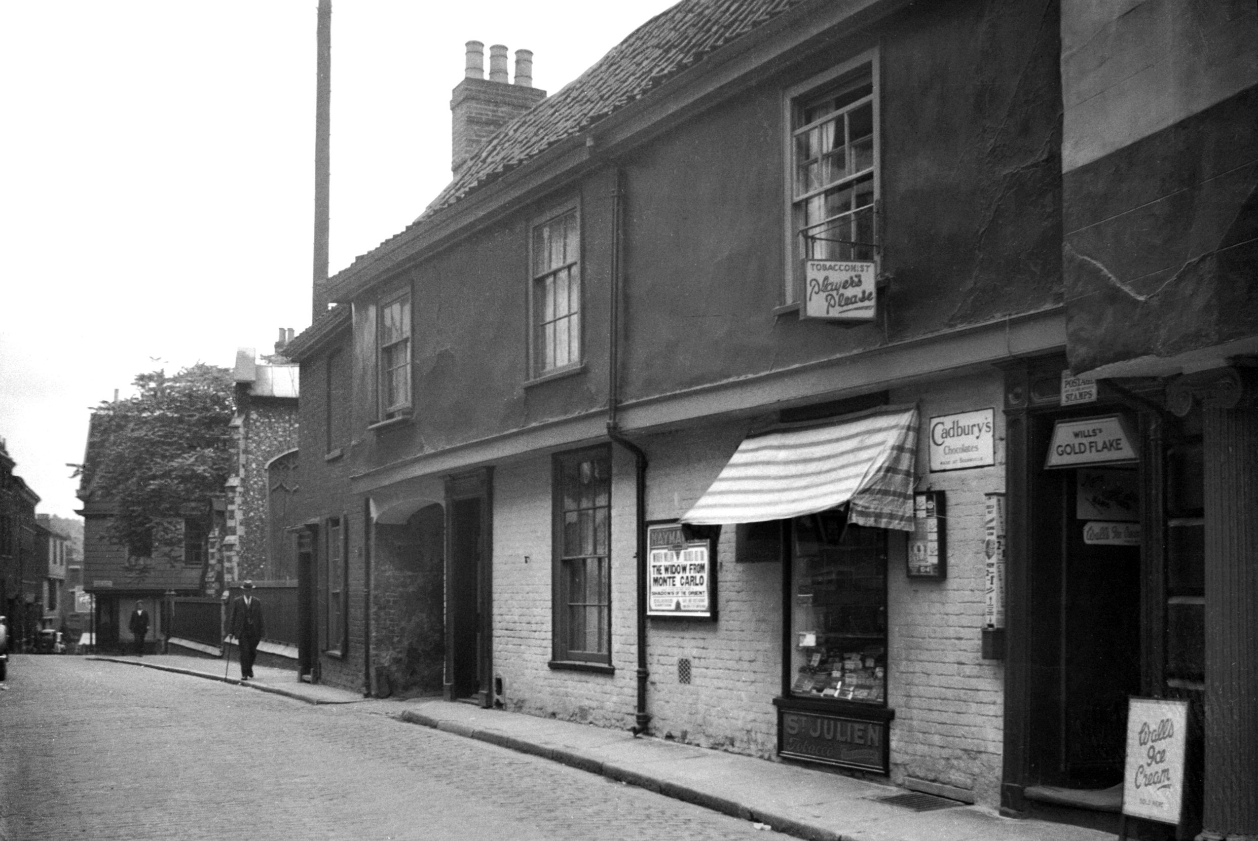
    The LDWA 100 in May is creeping up rather fast and so it was time for us to go on another little meander in the quiet Norfolk countryside. Above is what is currently Zaks American restaurant and they’ve been in these premises since 1979. Apologies for yet another mention of George Plunkett, but he has a photo of what this former tea pavilion looked like in 1931.

    Nathan guided us through Mousehold Heath through trial and error (mostly error), but I must confess that I still manage to get lost in this area so I wasn’t much help. Here’s a pile of big twigs constructed to build a shelter.

    A beehive sign, suitable given that the building behind was until relatively recently the Beehive pub. It’s now a Co-op, but the old web-site for the pub is being maintained as a community project, which is a marvellous idea. I’m not entirely taken by this habit of supermarkets taking over former pubs, once an asset like that is lost it’s going to nearly certainly be a permanent loss.

    This is the end of the pavement on the Norwich to Wroxham Road, beyond that pedestrians are expected to walk down the round. It’s not ideal…… We decided that we wouldn’t walk back this way, instead going via Rackheath, which proved to be a sensible decision. One day there will be proper access for walkers and cyclists on roads such as this, but I fear that we have a little bit of a wait for that.

    I’m very pro-rail and often grumble about new roads, but the council have done a good job here with the Northern Distributor Road (alternatively known as the Taverham-Postwick Road) in terms of footpaths and cycle access. The council were content not to make pedestrians to walk along the road here, so that made matters rather more pleasant.

    Moist roads….. Komoot wasn’t entirely helpful in the stretch beyond this, as its routings tried to send us down private paths that weren’t on the definitive map. That meant some backtracking was necessary and although Komoot are reliant on external data, it’s a situation that means significant caveats would have to be made before anyone uses Komoot in rural Norfolk. Nathan muttered about Komoot quite a lot today but I considered it to be user error. I didn’t say that though, I didn’t want to cast a dark cloud on proceedings.

    On the right is the railway line that runs from Norwich to Sheringham, and this point is just before entering Wroxham. There’s an amazing amount of earthworks that took place for this line to be constructed in what some people believe is a flat county. But, as Norfolk residents know, there are mountains and hills all over this area.

    Looking over the bridge towards to Norwich, although we managed to miss the trains today so there are no photos of the new Greater Anglia fleet.

    Here we are. A word of caution (I made have added jeopardy there, as it’s not really a problem to get this muddled up), the villages of Hoveton & Wroxham have effectively merged together, and the railway station is known as that, Hoveton & Wroxham (although that wasn’t the case before 1966, when it was just Wroxham). Roys of Wroxham is actually in Hoveton, along with most of the shops and food outlets.

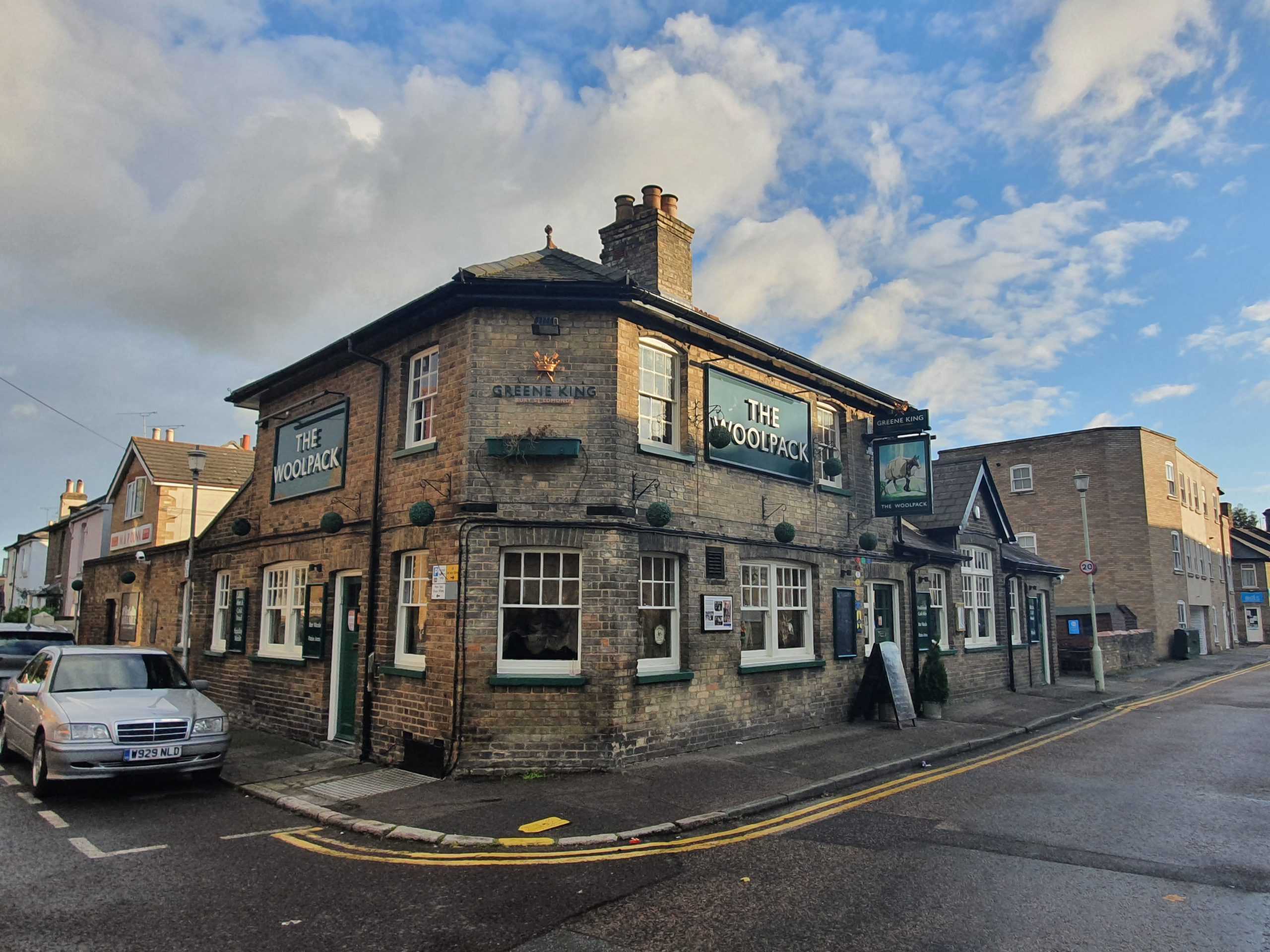
    This was the Castle Hotel, the only pub in Wroxham, but it closed in November 1996 and is now a residential property. There isn’t much more of a choice in Hoveton, with the really average Greene King King’s Head pub being the most obvious one.

    They appear to have built Wroxham library on a floodplain (or where the river floods, I’m not sure of the geological term I’m supposed to use) but at least the stilts look sufficiently high to avoid damp books.

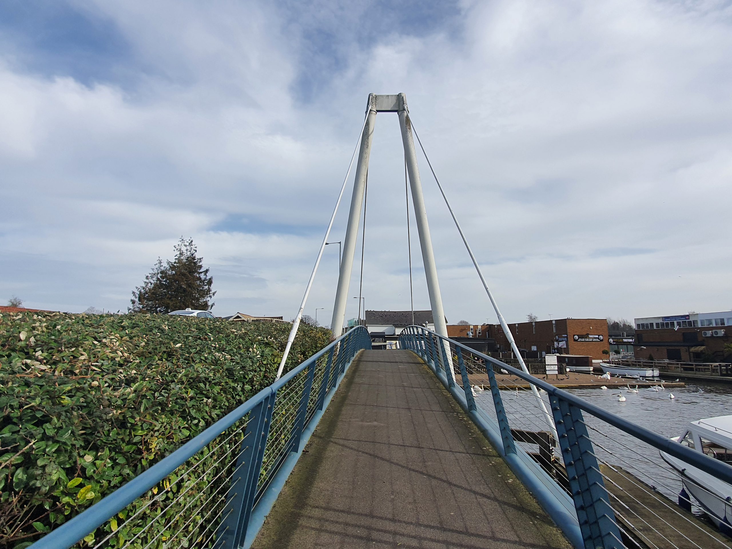
    The footbridge over the River Bure, that’s Hoveton in the background.

    This reminds me of days spent on Broads cruisers, although I found the driving the boat quite a hassle. I preferred the sitting down watching the scenery whilst eating sausage rolls.

    The old stone bridge and there has been some structure here since the early medieval period such is the importance of this crossing. This is a challenging bridge to get under, and I think Heidi guided operations when we did this in a Broads cruiser, but accidents here aren’t rare. For anyone who fancies having a look at proceedings, here’s a YouTube video, although there have been much worse incidents here. It’s recommended to use the pilot service to get through here, to avoid any scraping issues.

    And here’s another little video of what boating is like at Wroxham, involving an angry man from Broads Tours. I quite like this video.

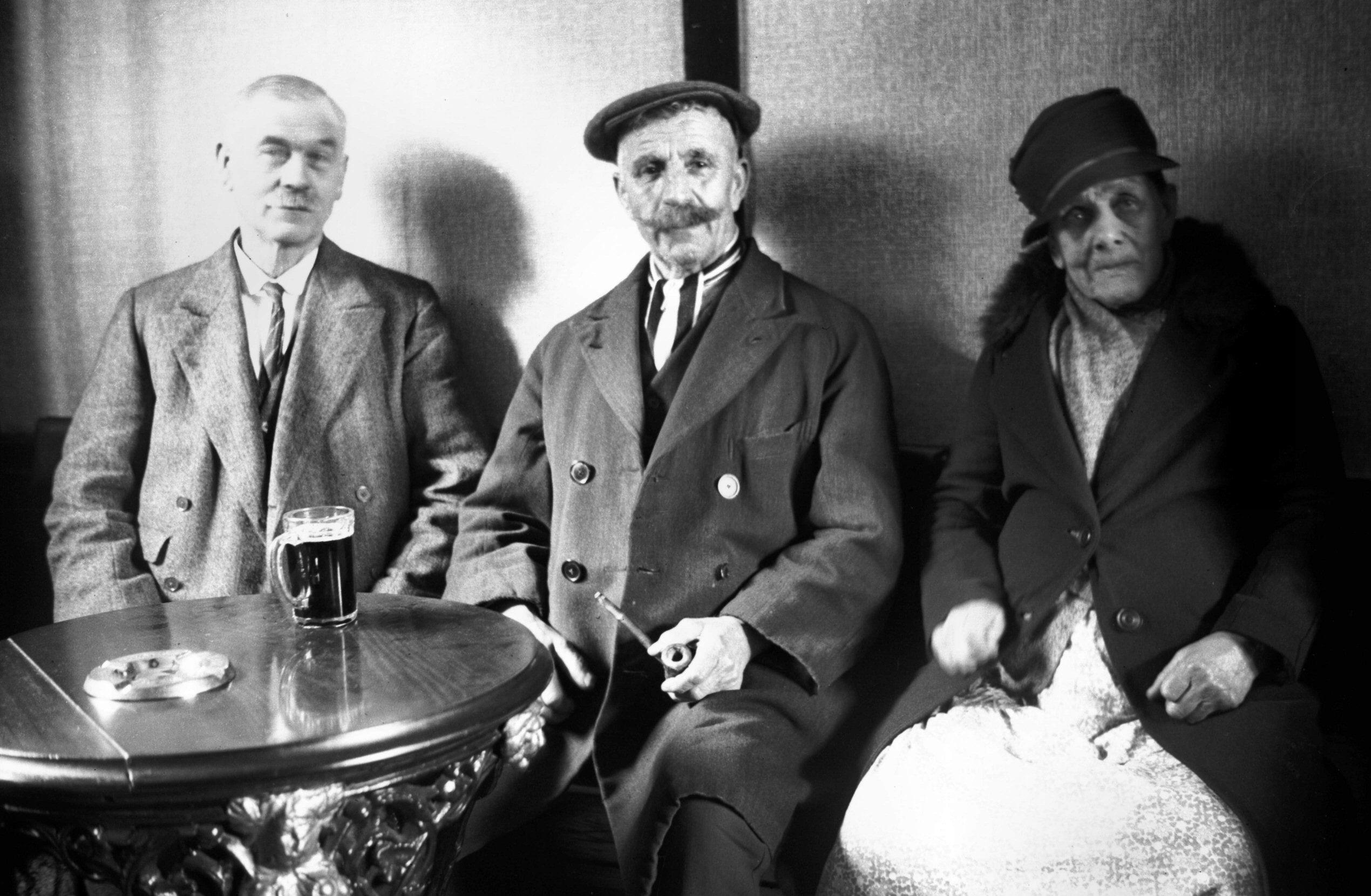
    We opted for chips at Greys in Hoveton and they were priced towards the higher end of the scale, but met my expectations in terms of the taste and temperature. More on this in another post though. At this point we had a quick meander around Wroxham, but it was rather packed with tourists and so we decided not to linger. We did though have time for a mini game of GeoGuessr and more on that in another post. Nathan saw someone he thought he knew, but it was all a bit vague (he claimed he hadn’t met him in person and only on Zoom, but I like to think there’s some gossip behind the whole situation), so I’m not counting that one in the tally at the top of the page.

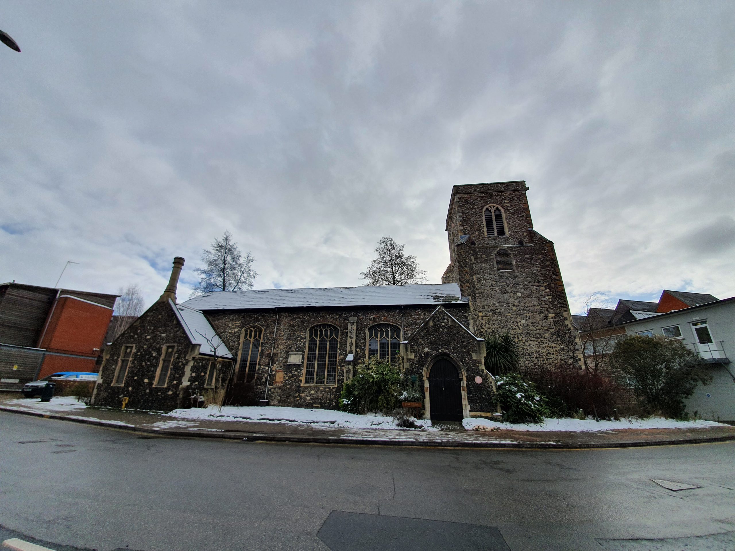
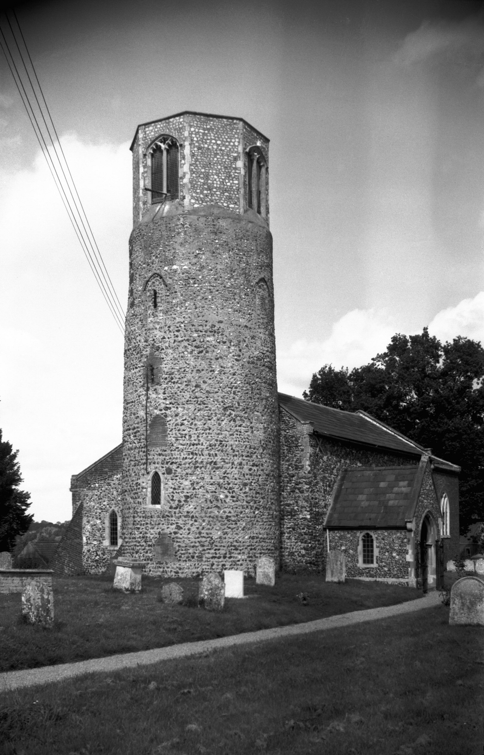
    This is St. Mary’s Church in Wroxham, unfortunately closed otherwise I could have seen the doorway which is apparently of considerable note. It’s a building rather marred by what I consider to be ugly additions, but its location near to the river gives it a peaceful feel. More on this Grade I listed (primarily for the doorway) church in another post, but it’s mainly fifteenth century although there are parts of the previous twelfth century church still in situ.

    Trafford Mausoleum which is located in the churchyard of St. Mary’s Church and was constructed for the Trafford family who lived in Wroxham Hall, which has now been demolished. It was constructed in around 1830 and was designed by Anthony Salvin, also known for his work on restoring castles.

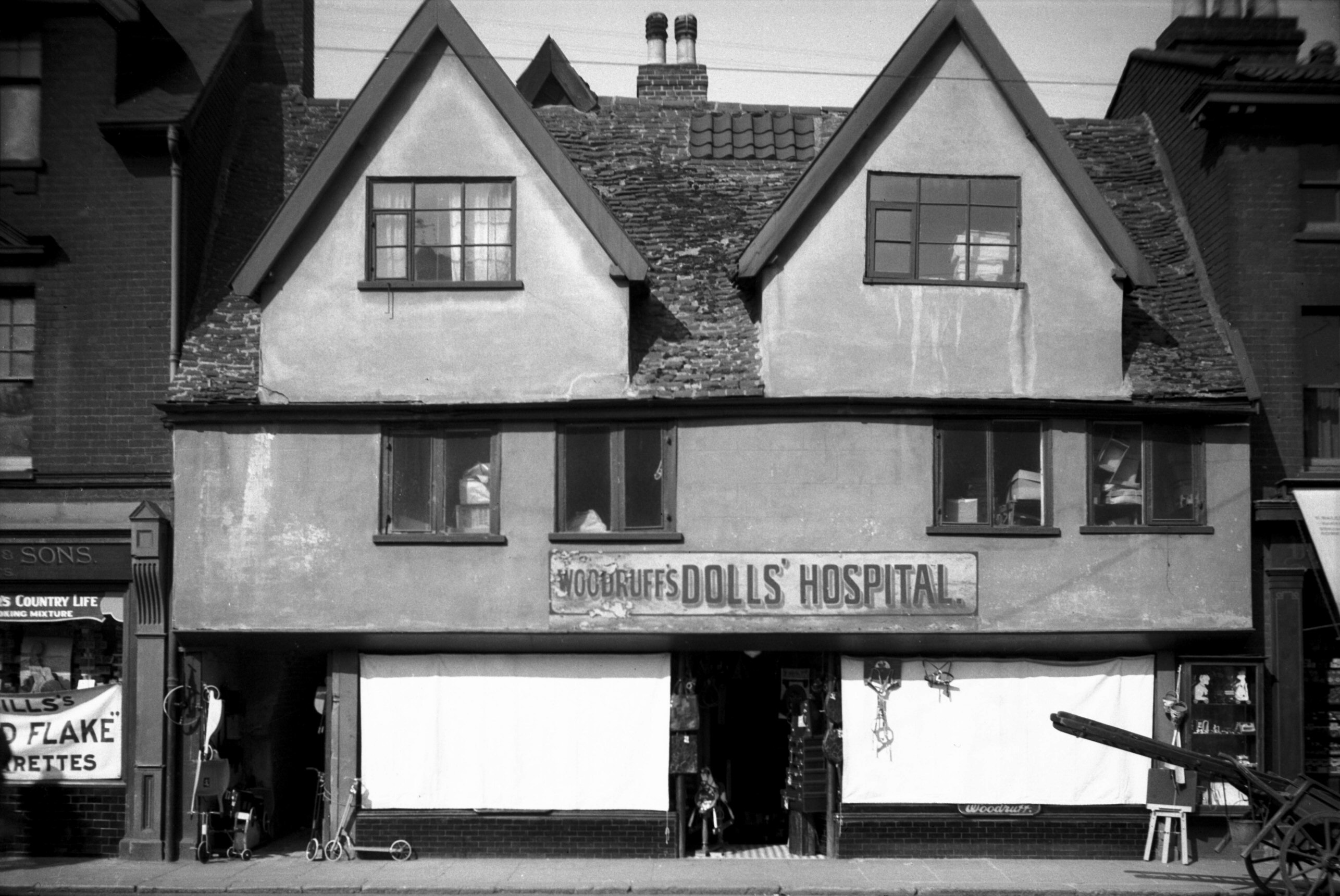
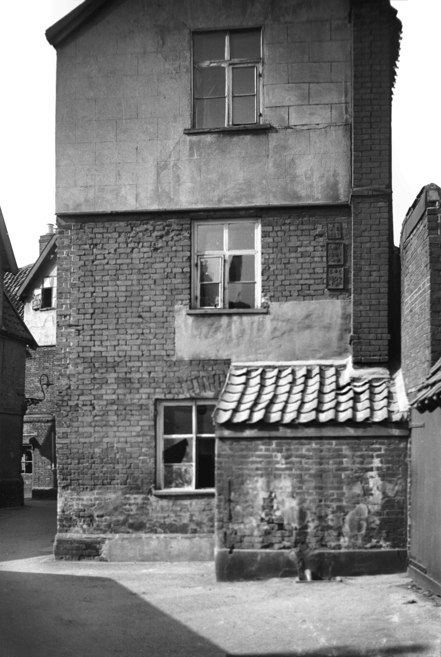
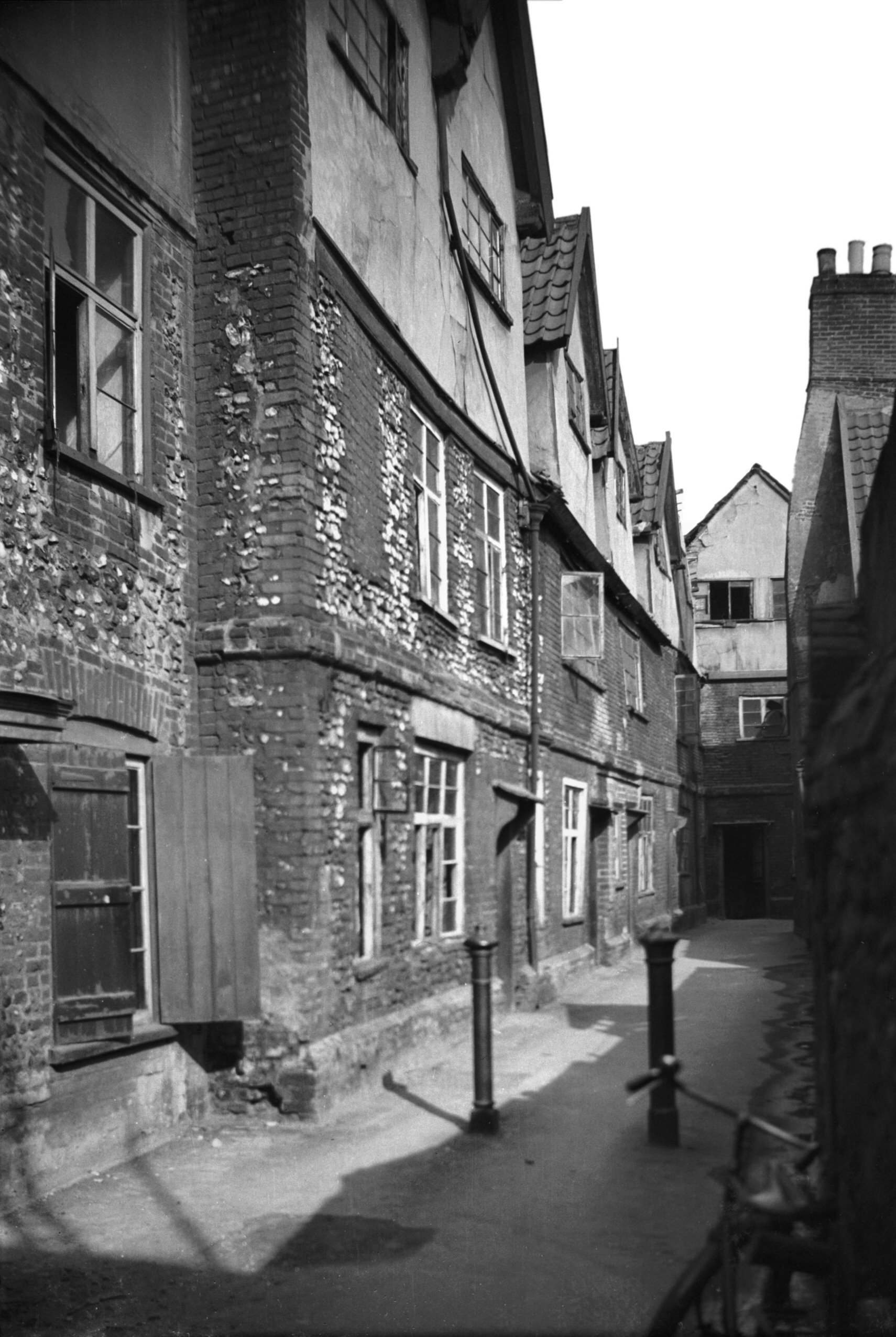
    An interesting old property on Church Lane, which was once the heart of the medieval village but now feels a little more remote. It’s a really nice area of Wroxham, and there’s also a pleasant area by the river known as Caen Meadow. Nathan decided I was faffing about too much here taking photos, but I ignored those complaints because I couldn’t be bothered to walk any quicker.

    Aaaaah, a lamb, how very lovely.

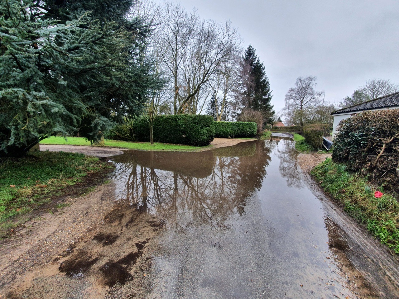
    The walk was quite dry today, but there were areas of water to navigate.

    The Taverham-Postwick Road as I’m now calling it, with lots of trees planted on the side of the bank. This was like a wind tunnel though walking alongside it, which wasn’t entirely ideal.

    I’m not sure that I’ve been to Thorpe End Village, but it was nice to see the local LDWA treasurer here. As the name suggests there’s a village feel to this little settlement, which has rather now merged into the outskirts of Norwich.

    And walking back into Norwich, this is the same path that Nathan took us down on a previous GeoGuessr evening walk. It was less muddy on this occasion and, fortunately, I had more suitable shoes on which made matters easier.

    All told, this was another walk that went quickly and we didn’t encounter any medical issues on the expedition, which bodes rather well for the 100. The weather was quite balmy at lunchtime and we did debate getting an ice cream in Wroxham as a dessert for the chips, but the area was a bit busy and we thought it best to try and avoid people given the current health situation. So, another rather lovely day.

  • Norwich – Black Lives Matter Graffiti

    Norwich – Black Lives Matter Graffiti

    I don’t intend to veer into politics on this blog, but this graffiti has appeared under the flyover on Magdalen Street and it seems nicely done. Something which tells a story and adds some interest to the area near Anglia Square is perhaps really quite welcome.

    As an aside, this is a ugly area, it’s a shame that nothing in the past could have been built under the flyover to tidy this whole site up. This rather beautiful building is what used to stand here…..

  • Chelmsford – Woolpack

    Chelmsford – Woolpack

    I visited this pub in October 2020, this isn’t some lockdown breach…… Although it’s Greene King, it’s also in the Good Beer Guide and has been the local branch’s pub of the year.

    The pub didn’t have any dark beers and no craft beer, and the poor member of bar staff was left with a dire choice of beers to recommend to me, namely Hardys & Hansons Olde Trip. This beer is, frankly, not particularly good at the best of times, so I wasn’t entirely thrilled. However, I forced myself to have a half, as it seems a little pointless to try and visit every Good Beer Guide pub and then not have a drink.

    The interior was decorated for Halloween, or at least I assumed it was….. I tried to ignore the ‘Create Your Own Dance Video’ machine, which seemed ill-fitting in numerous different senses. The presence of this machine confused me a little, is this trying to be a local community pub or Yates? There were also numerous ‘4 shots for £12’ which isn’t really much of an offer when it includes Cactus Jacks, where an entire bottle costs far less than £12. Anyway, all this seemed muddled, and I got the impression that beer drinkers are being shunted out. If you want a young and vibrant theme then get better craft beer, not machines to create your own dance video. Anyway, I digress.

    On the point of beer choice, I was slightly annoyed to see there was a picture frame full of Titanic Brewery pump clips as well, as that’s one of my favourite breweries and I would have very much liked to have enjoyed one of their beers. Instead, I was stuck with Greene King’s finest.

    The pub serves food including Sunday Roasts and there are burgers and the like.

    The service was fine, although the pub being empty didn’t add much to the atmosphere. The staff member asked me for help spelling words on a document he was writing, which made me feel useful at least. I suspect there’s quite a community feel to this pub in normal times, it had that sort of atmosphere to it. It’s quite a ‘lived-in’ pub and I hope they don’t try and modernise this VIctorian pub pointlessly, it’s got charm as it is.

    As for the beer, it was bloody awful and on the turn. Usually I’d get it replaced, but it’s such a bland and boring beer anyway that it didn’t much change my enjoyment of it. I think Greene King work hard on their obsession to deliver mediocrity and this beer delivers on that. It comes to something though when I’ve started to wonder whether Greene King beers actually tasted better when they’ve gone off, at least there’s some sort of flavour.

    It seems that in normal times there is actually a relatively wide beer choice available, so I was maybe unfortunate to visit when the pub was struggling to offer much of a range. The Railway Tavern in Chelmsford had told me the day before that they didn’t have the trade to justify putting darker beers on, which didn’t seem an unreasonable thing to say. But, judging solely on what was available when I visited, this was sadly just the bland Greene King offering and it also wasn’t kept well.

    Whatpub note that the pub underwent a change of management at around the time that I visited, so perhaps this was the dying days of the previous owners, which would explain why things were a bit ropey. So, nothing particularly impressive from when I visited, although it was clean and the pub seemed to be taking the Covid-19 rules seriously. But, the whole set-up seemed to be focused more on moving away from beer towards gimmicks, and I’d rather they went the other way and pushed towards craft beer as that’s where being on-trend lies. This is all very confusing though, the pub is clearly popular with CAMRA and real ale drinkers, but it felt like it was trying to be something else. Maybe this just all makes more sense during normal times, being a publican is hardly easy during these strange times.

  • Norwich History by Parish : St. Peter Hungate

    Norwich History by Parish : St. Peter Hungate

    And a new little project that Jonathan and I are undertaking because this lockdown is clearly here for at least a few more weeks. It’s a bit niche (our project I mean, not the lockdown), I’ll accept that, but there we go. Effectively, it’s walking around Norwich, ancient parish by ancient parish and seeing what is there now compared to a map from the 1880s (the map above is from 1789, but the one from the 1880s is more detailed, which is why we used that). There’s a PDF of these boundaries to provide some extra background to this whole project.

    St. Peter Hungate is the fourth parish we’ve done this for and although it’s relatively small in size, it has got some considerable heritage packed into it. There’s substantially more history than I can mention in this post, a reminder of just how much heritage remains in Norwich.

    The parish boundaries map.

    And a map of the area from the 1880s.

    The parish boundary goes right through the middle of this building, better today known as the Halls and it’s where Norwich Beer Festival is held. It’s actually though two buildings, St. Andrew’s Hall on the left and the building off to the right is Blackfriars’ Hall. We ignored the former today, as it’s in a different parish, just looking at Blackfriars’ Hall which is named after the Dominican Order which took over here in 1307. There’s imagery of inside of Blackfriars’ Hall on their official web-site.

    The area next to Blackfriars’ Hall, which isn’t accessible to the public, but the parish boundary runs through the middle of it, along the line of the concrete wall.

    This keyboard mould was pushed into the concrete in around 2000 by Molly Sole, a local art student, and there was a wave of public interest about it in 2020.

    Formerly one residential property, this house has now been divided into two and in the nineteenth century a corner shop was opened. It’s been used for numerous purposes since then, including as a cafe.

    At the top of Elm Hill, a pair of eighteenth century residential houses, with a plaque noting that the Friars de Sacco settled in a property on this site which was given to them by William de Gissing in around 1250.

    The rear of Blackfriars’ Hall, this is the most complete friary complex remaining in the country. Volunteering at Norwich Beer Festival has numerous exciting benefits, including free beer and food (and meeting people and all that stuff), but also being able to explore this wonderful building.

    The entrance to Monastery Yard.

    This area is now a car park (I think the city council have a plan for Norwich to become the European City of Car Parks), but there were residential properties which were on the left-hand side here. On the right-hand side is a monastery chapel which was built by Father Ignatius (more on him later), but which was forced to close in 1876.

    The rear wall of Monastery Street and there used to be residential properties which backed onto it.

    It’s now possible to walk by the River Wensum, but there were once buildings all along here which went down to the riverside. The situation here was that in the medieval period there were some grand properties owned by wealthy merchants on Elm Hill and they would have gone down to the river. Over time, these rear areas were filled with often poor quality residential properties and industrial buildings accessed by courts and yards, most of which were pulled down during slum clearances.

    This was once Crown Court Yard and its entrance remains, but the buildings have gone and it’s just a car park now. This really isn’t a great use for a site such as this in a prime part of the city.

    This is the remains of Towler’s Court which connects from the river to Elm Hill, with the buildings here being demolished as part of the 1920s slum clearances.

    And these are the parish boundary markers on Elm Hill, with the boundary of St. Simon and St. Jude on the left from 1842, and St. Peter Hungate on the right from 1814 and 1834. The parish boundaries are rarely logical, twisting and turning through buildings, so these iron markers really were essential.

    And the same parish boundary markers on the other side of the road, a real legacy of this system of dividing up the city.

    37 Elm Hill, with an entrance to Norris Court Gardens.

    Elm Hill is one of the more historic streets in Norwich and there are numerous Tudor buildings and undercrofts along here. So, what did the city council want to do in the 1920s? They proposed demolishing the properties along here so that they could build a swimming pool. Fortunately, local opposition and the intervention of the Norwich Society saw off these misguided plans and fortunately this marvellous area survived.

    Some on the council were entirely blindsided by the local opposition, with Mr Manning saying in a council meeting in 1926:

    “The city would be purer and better if the site was cleared. It is one of the festering sores in the city and the council would be well advised if they cleared the whole of the street away and made a public restplace”.

    Just weeks later, the city said that it was reversing its decision and the City Engineer was drawing up plans to restore the frontage of the buildings along Elm Hill, working with William Weir, the architect to the Society for the Preservation of Ancient Buildings.

    As an aside, there was a meeting in early 1926 held by the Norfolk and Norwich Archaeological Society and the chairman said that he was hopeful that there were some members of the Labour Party present. The chair said that he was aware that it wasn’t everyone in the Labour Party who wanted old buildings pulled down as “some members in the Labour Party were now very cultured and fond of anything artistic and antique”.

    I mentioned Crown Court Yard earlier in this post, and this is the sign visible from Elm Hill.

    And the entrance to Crown Court Yard from Elm Hill, not that there’s much of a yard to go through to.

    Looking back down Elm Hill.

    There’s a parish pump and an elm tree, although both are modern replacements.

    An old doorway with a plaque commemorating the life of Father Ignatius (1837-1908) who was an Anglican Benedictine monk who wanted to bring back the monastery system. He purchased this house on Elm Hill, definitely suitably located given he could see Blackfriars’ Hall from his window, which must have been a constant inspiration. George Plunkett has a photo from 1935 of this doorway.

    Briton’s Arms is currently closed and is for sale, after being run by sisters Sue Skipper and Gilly Mixer for 45 years. The building likely dates to the middle of the fourteenth century and was a beguinage, or a house for religious women. It was the only house in the street to survive the fire in 1507 and for the next couple of centuries it was used by barbour surgeons and individuals involved in the wool trade. Timothy Gridley, a woolcomber, was perhaps the first landlord here when he was listed as a licensee in 1760. The pub was initially known as the Kings Arms, being changed to the Briton’s Arms in the early part of the nineteenth century. It remained in use as a pub until 1945, when it became a restaurant and cafe.

    Looking back down Elm Hill.

    A drawing, from around the same spot as the above photo, drawn in the 1920s as part of the plan to restore the street.

    The porchway of St. Peter Hungate, the first church in the country to be repurposed when it was declared redundant in 1936. It housed a museum of church art, an inspired and forward-thinking idea, but sadly it closed in 1995. Now under the management of the Norwich Historic Churches Trust, the church is now home to Hungate Medieval Art, a charity which promotes the city’s medieval history.

    Inside the porch, which can’t be accessed and I took this photo through the gate…. I will at some point hopefully find my photos of when I visited this church during the Flintspiration weekend in 2017. There are some photos of how the church looked on the web-site of Hungate Medieval Art.

    There may have been a church on this since the Anglo-Saxon period, although most of the current building dates to the fifteenth century. Much of the cost of this was paid for by John Paston and Margaret Paston, best known perhaps for the Paston Letters. The chancel and tower had been built in 1431 under the supervision of Thomas Ingham, although the chancel had to be rebuilt in 1604 when it fell down, which wasn’t entirely ideal. The church tower was shortened at the beginning of the twentieth century and the belfry was also knocked down, a period when the building was in generally a poor state of repair.

    The chancel end of the church with the graveyard behind, which is currently inaccessible to the general public.

    This building is on Prince’s Street and it used to be a shop, visible in this 1936 photo from George Plunkett. We went to stand by the entrance to where the shop was, but there’s no trace of it left at all, although the grate is in the same place.

    Two more parish markers, St. George Tombland 1777 and St. Peter Hungate from 1834. George Plunkett has a photo of these from 1934, and unfortunately one has gone missing, as his photo showed a St. George Tombland 1828 marker as well.

    Located on a new building on the other side of Princes Street is this parish boundary marker from 1834, a real survivor since this had to be taken off an older building and placed onto its replacement.

    And that was the end of our little tour, which was quite a moist expedition given the amount of rain. There are 16 listed buildings in this one parish and the streetlines haven’t really changed in this parish for over 500 years, so it’s an area of the city that is worth meandering to.

  • Norwich History by Parish : St. Edmund

    Norwich History by Parish : St. Edmund

    And a new little project that Jonathan and I are undertaking because this lockdown is clearly here for at least a few more weeks. It’s a bit niche (our project I mean, not the lockdown), I’ll accept that, but there we go. Effectively, it’s walking around Norwich, ancient parish by ancient parish and seeing what is there now compared to a map from the 1880s (the map above is from 1789, but the one from the 1880s is more detailed, which is why we used that). There’s a PDF of these boundaries to provide some extra background to this whole project.

    St. Edmund is the third parish we’ve done this for and it’s been the most challenging in terms of trying to compare it to the past, since there’s nearly nothing left with the exception of the medieval church itself.

    On the above map from the 1880s, the street of Fish Gate is at the base (now known as Fishergate), Peacock Street is at the left hand side (now known as Blackfriars) and Cowgate Street is on the right hand side (now known as Whitefriars). All of the buildings inside of that have gone, demolished as part of slum clearances, property redevelopment and road building. This entire site is now taken over by Smurfit Kappa, or the building perhaps still better known by most as the Norwich Corrugated Board, or NCB building.

    The premises of Smurfit Kappa, who produce various types of packaging. Once on this site there were schools, shops and residential buildings, including the courtyards known as Staff of Life yard and Fleece Yard.

    This is the side of the factory and this rather resolved a query we’d had the previous week. The factory wasn’t built in the 1980s as I had thought, it had been refronted in the 1980s and this older part of the building shows the original element of the structure.

    Rather helpfully, a staff member from the company came out at this point, as I don’t think they get many tourists taking photos of their building. It’s lovely, but I suspect more people take photos of Norwich Cathedral and Norwich Castle. What the helpful staff member did provide us with were photos of what the building used to look like, and there’s a walkway here over the road that I didn’t know about.

    This is another photo provided, showing the factory after it had been refronted, with the walkway now removed. The factory building which that walkway led to has now been demolished and has recently been replaced by residential properties. It was also nice for the two long-standing staff members to help us in this quest, they’d worked there for a considerable period of time and added lots of context to how the area had developed. I also very much appreciated their sending me the photos of the site, the one above shows just how much this area has changed, along with the roundabout to the top of the photo which was built for the inner ringroad.

    This is what was formerly known as Peacock Street, which I’ve written about before. These properties are standing on the site of the former Tiger Inn, demolished for road widening in 1936. George Plunkett’s photo of the building shows just what impressive buildings the council has pulled down in its quest to satisfy car drivers.

    Over the road is Hansard Lane, which I’ve written about before.

    This is the the church of St Edmund, from which the parish takes its name. The church has a small footprint with nearly no graveyard, although it perhaps had one in the medieval period. The church became redundant in the late nineteenth century, one of the early casualties of the sheer volume of churches that Norwich had. There has been a church here since the Anglo-Saxon period, but the current structure is from the fifteenth century onwards. The Anglo-Saxon origins are pretty certain, as the church is dedicated to Edmund the Martyr, the Saxon King of the East Angles. Inside the building, there’s a single nave and chancel, with the porch visible in the left of the above photo dating from the nineteenth century.

    Although the building is Grade I listed, it wasn’t far from being demolished in the early 1970s, following a Church of England which seemed to have forgotten that it was the protector of historic churches. Fortunately, the community took an interest into what the church was planning with its disposal of buildings, and it was saved. It’s currently used as a Christian house of worship once again, although has been used for storage and also as the Norwich Pregnancy Crisis centre.

    A shed at the rear of the church which is of no historic interest, I just liked the icicles…. I’m so easily pleased.

    The church was once surrounded on three sides by a factory building which is visible from the overhead photo earlier on. Today these are riverside residential properties and it’s impossible to walk along the river here as it’s gated off.

    It’s possible to reach the river as there’s a car park behind the GP’s surgery.

    The view of the River Wensum.

    Back on the other side of Fishergate, this is the area behind what was Thompson’s Yard, all now council housing which seems to date from around the 1970s. It’s all sadly devoid of history.

    I quite like little stumps of former buildings, a reminder of what was once here. George Plunkett is of help here (yet again), the rest of the building is in one of his photos from 1936. The now demolished building was once the Rampant Horse pub, which had been a licensed premises since the early nineteenth century and was closed in 1912, another pub lost in the wave of forced pub closures.

    The building still standing next to this stump of wall was also a pub, the Duke of Marlborough, at 29 Fishergate and George Plunkett excels himself again by providing a photo of the landlord and customers in the pub in March 1939. This pub had started to serve customers from 1708 and traded until its closure in 1952.

    It’s hard to establish where the parish boundaries were, but I’ve decided that some of Thoroughfare Yard was probably in the parish of St Edmund. The Church of England don’t supply boundaries of this particular parish, which is likely as the church isn’t in their use any more, and the definitive map doesn’t have them on, so they must have shifted at some stage.

    It’s George Plunkett who once again helps me here, as he has a photo from 1936 which has the parish plates visible, and one of them marks the parish boundary of St Edmund.

    Thoroughfare Yard goes through to Magdalen Street, but I feel I need to investigate it further on a future expedition to ascertain whether those parish plates are still visible (likely not, as the buildings have gone), or where these parish boundaries were. For the moment, here’s another photo from 1936 that George Plunkett took of how the yard once looked.

    So, this wasn’t the most historic of areas that we’ve covered so far, but there were elements that remain from the past. Thanks again to the staff of Smurfit Kappa for their assistance, much appreciated! And, after this walk we went to get chips, just in case anyone wondered.

  • Dictionary of the Vulgar Tongue – Day 293, 294 and 295

    Dictionary of the Vulgar Tongue – Day 293, 294 and 295

    The Dictionary of the Vulgar Tongue was first published at the end of the eighteenth century, and given that the current health crisis is giving too much time to read books, I thought I’d pick a daily word from it until I got bored…. And to catch up after getting behind with these posts, and because I’m getting towards the end of the book, I’m doing three days at once now. How lovely….


    Rot Gut

    I like the drinking definitions that Grose comes up with, this one is “small beer; called beer-a-bumble – will burst one’s guts before it will make one tumble”. The phrase has been used since at least the late sixteenth century and initially was made with reference to beer, but it later evolved into also meaning wine, whisky and anything vaguely alcoholic. The phrase was also used during the Prohibition period in the United States, where it’s fair to say that the standards of alcoholic drinks fell somewhat.

    The Google Ngram of how “rotgut” and “rot gut” have been used over the last century, having become more commonly used in recent decades.


    Round Robin

    This is another phrase that I hadn’t realised had such a long etymological heritage, being defined by Grose as “a mode of signing remonstrances practised by sailors on board the king’s ships, wherein their names are written in a circle, so that it cannot be discovered who first signed it, or was, in other words, the ringleader”.

    The phrase was in use from as early as the middle of the sixteenth century, but the word origins are lost. There’s a theory, which seems to be the most common, that it derives from the French “ruban rond”, when petitions were allegedly signed on a round ribbon. That suggestion doesn’t seem to be very likely to me and it’s also the wrong way round. There is though an interesting blog post about an example of one of these round robins from 1760.

    A newspaper article from 1730 about an example of a round robin in use, not entirely successfully on this occasion. There’s a reference to a round piece of paper and I wonder whether the origin of this phrase is just ’round’ because it’s a petition that needs to be presented in that way to give anonymity and ‘robin’ as that’s sort of the shape of the bird.

    Today, the phrase is more commonly used with regards to sports tournaments and Christmas cards……


    Rum Bubber

    And back to the licensed trade, Grose defined this as “a dexterous fellow at stealing silver tankards from inns and taverns”. Customers stealing glasses from pubs can by annoying today for the management, although at least they aren’t as expensive to replace as silver tankards. The word ‘bubber’ is from the seventeenth century and originally meant a drinking bowl and which evolved into a word used to describe anyone who stole plate. This is also one of the definitions that Grose has just lifted out of Nathan Bailey’s “Universal Etymological English Dictionary” which was published in 1721.

  • LDWA 100 – Training Walk 11

    LDWA 100 – Training Walk 11

    This was our eleventh walk in preparation for the 2021 LDWA 100.


    WALK NUMBER: 11 (Faffing about near Surlingham)

    DISTANCE COVERED: 17.8 miles

    NUMBER OF NATHAN’S FRIENDS WE “ACCIDENTALLY” BUMP INTO: 3

    SUFFICIENT BEER CONSUMED: No (all the pubs are shut)

    PUBS VISITED: 0 (not through choice)

    WEATHER CONDITIONS: Moist

    ATTACKED BY ANIMALS: No

    NUMBER OF SNAKES SEEN: 0


    We didn’t set out today with any particular route in mind, but we did want to walk some of the Wherryman’s Way, which will be the first half of the path we’re taking on our actual LDWA 100 effort. So, that’s where we started and since I didn’t take any food along with me, we couldn’t go anywhere too rural for the entire day.

    Nathan pointed this building out, which we’ve walked by many times, and I realised that I didn’t have a clue what it was. I’m not an urban explorer, as I’m not brave enough, but, fortunately, someone has done that already and taken photos of what’s there.

    Here’s a map from around a century ago, showing at the time that the site was the Norwich Corporation’s sewage works. The buildings were constructed between 1865 and 1871 under the supervision of Joseph Bazalgette, best known for his work on sewage systems in London. They’ve now been superseded by Whitlingham Sewage Works, but the buildings remain and are in a decent condition.

    One of the wooden sculptures at Whitlingham Lake.

    We set off along Wherryman’s Way walking along the river and this is Woods End. It started to rain quite hard during this time, so this wasn’t looking like the more ideal of days for meandering around, but it stopped after about an hour and didn’t return. Perhaps quite usefully, the route wasn’t at all busy and we didn’t see that many people during the entire day.

    It has been a wet few months and much of the area was either flooded or quite damp.

    Well, and quite muddy as well.

    We had a little meander around St. Mary’s Church in Surlingham.

    When we were walking down the road a local resident mentioned that there was quite a flood up ahead. Always hunting for some form of adventure (OK, it’s true that walking down a flooded road isn’t that adventurous, but we are a bit limited at the moment) we thought this sounded more exciting than off-putting.

    I had my phone ready to capture anyone (and I won’t name names) who might have slipped over into the water and although that didn’t happen, this is how moist the area was. It’s certainly not ideal.

    After Nathan had climbed over the stile I helpfully said the words “bull in field” just to warn him of the potential danger. He interpreted that as my having seen a bull in the field, and I was impressed at how fast he was able to return. It shows what excellent reactions he has, which will prove useful in the event of a snake attack during the warmer months when adders and grass snakes flood into the area.

    Mud, which was really rather quite slippy. Not ideal. There were also numerous fields like this where the line of the public footpath isn’t marked out even in the most basic of forms.

    Walking past the solar farm at Yelverton, fiercely opposed by many residents when it was announced in 2014, but it certainly makes an impression of the landscape as it’s a pretty huge site.

    The Old Water Tower on Framingham Earl Lane, which appears to have been converted into a residential property given the letter box arrangement.

    We did think about getting chips, but the excitement of a One Stop meal deal proved just too much to turn down. We were quite impressed at the efforts made by One Stop to offer a selection of craft beer and although we didn’t get any today, there’s definitely a tide turning where shops are focusing more on decent beers and less on other alcoholic drinks and generic lagers.

    We had a choice of two routes back from Arminghall into the city, and we perhaps chose the wrong one as this one was rather muddier than we expected. But, neither of us complained….. Well, not for long anyway.

    This is the sand and gravel quarry near to Trowse, which is one hell of a hole in the ground now. I’m hoping that they turn this into some water park arrangement when they’ve finished their digging, perhaps with a Greggs and decent pub there as well to serve visitors.

    The collections box on Boudicca Way, which has some random pottery which has been found in the field and some feathers…..

    A horse which stared at me in what I thought was quite a disdainful manner. I think I need to get out more….

    And back into Norwich, this is one of the warehouses beside the River Wensum which I suspect will be transformed by property developers over the next couple of decades. It took us some time to get back into the city centre as we had to keep stopping so Nathan could talk to his friends that we kept bumping into. We had a variety of people on this one, including work colleagues and a former teacher…..

    In terms of the walk itself, it was only 18 miles and that’s obviously a long way short of the 100 miles LDWA challenge that we’re planning. But, there were no problems during the way and so it was useful to get some distance in given the current limitations that we have. We had hoped to walk Wherryman’s Way in its entirety again, but we can’t use public transport to get to Great Yarmouth at the moment, although hopefully that might change.

    As for the write-up of today, that’s the best I can do with the route we chose, which was quite a lot of wet footpaths and river banks and it’s territory that we’ve walked along before. It’s still what I’d call a training walk though, so I didn’t want it to pass by without making at least a brief reference to it.

  • Surlingham – St. Mary’s Church

    Surlingham – St. Mary’s Church

    This is St. Mary’s Church in Surlingham, located a short walk away from the River Yare. The church sits on slightly higher ground in a bid to protect it from the nearby marshes, something evident when we were walking through them to get here. George Plunkett has a photo of the church from 1978 which was taken in around the same place as above, although little has changed in that time.

    There is a nearby ruined church, St. Saviour’s, which was constructed in the twelfth century but which became redundant in the early eighteenth century.

    The round tower is Norman at the base, with the octagonal top dating from the fourteenth century. Much of the current nave is also fourteenth century, with the north aisle having been added in the fifteenth century.

    There are numerous patches of repair on the tower, mostly using this tiled style to fill in the gaps. I’m unsure why such a different looking material was chosen in the repairs, although it gives the tower a rather memorable look. As is noticeable on photo further down this post, the tower was once covered in ivy and that might have meant repairs were less noticeable.

    The stair turret on the tower.

    The chancel dates from the eighteenth century and was made from brick, giving quite a contrasting look to the church. Although I’m not sure how comprehensive the repairs were, as there was an appeal made in 1831 to secure funds to pay for a new church roof and advertisements were placed in the Norwich Mercury to find carpenters and bricklayers.

    This photo is from the beginning of the twentieth century, and both graves leaning against the end of the chancel wall are still there, although a few others seem to have disappeared. The church tower is fortunate not to have that much ivy still attached to it.

    The other side of the chancel is built in old stone, seemingly solely with the intention of giving it an older appearance. I’m unsure where that stone has come from, but I suspect that its been taken from another old building at some point.

    The end of the chancel, it’s all quite a clean design, but perhaps not breathtakingly beautiful.

    A rather beautiful carved stone font inside the church and it probably dates to the fourteenth century.

    Looking down the nave of the church into the chancel, where there’s evidence of where the rood screen stairs were located.

    Looking back down the nave towards the organ loft, I thought that everything was nicely proportioned and all seemed calm. It was possible to peer inside the tower and I’m not normally that interested in church bells, but this church has two which were cast in 1381 and that’s a pretty impressive survival……

    I liked that the church was open during this difficult times and although there are bits of Victorian repair which are readily visible, there’s lots of history to the building which hasn’t been swept away. It’s another of those churches where I suspect the parishioners from the late sixteenth century would have found relatively little had changed over the centuries, although they might have wondered where their box pews had disappeared to. These were removed in 1888 and the local press noted that there were now more open and airy pews, although I love the character that box pews have.

  • Saloon Bars and Public Bars

    Saloon Bars and Public Bars

    This article was published fifty years ago today in the Birmingham Post and there’s an element of this being a watershed in the evolution of British pubs. The distinction between the public bar and the lounge (or saloon bar) was being removed and women were being encouraged to visit pubs, although there was some considerable way to go on that at the time. It meant that prices were being standardised across the two areas of the pub, and being realistic, that usually meant a price increase.

    John Gilbert, the Labour MP for Dudley, wasn’t best pleased by all accounts, saying:

    “Some people are being forced to drink in places more like ladies’ boudoirs, when all they want is to drink a man’s drink in a man’s bar”.

    He commented on the influx of plush furnishings, carpets, colour TVs and jukeboxes, suggesting that this was forcing up prices. And fair play on this, a decent pub even fifty years on doesn’t need plush furnishings or carpets, and it certainly doesn’t need a colour TV or jukebox. Gilbert also described himself as “modest drinker”, which is a phrase that I’d use about myself, he sounds a rather measured man.

    I quite like the response from Watney Mann, who the article noted owned 6,500 pubs:

    “There would be no point in a pub on Park Lane having a public bar, but down by the docks it would be a necessity”.

    As an aside, Watney Mann were the brewery who produced Red Barrel, not a product that would ever be called a craft beer, let’s say that. Indeed, they were probably pushing it calling it a beer and there’s an interesting article elsewhere about that. But without breweries such as this, maybe there wouldn’t have been a CAMRA…..

    So, perhaps there’s something about the democratisation of the pub here, the removal of the class barriers between the different sections of the pub. I’ve seen articles written about how locals would ensconce themselves in the public bar, meaning that visitors would be encouraged to use the lounge bar. And that wouldn’t play well with how pubs are marketing themselves today, which is to a wider audience and not just to a small bunch of locals.

    I normally rail against change, especially when pubs, railways or crisps are concerned. But here, I think the right decision was made, a pub for the many, not the few…. As for John Gilbert, he was probably right that pubs didn’t need this wave of plush furnishings and maybe chains like Greene King even today could focus more on the beer than their pub interiors, but I’m not convinced that every pub needed a public bar. And the Government agreed, the letter that Gilbert sent to the then Home Secretary Reg Maudling was in vain, the dual bar set-up was coming to an end.

  • Carleton St Peter – St. Peter’s Church

    Carleton St Peter – St. Peter’s Church

    This is a remote little church in Carleton St Peter and this is the track which reaches it from the road. The parish is small with just a handful of properties, although there is evidence of prehistoric, Roman and medieval activity in the area. It seems that the villagers have just moved away since the medieval period, which makes the survival of this church all the more remarkable.

    Although there was a church here in late Saxon times, the currently building primarily dates from the thirteenth and fourteenth centuries, with numerous later additions. There are some early Norman features in the building, namely some lancet windows, which have likely been kept from the earlier structure and built into the fabric of the current church.

    An older infilled window, likely Norman.

    The chancel with no windows here on this side of the church, although it’s hard to see from the outside where it joins to the nave, as there’s a continuous slate roof.

    The tower is later than the main fabric of the church, dating to the early sixteenth century, with construction perhaps halted at one point which is evident from the different stonework.

    The polygonal stairs on the church tower.

    The churchyard, with a plot dug for a burial, and the area is quite open and spacious. There was an article in the Lowestoft Journal in 1876 which mentions when Edmund Perkins Hytton was buried in a vault in the graveyard, with his sister, Deborah Perkins Hayward, being buried in the same vault when in 1891 she died at the age of 97.

    The crossed keys of St. Peter on the stonework.

    Unfortunately, this is a church that is currently locked, although the Church of England say that it will open during daylight hours when some form of normality resumes. The porch is nineteenth century and likely replaced an earlier one, but there’s some history to that wooden door and it dates to some time in the medieval period.

    There’s an information board at the entrance to the porch and this notes that the church still has its King James Bible from 1611, which they refer to as a ‘Black Bible’ as it was without colouring (I haven’t heard of that term before). I’ve heard of the Great She Bible and these crop up from time to time, such as in the parish of Gisburn in 2015.

    A tithe map from the 1840s which shows the location of the church, and also how there’s nothing more than just a path to it. And therein lies the beauty of this church, a rural building unburdened by traffic and as familiar today as it would have been to the congregation of 500 years ago. And, hopefully, it’ll still look nearly exactly the same in another 100 years.