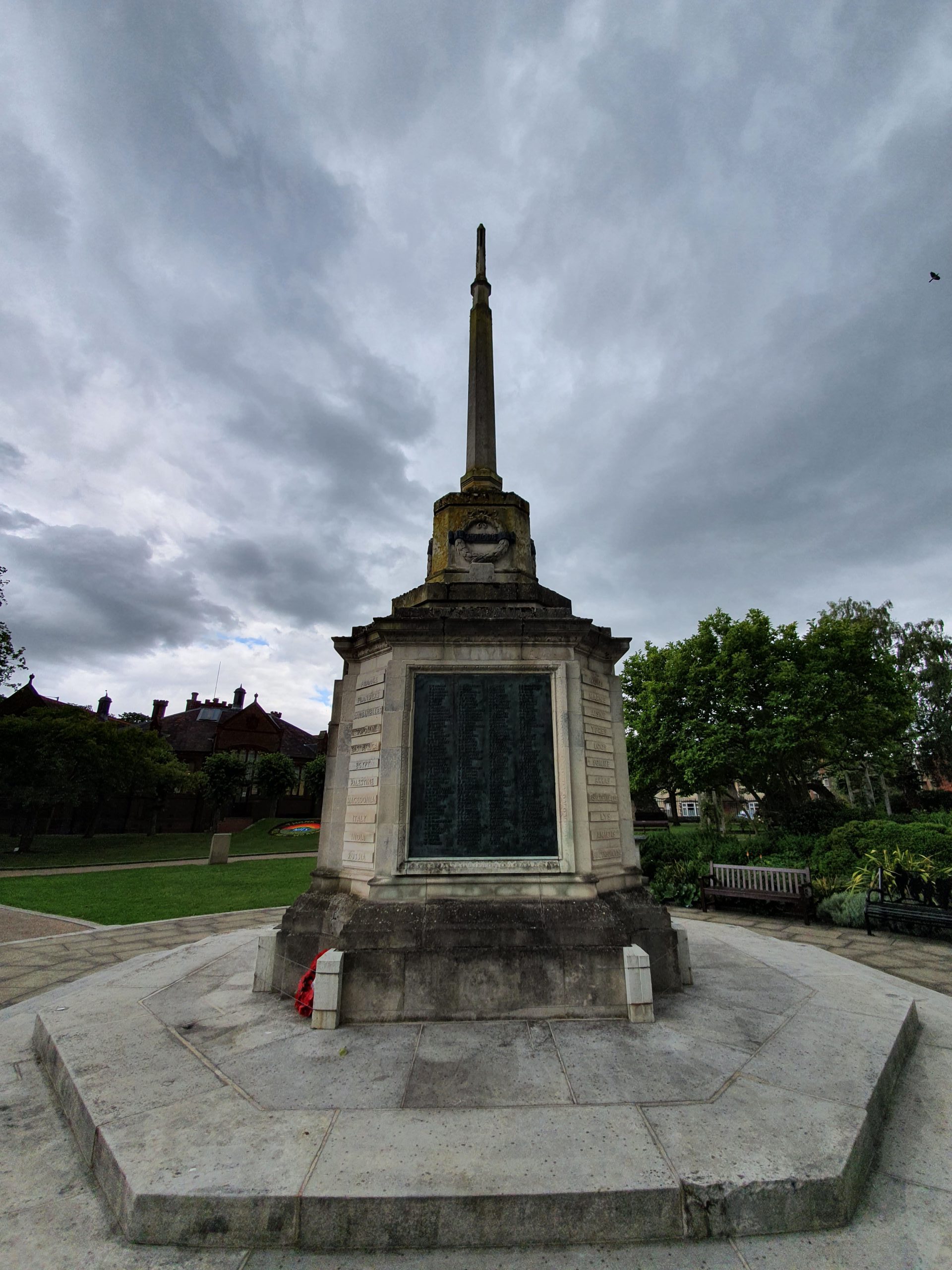
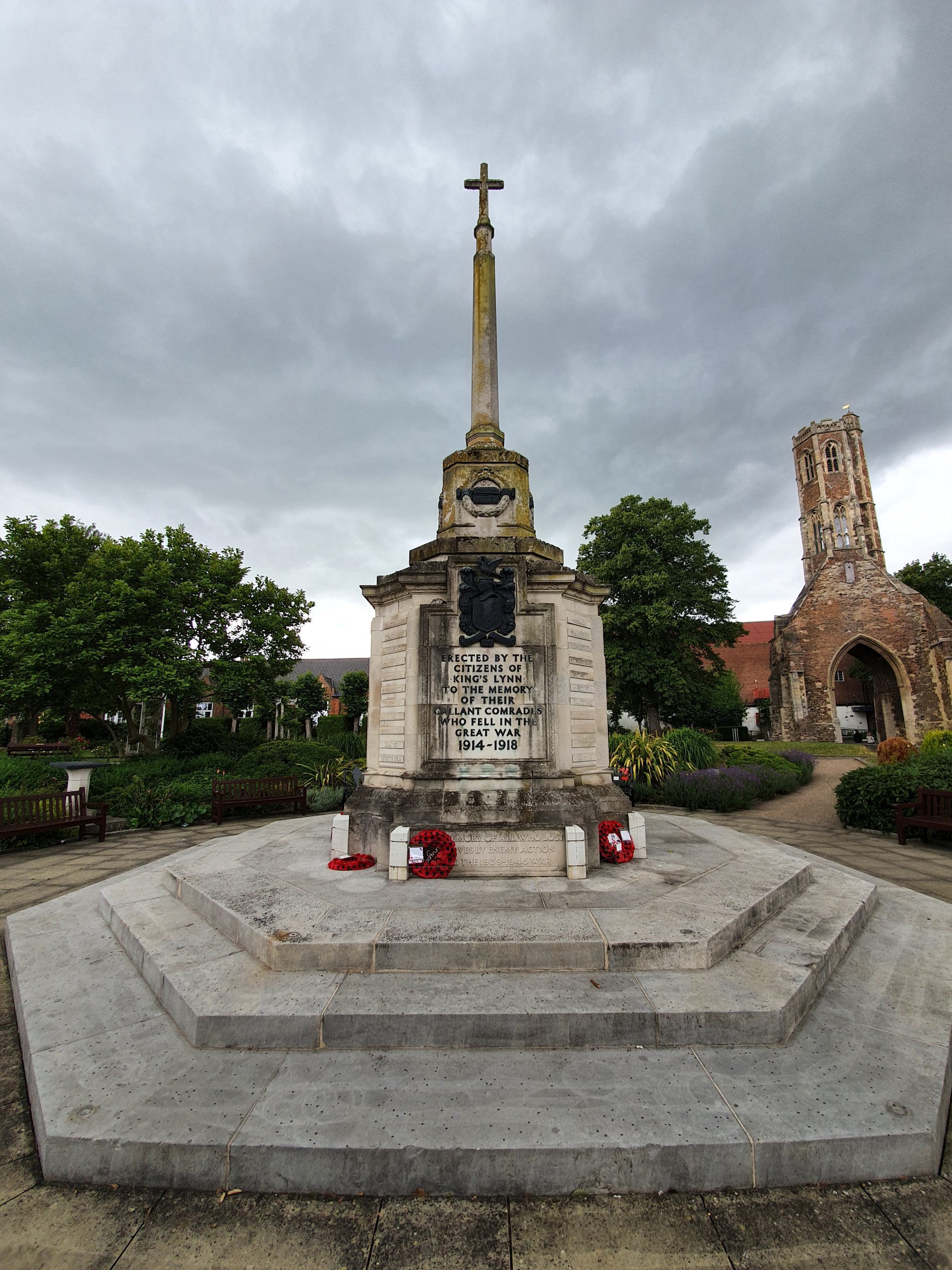
Category: UK

  • Caistor St. Edmund – Forged Coin

    Caistor St. Edmund – Forged Coin

    This coin is in the collections of the British Museum, and the image is copyright of the Trustees of the British Museum.

    It was found at Caistor St Edmund in 1978 and was purchased by Charles A Hersh, who donated it to the British Museum following his death in 1999. The denarius silver coin is a forgery, but not a recent copy, but instead made in antiquity. And, because it’s a forgery, the museum can’t easily date it, but it’s probably from around the end of the second century.

    Forged coins were a problem for the authorities throughout the Roman period and some people only collect these ancient forgeries. I like that at some point that this was being used at Caistor St Edmund, evidence of a fraud committed nearly 2,000 years ago. Fortunately for my understanding, the museum has also indicated what is on each side of the coin:

    On the reverse, there is Fortuna seated on the left, holding a rudder in right hand and cornucopia in left hand. On the obverse there is a Laureate head of Septimius Severus, the Emperor from 193 until 211.

    This coin isn’t on display at the British Museum, but neither are 99% of items in its collections. I hadn’t previously realised though that anyone can make an appointment to have a look at one of their items, so they do remember at least partially accessible.

  • Caistor St Edmund

    Caistor St Edmund

    The village of Caistor St Edmund is located around three miles from Norwich and today has a population of a little under 300. The village is perhaps best known for being next to Venta Icenorum, the Iceni and Roman town which was once of some considerable importance. More about the origins of the village’s name here.

    The village’s church, St. Edmund’s, is located by the remains of the Roman settlement and the war memorial is also located there, which is a walk of around 200 metres from the village itself.

    Here’s the village in 1900 and it’s pretty much unchanged today. The Roman settlement is in the bottom-left of the map and the important large buildings of Caistor Old Hall, Caistor Hall and the Rectory are visible, along with Markshall Farm in the north.

    Caistor Hall.

    Caistor Old Hall.

    Visible in the centre of the above map is a crossroads, with the north-south road being Stoke Road, the road to the west being Markshall Lane and the road to the east is Caistor Lane.

    There’s the entrance to Markshall Lane.

    There’s a row of three cottages at the heart of the town, near the crossroads, with the building in the distance, with the white edge to the roof, being the former Post Office.

    This is today’s Post Office.

    There’s not much more to the village, Caistor Lane continues to the left, whilst the road to the right leads to villages such as Stoke Holy Cross and Poringland.

    This is the only listed building in the heart of the village, which is Queen Anne Cottage, formerly known as Caistor Cottage. The property was constructed in 1729, for the Cogman family.

    But, more about all of this in other posts…. Since I haven’t worked out most of what I need to write yet  🙂

  • Caistor St Edmund – Village Sign

    Caistor St Edmund – Village Sign

    This didn’t come out as clearly as I hoped, I’ll take another photo at some point. But, it’s a decent village sign with its columns and portico arrangement, a link to the Roman and Iceni settlement which effectively founded Caistor St. Edmund.

    It’s 100 years ago last month that Prince Albert, who became King George VI, gave a speech at the Royal Academy which promoted the introduction of village signs. He was inspired by some local examples that he had seen around the Sandringham Estate and there developed a bit of a national craze in ensuring that nearly every village had one.

    I have no idea when the village sign was erected here and I’m not an expert in such things (or indeed about anything of use), but it’s probably from around the 1970s.

  • Caistor St Edmund – War Memorial (Walter John Blake)

    Caistor St Edmund – War Memorial (Walter John Blake)

    Walter William John Blake is one of the names listed on the war memorial in Caistor St Edmund.

    Walter served in France and Flanders during the First World War, dying of his wounds on 29 March 1918 at the age of 19. He was born on 26 November 1898 and was the son of Mrs Eliza Blake, who lived in Hall Cottages, Wacton Common in Long Stratton.

    In the 1911 census, he was living in Kimberly, near Wymondham, when he was listed as being a 12-year old still at school, living with his younger brother Leonard who was aged 9, along with his mother Eliza and his father Walter Blake, who was a farm labourer.

    He’s commemorated today at the Pozieres Memorial, which is around five miles from the French town of Albert.  There are 14,700 casualties recorded here and many of those are listed only on a panel as the bodies were never recovered, but they were men in the Allied Fifth Army (renamed the Fourth Army on 2 April 1918) which was driven back by the Germans. As Blake is listed only on a tablet, I’m assuming that his body was never found.

    I haven’t ascertained where he lived before going to war, it must have been in the village as I can’t see any other connections that he had to Caistor St. Edmund.

  • Caistor St Edmund – War Memorial (Charles Edward Back)

    Caistor St Edmund – War Memorial (Charles Edward Back)

    Charles Edward Back is one of the names listed on the war memorial in Caistor St Edmunds.

    Charles Edward Back was a rifleman who died at the age of just 20 on 20 September 1917, having started his military career serving in France in 1915. He was born in Poringland, the son of John Back, and they both worked as herdsmen (or cowman as John was listed as in the 1911 census). In that 1911 census, Back was aged 14 and was working as a yard boy, and he lived with his sister, Mabel Anne Back who was aged 12 and was a schoolgirl.

    Going back to the 1901 census, Charles and Mabel were listed, with John as the head of the household, along with Frederick Robert, who was aged 12 at that time (Charles was listed as being 4, Mabel as 2). Sadly, Frederick Robert also died in the First World War, dying in Thessaloniki in 1918.

    Rolling back further to 1891, it was clear that this was a bigger family than I had at first thought. For the first time, John Back’s wife is listed, Elizabeth Jane Back, with John working as a gardener at that time. There are also more children on the census list, Fanny aged 13, George Harry aged 11, Maud aged 9, Emma aged 2, as well as a 2-year old Frederick Robert. As well as all of these, in the census before, Albert and Kate were listed.

    So, something went wrong between 1891 and 1901, and it transpired that Elizabeth Jane Back died in 1895, at the age of just 46. So, I’m not sure who the mother of Charles Edward Back was, and although I can take a stab at that answer by looking at the 1901 census, guessing parentage doesn’t feel entirely appropriate.

    Back to Charles and the First World War. Since he is buried at Tyne Cot, that means he would have likely been involved with the Battle of Passchendaele, with the date of his death suggesting he was involved with the Battle of the Menin Road Ridge meaning he was one of 20,255 people dying in that battle.

    The above photo is taken on the day that Charles died, at the same location, although the photo shows a different regiment.

  • Caistor St Edmund – War Memorial

    Caistor St Edmund – War Memorial

    The war memorial in Caistor St Edmund is located near to the entrance of the Church of St. Edmund. It was unveiled in 1922 at a ceremony overseen by John Corbould Warren, with eight names listed on it, including Warren’s son. There were only 32 households in the village at that time, so this was an enormous loss to Caistor St Edmund.

    Fortunately, the war memorial is well looked after and there’s an information board with some details about the eight men who died, as well as another one later added to the memorial who died in the Second World War. Given that, I’ll post individually about those who died, partly to help me understand something about what this village looked like just over 100 years ago.

    Charles Edward Back.

    Walter John Blake.

    J. Derek Corrould Warren.

    Walter Ellis.

    George Franklin.

    Arthur Fuller.

    William Leech.

    Roland La Fontaine Whittall.

    Cederic Roland Minns.

  • Caistor St Edmund – St. Edmund’s Church (Exterior)

    Caistor St Edmund – St. Edmund’s Church (Exterior)

    It’s good to be back walking longer distances, and today’s ten-mile round trip was to Caistor St. Edmund. It’s a complex village because of its long history, so there might be quite a few posts and repeat visits for me to work it out to my own satisfaction. And probably to no-one else’s…..

    I’ll have to come back so that I can find out more about this church, as due to the virus, they’ve closed off the whole churchyard. The church itself is of interest as it’s next to the remains of the Roman town of Venta Icenorum and there is Roman brick used in the repair and construction of the structure.

    There was a church on this site from around the ninth century, which the Anglo-Saxons placed near to Venta Icenorum and on top of the Pye Road, which was the Roman road from the fort all the way to Colchester.

    There’s a helpful information board by the entrance, which makes dating the different elements of the church much easier. The main part of the nave was built in the late eleventh century, with the chancel added in the thirteenth century. The porch and tower were added in the fourteenth century and the tower was crenellated in the sixteenth century. There was a thatched roof until 1800, when it was replaced and the roof-line was also lowered a little at this time.

    The church is dedicated to Edmund the Martyr, the King of East Anglia between 855 and 869. What a wonderful honour being the King of East Anglia would be today, but I digress. He was killed when the Vikings attacked the country, but I prefer the Anglo-Saxon named for these invaders, which was the “Great Heathen Army”. He is buried at Bury St. Edmunds, which I still think is one of the most gloriously accurate of all place names in the area.

  • Streets of Norwich – Wherry Road

    Streets of Norwich – Wherry Road

    Part of my Streets of Norwich project….

    Wherry Road, named after the type of boat that carried cargo along the River Wensum, is a relatively new road which isn’t visible at all on the above map from 1900. It starts from the middle of where the Goods Station once stood, then goes down parallel to the river before following the route where it says “allotment gardens” and then stops where I’ve put the cursor, which is now Koblenz Avenue.

    At some point in the mid-twentieth century, a road was placed alongside the river, which in turn was ripped up in around 1999 when work on the Riverside retail complex started. The main road was rerouted to the new Koblenz Avenue and Wherry Road was formed, a mainly pedestrian road.

    Wherry Road from the railway station end, so I’m now standing on where the goods shed used to be. As an aside, back in the day, the goods shed was bigger than the main passenger terminal at Norwich railway station.

    The mural above Frankie & Benny’s. As another entirely random aside, before the Covid-19 situation, I was pretty much deluged from various sources with ridiculous discounts of getting up to 60% off from this restaurant. I always felt sorry for people who just walked into the restaurant thinking they were going to get a decent meal, perhaps spending money that they didn’t have as a birthday treat, without realising that the owners were giving huge discounts to nearly every other diner. I’d be surprised if the chain survives in its current form, but that’s a matter for another day.

    This photo was taken on a Bank Holiday Sunday, it’s not quite what the business owners down here must have been expecting. TGI Fridays on the right, I’m still missing their unlimited appetisers.

    Las Iguanas on the left, JD Wetherspoons on the right.

    Hollywood Bowl on the left, the Odeon ahead and Nando’s and Las Iguanas on the right. All deadly quiet….

    I’m not sure how well these buildings were constructed, but I’m not sure that they have a long life ahead of them. Riverside has quite a pleasant vibe generally, and is usually busy on most evenings, with a large car park for those who like that sort of thing.

    The entrance to Lady Julian Bridge.

    The Queen of Iceni, which is a JD Wetherspoon outlet, named after Boudicca. There was a railway track which reached to pretty much exactly where the pub’s front door is now.

    The rear of the Odeon cinema on the left, as the area now becomes residential.

    Leading onto Albion Way to the left.

    The Novi Sad Friendship Bridge, and a new housing development alongside it.

    And looking towards the end of Wherry Road, with a leisure centre on the right and ahead is Carrow Road, Norwich City’s football ground. This is the area that was previously allotment gardens, so no doubt it was once quite serene and peaceful.

    And, that’s Wherry Road, not the most of intriguing locations in terms of history as it’s all around twenty years old, even the two bridges are newly constructed within that time.

  • Streets of Norwich – Lady Julian Bridge

    Streets of Norwich – Lady Julian Bridge

    Part of my Streets of Norwich project….

    Lady Julian Bridge, which is a pretty decent name for a river crossing, is a little difficult to place on an old map, such as the one above from 1900, as so much of the landscape has changed. It connects Old Barge Yard (which is still there today) on the left bank across to some railway building on the right bank, with a cursor I’ve carefully placed marking where it goes over the River Wensum.

    The entrance from Riverside, with the bridge taking pedestrians and cyclists over the river. The bridge cost £2.5 million and during the construction phase, it was called the Old Barge Yard Bridge.

    Looking back at the bridge, again from the Riverside side. The bridge is named after Lady Julian, an anchoress in a nearby church, which still sort of stands (it was rebuilt thanks to a bombing during the Second World War) who lived in the fourteenth century. She also wrote the first book by a woman which was written in English and she’s still in print, not a bad little effort.

    The bridge was constructed in 2009 and it’s a swing bridge, as there is still a need for boat movements along this stretch of the river. There were over 200 entries submitted in 2008 as to what the bridge should be called, with around 40 of them suggesting a theme around Julian of Norwich. I remember submitting an entry of what I thought it should be called, but this ridiculously wasn’t chosen. I won’t say what it was…..

  • Streets of Norwich – Cathedral Street

    Streets of Norwich – Cathedral Street

    Part of my Streets of Norwich project….

    Cathedral Street leads from Prince of Wales Road to St. Faith’s Road and Horse Fair. It hasn’t changed much since the 1880s map, just the building of some houses which cover the empty space at the top-left side of the street.

    But, all of this development was relatively new at that time, as in this 1830s map it’s evident that Prince of Wales Road and Cathedral Street didn’t even exist. Prince of Wales Road was constructed to be a sweeping boulevard to the new railway station and Cathedral Street was laid out at the same time.

    Looking down from the Prince of Wales Road end, towards one of the entrances to the Cathedral Close. The buildings on the left-hand side are numbers 4, 6 and 8 Cathedral Street and by the 1930s they had been merged and turned into a hotel. In 1939, the hotel owners were Frederick Bryant and his wife, Kate Bryant. They’re all still one unit and have been jointly converted into flats with a substantial rear building added onto them.

    This has been, for at least twenty years, a Chinese restaurant, but it was previously the Duke of Connaught public house. The pub opened in the 1860s and it closed in around the 1970s, when it was converted into a restaurant.

    The properties at 4, 6 and 8 Cathedral Street mentioned above are on the left-hand side of this photo, then there’s a dentist at 10 Cathedral Street and an archway leading to the rear of the properties.

    Looking back towards Prince of Wales Road.