Category: UK

  • Norwich History by Parish : St. Peter Hungate

    Norwich History by Parish : St. Peter Hungate

    And a new little project that Jonathan and I are undertaking because this lockdown is clearly here for at least a few more weeks. It’s a bit niche (our project I mean, not the lockdown), I’ll accept that, but there we go. Effectively, it’s walking around Norwich, ancient parish by ancient parish and seeing what is there now compared to a map from the 1880s (the map above is from 1789, but the one from the 1880s is more detailed, which is why we used that). There’s a PDF of these boundaries to provide some extra background to this whole project.

    St. Peter Hungate is the fourth parish we’ve done this for and although it’s relatively small in size, it has got some considerable heritage packed into it. There’s substantially more history than I can mention in this post, a reminder of just how much heritage remains in Norwich.

    The parish boundaries map.

    And a map of the area from the 1880s.

    The parish boundary goes right through the middle of this building, better today known as the Halls and it’s where Norwich Beer Festival is held. It’s actually though two buildings, St. Andrew’s Hall on the left and the building off to the right is Blackfriars’ Hall. We ignored the former today, as it’s in a different parish, just looking at Blackfriars’ Hall which is named after the Dominican Order which took over here in 1307. There’s imagery of inside of Blackfriars’ Hall on their official web-site.

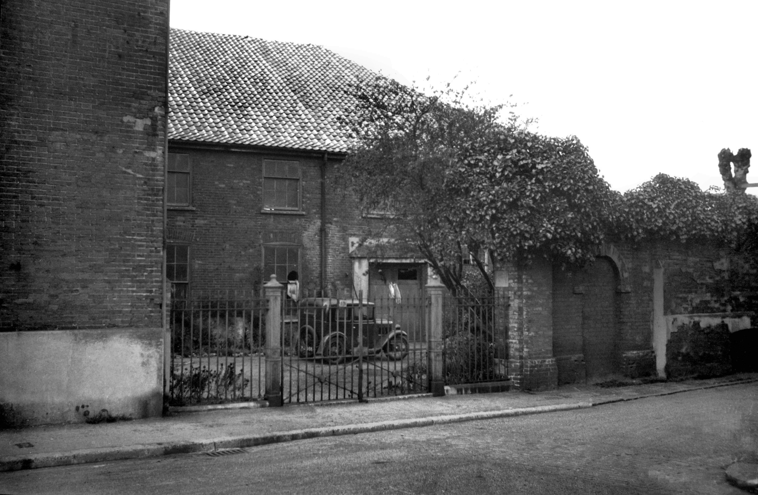
    The area next to Blackfriars’ Hall, which isn’t accessible to the public, but the parish boundary runs through the middle of it, along the line of the concrete wall.

    This keyboard mould was pushed into the concrete in around 2000 by Molly Sole, a local art student, and there was a wave of public interest about it in 2020.

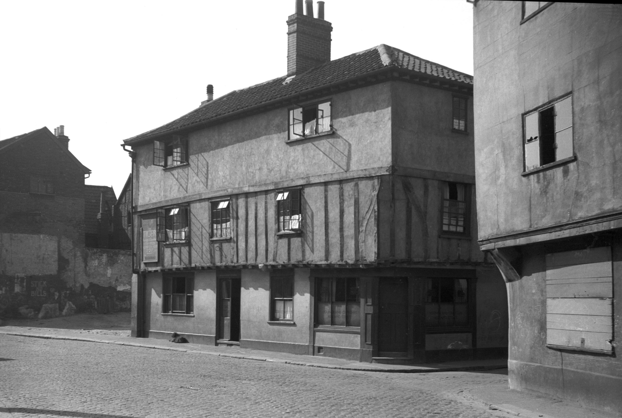
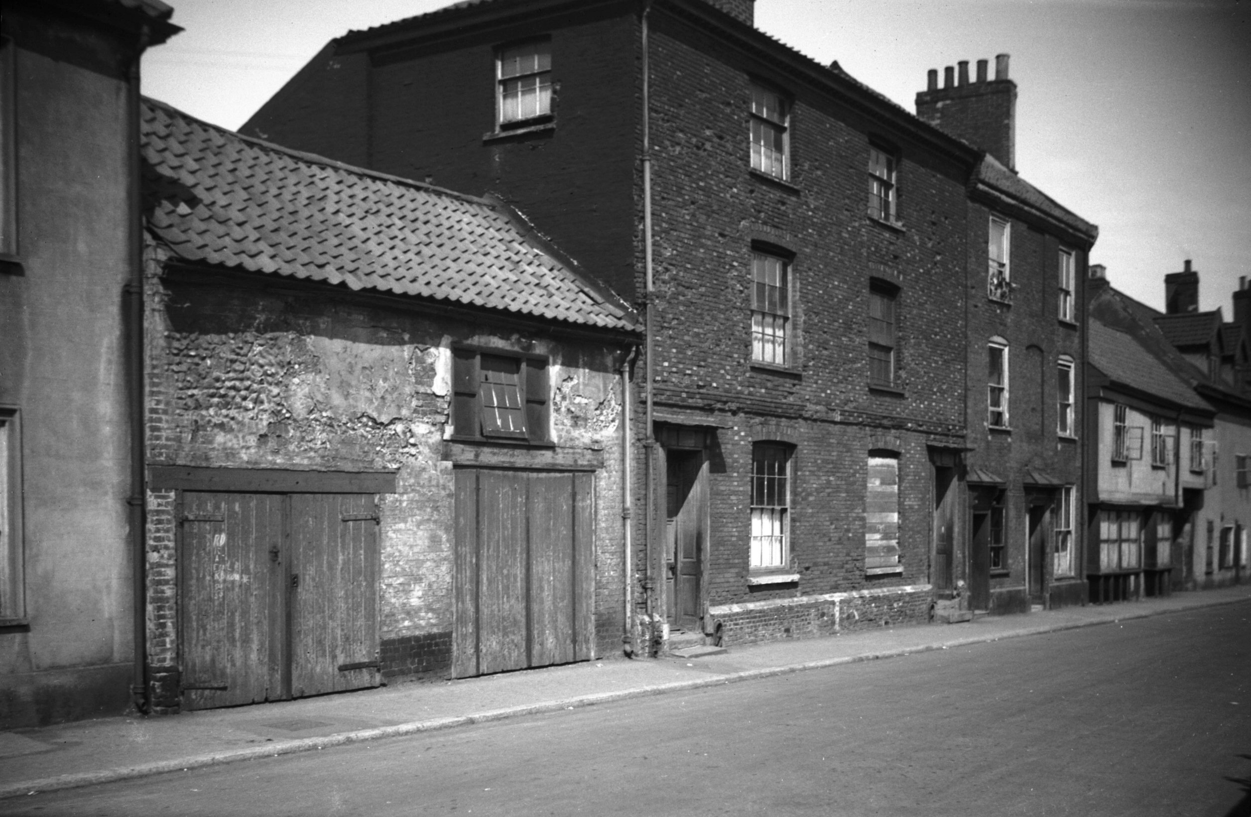
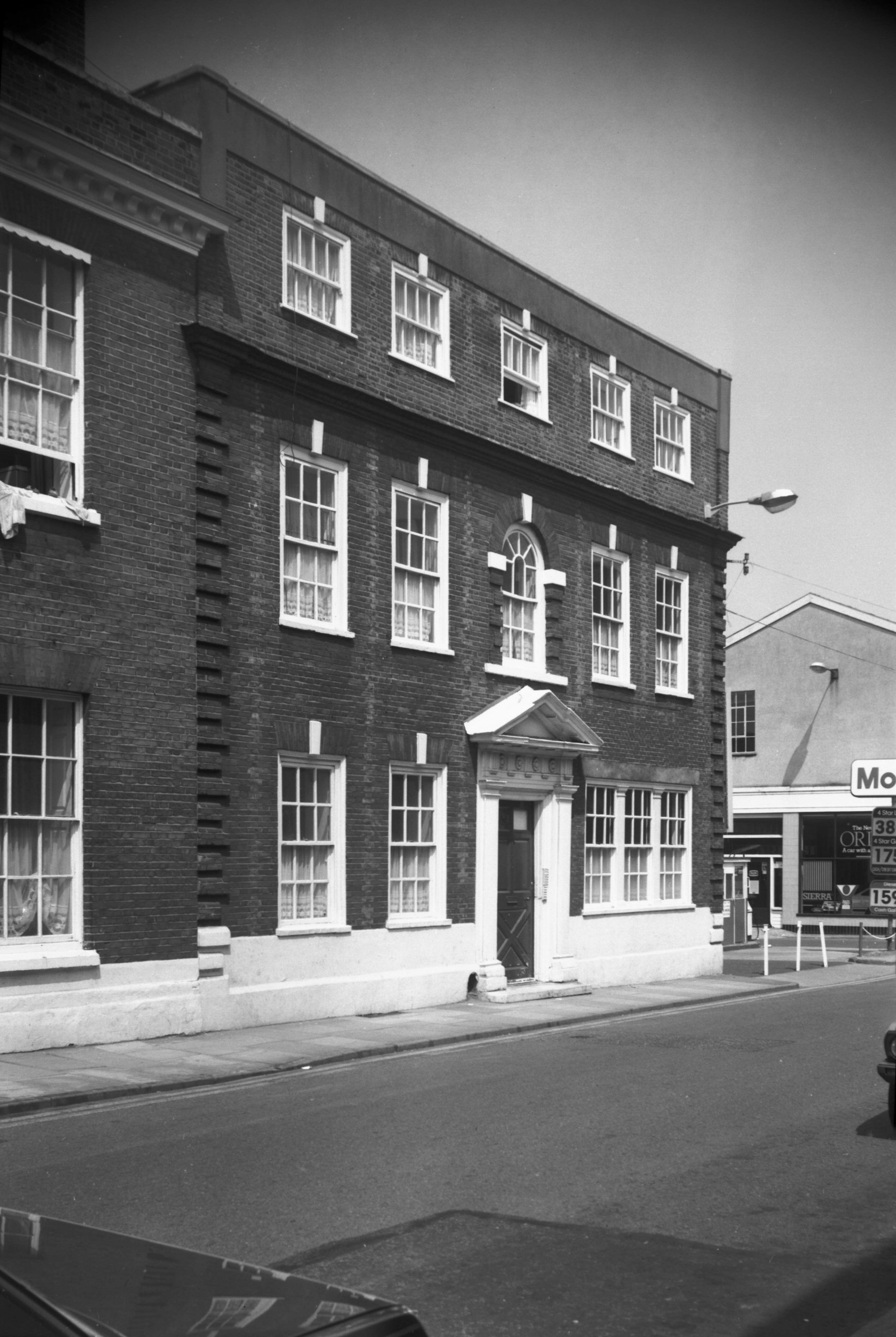
    Formerly one residential property, this house has now been divided into two and in the nineteenth century a corner shop was opened. It’s been used for numerous purposes since then, including as a cafe.

    At the top of Elm Hill, a pair of eighteenth century residential houses, with a plaque noting that the Friars de Sacco settled in a property on this site which was given to them by William de Gissing in around 1250.

    The rear of Blackfriars’ Hall, this is the most complete friary complex remaining in the country. Volunteering at Norwich Beer Festival has numerous exciting benefits, including free beer and food (and meeting people and all that stuff), but also being able to explore this wonderful building.

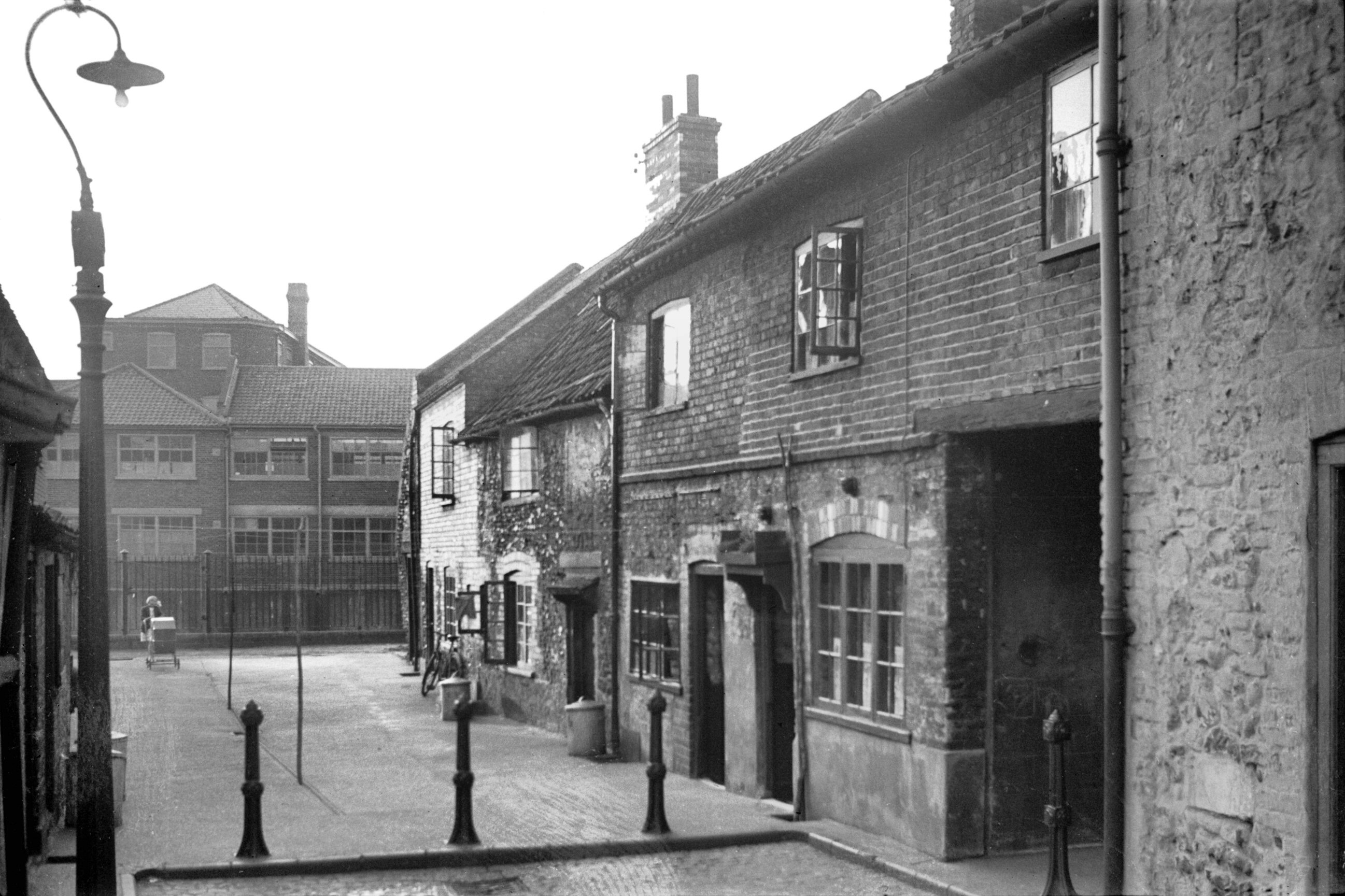
    The entrance to Monastery Yard.

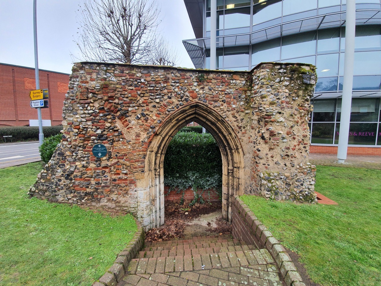
    This area is now a car park (I think the city council have a plan for Norwich to become the European City of Car Parks), but there were residential properties which were on the left-hand side here. On the right-hand side is a monastery chapel which was built by Father Ignatius (more on him later), but which was forced to close in 1876.

    The rear wall of Monastery Street and there used to be residential properties which backed onto it.

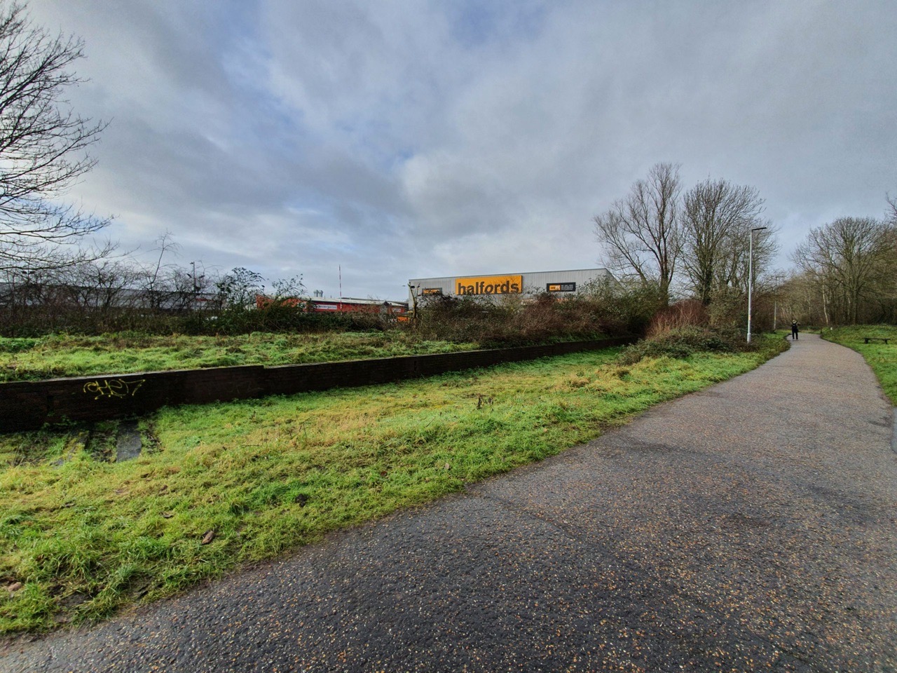
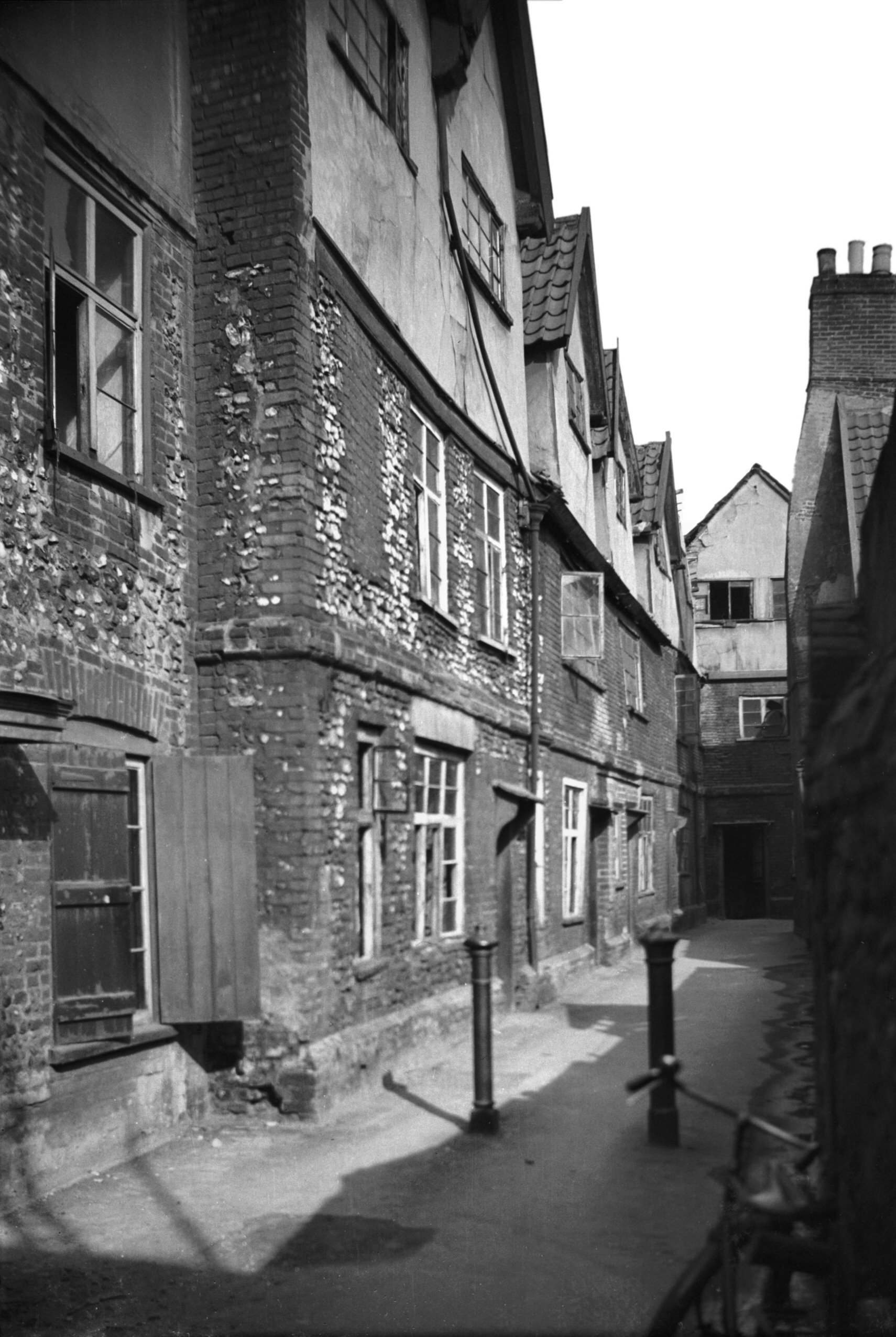
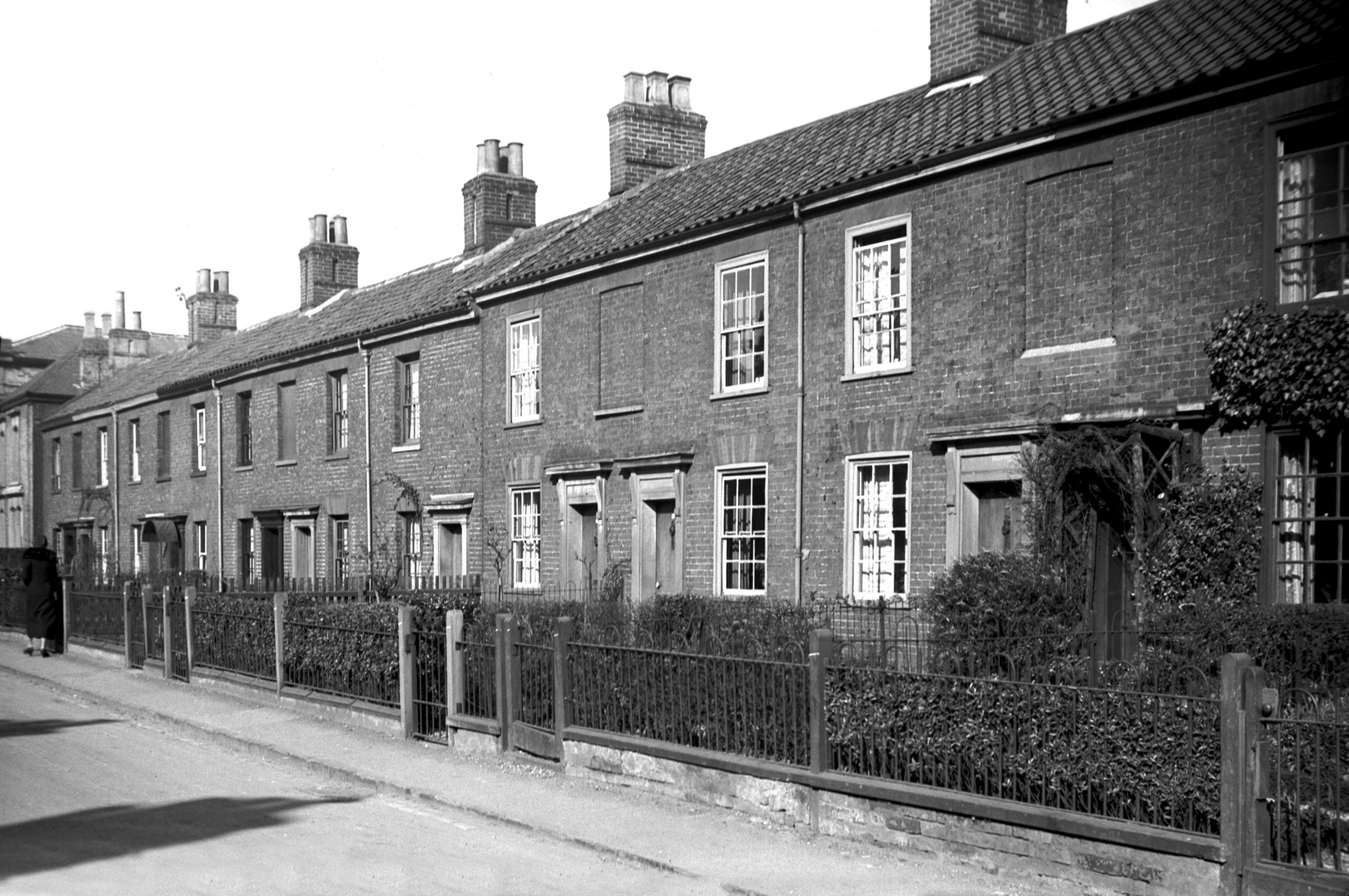
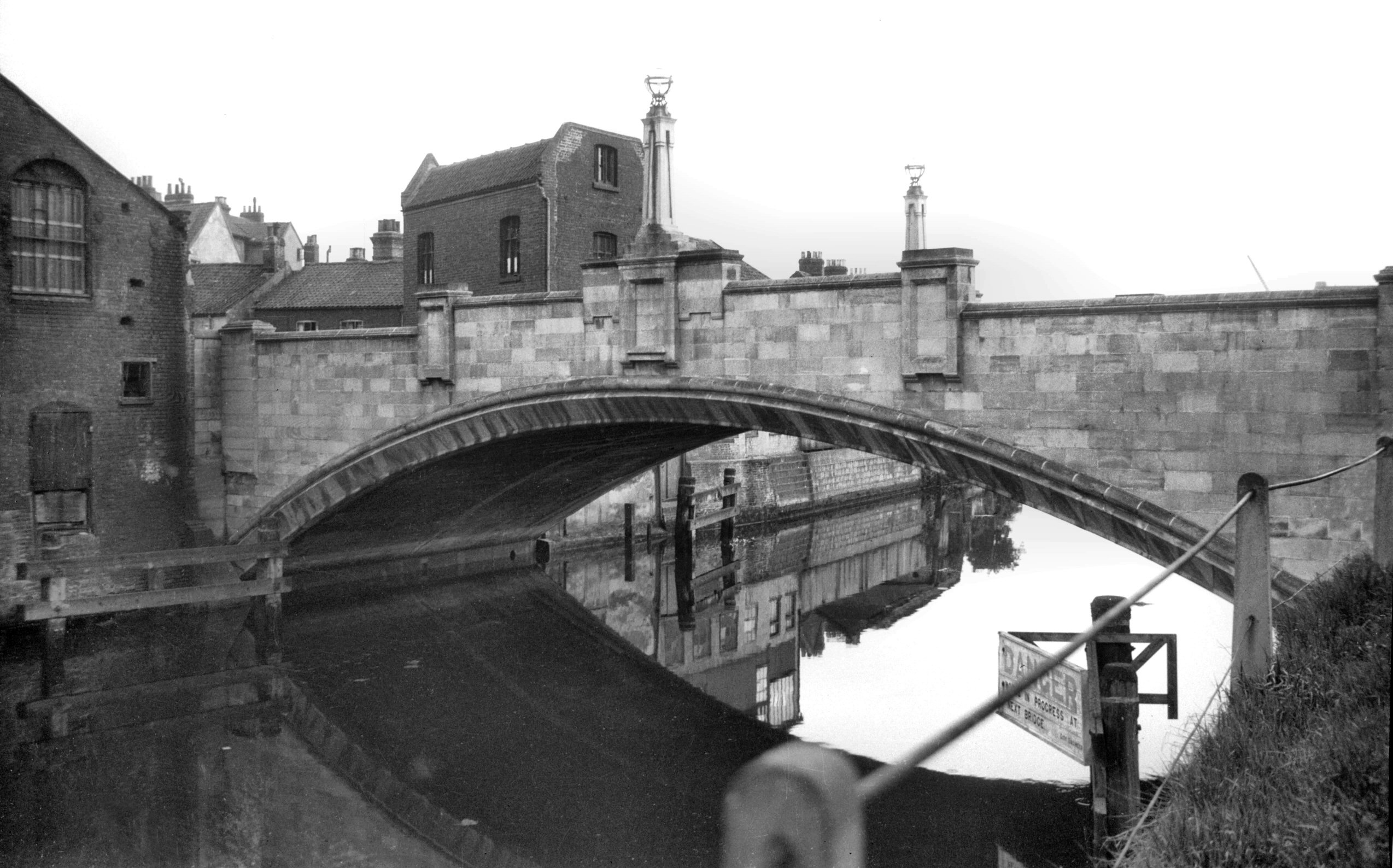
    It’s now possible to walk by the River Wensum, but there were once buildings all along here which went down to the riverside. The situation here was that in the medieval period there were some grand properties owned by wealthy merchants on Elm Hill and they would have gone down to the river. Over time, these rear areas were filled with often poor quality residential properties and industrial buildings accessed by courts and yards, most of which were pulled down during slum clearances.

    This was once Crown Court Yard and its entrance remains, but the buildings have gone and it’s just a car park now. This really isn’t a great use for a site such as this in a prime part of the city.

    This is the remains of Towler’s Court which connects from the river to Elm Hill, with the buildings here being demolished as part of the 1920s slum clearances.

    And these are the parish boundary markers on Elm Hill, with the boundary of St. Simon and St. Jude on the left from 1842, and St. Peter Hungate on the right from 1814 and 1834. The parish boundaries are rarely logical, twisting and turning through buildings, so these iron markers really were essential.

    And the same parish boundary markers on the other side of the road, a real legacy of this system of dividing up the city.

    37 Elm Hill, with an entrance to Norris Court Gardens.

    Elm Hill is one of the more historic streets in Norwich and there are numerous Tudor buildings and undercrofts along here. So, what did the city council want to do in the 1920s? They proposed demolishing the properties along here so that they could build a swimming pool. Fortunately, local opposition and the intervention of the Norwich Society saw off these misguided plans and fortunately this marvellous area survived.

    Some on the council were entirely blindsided by the local opposition, with Mr Manning saying in a council meeting in 1926:

    “The city would be purer and better if the site was cleared. It is one of the festering sores in the city and the council would be well advised if they cleared the whole of the street away and made a public restplace”.

    Just weeks later, the city said that it was reversing its decision and the City Engineer was drawing up plans to restore the frontage of the buildings along Elm Hill, working with William Weir, the architect to the Society for the Preservation of Ancient Buildings.

    As an aside, there was a meeting in early 1926 held by the Norfolk and Norwich Archaeological Society and the chairman said that he was hopeful that there were some members of the Labour Party present. The chair said that he was aware that it wasn’t everyone in the Labour Party who wanted old buildings pulled down as “some members in the Labour Party were now very cultured and fond of anything artistic and antique”.

    I mentioned Crown Court Yard earlier in this post, and this is the sign visible from Elm Hill.

    And the entrance to Crown Court Yard from Elm Hill, not that there’s much of a yard to go through to.

    Looking back down Elm Hill.

    There’s a parish pump and an elm tree, although both are modern replacements.

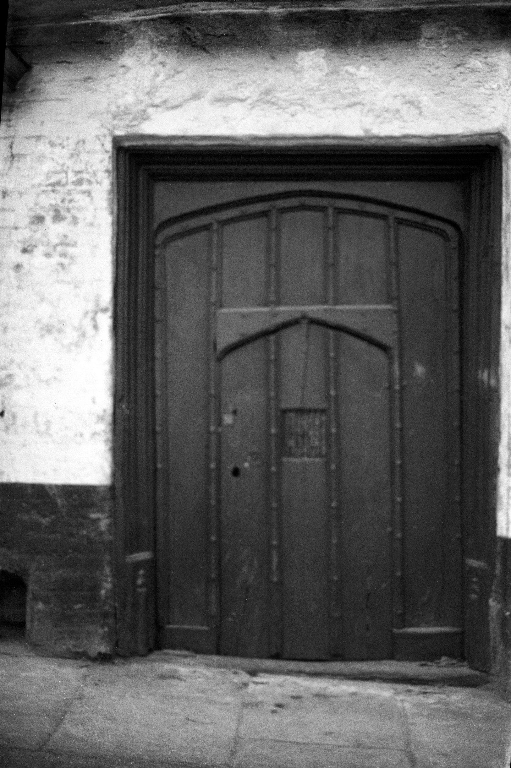
    An old doorway with a plaque commemorating the life of Father Ignatius (1837-1908) who was an Anglican Benedictine monk who wanted to bring back the monastery system. He purchased this house on Elm Hill, definitely suitably located given he could see Blackfriars’ Hall from his window, which must have been a constant inspiration. George Plunkett has a photo from 1935 of this doorway.

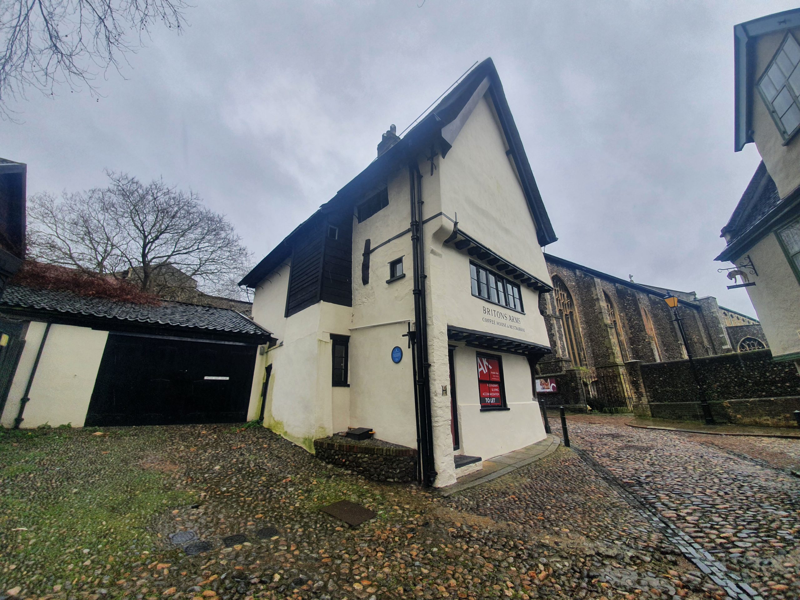
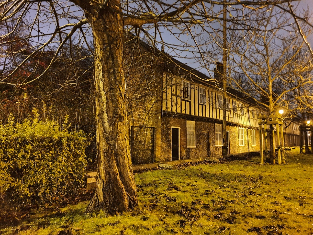
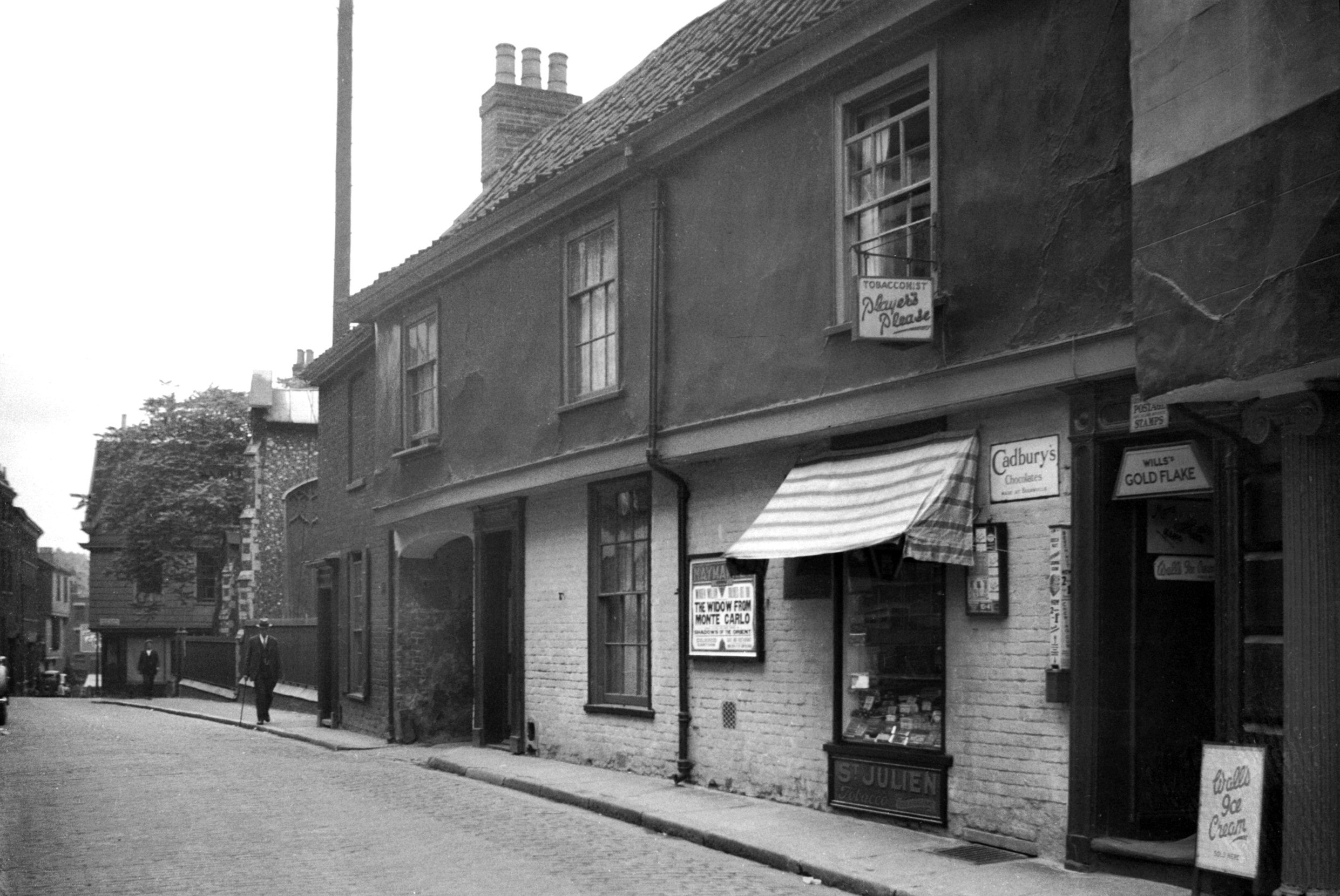
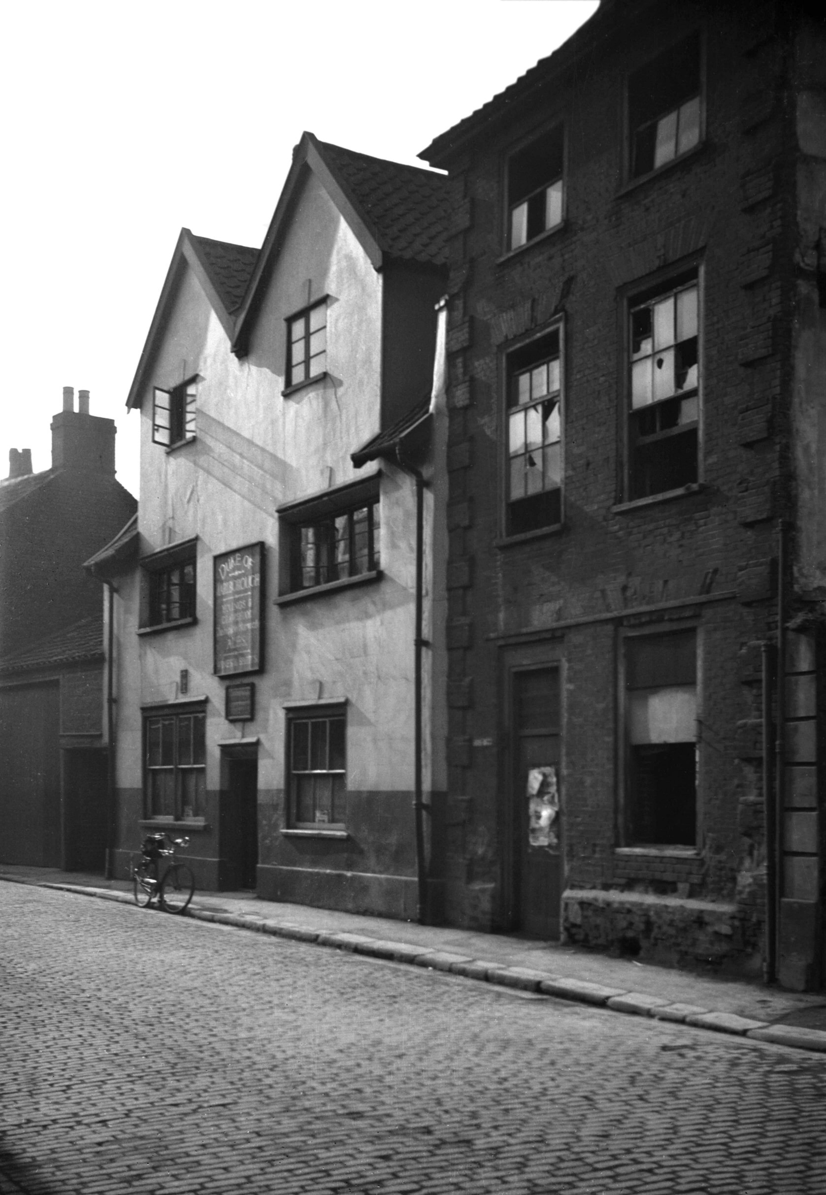
    Briton’s Arms is currently closed and is for sale, after being run by sisters Sue Skipper and Gilly Mixer for 45 years. The building likely dates to the middle of the fourteenth century and was a beguinage, or a house for religious women. It was the only house in the street to survive the fire in 1507 and for the next couple of centuries it was used by barbour surgeons and individuals involved in the wool trade. Timothy Gridley, a woolcomber, was perhaps the first landlord here when he was listed as a licensee in 1760. The pub was initially known as the Kings Arms, being changed to the Briton’s Arms in the early part of the nineteenth century. It remained in use as a pub until 1945, when it became a restaurant and cafe.

    Looking back down Elm Hill.

    A drawing, from around the same spot as the above photo, drawn in the 1920s as part of the plan to restore the street.

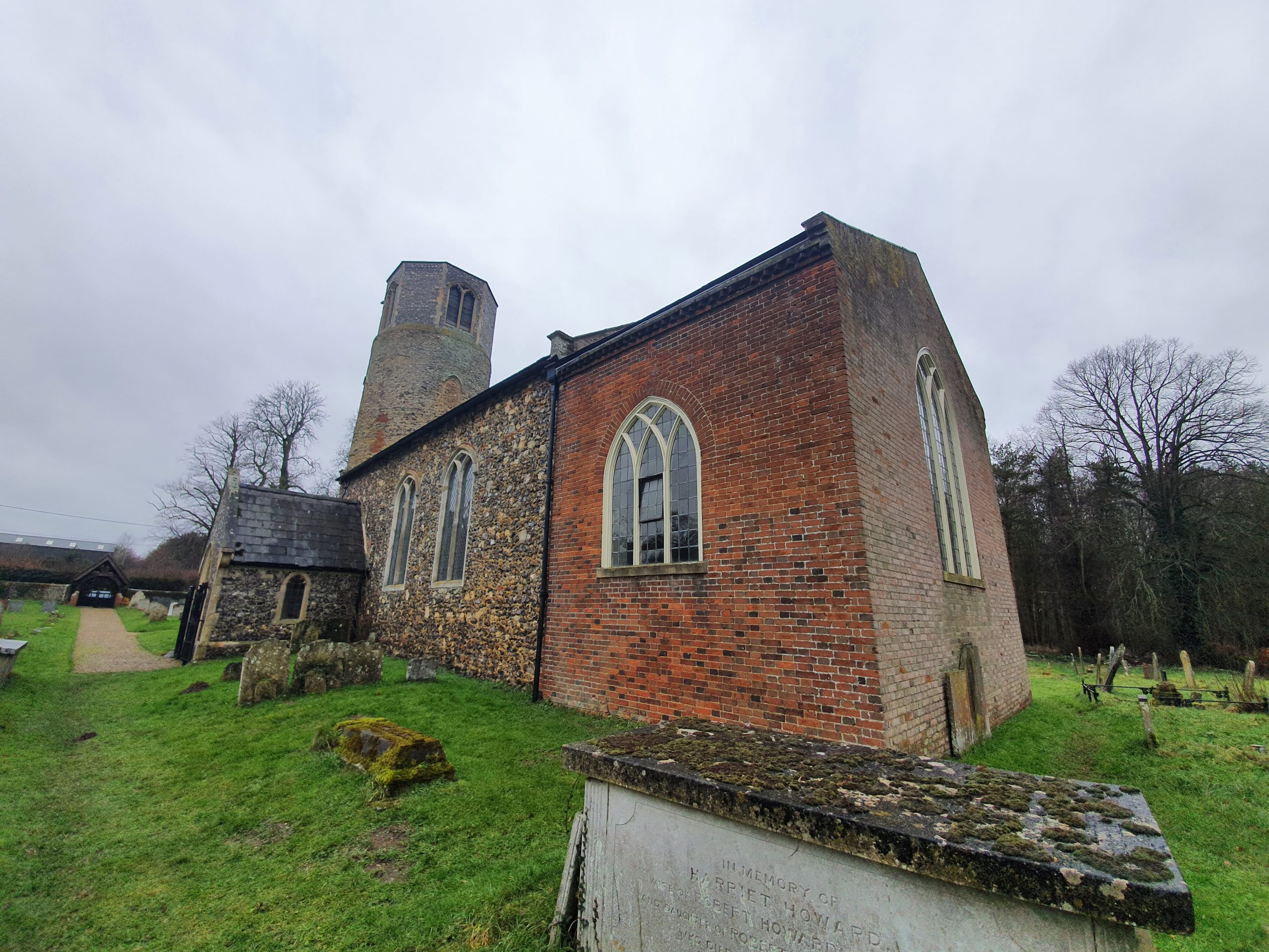
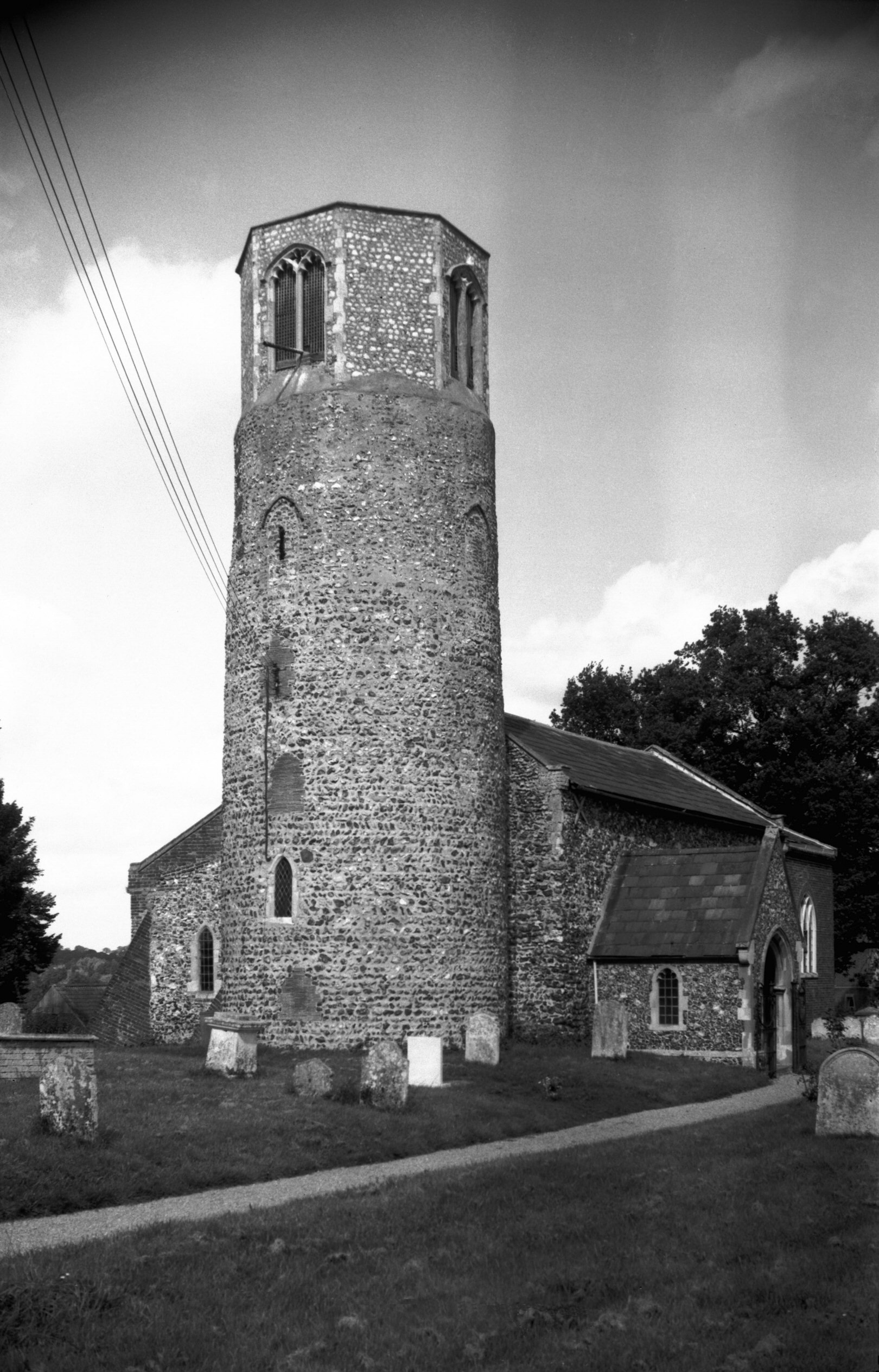
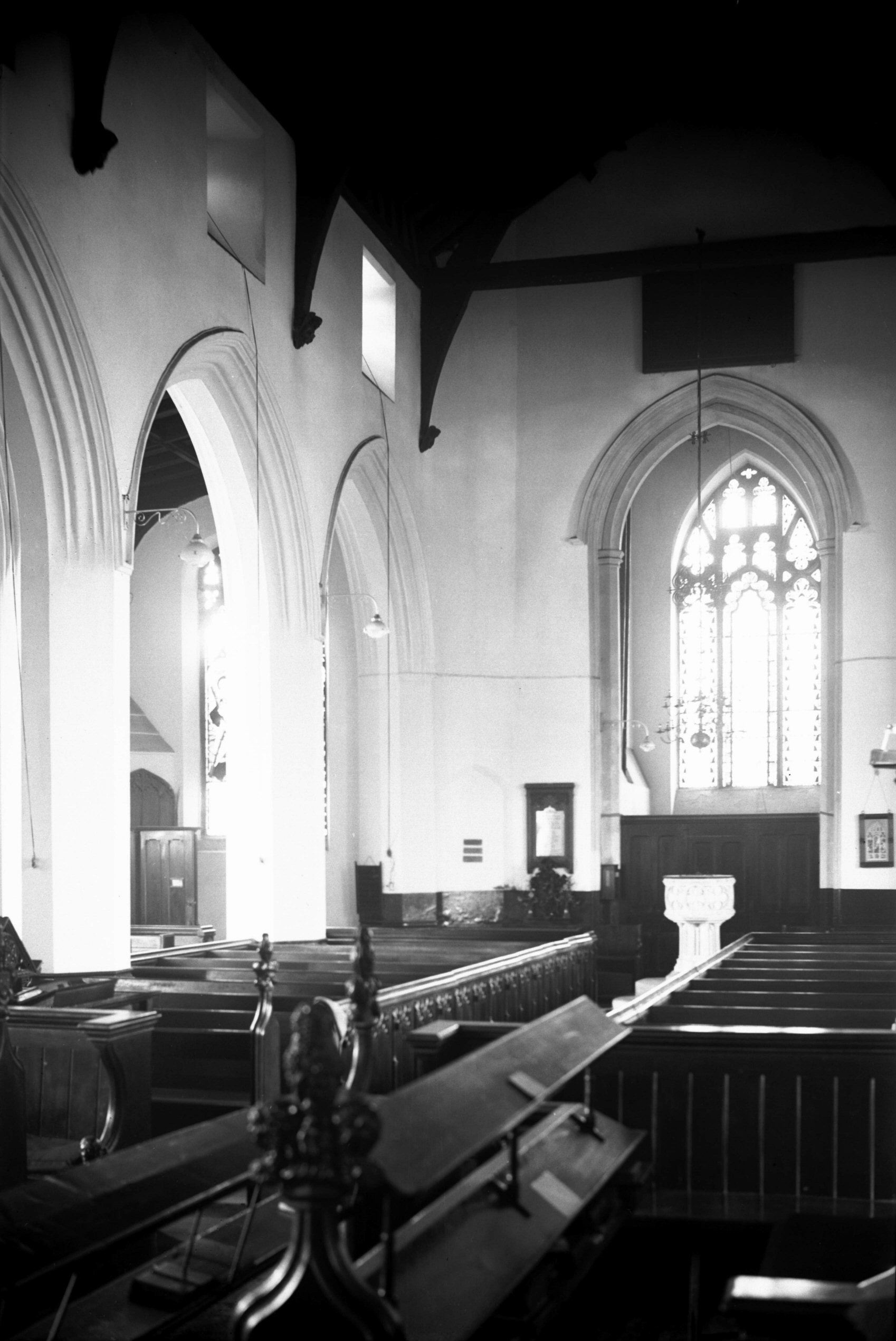
    The porchway of St. Peter Hungate, the first church in the country to be repurposed when it was declared redundant in 1936. It housed a museum of church art, an inspired and forward-thinking idea, but sadly it closed in 1995. Now under the management of the Norwich Historic Churches Trust, the church is now home to Hungate Medieval Art, a charity which promotes the city’s medieval history.

    Inside the porch, which can’t be accessed and I took this photo through the gate…. I will at some point hopefully find my photos of when I visited this church during the Flintspiration weekend in 2017. There are some photos of how the church looked on the web-site of Hungate Medieval Art.

    There may have been a church on this since the Anglo-Saxon period, although most of the current building dates to the fifteenth century. Much of the cost of this was paid for by John Paston and Margaret Paston, best known perhaps for the Paston Letters. The chancel and tower had been built in 1431 under the supervision of Thomas Ingham, although the chancel had to be rebuilt in 1604 when it fell down, which wasn’t entirely ideal. The church tower was shortened at the beginning of the twentieth century and the belfry was also knocked down, a period when the building was in generally a poor state of repair.

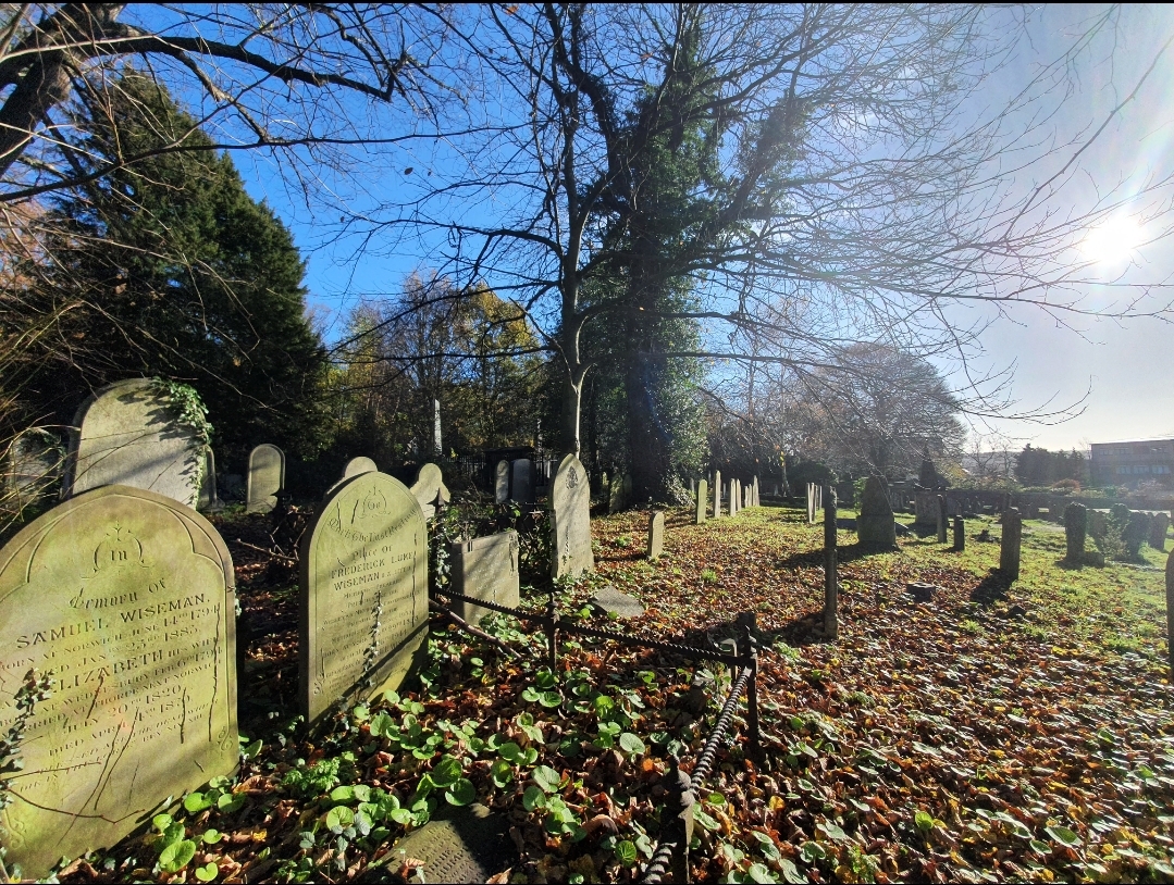
    The chancel end of the church with the graveyard behind, which is currently inaccessible to the general public.

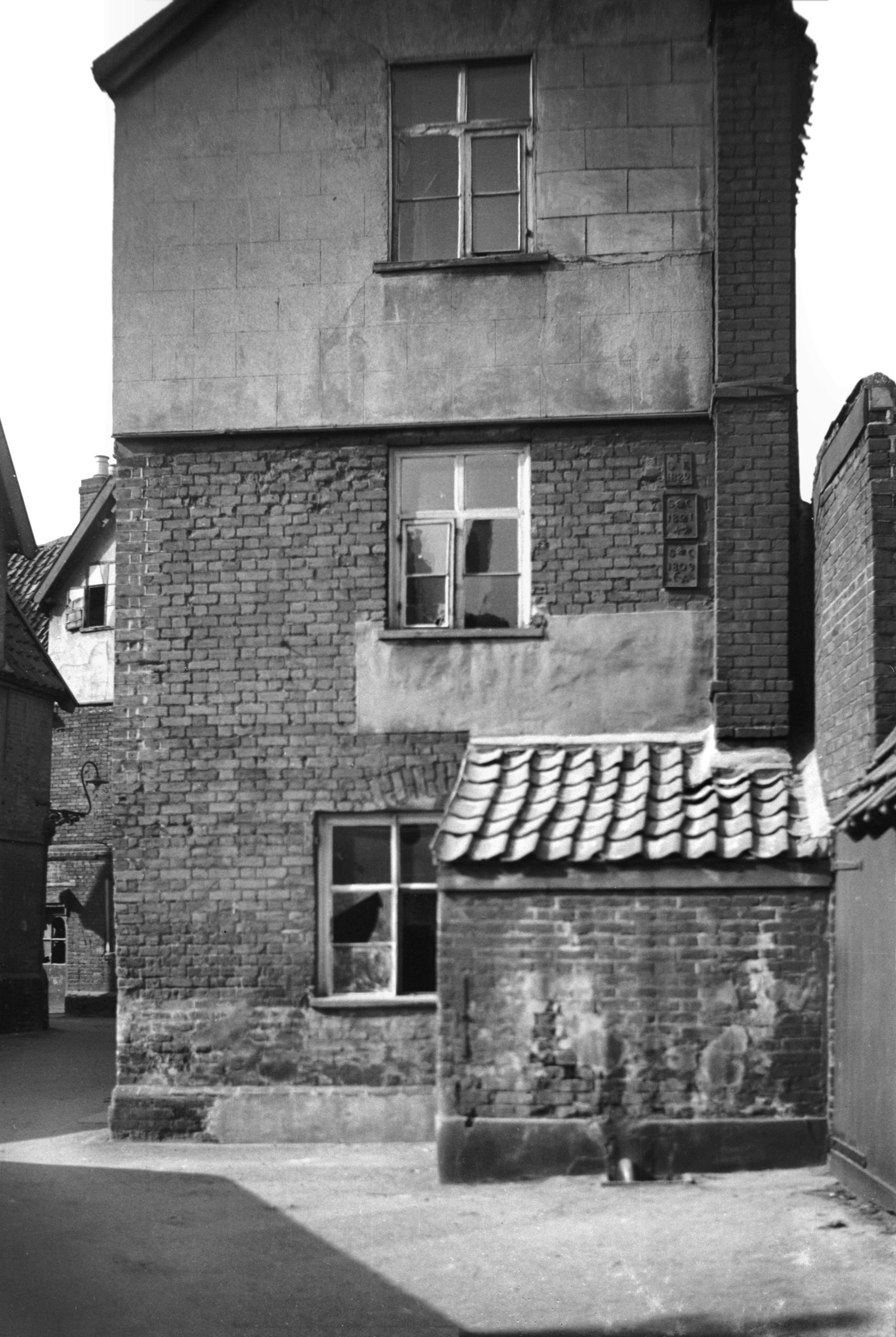
    This building is on Prince’s Street and it used to be a shop, visible in this 1936 photo from George Plunkett. We went to stand by the entrance to where the shop was, but there’s no trace of it left at all, although the grate is in the same place.

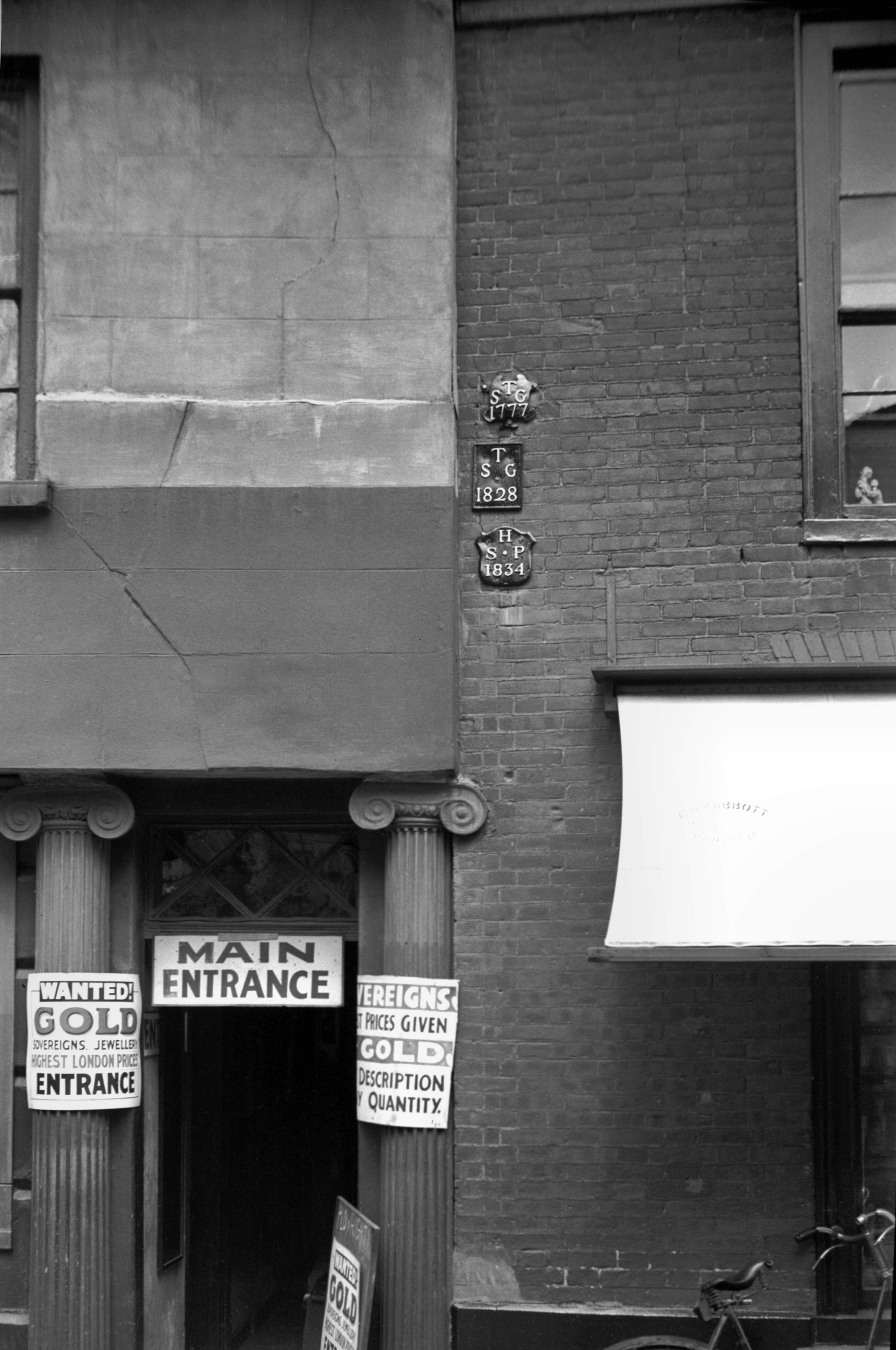
    Two more parish markers, St. George Tombland 1777 and St. Peter Hungate from 1834. George Plunkett has a photo of these from 1934, and unfortunately one has gone missing, as his photo showed a St. George Tombland 1828 marker as well.

    Located on a new building on the other side of Princes Street is this parish boundary marker from 1834, a real survivor since this had to be taken off an older building and placed onto its replacement.

    And that was the end of our little tour, which was quite a moist expedition given the amount of rain. There are 16 listed buildings in this one parish and the streetlines haven’t really changed in this parish for over 500 years, so it’s an area of the city that is worth meandering to.

  • Norwich History by Parish : St. Edmund

    Norwich History by Parish : St. Edmund

    And a new little project that Jonathan and I are undertaking because this lockdown is clearly here for at least a few more weeks. It’s a bit niche (our project I mean, not the lockdown), I’ll accept that, but there we go. Effectively, it’s walking around Norwich, ancient parish by ancient parish and seeing what is there now compared to a map from the 1880s (the map above is from 1789, but the one from the 1880s is more detailed, which is why we used that). There’s a PDF of these boundaries to provide some extra background to this whole project.

    St. Edmund is the third parish we’ve done this for and it’s been the most challenging in terms of trying to compare it to the past, since there’s nearly nothing left with the exception of the medieval church itself.

    On the above map from the 1880s, the street of Fish Gate is at the base (now known as Fishergate), Peacock Street is at the left hand side (now known as Blackfriars) and Cowgate Street is on the right hand side (now known as Whitefriars). All of the buildings inside of that have gone, demolished as part of slum clearances, property redevelopment and road building. This entire site is now taken over by Smurfit Kappa, or the building perhaps still better known by most as the Norwich Corrugated Board, or NCB building.

    The premises of Smurfit Kappa, who produce various types of packaging. Once on this site there were schools, shops and residential buildings, including the courtyards known as Staff of Life yard and Fleece Yard.

    This is the side of the factory and this rather resolved a query we’d had the previous week. The factory wasn’t built in the 1980s as I had thought, it had been refronted in the 1980s and this older part of the building shows the original element of the structure.

    Rather helpfully, a staff member from the company came out at this point, as I don’t think they get many tourists taking photos of their building. It’s lovely, but I suspect more people take photos of Norwich Cathedral and Norwich Castle. What the helpful staff member did provide us with were photos of what the building used to look like, and there’s a walkway here over the road that I didn’t know about.

    This is another photo provided, showing the factory after it had been refronted, with the walkway now removed. The factory building which that walkway led to has now been demolished and has recently been replaced by residential properties. It was also nice for the two long-standing staff members to help us in this quest, they’d worked there for a considerable period of time and added lots of context to how the area had developed. I also very much appreciated their sending me the photos of the site, the one above shows just how much this area has changed, along with the roundabout to the top of the photo which was built for the inner ringroad.

    This is what was formerly known as Peacock Street, which I’ve written about before. These properties are standing on the site of the former Tiger Inn, demolished for road widening in 1936. George Plunkett’s photo of the building shows just what impressive buildings the council has pulled down in its quest to satisfy car drivers.

    Over the road is Hansard Lane, which I’ve written about before.

    This is the the church of St Edmund, from which the parish takes its name. The church has a small footprint with nearly no graveyard, although it perhaps had one in the medieval period. The church became redundant in the late nineteenth century, one of the early casualties of the sheer volume of churches that Norwich had. There has been a church here since the Anglo-Saxon period, but the current structure is from the fifteenth century onwards. The Anglo-Saxon origins are pretty certain, as the church is dedicated to Edmund the Martyr, the Saxon King of the East Angles. Inside the building, there’s a single nave and chancel, with the porch visible in the left of the above photo dating from the nineteenth century.

    Although the building is Grade I listed, it wasn’t far from being demolished in the early 1970s, following a Church of England which seemed to have forgotten that it was the protector of historic churches. Fortunately, the community took an interest into what the church was planning with its disposal of buildings, and it was saved. It’s currently used as a Christian house of worship once again, although has been used for storage and also as the Norwich Pregnancy Crisis centre.

    A shed at the rear of the church which is of no historic interest, I just liked the icicles…. I’m so easily pleased.

    The church was once surrounded on three sides by a factory building which is visible from the overhead photo earlier on. Today these are riverside residential properties and it’s impossible to walk along the river here as it’s gated off.

    It’s possible to reach the river as there’s a car park behind the GP’s surgery.

    The view of the River Wensum.

    Back on the other side of Fishergate, this is the area behind what was Thompson’s Yard, all now council housing which seems to date from around the 1970s. It’s all sadly devoid of history.

    I quite like little stumps of former buildings, a reminder of what was once here. George Plunkett is of help here (yet again), the rest of the building is in one of his photos from 1936. The now demolished building was once the Rampant Horse pub, which had been a licensed premises since the early nineteenth century and was closed in 1912, another pub lost in the wave of forced pub closures.

    The building still standing next to this stump of wall was also a pub, the Duke of Marlborough, at 29 Fishergate and George Plunkett excels himself again by providing a photo of the landlord and customers in the pub in March 1939. This pub had started to serve customers from 1708 and traded until its closure in 1952.

    It’s hard to establish where the parish boundaries were, but I’ve decided that some of Thoroughfare Yard was probably in the parish of St Edmund. The Church of England don’t supply boundaries of this particular parish, which is likely as the church isn’t in their use any more, and the definitive map doesn’t have them on, so they must have shifted at some stage.

    It’s George Plunkett who once again helps me here, as he has a photo from 1936 which has the parish plates visible, and one of them marks the parish boundary of St Edmund.

    Thoroughfare Yard goes through to Magdalen Street, but I feel I need to investigate it further on a future expedition to ascertain whether those parish plates are still visible (likely not, as the buildings have gone), or where these parish boundaries were. For the moment, here’s another photo from 1936 that George Plunkett took of how the yard once looked.

    So, this wasn’t the most historic of areas that we’ve covered so far, but there were elements that remain from the past. Thanks again to the staff of Smurfit Kappa for their assistance, much appreciated! And, after this walk we went to get chips, just in case anyone wondered.

  • Surlingham – St. Mary’s Church

    Surlingham – St. Mary’s Church

    This is St. Mary’s Church in Surlingham, located a short walk away from the River Yare. The church sits on slightly higher ground in a bid to protect it from the nearby marshes, something evident when we were walking through them to get here. George Plunkett has a photo of the church from 1978 which was taken in around the same place as above, although little has changed in that time.

    There is a nearby ruined church, St. Saviour’s, which was constructed in the twelfth century but which became redundant in the early eighteenth century.

    The round tower is Norman at the base, with the octagonal top dating from the fourteenth century. Much of the current nave is also fourteenth century, with the north aisle having been added in the fifteenth century.

    There are numerous patches of repair on the tower, mostly using this tiled style to fill in the gaps. I’m unsure why such a different looking material was chosen in the repairs, although it gives the tower a rather memorable look. As is noticeable on photo further down this post, the tower was once covered in ivy and that might have meant repairs were less noticeable.

    The stair turret on the tower.

    The chancel dates from the eighteenth century and was made from brick, giving quite a contrasting look to the church. Although I’m not sure how comprehensive the repairs were, as there was an appeal made in 1831 to secure funds to pay for a new church roof and advertisements were placed in the Norwich Mercury to find carpenters and bricklayers.

    This photo is from the beginning of the twentieth century, and both graves leaning against the end of the chancel wall are still there, although a few others seem to have disappeared. The church tower is fortunate not to have that much ivy still attached to it.

    The other side of the chancel is built in old stone, seemingly solely with the intention of giving it an older appearance. I’m unsure where that stone has come from, but I suspect that its been taken from another old building at some point.

    The end of the chancel, it’s all quite a clean design, but perhaps not breathtakingly beautiful.

    A rather beautiful carved stone font inside the church and it probably dates to the fourteenth century.

    Looking down the nave of the church into the chancel, where there’s evidence of where the rood screen stairs were located.

    Looking back down the nave towards the organ loft, I thought that everything was nicely proportioned and all seemed calm. It was possible to peer inside the tower and I’m not normally that interested in church bells, but this church has two which were cast in 1381 and that’s a pretty impressive survival……

    I liked that the church was open during this difficult times and although there are bits of Victorian repair which are readily visible, there’s lots of history to the building which hasn’t been swept away. It’s another of those churches where I suspect the parishioners from the late sixteenth century would have found relatively little had changed over the centuries, although they might have wondered where their box pews had disappeared to. These were removed in 1888 and the local press noted that there were now more open and airy pews, although I love the character that box pews have.

  • Carleton St Peter – St. Peter’s Church

    Carleton St Peter – St. Peter’s Church

    This is a remote little church in Carleton St Peter and this is the track which reaches it from the road. The parish is small with just a handful of properties, although there is evidence of prehistoric, Roman and medieval activity in the area. It seems that the villagers have just moved away since the medieval period, which makes the survival of this church all the more remarkable.

    Although there was a church here in late Saxon times, the currently building primarily dates from the thirteenth and fourteenth centuries, with numerous later additions. There are some early Norman features in the building, namely some lancet windows, which have likely been kept from the earlier structure and built into the fabric of the current church.

    An older infilled window, likely Norman.

    The chancel with no windows here on this side of the church, although it’s hard to see from the outside where it joins to the nave, as there’s a continuous slate roof.

    The tower is later than the main fabric of the church, dating to the early sixteenth century, with construction perhaps halted at one point which is evident from the different stonework.

    The polygonal stairs on the church tower.

    The churchyard, with a plot dug for a burial, and the area is quite open and spacious. There was an article in the Lowestoft Journal in 1876 which mentions when Edmund Perkins Hytton was buried in a vault in the graveyard, with his sister, Deborah Perkins Hayward, being buried in the same vault when in 1891 she died at the age of 97.

    The crossed keys of St. Peter on the stonework.

    Unfortunately, this is a church that is currently locked, although the Church of England say that it will open during daylight hours when some form of normality resumes. The porch is nineteenth century and likely replaced an earlier one, but there’s some history to that wooden door and it dates to some time in the medieval period.

    There’s an information board at the entrance to the porch and this notes that the church still has its King James Bible from 1611, which they refer to as a ‘Black Bible’ as it was without colouring (I haven’t heard of that term before). I’ve heard of the Great She Bible and these crop up from time to time, such as in the parish of Gisburn in 2015.

    A tithe map from the 1840s which shows the location of the church, and also how there’s nothing more than just a path to it. And therein lies the beauty of this church, a rural building unburdened by traffic and as familiar today as it would have been to the congregation of 500 years ago. And, hopefully, it’ll still look nearly exactly the same in another 100 years.

  • Norwich – Rosary Cemetery (Alfred Edward Hubbard)

    Norwich – Rosary Cemetery (Alfred Edward Hubbard)

    Alfred Edward Hubbard was born on 22 June 1889 and was baptised on 16 July 1889 at St. Peter Parmentergate in Norwich. He was the son of George Hubbard, who worked as a telegraph clerk, and Bertha Hubbard. The family lived on Synagogue Street, a street off Mountergate sadly now lost, although George Plunkett has a photo of how it looked.

    Alfred was one of a large family, at the 1891 census he had older brothers Frank, Charles and Harry, along with older sisters Alice and Bertha. Tragedy hit the family in the 1890s with the death of George Hubbard, meaning that Bertha was left alone to support her family. A later census noted that she had six children and they were all still alive, which wasn’t all that common, often children died young.

    At the 1901 census, Bertha ran a lodging house at 88 Chapelfield Road, living with her children Frank (working as a carpenter), Alice, Bertha (a pupil teacher), Henry (a clerk) and Alfred. By the time of the 1911 census, the family had moved to 73 St George’s Street, including Bertha and her children Frank (working as a carpenter), Alice, Bertha Constance (a teacher employed by Norwich City Council), Harry (a brewer’s clerk) and Alfred (now working as a teacher employed by Norfolk County Council).

    In early 1915, Alfred married May Mann and they lived on Yarmouth Road in Caister-on-Sea. He joined the Norfolk Regiment, service number 15653.

    Unfortunately, Hubbard’s war records are amongst those which were destroyed in an air raid during the Second World War, but he was in the 7th Battalion, which was formed of volunteers, also known as Kitchener’s Army. Alfred was injured in Hulluch, in northern France, in October 1915. The regimental records written in the field survive, although Hubbard isn’t specifically mentioned, but the above image is from that battalion in the Hulluch area from earlier in October 1915, showing the scale of the losses.

    Copyright Imperial War Museum (45786).

    This image is posted on Wikipedia, showing the state of the area between Loos and Hulluch in 1917. The British trenches are on the left, the German trenches on the right, with a now heavily damaged road going through them.

    Alfred died on 19 December 1919, at the age of 30, likely because of the injuries occurred during the First World War. The inscription on his gravestone reads “having fought a good fight in life and war, rest on”. There aren’t that many burials of the war dead at the Rosary Cemetery in Norwich, they’re mostly at Earlham Cemetery, so this stood out amongst the nearby graves. The uniformity of war graves ensures their visibility in a graveyard, and is a reminder that in death everyone was equal regardless of rank.

    It’s hard to imagine what Alfred’s brothers and sisters must have thought when standing at his graveside in late December 1919, it’s a far cry from the time of the 1911 census when they were all embarking on their new careers. And Alfred’s new career as a teacher was cut short, fighting a battle in a country to which he might never have otherwise visited.

  • London – Greenwich (Borough of) – National Maritime Museum (Guillotine Blade)

    London – Greenwich (Borough of) – National Maritime Museum (Guillotine Blade)

    This exhibit, which I accept isn’t the cheeriest, is in the collections of the National Maritime Museum in London. It’s a guillotine which dates from around 1792 and it was used on the Caribbean island of Guadeloupe to execute about 50 royalists.

    I have to say that I’m not sure I’d have wanted to live on Guadeloupe in the late eighteenth century. It was French until 1759, when the British took it over, but the French really liked having it. The French decided that they wanted it so much that at the Treaty of Paris in 1763, they swapped their French colonies in Canada to keep control of it, so they took over the island again. The French Revolution, which really wasn’t ideal for the wealthy in France, also spread to Guadeloupe and everyone was made free on the island, regardless of their colour. The British decided that this political power vacuum was a chance to get the island back, so they invaded in 1794 and gained control, only to see the French quickly take it back.

    The guillotine was likely taken over by Victor Hugues when he went out to try and purge the Royalists and set the country free from the British who had interfered with arrangements. Hugues arrived on the island with his guillotine on 2 June 1794 along with 1,153 Republican soldiers who were keen and eager to fight and kill people. Documentation mentions that those killed included the estate owners on the island, as well as some military officers, and the guillotine was carried around the island as further victims were sought.

    It is said by the National Maritime Museum that Captain Matthew Scott of the Royal Navy decided that it seemed an ideal souvenir, so he brought this guillotine back on HMS Rose when the British left the island. I can understand why Captain Scott took the item, as he might have thought it was something important politically, but Hugues attacked and pushed the British off the island, so it’s unclear why Scott would have this guillotine. It’s unlikely that Hugues would have willingly given it up (Paul Fregosi in his book Dreams of Empire said that he was very attached to it), as he still had work to do with it.

    And the next part of this mystery, HMS Rose sank near Jamaica on 28 June 1794, so I have some queries about this situation as well….. It’s clear that Scott hasn’t sailed home with it and come back, as there wasn’t time, so that guillotine would have been on board when the ship sank. The 200 sailors on board had to fashion bits of the ship to create rafts to paddle to safety, this wasn’t some little incident in the harbour where they had chance to reclaim everything. I’m unsure whether someone decided that the guillotine needed salvaging as some sort of priority, was Scott that keen to have it?

    So, there’s perhaps something slightly wrong about the story told by the National Maritime Museum and my theory (based on no evidence at all) is that Scott did bring this item back, but that he did so later on. Scott later became a Vice Admiral and he was still on board ships in the region in 1810, the year that the British took back Guadeloupe. So, my historical guess (like this is of relevance to anyone) is that Scott brought back the guillotine as a war trophy at this point, and not before. And I am unanimous in that to quote Mrs Slocombe….

  • GeoGuessr (Norwich Version) – Walk 2

    GeoGuessr (Norwich Version) – Walk 2

    I already have a better explanation (well, longer explanation anyway) for this plan. In essence, whilst lockdown is on, I need to find ways of walking nearby to Norwich in quiet areas for my LDWA 100 training. So, I’m using GeoGuessr to pick out five random locations within a certain area which I’ve defined and then walking to them, to see what kind of story I can uncover.

    So, this was the second of these walks, this time Nathan was dragged out to walk in the dark. We were using a map which used the ring-road as our limit, simply for time reasons, although we did manage to get the B&Q right on that line. Tonight’s little expedition was 11.2 miles, in the rain……

    This was the start of the walk, there really was no beginning to our bravery tonight…..

    Once we had summited Gas Mountain, we had a little rest and looked back down towards the city of Norwich, nestled in the foothills. We had walked around thirty metres at this point.

    My local voting station. How lovely.

    The Gordon pub, which I haven’t visited for a while, it’s a reasonably popular community pub though.

    And we reached our first location. We didn’t make much effort to match the photos up exactly, life’s too short…. Well, actually, it doesn’t seem too short to do this walking thing, so perhaps we could have made more of an effort.

    Past Thorpe St. Andrew School and I had a look on Wikipedia to see which former pupils went there. There are four listed and I haven’t heard of three of them, but I have discovered that Ben Bradshaw MP went to school there.

    In the diminishing light we strolled into some woods, which wasn’t perhaps ideal. The inaugural tree at Queen Elizabeth II Woods was planted by Chloe Smith, another fascinating fact that people should know.

    The second location, which wasn’t lined up at all, primarily as I didn’t want to stand outside someone’s house at night taking photos.

    Nathan had just spent thirty minutes complaining that he couldn’t get his phone to display the map, so I led us efficiently during that time. In a crisis, I’m always calm and reassured. Then Nathan, after a fit of pique, announced that he had worked out how to turn his phone on (or whatever he was faffing about doing) and he would lead us. So, here we went, entering some park with minimal lighting.

    The “please consider” is perhaps in vain, the careful and caring dog owners would anyway, and those inconsiderate ones won’t. Always worth a try though, passive aggressive signs can work.

    Remember I mentioned that Nathan was in charge of navigating? He found the muddiest path in Norfolk to walk down in Norwich City Centre, which isn’t generally known for its muddy paths. I didn’t complain though.

    After walking miles through a sea of mud, we decided that a road might be nice. This is the Norfolk Regiment War Memorial, located near to Mousehold Heath, and I’ll take a better photo in the day as this warrants that.

    The Rishi Indian, which was the Duke of Norfolk pub between 1938 and 2009, re-opening as a restaurant in 2011.

    We then popped into the Co-operative, and their beer selection wasn’t entirely dreadful. But, I wasn’t sufficiently tempted and I couldn’t be much bothered to carry it. Tonight didn’t feel like a drinking night, although I suspect the next walk might well have a few craft beer delights along the way.

    I could though be bothered to carry my five custard doughnuts for 21p that I found in the reduced section. Not that I had to carry them for long if I’m being honest, they were very moreish.

    Nathan, who is much more decadent than me, splashed out 34p on sausage rolls. We had been intending to get chips, but this seemed satisfactory under the circumstances.

    The third stop was the B&Q car park. It’s not ideal is it? But, we have to get walk training in for the LDWA 100, so this is as good a place as any. There were a fair few people around at B&Q, but we couldn’t much complain about that whilst standing in the middle of their car park. On the bright side, we walked past nearly no other pedestrians, just a few joggers.

    Walking back into Norwich city centre, these are the houses looking out onto St. Augustine’s Church.

    Our fourth location, which was sort of lined up, this is St. George’s Street.

    I faffed about taking photos of this willow tree, located by the River Wensum.

    St. Andrew’s Hall and Blackfriars’ Hall, the scene for one of my highlights of the year, Norwich Beer Festival held at the end of October every year. Fingers crossed that this year’s can go ahead, I’m missing doing my annual volunteering effort at glasses and tokens.

    Tombland road works, there were toilets here, but they’ve been removed. I had expected the council to be building another car park, but they’re creating some open space (which will likely happen to have cars parked on it if the council get their way). The council spent some money a couple of years ago putting in traffic lights for cyclists, but they’ve been ripped out.

    And our fifth location and we could have had much worse than Norwich Cathedral Close which looked rather beautiful in the fading light. Incidentally, it was actually pretty dark, my phone was in night setting and the images look much lighter than the reality.

    St. Ethelbert’s Gate, built in 1316 and still maintaining its beauty.

    And I couldn’t resist a photo of Norwich Cathedral, taken from under the Erpingham Gate.

    That concluded this little adventure, which we did at quite a fast pace. Given how quickly the whole evening went, it’s given us some more confidence about the 100, that if we can just gossip and complain about our friends for 40 hours or so (this is quite likely) then we might just get round. Well, maybe.

  • Norwich History by Parish : St. Martin at Palace

    Norwich History by Parish : St. Martin at Palace

    And a new little project that Jonathan and I are undertaking because this lockdown is clearly here for at least a few more weeks. It’s a bit niche (our project I mean, not the lockdown), I’ll accept that, but there we go. Effectively, it’s walking around Norwich, ancient parish by ancient parish and seeing what is there now compared to a map from the 1880s (the map above is from 1789, but the one from the 1880s is more detailed, which is why we used that). There’s a PDF of these boundaries to provide some extra background to this whole project. Our first parish was St. Helen’s and this is the neighbouring parish of St. Martin at Palace.

    The precise ward boundaries are in the PDF above, but this is the area of Norwich that we had a little meander around.

    This is an area that neither Jonathan or I were aware of, despite my having walked by it hundreds of times. It’s located in front of the courts complex in Norwich and it’s the former site of the Tabernacle. This church, which held 1,000 people, was opened in 1753 and there’s plenty of information about the history of the building at https://ukwells.org/wells/the-tabernacle-norwich.

    The 200th anniversary of the building wasn’t the most fortunate, as it was entirely demolished in 1953 as it had fallen into a state of disrepair. The demolition was perhaps a mistake, this would have remained an interesting and quirky building if it had been allowed to stand. George Plunkett has a photo of what it looked like in 1941 and to give an idea of where it stood, that kerb on the bottom right hand side of the photo is where the Adam and Eve pub is located today.

    Nearly nothing remains of the Tabernacle, but this now quite damaged tablet is visible in the area where the house next to the tabernacle stood.

    Jonathan noticed a giant rat just before I decided I needed to have a look at this grave, but I braved the area anyway. There is very little I won’t brave for the sake of historical investigation. Well, not snakes though, I wouldn’t have gone in here if it had been ridden with snakes.

    This whole area of land is now used by the courts, but 100 years ago this was the site of a large gas works. The road in the foreground is modern, but at this end it follows the route of the old World’s End Lane. The area to the left is now just left empty, but this is where it fronts onto Bishopgate today, although the buildings that George Plunkett took a photo of in 1936 have been demolished. I’m really not sure that the courts need such a large car park, there’s definitely space for a Greggs or something here.

    This might not be much to look at, but underneath here is the Norman House (https://www.norwich360.com/normanhouse.html). I visited here on a Heritage Open Day, it’s well worth going to see for those who can, and I’ll put photos up in due course from when I went. Upstairs in the court area there’s also the Arminghall Arch.

    This is the Bishop’s Gate (and is where the street Bishopgate gets its name, although I think most people would guess that) which is Grade I listed and was constructed in around 1436. Just behind it is the new Bishop’s Palace, but this was also the entrance to the old Bishop’s Palace, today part of Norwich School.

    And I have managed never to notice this sizeable building which is attached to the Bishop’s Gate. This is a medieval barn and granary, although it was much changed in the eighteenth, nineteenth and twentieth centuries and is now offices. This also leads to the area where St Matthew the Apostle’s church once stood, long since demolished. The former churchyard, which was formerly left as a park, has now been built on by the council.

    St. Martin’s Vicarage, serving the church that this parish takes its name from and is located opposite, St. Martin’s at Palace Plain. The building dates to the middle of the nineteenth century, although there was another building here before that.

    St. Martin’s at Palace Plain church, which ceased to be used for services in 1971 and was later converted to be used by the Probation Service. It’s now used by the Norwich Historic Churches Trust as their base, and access is encouraged (well, not at the moment, but it will be again when normality resumes). There’s a George Plunkett photo of the interior from 1938, it’s quite a charming and well-ordered church.

    When the building was being converted to better suit its new office usage, which as an aside was done quite sensitively, there was an archaeological dig underneath the floor. This discovered that there were once two Saxon wooden churches on this site, with the foundations of the current church dating from the eleventh century. Most of the current structure dates to the fifteenth century, although following a little incident in the 1840s when the nave and chancel fell down (which wasn’t ideal), with a Victorian restoration of the structure. The slum clearances of the 1930s swept away much of the church’s congregation, so it did well to manage to survive as a working parish church until the beginning of the 1970s.

    The chancel wall, with the graves having been removed from their original place and shoved up against the church.

    A garage type arrangement, visible on the left of the photo, has been inserted under the churchyard. This road is now private access to the courts, but it was once the end of World’s End Lane, so effectively the church site was in the middle of a traffic island.

    The parish boundary takes in territory across the River Wensum, requiring a walk over Whitefriars Bridge. I’m not sure why it does this, I assume it was some medieval way of trying to balance out the population sizes between churches.

    All that remains of the Anchorite House, part of the Whitefriars Monastery, which stood here between 1256 and 1538.

    When younger, I thought that this was the National Coal Board building, which isn’t perhaps a bad guess. It’s actually the premises of Norwich Corrugated Board (well, Smurfit Kappa now, which goes to show that putting a company name on a building in brick isn’t perhaps ideal when the ownership changes) in what is an unusually large manufacturing building still in the centre of the city. More about this in the parish we visited the week after….

    The corner area here now has a modern building on it, but this was the site of a shoe factory a century ago. The street here is now known as Whitefriars, although it has historically been known as Cowgate. When the council smashed through the area with their new road, it split Cowgate into two, hence why this section has now been given the new Whitefriars name.

    This is Whitefriars Bridge, which has also historically been known as St. Martin’s Bridge. It was first constructed in around 1110, but this story is best told by the formidable George Plunkett (and he has a photo of the bridge from 1933):

    “Whitefriars Bridge is one of several in Norwich rebuilt during the 20c. Formerly known as St Martin’s bridge, it is first mentioned in a grant made by King Henry I to Bishop Herbert de Losinga shortly after 1100. In 1290 it was washed away by a great flood, and there are records of it having to be rebuilt at different times throughout the centuries. The earlier ones would have been wooden constructions; during Kett’s rebellion in 1549, we are told, the bridge was deliberately demolished with the dual purpose of impeding the rebels and using its timbers to strengthen the nearby city gates. In 1591 a more permanent edifice was built of stone, with a single pointed arch. This survived until replaced by the present bridge designed by Arthur E.Collins, City Engineer, and built by unemployed labour under a skilled foreman. It is of concrete reinforced by 1.5 inch steel bars and faced with mica quartz and white cement. The first half was opened to traffic on 19th February 1925. Its span of about 80 feet is some 50 feet wider than that of its predecessor.

    It was said at the time that the stones of the old bridge would be marked in order that it could be re-erected on a different site, but this was never done. Several suggestions have been put forward as to their fate, one of the least plausible being “that they happened to fall into a wherry as it passed under the bridge” and were conveyed by water to Wroxham and Horning to be used as foundations for riverside bungalows. It sees more likely that some at least were taken from the bridge to the Corporation Depot at Infirmary Square (now Starling Rd), and were later moved to another store at St Martin at Oak Wall Lane, finally ending up as foundations for roadworks on Aylsham Rd.”

    Now known as Quayside, this row of houses facing the river are around 100 years old. Although it wouldn’t have been possible at the time, there’s a path now along the river for those want to walk along it, a project which must have showed considerable foresight to establish.

    Pyes Yard, which has also been known as Fyes Yard and Pyes Court. In 1938, there was a slum clearance of the 17 houses down here, so everything of historic interest down to the river is lost. George Plunkett took a photo shortly before the area was condemned, which might have today made for some rather beautiful townhouses with a little (well, quite a lot) of modernisation.

    The old signage to the yard.

    The buildings facing Palace Plain have survived, even if the yards behind them have now been taken down. The white building on the left is 1 and 2 Palace Plain, originally built in the seventeenth century, then used as a shop before more recently being incorporated into an office building. The white building in the centre of the photo is what is historically known as the White Lion pub which has been a licensed premises from the mid eighteenth century and which was originally built in the sixteenth century as a residential property. When the courts were opened in 1985, the pub name was changed to the Wig and Pen, perhaps to tempt the wealthy lawyers and judges over. The red brick building on the right of the photo is Cotman House, originally built in the eighteenth century as a residential property.

    Cotman House is so named as John Sell Cotman (1782-1842) lived at the property. He was one of the artists who was part of the Norwich School of Painters, one of the first local art movements in the UK. The group was originally led by John Chrome, before Cotman took over to keep the informal movement going, although it fell apart a bit when he moved to London.

    The back of what was Busseys, the Ford car dealership, whose city centre land no doubt just became worth far more for building than it did for selling cars. The street that runs behind the back of these buildings, connecting Bedding Lane to Pigg Lane, is Joseph Lancaster Way.

    I’m not entirely confident that I know why this modern street has been given this name, so I’ll have to make a guess. The area behind Busseys was once a school and there is a Joseph Lancaster who was important in the nineteenth century for the establishment of more modern educational methods. He’s known for the phrase “a place for everything and everything in its place”, which makes him sound rather organised…. Anyway, I’ll probably find out that it’s been named after some local councillor, but that’s the best reasoning I’ve got as to the naming of the street.

    The building in the centre is 17 Palace Street, which dates from the eighteenth century, although the range stretching back a little at the rear is from the seventeenth century. The building next to it is modern and is where the entrance to Busseys once was, and George Plunkett has a photo of that from 1987.

    That concluded the day’s historical activities, we then went to try Ron’s Chips.

  • Norwich – Barrett’s Fish and Chips

    Norwich – Barrett’s Fish and Chips

    Whilst meandering near to the Reepham Road on a random walk, I thought that I’d pop in here as the chip shop was well reviewed. It takes its name from Noel Barrett who owned and operated these premises for some decades, but there’s a new family now managing the shop. Incidentally, I’m not entirely taken by that signage, feels a bit generic to me.

    Anyway, the service here was marvellous, and that’s evident in the reviews I read as well. One reviewer wrote, and wasn’t being sarcastic, that he refers to the owners as “Mr and Mrs Smiler”, which seems a suitable name given the friendly welcome that I received. It’s always nice to get a bit of welcoming enthusiasm, especially on a drab day.

    The chips costs £1.80, which is a little higher than the average, but hardly anything to become overly irate about. And another of my complaints about not accepting cards is true here, although I was pre-prepared on this occasion so as not to be deprived of chips. Anyway, the packaging was rather thrifty, but the chips were suitably hot, firm on the exterior and cooked appropriately, just what I was hoping for. So, all rather lovely.

  • GeoGuessr (Norwich Version) – Walk 1

    GeoGuessr (Norwich Version) – Walk 1

    I already have a better explanation (well, longer explanation anyway) for this plan. In essence, whilst lockdown is on, I need to find ways of walking nearby to Norwich in quiet areas for my LDWA 100 training. So, I’m using GeoGuessr to pick out five random locations within a certain area which I’ve defined and then walking to them, to see what kind of story I can uncover.

    Pointless? Well, yes, it is a bit. But it’s good exercise and I’m hoping to always see something new or uncover a different part of Norwich. And I’ve got Liam, Nathan and Jonathan signed up to do these walks with me as well (separately as the maximum group size is two), so I won’t have any shortage of opportunities to meander around Norwich.

    Anyway, the five locations randomly selected using GeoGuessr are in the map above. I used Komoot to draw a line between them, although I didn’t always follow it if something else looked interesting nearby. And, I accept this isn’t the most exciting walking adventure possible, but it’s about all that’s safe to do at the moment, so it’ll have to do.

    So, the start of the walk in Barrack Street, which take its name from the Cavalry Barracks which were located here between 1792 and 1963. It’s now the Heathgate estate, which doesn’t seem to get a very good press in the local media.

    The route goes up the big hill of Mousehold, by the entrance to Dragoon Way, a former cavalry way.

    I realised at this point that I hadn’t bothered putting on walking boots, just normal shoes, which wasn’t entirely in keeping with meandering through the mud of Mousehold Heath. This route wasn’t too bad, although there were numerous options that looked quite moist.

    I had a minor problem here, as I needed to get down to the road. And there were some slightly steep elements where I could have fallen down the slope. There’s a road at the back of this photo and people walking along it, so I didn’t wish them to have their walk distracted by the sound of someone falling down a hole. So I found a more manageable route back down to the safety of the pavement and I don’t think anyone noticed. I didn’t go too far into Mousehold Heath based on this experience, sticking to firmer ground.

    This is a quite wonderful building and one of the oldest in the city, at over 900 years old. It’s the city’s lazar house, or leper hospital, founded by the first Bishop of Norwich, Herbert de Losinga. After centuries of helping the ill and poor, it was closed following the Dissolution of the Monasteries and used as a barn. The city was fortunate to have had people who managed to save it from destruction in the early twentieth century and it was restored and turned into a branch library. As yet another appalling decision from the local council, they decided in 2003 to scrap this library and stop free public access to the building. It is now used by a charity to help those with learning difficulties and they no doubt do an admirable job, but it’s a great shame that the usage as a library had to stop.

    This is St. George’s Catholic Church on Sprowston Road. Simon Knott, who writes in detail on Norfolk churches, has an appalling tale about the unfriendliness of this church. I’ve never been turned away from a church and I’d be equally disappointed to be turned away in such a manner. If it was me, I’d be so annoyed that I’d stomp off whilst writing in my mind the letter that I was going to send to the Pope.

    I don’t often see the word ‘Loke’ used in Norwich, another word to describe a road which come to a dead end or a narrow path.

    I don’t have any interest in live music, so this is a pub that holds little relevance to me, but it has a formidable reputation for its work. There was a petition last year to keep this place going and I hope that it can continue, live music is important in pubs (albeit not the ones I visit) and it would be a shame to lose it.

    Now starting to enter Old Catton, this is School Lane and appropriately this is the large former school building. It’s now the Sprowston Diamond Centre, but it was originally built as a school in 1860, soon being extended in 1873.

    The Woodman pub, which I can’t say that I’ve ever been to. it was opened as a pub in the early nineteenth century and there were rumours of its closure a couple of years ago, but it’s still here.

    GEOGUESSR 1 – I haven’t taken a huge amount of care in finding the exact spot of the five GeoGuessr locations in terms of matching up photos. This was the first one in Old Catton, on George Hill.

    One of the things that I wanted to do on these walks was to identify some listed buildings that I’ve never noticed before. This is one, which is The Firs in Old Catton, and it was first constructed in around 1750. It has since been split into four buildings, although apparently the historic eighteenth century interior is intact.

    This is the best non-pub pub sign that I’ve seen.

    Taken over by Enterprise Inns in 2009, so it’s fortunate that it’s still here, this is the Maid’s Head which has been trading since around 1830. Now a Stonegate pub, I’ve never been to it, although perhaps I’ll get back here again to try the real ale (which judging from Whatpub looks a bit generic to be honest).

    This is Catton Park, which wasn’t exactly the busiest today. This land was originally part of Catton Hall, which was built in the 1770s by Charles Buckle. That property is still standing, now owned by Norfolk County Council, but the land can be used by the public. The paths here were quite wet and muddy, but it’s a nice piece of open space.

    Some World War Two history in Old Catton.

    The Old Catton village sign and St. Margaret’s Church.

    Mary Sewell is perhaps better known for being the mother of Anna Sewell, the author of Black Beauty.

    Another listed building, this is the Manor House in Old Catton, built in the sixteenth century and extended in the following century.

    Moving away from Old Catton, I had forgotten about this Greggs on Fifers Lane, although I’ve visited a few times before. It mainly serves the industrial units in the area, and, today it had the delight of my custom.

    And a quick sausage roll, which was entirely delicious.

    Norse Groups is owned by Norfolk County Council and it’s a trading company providing services to local Governments across the country. Their company sign seems to have included random bits of material that they use and I couldn’t work out whether it looked really smart or really tacky.

    The sad end to the Firs pub in Norwich, which closed down in 2009 and was turned into a Tesco. At least the building is still there, but I’d rather that it was in use as a pub selling decadent craft beer.

    GEOGUESSR 2 – OK, I’ve cheated here (and I can hear Nathan tutting). The actual route that got selected for me was on the NDR, which isn’t accessible to pedestrians as they annoy Norfolk County Council. So, I was going to just get a photo of it from the nearest point, but that would have involved a huge detour. So, I thought I’d get a photo of it from Norwich Airport, but it was all a bit misty. So, this is the memorial at Norwich Airport to RAF Horsham St Faith, and that’s doing me as the second point.

    Well, it was open, so I went in, as if I’m traipsing out to these places I might as well take advantage of the situation.

    I’ll write about this elsewhere in more detail, but the service here was welcoming, the prices were OK (although not particularly cheap) and the chips were delicious.

    Sad to see the Whiffler, a JD Wetherspoon pub, all closed up. This was, until last year, their car park, but to encourage social distancing and to give them more space, they opened it up as an external seating area. I hope that change of use continues in the future.

    I noticed on the side of this sign it has printed on it “Do Not Display on Drive-Thru Lane”. I suspect this is because it mentions their cheap products on the Saver Menu (the ones I keep buying) and they don’t actually want customers to be reminded of them at the point of ordering.

    I’ve been meaning to visit this, hence my detour along the Boundary Road, it’s the boundary cross which was erected in the fifteenth century to mark where the King’s Way crossed the Norwich City boundary.

    I was slightly annoyed at this. I saw a sign to “new cemetery” and I’m intrigued by cemeteries, so went to have a look. It transpired that this was the back of St. Mary’s Church in Hellesdon, which I hadn’t initially realised. And, the sign was a lie, as there’s a bloody great big gate which stops pedestrians getting in. Looking at old maps, there were footpaths here which allowed people to access the rear of the church, but they never made it through to the Definitive Map and the church has taken the opportunity to restrict access. Or, at least, I couldn’t find access, hence the above photo. It’s also clear that people have been trying to gain access and the fence there has been added to stop them. Personally, if I had a church (which I don’t, and I don’t intend to acquire one), I’d quite like people to go in it.

    Back on the route that Nathan and I undertook a few weeks ago.

    GEOGUESSR 3 – this is the reason that I went out this far, to get to Gunton Lane.

    This is the Marlpit Community Garden, a seven acre plot of land that was once part of Lower Earlham Farm. Individuals now use the land for communal growing and there’s a bee area, footpaths, orchards and wild flowers.

    To get back to the city centre, I ignored the Komoot suggested route and just went along Marriott’s Way, which was much quieter than I had expected.

    One of the sculptures along Marriott’s Way, a former railway line. There’s a sculpture every mile along the route, this is the second one along which was installed in 2009, designed by John Behm and Nigel Barnett.

    The former inspection platforms at the engine shed at the now closed Norwich City Station.

    I’m always sad to see railway lines closed, this is the site of Norwich City Station which closed to passengers in 1959.

    This is a listed structure, a urinal which was designed by AE Collins, the city engineer, in 1919. It’s the oldest surviving concrete urinal in Britain and the city council now use it for people to graffiti on.

    The walk back into Norwich covers areas that I’ve written about already, but I hadn’t noticed these flood level markers at New Mills Yard before.

    Some information about St Giles’s Street that I hadn’t noticed before.

    GEOGUESSR 4 – the fourth location was Norwich City Hall, a building that destroyed much local heritage when it was constructed in 1938. I quickly popped into Tesco on Westlegate at this point to buy their reduced sandwiches…..

    Walking past St. Julian’s Church, which I wrote about the other day.

    Going onto King Street, this is Dragon’s Hall, sadly no longer open to the public, but this was a museum that wasn’t allowed to continue. It’s a Grade I listed building, with much of the current structure dating to the fifteenth century, although there is evidence of a ninth century structure having been here before. I hope that this building can in future be repurposed and brought back into public use, as it’s currently been taken over by the National Centre for Writing.

    Work has started this week on the development of the former Ferry Boat Inn site by the River Wensum. I don’t see why the developers couldn’t have restored the pub element in their project, but apparently the building was too damaged (although not too damaged to allow its conversion into two residential properties). It’s positive to see this area being brought back into usage though, it’s been derelict for over a decade now.

    GEOGUESSR 5 – and the final point of the day, Norwich City Football Club. The club was founded in 1902 and they’ve played at this Carrow Road site since 1935.

    And that was the end of the walk. It was fourteen miles and took me just under five hours, although I did keep getting distracted along the way, hence the slow pace. I’m not sure that there’s any great unifying story for me to tell here, but I discovered some things that I didn’t know existed in Norwich. And I like this element of random, it gives a purpose to an expedition, as otherwise there’s no way I’d have been bothered to have walked so far.