What made you want to open a micropub and why in Norwich?
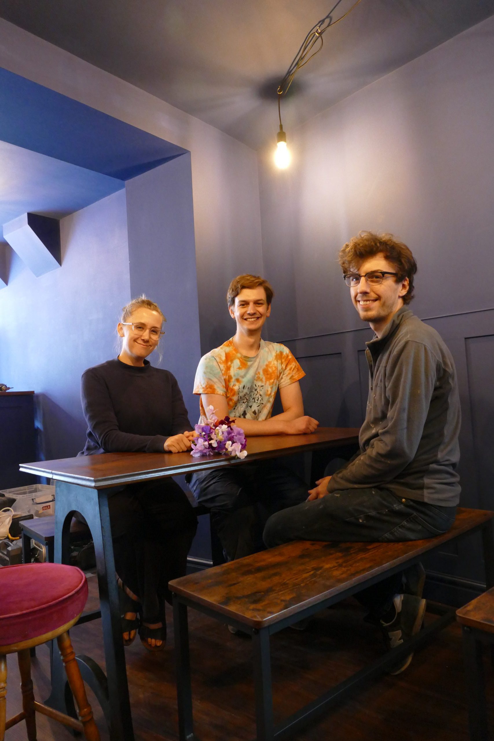
It was my partner, Elliot, who first came up with the idea of opening a micropub. He’s always been a huge fan of real ale pubs but opening one himself was more of a dream than a likely reality. However, in the summer of 2020, he, myself, and our friend Johnny decided to take the plunge and open a micropub. The appeal was that we could realise our dream of creating a space where real ale could be enjoyed while still keeping our jobs part-time and having some financial security while we got up and running.
We decided to open our micropub, The Malt and Mardle, in Norwich as it is where all three of us live. We absolutely love Norwich – it has such a rich history, especially when it comes to pubs, and a brilliant, thriving community of independent businesses too.
Have you been inspired by any other micropubs?
Yes, we have definitely been inspired by other micropubs. A big local source of inspiration is Nigel who runs the Hop Inn in North Walsham, North Norfolk. Further afield, we’ve been inspired by Lucy from The Dodo in Hanwell, London. A lot of how we wanted our pub to look and feel is inspired by the pubs we visited in Yorkshire when we were students. Whitelock’s in Leeds and Haworth Old Hall, for example, have been big influences on us.
You’re opening in an area near to great pubs like the Artichoke, the Leopard, the Plasters and the King’s Head. Was that part of the reason you went for your location?
Partly! I guess you could argue ‘yes’ as we chose a location that we were familiar with and, as a result, that happened to be near to where we live. But part of the reason why we live here is that we’re surrounded by such great pubs like the ones you listed!
What is your opening date? Will you be open every evening?
Our opening date is the 22nd of July. We’ll be open Thursday, Friday, Saturday and Sunday and hope to extend this in the future.
How easy or hard was the licensing part of your pub, getting permission to convert a shop unit into a micropub?
It certainly wasn’t easy but nor was it quite as difficult as people were warning us it could be. It did take a long, long time though which really tested our patience – we were so relieved when it all went through ok!
Nothing goes entirely to plan, have you had any difficulties so far with the conversion?
At times, it’s been a bit of a bumpy ride but what else could we expect?! It’s almost inevitable when starting a new business! Thankfully, there’s not been a problem too large that we couldn’t find a solution for.
One of the biggest challenges has been having the time and energy to get everything ready for our opening. While Elliot and Johnny have been spending as much time as they can on the micropub in addition to juggling part-time and full-time jobs, I’ve been struggling with my chronic health conditions. Our friends and family have been a huge support, though, and we’re definitely so grateful to them for helping us almost reach the finish line!
Micropubs have the benefit of allowing conversation to flow between not just regulars, but those coming in for the first time. Is that a core part of your thinking?
Yes, in the true spirit of micropubs, we’ve actively decided not to have loud music playing and distracting screens etc. We’ve also got a couple of larger tables that, when safe from Covid to do so, smaller groups can share and perhaps strike up a chat if they feel like it.