Category: Streets of Norwich

  • Streets of Norwich – St Lawrence Little Steps

    Streets of Norwich – St Lawrence Little Steps

    Part of my Streets of Norwich project….

    This short lane connects Westwick Street and St. Benedict’s Street, taking its name from St. Lawrence’s Church.

    The steps at the bottom, leading onto Westwick Street.

    The churchyard is to the left.

    Looking back down to Westwick Street, with an entrance to the fifteenth-century St. Lawrence’s church on the right-hand side.

    And another set of steps up to St. Benedict’s Street.

  • Streets of Norwich – Wellington Lane

    Streets of Norwich – Wellington Lane

    Part of my Streets of Norwich project….

    Wellington Lane today is a strange little affair, running parallel to the inner ring-road street (I say street, more like a minor motorway) of Grapes Hill. Back in 1900, Wellington Lane is visible, but it now also covers what was Duck Lane. Grapes Hill was widened after the Second World War, so there is now no housing between Wellington Lane and Grapes Hill, it’s a soulless area of the city where the car triumphed.

    This metal relief sculpture is located where St. Benedict’s Street and Wellington Lane meet, but more about that sculpture here.

    Starting from the Duck Lane end, the city wall is on the right-hand side and these sections were previously embedded into housing.

    A relatively long section of wall which has been mauled about over the centuries, but at least something has survived.

    A gap between the wall, which starts to peter out at this point.

    Looking back towards the Duck Lane end, the line of the wall has been retained.

    The line of the wall goes shooting off into the bushes, with Grapes Hill on the right. There was an intriguing square tower here, but it was pulled down as part of the road expansion plans.

    This is now getting towards the end of what was Duck Lane, and now into what was always known as Wellington Lane. Somewhere around where that tree is at the front, that was once the Wellington pub, which is how the street got its name. That pub, built in the mid-seventeenth century as a residential property, traded between 1822 and 1930, part of the Youngs & Co estate in the later part of its period of operation.

    The bushes on the right are the former stretch of residential properties along Wellington Street and the city wall existed in this section. However, the whole lot went as part of the Grapes Hill road widening, although some of the properties in this area had already been lost or damaged during the Second World War.

    The road starts to end here, connecting in with St. Giles Street on the left.

    And looking back down Wellington Street, a heavily changed road over the last century. The houses on the left have gone as part of the Grapes Hill construction, and although some efforts have been made with landscaping, it’s not the most glamorous of areas. The road is so busy that it can’t be easily crossed, but there is a pedestrian bridge now so that people can get over to the Earlham Road area.

  • Streets of Norwich – St. Augustine’s Street (West Side)

    Streets of Norwich – St. Augustine’s Street (West Side)

    Part of my Streets of Norwich project….

    This is how St. Augustine’s Street looked at the beginning of the nineteenth century. Starting in this post just with the buildings on the west side of the street.

    The road starts with St. Augustine’s Church, but more on this in another post as I went on a tour of this rather lovely church and have plenty more photos. But, what is perhaps of most obvious note about the building is its brick tower, which dates to the seventeenth century and is the only one of its type in Norwich.

    This is the entrance to Winecoopers Arms Yard, the building that juts out is the former pub of the same name (without the word yard at the end obviously). The buildings on the far left, next to the trees, are mostly all listed and were constructed in the early nineteenth century as shops and residences.

    The building on the right-hand side (and indeed those attached to it along the street) are listed, as they’re seen as important examples of early nineteenth shopfronts. The corner building itself was once the Sussex Arms public house which traded from the 1850s until it was closed by Bullards in 1963.

    The building in white was the Royal Oak public house, the pub sign was once where there’s a stretch of white wall which looks like it could have a window. The pub had started trading in the late eighteenth century and survived until the late 1960s, when it was converted into a residential property.

    Stretching into Bakers Road, this is the side of the Staff of Life public house. It was opened in the 1830s as a bakery and pub, remaining open until 1971, despite being damaged during the Second World War.

    Not much has really changed on this side of the street, the buildings have changed their uses, but most of them have survived. Some of the yards have been closed off, but again, many of the structures in them remain. The element that has changed the most is that this is no longer an upmarket shopping street, as it was split off from the main shopping area by a clumsy road development that lost Botolph Street. The tone of the street changed and most of the shops closed and the area didn’t have the best of reputations.

  • Streets of Norwich – Nunns Yard

    Streets of Norwich – Nunns Yard

    Part of my Streets of Norwich project….

    I like how the council have placed several of these tablets on the pavement along St. Augustine’s Street, noting where a number of yards are located.

    The yard is now closed off and its named after the Nunn family who ran a number of businesses in this locality in the early nineteenth century. Looking at some old census records for this yard, it’s notable just how many people lived in each household. In one house, the head of which was Charles Coxford, there were seven people in a small property (and some along this street had twice that number), including three lodgers.

  • Streets of Norwich – Winecoopers Arms Yard

    Streets of Norwich – Winecoopers Arms Yard

    Part of my Streets of Norwich project….

    This yard is located off of St. Augustine’s Street, visible on the above 1880s map next to the pub from where it takes its name, the Winecoopers’ Arms. The pub traded between the 1830s and 1936, although nearly managed to get itself shut down in 1905 when the police didn’t like that the pub’s back yard opened into the yard where people lived. I suspect some residents would have preferred that for convenience, but, perhaps not all.

    The pub frontage hasn’t changed enormously, it’s the bit sticking out with glass, with George Plunkett having taken a photo of what it looked like in 1938.

    Now a modern building on the site of the yard’s entrance.

    Although the old style street name survives, with four households being registered here when the 1939 Register was completed.

  • Streets of Norwich – Rose Yard

    Streets of Norwich – Rose Yard

    Part of my Streets of Norwich project….

    Rose Yard is located off of St. Augustine’s Street and back in the 1880s, it was more than just a yard and was instead a sizeable street which led onto Edward Street.

    There’s a chunk of lost heritage here, the site is now pretty much just a car park, but George Plunkett has a photo of what it used to look like. It’s a real loss of an area which should still be housing, with the properties being demolished after the Second World War and then the site was just flogged off in bits.

    The building on the right was once the Rose Inn and there had been an inn on the site since the fourteenth century, with space for 100 horses being advertised in the nineteenth century. The window visible on the right is the original nineteenth century pub frontage and the pub carried on trading until 1981. With over 500 years of trading history, it’s sad to see the building in this state, it’d make a fine site for a pub….

  • Streets of Norwich – Nichols Yard

    Streets of Norwich – Nichols Yard

    Part of my Streets of Norwich project….

    This yard is located by the ‘T’ of Street and it used to lead into Barnes’s Yard, although that has now been closed off.

    The frontage of the yard, which is closed off from St. Augustine’s Street.

    As for why its called Nichols Yard, no-one seems quite sure….

  • Streets of Norwich – Hindes Yard

    Streets of Norwich – Hindes Yard

    Part of my Streets of Norwich project….

    Hindes Yard is located off of St. Augustine’s Street, just above where it says ‘free trade tavern’ on the above map from the 1880s.

    It’s one of many yards along this street, many of which have survived in some form, although some of them are closed off. The name of the yard likely comes from the early part of the nineteenth century, after the local Hinde family who ran a nearby manufacturing business.

    Back in 1939, there were three households in the yard, with six people living across the properties.

  • Streets of Norwich – Bakers Road

    Streets of Norwich – Bakers Road

    Part of my Streets of Norwich project….

    Baker’s Road, also known as Baker Road, connects Oak Street and St. Augustine Street, and it’s one that has changed substantially over the last century.

    This is Baker’s Road from the St. Augustine’s Street end, looking very different to 50 years ago as all of the terraced houses on the left hand-side were pulled down in July 1973.

    The pulling down of the houses meant that previously hidden sections of the city wall were uncovered, which were previously in the backyards of the properties along here (and visible in the above map).

    Looking back towards St. Augustine Street.

    Not much remains of this section down towards Oak Street, but the council are looking at the potential of making clear that the wall used to be wider than this suggests.

    The house painted white is number 31, which in 1939 was lived in by 6 people, all from the Hardy family. There was Amos Hardy, a pedlar, and his wife, along with five children, including Benjamin, Joyce, Eric and Douglas. Benjamin’s job was marked as “of national importance”, working as a coil spring operator.

    A green area where the houses stood, with the street being named after the number of bakeries that were once here.

  • Streets of Norwich – Recorder Road

    Streets of Norwich – Recorder Road

    Part of my Streets of Norwich project….

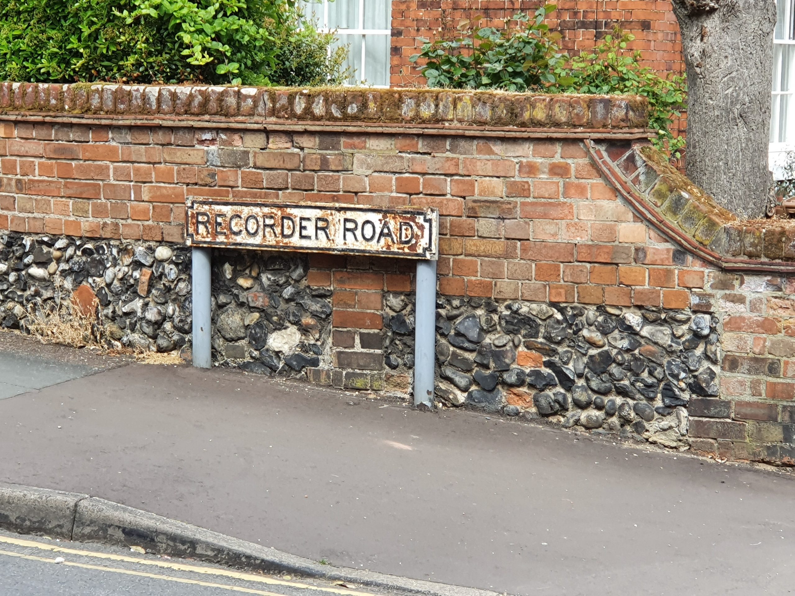
    Recorder Road is a relatively new street in Norwich, winding its way through what was until the early twentieth century a distillery and vinegar works. It is L-shaped and connects Horsefair to Prince of Wales Road.

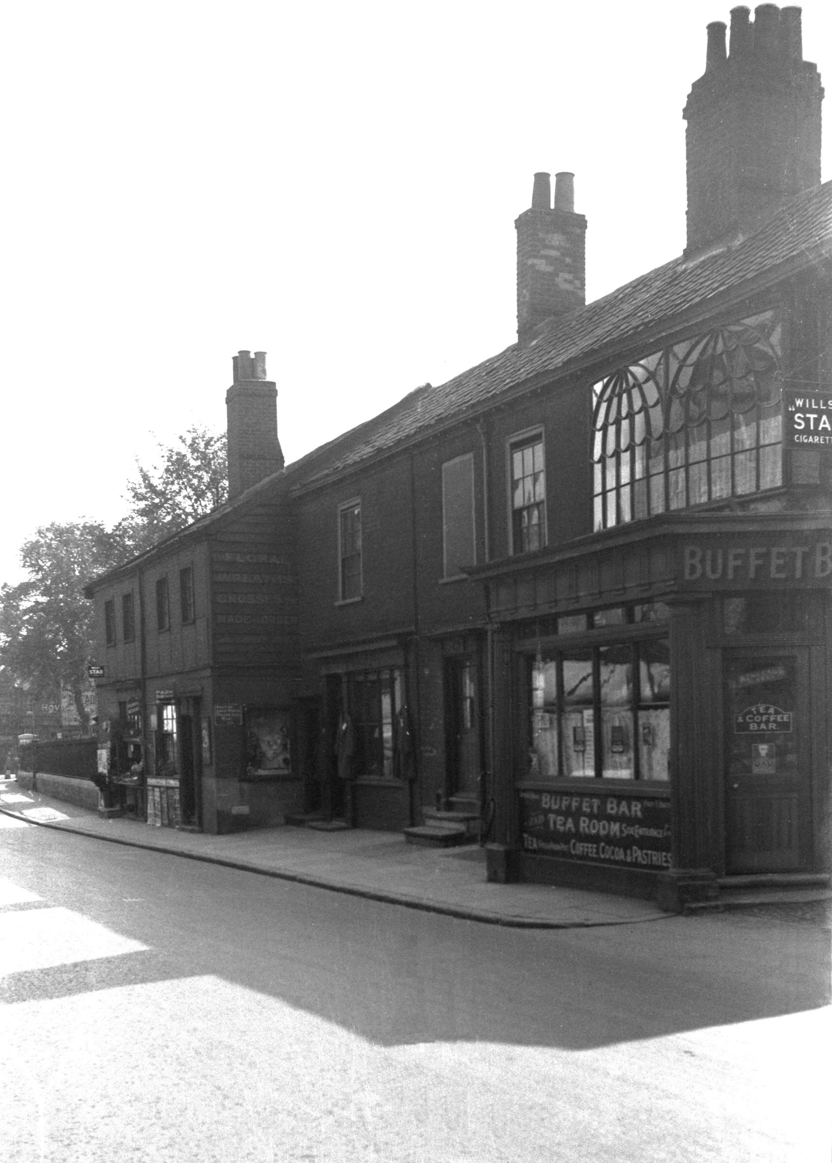
    As the road is relatively new, there’s not a great of historic interest along here, with this being the road from the Prince of Wales Road end.

    The Greek Orthodox Church, which was built for the Christian Scientists in 1934 and was designed by Herbert G Ibberson to seat 300 people. I’ve never thought it was particularly exciting architecturally, but it is a listed building as it’s apparently notable for its Arts and Crafts style of design

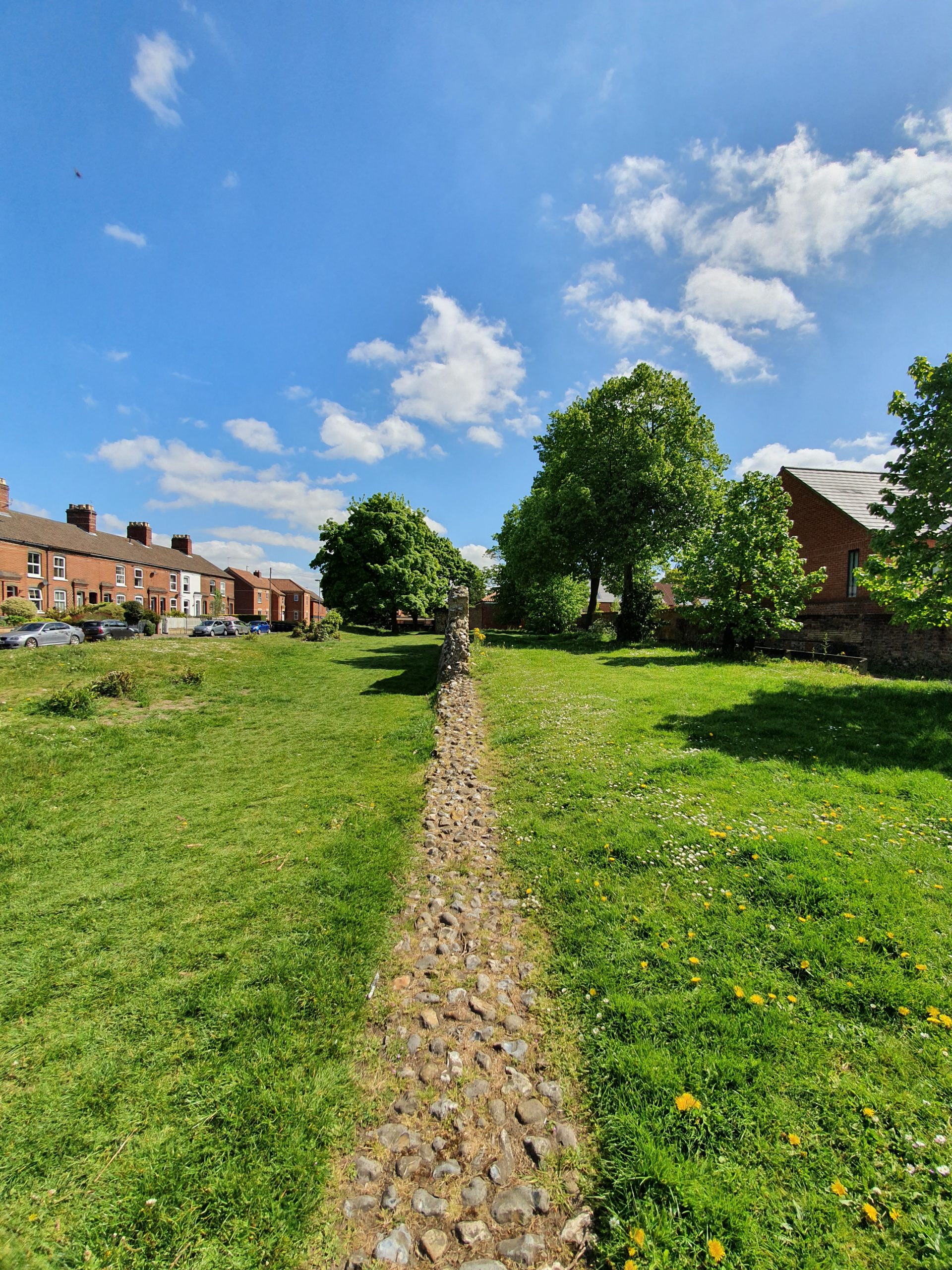
    There’s a walkway which connects through to the River Wensum riverside footpath.

    This is where it gets more exciting, when we approach Horsefair, and it’s Stuart Court. These are almshouses which were constructed in 1914 and are listed buildings noted for their Dutch-style design.

    The plaque reads “these housen were built in the year 1915 in memory of James Stuart, Privy Councillor born at Balgonie, Scotland, 1843. Sometime a citizen of Norwich died at Carrow Abbey 1913”. I’m going to post about that word ‘housen’ in another post, it should be used more…..

    A media report at the time noted that “these cottages are two-storied and designed on the flat principle, since owing to the preciousness of land it is impossible to build this class of dwelling economically on any other plan. Each storey, therefore, forms a complete and entirely private home, planned on thoroughly hygienic lines and fitted up in a way which is too rarely met with houses designed for persons of such small means. A wash-house is provided, for instance, containing a tip-up bath, a copper with a patent steam extractor, and many other useful features; while every building is supplied with gas pipes, and in each wash-house space has been left for a gas cooker, tenants being allowed to install a slot meter or not as they wish”.

    Once again, I’ve managed to pay no attention to this despite walking by it hundreds of times.

    This plaque is inside the entranceway to the gardens constructed in 1922, with the gardens also being named after James Stuart. This is the third listed building on Recorder Road, impressive since everything on it is twentieth century (or this century I suppose). The gardens and the gateway were designed by Edward Boardman, who died in 1910, showing how long this took to be finished.

    Some rather nice gardens, very peaceful.

    One mystery I haven’t been able to answer, I don’t know why it’s called Recorder Road. I’m sure it’s obvious, but it’s gone over my head.