Category: Streets of Norwich

  • Streets of Norwich – Mountergate

    Streets of Norwich – Mountergate

    Part of my Streets of Norwich project…. [updated in September 2023]

    Screenshot-2020-05-14-at-12.50.16

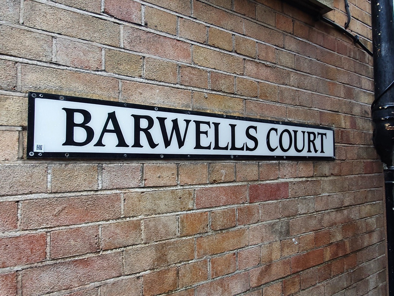
    Mountergate has also been referred to as the southern end of St. Faith’s Lane and the small section where it meets Prince of Wales Road is now better known as Eastbourne Place. The road name comes from the corruption of the parish name of St. Peter Parmentergate, which over time became Permountergate, and then Mountergate (and Mountergate Street).

    20200512_102418

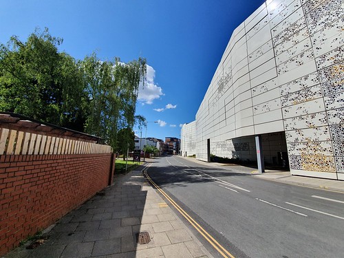
    Norwich City Council is very proud of its car parks and they put to one side perhaps too readily an English Heritage report asking them to reconsider building this. I’d rather that the council were proud of Norwich’s heritage and stopping knocking things down, but there we go. This is likely another one of those decisions that will be regretted in thirty years, although the building on the front part of this site was in fairness of no great historic loss.

    20200512_102534

    As can be seen here, the car park beautifully blends into its environment.

    20200512_102601

    There’s a road opposite the car park which leads to the Premier Inn and riverside walk.

    20200512_102610

    On the left of this photo is a building which has been left empty since around 2005, whilst the beautiful car park still keeps going on the right.

    20200512_102641

    The same neglected building from the front.

    20200512_102631

    When certain Norwich City councillors were excitedly talking about their new car park, they were asked by some heritage bodies to moderate their plans to try and save the historic fishmarket site. The fishmarket buildings weren’t that appealing visually, but there was historic interest to them, even though they had only been constructed in 1914 when they moved from their previous site on St. Peter’s Street.

    English Heritage said:

    “The complete demolition of the fishmarket would result in the loss of this heritage interest and the buildings’ contribution to the historic environment. We would urge the council to consider alternative uses of part of the site that would allow retention of the fishmarket, but also alternative designs for the car park.”

    So, there was potential for the council to change their plans slightly to build their car park, but to save some of the fishmarket site. What the council actually did was ignore all of that, but they did save the plaque which they’ve attached to their lovely new car park. So, when people come to have a look at the fishmarket site, which was of historic note albeit very run-down, they can now see where it was. Great.

    There was a question asked of the council at the time about surely their own public transportation plans were failing if their only solution was to keep building car parks. I’m not sure they came up with an answer to that.

    Anyway, there’s no point in being negative. One advantage in the council knocking down sites of interest is that there are fewer listed buildings for me to note.

    20200512_102701

    This is one listed building that remains, a seventeenth-century former factory site which still has some character to it, even though there have been a couple of extensions in the eighteenth and nineteenth centuries when it was used in the manufacture of boots and shoes. Behind it is St. Faith’s House, which fronts onto Baltic Wharf.

    20200512_102742

    A more modern office building, and then the entrance to the new St. Anne’s Quarter building development. Somewhere along here was the site of the Orchard Tavern, which was the only pub located on Mountergate.

    Screenshot-2020-05-15-at-14.51.20

    The pub was badly damaged during an air raid in 1940 and the owners, the Lacon Brewery, decided that they wouldn’t rebuild it.

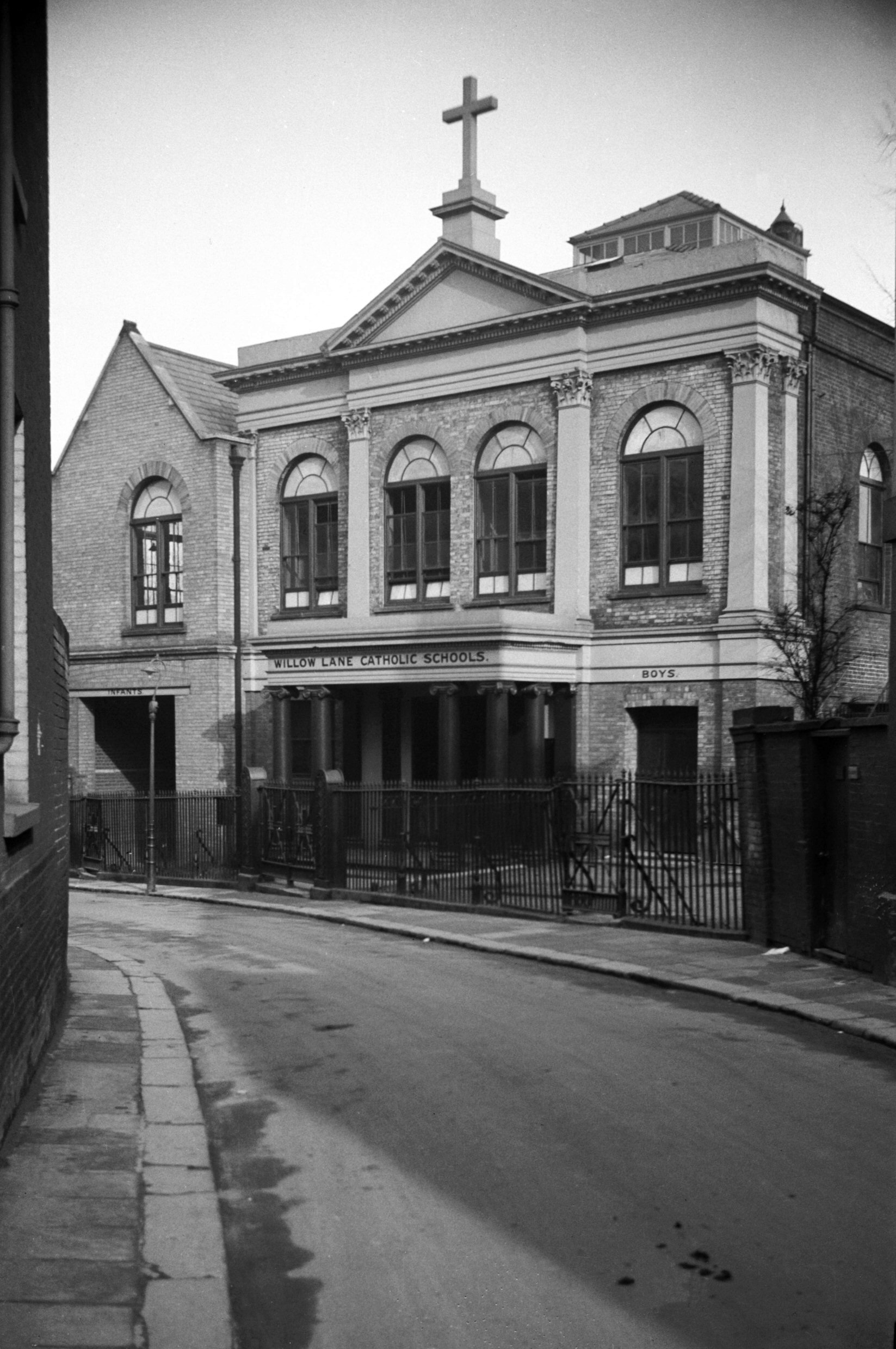
    Taking a look at the 1939 Register, St. Faith’s Tavern was located at 17 Mountergate and the landlord Fred Furze lived on the premises with his wife, Melinda. The pub closed in 1961 and it was once located at the corner of Mountergate and Synagogue Street.

    20200512_102842

    Everything on the left has been lost to the St. Anne’s Quarter site (although much had already been lost to war damage), but the wall on the right-hand side has been retained.

    20200512_102922

    And that wall leads to this gate, which led into where the Rose Lane iron-works are marked on the map. Now replaced by the Parmentergate Court housing project, at least this element has been kept as part of the site redevelopment. George Plunkett, who I’ve never known to be wrong on anything, wrote that the walls were from the Co-op shoe factory and were “retained as a baffle against traffic noise for Parmentergate Court”. Another source says they’re the old iron-work walls, and I have no idea which they are, unless both were at the site at the same, or different, times. On balance, I can’t imagine Plunkett was wrong though.

    20200512_102943

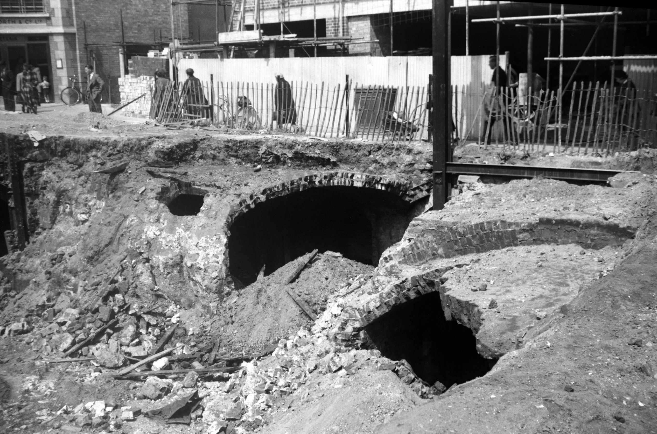
    The road, which is pedestrianised at this point, then meets King Street and straight over is Stepping Lane. A century ago, there would have been a road on the left-hand side, which was where Synagogue Street once stood. Much of this was lost during air raids in the Second World War, with the synagogue the street was named after being badly damaged, and then moved to a new site on Earlham Road in 1948.

  • Streets of Norwich – Ninham’s Court

    Streets of Norwich – Ninham’s Court

    Part of my Streets of Norwich project…. [updated in September 2023]

    20210118_114544

    Ninham’s Court is a thoroughfare which connects Bethel Street to Chapelfield and it hasn’t changed its route over the last few centuries.

    Screenshot-2021-01-22-at-08.35.01

    In this 1880s map, the thoroughfare was known as Masters Court and it takes its current name from the artist Henry Ninham, who lived at one end of the street. Ninham, who lived at the Chapelfield end, was a landscape artist and member of the Norwich School of Painters. He rather helpfully painted and drew many images of Norwich’s yards, courts and old buildings, with these sometimes being the only memory of them since they have long since gone.

    20210118_114546

    20210118_114609

    20210118_114624

    20210118_114643

    20210118_114648

    20210118_114704

    Photos from the route of Ninham’s Court, which is a narrow passage which reminds me somewhat of the rows in Great Yarmouth. The moss growing on the wall adds some atmosphere, but otherwise this isn’t really a street that anyone should necessarily travel to visit…..

    20210118_114627

    This photo is of limited use here (but George Plunkett can help here with this photo and also this one), but along the route are some houses which were likely built in the sixteenth century, although the fifteenth century undercrofts of older structures remain. This is the text about this property from the new city council’s heritage walk, which is what took me down this thoroughfare in the first place:

    “In the alley is the house of Nugent Monck, who founded the Norwich Players here in 1911. His company first performed in the large drawing room, which accommodated a small stage and an audience of about 70 people. Their popularity meant he needed more space and moved to the site of the current Maddermarket Theatre in St. John’s Alley.”

    There was an article in the Norwich Mercury in September 1896 where freehold properties were for sale in the alley, split across nine lots with an annual rent of £204 12s.

    One resident of note was Robert Briggs, whose death the Norwich Mercury announced in 1901. He had become something of a notable character locally as he was the last Norwich survivor of the famous 1854 charge of the Light Brigade at Balaclava.

    There was a tragedy on the alley in January 1911 when three year old Ada Louisa Waterson perished in a fire. Her mother had left her, and her tied up to a chair baby sister, whilst she went off to walk to Cow Hill for fifteen minutes. When she returned she saw smoke and then realised that Ada had died by burning, likely by wearing flannelette. The Coroner was most unimpressed, he condemned the mother saying that it was deplorable that children had been left unprotected.

  • Streets of Norwich – Old Mint Yard

    Streets of Norwich – Old Mint Yard

    Part of my Streets of Norwich project…. [updated September 2023]

    20200502_093641

    This yard is located off of Fishergate, and I hadn’t paid much attention to it until reading that it was likely the home of Norwich’s mint in medieval times, which produced this coin.

    20200502_093645

    There’s not much left in this yard area now, just a car park. There’s very little information about the yard on-line, although in 1900, Mr H.O. Greengrass of Norwich charged £69 10s to make the old yard up as part of improvements schemes across Norwich.

  • Streets of Norwich – Watts Court

    Streets of Norwich – Watts Court

    Part of my Streets of Norwich project…. [updated in September 2023]

    Screenshot-2021-01-23-at-08.20.54

    Watts Court connects Chapelfield and Bethel Street, running parallel with Ninham’s Court. It’s likely named after John Langley Watts, a former Mayor of Norwich and whose memorial is still in situ inside All Saints’ Church, Westlegate.

    20210118_114138

    The Chapelfield end of the court, which isn’t the most decadent entrance…. And I mention this because at the other end, on Bethel Street, there was until the Second World War a rather lovely original Tudor surround to the court, unfortunately, lost in 1942 in the Blitz. George Plunkett, reliable as ever, has a photo of this entrance that he took in 1935. There’s nothing there now, the buildings here have been removed and not replaced.

    20210118_114145

    20210118_114156

    20210118_114205

    Photos of the court along its length, there are traces of history in the old wall, but unfortunately, most of interest has been lost.

    One resident in 1849 was John Shenfield, who lived at number 42, but his business as a chair maker and lodging house keeper must have encountered problems as he was declared an insolvent debtor. This process meant that he had to attend the Guildhall to discuss his financial matters with the court. An insolvent debtor was different from a bankrupt, it wasn’t until 1861 that insolvent debtors could apply to become a bankrupt. It would have been a worrying moment for John Shenfield, as insolvent debtors could be kept indefinitely in a debtors’ prison.

  • Streets of Norwich – Damocles Court

    Part of my Streets of Norwich project…. [updated in September 2023]

    20210118_115600

    Firstly, and annoyingly, I have no idea why this street has this name. Answers on a postcard…. Unless it’s a recent dig at the authorities, since Damocles is about the constant threat which is faced by those who hold positions on power.

    Screenshot-2021-01-27-at-08.20.55

    The court isn’t named on the above map, but it’s the one in the centre, which leads off Pottergate. Indeed, it doesn’t seem to have been named anywhere before 1980, so it sounds like a modern name. The court did once lead into Wellington Square, which has long since been demolished.

    20210118_115557

    Looking down the courtyard, number 100 Pottergate is on the right.

    In June 1980, the Illustrated London News had an article about housing in Norwich City Centre, noting:

    “Damocles Court is a mixture of upgraded old houses and new buildings in vernacular style on decaying backlands”.

    I’m not sure that I’ve seen Norwich city centre defined as “decaying backlands”…..

    So, for the moment, this one is puzzling and I shall wait patiently for someone to solve this little mystery.

  • Streets of Norwich – Hampshire Hog Yard

    Streets of Norwich – Hampshire Hog Yard

    Part of my Streets of Norwich project….

    Screenshot-2021-01-21-at-08.24.10

    Located along St. Swithin’s Alley is the remnants of Hampshire Hog Yard, which was accessed from behind the Hampshire Hog pub, from which it took its name.

    20210118_120658

    This is one of the six remaining thatched properties in Norwich and its current name, rather sensibly, is the Thatched Cottage. It was built as a residential property in the seventeenth century and became a pub in the early nineteenth century. The licensee in the 1880s was John ‘Licker’ Pratt who fought Jem Mace in a two-hour long bare knuckles fight and I can’t imagine that was pretty. Pratt won the contest though and I suspect he wasn’t concerned about dealing with any problems that might arise in his pub after that. It remained as a pub until 1912 when the authorities were trying to reduce the number of licensed premises. The street line used to go up to the frontage of the house, so there wasn’t historically a garden area as there is today and George Plunkett has a photo of this from 1938.

    20210118_120802

    The Norwich Preservation Trust acquired the building in 1971 and renovated it over the next few years. George Plunkett offers some additional information about the pub, noting:

    “A yard at the rear bears the name of the Hampshire Hog, the sign of an adjacent tavern, being possibly the last house in England where the game of logats was played. The logats, resembling policemen’s truncheons, were to be tossed as near as possible to a wheel-shaped jack which had previously been thrown towards the opposite end of the ground; there was some similarity to the game of bowls. A set of logats is preserved in the Strangers Hall Museum.”

    20210118_120815

    The sign, which isn’t immediately obvious to those walking by, to the former entrance to Hampshire Hog Yard. The yard was cleared just before the Second World War as part of the project to remove slum dwellings in the city, with no access now possible. In 1906, it was advertised that all the housing in the yard, and some besides, was for sale at public auction and, at that time, the properties here were unlikely to have been in a particularly good state of repair.

    20210118_120818

    I’m not sure how old that sign is (someone has produced a guide to London street signs to help age them, but I’m not sure that any such facility exists in Norwich) but it must be at least eighty years old and is likely a fair chunk older than that.

    As for why the Hampshire Hog got its name, I’m unsure. A pub with the same name in London has its origins as a nickname for members of the Royal Hampshire Regiment, rather than anything to do with pigs. Perhaps there’s some similar link here.

  • Streets of Norwich – Stamp Office Yard

    Streets of Norwich – Stamp Office Yard

    Part of my Streets of Norwich project…. [Updated in November 2023]

    Screenshot-2020-05-02-at-11.50.28

    One of the reasons I started doing this long-winded thing of walking around every street in Norwich is that I hoped to notice some things that I hadn’t really seen before. I’ve found all manner of things I didn’t know existed, including plaques, streets and historic buildings. And, although I’ve been by it hundreds of times, I’ve never noticed Stamp Office Yard located off of St. Andrew’s Street (it’s the one in the centre of the above map, so to the left of the S of St. Andrew’s Street).

    20200502_091922

    The street takes its name from a business that operated here in the eighteenth century, which stamped official documents. Although in the map above, from 1885, there were plenty of buildings in the yard, it’s all been opened up now at the rear and is mostly car parking. The building to the right hand-side of the Stamp Office Yard is St. Andrew’s House, and when that was extended in the 1970s there were plenty of medieval pottery finds.

    At the 1921 census, there were two households reported as living on the street. In the first property there were six members of the Sabberton family, Frank William (aged 56), Emily (aged 59), Stanley (aged 22), Hilda (aged 25), Emily Ellen (aged 19) and Winifred (aged 16). Frank William Sabberton worked as an engineer at a clothing manufacturer, whilst Emily was noted to be working at home duties. Stanley was an engineer at Sabberton Brothers Engineers at Palace Plain, Hilda was a shorthand typist at Boulton & Paul, Emily was a clerk at Mann Egerton Cars on Prince of Wales Road, whilst Winifred was a shorthand typist at Singer Sewing who were at 16 Calvert Street in the city. In the other household was husband and wife Reginald Arthur Sabberton and Amelia Sabberton, aged 28 and 34. Reginald worked as a motor engineer for Goffs at Aylsham Road.

  • Streets of Norwich – Willow Lane

    Streets of Norwich – Willow Lane

    Part of my Streets of Norwich project…. [updated in October 2023]

    Screenshot-2020-05-08-at-22.18.29

    Willow Lane connects St. Giles Street to Cow Hill, a looping road that is shaped by the St. Giles’s Church site. The lane takes its name from the willow trees which were once on the south side in the seventeenth century, with the Mayor of Norwich being responsible for checking them. Despite this being a relatively short road, there are nine listed buildings along it.

    20200508_101932

    This is the St. Giles Street end of the road, the building on the right (which is 53 St. Giles Street) is the side of Ellis Second Hand Books and then the building behind is 1 Willow Lane, an early nineteenth-century residential property which was sold in 2019.

    20200508_101958

    The next building along is a former Catholic church which was built in 1827 by JT Patience, which was then turned into a Catholic school. The building is now used by Rogers & Norton solicitors and George Plunkett has a photo of when the building was still used as a school.

    20200508_102005

    Looking back towards St. Giles Street, the former church is on the left behind the fence.

    20200508_102008

    What looks like a Georgian building on the left, the entrance to the former church site is now on the right of this photo.

    20200508_102019

    The series of buildings on the left-hand side are early nineteenth-century residential buildings, which remain as houses. The white building on the right-hand side is number 9, also known as Willow Lane House, an eighteenth-century residential building that has been converted into offices.

    20200508_102040

    The brick building on the right is 15 Willow Lane and is a seventeenth-century residential building that was extended in the nineteenth century. It was also the home of Francis Blomefield (1705-1752) who was a local historian who wrote the ‘History of Norfolk’. The building was used as a boarding house in 1939, so the register gives an interesting look at its occupants. There were:

    Mary and Stanley Page (boarding house owner and husband was a hairdresser)

    Barbara Dash (assistant in grocer’s shop)

    Alice Nicholls (billiards room attendant)

    Sarah Barber (private nurse)

    Jacob Black (steel bender)

    Mary Black (unpaid domestic duties, wife of Jacob)

    Elizabeth Ledleve (boot and shoe branding).

    There were also two other people on the register where the record remains closed, so it’s possible that they’re still alive.

    20200508_102105

    Looking back the street from the Cow Hill end. The street feels very Georgian and unchanged, and there’s also the hidden property that was once the George Borrow museum, where the author lived between 1816 and 1824. However, this now has more in common with Cow Hill, so more on that in another post.

    Norfolk Pubs also suggests that there might have been a licensed premises called the Cellar House located along the street in the early nineteenth century.

  • Streets of Norwich – York Alley

    Streets of Norwich – York Alley

    Part of my Streets of Norwich project….

    As can be seen from the graffiti over the signage, this isn’t the most salubrious street in Norwich. It connects White Lion Street with Red Lion Street and as the sign says, it used to be known as Castledyck Lane as is led to the castle ditches (now Castle Meadow).

    The street isn’t marked on this 1870s map, but it’s the narrow street next to York Tavern, from which the street takes its name. The street layout here has changed, the building below York Tavern on the map has been demolished to allow trams to get through to Castle Meadow. The York Tavern opened in the late eighteenth century and continued trading until 1964, with the building still standing and now used for retail.

    The tram line cut through the middle is visible in this later map from the 1920s.

    This information board really isn’t the most usefully placed.

    Using my camera to zoom in, it’s a reminder that on 17 June 1902 there was a meeting at the Criterion Cafe, where Norwich City Football Club were established.

  • Streets of Norwich – Barwells Court

    Streets of Norwich – Barwells Court

    Part of my Streets of Norwich project….

    This court connects St. Stephen’s Church to St. Stephen’s Street and isn’t the easiest of pathways to socially distance on, although fortunately I didn’t see anyone when walking down it.

    There is very little visually that is of much interest along this court, but its survival is quite remarkable as nearly every building along its route has changed over the last century. This was once where people lived and worked, but is now the rear of shops which stretch along St. Stephen’s Street. Norwich once had hundreds of courts and yards, although relatively few of them have survived in anything like their original form.

    This is the original width of the path and it has always been a thoroughfare and not just a court which has been opened up.

    This is looking towards St. Stephen’s Street and there is now a connection between the two properties which joins the buildings.

    Looking at the entrance to Barwells Court from St. Stephen’s Street, where there is now a Superdrug on one side and M&S on the other (formerly an H Samuels before M&S kept making their shop bigger).

    The court takes its name from Barwells Wine Merchants, which had been set up by John Barwell (1798-1876) and he was married to Louisa Barwell, the musician and educational writer. As ever, George Plunkett has a photograph here of interest, which shows damage from the Second World War and also what was underneath what is now Superdrug, but was then the premises of Barwells Wine Merchants.