Author: admin

  • Streets of Norwich – King Street (upper end between Rose Lane and Prince of Wales Road)

    Streets of Norwich – King Street (upper end between Rose Lane and Prince of Wales Road)

    Part of my Streets of Norwich project….

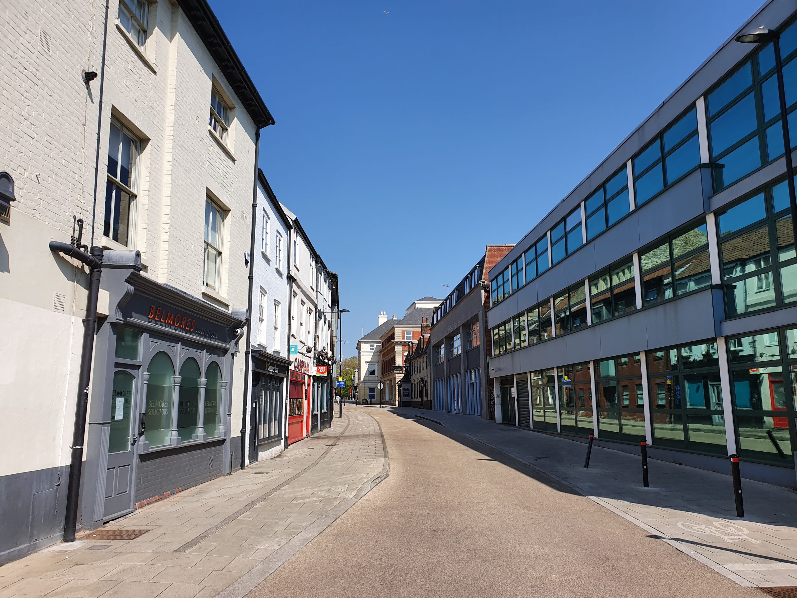
    King Street is one of the longer streets in the city centre, with this section running between Prince of Wales Road and Rose Lane.

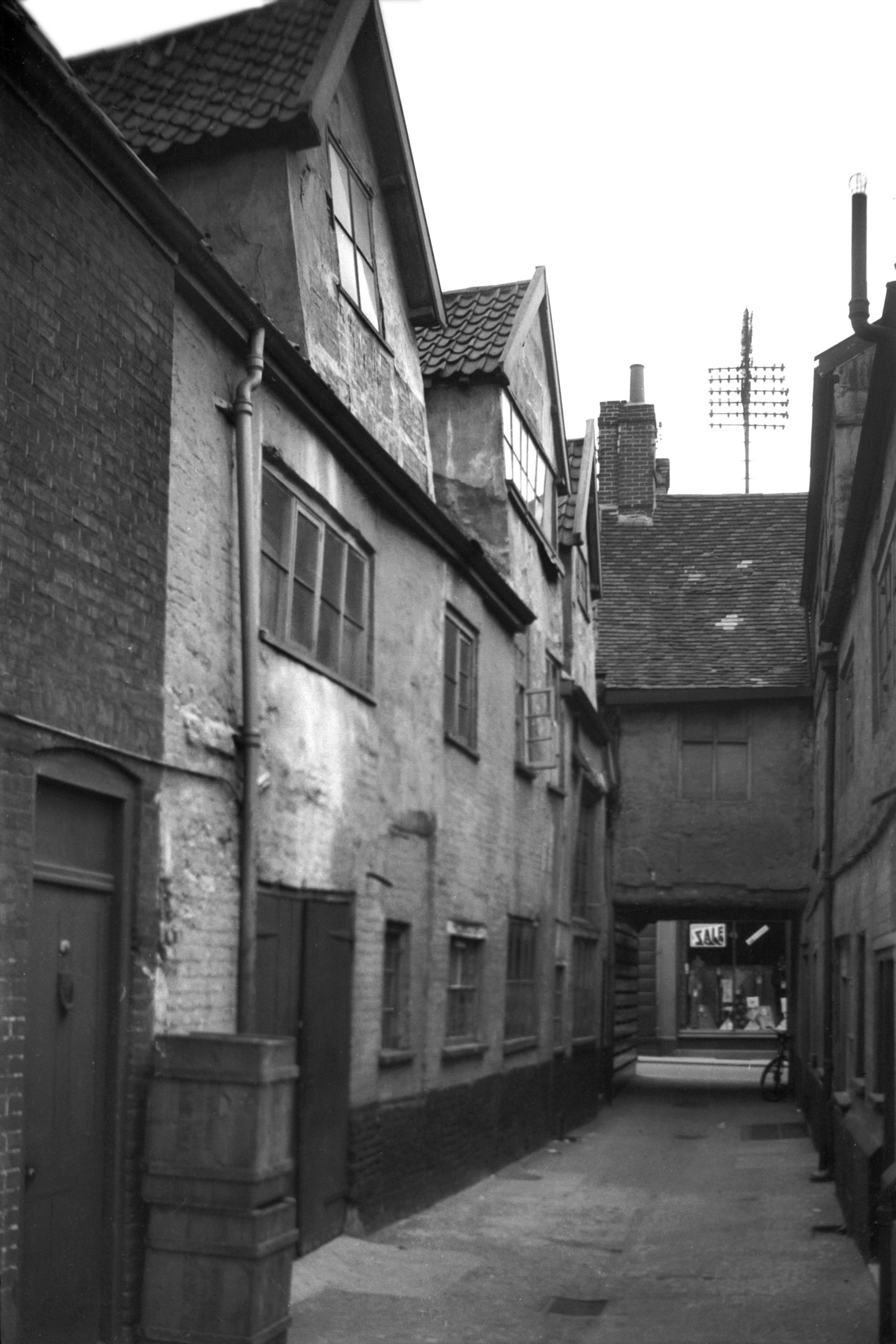
    This is how the street looked like in the 1880s.

    The building on the left is, I think, the former Royal Oak public house, in operation between the 1850s and closed in 1921.

    The building which has what looks like a black frontage (behind the blue sign) was the Cock pub which was a licensed premises between the mid-eighteenth century and 1975 when it finally closed. It’s located at 32 King Street and the frontage is an original pub frontage from the nineteenth century.

    What is now the Last Pub Standing, which is a reference to it being the last public house on King Street, but was formerly known as Kings, Bar Rio, Tusk and the Nags Head. The building, which is at 27-29 King Street, was formerly two residential properties from the seventeenth century.

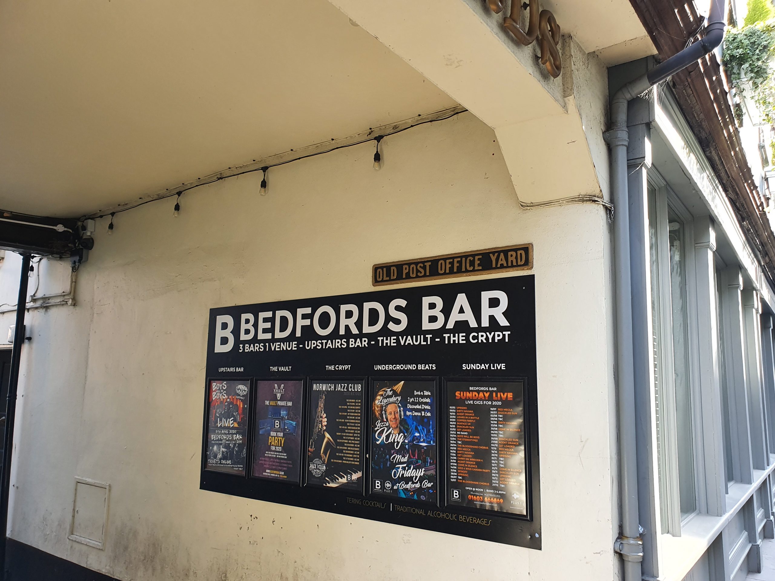
    The building on the left is the side of Hardwick House, which was built as a bank, before becoming the city’s main Post Office.

    The stretch of King Street was once the main road through, but this section has now been mostly pedestrianised.

  • Dictionary of the Vulgar Tongue – Day Thirty-Eight

    Dictionary of the Vulgar Tongue – Day Thirty-Eight

    The Dictionary of the Vulgar Tongue was first published at the end of the eighteenth century, and given that the Coronavirus crisis is giving too much time to read books, I thought I’d pick a daily word from it until I got bored…..

    Bragget

    The dictionary defines this as “mead and ale sweetened with honey”, which seems to have been a common word at the time, derived from the medieval word ‘brag’ meaning malt. The drink was sweet, and often had spices added to it, with the word also being spelt ‘braggot’ or ‘braket’.

    Chaucer used the word as early as the fourteenth century, but it has pretty much fallen out of use now.

  • Streets of Norwich – The Nest

    Streets of Norwich – The Nest

    Part of my Streets of Norwich project….

    This is quite an easy street in terms of the history of the buildings on it, as they were all built over the last couple of years.

    It’s located off of Rosary Road, which is a much older street, with The Nest being located around where it says ‘Lime Kilns’ on the above map from 1830.

    By 1885, the current location of The Nest is pretty much where the buildings were located under the Brick Works site.

    The street takes its name from The Nest, which was Norwich City’s football ground between 1908 and 1935. Although the street isn’t on the site of the former ground, it is relatively near.

  • Dictionary of the Vulgar Tongue – Day Thirty-Seven

    Dictionary of the Vulgar Tongue – Day Thirty-Seven

    The Dictionary of the Vulgar Tongue was first published at the end of the eighteenth century, and given that the Coronavirus crisis is giving too much time to read books, I thought I’d pick a daily word from it until I got bored…..

    Bowsprit

    The dictionary defines this as “the nose, from its being the most projecting part of the human face, as the bowsprit is of a ship”.

    Another one of those words which is slowly going out of use. However, the word ‘bow’ is still listed as another word for noise, so perhaps this is the same derivative.

  • Streets of Norwich – School Lane

    Streets of Norwich – School Lane

    Part of my Streets of Norwich project….

    School Yard is located off of Bedford Street, just to the left and above of the letter B of Bedford in the above map from 1885.

    This map from the 1830s suggests that this street was then known as the Hole in Wall Lane, with 27 representing the Girls Charity School. It’s from this that I assume the street takes its current name.

    This leads through to St. Andrew’s Street, although I’m not sure that there is a right of way down there.

    The building on the right is a former granary, but its frontage is on Bedford Street.

    The sign with white writing on a black background denotes that this is the boundary of St. Andrew’s parish.

  • Streets of Norwich – Old Post Office Yard

    Streets of Norwich – Old Post Office Yard

    Part of my Streets of Norwich project….

    Looking into Old Post Office Yard, which is accessible from Bedford Street. Bedfords Bar now takes up much of this little arrangement, they’ve also got a fourteenth century undercroft in their building, which is all to the right once going through the arch. This building was saved in the 1980s and George Plunkett’s archive has a photo of what it once looked like.

    The building on the left-hand side of the arch was once the Nelson Tavern, with Bedfords Bar being on the other side to this. There was a Bedford Arms, but that was further down Bedford Street. The Norfolk Pubs web-site mentions that the Nelson Tavern was in operation from the mid-nineteenth century until it was closed down in 1918, during the period when the Government wanted to cut down on the number of licensed premises. It was also known, quite ridiculously perhaps, as the Pink Dominoes in 1881 (that’s almost a gastropub name from today) and as Klondyke towards the end of its existence as a pub. History often comes full circle though and it’s now a licensed premises once again, known as Frank’s Bar.

    The Post Office connection is better described from St. Andrew’s Street (which is what the court backs on to), so more on that another time.

  • Streets of Norwich – Opie Street

    Streets of Norwich – Opie Street

    Part of my Streets of Norwich project….

    Norwich in the 1880s, with Opie Street not having change much since then. It connects Castle Meadow to London Street. The name of the street did have to be changed, as the legacy of the medieval period was that it was called Gropekuntelane, for reasons of prostitution, so it was changed in the 1860s to be named after Amelia Opie. Opie was a local woman who was a Quaker, a writer and she also involved herself in politics, particularly in the anti-slavery movement.

    The street had also been called Devil’s Alley.

    On the wall just to the left of the hairdressers on the right-hand side of the photo is a stone plaque dating from around the 1930s marking where a sedan chair stood for hire in the early nineteenth century.

    The street is a little steep (especially for Norfolk) and at one point there were steps along part of its route up to Castle Meadow.

    A post-box from the reign of King Edward VII. One thing I didn’t know until today, and it’s one thing that I didn’t really need to know, is that the Post Office don’t need planning permission to put a new post-box up. So they can shove them where they like, which must be an exciting possibility.

    What is now Trailfinders was once The Queen public house.

    In the 1939 register, Louis Marchesi was living at number 6 Opie Street, a man who founded the Round Table movement in 1927. There’s also a pub named after him opposite the Erpingham Gate, fortunately reverted back recently after it was briefly renamed to Take 5.

  • Dictionary of the Vulgar Tongue – Day Thirty-Six

    Dictionary of the Vulgar Tongue – Day Thirty-Six

    The Dictionary of the Vulgar Tongue was first published at the end of the eighteenth century, and given that the Coronavirus crisis is giving too much time to read books, I thought I’d pick a daily word from it until I got bored…..

    Bouncer

    The dictionary defines this as “a large man or woman”, which is interesting insomuch as that using the word bouncer as a slang for door staff is thought to originate from a novel by Horatio Alger called The Young Outlaw. I was hoping that instead the word evolved from inns and pubs using large men to ensure order at their establishments, but unfortunately I can’t find any evidence of that…..

  • Florence – Museo Galileo (Organum Mathematicum)

    Florence – Museo Galileo (Organum Mathematicum)

    This is an Italian Organum Mathematicum from the late seventeenth or early eighteenth century. I didn’t have a clue what this meant, but again, the museum’s web-site has the answer, it’s effectively a portable encyclopaedia.

    The museum describes more elegantly than I could:

    “The inside of the chest is divided into nine compartments, one for each of the following subjects: Arithmetic, Geometry, Art of fortifications, Chronology, Horography, Astronomy, Astrology, Steganography, and Music. Each compartment contains twenty-four small rods ending in a coloured triangular tip. On each of the nine series of twenty-four small rods are inscribed definitions and information on the corresponding subject. At least one rod in each of the nine compartments has a black tip and constitutes the application table, which gives the rule for proper use. To multiply 74 x 8, for example, one removes the black-tipped rod from the Arithmetic compartment and places it next to the rods carrying the numbers 7 and 4 at the top. The eighth line on the black-tipped rod gives the desired product.”

    I think it’s delightful, Wikipedia notes just how important they were:

    “Kircher adopted some of the ideas in the Organum from preexisting inventions like Napier’s bones, almanacs, and his own Arca Musarithmica. Like other calculating devices of the period, the Organum prefigures modern computing technology. Yet, due to its general lack of adoption, it remains an interesting but obscure footnote in the history of information technology.”

    Nathan and Richard would definitely one.

  • Florence – Museo Galileo (Box for Mathematical Instruments)

    Florence – Museo Galileo (Box for Mathematical Instruments)

    This is one of those excellent museums which gives some brief information about the object on a panel nearby, whilst adding more details on-line for those who want to find out more. So, the description by the object simply said that this was an eighteenth-century box for storing mathematical instruments. On-line, there’s lots more information about what’s inside the box:

    “The inside contains a drawer and three shelves carrying the instruments, some of which are missing. There are now several proportional compasses, reduction compasses and dividers; polymetric compasses (i.e., capable of multiple measurements); a plumb level; a few squares including a double square; a radio latino; several rulers; a quadrant; a surveying compass; a trigonometer, and a cylindrical weight tapering to a point and fitted with a ring.”

    I don’t really have that many mathematical instruments to store, but if I did, I’d like it in a grand red book-like box like this. Incidentally, I had to look up what a radio latino was, apparently it’s “a measuring instrument used in surveying and military engineering starting in the 16th century”.