

I misread this farm’s name at first and it’s probably evident what I thought the sign said. It’s actually derived from Snail’s Pit, a local lake.
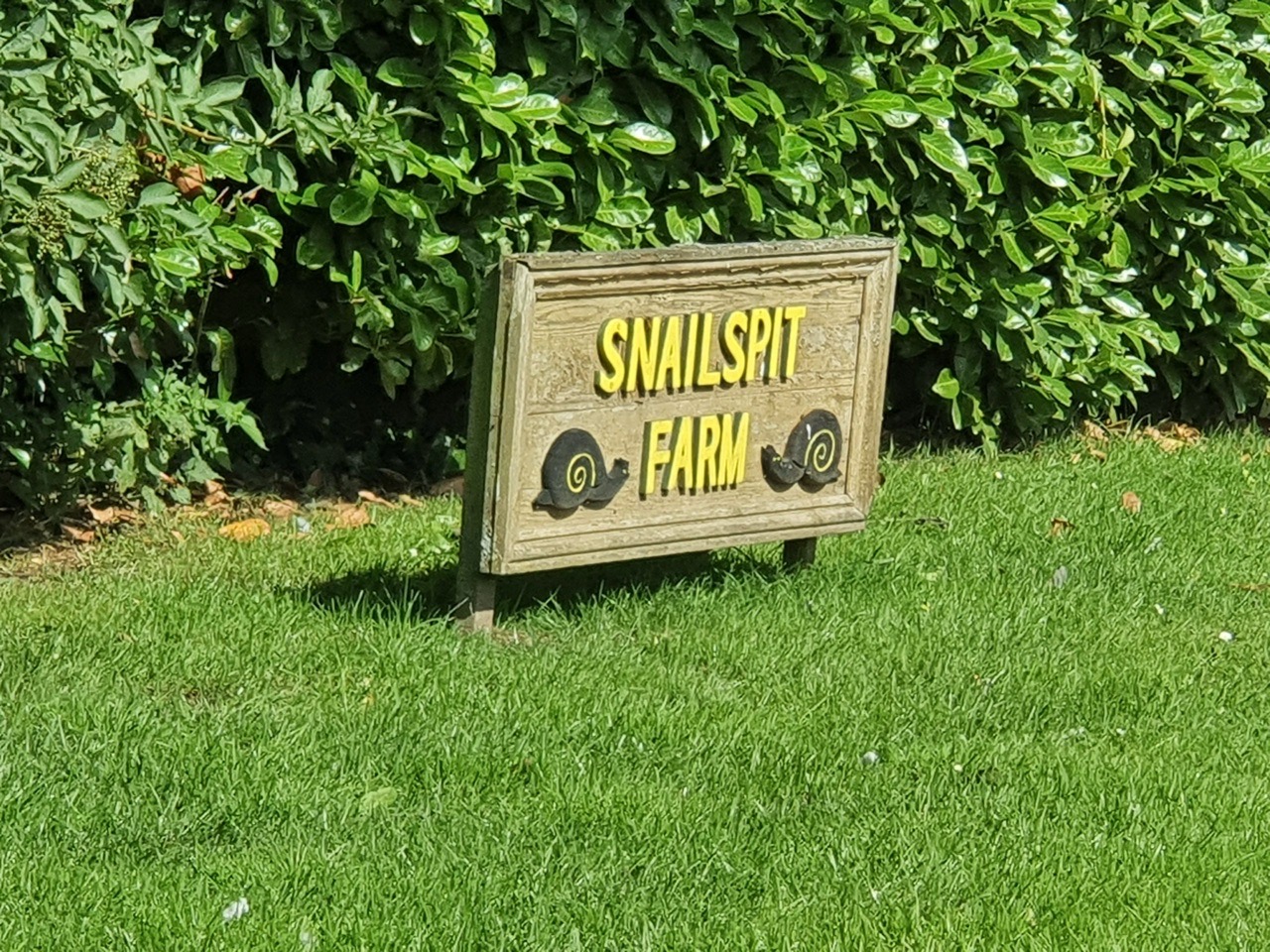
I misread this farm’s name at first and it’s probably evident what I thought the sign said. It’s actually derived from Snail’s Pit, a local lake.
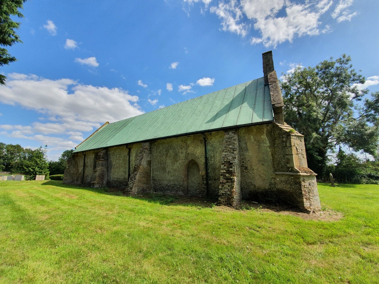

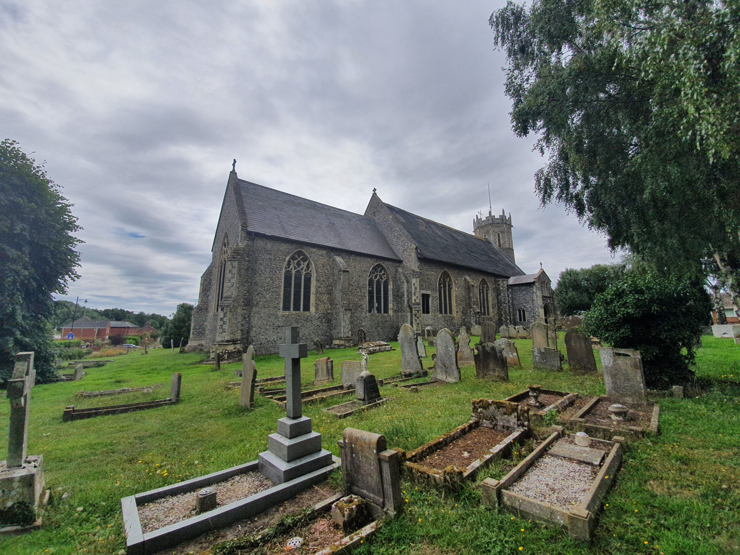
There isn’t much to Shingham and it has been a little subsumed into Beachemwell now, but its glorious church has remained. The above photo was taken from the main road (I say main road, but it’s not exactly the Las Vegas Strip) and I’ve no idea why the church is stuck back there. The land in the foreground wasn’t part of the church’s land even a century ago and was just part of the field.

It’s not known when the church was built, some histories suggests the thirteenth and others suggest the fourteenth centuries.

There’s something about this beautiful south door which to my very untrained eye just feels like the church is twelfth or thirteenth century. I hadn’t realised at the time that John Sell Cotman greatly appreciated this door and it’s pleasing to see the arch is still as he drew it nearly 200 years ago, with nothing dropped off.

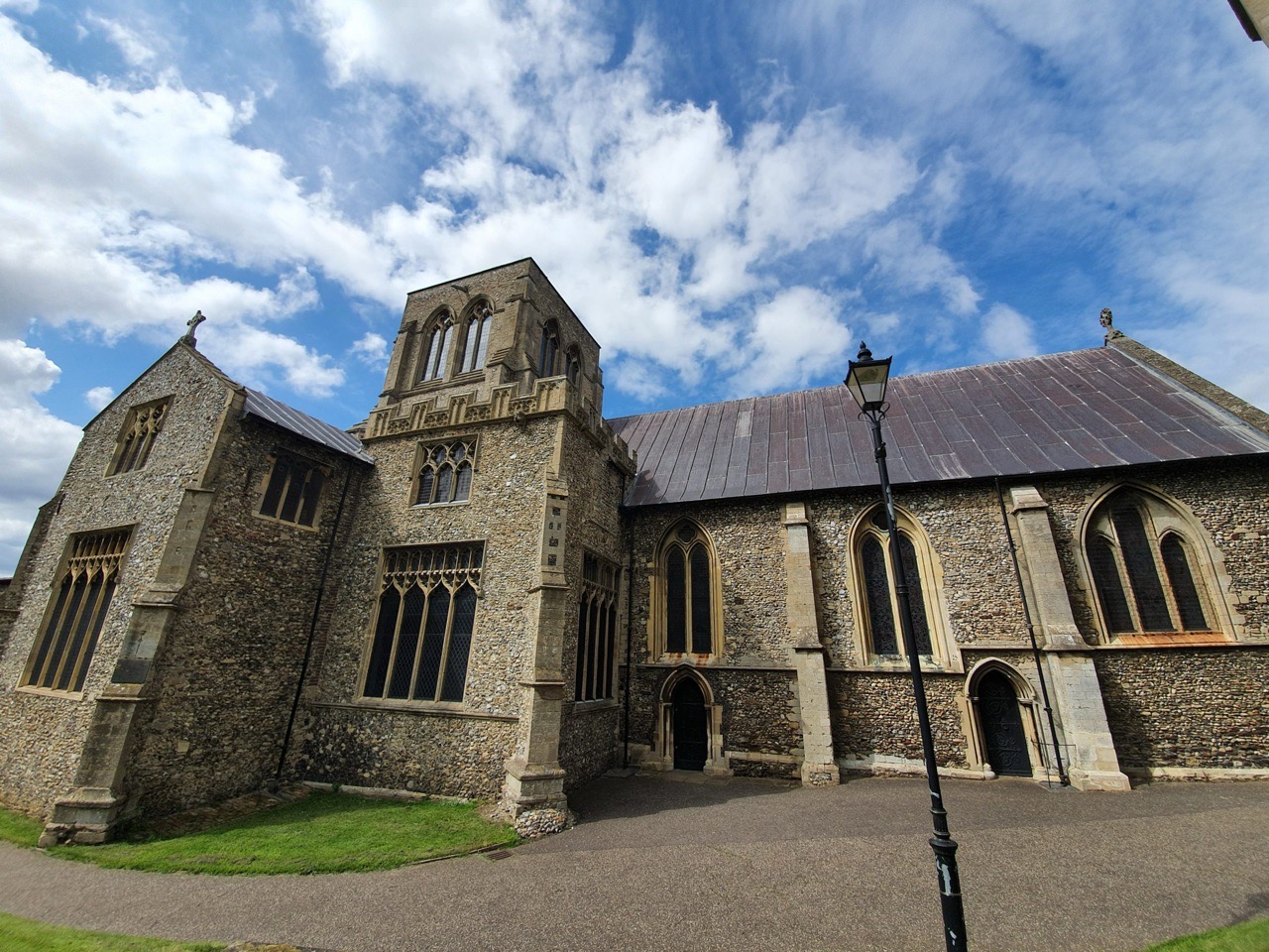
The church was redundant by the mid-nineteenth century, as there simply weren’t enough people in the local area to support it. The thatched roof had mostly fallen in by the late nineteenth century and the walls were in a bad state of repair by this time. However, there was a saviour, money was raised at the beginning of the twentieth century to repair the church, to put an iron roof on, to re-plaster the walls and to fix the broken floor. All of the work was completed in just five weeks in early 1904, an impressive effort.

Despite the restoration in 1904, not much had ever really changed with the church. The interior had been modernised a bit, but it retained its seventeenth-century pulpit and communion rails, as well as having some medieval benches. Unfortunately, the church is nearly never open now, so it’s hard to see inside. But, very little was ever added to this church, so although the roof isn’t really entirely in keeping with the structure, it feels like little else has changed here over the last millennium.
A correspondent for the Illustrated London News visited the church in 1892, commenting that “in living memory, the parish clerk was a woman, who led the responses, gave out the hymns, knocked the boys on the head during the service when necessary, and in the absence of the rector, prepared the young parishioners for confirmation”. No wonder the boys stopped going…..
Since I was back in Fakenham today, I thought I’d tick off a few more heritage trail sights. Not that I took much care in this, I meandered about until I had found a few, it’s more exciting that way to stumble across stuff.

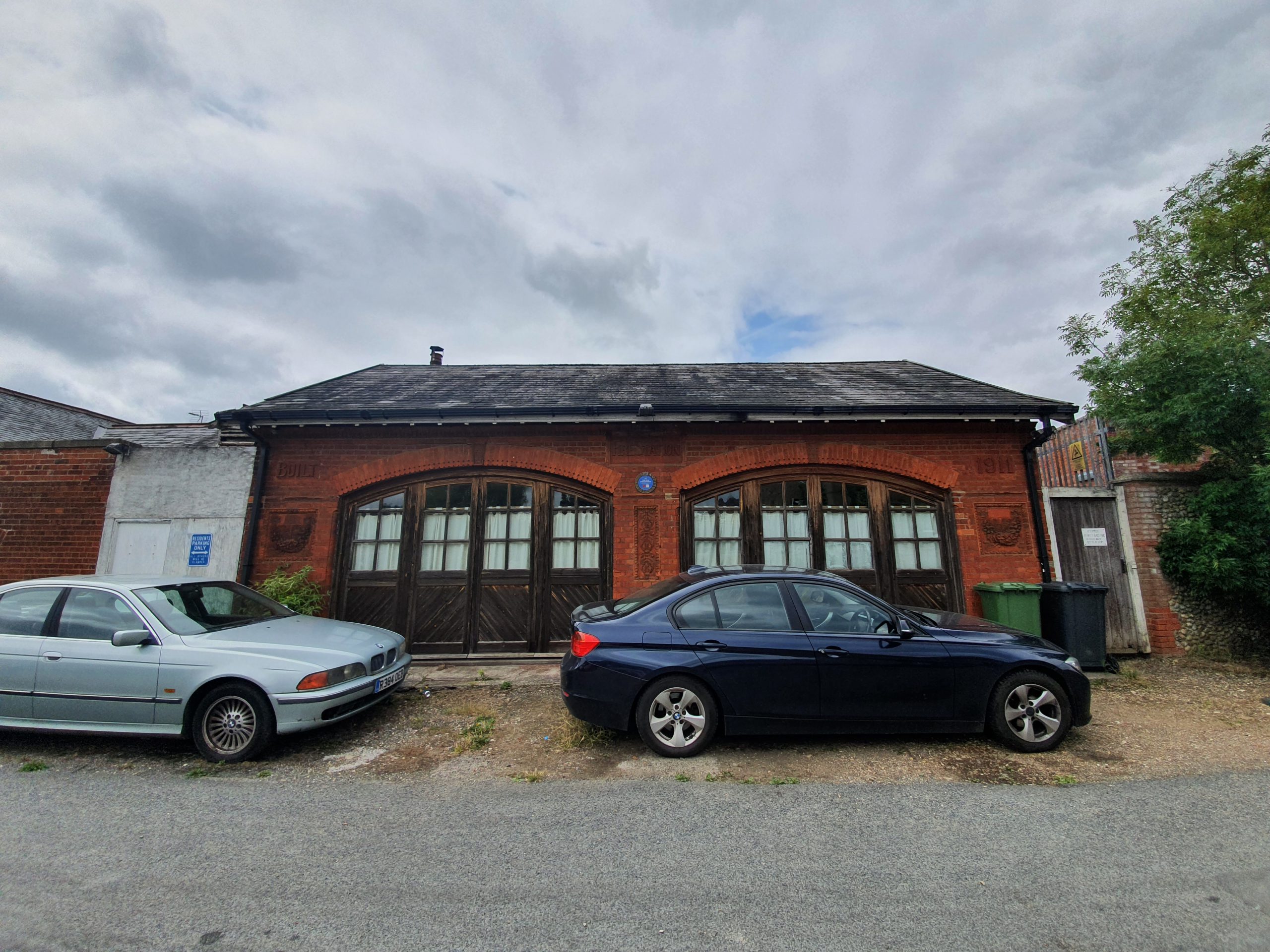
Some care has gone into this fire station building at Hall Staithe, which was constructed out of brick in 1911 (the fire station, not the staithe). The cars parked in front make it a little harder to see the building clearly, but it was clearly a functional structure. Well, functional for the height of fire engines at the time, probably not quite so useful for the current ones.

The decorative effort that has gone into the building and the heritage trail sign is also visible, noting that both then and now, the fire station is manned by volunteers. The new replacement fire station is much larger and it’s now located on Norwich Road in the town.
The heritage trail’s web-site has some glorious photos of how it used to look when it was in use.

One exciting new walking project is Slow Ways, an attempt led by Dan Raven-Ellison to create a network of walking routes across the UK. This is of interest to the LDWA, we’re always keen to find ways of connecting shorter routes together to create something longer, but what’s impressive is how many people have already engaged in this project. They’re looking for 10,000 volunteers to help with this work and I’m hopeful many members of the LDWA will be interested in this.
There’s lots more information on the Slow Ways official web-site, but David Morgan, the national LDWA chair, and myself, the national LDWA communications officer, were keen to find out even more. Below are some questions and answers from Dan, which we will also be using in numerous ways on our social media and internal communications.
Q. Can people use this project to plan long-distance walks?
That’s one of the aspects of the Slow Ways that I’m most excited about. While each Slow Way route connects two neighbouring settlements, people will be able to combine routes for long distance journeys. Someone who wants to walk from Falmouth to Huddersfield or Swansea to Norwich will be able to see multiple options for making those journeys that use existing footpaths. Critically, they’ll also be able to see a village, town or city that they can stop, rest or sleep in at the end of each day.
We are so fortunate to have a wealth of incredible long-distance paths and routes in Great Britain, but while they do connect on the ground they don’t necessarily connect in people’s imaginations, ambitions or stories. The Slow Ways will help more people make more of those connections more of the time.
Q. You’ve got a large number of people working with you on the project already, how did you engage so many people so quickly?
For many different reasons. Most people involved just got the idea of the Slow Ways straight away on an intuitive level. In February we held a hack-day to start creating the network that was attended by 70 people from across the country. People for a mixture of reasons. They either liked maps and plotting routes, loved walking, were interested in the environmental, health, economic, cultural and social benefits of more people walking or wanted to be part of the Slow Ways in a very personal way.
After the success of the hackday I had planned to organise 10 more events in 10 different regions of Great Britain, but then Covid-19 hit and the country went into lockdown. In response to that challenge a small team of volunteers from the hackday spent four weeks creating an overview plan for the network and setting things up so that anyone who loved maps, were missing walking and had an internet connection. We then used Twitter, Zoom, Skype, Google Docs and OS Maps to recruit and train 700 volunteers who then created over 7,000 Slow Ways routes that stretch for over 100,000km.
Lockdown certainly helped to bring people together and catalyse the effort.
Q. How could LDWA members help you on this project?
We’d loved LDWA members to help with the project. We are going to be looking for 10,000 volunteers to help test the routes. We need people to ground truth, verify and rate all the routes and in some places, suggest new ones. I’m hoping that we’ll have everything set up for people to help with this giant effort before the autumn.
Anyone who wants to help should sign-up for the Slow Ways newsletter on my website ravenellison.com. We’re currently working on a website to host the development of the routes.
Q. Do you think that the lockdown has brought about a new era in walking and people wanting to explore their local communities?
I think there is lots of evidence that more people have been out exploring their local neighbourhoods. I’m interested to see how this translates into people deciding to walk longer distances. I think the Slow Ways can help with that as people want to avoid public transport and walking to a neighbouring settlement will be an option for many people.
Q. Is ‘Slow Ways’ relying on paths that are known to exist on the ground, or theoretical rights of way that in reality have been lost?
Slow Way is a principle and an idea. It’s the idea that you can walk to your neighbouring settlement and the principle that it should be possible to do so directly, safely and enjoyably. This is not always the case.
Each Slow Way might have multiple route options. These route options may be more or less direct, safe, doable or accessible. Volunteers were asked to create Slow Ways routes that used footpaths and rights of way that are visible on OS Maps. There will certainly be many “lost ways” included in the network and we need to do the ground truthing to find, test and potentially even challenge some of these.
I’m also interested in where there are no safe rights of way but should be. The Slow Ways help to expose places where the walk between neighbouring settlements is unacceptable. In these places I hope they inspire parish councils, councils and local groups to create new routes and rights of way.
Q. Will ‘Slow Ways’ liaise with the Ramblers ‘Don’t Lose Your Way’ campaign as ancient routes are protected for the future?
I’m good friends with Jack Cornish who leads on that and Jack’s been volunteering on the Slow Ways from the start. We’re chatting about the best ways to collaborate and combine energies.
Q. And for many of our members this would be of interest, would these walks let them encompass a pub visit easily?
Great question. When designing the routes I asked volunteers to make sure they, as far as possible 1) Start and finish at a good central point 2) are direct 3) are off-road 4) are safe and accessible 5) have resting places every 5-10km 6) pass through train and bus stations 7) are enjoyable and beautiful and 8) use already established routes.
The “resting points” requirement meant using OS Maps to find regular villages where people could stop for rest, sustenance and potentially a bed. The guidance was to look for a pint glass symbol on Explorer maps as an indicator for good places to pick. So yes, in some ways the Slow Ways could be considered to be world’s longest-distance pub crawl.

This grave stands out in the churchyard because of its design, but it was the content that was the saddest, the death of a five-month old boy. Robert Aldous Faulke was baptised in the church on 13 September 1860 and he was the son of Robert Cooper Faulke and Anna Maria Faulke. Robert Cooper Faulke worked as a miller and farmer, employing three men and one boy, looking after 98 acres. There must have been some wealth, as the cost of such a headstone would have been relatively substantial.
Robert died on 20 February 1861 and was buried on 25 February 1861 and the bottom of his beautiful gravestone reads “he died for Adam sinned, he lives for Jesus died”. It must have made for a painful census for the family, as the 1861 national register was taken on 7 April, just a few weeks after the death of Robert. One notable thing is that the census lists 7-month old Fanny Elizabeth as the only child, which made me realise that Robert was a twin (I had otherwise missed that his sister was baptised on the same day).

In a similar vein to the grave at Attleborough church that was overgrown, there’s something quite corporeal and spiritual (if something can be both these things) when graves get covered like this.
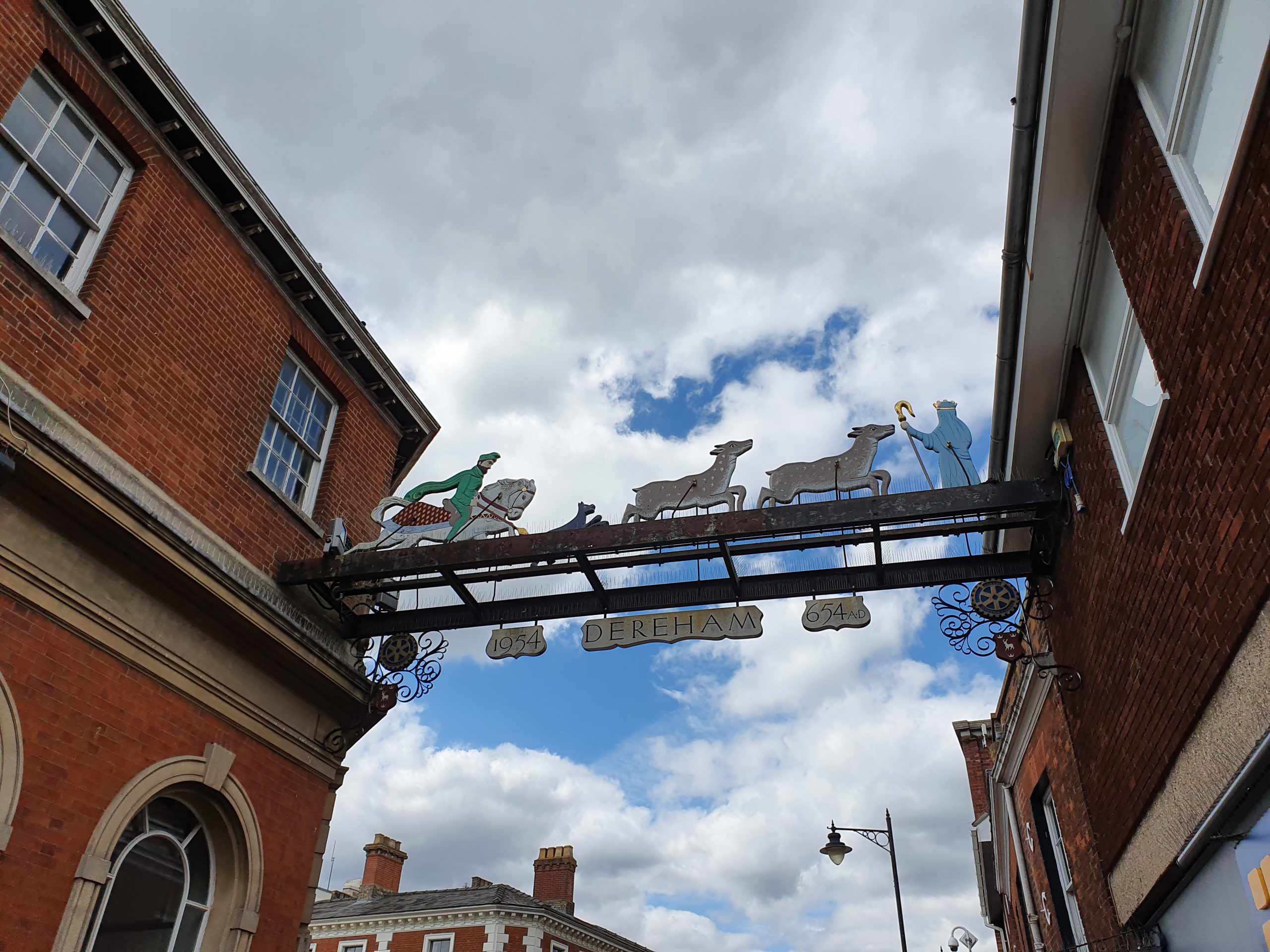

Dereham has a town sign which hangs over the High Street which was placed here in 1954, to mark the 1,300th birthday of when the town was founded. Realistically, this is probably a bit of a made-up date as there’s no historic evidence for this, but it’ll do as a best guess until someone can prove otherwise.
The story goes that the settlement of Dereham was founded by St. Withburga and there’s a tale that goes alongside this that the Virgin Mary guided her towards a stream where there were deer who provided milk to sustain her. Sounds about as likely as the more recent Castle Barnard story, but I won’t go there……

The next bit of the story, which explains the town sign, is that an evil local man didn’t like the deer being so generous to St. Withburga, so he tried to kill the lovely deer. Unfortunately, he was a bit inept and he fell off his horse and broke his neck. It’s not exactly a fairy tale story you’d tell to children, but that’s the imagery that Dereham wanted on its sign.
And here’s how it looked in 1960.
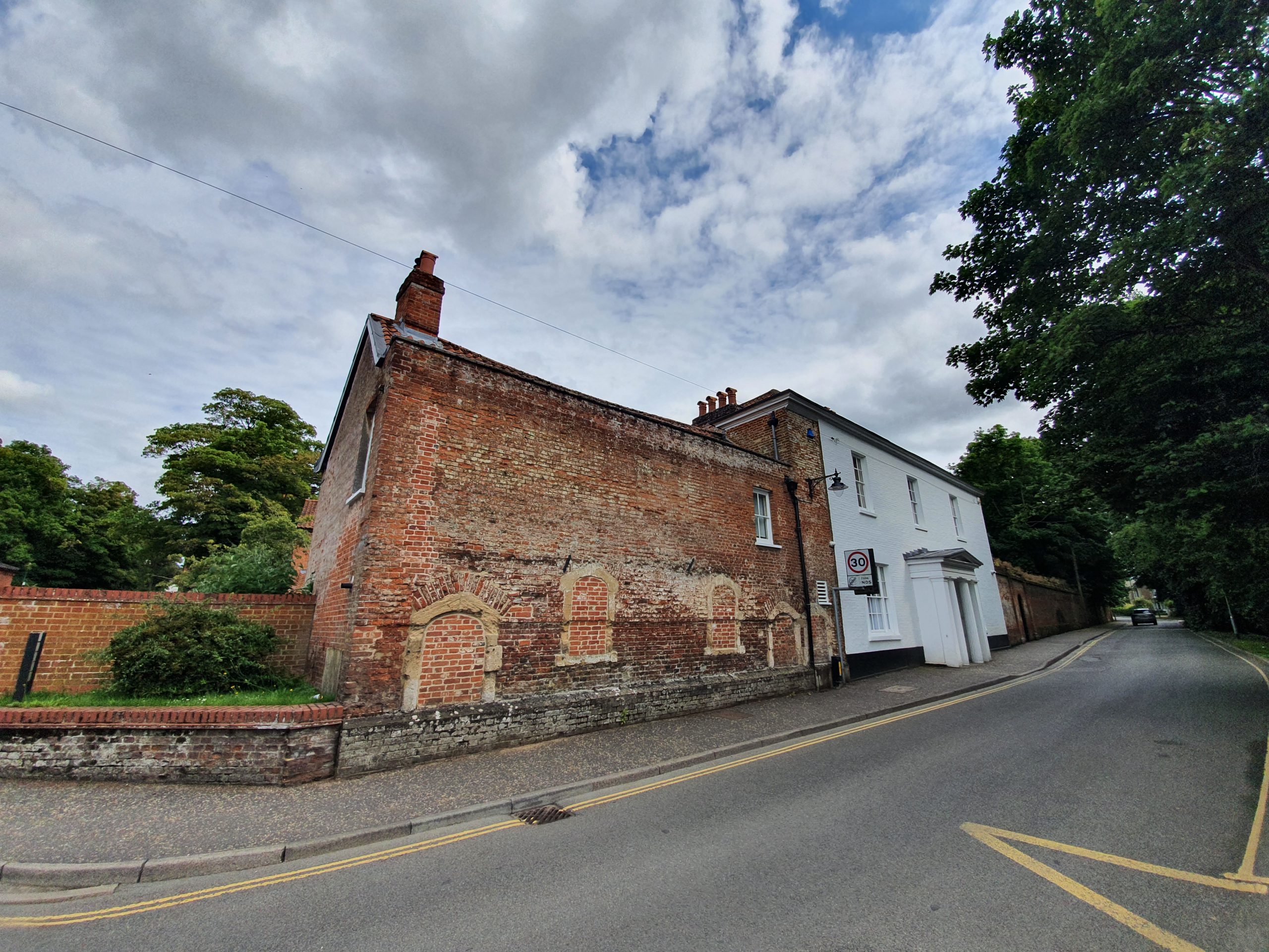

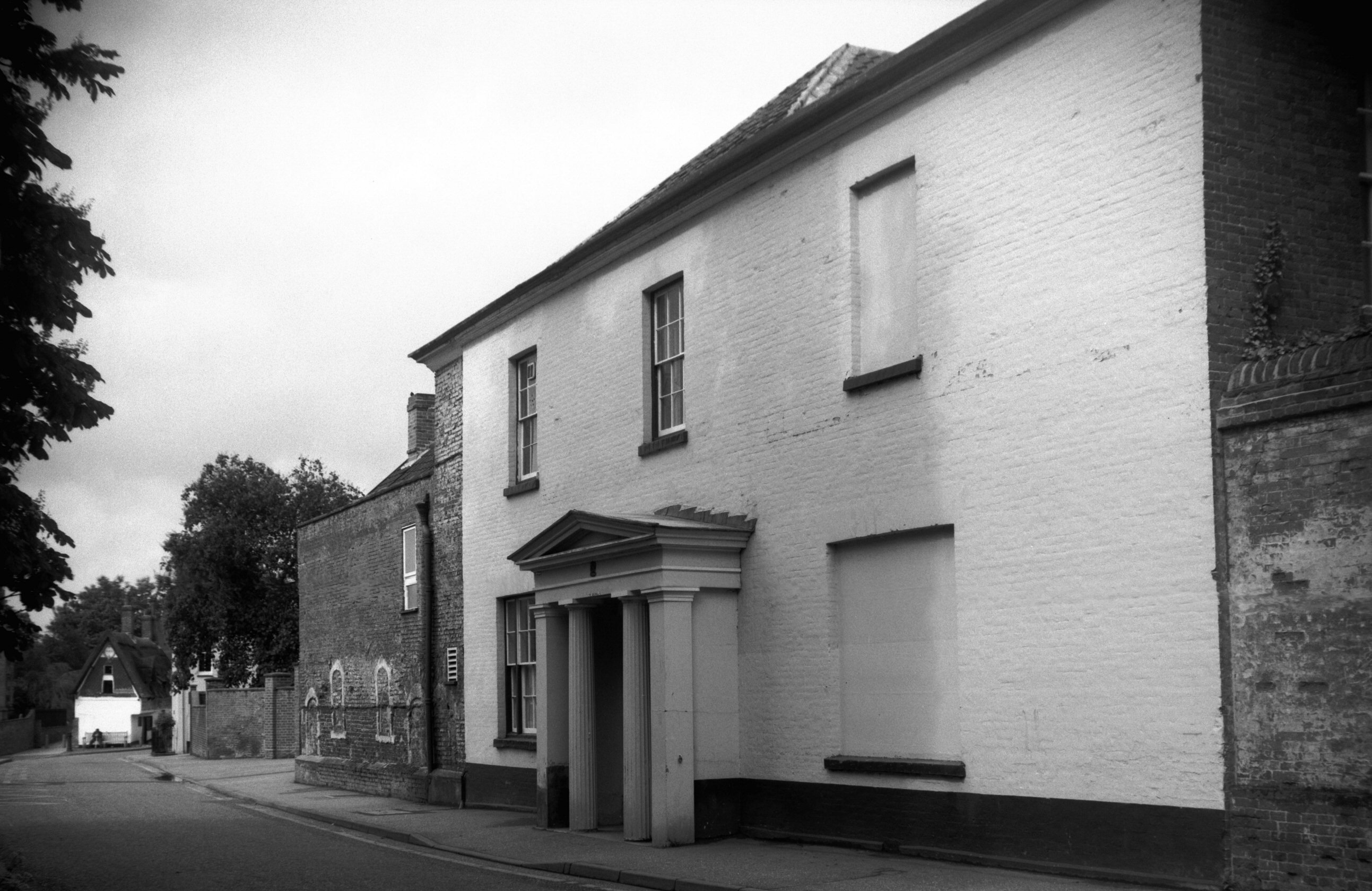
This is the former Dereham Guildhall and although heavily modernised, some sections from the sixteenth century remain in the wall and basement. It’s also been tidied up from when George Plunkett came to Dereham and took a photograph of it.

What is interesting from a heritage point of view is this, evidence of a separate property that is now joined with the main building. Those blocked up windows tell a story of their own, some are clearly evident, but there are a couple of harder to see blocked up windows on the first floor.
The Dictionary of the Vulgar Tongue was first published at the end of the eighteenth century, and given that the current health crisis is giving too much time to read books, I thought I’d pick a daily word from it until I got bored….
Fiddle Faddle
I’ve decided that I very much like this phrase, which is defined as “trifling discourse, nonsense. A mere fiddle faddle fellow; a trifier”. I think that ‘trifier’ is a mis-spelling for ‘trifler’, but ignoring that, I suspect that many people could guess what this phrase might mean even without the definition.
In the United States, the phrase is probably better known for different reasons, namely that it’s a brand of popcorn that was introduced in 1967. The original phrase dates back to around the sixteenth century, and it’s just the present tense of fiddle and the past-tense of fiddle, which was then ‘faddle’.

And we can see the sad evidence of this charming little phrase going out of usage…… Having written that, I’m sure there are some people who still use the phrase. But not enough, I shall make an effort to use this more on the blog.


Poor Travelodge has been rather battered about over the last few years, primarily as it never really caught up with the resurgence of Premier Inn. Travelodge has been financially damaged, not least by its internal structure, and it forced a large number of its hotel building owners to take a reduction in the rent that they could collect. This didn’t thrill the owners of many of these properties, who joined together to form the Travelodge Owners Action Group.
This week, this group of landlords has revealed that they are considering switching hotel brands, which they can do thanks to a handily inserted break clause which they have. A spokesperson for the group said:
“Our mission as an action group has always been to protect the interests of domestic savers and investors, who have been forced to contend with the aggressive tactics of offshore hedge funds willing to expend unparalleled resources to protect their profits, even at the expense of their own stakeholders. We are carrying on the fight against this unjust abuse of insolvency law that has been fuelled by weak government intervention and will do everything possible to mitigate the damage caused by this CVA.
Following the inclusion of a landlord break option for over 500 Travelodge hotels within the terms of the CVA, we are in talks with a number of leading global hotel brands aimed at providing savers and investors with the long-term stability they require. Advanced discussions are ongoing with major operators such as Accor, Marriott, IHG, Hilton, Jury’s Inn, Magnuson Hotels and others. The purpose of this is to present a range of alternative options to Travelodge landlords, so that they can decide which structure would work best for them.”
So, there are numerous hotel chains which might take over some of the sites, forcing Travelodge out. The one that I’m most hopeful about is Accor, they could operate a fair number of these sites and probably pay a larger rent than Travelodge are managing to. It’s unlikely to come to anything in the near future, but if Travelodge don’t work out their CVA in the next couple of years, that might mean an increased number of Accor locations for me to pop along to….