Tag: Streets of Norwich

  • Streets of Norwich – The Nest

    Streets of Norwich – The Nest

    Part of my Streets of Norwich project….

    This is quite an easy street in terms of the history of the buildings on it, as they were all built over the last couple of years.

    It’s located off of Rosary Road, which is a much older street, with The Nest being located around where it says ‘Lime Kilns’ on the above map from 1830.

    By 1885, the current location of The Nest is pretty much where the buildings were located under the Brick Works site.

    The street takes its name from The Nest, which was Norwich City’s football ground between 1908 and 1935. Although the street isn’t on the site of the former ground, it is relatively near.

  • Streets of Norwich – School Lane

    Streets of Norwich – School Lane

    Part of my Streets of Norwich project….

    School Yard is located off of Bedford Street, just to the left and above of the letter B of Bedford in the above map from 1885.

    This map from the 1830s suggests that this street was then known as the Hole in Wall Lane, with 27 representing the Girls Charity School. It’s from this that I assume the street takes its current name.

    This leads through to St. Andrew’s Street, although I’m not sure that there is a right of way down there.

    The building on the right is a former granary, but its frontage is on Bedford Street.

    The sign with white writing on a black background denotes that this is the boundary of St. Andrew’s parish.

  • Streets of Norwich – Old Post Office Yard

    Streets of Norwich – Old Post Office Yard

    Part of my Streets of Norwich project….

    Looking into Old Post Office Yard, which is accessible from Bedford Street. Bedfords Bar now takes up much of this little arrangement, they’ve also got a fourteenth century undercroft in their building, which is all to the right once going through the arch. This building was saved in the 1980s and George Plunkett’s archive has a photo of what it once looked like.

    The building on the left-hand side of the arch was once the Nelson Tavern, with Bedfords Bar being on the other side to this. There was a Bedford Arms, but that was further down Bedford Street. The Norfolk Pubs web-site mentions that the Nelson Tavern was in operation from the mid-nineteenth century until it was closed down in 1918, during the period when the Government wanted to cut down on the number of licensed premises. It was also known, quite ridiculously perhaps, as the Pink Dominoes in 1881 (that’s almost a gastropub name from today) and as Klondyke towards the end of its existence as a pub. History often comes full circle though and it’s now a licensed premises once again, known as Frank’s Bar.

    The Post Office connection is better described from St. Andrew’s Street (which is what the court backs on to), so more on that another time.

  • Streets of Norwich – Opie Street

    Streets of Norwich – Opie Street

    Part of my Streets of Norwich project….

    Norwich in the 1880s, with Opie Street not having change much since then. It connects Castle Meadow to London Street. The name of the street did have to be changed, as the legacy of the medieval period was that it was called Gropekuntelane, for reasons of prostitution, so it was changed in the 1860s to be named after Amelia Opie. Opie was a local woman who was a Quaker, a writer and she also involved herself in politics, particularly in the anti-slavery movement.

    The street had also been called Devil’s Alley.

    On the wall just to the left of the hairdressers on the right-hand side of the photo is a stone plaque dating from around the 1930s marking where a sedan chair stood for hire in the early nineteenth century.

    The street is a little steep (especially for Norfolk) and at one point there were steps along part of its route up to Castle Meadow.

    A post-box from the reign of King Edward VII. One thing I didn’t know until today, and it’s one thing that I didn’t really need to know, is that the Post Office don’t need planning permission to put a new post-box up. So they can shove them where they like, which must be an exciting possibility.

    What is now Trailfinders was once The Queen public house.

    In the 1939 register, Louis Marchesi was living at number 6 Opie Street, a man who founded the Round Table movement in 1927. There’s also a pub named after him opposite the Erpingham Gate, fortunately reverted back recently after it was briefly renamed to Take 5.

  • Streets of Norwich – Haymarket

    Streets of Norwich – Haymarket

    Part of my Streets of Norwich project….

    The Haymarket is a slightly quirkily defined area, cutting in between Brigg Street and the Market Place (Gentleman’s Walk), as well as joining in what is now called Millennium Plain and William Booth Street. For a while this was the city’s Jewish quarter and there was a synagogue here, before the Jews were expelled in 1286. Haymarket was also the annex of the main market place where hay and straw was brought for sale, a role it had for many centuries.

    The temporarily boarded up McDonald’s, which was formerly the George & Dragon pub. it was a pub from the 1730s until 1988, when it was converted first into a bank and then into McDonald’s in 2002. This really should be a pub again given its long heritage….

    The building at the rear was the once impressive Lambert’s warehouse, demolished in around 1970 and replaced with an awful bland building. On the right-hand side is St. Peter Mancroft, Norwich’s largest medieval parish church.

    Some sculptures. In another brilliantly inspired move, Norwich City Council ripped out the fountains and seating which were here, replacing them with nearly no seating and more paving slabs. This used to be a little park area in the mid-twentieth century, something that could perhaps be brought back in.

    The Thomas Browne statue, which was placed here in October 1905, to mark the three hundredth anniversary of his birth.

    Interestingly, where the statue sits today, there used to be a pub, the White Horse, which was demolished at the end of the nineteenth century (the map above is from 1885), in around 1898. For much of the nineteenth century it had also been called the Seed Mart, which is perhaps a unique pub name.

    Another dreadful modern building on the left-hand side, another in a substantial series of incompetent decisions from local planners. It was built as Peter Robinson’s store in the 1962, but it required the demolition of the Gaumont theatre, formerly the Haymarket Picture House, in 1959.

    The council have mauled this square so much that it’s lost nearly all of its character. Not that long ago it had a pub that was 250 years old, a huge theatre and an historic warehouse, now it’s got some generic retail buildings that give no nod to the heritage here and nearly no seating areas. There is though some heritage to the buildings which are on one side of the Haymarket, at the rear of this photo, more on which in another post.

  • Streets of Norwich – Swan Lane (Jem Mace)

    Streets of Norwich – Swan Lane (Jem Mace)

    As a follow-up to my post about Swan Lane.

    On the side of Turtle Bay is a sign marking that Jem Mace, “the father of modern boxing”, was the landlord of the White Swan public house. That building was demolished in the mid-nineteenth century, with the replacement structure now being the home of Turtle Bay.

    Jem mace.jpg

    James Mace was born on 8 April 1831 in Beeston, near to Dereham, the fifth of eight children of blacksmith William Mace and his wife Ann. He got into boxing young, which at that time was usually bare knuckles, as boxing gloves weren’t required until 1867. Originally he was interested in a career as a musician, and it’s said that this dream ended when three youths smashed up his violin for no reason in Great Yarmouth, which was also said to have fuelled his anger.

    Mace became the Heavyweight Champion of England in 1861, the English Middleweight champion in 1863 and the World Heavyweight champion in 1870. It was this fight that was perhaps the most important of his career, fought in Kennerville in Louisana (a place I’ve been when I stayed at the Kenner Econolodge, as it’s now effectively all part of New Orleans). The prize fund for the winner was £3,000, which is around £200,000 in today’s money, so this was a huge event.

    Mace owned the White Swan from 1857, during which time he managed in 1858 to be fined a sizeable sum for using bad language to a woman. It’s not clear when he left, likely not until the early 1860s when the building was taken down. He died on 30 November 1910 in Jarrow, County Durham, certainly an eventful life….

  • Streets of Norwich – Eastbourne Place

    Streets of Norwich – Eastbourne Place

    Part of my Streets of Norwich project….

    Not much has changed on this little street since the above map was published in 1885. The only change is to the name, as St. Faith’s Lane used to go all the way from Tombland to King Street. It sort of still does, although St. Faith’s Lane as a road name stops at Prince of Wales Road, then becomes Eastbourne Place and then becomes Mountergate.

    This map, from twenty years earlier, seems to suggest that Eastbourne Place was constructed in the early 1860s as there are no buildings marked here. Why they choose the name Eastbourne, I have no idea…..

    And the building would have been possible because of the construction of Prince of Wales Road, which was in the late 1850s (the above map is 1849), which finally opened in 1862.

    The area in front of Eastbourne Place has been messed around by the council on numerous occasions, the once little wooded area barely now exists, although at least the nearly always broken public toilet has been removed.

    The building on the left-hand side, which is now blacked out, was until the 2019 a branch of Domino’s, but it has a long history of being a food outlet, as in the 1860s John Sword opened up a refreshment rooms here which sold tea, coffee and other drinks. He also provided accommodation, which I assume was in the rooms which are now occupied by the nightclub Loft.

    The Presto Bar was also here, which housed a 60-foot long model car track, which still exists as Presto Park, although has been much changed over the decades. I think the Presto Bar occupied the same space as the refreshment rooms opened up by John Sword.

    This area looks better now than it has for some years, the space in front has been opened out and the number of cars reduced, although some more greenery would be nice. And someone needs to open up where Domino’s once was….

  • Streets of Norwich – Bank Street

    Streets of Norwich – Bank Street

    Part of my Streets of Norwich project….

    The above map is from the 1870s, with no substantial changes to Bank Street since then, although the area to the south of it was turned into a hotel.

    On the left is the entrance to what was Wade’s Court, although has also been known, and is now signed as Wade’s Yard. On the right is the back of the Royal Hotel, which takes up the whole block and which was built between 1896 and 1897. When they were demolishing the buildings on the site they discovered archaeological remains from the outer precincts of Norwich Castle. Built with 65 bedrooms for guests, the hotel remained trading until 1977 when a lack of car parking saw its demise. Fortunately, plans in the 1970s to demolish it and replace it with a glass office block were rejected, with the building more recently being used for offices.

    The second building on the left, with the sign hanging up above the door, is the former Bank Tavern. Later on part of the Steward & Patteson brewery, this pub first opened in the early part of the nineteenth century and it remained trading until November 1965.

    Looking back down Bank Street towards Bank Plain.

  • Streets of Norwich – White Lion Street

    Streets of Norwich – White Lion Street

    Part of my Streets of Norwich project….

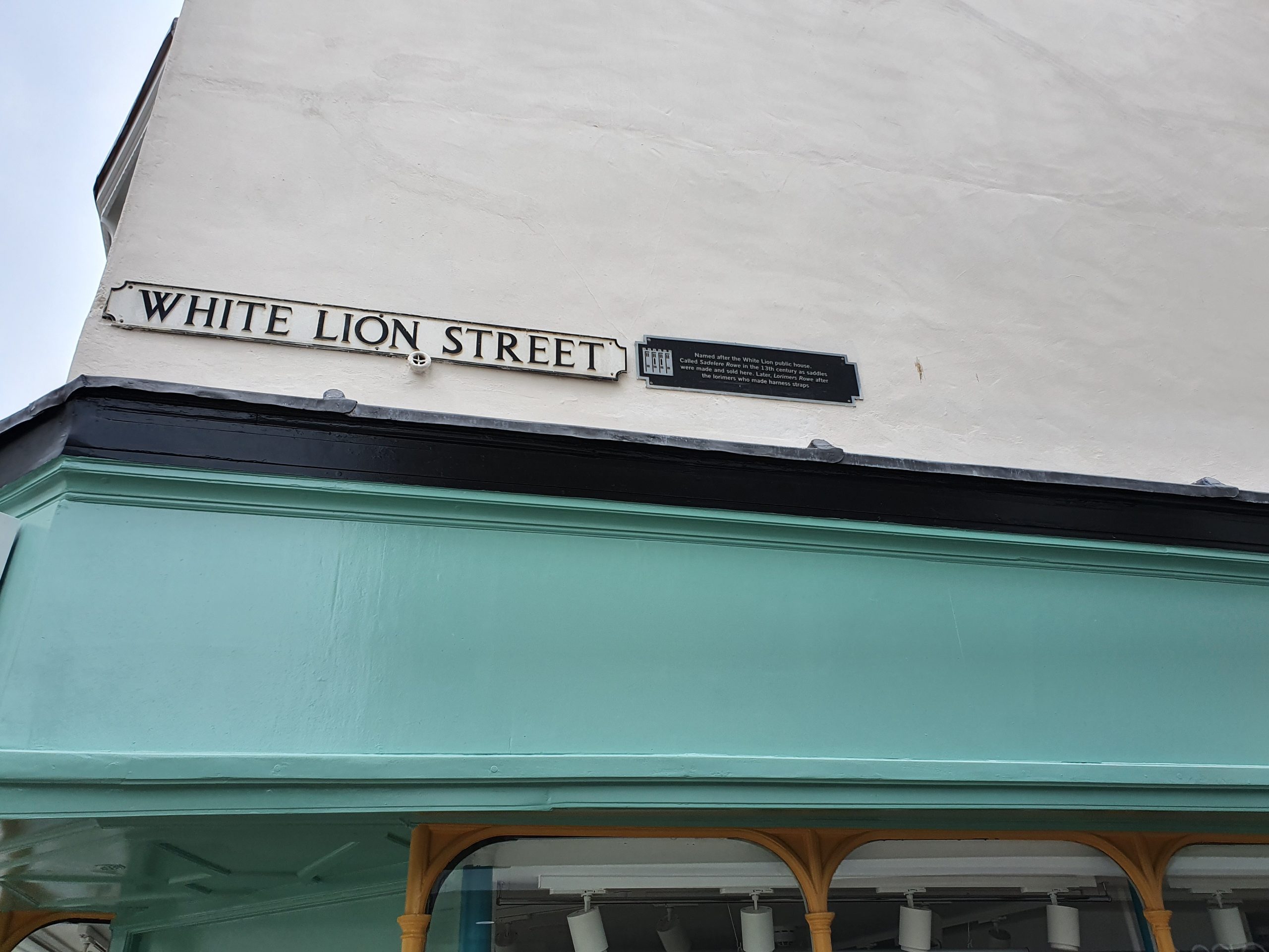
    White Lion Street runs from Gentlemans’ Walk and bends into Orford Hill and Red Lion Street, all very much unchanged over the last 150 years. The street takes its name from the former White Lion pub, but was originally called Sadelere Rowe in the thirteenth century due to the saddle-making industry here, and later Lorimers Rowe due to the harness strap makers that were located along the street.

    Although it’s relatively short, there used to be a few pubs down this street, with the Adelphi (13 White Lion Street), the Fruiterers Arms (2-4 White Lion Street) and the White Lion / Haymarket Stores (10 White Lion Street).

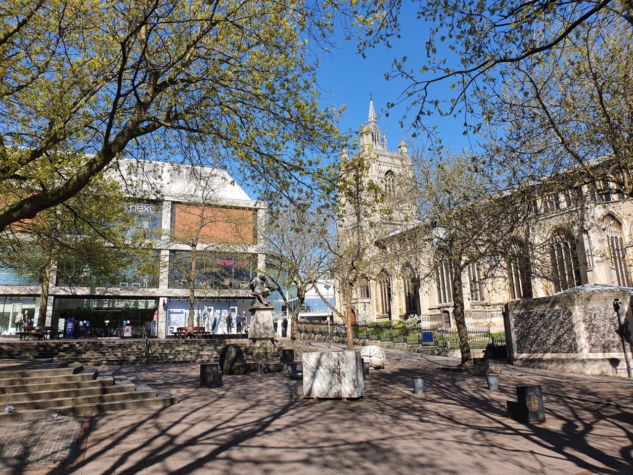
    The end of the street, which is all now pedestrianised, which joins Gentlemans’ Walk.

    Looking along the road to the Castle Quarter shopping centre. WH Smiths is on the left, this is the former Fruiterers Arms and is a real loss to the city centre as this would be a rather lovely setting for a pub. The building dates to the seventeenth century and was a pub from the mid-nineteenth century until 1989.

    Looking back towards to the market place area. The building to the left of Ladbrokes was Costa, but they closed in early 2020, so it’s up for rental, with this being the former Haymarket Stores pub. The Haymarket Stores, which was once known as the White Lion, closed in 1974.

    Back in 1912, the businesses along the street were:

    NORTH SIDE

    1 – Pearks, grocers

    1A – Albert Turner, confectioner

    3 – Cozen Randall, hairdresser

    5 – Sam Ellis, fruit merchant

    7 – W. Fletcher, butchers

    9 – Eastern Counties Rubber Company

    11 – London & Norwich Cycle & Rubber Company

    13 – Back’s, wine and spirits merchants

    15 – Back’s, tobacconists

    17 – Henry Moore William, wine and spirits store

    19-21 – Grix William, dining rooms

    SOUTH SIDE

    2-4 – Fruiterers Arms, pub

    6 – Edward Richard Pooley, shoe warehouse

    10 – White Lion, pub

    12 – E. Reeve & Son, grindery


    The 1939 register had the following residents living on the street:

    1A – Rosetta Clarke, Douglas Clarke, Frances Webster, Olive Johnson

    6 – Norah Sage

    10 – Edward Thaxton, Emmeline Thaxton, Leonard Thaxton

    13 – William G Gerry, Lily Gerry, William J Gerry

  • Streets of Norwich – King Street (191-197 King Street)

    Part of my Streets of Norwich project, although I’ve had to break King Street up since it’s so long….

    The site of what was once 193 to 197 King Street, sadly demolished in the mid-twentieth century. The building which stands is the former Ferry Boat Inn, at 191 King Street.

    There was once a yard at 193 King Street, known as Wickham’s Yard, which went down to the river, but this went when the properties at 193 to 197 were demolished. Five properties along this yard, which was pretty much all of it, came up for sale en masse in 1908 with the purchase including the yard itself and river access.

    There was an archaeological dig here a few years ago when a building project was planned, but there hasn’t been much progress recently. But the armchair remains….

    The Ferry Boat Inn, which closed in 2006 and unfortunately is unlikely to ever reopen now. This is particularly sad as it’s one of the few pubs which was left along the King Street from the many which once stood along here. The building has been used as a pub since at least the beginning of the nineteenth century, and was likely a private residence before then dating back to the seventeenth century.

    The pub was formerly known as the Steam Barge and the Steam Packet, taking its current name as this was the location for the boatmen who carried people and goods across the River Wensum. The pub is Grade II listed, so it should remain standing as a residential property even when the rest of the site is converted into housing. For a short while in 1987 the pub’s landlord was Steve Wright, later convicted as a serial killer who killed five women in Ipswich.