Tag: River Wensum

  • Finding the Source of the River Wensum Part 3

    Finding the Source of the River Wensum Part 3

    PART 3 OF FINDING THE SOURCE OF THE RIVER WENSUM


    When Nathan and I were training for the LDWA 100, we started on a series of expeditions to find the source of the River Wensum. I accept this isn’t as challenging as finding the source of the Nile or the Ganges, but there was limited ability to use public transport and venues open during the lockdown, so we had to be a little resourceful. Anyway, we got as far as Lyng, and I wanted to go further to complete what we started. Nathan has retired from walking now, so this time, I convinced friends Richard and Liam to come with me. It took us a while to organise, but with my complaining that I was tired after marshalling the LDWA Winter Poppyline on the Saturday (more on which later) we were ready to go.

    Standing in the same spot as my photo from the last section of the walk, we started at Lyng Mill. The fun fact for this mill is that there is some support for the theory that it was where blotting paper was first created, a mistake caused by messing up production of normal paper. Another great Norfolk achievement.

    I was still quite sleepy when I took this photo, but Richard noted that the village sign notes some other spellings of the village’s name. The village sign was placed here in 2010 and shows the church, the now disappeared medieval abbey, the mill, a blacksmith and Humphry Repton who designed the gardens at Lyng Rectory. Lyng might now feel like quite a sleepy village, but it was once an important settlement with its two religious buildings.

    An old heritage map of the village. Some far-sighted council likely put this up 20 years ago and it’ll probably stay here until it falls down. We walked through the courtyard of the Fox at Lyng to get through to the church, reminding ourselves that next time we do this then we’ll get a Sunday lunch at a pub en route.

    St. Margaret’s Church in Lyng, which deserves a longer visit, as this was a building with some considerable character.

    The west tower dates to the thirteenth century, as does the bulk of the nave. The font is also from this period, another remarkable survival.

    This is rather odd (the church I mean, not Richard standing in the foreground), as the chancel is off-centre compared to the rest of the building. It transpires that the chancel was rebuilt in the 1860s on the site of the original floorplan, which suggests to me one of two things. Either there was an north aisle which has been brought under one larger roof later on, or the church was widened in the late medieval period and they never got to widening the chancel as well. I suspect it’s the latter, there’s not much space on that north aisle.

    The Victorian plan for the new church.

    I think this was appropriate to the day’s quest, a map of the local area on the wall of the church, with the river’s route being clearly noticeable.

    This is a legacy of when some pews were available for free usage, as opposed to those who got a seat up-front but had to pay pew rental for that benefit.

    A blocked up door, which I initially couldn’t work out, but I think it was the former entrance to the two-storied fifteenth century porch.

    There are numerous more stories to tell about this church, I’ll return…..

    Given the walk, I felt the need to take a photo of this sign.

    Our rule was to try and catch sight of the Wensum whenever we could. Walking through Lyng, this isn’t it, these are the lakes formed from the former quarry that was located here. However, the Wensum winds it way behind here, so we went to investigate.

    We walked by the lakes, located on Quarry Lane, in the hope of seeing the river at the rear of the lakes. Liam took the lead here in case there were any dangerous animals in the undergrowth.

    To cut a long story short, it’s not really quite possible to see the river, but we could see the route that it was taking in the distance. So we walked back to the road, but pleased that we had investigated.

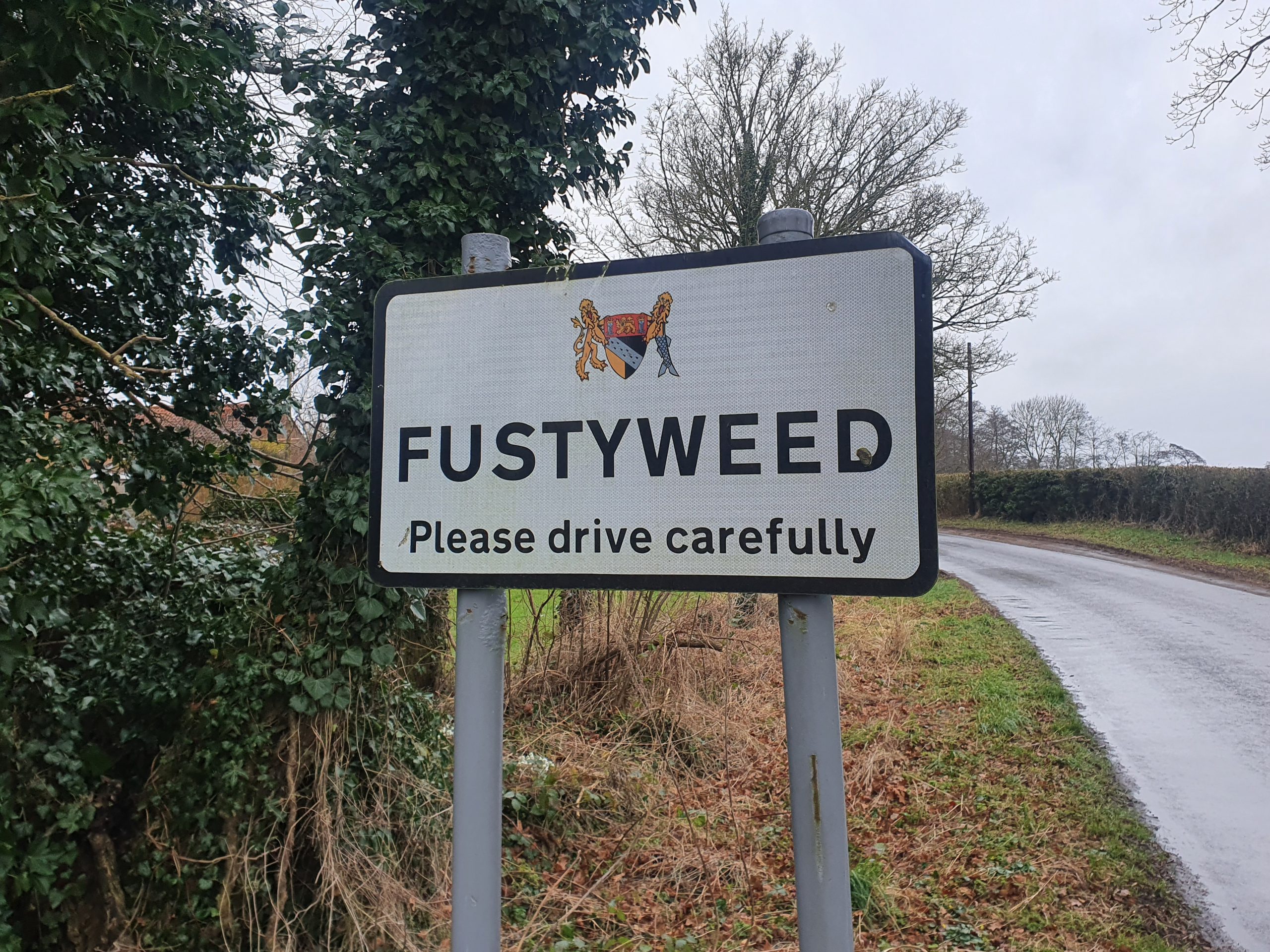
    Back on the main road we walked through the metropolis of Fustyweed, which seemed to consist of four houses, of which one was a treehouse. This small hamlet has name origins which are uncertain, although there’s a guess at trying to explain the situation at http://www.lyngonline.org.uk/whats-in-a-name.html.

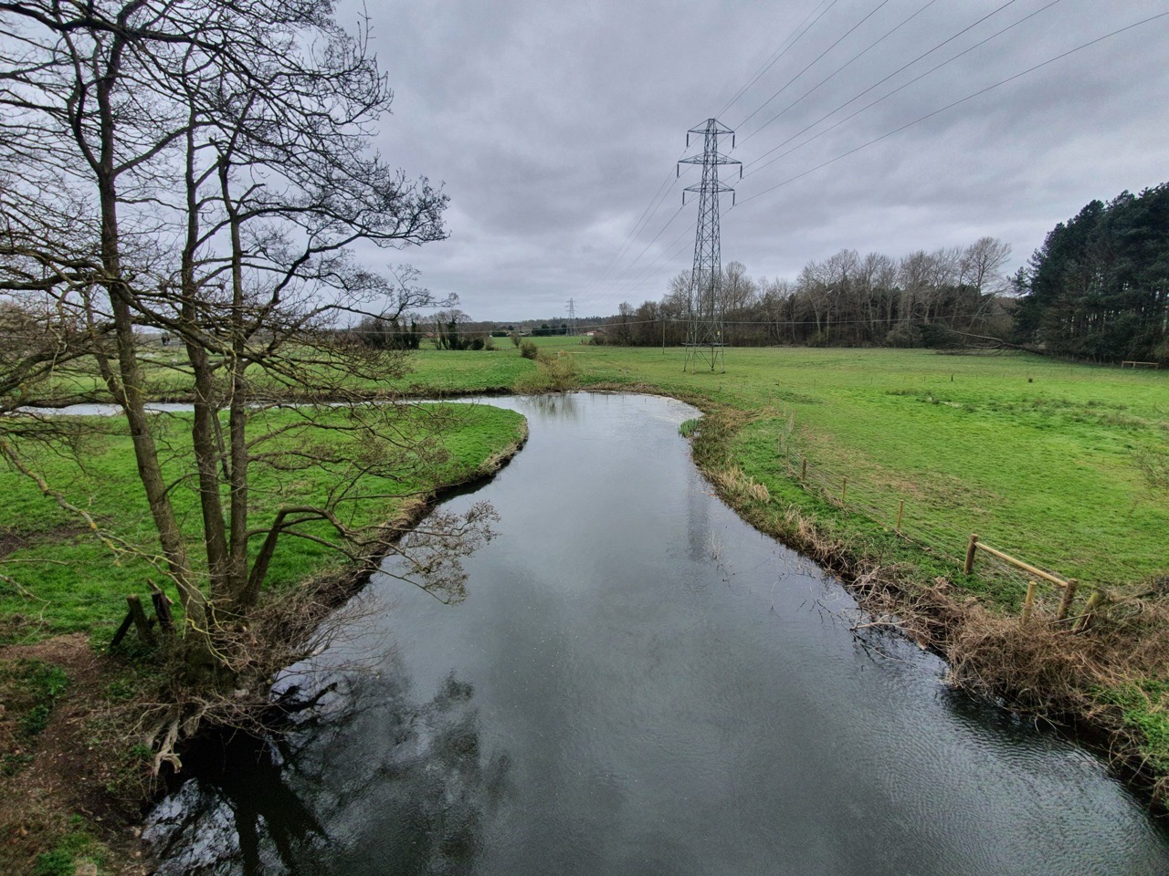
    This is the bridge on Elsing Lane, with Richard and Liam standing in front of the river as it heads towards Norwich.

    And there’s the landscape from the other side of the road, looking towards the source of the river.

    A photo from the same location, without the bridge’s ironwork in the way.

    The village’s mill is visible.

    As we walked northwards, a rather fancy wall appeared, which I imagine is the country estate wall of Bylaugh Park.

    One of the lodges at the entrance to the road leading to Bylaugh Park.

    This will definitely need further investigation, St. Mary’s Church at Bylaugh. This is kept permanently locked, but there’s keyholder information and we’re planning to get in touch to visit this church in the future. Richard, who is the most social, is going to get in touch with the church as there are some interesting things to see inside it seems.

    The tower is late Saxon or early Norman, the rest is a much later rebuild from when a grander building was needed for the hall. It’s positive that this church survives as there’s no real congregation here, the hall isn’t lived in and there are very few residential properties nearby.

    Richard and Liam standing in the graveyard, and this is really quite a pleasant place to be buried (as far as these things go….) with its view over the River Wensum.

    All very tranquil and there’s a newer section to this graveyard a little nearer to the road. The Wensum is quite wide at this point, it’s showing few signs of narrowing at the moment.

    The pleasant path from the church back to the road.

    The second lodge of the hall. The road here goes to the north of the Wensum and we could see the river’s route, but couldn’t get near to it. The hall is worthy of more investigation and I wonder whether it might be possible to visit, although it’s currently in use as a training centre. The hall had been completed in 1852 and was designed by the architects Charles Barry, Jr. and Robert Richardson Banks. It was one of the most substantial residential buildings in Norfolk and one of the first to be constructed with a steel girder frame. The building was damaged during the Second World War after it was used by the military, and there were attempts to turn it into a nursing home following the end of the conflict. The core of the building was flogged off in 1950 at an auction, including the roof and the interiors.

    I noted this destruction to Richard and Liam as I had found that information on-line. So imagine my surprise when three minutes later we walked near to the entrance to Bylaugh Hall and it looks very complete with not much evidence of destruction. It transpires that it was only around twenty years ago that it was decided to save the building, and a grand reconstruction has taken place at what was previously a wreck. There’s more about this work at https://thecountryseat.org.uk/2013/02/22/bylaugh-hall-the-hidden-history-to-a-remarkable-restoration-opportunity/.

    There is some evidence that President Eisenhower came to the building during the Second World War and apparently Winston Churchill visited on a few occasions. It’s hard to imagine that a former President of the United States has been driven down this quiet back road, but I rather hope that the story is true.

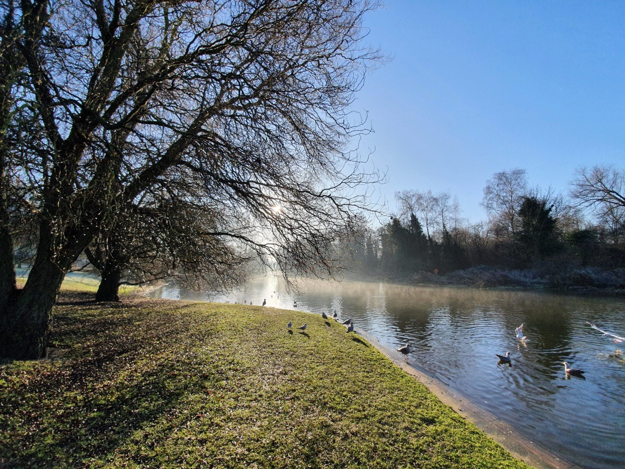
    The walk then goes to the Swanton Morley Waterfalls. You can see the look of excitement in the faces of Richard and Liam, I think they felt quite humbled to be near such an important site. This is very much Richard’s patch of Norfolk (I mean Dereham, rather than this particular stretch of mud), although he hadn’t been aware of this water feature despite driving by it on numerous occasions.

    I’m surprised that there isn’t a visitor centre by this major attraction, although I accept that it’s not quite Niagara Falls. This isn’t the River Wensum, it’s a channel that was created from it for the purposes of constructing a mill. I think that’s one thing that I’ve learned from this whole process, there were a lot of mills along stretches of the river, an essential early power source. We saw a few fishermen in the area, and although this isn’t a hobby that is in the slightest bit of interest to me, I can imagine it’s a quiet and peaceful location if they can ignore the sound of the thundering waterfall.

    The river reappears at Swanton Morley, including this rather lovely bridge, but more about that in the next post.

    And here are Richard and Liam on the bridge, celebrating the completion of our short walk.

    Despite Richard being told clearly not to look at the next part of the river walk, which we’ll tackle in a few weeks, he ignored that and excitedly ran towards it pointing. I disregarded his exuberance and obsession with questioning authority. I mentioned that Nathan would have been appalled at this continued breach of the rules that we had established, but Richard didn’t seem concerned at his lack of river walking etiquette. Anyway, I digress….

    And that’s that, not the longest of walks, just 7.3 kilometres, but it was really rather lovely to get nearer to the source of the River Wensum……. And just as we finished the walk, I had woken up after my lack of sleep from the previous evening, which perhaps wasn’t ideal timing.

  • LDWA 100 – Training Walk 14 (Finding the Source of the River Wensum Part 2)

    LDWA 100 – Training Walk 14 (Finding the Source of the River Wensum Part 2)

    This was our fourteenth walk in preparation for the 2021 LDWA 100.


    WALK NUMBER: 14 (Finding the Source of the River Wensum Part 2)

    DISTANCE COVERED: 15.5 miles

    NUMBER OF NATHAN’S FRIENDS WE “ACCIDENTALLY” BUMP INTO: 0

    SUFFICIENT BEER CONSUMED: No (all the pubs are shut)

    PUBS VISITED: 0 (not through choice)

    WEATHER CONDITIONS: Warm and overcast

    ATTACKED BY ANIMALS: No

    NUMBER OF SNAKES SEEN: 0


    One of the projects that we started in early January was an attempt to find the source of the River Wensum. We sort of know where the source is, but it’s more exciting to actually walk to it. Our first effort was just over 15 miles and this effort was nearly the same distance, so all credit to Nathan for planning this route. He made relatively few mistakes and I was very impressed. Public transport planning was less impressive on his behalf, but I don’t intend to much mention that as I’m not one for negativity.

    We started this little expedition at 08:30, getting the bus to Costessey to begin the adventure. I say adventure, but I’ve just watched a video on YouTube of someone (Anton) climbing Reactor 4 in Chernobyl and it’s not exactly the same level of challenge as that I admit….

    This was our end point on the last walk, the heart of Costessey, the jewel of the Norwich suburbs.

    The former Red Lion pub in Costessey.

    I thought that this was an interesting tree, but Nathan muttered something about how I was faffing about taking photographs early on during the walk. I ignored him and took photos anyway, as I have a blog to write whilst he sits at home drinking beer in the evenings.

    A frog crossing, or maybe a toad crossing, I’m not entirely sure how they differ.

    And it was nice to see the Wensum River again, since that was the point of this walk.

    This bridge is just outside Taverham and it also makes a little appearance in a walk that Liam and I did a few weeks ago.

    We didn’t go into Taverham itself, but backed up a little bit and we started to walk alongside the river at Ringland Lane.

    Some lovely swans opposite Beehive Lodge.

    The Swan at Ringland, a pub which has been trading since the 1930s. This would have been a lovely spot to have a little drink whilst planning the next part of the walk, but it’s not long until pubs re-open. We thought this numerous times during the day, but it really isn’t too long now.

    We walked down to the river here to Ringland River Green and that’s the bridge over the Wensum on Ringland Road.

    There were lots of rope swings. I didn’t go on them, they didn’t look very secure and I didn’t want any incidents as I didn’t feel that Nathan would have taken my plight with sufficient seriousness.

    What looks like some very new signage for the Walsingham Way, and I now feel the need to walk that at some point. It seems to be a work in progress and there’s further information at https://walsinghamway.blog/.

    A beautiful little lamb. It’s a meat I try to avoid now as I feel guilty having seen too many cute lambs in fields. It’s all a bit hypocritical really since chickens are cute and I eat them, but I suppose it’s important to take a stand on a few things at least.

    This beautiful landscape is what Norfolk County Council are considering putting a road through, the Western Link Road. It’s not for me to get political (well, no more than normal), but it strikes me as rather a shame if that happens. Public transport really isn’t ideal in this area, much more needs to be done to improve it.

    We had to cut across a field near to Wensum Valley golf club here and I was a little concerned that we’d plunge into the marsh. Fortunately, it was just about all dry enough to walk over, but I suspect it might be out of bounds during the winter months when it’s all quite moist.

    The bridges are in a good state of repair though and there are a few here, connecting Ringland onto the Norwich to Fakenham Road.

    No need replacing the old sign, shove another one on top.

    The River Wensum is back, with a friendly farmer at the end of the bridge putting up his cows in field sign. I’m pleased that we avoided those, as it’s fair to say that Nathan and I don’t find cows in fields to be in the slightest bit pleasant. They’re big lumpy things which always look like they’re going to charge at me (the cows I mean, not Nathan).

    Standing on the bridge looking at the River Wensum in the Norwich direction.

    I thought that this was a thoughtful little sign as I had wondering what all the firing noises were.

    A little valley, although all of this land is private (despite Komoot trying to route us through it).

    This is the bridge on the A1067, which bypasses Attlebridge.

    The old road bridge at Attlebridge, there are two separate bridges which are both now closed to vehicles.

    The second of the bridges, from which the village takes its name. There has likely been a bridge here since the medieval period, but a stone bridge was constructed in 1668. This bridge was in turn replaced in 1913, with the new one being quite mundane, but apparently some of the stone from the older bridge is still underneath. I have to confess that I didn’t have a little look.

    When I was here a few weeks ago I didn’t come down to look at the bridges, so I was pleased to see them this time. It must have been quite a challenge for vehicles before a bypass was constructed, there doesn’t seem to be much space here to pass.

    Interesting place for such a sticker, on the old Attlebridge bridge.

    This is St. Andrew’s Church in Attlebridge and the stone in the niche on the left-hand side of this photo contains stonework found by the old Attlebridge crossing. It’s thought that this stone was once the plaque that sat on the parapet of the bridge, which suggested it was a much grander affair than what is there now.

    Another photo of the church as we walked by.

    From Attlebridge we walked a bit of Marriott’s Way (again), the former railway line from Norwich. This route is easy walking and that’s why we’re taking this path in for our 100 efforts in a few weeks. On that point, we’re still a little nervous of how far we’ll get, but we’ve rather stopped thinking about it now as we don’t want to get pre-annoyed before we’ve even starting walking.

    There are some really interesting art installations along Marriott’s Way, along with what I consider to be a few rather less impressive efforts such as this. But, everyone has different views on art.

    The River Wensum looking towards Norwich.

    And, on the other side of the bridge, the River Wensum looking towards its source. I liked how this tree has managed to get its roots bending around the wall.

    What I considered to be an intriguing tree arrangement.

    Some old rail and sleepers, a reminder of what this path used to be.

    The remains of Lenwade railway station platform which closed to passengers in 1959, but remained open to freight until 1983. If it could have lasted a few more years, it’s possible that the line might have been saved and returned to passenger usage. That is now highly unlikely ever to happen, but at least remnants survive to help bring the past back to life.

    We left the Marriott’s Way to join the Wensum Way, a conveniently named path for our expedition today. The LDWA have more information about the Wensum Way for those who fancy walking it.

    The former entrance to Lenwade railway station, which is now a private residential property.

    Walking along the Wensum Way, the river reappeared to our right.

    The quite impressive Lenwade mill, a large structure dating from the late eighteenth century.

    The Bridge Inn which has been trading since the late eighteenth century, and we were slightly saddened that we couldn’t go in it. Only a few weeks left until they open though as I may have already mentioned. Credit to the owners over the years for keeping this going, it must have been challenging in recent years.

    I was surprised to see one pub still trading in Lenwade (or Great Witchingham, they seem to run into each other), let alone two, this is the former King’s Head, now known as the Queen of Hearts. It’s been open since the 1830s and I think it operates as more of a restaurant now. I wasn’t taken by the imagery they’ve got on the signs, might need to take a photo of a more decadent roast. On which point, Nathan spent most of the day telling me how he was making a roast tomorrow and how talented he was at making them (he didn’t say that last bit, but I could tell that he was thinking it).

    We were considerably disappointed to see that this was shut. We hadn’t expected it to be there, so we hadn’t exactly been looking forwards to it all day, but there was a moment of excitement as I quite fancied some chips and a battered sausage. It should be a criminal offence to operate a fish and chip shop and not open it every lunchtime.

    We turned down Common Lane to go and find our river.

    Some of the signage by the cricket ground has seemingly been deliberately broken down and the path system here is a bit muddled. Nathan navigated this with some ease, and I’m sure he’ll be grateful that I’m throwing more glowing praise in his direction.

    Nathan bravely and nervously led us through a courtyard packed with cows, and we were protected only by the big metal gates…….

    Some form of sculpture. Nathan reassured me that it wasn’t real, which I ignored as he seemed to think that he had found the village idiot when telling me that.

    There was a warning on the gate that the boardwalk here was a bit broken and that didn’t seem ideal, but we saw other people walking in the area. We did have to navigate over this bit of wood in the water, whilst pondering how some of our more clumsy friends would have fallen in. We missed them quite a lot at that point and would have very much liked them to have been there.

    More not ideal boardwalk….

    This bit was better.

    This path took us near to Sparhamhill and this all felt quite remote, as Marriott’s Way had been a little busier.

    This is a really lovely area, somewhere that I’ve never been before (or if I have, I’ve promptly forgotten it), Sparham Pools. There were a few people walking around this area and it’s all quite nicely laid out with signage. It’s a nature reserve operated by the Norfolk Wildlife Trust and it was once a gravel pit. The trust’s web-site says that it’s a great place to see grey wagtails, although I struggle to identify a pigeon from a dove so I doubt that I’d recognise one.

    This is where we ended our walk today, at Lyng, but I’ll start the story of that village at the beginning of the next walk.

    I was very lucky to have Nathan who is a bus expert, which meant that he was able to skillfully guide us towards a bus stop where we would have a minimal wait to get the Fakenham to Norwich bus back home. What a relief I thought to be able to be whisked back home with no more walking or waiting. To cut a long story short, we walked for another two miles and then sat at Lenwade bus shelter for over half an hour. I didn’t say anything, I thought that might be impolite given Nathan’s efforts and I didn’t want to cause a scene.

    All in all, a rather lovely little adventure. I did forget about the river a bit today, since we were often separated from it, but I might get an emotional attachment back again when we get nearer to its source.

  • LDWA 100 – Training Walk 8 (Finding the Source of the River Wensum Part 1)

    LDWA 100 – Training Walk 8 (Finding the Source of the River Wensum Part 1)

    This was our eighth walk in preparation for the 2021 LDWA 100.


    WALK NUMBER: 8 (Finding the Source of the River Wensum Part 1)

    DISTANCE COVERED: 15.1 miles

    NUMBER OF NATHAN’S FRIENDS WE “ACCIDENTALLY” BUMP INTO: 1 (they didn’t recognise Nathan)

    SUFFICIENT BEER CONSUMED: No (all the pubs are shut)

    PUBS VISITED: 0 (not through choice)

    WEATHER CONDITIONS: Sun

    ATTACKED BY ANIMALS: No

    NUMBER OF SNAKES SEEN: 0


    Finding the source of the River Wensum. It’s not exactly the exploration of the Amazon I will admit and I’m not sure that Michael Palin will be making a television series of this. But, travel is limited at the moment and so Nathan and I had this plan to walk to the source of the Wensum which is off somewhere near Fakenham.

    However, it became apparent that using public transport or getting a lift back from Fakenham isn’t really within the current rules on travel. So, we decided to split the walk up into different sections and today we followed the River Wensum from Norwich, where it ends when it meets the Yare, to a point a few miles away and then we planned just to walk back. I thought we saw more history and river than we had anticipated, so it was a useful exercise. It means that there will be a part two (and maybe part three) to this plan, but it won’t be until we’re allowed to use public transport again.

    This was the starting point of the walk, part of the city wall and it’s actually not far from the River Wensum. We didn’t follow the Wensum for the first part of this walk, instead joining it further along as we wanted to avoid the city centre at the moment.

    These photos are all from the river section at Wensum Park, which looks rather beautiful in the morning. Best known now as where Nathan dumps his unwanted bread into the river, this stretch of land was purchased by the city council in 1907. This was rather forward thinking of them, a useful amenity for the people of Norwich and they built a swimming pool, paddling pool and wading pools for the locals to use. The locals responded to this by using the swimming pool as a refuse tip, so a new plan was put forwards by the council to use the area as a public park. Designed by Captain Sandys-Winsch and constructed with unemployed labour, the park was opened in 1925 and it remains in use for that purpose today.

    Just a little further along the river, this looks quite remote, but it’s actually next to the Recycling Centre at Mile Cross.

    We did plan, many years ago, to come to the Gatehouse Pub at some point, partly as it’s on the CAMRA Regionally Important Historic Interiors list. Now that we finally get here the damn thing is of course shut, but we’ll go back when pubs re-open. The pub has a large beer garden which stretches down to the Wensum and it’s built on the site of a former toll-house.

    A stretch of the Wensum just off Hellesdon Road. It was around here that I started to try and break the iced up sections at the side of the river like some kid…. I got bored of that quite quickly when I realised that I might fall into the mud.

    I read the other day in the newspaper that there are parakeets flying about all over England, which is giving some concern as they’re not a native species. And there were several in the trees here, I think they’re rather interesting birds which add some character, but maybe their invasive behaviours upset seagulls or something. Nathan used his wooing skills, which seemed to be similar to the random noises he makes to his cat, to charm the parakeets down. It didn’t work. I pretended that I thought Nathan was like Bill Oddie and it was very surprising to me the birds didn’t flock down.

    A little collection of cut down trees.

    This is the river at the junction with Hellesdon Road, near to where Marriott’s Way is. We didn’t walk on Marriott’s Way (the former railway line that got shut down in the 1960s) on the way out, instead remaining on the other side of the river bank.

    This was rather lovely for Nathan, back to where he got married last year.

    The medieval standing cross in the churchyard. The lower section is thought to have been in situ for over 700 years.

    The village sign.

    It’s now been converted into residential properties, but this was Hellesdon Mill, a formidable building.

    We did have a plan to investigate this area as it’s by the river, but it’s owned by the Environment Agency and they’ve kept their bridge firmly locked to discourage anyone from crossing it. We didn’t try.

    These photos are of Drayton Green Lanes, an area of walking that we hadn’t noticed on the map, but which let us get close to the river. It’s really nicely looked after and some volunteers from Norwich Fringe Countryside Management Project recently fixed some damaged boardwalk under the supervision of Drayton Parish Council. This bit of land, which it appears no-one ever claimed ownership of, was a quite welcome surprise.

    The walk into Drayton along Low Road, which meant that we could see the river on our left. I must admit to getting quite into this whole project by this point as although I live near to the River Wensum, it suddenly seemed to be quite magical as we walked along it towards its source. To be honest, I think I need to get out more……

    I had hoped that E Pratt and Co were doing some delicious sausage rolls as their reviews looked rather positive. They’re a local butcher, but the situation was confused (well, I was confused, which doesn’t take much) and I came to the conclusion they weren’t selling hot food as despite a carvery sign the menu boards were all for raw meat. Delicious as that probably was, I thought better of it. Marginally disappointing, I was hoping it’d be as good as Greggs.

    I did try and find some food in the Applegreen petrol station instead, but it appeared to me from the pricing that Harrods had done a take-over of the premises. There was a Tesco next door, but I didn’t want to go shopping for the sake of it at the moment when all I had wanted was chips or a sausage roll. So, I bravely left Drayton with no food.

    This is the stretch of the Wensum between Drayton and Costessey Mill. The river has been diverted, likely a very long time ago, so there are two stretches here, one which is likely the original course of the Wensum and another which is what powers the mill.

    The mill here has gone, destroyed in a fire in the 1920s.

    Nathan navigating a minor tributary of the Wensum.

    This is St. Edmund’s Church in Costessey, which I visited briefly on Steve’s walk last year. The building’s history puzzled me, I’ll have to read up about it as there seem to be numerous additions from different periods. In short, there has likely been a church here since Saxon times, but the current one is mostly from the thirteenth century, albeit with a Victorian restoration.

    I hadn’t noticed this before, in memory of 10 members of 564 Bomb Squadron who crashed in Carr’s Hill Wood in Costessey on 7 March 1945. There was a campaign for the footpath to this site to be kept open, as it was on permissive land and the owner wanted it closed off. I don’t know what came of that, as the permissive path ceased in 2017, but I’ll find out.

    An unusual positioning of some of the older graves.

    Nathan was fascinated with the grave of Wandering Wal, and it sounds like this man had an eventful and interesting life.

    I assumed when walking by this building that it was a Victorian school, but it’s actually a hall which I think is linked to the Our Lady and St Walstan Roman Catholic Church which is located opposite.

    Although we had to walk back to Norwich at this point, nothing of huge interest happened although we discovered just how many people are walking along Marriott’s Way. And, the point of this walk was to follow the route of the River Wensum, so in a future blog post, we will continue our trail from where we finished and pick up the story again as we head off from the Taverham area. For anyone who looks on a map, they might notice that we didn’t get very far along the River Wensum, but there’s no need to rush adventure….

    As for our training for the LDWA 100….. This seems to be creeping up on us if I’m being honest and I’m not entirely sure that we’re filled with optimism. We’re confident of completing 60 miles, but more than that will be down to the Gods. Well, I say Gods, but I more mean our feet. Anyway, we’ll see what happens, but we’ve been very brave so far. There were no injuries today, other than Nathan’s slightly dodgy knee, and at least that bodes well (the no injuries part that is)