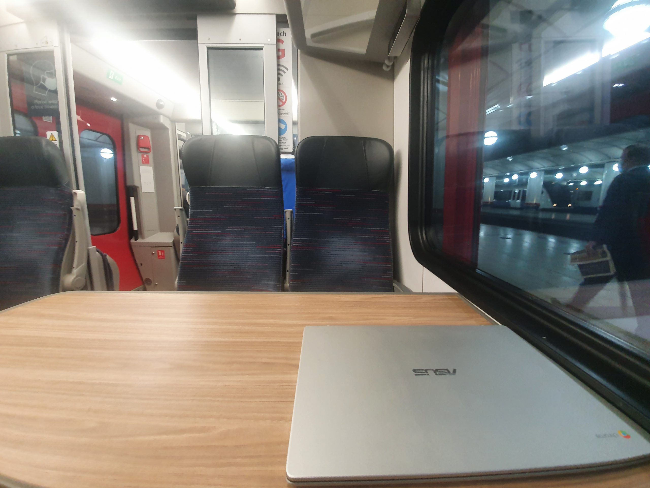
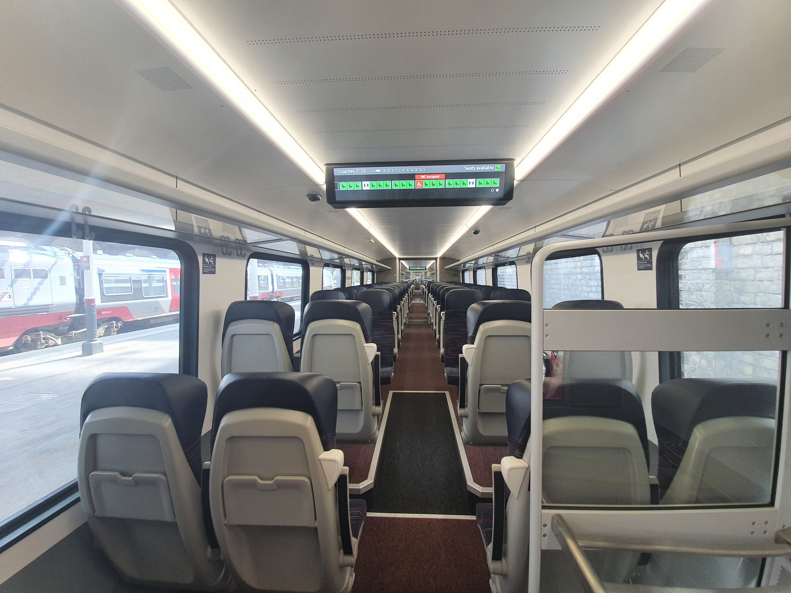
Tag: Norwich

  • Norwich – Missing City Sign

    Norwich – Missing City Sign

    This isn’t entirely ideal, the sign welcoming people to Norwich has disappeared, perhaps due to theft or more hopefully down to cleaning or similar. And I never cease to be amazed, well more moderately surprised, at the sheer range of articles on Wikipedia as they even have a Street Sign Theft page.

  • Norwich – Rosary Cemetery (Edwin Vickers and George Vickers)

    Norwich – Rosary Cemetery (Edwin Vickers and George Vickers)

    This gravestone at Rosary Cemetery in Norwich suggested initially that there might be something of a story, with two deaths at relatively young ages both in the same year. I’m not entirely sure I’ve found much of a story here, notably because I haven’t found out why these brothers died in their 30s.

    Edwin was born in Penkridge, Staffordshire in 1838, the son of William Vickers and Harriet Vickers. George was born in Hyde, Cheshire in 1842, also the son of William and Harriet. Edwin and George also had James and William as brothers and Martha and Emma as sisters.

    At the 1851 census, the family had moved to Norwich and were living at 24 Railway Cottages on Carrow Road in Thorpe. William was working as a journey blacksmith, with in this instance that word journey deriving from the French ‘journee’ meaning day as this was how frequently they’d be paid. It evolved from when there were masters and apprentices, with journeyman being in the middle of that scale. The family had only just moved to Norwich as William, the youngest in the family, had been born in Shropshire.

    George married Mary Anne Meek in early 1869 and it appears that their daughter Jane was born on 19 March 1869 (perhaps not an ideal situation in Victorian times). She went to St Peter Parmentergate National School and the family were living at Rising Sun Lane. Jane later went to Thorpe Hamlet Girls’ School and she left in 1881.

    At the 1871 census, George was living at the Thorolds Buildings in St Peter Parmentergate, along with his wife Mary Anne and their daughter Jane, aged 2. At the same census, Edwin was living at Castle Meadow, also in St Peter Parmentergate, along with a Maria Goatley.

    We know a little about Edwin Vickers due to an argument that took place in 1874 which led to Robert Baxter, the landlord of the Nag’s Head pub smashing Edwin’s windows. The argument was concerning who could use an out-building at the rear of their properties, although the matter was later resolved by the mutual landlord. It though tells us (I say us, but mean me….) that Edwin was a carpenter, but this is unfortunately the only information that I can find in the media of the time about either him or his brother.

    Edwin Vickers died on 22 January 1876 at the age of 37 and George Vickers died on 19 November 1876 at the age of 34. George was buried in the same grave as Edwin and I think that George’s wife remarried, hence why she isn’t listed on the grave. Why they died so young is another mystery that I can’t resolve, but maybe someone knows….

  • Norwich – It’s Snowing….

    Norwich – It’s Snowing….

    I can’t recall the last time that I was in Norwich when it was snowing, but overnight there was a reasonable covering over the city. This morning it continued to snow and so it looks like it might be here for a little while yet. This post is mostly photos, a couple of Norwich Cathedral and the rest from Mousehold Heath which felt positively Austrian in the snow….. There were already a few people tobogganing at Mousehold and I imagine there will be many more children there this afternoon.

  • Norwich – The 1834 Case of Whether Freemen Should Pay for Stalls at Norwich Market

    Norwich – The 1834 Case of Whether Freemen Should Pay for Stalls at Norwich Market

    Whilst looking for information about a different John Burrows buried at Rosary Cemetery, I found a story in the Norwich Mercury from August 1834 about how a butcher named John Burrows refused to pay for his stall at Norwich Market. He claimed that as a freeman of the city that he shouldn’t have to pay the sums which the City Corporation said were owed by him.

    A special jury had been called to hear the case and there was a busy courtroom of Norwich freemen and other market traders who wanted to see how this would all turn out. If I’m being honest, this is the sort of excitement that would have made me turn up in court, a fascinating bit of drama being played out. I can imagine it was portrayed by some as an honest and hard working local man against the might of the greedy City Corporation.

    The City Corporation explained that they wanted their 16s 1d from John Burrows, as he had been trading at the market as a butcher at a stall whilst knowing the costs involved. They claimed that there was no right of exemption and if there ever had been, then it was no longer in force. The Corporation wanted this settled as otherwise there would be other people not paying their bills and the market administration would soon descend into some sort of farce.

    Richard Harman was called as a witness and he had been the clerk of the market for 38 years, which to be fair did make him something of an expert about the local arrangements. Burrows was not content at this and his defense team made a call for Harman’s evidence to be rejected as he was an interested witness as a collector of fees at the market, so he couldn’t be independent. The court said that it would note this, but that Harman was still entitled to speak to the court to explain the situation. I can understand why, it’d be hard to find anyone of Harman’s experience to try and give insight to this situation.

    Harman explained that there were something like 300 or 400 notices at the market explaining the rates that were charged. This sounds like the bureaucracy that I can imagine from a city council, so is no doubt true. He added that he also understood that Norwich Market was corporate property and that the Norwich Corporation could build on it and charge accordingly if they so wished.

    The defense team wanted to know where the charter was that gave the City Corporation the right to charge monies and they raised the point that without such evidence that the Corporation could lay any charge they wanted on their client. I can honestly almost feel the murmurings of support in the court for that line of argument. They said that custom meant that if a practice had gone on for 60 years, it might be seen as acceptable. But the market’s Richard Harman had worked there for 38 years, so there were still 22 years that weren’t explained before that.

    The historical argument continued; the defense said that the only way that the City Corporation could have any right to the market was by the Charter of King Henry II, or “one of the Henrys” (that argument seems slightly vague, but there we go), and in that the waste grounds were given to the City Corporation. If that was the case, then the city freemen, who were a part of the corporate body, would have free access to it.

    The chairman of this committee, who I can imagine was entirely confused by what had turned into an historical debate, said that it was foreign to his duty to enter into discussions about charters and corporations. I think that’s legal speak for he didn’t have a clue what was going on and probably wanted to go home. He asked the jury to give a decision based on what they’d heard, thereby resolving this predicament.

    It took the jury 15 minutes to decide what to do. John Burrows was ordered to pay the City Corporation all the monies which he owed. I have to say, this is a little bit of an anti-climax to what could have caused the city no end of difficulties to try and resolve. But, Burrows was not giving up and he announced that he still wasn’t paying it.

    Now, the City Corporation had a choice here of how it wanted to act. Did it want to be graceful and try and find a workable option on how to progress, especially given some officials wanted a resolution? No, it issued a debtors order against Burrows and he was sent to Fleet Prison in London. I’m not sure that much has changed here with the arrangements that councils go through, but there we go….

    A group of Norwich freemen were not content about this and in September, they met at a pub in St. George’s Street in Norwich to discuss what to do. It was agreed that funds would be raised to clear the debts of Burrows and also for clarification of the laws and rules that the City Corporation were following.

    In November 1834, the court said that a petition would be heard the following week at the Court House on Portugal Street, Lincoln’s Inn Fields, which effectively meant that he would be discharged from his debts and released from prison. The subscriptions had been successful and Burrows was free once again, although he had had to endure a couple of months in prison. There’s something of the recent shopkeepers claiming rights dating back to the Magna Carta (a case without merit, but that’s for others to explain) going to court, with the outcome perhaps inevitably the same. But, at least it was some drama for the people of Norwich….

  • Norwich – Rosary Cemetery (Samuel Brock)

    Norwich – Rosary Cemetery (Samuel Brock)

    This is the grave of Samuel Brock which is located in Rosary Cemetery in Norwich.

    Samuel was born in 1810 and he married Ann Steward at St. John the Baptist Church in Old Lakenham (a church I visited a couple of weeks ago) on 27 October 1834.

    At the 1841 census, Samuel and Ann were living on Middle Street in the St. Augustine parish of Norwich. They lived with their sons Samuel, aged 4, and William, a new-born. Samuel appeared on the electoral registers at this time, because he operated a shop on Middle Street. This street name changed to become the northern end of St. George’s Street where it met Botolph Street, and this area has now been partly demolished.

    At the 1851 census, the couple were living on Botolph Street along with their son Henry, aged 16, and a servant Mary A Wells, who was aged 17. Samuel was working as a baker, by this time having a shop on Botolph Street, and Henry was still studying. This didn’t help the family in terms of their finances, as the local press reported in 1857 that Samuel had gone insolvent. And for this ‘crime’, Samuel was sent to Norwich prison, although I can’t find out for how long. However, there’s no record of any of Samuel’s family in the 1861 census.

    At the 1871 census, the couple were living at Howletts Yard, located off Botolph Street. This yard had fifteen houses and was demolished as part of the city’s slum clearance in 1935. Botolph Street used to link Augustine Street to Magdalen Street, a part of Norwich wrecked by the Anglia Square development.

    Howletts Yard isn’t marked on this map from the 1920s, but it’s the one above Cat & Fiddle Yard. The house that Samuel Brock and his wife lived in is where Iceland now stands on Anglia Square.

    Samuel died on 15 August 1874 at the age of 64 and his son, Samuel jr, took over the bakery. A notice in the Norfolk News said “Samuel died after a long affliction, borne with Christian fortitude”.

    At the time of the 1881 census, Ann lived with her son Samuel jr on Botolph Street, along with Anna, his wife, and their children Harry and Anna (there are a lot of Ann or Anne Brocks in this story). Ann Brock died on 11 March 1883 at the age of 72.

    There isn’t perhaps much of a story to tell about Samuel Brock beyond where he was living and what he did. But, it’s a slice (excuse the pun) of a baker’s life in the north of the city centre, in an area which has now nearly entirely been demolished. What I have found out about Samuel is that his finances sound challenging and his health seems to have been poor, this could not have been an easy life.

  • Norwich – Rosary Cemetery (Alexander Thomas Lewthwaite)

    Norwich – Rosary Cemetery (Alexander Thomas Lewthwaite)

    This caught my eye yesterday at Rosary Cemetery and I’m not sure how I haven’t seen it before, the war grave of Corporal Alexander Thomas Lewthwaite.

    There aren’t that many war graves at the Rosary Cemetery, they’re mostly at Earlham Cemetery which has two areas to commemorate the war dead. There are though 31 war dead at the Rosary Cemetery, with 19 having lost their lives in the First World War and their details are above.

    Alexander was born in Manor Park, West Ham in London (although then technically in Essex) in 1896, the son of Robert Kendrew Lewthwaite and Leonora Lewthwaite. By 1901, his family had moved to Croydon Road, Caterham, Godstone which was in Surrey. Alexander was by then five and he lived with his parents, then both aged 40, along with Robert P (aged 9), Leonora Hilda (aged 8) and Evelyn May (aged 6).

    The family had moved again by the 1911 census and it’s clear that there was a difference of opinion somewhere along the line between Robert and Leonora, primarily since they had “judicially separated” according to the census. This is a legal term which can still be used today, to signify that the couple are no longer living together, but they do remain married. This wasn’t entirely uncommon at the time, but I suspect that Leonora would have faced some social disapproval when people discovered her arrangements.

    Whatever the reason was that Leonora had to move, she was living in Claxton in 1911, along with Leonora Hilda (aged 18), Evelyn Mary (aged 16), Alexander (aged 15), Kathleen Errol (aged 9) and servants. The family moved again over the next few years, this time to 2 Lakenham Terrace in Norwich.

    Alexander enlisted into the military (service number 22755) on 4 December 1915, by which time he was 19, standing 5’10” tall and weighing 9 stone. He remained at his home base until 5 December 1915, before returning to Norwich on 22 January 1916, so it doesn’t seem he saw any front line military action. He went to Colchester between 23 January and 16 March 1916, then remained training in Essex.

    It was at that training at Ray Farm Encampment (which was near to Parkeston in Essex, next to Harwich) that something dreadful happened. During some firearms training, Alexander was shot by Alfred Ernest Turner and he died nearly immediately from brain injuries caused from that rifle bullet. This was a mystery then and actually still is today, they weren’t using live ammunition and so the death just shouldn’t have happened.

    The police came to investigate and an inquest was held the next day which heard from some of the men at the site. There was a decision that this was “an accidental death causing injury to the brain”. Alexander was aged just 20.

    This is the letter sent on the day of the death in an attempt to establish the circumstances of what happened. As an aside here, these are part of the burnt documents which were damaged following an air raid in September 1940. The bomb destroyed two thirds of the military records which were stored at Arnside Street in London, about 4 million pages were lost. These ones were salvaged from the fire, but unfortunately were badly damaged.

    Sergeant Walter Crane, who was in charge of the recruits, explained what had happened.

    William Murrell Claxton came to investigate the matter from a police perspective.

    The explanation of the matter to the inquest from Charles Kenneth Hatherall Wyche.

    And, the testimony from the man who fired the gun which had fatal consequences, Alfred Ernest Turner.

    As for what actually happened, it’s clear no-one really knows. Alfred was clearly questioned about whether he had deliberately killed Alexander, which remains a possibility although there’s no obvious motive.

    I don’t understand what happened with Alexander’s grave at the Rosary Cemetery, as it seems that his gravestone was added following his death and there’s no reason why his body wouldn’t have been buried. There was though a new gravestone made in 1996, perhaps just because the old one was damaged. I’m unsure of why his grave is where it is in the Rosary Cemetery, it’s in an unusual place next to an older tomb and that doesn’t seem to have a familial link.

    What isn’t recorded is what Alexander’s parents thought of what had happened. It might be enormously difficult to lose a son during the First World War, but the pain of this must have been compounded by the circumstances of how he lost his life. It’s unclear to me whether anything sinister took place or it was just incompetence, but, either way, this was perhaps a life needlessly lost.

  • Norwich – City Wall and Tower at Bull Close and Silver Road

    Norwich – City Wall and Tower at Bull Close and Silver Road

    Although Norwich doesn’t have anywhere near as much defensive wall left compared to cities such as York and Chester, there are still surviving stretches. There are also very few sections of wall in Norwich which can be walked on today, with this stretch having none of the original walkway left.

    The stretches of wall that do survive have often only done so because later properties were built onto them. As an aside, I quite like the thought of the school playground backing onto the city wall, I wonder if the children had an understanding of how important the structure once was. If they did, I suspect they’d be rather disappointed that they couldn’t walk along it whilst pretending to be medieval soldiers defending Norwich from barbarians.

    In the above map from the 1880s, there was once a school, memorial hall and some residential properties along here, on what is now a car park. The wall that they back onto is much repaired and likely formed part of the rear of the later structures. The area here is a little barren now, but it would have been bustling and it was located opposite the Pockthorpe Brewery which would have added extra atmosphere and brewing smells. At least though the area around this tower has been smartened up over the last fifty years, this photo from George Plunkett is from 1970.

    The tower dates to the 1320s and the interior likely collapsed some centuries ago. It’s not entirely clear whether the building was repurposed for anything in the seventeenth and eighteenth centuries, but I’d suspect that some enterprising soul did something with it. Perhaps in some cases the tower would have been reused for building material, but there’s no fine stonework here for local builders over the centuries to pinch in the way that many religious structures had following the Dissolution of the Monasteries, it’s just a lot of flints and rubble.

    What’s left inside of the tower, which had two storeys, with the lower floor being vaulted. There’s a growing amount of foliage on the structure as well which will probably need attention in the years to come.

    The course of the wall is marked out where it leads from the tower towards the River Wensum. It would have also met the Pockthorpe Gate (or Barregates) at this point. As an aside, the land is higher today than when the walls and tower were built, which gives a distorted view now of how tall they were.

    Pockthorpe Gate was taken down at the end of the eighteenth century, a period when much of the wall was lost.

    So, it’s unfortunate that much of the city wall has been lost, but at least stretches do survive thanks to their being repurposed and partly incorporated into newer buildings. It means that the wall is much repaired in places, including some patches which look distinctly Victorian, but that does just all add to the history of this structure and its part in Norwich’s story.

  • Norwich – Earlham Cemetery (Alan George Gibling – Update)

    Norwich – Earlham Cemetery (Alan George Gibling – Update)

    I wrote a few weeks ago about Alan George Gibling and how his name was wrong on the CWGC web-site. I’m pleased that following the documents that I sent them that Alan’s details have been corrected on all of their systems and his information is now correct. It’s probably not really important in the scale of world problems, but I like that a long-standing error has now been put right.

  • Streets of Norwich – York Alley

    Streets of Norwich – York Alley

    Part of my Streets of Norwich project….

    As can be seen from the graffiti over the signage, this isn’t the most salubrious street in Norwich. It connects White Lion Street with Red Lion Street and as the sign says, it used to be known as Castledyck Lane as is led to the castle ditches (now Castle Meadow).

    The street isn’t marked on this 1870s map, but it’s the narrow street next to York Tavern, from which the street takes its name. The street layout here has changed, the building below York Tavern on the map has been demolished to allow trams to get through to Castle Meadow. The York Tavern opened in the late eighteenth century and continued trading until 1964, with the building still standing and now used for retail.

    The tram line cut through the middle is visible in this later map from the 1920s.

    This information board really isn’t the most usefully placed.

    Using my camera to zoom in, it’s a reminder that on 17 June 1902 there was a meeting at the Criterion Cafe, where Norwich City Football Club were established.

  • LDWA 100 – Training Walk 8 (Finding the Source of the River Wensum Part 1)

    LDWA 100 – Training Walk 8 (Finding the Source of the River Wensum Part 1)

    This was our eighth walk in preparation for the 2021 LDWA 100.


    WALK NUMBER: 8 (Finding the Source of the River Wensum Part 1)

    DISTANCE COVERED: 15.1 miles

    NUMBER OF NATHAN’S FRIENDS WE “ACCIDENTALLY” BUMP INTO: 1 (they didn’t recognise Nathan)

    SUFFICIENT BEER CONSUMED: No (all the pubs are shut)

    PUBS VISITED: 0 (not through choice)

    WEATHER CONDITIONS: Sun

    ATTACKED BY ANIMALS: No

    NUMBER OF SNAKES SEEN: 0


    Finding the source of the River Wensum. It’s not exactly the exploration of the Amazon I will admit and I’m not sure that Michael Palin will be making a television series of this. But, travel is limited at the moment and so Nathan and I had this plan to walk to the source of the Wensum which is off somewhere near Fakenham.

    However, it became apparent that using public transport or getting a lift back from Fakenham isn’t really within the current rules on travel. So, we decided to split the walk up into different sections and today we followed the River Wensum from Norwich, where it ends when it meets the Yare, to a point a few miles away and then we planned just to walk back. I thought we saw more history and river than we had anticipated, so it was a useful exercise. It means that there will be a part two (and maybe part three) to this plan, but it won’t be until we’re allowed to use public transport again.

    This was the starting point of the walk, part of the city wall and it’s actually not far from the River Wensum. We didn’t follow the Wensum for the first part of this walk, instead joining it further along as we wanted to avoid the city centre at the moment.

    These photos are all from the river section at Wensum Park, which looks rather beautiful in the morning. Best known now as where Nathan dumps his unwanted bread into the river, this stretch of land was purchased by the city council in 1907. This was rather forward thinking of them, a useful amenity for the people of Norwich and they built a swimming pool, paddling pool and wading pools for the locals to use. The locals responded to this by using the swimming pool as a refuse tip, so a new plan was put forwards by the council to use the area as a public park. Designed by Captain Sandys-Winsch and constructed with unemployed labour, the park was opened in 1925 and it remains in use for that purpose today.

    Just a little further along the river, this looks quite remote, but it’s actually next to the Recycling Centre at Mile Cross.

    We did plan, many years ago, to come to the Gatehouse Pub at some point, partly as it’s on the CAMRA Regionally Important Historic Interiors list. Now that we finally get here the damn thing is of course shut, but we’ll go back when pubs re-open. The pub has a large beer garden which stretches down to the Wensum and it’s built on the site of a former toll-house.

    A stretch of the Wensum just off Hellesdon Road. It was around here that I started to try and break the iced up sections at the side of the river like some kid…. I got bored of that quite quickly when I realised that I might fall into the mud.

    I read the other day in the newspaper that there are parakeets flying about all over England, which is giving some concern as they’re not a native species. And there were several in the trees here, I think they’re rather interesting birds which add some character, but maybe their invasive behaviours upset seagulls or something. Nathan used his wooing skills, which seemed to be similar to the random noises he makes to his cat, to charm the parakeets down. It didn’t work. I pretended that I thought Nathan was like Bill Oddie and it was very surprising to me the birds didn’t flock down.

    A little collection of cut down trees.

    This is the river at the junction with Hellesdon Road, near to where Marriott’s Way is. We didn’t walk on Marriott’s Way (the former railway line that got shut down in the 1960s) on the way out, instead remaining on the other side of the river bank.

    This was rather lovely for Nathan, back to where he got married last year.

    The medieval standing cross in the churchyard. The lower section is thought to have been in situ for over 700 years.

    The village sign.

    It’s now been converted into residential properties, but this was Hellesdon Mill, a formidable building.

    We did have a plan to investigate this area as it’s by the river, but it’s owned by the Environment Agency and they’ve kept their bridge firmly locked to discourage anyone from crossing it. We didn’t try.

    These photos are of Drayton Green Lanes, an area of walking that we hadn’t noticed on the map, but which let us get close to the river. It’s really nicely looked after and some volunteers from Norwich Fringe Countryside Management Project recently fixed some damaged boardwalk under the supervision of Drayton Parish Council. This bit of land, which it appears no-one ever claimed ownership of, was a quite welcome surprise.

    The walk into Drayton along Low Road, which meant that we could see the river on our left. I must admit to getting quite into this whole project by this point as although I live near to the River Wensum, it suddenly seemed to be quite magical as we walked along it towards its source. To be honest, I think I need to get out more……

    I had hoped that E Pratt and Co were doing some delicious sausage rolls as their reviews looked rather positive. They’re a local butcher, but the situation was confused (well, I was confused, which doesn’t take much) and I came to the conclusion they weren’t selling hot food as despite a carvery sign the menu boards were all for raw meat. Delicious as that probably was, I thought better of it. Marginally disappointing, I was hoping it’d be as good as Greggs.

    I did try and find some food in the Applegreen petrol station instead, but it appeared to me from the pricing that Harrods had done a take-over of the premises. There was a Tesco next door, but I didn’t want to go shopping for the sake of it at the moment when all I had wanted was chips or a sausage roll. So, I bravely left Drayton with no food.

    This is the stretch of the Wensum between Drayton and Costessey Mill. The river has been diverted, likely a very long time ago, so there are two stretches here, one which is likely the original course of the Wensum and another which is what powers the mill.

    The mill here has gone, destroyed in a fire in the 1920s.

    Nathan navigating a minor tributary of the Wensum.

    This is St. Edmund’s Church in Costessey, which I visited briefly on Steve’s walk last year. The building’s history puzzled me, I’ll have to read up about it as there seem to be numerous additions from different periods. In short, there has likely been a church here since Saxon times, but the current one is mostly from the thirteenth century, albeit with a Victorian restoration.

    I hadn’t noticed this before, in memory of 10 members of 564 Bomb Squadron who crashed in Carr’s Hill Wood in Costessey on 7 March 1945. There was a campaign for the footpath to this site to be kept open, as it was on permissive land and the owner wanted it closed off. I don’t know what came of that, as the permissive path ceased in 2017, but I’ll find out.

    An unusual positioning of some of the older graves.

    Nathan was fascinated with the grave of Wandering Wal, and it sounds like this man had an eventful and interesting life.

    I assumed when walking by this building that it was a Victorian school, but it’s actually a hall which I think is linked to the Our Lady and St Walstan Roman Catholic Church which is located opposite.

    Although we had to walk back to Norwich at this point, nothing of huge interest happened although we discovered just how many people are walking along Marriott’s Way. And, the point of this walk was to follow the route of the River Wensum, so in a future blog post, we will continue our trail from where we finished and pick up the story again as we head off from the Taverham area. For anyone who looks on a map, they might notice that we didn’t get very far along the River Wensum, but there’s no need to rush adventure….

    As for our training for the LDWA 100….. This seems to be creeping up on us if I’m being honest and I’m not entirely sure that we’re filled with optimism. We’re confident of completing 60 miles, but more than that will be down to the Gods. Well, I say Gods, but I more mean our feet. Anyway, we’ll see what happens, but we’ve been very brave so far. There were no injuries today, other than Nathan’s slightly dodgy knee, and at least that bodes well (the no injuries part that is)