Tag: Hoveton

  • GeoGuessr (Hoveton and Wroxham Version)

    GeoGuessr (Hoveton and Wroxham Version)

    I already have a better explanation (well, longer explanation anyway) for this plan. In essence, whilst lockdown is on, I need to find ways of walking nearby to Norwich in quiet areas for my LDWA 100 training. So, I’m using GeoGuessr to pick out five random locations within a certain area which I’ve defined and then walking to them, to see what kind of story I can uncover.

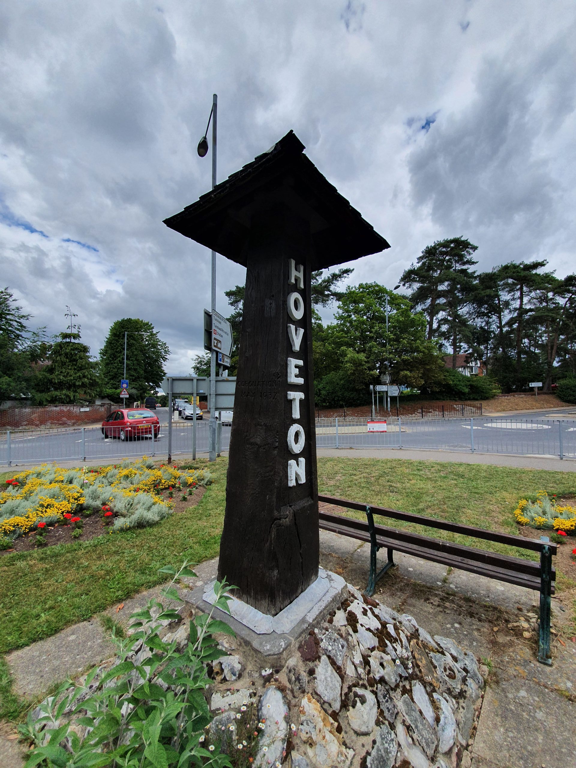
    This walk was very basic, as it was part of our longer Wroxham Wander (I’m pinching the idea of naming walks in the way that the LDWA do now….) walk. Anyway, this was just five random locations in Hoveton and Wroxham, done primarily to see a little bit of the villages that we might not otherwise have done.

    Our five random locations, all within about five minutes walk of each other…..

    Our first location was on Brimbelow Road, which is a long road with many riverside properties, all quite decadent. This was the part of Hoveton that expanded during the late nineteenth century and early twentieth century, when it became something of a holiday destination.

    Our second location was Roys of Wroxham, known as the largest village store in the world. They’ve been trading since 1895 when the Roy brothers opened their first store in Coltishall, and they opened in Hoveton in 1899. Although the store is located in Hoveton, it takes its name from when supplies used to be sent to them at the local railway station, then known simply as Wroxham (it wasn’t named Hoveton & Wroxham until 1966). That meant that the store became known as Roys of Wroxham and that name has stuck since.

    The building in the above photo is the department store section of Roys and was constructed in 1966, although was nearly entirely destroyed in a fire that took place in May 1995. A temporary store was opened for a year so that Roys could keep trading, but their new store was open by mid-1996.

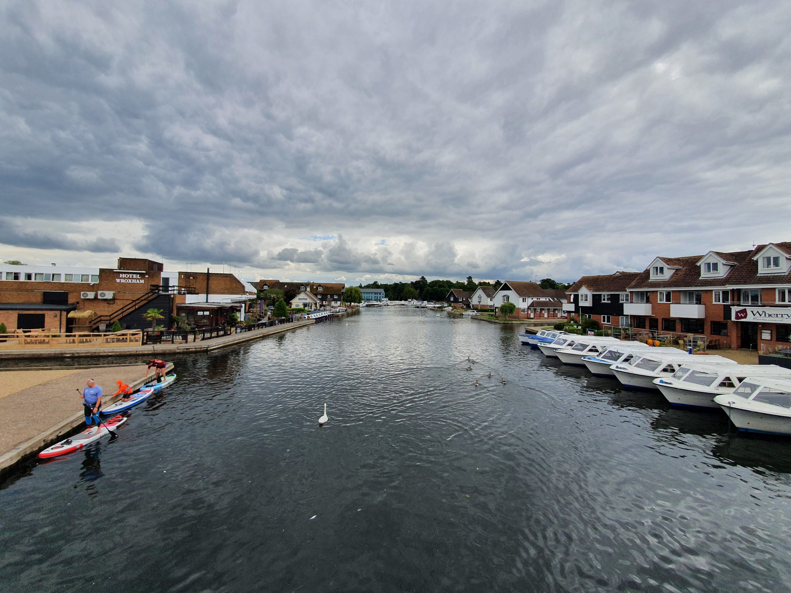
    Our third location was the chip shop, although we visited Greys Chips over the road for lunch. It’s a busy little area of Wroxham, it’ll be packed in the summer when (well, and if) lockdown is over.

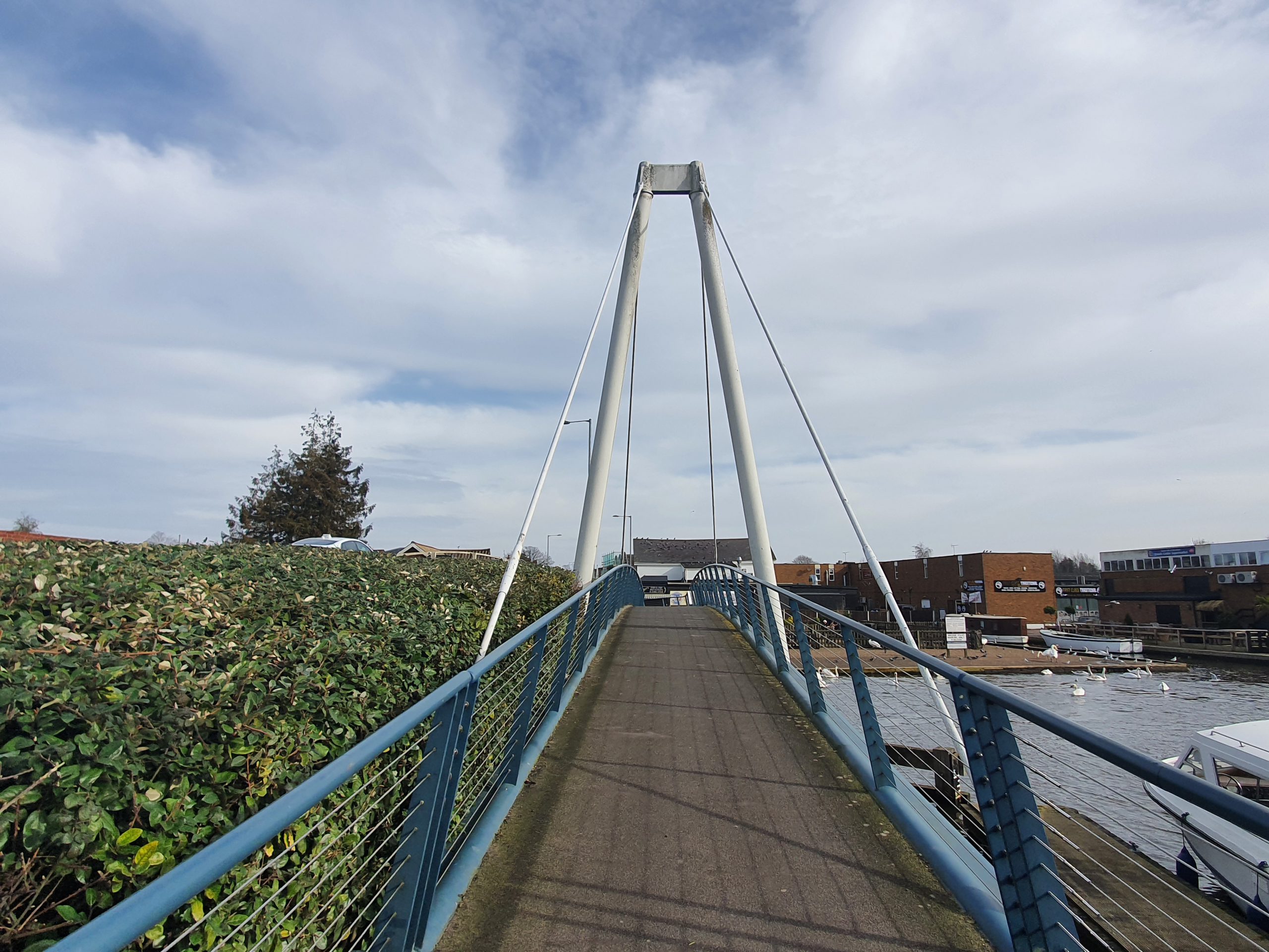
    A photo by the river at the rear of the King’s Head and there’s a path which goes by the river all the way to Hoveton & Wroxham railway station.

    Lots of swans on the River Bure. Clive (someone I know who panicked when he saw a swan in the river and he capsized his canoe) would very much like it here….

    Our fourth location was Grange Walk, named after the Grange building on this street. The Grange is Grade II listed and was built in the early nineteenth century, although it likely has an older core as there’s been a structure there for some centuries. Today, the Grange is in use as an antique dealer’s shop.

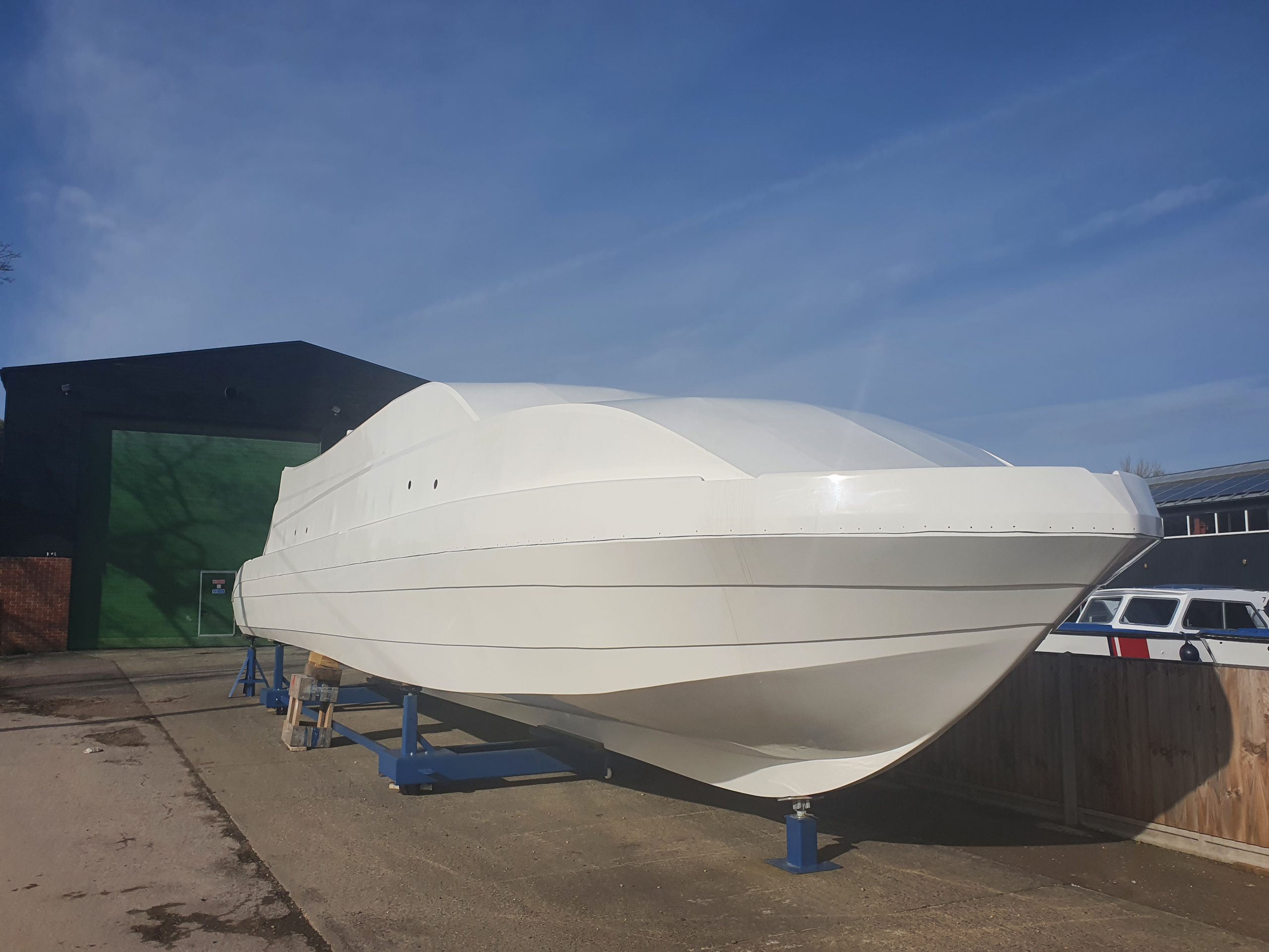
    One of the boats in the boatyard next to the Bure.

    We missed the train passing under here by only a minute, so there’s no photo of the new Greater Anglia fleet…. This is the Norwich to Sheringham line, perhaps a surprising survivor of the cuts in the 1950s and 1960s. The line from Hoveton & Wroxham to Aylsham, the Bure Valley line, was less fortunate and was closed, although is still in use as a heritage railway.

    Our fifth location was at Nobel Crescent, located near to St. Mary’s Church.

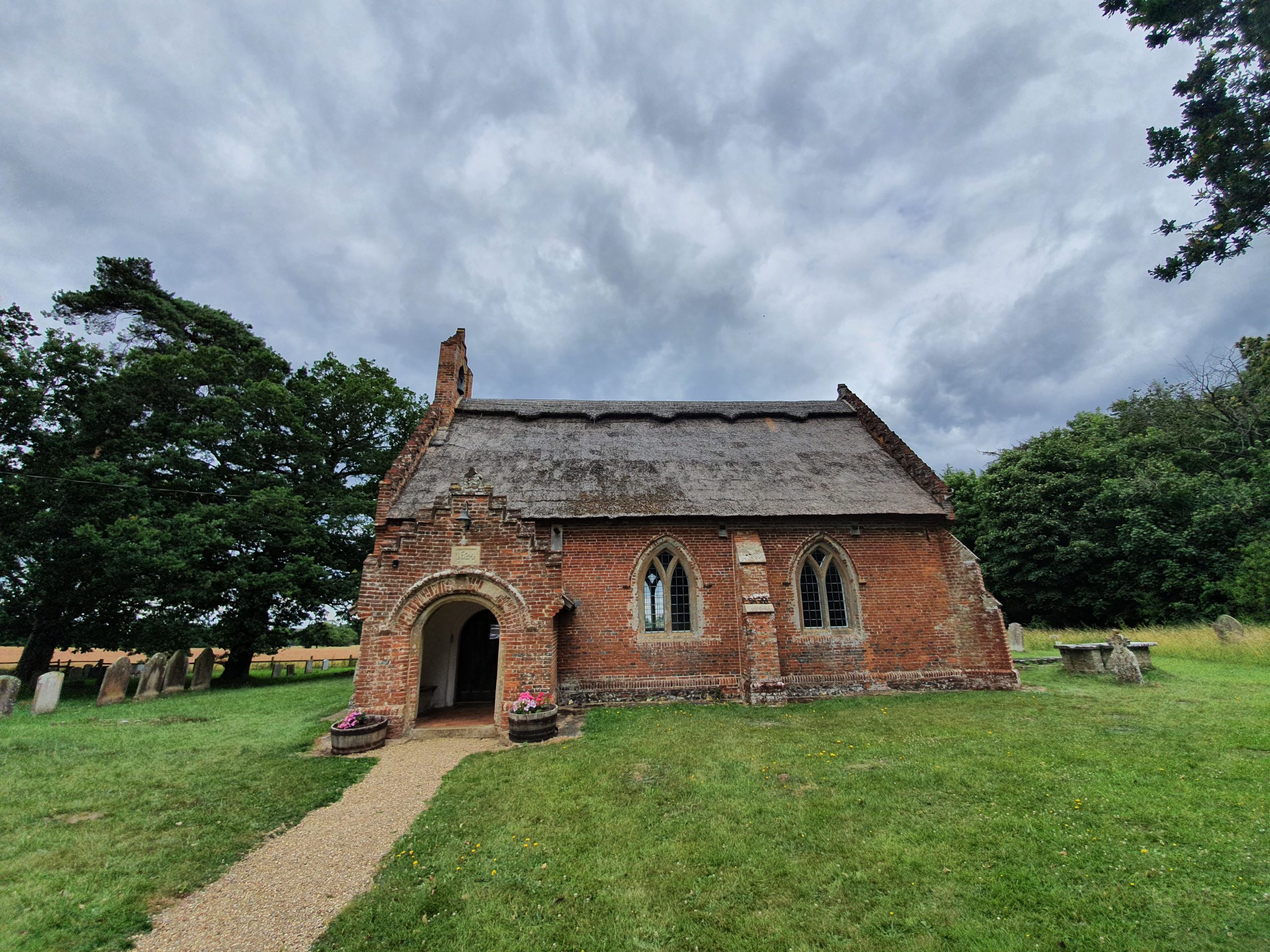
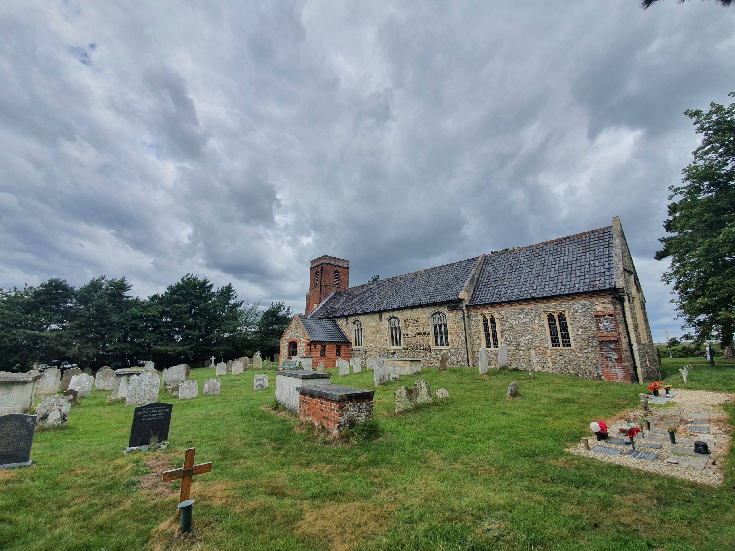
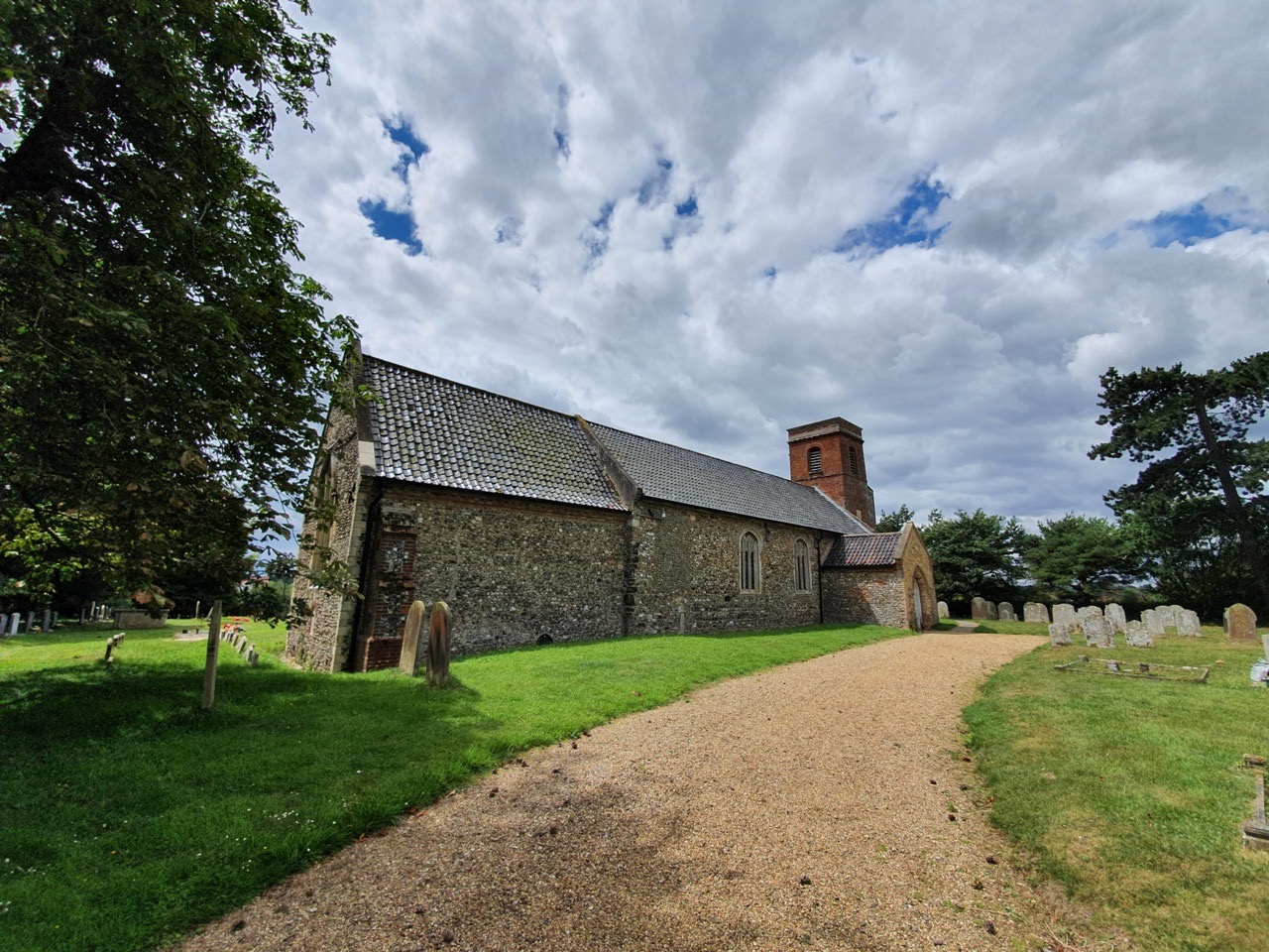
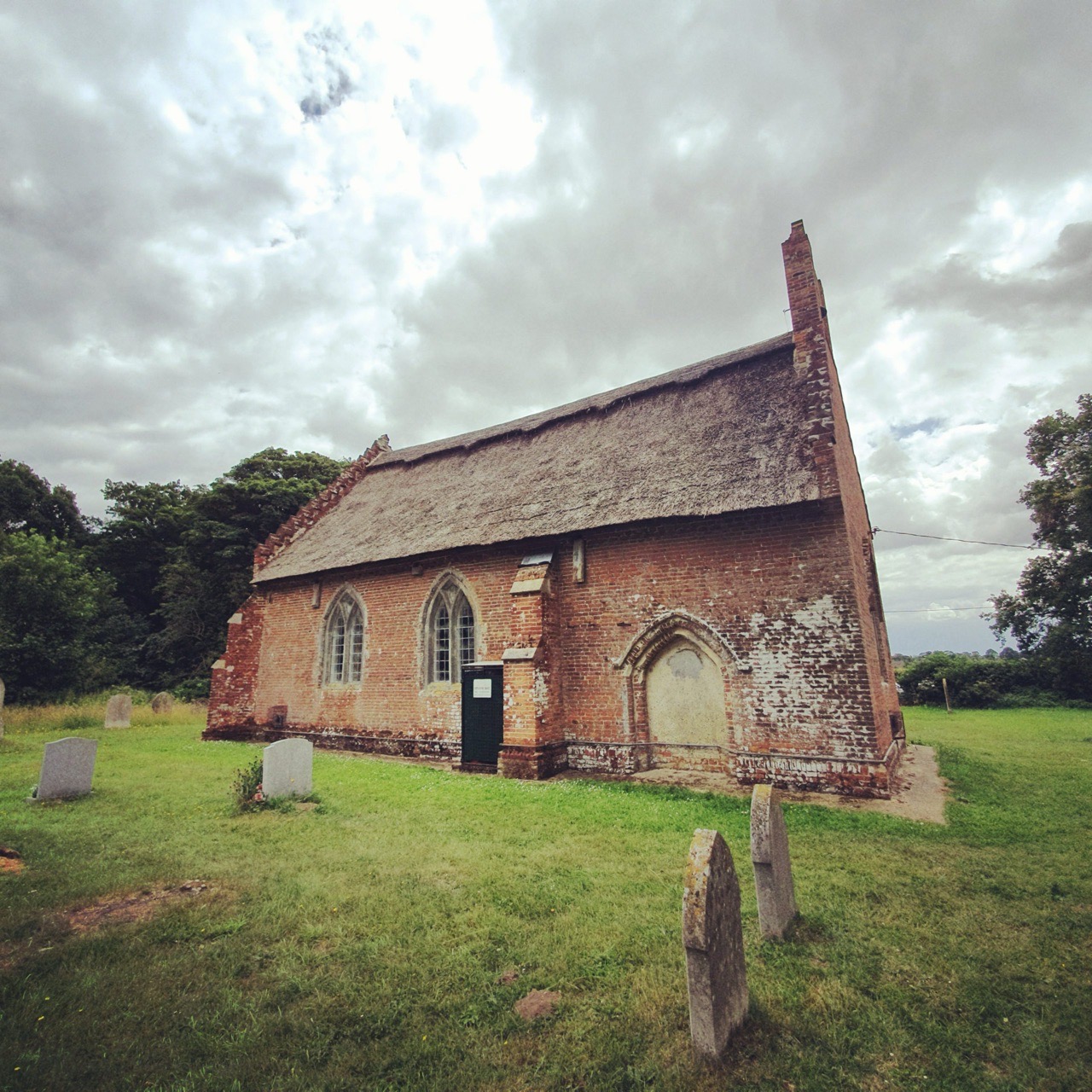
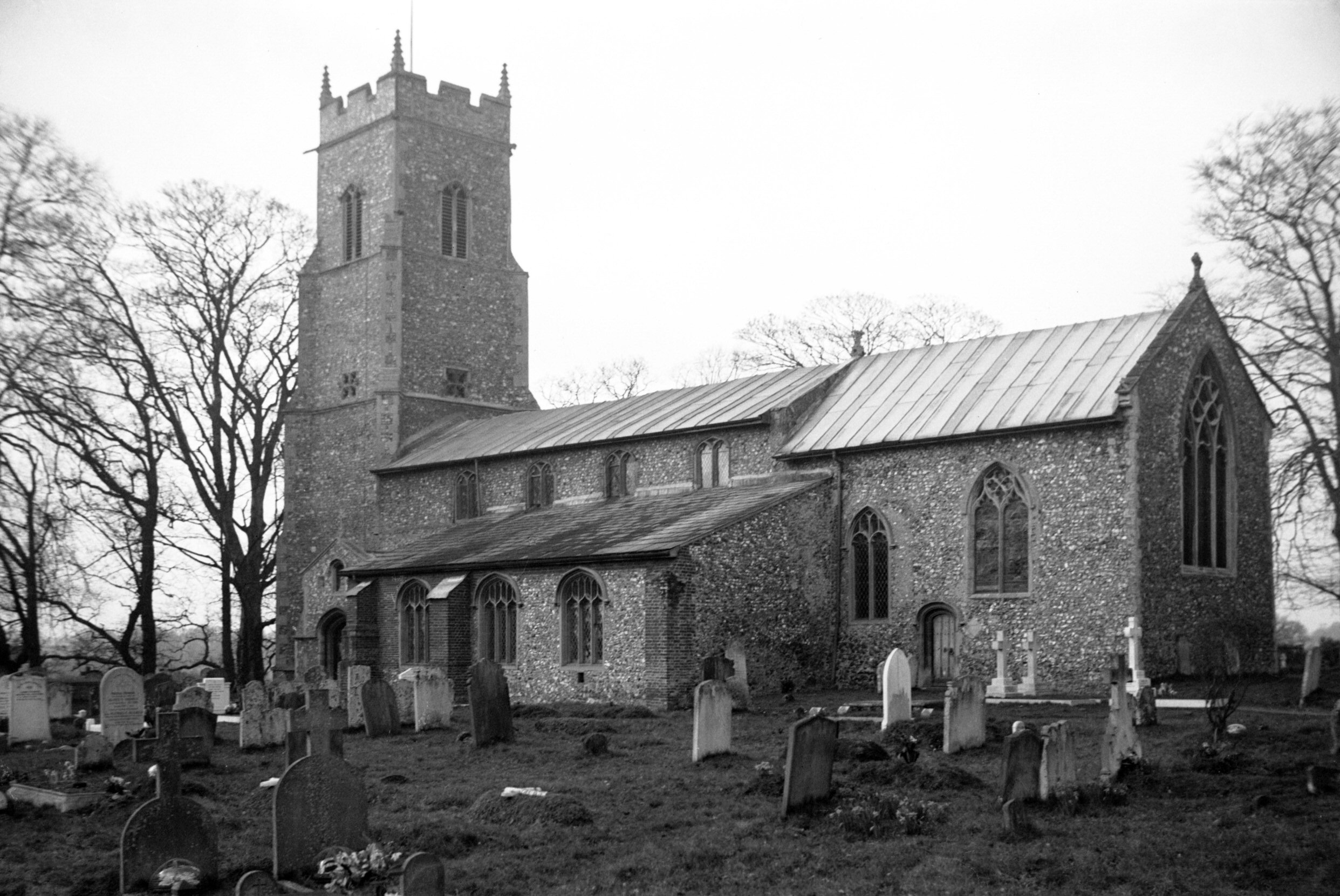
    St. Mary’s Church, a Grade I listed building of note because of its Norman door, although that wasn’t visible when we visited as the building was locked. We did compare a photo of the graveyard today with the one taken by George Plunkett in 1934, and it’s notable how some gravestones have disappeared since that time. I do wonder where these headstones have ended up, whether they’ve been laid flat or just destroyed.

    The Trafford Mausoleum, located in the churchyard of St. Mary’s and built in around 1830 to be the family vault of the Trafford family, who lived at the now demolished Wroxham Hall. The design was deliberately medieval and is attractive, although it really does dominate the churchyard.

    There’s a drop at the rear of the church down to the River Bure, which shows quite sensibly that they’ve located the church on a raised piece of ground.

    The Grade II listed Church Cottage, located next to the churchyard of St. Mary’s. This property was constructed in around 1830 and it was extended in 1999 in a similar design.

    Walking down Church Lane, whilst listening to Nathan muttering something about me faffing about taking photos…. This street is the old heart of Wroxham when it was a medieval village, although the centre of the settlement has shifted towards today’s tourist heart of the river.

    I never knew about Caen Meadow until we saw a sign pointing towards it, and it’s a rather lovely area near to the River Bure and there are numerous benches and places to sit, along with the opportunity to paddle in the river (we didn’t do this). It’s not known why Caen Meadow has this name, it might be because stone from Caen was used in the building of the nearby St. Mary’s Church and so this could have been brought up from here. Alternatively, it has been suggested that there might have been a monastery on this site which would have perhaps been part of the lands owned by the Abbess of Caen.

    Anyway, this was the shortest GeoGuessr challenge that we’ve done, being completed in around twenty minutes. But, it did have the advantage of bringing us to a part of Wroxham that I’ve never visited before. And then we had to walk back to Norwich…..

  • LDWA 100 – Training Walk 12

    LDWA 100 – Training Walk 12

    This was our twelfth walk in preparation for the 2021 LDWA 100.


    WALK NUMBER: 12 (The Wroxham Wander)

    DISTANCE COVERED: 18.5 miles

    NUMBER OF NATHAN’S FRIENDS WE “ACCIDENTALLY” BUMP INTO: 0 (but see below)

    SUFFICIENT BEER CONSUMED: No (all the pubs are shut)

    PUBS VISITED: 0 (not through choice)

    WEATHER CONDITIONS: Dry and surprisingly warm

    ATTACKED BY ANIMALS: No

    NUMBER OF SNAKES SEEN: 0


    The LDWA 100 in May is creeping up rather fast and so it was time for us to go on another little meander in the quiet Norfolk countryside. Above is what is currently Zaks American restaurant and they’ve been in these premises since 1979. Apologies for yet another mention of George Plunkett, but he has a photo of what this former tea pavilion looked like in 1931.

    Nathan guided us through Mousehold Heath through trial and error (mostly error), but I must confess that I still manage to get lost in this area so I wasn’t much help. Here’s a pile of big twigs constructed to build a shelter.

    A beehive sign, suitable given that the building behind was until relatively recently the Beehive pub. It’s now a Co-op, but the old web-site for the pub is being maintained as a community project, which is a marvellous idea. I’m not entirely taken by this habit of supermarkets taking over former pubs, once an asset like that is lost it’s going to nearly certainly be a permanent loss.

    This is the end of the pavement on the Norwich to Wroxham Road, beyond that pedestrians are expected to walk down the round. It’s not ideal…… We decided that we wouldn’t walk back this way, instead going via Rackheath, which proved to be a sensible decision. One day there will be proper access for walkers and cyclists on roads such as this, but I fear that we have a little bit of a wait for that.

    I’m very pro-rail and often grumble about new roads, but the council have done a good job here with the Northern Distributor Road (alternatively known as the Taverham-Postwick Road) in terms of footpaths and cycle access. The council were content not to make pedestrians to walk along the road here, so that made matters rather more pleasant.

    Moist roads….. Komoot wasn’t entirely helpful in the stretch beyond this, as its routings tried to send us down private paths that weren’t on the definitive map. That meant some backtracking was necessary and although Komoot are reliant on external data, it’s a situation that means significant caveats would have to be made before anyone uses Komoot in rural Norfolk. Nathan muttered about Komoot quite a lot today but I considered it to be user error. I didn’t say that though, I didn’t want to cast a dark cloud on proceedings.

    On the right is the railway line that runs from Norwich to Sheringham, and this point is just before entering Wroxham. There’s an amazing amount of earthworks that took place for this line to be constructed in what some people believe is a flat county. But, as Norfolk residents know, there are mountains and hills all over this area.

    Looking over the bridge towards to Norwich, although we managed to miss the trains today so there are no photos of the new Greater Anglia fleet.

    Here we are. A word of caution (I made have added jeopardy there, as it’s not really a problem to get this muddled up), the villages of Hoveton & Wroxham have effectively merged together, and the railway station is known as that, Hoveton & Wroxham (although that wasn’t the case before 1966, when it was just Wroxham). Roys of Wroxham is actually in Hoveton, along with most of the shops and food outlets.

    This was the Castle Hotel, the only pub in Wroxham, but it closed in November 1996 and is now a residential property. There isn’t much more of a choice in Hoveton, with the really average Greene King King’s Head pub being the most obvious one.

    They appear to have built Wroxham library on a floodplain (or where the river floods, I’m not sure of the geological term I’m supposed to use) but at least the stilts look sufficiently high to avoid damp books.

    The footbridge over the River Bure, that’s Hoveton in the background.

    This reminds me of days spent on Broads cruisers, although I found the driving the boat quite a hassle. I preferred the sitting down watching the scenery whilst eating sausage rolls.

    The old stone bridge and there has been some structure here since the early medieval period such is the importance of this crossing. This is a challenging bridge to get under, and I think Heidi guided operations when we did this in a Broads cruiser, but accidents here aren’t rare. For anyone who fancies having a look at proceedings, here’s a YouTube video, although there have been much worse incidents here. It’s recommended to use the pilot service to get through here, to avoid any scraping issues.

    And here’s another little video of what boating is like at Wroxham, involving an angry man from Broads Tours. I quite like this video.

    We opted for chips at Greys in Hoveton and they were priced towards the higher end of the scale, but met my expectations in terms of the taste and temperature. More on this in another post though. At this point we had a quick meander around Wroxham, but it was rather packed with tourists and so we decided not to linger. We did though have time for a mini game of GeoGuessr and more on that in another post. Nathan saw someone he thought he knew, but it was all a bit vague (he claimed he hadn’t met him in person and only on Zoom, but I like to think there’s some gossip behind the whole situation), so I’m not counting that one in the tally at the top of the page.

    This is St. Mary’s Church in Wroxham, unfortunately closed otherwise I could have seen the doorway which is apparently of considerable note. It’s a building rather marred by what I consider to be ugly additions, but its location near to the river gives it a peaceful feel. More on this Grade I listed (primarily for the doorway) church in another post, but it’s mainly fifteenth century although there are parts of the previous twelfth century church still in situ.

    Trafford Mausoleum which is located in the churchyard of St. Mary’s Church and was constructed for the Trafford family who lived in Wroxham Hall, which has now been demolished. It was constructed in around 1830 and was designed by Anthony Salvin, also known for his work on restoring castles.

    An interesting old property on Church Lane, which was once the heart of the medieval village but now feels a little more remote. It’s a really nice area of Wroxham, and there’s also a pleasant area by the river known as Caen Meadow. Nathan decided I was faffing about too much here taking photos, but I ignored those complaints because I couldn’t be bothered to walk any quicker.

    Aaaaah, a lamb, how very lovely.

    The walk was quite dry today, but there were areas of water to navigate.

    The Taverham-Postwick Road as I’m now calling it, with lots of trees planted on the side of the bank. This was like a wind tunnel though walking alongside it, which wasn’t entirely ideal.

    I’m not sure that I’ve been to Thorpe End Village, but it was nice to see the local LDWA treasurer here. As the name suggests there’s a village feel to this little settlement, which has rather now merged into the outskirts of Norwich.

    And walking back into Norwich, this is the same path that Nathan took us down on a previous GeoGuessr evening walk. It was less muddy on this occasion and, fortunately, I had more suitable shoes on which made matters easier.

    All told, this was another walk that went quickly and we didn’t encounter any medical issues on the expedition, which bodes rather well for the 100. The weather was quite balmy at lunchtime and we did debate getting an ice cream in Wroxham as a dessert for the chips, but the area was a bit busy and we thought it best to try and avoid people given the current health situation. So, another rather lovely day.

  • Hoveton – Etching by John Crome

    Hoveton – Etching by John Crome

    I’m not sure exactly where this etching was made, but it’s somewhere in the area near to St. Peter’s Church in Hoveton. It was drawn in either 1811 or 1812 by John Crome (1768-1821), a local artist who was one of the founders of the Norwich School of painters. There’s something timeless about the etching, and although I can’t place where it was drawn, it probably looks the same today. Well, unless it’s now under a housing estate, but given how peaceful and remote St. Peter’s Church is, I rather hope not. One thing that I hadn’t realised until today is that Crome was also a teacher at Norwich School, as in the educational establishment and not the painting circle.

    The plate was sold by Mrs. Judkin to the British Museum in 1872 following the death of her collector husband, Thomas James Judkin, who had died the year before. This etching, which is © The Trustees of the British Museum, isn’t on display in the museum and there’s also a similar one in their collections.

  • Hoveton – Granary Staithe

    Hoveton – Granary Staithe

    Granary Staithe is located by the bridge which separates Wroxham and Hoveton (clicking on the above map makes it easier to see) on a spot in Hoveton by the river. It’s the bit under the right-hand Norwich Road on the second map.

    The River Bure, with Granary Staithe on the right. There were concerns in 2012 when the owners of the land, Norfolk County Council, wanted to sell it for £250,000 or lease it for £25,000 per year. The only problem was that the Broads Authority said they’d oppose any building on the site, so plans to make it an attraction or similar wouldn’t have been viable. After some fund-raising, Hoveton Parish Council were able to buy the land and it opened as a public area in March 2013.

    No shortage of swans, mostly looking for food from visitors. One disadvantage of this part of the village is that it’s a bit swamped with seagulls hoping to grab some chips from locals who have visited the neighbouring fish & chip shop.

    A useful history board about Granary Staithe, which is visible behind it with seating and excellent views over the river. Before the council acquired the land, it had been a flat area which visitors could use, but it’s now been tidied up.

  • Hoveton – Hoveton Village Sign

    Hoveton – Hoveton Village Sign

    There’s not a huge amount of innovation in Hoveton’s village sign in terms of the design, but it’s a pleasant area with benches and a lovely view of the busy road.

    The village sign was installed here to mark the Coronation of King George VI in 1937 and there were also plans to build a playing field to celebrate the Royal event.

    The sign was refurbished and restored in 2012.

    Another view of the sign. And busy road. This reminds me that I must also go back to Hoveton and cross over the river so that I can get a photo of Wroxham’s village sign.

  • Hoveton – St. Peter’s Church (George Neave)

    Hoveton – St. Peter’s Church (George Neave)

    The grave of George Neave (1803-1871) is in the churchyard of St. Peter’s Church in Hoveton. He was born in Smallburgh and he spent his life working as an agricultural labourer, initially living in Neatishead. George was listed on the 1841 census, living with his wife Elizabeth in Cangate Common in Neatishead, along with his 12-year old daughter Mary, his 10-year old daughter Clarisy, his 7-year old son William, his 5-year old son James and his 1-year old daughter Emily.

    In 1851, George was living with Elizabeth, as well as with his 16-year old son William, who worked as an agricultural labourer, his 12-year old daughter Emily, his 9-year old daughter Emma, his 6-year old daughter Sarah Ann, his 5-year old daughter Susan, his 1-year old daughter Jane, and his grandson William, aged 5. All of George’s children, and his grandson, had been born in Neatishead. Looking through the burial records at Neatishead, there is a 3-year old, Ann Neave, recorded as having been buried in the church in 1858 and this could have been one of George’s children.

    In 1861, George was living with Elizabeth, along with his 16-year old daughter Sarah, his 14-year old daughter Susan and the new-born George, who was George senior’s grandson. Unlike the others who had been in Neatishead, George, the grandson, had been born in Salhouse. That must have seemed just a little bit exotic….

    By the 1871 census, he was listed as living near the Common in the village, along with his wife Elizabeth and Hannah Hales, a servant out of situation. A few months after the census was taken, George died at the age of 68.

    George’s entry in the burials register for the church, the vicar was from the local Blofeld family of Hoveton Hall and the burial took place on Tuesday 30 May 1871. Elizabeth, his wife, was buried with George following her death in 1889, at the age of 85.

  • Hoveton – St. John’s Church (Elizabeth Agnes Thrower)

    Hoveton – St. John’s Church (Elizabeth Agnes Thrower)

    Located in the churchyard of St. John’s Church in Hoveton, this unusual grave marker is that of Elizabeth Agnes Thrower. Aged just 27 at her death, the grave marker was paid for by her husband, Alfred Thrower. Elizabeth died on 25 July 1892 and was buried on 31 July 1892, in a service overseen by the vicar Jonathan William Woolley. Sadly, that’s as far as I’ve got with the story of Elizabeth’s life, but her grave marker is near to the entrance to the church and is quite evocative of the period.

  • Hoveton – St. John’s Church

    Hoveton – St. John’s Church

    The parish church of Hoveton is a short walk from the village centre, now dominated by Roys of Wroxham. The nave of the church dates to the late eleventh century, with the chancel being a little later and was finished at the end of the thirteenth century. The church was once alone at the top of a small hill that overlooked the village, but more modern building development has brought it into an urban setting.

    The brick tower was constructed in the 1760s.

    There are a few architectural styles here and the chancel door on the south side of the church has been bricked up, probably relatively early on.

    The church was modernised in 1890 under the supervision of HJ Green and in August 1889 the EDP mentioned the fund-raiser that was taking place to secure funds for this. There was a military band, lawn tennis, fish ponds, photography, fortune-telling, an art gallery, concerts and refreshments. That’s some considerable effort for a church bazaar, I’m impressed.

  • Hoveton – St. Peter’s Church (Solomon Hannant)

    Hoveton – St. Peter’s Church (Solomon Hannant)

    The grave of Solomon Hannant (1821-1901) is in the churchyard of St. Peter’s Church in Hoveton.

    At the 1841 census, Solomon was listed as being a farm labourer, although I can’t find him in the 1851 census (not that I’ve looked very hard). But there’s something interesting in the 1861 census, as a large family has formed:

    Solomon Hannant (40-year old agricultural labourer)

    Maria Hannant (37-year old housewife, born in East Ruston)

    George Hannant (13-year old agricultural labourer, born in East Ruston)

    Hannah Hannant (11-year old, at school)

    Harriet Hannant (9-year old, at school)

    Robert Hannant (6-year old, at school)

    Sarah Hannant (3-year old)

    Benjamin Hannant (1-year old)

    Solomon Hannant (81-year old pauper, born in Worstead)

    By the 1871 census, the family were living on Common Road in the village and Solomon, Maria, George, Robert, Sarah, Benjamin and Emily were living at home. Solomon (the elder) died at the age of 84 and was buried at the church on 24 March 1864. At the 1881 census, the children had all left home, other than Benjamin who was aged 21 and was working as a carpenter’s apprentice.

    By the 1891 census, Solomon and Maria was living on Plantation Road in Hoveton St. Peter and by now they were living alone. By 1901, Solomon and Maria were living at Upper Street in Hoveton, along with Sarah Hannant who was still single and by now was aged 43. By the time of his death, Solomon was paying £5 per year rent on his home, which is around £500 per year by today’s money and this is perhaps a sign of how much things have changed.

    And, with a touch of pathos, here is the burial register for St. Peter’s Church. Solomon was buried on 10 May 1901 and the next burial at the church was that of Maria, on 23 December 1901.

  • Hoveton – St. Peter’s Church

    Hoveton – St. Peter’s Church

    Unusually, this church was built in the early part of the seventeenth century, in 1624. Its location, near to Hoveton Hall, seems to suggest it was more constructed for the country house rather than for the people of Hoveton. They also didn’t need a church, they already had St. John’s which was actually near to the settlement of Hoveton.

    There is the possibility that the settlement of Hoveton St. Peter might have been larger and once had a church of its own, but no-one is quite sure where this might have been located.

    The building itself was ‘modernised’ internally in the 1880s, but externally, the church is nearly entirely unchanged since it was built.

    The only change to the building is that the north door has been blocked, but the thatched roof remains and this feels like a little bit of a hidden treasure in the Norfolk countryside.