Streets of Norwich – Mountergate
Part of my Streets of Norwich project…. [updated in September 2023]
Mountergate has also been referred to as the southern end of St. Faith’s Lane and the small section where it meets Prince of Wales Road is now better known as Eastbourne Place. The road name comes from the corruption of the parish name of St. Peter Parmentergate, which over time became Permountergate, and then Mountergate (and Mountergate Street).
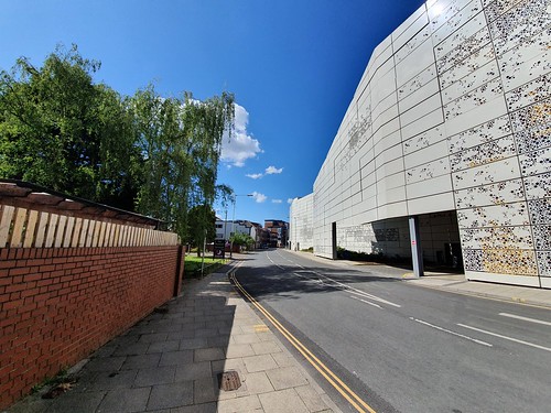
Norwich City Council is very proud of its car parks and they put to one side perhaps too readily an English Heritage report asking them to reconsider building this. I’d rather that the council were proud of Norwich’s heritage and stopping knocking things down, but there we go. This is likely another one of those decisions that will be regretted in thirty years, although the building on the front part of this site was in fairness of no great historic loss.
As can be seen here, the car park beautifully blends into its environment.
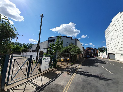
There’s a road opposite the car park which leads to the Premier Inn and riverside walk.
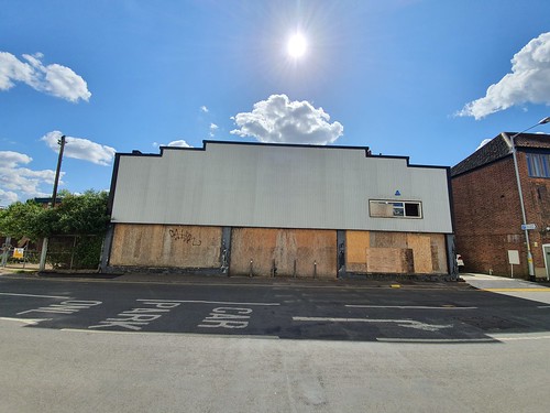
On the left of this photo is a building which has been left empty since around 2005, whilst the beautiful car park still keeps going on the right.
The same neglected building from the front.
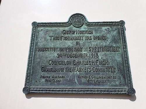
When certain Norwich City councillors were excitedly talking about their new car park, they were asked by some heritage bodies to moderate their plans to try and save the historic fishmarket site. The fishmarket buildings weren’t that appealing visually, but there was historic interest to them, even though they had only been constructed in 1914 when they moved from their previous site on St. Peter’s Street.
English Heritage said:
“The complete demolition of the fishmarket would result in the loss of this heritage interest and the buildings’ contribution to the historic environment. We would urge the council to consider alternative uses of part of the site that would allow retention of the fishmarket, but also alternative designs for the car park.”
So, there was potential for the council to change their plans slightly to build their car park, but to save some of the fishmarket site. What the council actually did was ignore all of that, but they did save the plaque which they’ve attached to their lovely new car park. So, when people come to have a look at the fishmarket site, which was of historic note albeit very run-down, they can now see where it was. Great.
There was a question asked of the council at the time about surely their own public transportation plans were failing if their only solution was to keep building car parks. I’m not sure they came up with an answer to that.
Anyway, there’s no point in being negative. One advantage in the council knocking down sites of interest is that there are fewer listed buildings for me to note.
This is one listed building that remains, a seventeenth-century former factory site which still has some character to it, even though there have been a couple of extensions in the eighteenth and nineteenth centuries when it was used in the manufacture of boots and shoes. Behind it is St. Faith’s House, which fronts onto Baltic Wharf.
A more modern office building, and then the entrance to the new St. Anne’s Quarter building development. Somewhere along here was the site of the Orchard Tavern, which was the only pub located on Mountergate.
The pub was badly damaged during an air raid in 1940 and the owners, the Lacon Brewery, decided that they wouldn’t rebuild it.
Taking a look at the 1939 Register, St. Faith’s Tavern was located at 17 Mountergate and the landlord Fred Furze lived on the premises with his wife, Melinda. The pub closed in 1961 and it was once located at the corner of Mountergate and Synagogue Street.
Everything on the left has been lost to the St. Anne’s Quarter site (although much had already been lost to war damage), but the wall on the right-hand side has been retained.
And that wall leads to this gate, which led into where the Rose Lane iron-works are marked on the map. Now replaced by the Parmentergate Court housing project, at least this element has been kept as part of the site redevelopment. George Plunkett, who I’ve never known to be wrong on anything, wrote that the walls were from the Co-op shoe factory and were “retained as a baffle against traffic noise for Parmentergate Court”. Another source says they’re the old iron-work walls, and I have no idea which they are, unless both were at the site at the same, or different, times. On balance, I can’t imagine Plunkett was wrong though.
The road, which is pedestrianised at this point, then meets King Street and straight over is Stepping Lane. A century ago, there would have been a road on the left-hand side, which was where Synagogue Street once stood. Much of this was lost during air raids in the Second World War, with the synagogue the street was named after being badly damaged, and then moved to a new site on Earlham Road in 1948.

