Norwich History by Parish : St. Edmund
And a new little project that Jonathan and I are undertaking because this lockdown is clearly here for at least a few more weeks. It’s a bit niche (our project I mean, not the lockdown), I’ll accept that, but there we go. Effectively, it’s walking around Norwich, ancient parish by ancient parish and seeing what is there now compared to a map from the 1880s (the map above is from 1789, but the one from the 1880s is more detailed, which is why we used that). There’s a PDF of these boundaries to provide some extra background to this whole project.
St. Edmund is the third parish we’ve done this for and it’s been the most challenging in terms of trying to compare it to the past, since there’s nearly nothing left with the exception of the medieval church itself.

On the above map from the 1880s, the street of Fish Gate is at the base (now known as Fishergate), Peacock Street is at the left hand side (now known as Blackfriars) and Cowgate Street is on the right hand side (now known as Whitefriars). All of the buildings inside of that have gone, demolished as part of slum clearances, property redevelopment and road building. This entire site is now taken over by Smurfit Kappa, or the building perhaps still better known by most as the Norwich Corrugated Board, or NCB building.


The premises of Smurfit Kappa, who produce various types of packaging. Once on this site there were schools, shops and residential buildings, including the courtyards known as Staff of Life yard and Fleece Yard.

This is the side of the factory and this rather resolved a query we’d had the previous week. The factory wasn’t built in the 1980s as I had thought, it had been refronted in the 1980s and this older part of the building shows the original element of the structure.

Rather helpfully, a staff member from the company came out at this point, as I don’t think they get many tourists taking photos of their building. It’s lovely, but I suspect more people take photos of Norwich Cathedral and Norwich Castle. What the helpful staff member did provide us with were photos of what the building used to look like, and there’s a walkway here over the road that I didn’t know about.

This is another photo provided, showing the factory after it had been refronted, with the walkway now removed. The factory building which that walkway led to has now been demolished and has recently been replaced by residential properties. It was also nice for the two long-standing staff members to help us in this quest, they’d worked there for a considerable period of time and added lots of context to how the area had developed. I also very much appreciated their sending me the photos of the site, the one above shows just how much this area has changed, along with the roundabout to the top of the photo which was built for the inner ringroad.

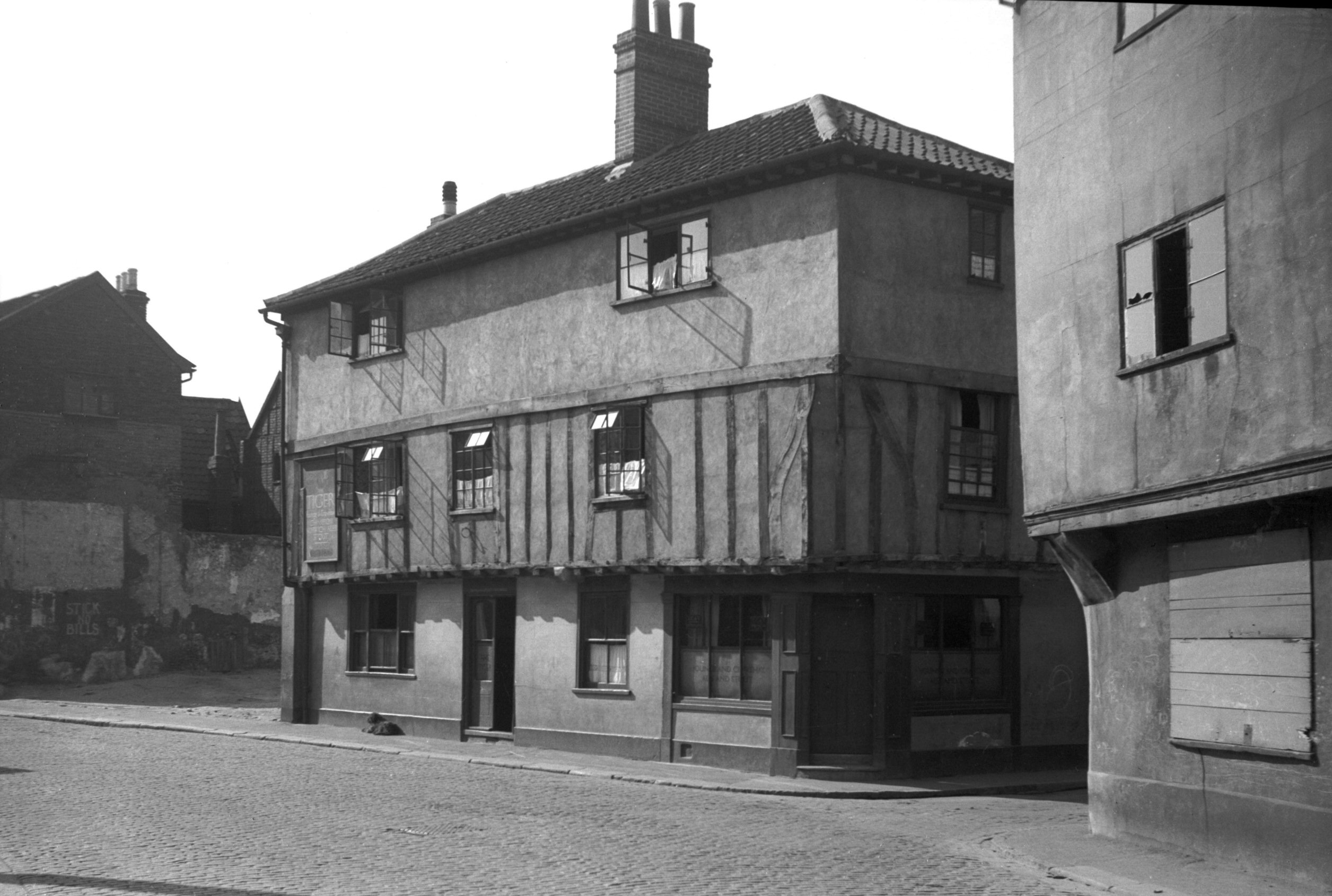
This is what was formerly known as Peacock Street, which I’ve written about before. These properties are standing on the site of the former Tiger Inn, demolished for road widening in 1936. George Plunkett’s photo of the building shows just what impressive buildings the council has pulled down in its quest to satisfy car drivers.

Over the road is Hansard Lane, which I’ve written about before.

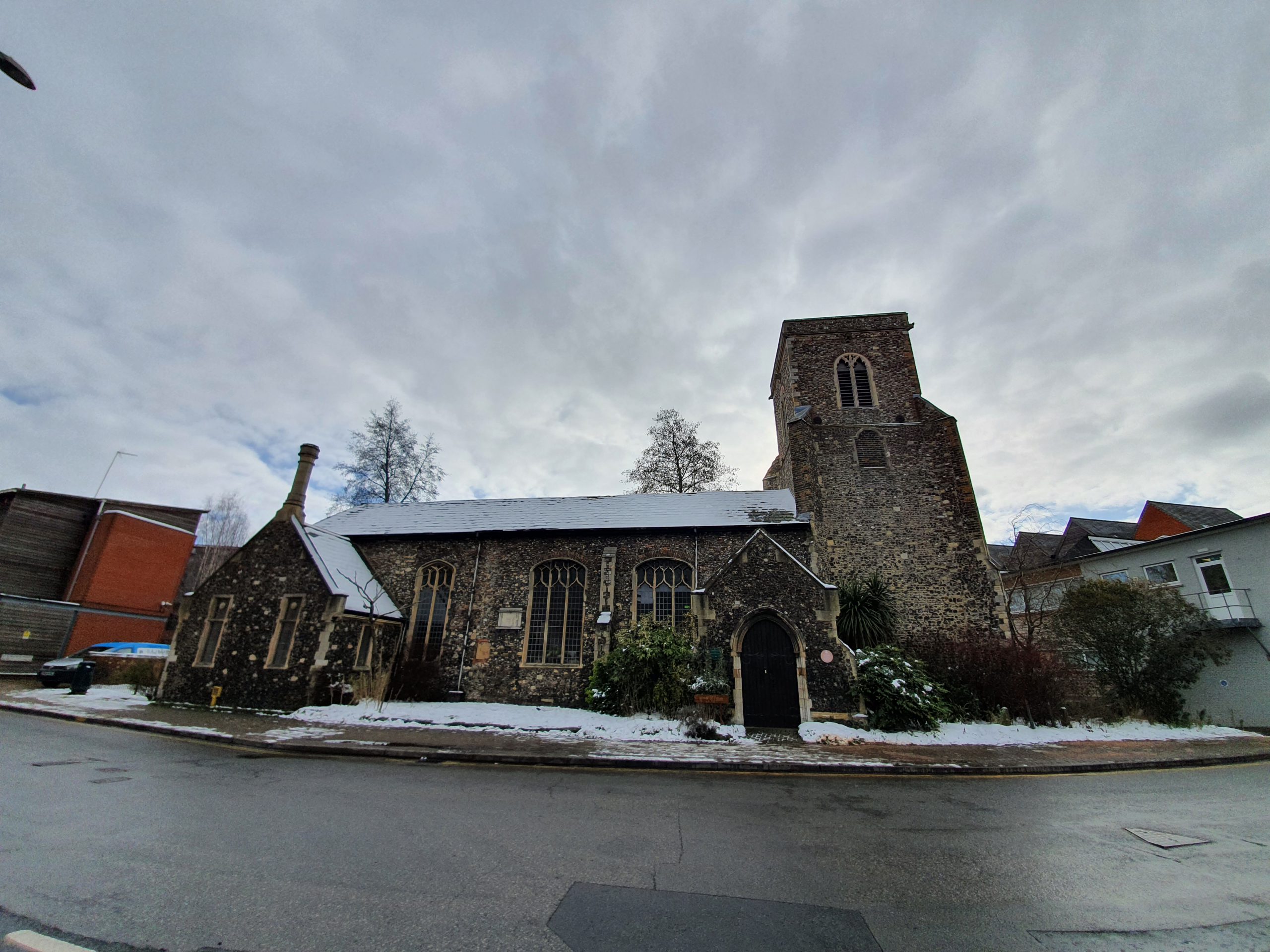
This is the the church of St Edmund, from which the parish takes its name. The church has a small footprint with nearly no graveyard, although it perhaps had one in the medieval period. The church became redundant in the late nineteenth century, one of the early casualties of the sheer volume of churches that Norwich had. There has been a church here since the Anglo-Saxon period, but the current structure is from the fifteenth century onwards. The Anglo-Saxon origins are pretty certain, as the church is dedicated to Edmund the Martyr, the Saxon King of the East Angles. Inside the building, there’s a single nave and chancel, with the porch visible in the left of the above photo dating from the nineteenth century.

Although the building is Grade I listed, it wasn’t far from being demolished in the early 1970s, following a Church of England which seemed to have forgotten that it was the protector of historic churches. Fortunately, the community took an interest into what the church was planning with its disposal of buildings, and it was saved. It’s currently used as a Christian house of worship once again, although has been used for storage and also as the Norwich Pregnancy Crisis centre.

A shed at the rear of the church which is of no historic interest, I just liked the icicles…. I’m so easily pleased.

The church was once surrounded on three sides by a factory building which is visible from the overhead photo earlier on. Today these are riverside residential properties and it’s impossible to walk along the river here as it’s gated off.

It’s possible to reach the river as there’s a car park behind the GP’s surgery.

The view of the River Wensum.

Back on the other side of Fishergate, this is the area behind what was Thompson’s Yard, all now council housing which seems to date from around the 1970s. It’s all sadly devoid of history.

I quite like little stumps of former buildings, a reminder of what was once here. George Plunkett is of help here (yet again), the rest of the building is in one of his photos from 1936. The now demolished building was once the Rampant Horse pub, which had been a licensed premises since the early nineteenth century and was closed in 1912, another pub lost in the wave of forced pub closures.

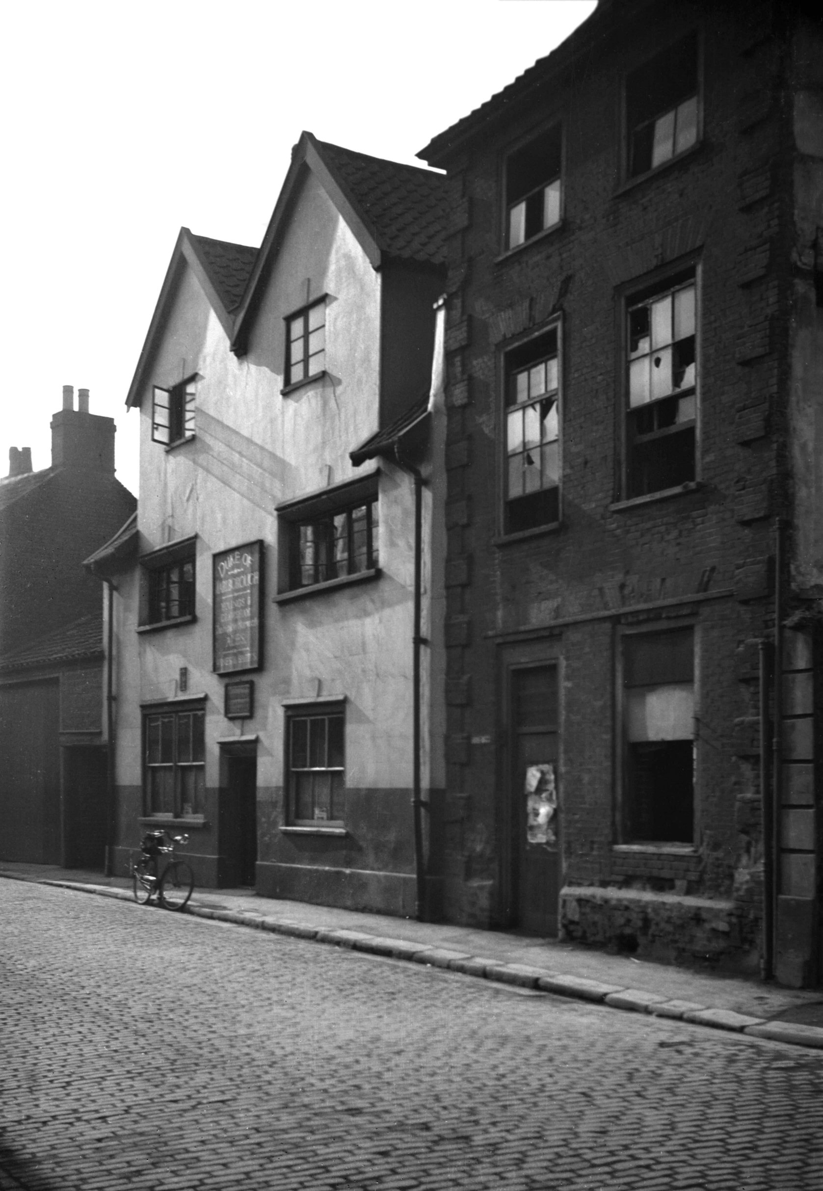
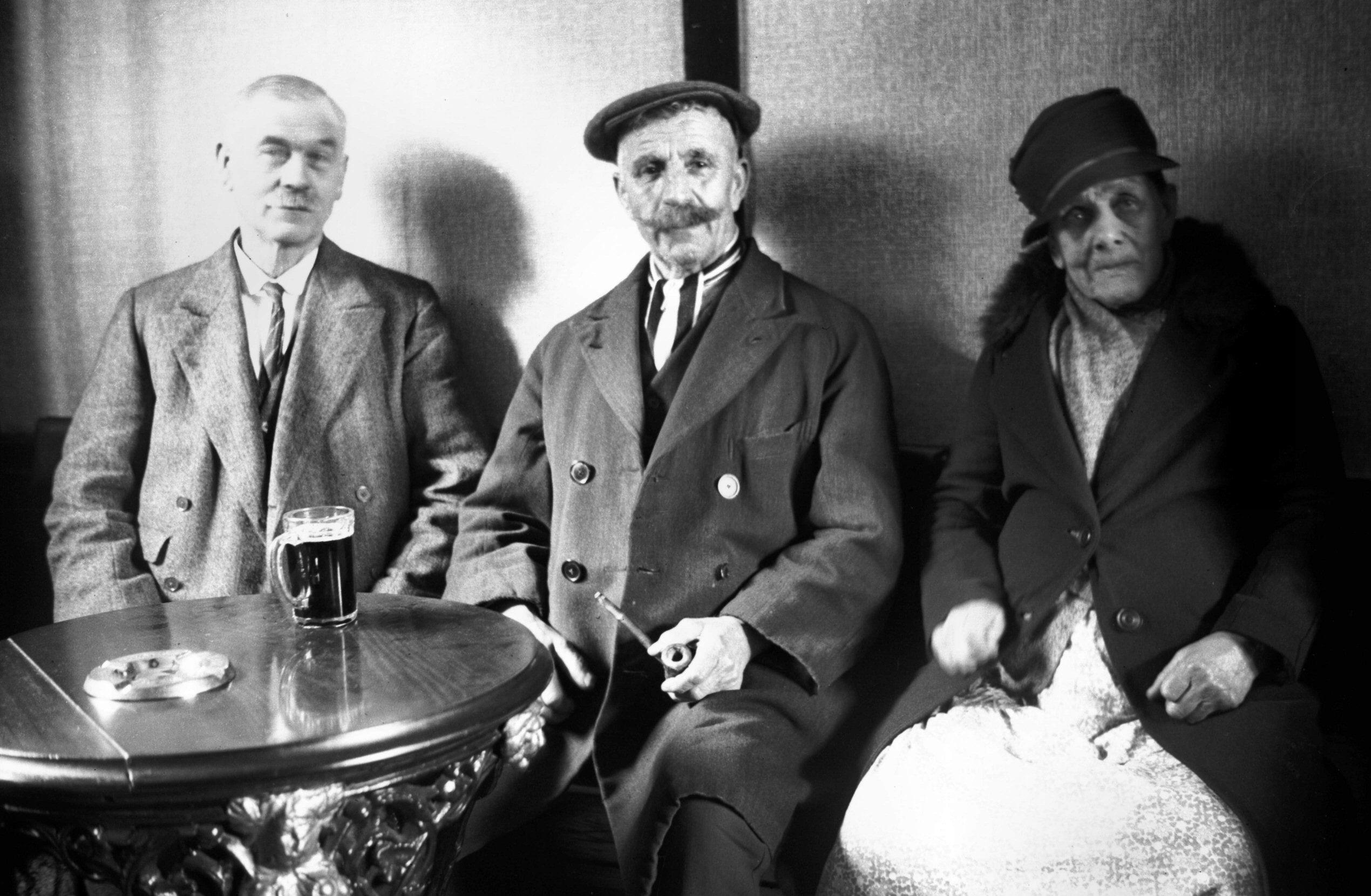
The building still standing next to this stump of wall was also a pub, the Duke of Marlborough, at 29 Fishergate and George Plunkett excels himself again by providing a photo of the landlord and customers in the pub in March 1939. This pub had started to serve customers from 1708 and traded until its closure in 1952.

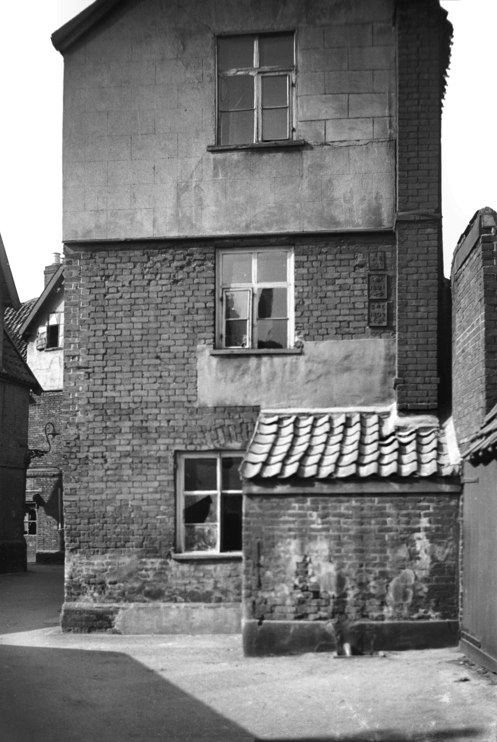
It’s hard to establish where the parish boundaries were, but I’ve decided that some of Thoroughfare Yard was probably in the parish of St Edmund. The Church of England don’t supply boundaries of this particular parish, which is likely as the church isn’t in their use any more, and the definitive map doesn’t have them on, so they must have shifted at some stage.
It’s George Plunkett who once again helps me here, as he has a photo from 1936 which has the parish plates visible, and one of them marks the parish boundary of St Edmund.

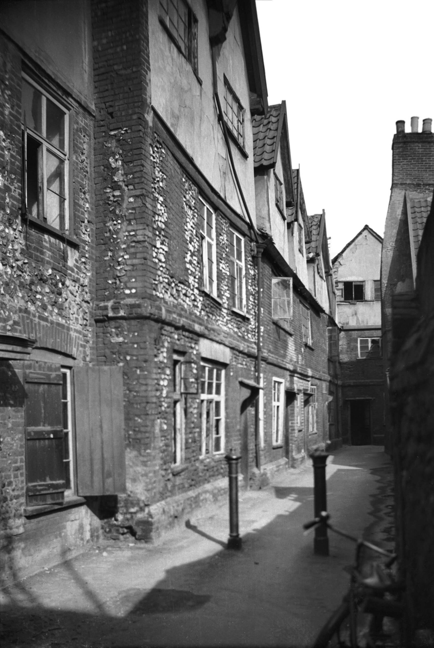
Thoroughfare Yard goes through to Magdalen Street, but I feel I need to investigate it further on a future expedition to ascertain whether those parish plates are still visible (likely not, as the buildings have gone), or where these parish boundaries were. For the moment, here’s another photo from 1936 that George Plunkett took of how the yard once looked.
So, this wasn’t the most historic of areas that we’ve covered so far, but there were elements that remain from the past. Thanks again to the staff of Smurfit Kappa for their assistance, much appreciated! And, after this walk we went to get chips, just in case anyone wondered.
