London – City of London – Noble Street Roman Fort Ruins

The Second World War brought many changes to the streets of London, including the uncovering of pieces of the city’s past. The above map (click to make it larger) is from 1900 on the left and from today on the right, with Noble Street looking very different. Properties had been built backing onto the Roman wall and it had been covered up over the centuries, but the wartime bombings of the city brought the wall back into view.

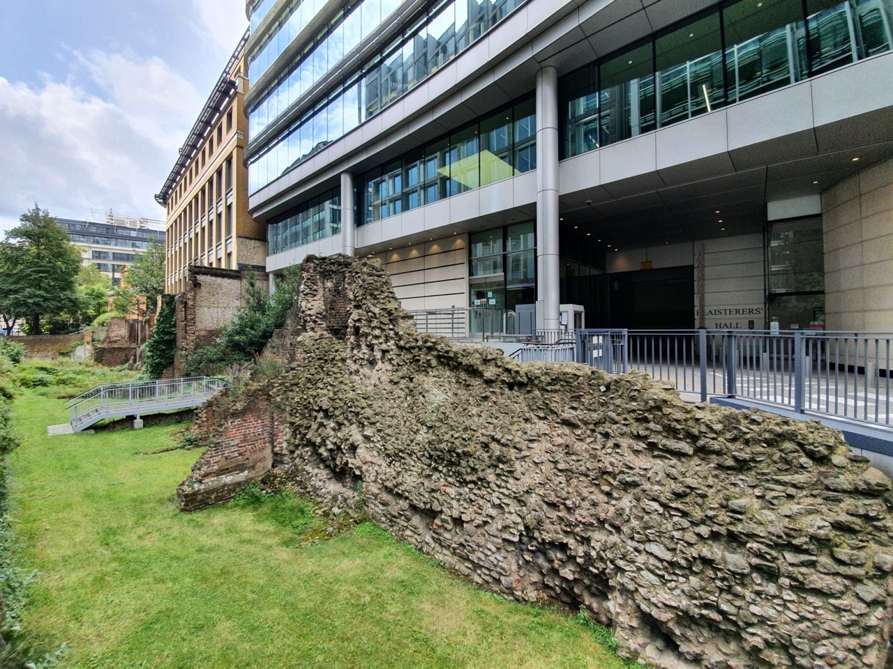
The old meets the new.

It’s not very clear, but there’s an overlay on this panel which gives an indication of what the area looked like in Roman times.

The Roman wall was built in one go to defend the city, starting in around 190AD and being completed by around 225AD. It served as the boundary wall of London until the medieval period and it wasn’t much changed until the sixteenth century, just some strengthening works in places.

The bits of brickwork jutting out are from eighteenth to twentieth-century buildings that were damaged or destroyed during the Second World War. There were extensive archaeological investigations here in the late 1940s and 1950s, with a decision being made to protect the area and to prohibit redevelopment.

A boundary marker.